
Mori Atlas logo
National parkShenandoah National Park

Discover the mapped terrain and geographic identity of Shenandoah National Park.

Shenandoah National Park: A Protected National Park Landscape in Virginia

Shenandoah National Park stands as a significant protected landscape within the state of Virginia, offering a unique lens through which to explore US National Park geography. This atlas-focused detail helps you understand the park's spatial presence, its natural terrain, and its contribution to the regional mapped environment. Dive into the protected area's mapped boundaries and landscape context.

Blue Ridge MountainsNational ParkWilderness AreaAppalachian TrailVirginia MountainsForest Protection
Illustration showing mountains, forest, waterfall, and river in a scenic landscape

Shenandoah National Park

National park

Park overview

Structured park overview, official facts, and landscape profile for Shenandoah National Park

Shenandoah National Park park facts, protected area profile, and essential visitor context

Review the core facts for Shenandoah National Park, including designation, size, terrain, visitor scale, habitats, and operating context in one park-focused overview.

About Shenandoah National Park

Shenandoah National Park occupies a remarkable position in the Appalachian Mountains, preserving a continuous corridor of mountain forest that represents one of the largest protected areas in the eastern United States. The park's long, narrow configuration reflects both the geography of the Blue Ridge Mountains and the historical circumstances of its creation. Skyline Drive serves as the park's primary access and recreational spine, following the crest of the mountains past numerous overlooks, trailheads, and historic lodges. The park encompasses parts of Warren, Page, Rockingham, Augusta, Rappahannock, Madison, Greene, and Albemarle counties, creating an administrative landscape that mirrors the mountainous region itself. Beyond its recreational offerings, the park serves as a critical corridor for wildlife movement and ecological continuity in a region where development has fragmented much of the original forest cover.

Quick facts and research context for Shenandoah National Park

Shenandoah National Park encompasses over 200,000 acres in eight Virginia counties along the Blue Ridge Mountains. The highest point is Hawksbill Mountain at 4,051 feet. Skyline Drive, a 105-mile scenic road that is itself a National Historic Landmark, traverses the park along its ridgeline. Nearly 101 miles of the Appalachian Trail pass through the park, which contains over 500 miles of total hiking trails. The park receives approximately 1.7 million visitors annually and is administered by the National Park Service.

Protection and recognition

Documented terrestrial boundaries, management scope, and conservation framework.

Shenandoah National Park Protection Status and Conservation Profile

Researchers and visitors can analyze the official terrestrial protection status and verified designation scope of Shenandoah National Park. Verified records frame the official boundaries and conservation classifications to clarify how the mountain landscape is globally registered.

Protection details

Protection scope
Terrestrial
Transboundary protection
No
Park context

Deeper park guide and search-rich context for Shenandoah National Park

Shenandoah National Park history, landscape, wildlife, and travel context

Explore Shenandoah National Park through its history, landscape character, ecosystems, wildlife, conservation priorities, cultural context, and seasonal travel timing in a structured park guide built for atlas discovery and search intent.

Why Shenandoah National Park stands out

Shenandoah is best known for Skyline Drive, the iconic National Scenic Byway that follows the mountain ridgeline through the heart of the park, offering sweeping views of the Shenandoah Valley to the west and the Virginia Piedmont to the east. The park's waterfalls, including Dark Hollow Falls, Whiteoak Canyon, and South River Falls, are major attractions accessible from the drive. The park's extensive wilderness areas provide exceptional backcountry hiking and camping opportunities, while its location along the Appalachian Trail makes it a significant destination for long-distance hikers.
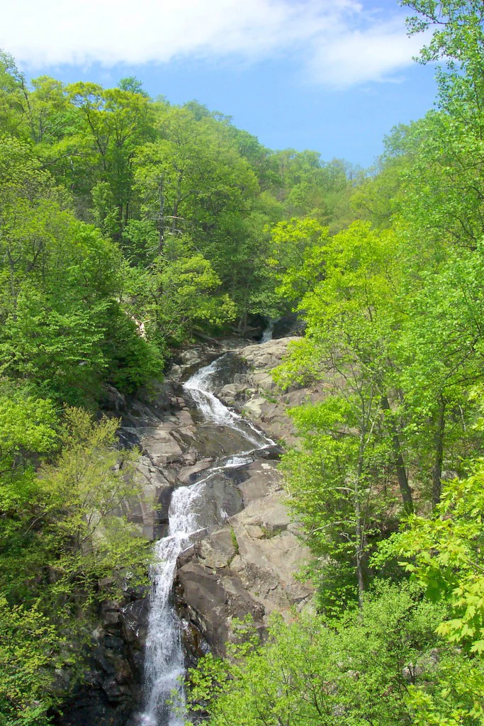
Waterfall cascading over rocky terrain surrounded by dense green forest under a blue sky
Waterfall in Whiteoak Canyon, Shenandoah National Park

Shenandoah National Park history and protected-area timeline

The creation of Shenandoah National Park began with legislative efforts in 1901, but the park was not authorized until 1926, when Congress directed the National Park Service to acquire between 250,000 and 521,000 acres to establish the park. Unlike western national parks created from federal lands, Shenandoah required the acquisition of private property, and the legislation prohibited the use of federal funds for land purchase. Virginia undertook the acquisition through eminent domain, eventually assembling the land from over 5,000 parcels. Many residents, particularly elderly landowners in the central counties, were forcibly evicted in the 1930s, a process that generated significant controversy and remains a subject of ongoing historical reconciliation efforts. The Civilian Conservation Corps played a major role in developing park infrastructure, constructing trails and facilities while removing dead chestnut trees killed by blight. The park was officially established on December 26, 1935, and President Franklin D. Roosevelt formally opened it in July 1936. The park also grappled with segregation, maintaining separate facilities for African Americans until the 1940s and 1950s. In recent decades, the park has worked to incorporate the stories of displaced mountain communities into its interpretation.

Shenandoah National Park landscape and geographic character

The landscape of Shenandoah National Park is defined by the Blue Ridge Mountains, a prominent ridge-and-valley geological province that forms the easternmost major mountain barrier in the Appalachians. The park's terrain rises sharply from the Shenandoah Valley, with elevations climbing from around 500 feet at the valley floor to over 4,000 feet at the ridgeline. Hawksbill Mountain stands as the park's highest point, while numerous other peaks provide panoramic views. The mountains expose some of the oldest rocks in Virginia, with basement granites dating back over a billion years and younger metamorphosed volcanic and sedimentary formations. The dramatic topography results from differential erosion of folded and faulted rock layers, creating the steep slopes, narrow ravines, and rocky summits that characterize the park's scenery. The ridgeline forms a distinct boundary between watersheds, directing drainage either westward to the Shenandoah River or eastward to the James and Rappahannock.
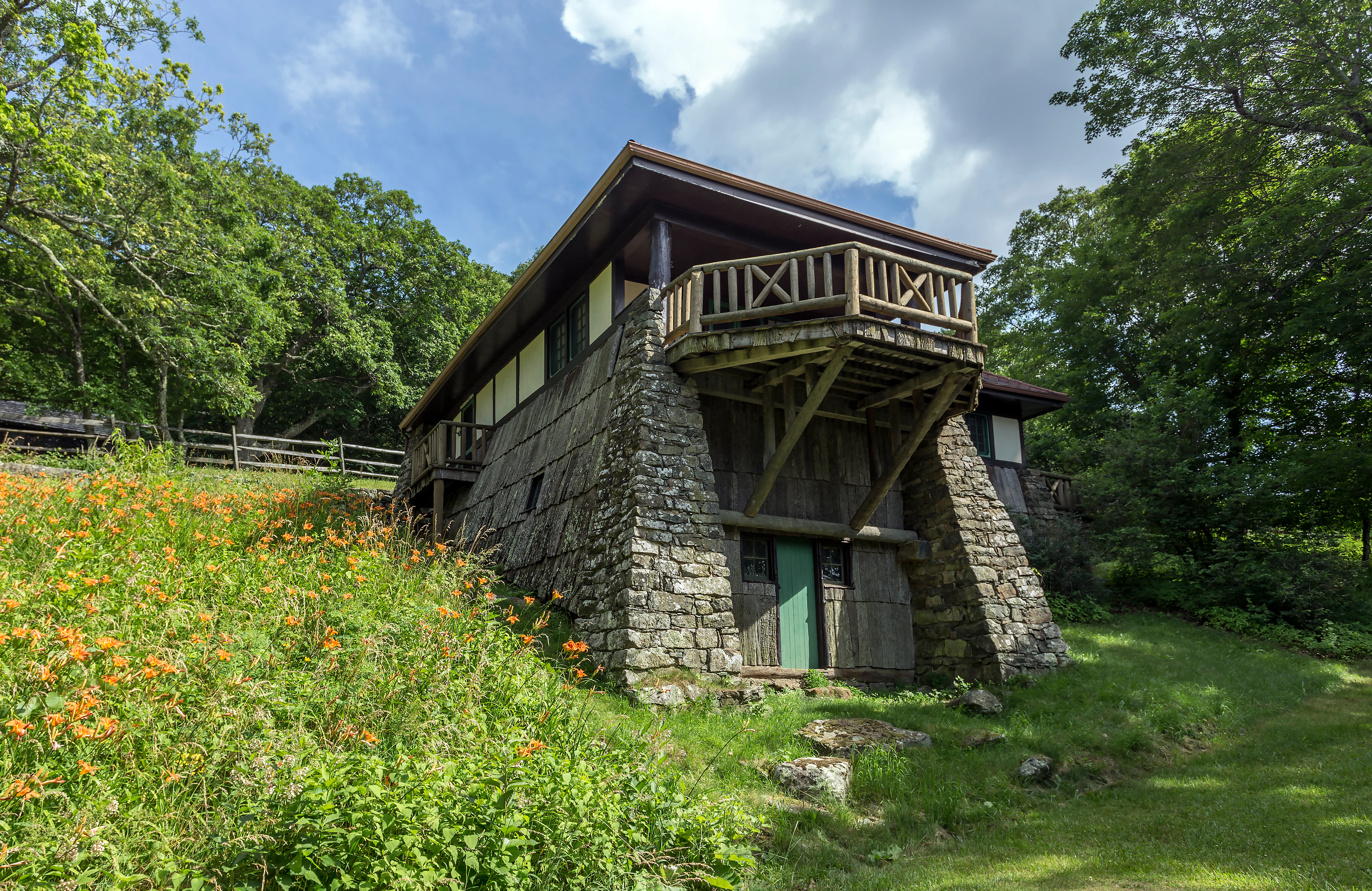
Stone and wood lodge building with a wooden balcony, surrounded by green grass and orange wildflowers, with trees in the background
Stone lodge with wooden balcony at Skyland Resort in Shenandoah National Park

Shenandoah National Park ecosystems, habitats, and plant life

The ecology of Shenandoah reflects the Appalachian forest biome, with mixed hardwood forests dominating the slopes and ridges. Oak and hickory form the primary canopy species, having largely replaced the American chestnut, which was eliminated by chestnut blight in the 1930s. The park supports diverse vegetation communities that vary with elevation, aspect, and moisture conditions. Southwestern slopes may support pine-dominated communities, while northeastern drainages feature hemlock forests with abundant moss. Mountain laurel, ferns, and diverse wildflowers populate the understory. The park's location along the Blue Ridge creates ecological connectivity that is increasingly important as surrounding lowland forests have been developed. The wilderness designation over substantial portions of the park provides protection for ecological processes and allows for natural disturbance dynamics.
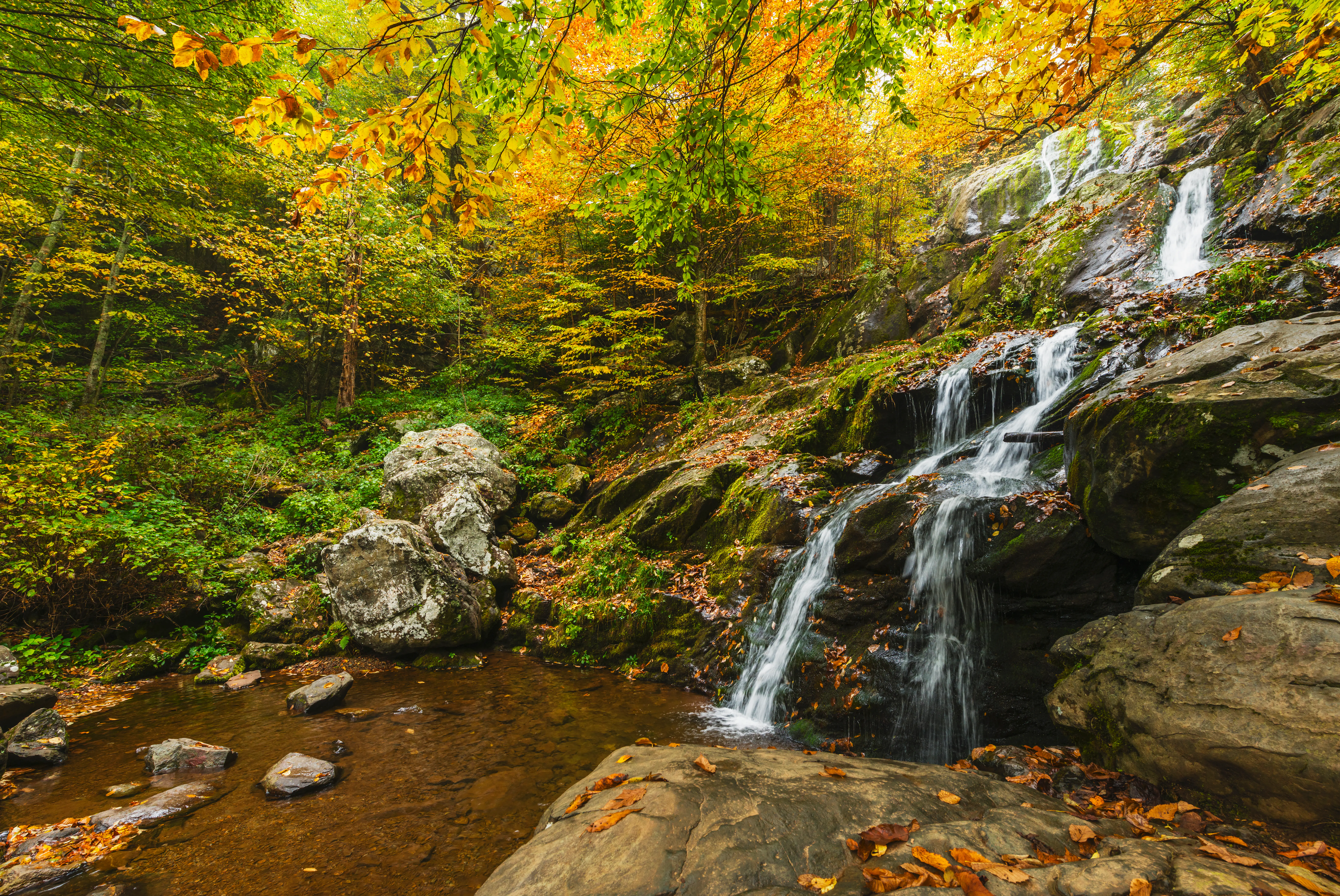
Waterfall cascading over rocks surrounded by autumn-colored trees and fallen leaves
Waterfall in Shenandoah National Park during early fall with autumn foliage

Shenandoah National Park wildlife and species highlights

Shenandoah supports a diverse community of wildlife typical of eastern Appalachian forests. Mammals include white-tailed deer, which are common throughout the park, as well as black bears, coyotes, bobcats, and smaller species such as raccoons, opossums, and various mustelids. The park is home to over 200 bird species, with approximately thirty species present year-round including barred owls, wild turkeys, and various raptors. Peregrine falcons, reintroduced in the 1990s, now nest in the park. Streams support native brook trout and other fish species. Black bears are a notable presence, and visitors are required to store food properly to prevent habituation. The park's elevation gradient and forest diversity create habitat for species ranging from warm-season specialists at lower elevations to cold-adapted species on the highest ridges.
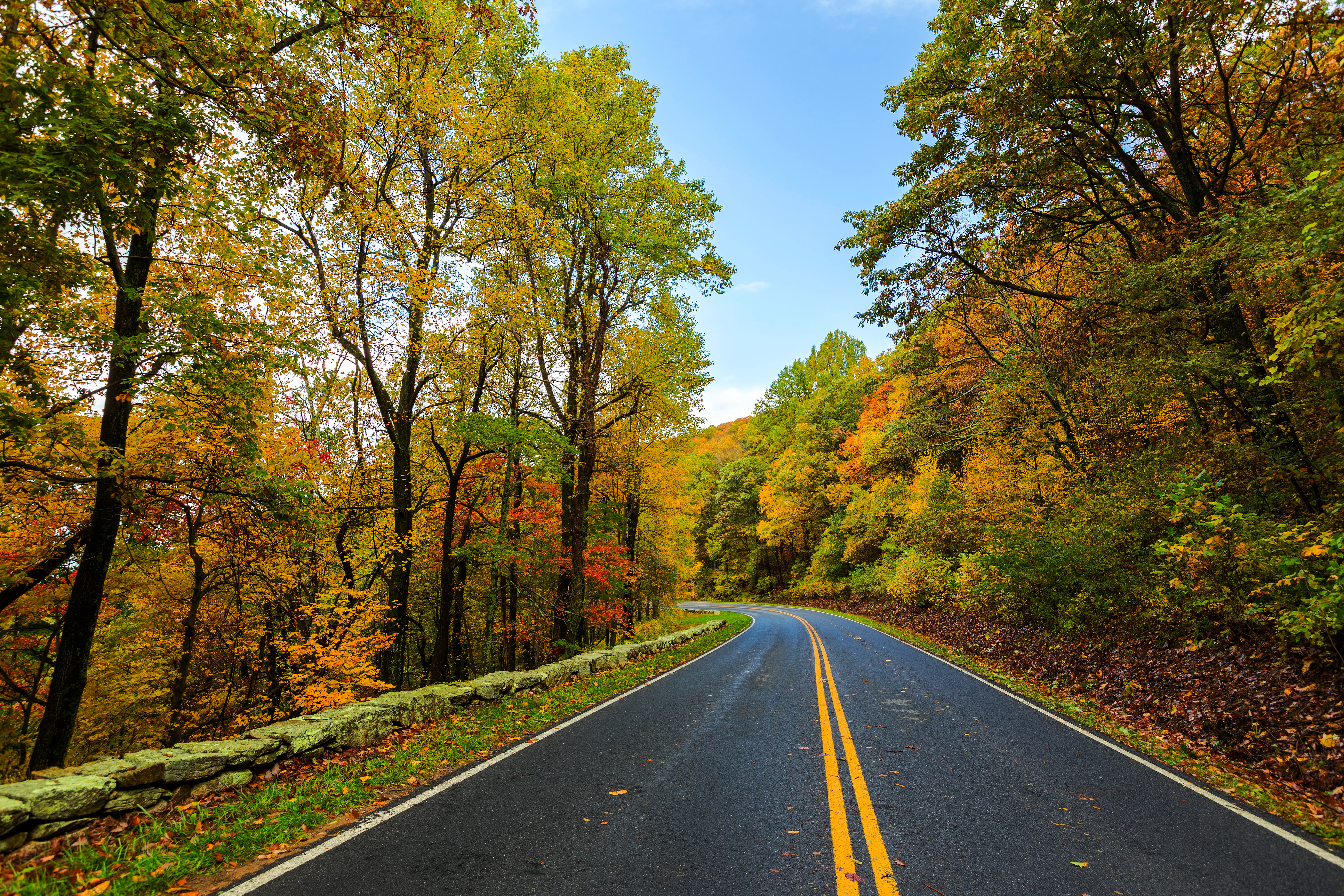
A paved road with double yellow lines running through a forest with vibrant autumn foliage, flanked by trees and a stone wall under a clear blue sky
Skyline Drive winding through autumn-colored forest in Shenandoah National Park

Shenandoah National Park conservation status and protection priorities

Shenandoah National Park represents a significant conservation achievement in the eastern United States, protecting a substantial contiguous forest corridor in a region where development has fragmented much of the original landscape. Nearly 80,000 acres, or almost 40 percent of the park, have been designated as wilderness under the National Wilderness Preservation System, providing the highest level of protection for these areas. The park's watershed protection role is significant, as the ridgeline forms the divide between major river basins. Conservation challenges include managing invasive species, addressing the impacts of atmospheric deposition, and maintaining ecological connectivity. The park also works to balance visitor use with resource protection across its extensive trail network and backcountry areas.

Shenandoah National Park cultural meaning and human context

The cultural history of Shenandoah National Park is marked by the displacement of mountain communities during the 1930s land acquisition process. Prior to the park's creation, numerous families lived in the hollows and ridges of what is now the park, practicing subsistence agriculture and maintaining connections to the land that stretched back generations. The forced evictions, though justified at the time as improving the lives of residents and creating economic opportunity, resulted in the loss of homes, land, and communities. In recent decades, the park has worked to acknowledge this history through interpretive programs and by incorporating the stories of displaced residents. Descendants of former residents have formed organizations to preserve the memory of mountain communities. The park also contains historic resources related to its development, including the presidential retreat at Rapidan Camp and the lodges built by the Civilian Conservation Corps.
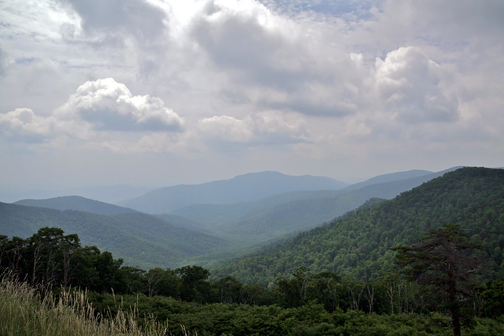
Wide landscape view of green mountain ridges, forested valleys, and distant hills under a partly cloudy sky
Scenic mountain valley view from Pinnacles Overlook in Shenandoah National Park

Top sights and standout views in Shenandoah National Park

Skyline Drive remains the park's defining feature, offering 105 miles of scenic driving along the mountain ridgeline with numerous overlooks providing views of the Shenandoah Valley and surrounding terrain. The Appalachian Trail passes through the park for 101 miles, making Shenandoah a major destination for thru-hikers and section hikers. The park's waterfall network includes numerous cascades accessible via hiking trails, with Dark Hollow Falls being the most visited. The historic lodges at Skyland and Big Meadows provide lodging opportunities within the park. The Rapidan Camp presidential retreat, built by Herbert Hoover, offers a window into the park's political history. The park's wilderness areas provide opportunities for backcountry camping and solitude.
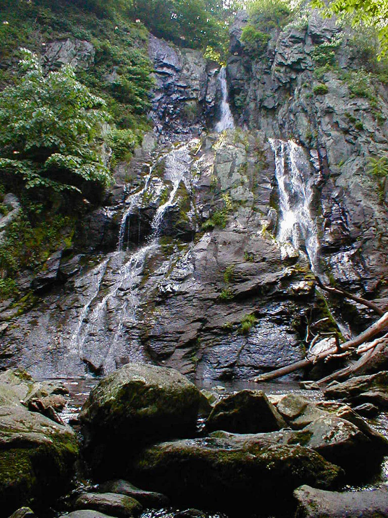
Waterfall with multiple streams flowing over moss-covered rock face, surrounded by green vegetation and large boulders
South River Falls cascading down rocky cliffs in Shenandoah National Park

Best time to visit Shenandoah National Park

Shenandoah offers distinct seasonal experiences throughout the year. Autumn brings the famous leaf-peeping season, when the hardwood forests display vibrant fall colors and the park sees its highest visitation. Spring features wildflower blooms and waterfall flows as snowmelt and rain fill the streams. Summer offers warm conditions at lower elevations and cooler temperatures on the ridgeline, though thunderstorms are common. Winter provides a quieter experience with potential for snow and ice at higher elevations, though some facilities operate on reduced schedules. The peak visitor season runs from mid-September through October for fall color, while summer weekends are also busy. Those seeking fewer crowds may find the best conditions in late March through early May or during the week in any season.
Monthly climate preview

Long term average temperatures and precipitation cycles in the Virginia highlands

Shenandoah National Park Climate Normals and Monthly Weather Patterns

Representative station records from Virginia showcase a broad thermal range spanning freezing winters to warm summer peaks alongside steady monthly precipitation. Exploring the complete monthly climate dataset provides the exact temperature averages and rain distribution needed to analyze the seasonal transitions of the protected landscape.
Annual mean13 °C
0 °C25 °C
Jan
Feb
Mar
Apr12°
May18°
Jun23°
Jul25°
Aug24°
Sep20°
Oct13°
Nov
Dec
Warmest month
July

25.2 °C

Coolest month
January

-0.2 °C

Wettest month
September

3.7 mm/day

Driest month
February

2.3 mm/day

Park location guide

Geography guide, regional context, and park location map for Shenandoah National Park

Shenandoah National Park park geography, regions, and map view in United States of America

Understand where Shenandoah National Park sits in United States of America through a broader geographic reading of the surrounding landscape, nearby location context, and its mapped position within the national park landscape.

How Shenandoah National Park fits into United States of America

The United States of America is a federal presidential republic and one of the world's largest countries by area and population. It consists of 50 states across a vast territory spanning multiple time zones, with its capital in Washington, D.C. and largest city in New York City. The nation has a diverse economy, influential political system, and significant cultural and military presence globally.

Wider geography shaping Shenandoah National Park in United States of America

The United States occupies a vast territory in North America, bordered by Canada to the north and Mexico to the south. The 48 contiguous states stretch from the Atlantic to the Pacific Ocean, while Alaska occupies the northwestern region and Hawaii is an archipelago in the Pacific. The country encompasses diverse terrain including the Rocky Mountains, Appalachian Mountains, Great Plains, and extensive river systems.

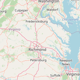
Map view of Shenandoah National Park

Use this park location map to pinpoint Shenandoah National Park in United States of America, understand its exact geographic position, and read its mapped placement within the surrounding landscape more clearly.

Pigeon | © OpenStreetMap contributors

Location context for Shenandoah National Park

Virginia
Natural feature types

Explore the Natural Landmark Collection of Shenandoah National Park

Deepen your understanding of the park geography by browsing the full index of named features associated with Shenandoah National Park. MoriAtlas provides a structured, map-focused look at the landforms and water systems that constitute this significant stretch of the Blue Ridge Mountains.
Recorded earthquake history

Review Recorded Earthquake History Near Shenandoah National Park

Access a comprehensive database of seismic activity recorded in the vicinity of Shenandoah National Park. MoriAtlas provides a clear, structured view of historical event data, including magnitude and epicentre location, for researchers and enthusiasts examining the regional geology of the Blue Ridge Mountains.

Shenandoah National Park Earthquake History

Catalogued events

4 events

Strongest magnitude

Magnitude 4.2

Most recent event

Sep 22, 2001

This history includes earthquakes recorded inside the park or within 50 km of its borders

Explore the distinctive terrain, dense forests, and sweeping valley vistas that define this protected Appalachian environment.

Shenandoah National Park Photos: Visualizing Blue Ridge Mountain Scenery and Protected Landscapes

Visually explore the diverse landscapes and natural features of Shenandoah National Park. Understand its Blue Ridge Mountain topography, from high ridgelines and forested slopes to cascading waterfalls, providing key insights into its protected environment and ecology. Immerse yourself in the park's scenic beauty, mapping its unique habitats and geographic character through a curated collection of imagery.

Waterfall cascading over rocky terrain surrounded by dense green forest under a blue sky

Rocky mountain peak with large boulders overlooking a vast valley and rolling hills under a clear blue sky.

Stone and wood lodge building with a wooden balcony, surrounded by green grass and orange wildflowers, with trees in the background

Waterfall cascading over rocks surrounded by autumn-colored trees and fallen leaves

A paved road with double yellow lines running through a forest with vibrant autumn foliage, flanked by trees and a stone wall under a clear blue sky

A mountain landscape with autumn-colored trees on hillsides under a partly cloudy sky

Wide landscape view of green mountain ridges, forested valleys, and distant hills under a partly cloudy sky

Waterfall with multiple streams flowing over moss-covered rock face, surrounded by green vegetation and large boulders

Sunset with golden light illuminating mountains and grassy foreground viewed from a stone overlook

Sunset sky with pink and orange hues over layered mountain ridges covered in dense forest

A juvenile American black bear standing on a forest floor with green vegetation and trees

Landscape showing layers of mountains with fog covering valleys and forested hillsides

Waterfall flowing over moss-covered rocks into a calm pool surrounded by greenery

White-tailed deer standing in a grassy field with yellow wildflowers, trees visible in background

Waterfall flowing over dark rocks with green vegetation in background

Snow-covered trees and mountains under a cloudy sky with a valley visible in the distance

Park atlas

Mapped Protected Landscapes and Regional Context Around Shenandoah National Park

Explore Other National Parks and Protected Areas Near Shenandoah National Park

Browse other national parks and protected areas geographically near Shenandoah National Park, including additional Blue Ridge Mountain and Appalachian Trail preserves. Deepen your understanding of regional conservation by comparing the mapped geography and diverse protected landscapes surrounding Shenandoah.
Wildlife reserveNelson County
25 km away#1 closest

Southwest

Priest Wilderness: A Deep Dive Into Appalachian Mountain Geography and Protected Forest Boundaries

High elevation ridge terrain in Nelson County, Virginia.

Priest Wilderness stands as a signature protected area in the Blue Ridge Mountains, defined by a dramatic 3,000 foot vertical gain and dense, mature hardwood forests. This documentation maps the rugged ridge and hollow topography that characterizes one of the most significant wilderness sections along the central Appalachian trail corridor.

Area
23.17 km²
Established
2000
IUCN
Ib
Relief
Mountain
Protected landscapeVirginia
About 31 km away#2 closest

West

George Washington and Jefferson National Forests: Appalachian Protected Landscape Mapping

Explore mountain ridges, river valleys, and wilderness corridors in Virginia.

Covering one of the largest public forest blocks in the eastern United States, George Washington and Jefferson National Forests offer a unique look at the central Appalachian mountain terrain. The area includes extensive wilderness tracts, the Appalachian Trail corridor, and significant geological landmarks like the Breaks gorge. Analyze the protected landscape boundaries and topographic features that define this major regional watershed and forest network.

Area
7,247.65 km²
Established
1995
Relief
Mountain
Climate
Temperate
Wildlife reserveUnited States of America
About 48 km away#3 closest

West

Ramseys Draft Wilderness: Appalachian Ridge and Valley Protected Landscape and Map Atlas

Examining wilderness boundaries and mountain stream geography in Virginia

Located in western Virginia, Ramseys Draft Wilderness is a federal protected area characterized by its extreme vertical relief and rugged Appalachian topography. Spanning from the main crest of Shenandoah Mountain to the valley floor, this wilderness serves as a vital corridor for high-elevation forest ecosystems, native brook trout, and neotropical migrant birds.

Area
26.38 km²
Established
1984
Relief
Mountain
Climate
Temperate
Wildlife reserveVirginia
66 km away#4 closest

Southwest

Rich Hole Wilderness: Appalachian Wildlife Reserve and Forest Geography

Protected cove hardwood forest in western Virginia

Rich Hole Wilderness represents a protected high quality forest landscape located within the James River Ranger District. This area spans steep, narrow hollows and high ridge crests, providing critical habitat and showcasing old growth timber specimens. Use this resource to understand the park terrain, drainage patterns, and its position within the broader Appalachian forest network of western Virginia.

Area
26.1 km²
Established
1988
IUCN
Ib
Relief
Mountain
Protected areaVirginia
67 km away#5 closest

Southwest

James River Face Wilderness: Mapping the Topography of Virginia's Blue Ridge Protected Landscapes

Geographic overview of mountain wildlands and boulder fields

Spanning over 8,900 acres, James River Face Wilderness serves as a vital protected area within the Appalachian mountain chain. The landscape contains steep creek drainages, vertical ridgelines, and significant geological formations such as the Devils Marbleyard, offering a comprehensive study of central Virginia's complex forest ecosystems and rugged mountain terrain.

Area
36.05 km²
Established
1975
IUCN
Ib
Relief
Mountain
Protected landscapeWest Virginia
67 km away#6 closest

West

Monongahela National Forest: Protected Appalachian Landscapes and Regional Geography

Mapping West Virginia wilderness and mountain terrain

Monongahela National Forest protects nearly one million acres of the central Appalachian Mountains. This massive federally managed landscape is defined by the Allegheny Front, the highest peak in the Allegheny range at Spruce Knob, and iconic geological formations like Seneca Rocks. The region represents a vital intersection of climate, hydrology, and biodiversity in the eastern United States, housing eight distinct wilderness areas and complex high-altitude ecosystems.

Area
3,727.8 km²
Established
1920
Visitors
3M annual
Relief
Mountain
Wildlife reserveVirginia
70 km away#7 closest

Southwest

Rough Mountain Wilderness: Mapping Appalachian Ridges and Protected Terrain

Remote wildlife reserve in western Virginia

Spanning over 9,000 acres, Rough Mountain Wilderness provides a rare example of undisturbed Appalachian forest. The area is characterized by consistently steep slopes, sharp ridgeline topography, and a deep sense of isolation within the George Washington and Jefferson National Forests of western Virginia.

Area
38 km²
Established
1987
IUCN
Ib
Relief
Mountain
Protected landscapeWest Virginia
About 77 km away#8 closest

West

Spruce Knob-Seneca Rocks National Recreation Area: West Virginia Mountain Landscapes

Mapped terrain of summits, cliffs, and river corridors

Spruce Knob-Seneca Rocks National Recreation Area stands as a unique protected landscape in eastern West Virginia. This area connects the high-elevation spruce forests of Spruce Knob with the vertical quartzite cliffs of Seneca Rocks and the remote depths of Smoke Hole Canyon. It remains a primary example of Appalachian high-country geography, offering a dense concentration of distinct natural features within the Monongahela National Forest.

Area
400 km²
Established
1965
Relief
Mountain
Climate
Temperate

Common questions about visiting, size, designation, and location context for Shenandoah National Park

Shenandoah National Park FAQs for park facts, access, geography, and protected area context

Find quick answers about Shenandoah National Park, including protected-area facts, park geography, trail and visitor context, and how the park fits into its surrounding country and regional landscape.
MoriAtlas Explorer

Continue Your Protected Areas Search Across the Global Atlas

Deepen your exploration by continuing the structured search for national parks and protected areas worldwide. Utilize the comprehensive filtering capabilities to compare different conservation landscapes and refine your understanding of global park geography. Discover more about the distribution and characteristics of protected natural areas.

Global natural geography