

Mori Atlas logo
National parkSierra de Órganos National Park

Discover the mapped boundaries and regional context of this protected area in Sombrerete Municipality.

Sierra de Órganos National Park: National Park Protected Landscape and Geographic Atlas

(Sierra de Órganos (Mountain Range of Órganos))

Delve into Sierra de Órganos National Park, a key protected natural area identified as a national park. This page offers a detailed atlas perspective, focusing on the park's protected landscape character and its specific geographic setting within Sombrerete Municipality. Understand the distribution and mapped boundaries of this significant conservation area, providing essential context for geographic discovery and landscape exploration.

Rock formationsNational parkSierra Madre OccidentalSemi-arid ecosystemPine-oak forestUNESCO World Heritage Site

Sierra de Órganos National Park

National park

Park overview

Structured park overview, official facts, and landscape profile for Sierra de Órganos National Park

Sierra de Órganos National Park park facts, protected area profile, and essential visitor context

Review the core facts for Sierra de Órganos National Park, including designation, size, terrain, visitor scale, habitats, and operating context in one park-focused overview.

About Sierra de Órganos National Park

Sierra de Órganos National Park occupies a remarkable position in the Sierra Madre Occidental of north-central Mexico, protecting a landscape of exceptional geological and ecological value. The park's defining features are its spectacular rock formations, which rise dramatically from the mountainous terrain in formations that can reach heights of 20 to 60 meters. These geological structures originated from volcanic activity combined with erosional processes that have sculpted the landscape over millennia, creating the distinctive columns, ridges, and steep cliff faces that characterize the area. The park sits at relatively high elevations ranging from 2,120 to 2,560 meters above sea level, placing it within the Mexican Plateau physiographic province. This elevated position within the Sierra Madre Occidental creates a diverse environmental setting where vegetation transitions from pine-oak forests in the higher elevations to xerophilous scrub and arid grasslands at lower altitudes. The protection of this semi-arid mountain ecosystem is significant because it preserves habitats for species that are endemic to the Sierra Madre Occidental region and others that face pressures from human activity in the surrounding areas. Beyond its natural significance, Sierra de Órganos forms part of the Camino Real de Tierra Adentro World Heritage Site, acknowledging its role in the historical cultural landscape of central Mexico.

Quick facts and research context for Sierra de Órganos National Park

Sierra de Órganos National Park lies in the northwestern corner of Sombrerete Municipality in Zacatecas, roughly 21 kilometers northwest of the town of Sombrerete along Highway 45. The park occupies elevations ranging from 2,120 to 2,560 meters above sea level within the Mexican Plateau physiographic province. Its most striking feature is the cluster of nearly vertical rock formations and steep peaks that form small plateaus amid the mountainous terrain. The semi-arid climate sees most precipitation during winter months, with temperatures ranging from warm to hot during daytime hours and cool to cold at night. The park is a recognized UNESCO World Heritage Site component and is home to more than 240 documented plant and animal species.

Protection and recognition

Documenting terrestrial conservation frameworks and official designation timelines within global databases.

Sierra de Órganos National Park Protection Status and Conservation Designation

Verifying the official designation timeline and terrestrial protection status of Sierra de Órganos National Park offers critical context for understanding regional conservation frameworks. Detailed registry records from 2010 provide baseline data on managed boundaries and environmental preservation efforts in North America.

Protection details

Protection scope
Terrestrial
Designated year
2010
Park context

Deeper park guide and search-rich context for Sierra de Órganos National Park

Sierra de Órganos National Park history, landscape, wildlife, and travel context

Explore Sierra de Órganos National Park through its history, landscape character, ecosystems, wildlife, conservation priorities, cultural context, and seasonal travel timing in a structured park guide built for atlas discovery and search intent.

Why Sierra de Órganos National Park stands out

Sierra de Órganos is best known for its extraordinary rock formations, which are the park's defining visual landmark and the source of its name. These towering, nearly vertical columns and cliff faces were formed through volcanic activity and subsequent erosion over thousands of years, creating a landscape that evokes the appearance of organ pipe cacti or the pipes of a pipe organ. The park is also notable for its ecological significance as a refuge for endemic and threatened species in the Sierra Madre Occidental, particularly the cacomixtle (a small procyonid mammal) and the kit fox, both of which face conservation challenges in the region. Additionally, the park's dramatic desert mountain scenery has made it a favored filming location for Western movies since the 1950s.

Sierra de Órganos National Park history and protected-area timeline

Sierra de Órganos National Park was established through federal decree on November 27, 2000, creating formal protection for this distinctive mountain landscape in Zacatecas. The park is administered by Mexico's Secretariat of Environment and Natural Resources (Secretaría de Medio Ambiente y Recursos Naturales), which oversees management and conservation activities within the protected area. The establishment of the park came during a period of growing recognition in Mexico of the need to preserve unique geological formations and the biodiversity they support. Prior to formal protection, the area had been subject to increasing recreational use and some environmental pressures from nearby agricultural and ranching activities. The park's designation as a national park reflected both its outstanding natural value and its potential for sustainable recreation and environmental education. Beyond its recent protected status, the area has a longer history of human presence and use, with the landscape serving as a filming location for Mexican and American filmmakers beginning in the 1950s, when the dramatic rock formations began attracting producers of Western films.

Sierra de Órganos National Park landscape and geographic character

The landscape of Sierra de Órganos National Park is defined by its dramatic topography and striking rock formations that dominate the visual character of the area. The terrain is characterized by uneven, mountainous relief with ridges and steep peaks forming small plateaus, from which nearly vertical cliff faces descend into small valleys. These geological formations create a visually spectacular environment where towering columns and rock walls rise abruptly from the surrounding landscape. The elevation range of approximately 440 meters between the lowest and highest points in the park contributes to the dramatic topographic variation. The underlying geology consists of volcanic rocks that have been sculpted by erosion into the distinctive formations visible today. The semi-arid environment produces a landscape where vegetation is adapted to dry conditions, yet the higher elevations support more lush pine-oak forest. Small valleys scattered throughout the mountainous terrain provide scenic viewpoints from which visitors can appreciate the scale and beauty of the rock formations. The absence of significant rivers in the area means the landscape relies on precipitation and groundwater, contributing to the xeric character of the lower elevations.

Sierra de Órganos National Park ecosystems, habitats, and plant life

The ecological character of Sierra de Órganos reflects its position within the Sierra Madre Occidental, where the park preserves important examples of mountain forest and desert scrub habitats. In the higher elevations, the park supports mixed pine-oak forests dominated by species such as Pinus cembroides (Mexican stone pine) and encino (Quercus magnoliifolia), creating closed canopy woodlands that provide habitat for forest-dwelling species. At lower elevations, the vegetation transitions to xerophilous scrub and arid grassland, with species adapted to semi-arid conditions including palms, various cacti such as biznaga, and drought-resistant shrubs like maguey, sotol, and jarilla. This altitudinal gradient in vegetation creates a mosaic of habitats within the relatively compact area of the park. The biodiversity survey documented by Mexico's National Commission for the Knowledge and Use of Biodiversity records more than 240 plant and animal species within the park, with eight species listed in some category of risk under Mexican environmental regulations. The park's position within the Sierra Madre Occidental makes it an important ecological corridor and refuge for species associated with this major mountain system.

Sierra de Órganos National Park wildlife and species highlights

The wildlife of Sierra de Órganos National Park represents the faunal diversity of the Sierra Madre Occidental region, with both common species and several endemic or threatened forms. Mammals inhabiting the park include typical desert and mountain species such as coyotes, gray foxes, cougars, bobcats, raccoons, and white-tailed deer, along with smaller mammals like hares, opossums, badgers, and collared peccaries. The park is particularly notable for supporting two endemic and threatened species: the cacomixtle (Bassariscus), a small procyonid related to raccoons, and the kit fox (Vulpes macrotis), both of which face conservation pressures in the region. Birdlife is diverse, with mourning doves, white-winged doves, scaled quail, and the common calandria (a mockingbird relative) among the commonly observed species. Birds of prey are well represented, with peregrine falcons and golden eagles nesting and hunting in the area. The diverse avifauna includes the Mexican jay and the pyrrhuloxia (siscaper cardinal), adding color to the bird communities. Reptiles, including the black-tailed rattlesnake, are present in the rocky habitats. While the park supports this biodiversity, external threats from nearby human settlements engaged in agriculture and livestock ranching, as well as sand mining operations, place pressure on wildlife populations and habitat integrity.

Sierra de Órganos National Park conservation status and protection priorities

Sierra de Órganos National Park represents an important conservation designation within the Sierra Madre Occidental, protecting both geological and biological values. The park's inclusion as a component of the Camino Real de Tierra Adentro UNESCO World Heritage Site in 2010 reflects international recognition of its outstanding universal value, though the World Heritage designation primarily reflects the historical cultural route rather than the park's natural features alone. As an IUCN Category II protected area (national park), the park aims to protect ecological processes and genetic resources while allowing for compatible human use. The biodiversity present within the park faces notable conservation challenges, with documented threats including proximity to agricultural and livestock operations that have caused ecosystem deterioration in some areas, as well as sand mining exploitation. Of the more than 240 species documented in the park, eight are listed in risk categories under Mexico's official species protection list (NOM-059). The presence of endemic and threatened species such as the cacomixtle and kit fox underscores the conservation importance of this semi-arid mountain habitat. Maintaining the ecological integrity of Sierra de Órganos requires addressing external pressures while managing the park for sustainable visitation and environmental education.

Sierra de Órganos National Park cultural meaning and human context

Sierra de Órganos holds cultural significance beyond its geological and ecological value, most notably as a dramatic backdrop for film production. Beginning in the 1950s, the park's striking rock formations attracted filmmakers producing Western movies, with both American and Mexican directors utilizing the landscape for its authentic rugged appearance. Over the decades, the park has served as filming location for numerous Western films, including productions starring prominent actors such as John Wayne, Kirk Douglas, Anthony Quinn, María Félix, and Pedro Armendáriz. This film history has embedded the park in popular culture and created a distinctive association between Sierra de Órganos and the visual language of the Western genre. The area's proximity to the historic Camino Real de Tierra Adentro, the World Heritage-listed trade route that connected Mexico City to the northern frontier, provides additional historical context. While the park does not encompass significant archaeological sites, its landscape forms part of the broader cultural and historical tapestry of north-central Mexico.

Top sights and standout views in Sierra de Órganos National Park

The most compelling highlight of Sierra de Órganos is its extraordinary rock formation landscape, where volcanic-derived columns and cliffs rise dramatically from the mountain terrain in formations that inspired the park's organ pipe-inspired name. Visitors can hike through the terrain and view these geological wonders from multiple angles, with small valleys offering particularly striking perspectives. The park's ecological diversity, transitioning from pine-oak forest to xerophilous scrub across its elevation range, supports a rich community of wildlife including the endemic and threatened cacomixtle and kit fox. The opportunity to observe birds of prey such as peregrine falcons and golden eagles adds to the nature-focused appeal. The park's role as a filming location for classic Western movies has created a unique cultural heritage dimension, with the landscape recognizable to film enthusiasts. The relative accessibility from Sombrerete along Highway 45, with a 10-kilometer access road from the highway, makes this geological wonder achievable for visitors interested in exploring one of Zacatecas's distinctive natural landmarks.

Best time to visit Sierra de Órganos National Park

The best time to visit Sierra de Órganos National Park depends on visitor preferences and tolerance for temperature extremes. The semi-arid climate means that spring and fall generally offer the most comfortable conditions for outdoor activities, with moderate daytime temperatures and cooler nights. Winter months can bring colder temperatures, particularly at night, but the drier conditions can make the rock formations more striking against clear skies. Summer months may see some precipitation and can experience higher daytime temperatures, though the higher elevation provides some moderation compared to lower desert areas. Visitors interested in wildlife observation may find different species active during different seasons, while those focused on photography may prefer times of year with favorable light and less atmospheric haze. The park's popularity as a filming location has declined from its peak decades ago, but the dramatic landscape remains compelling year-round for visitors prepared for the semi-arid mountain conditions.
Monthly climate preview

Long-term temperature averages and monthly precipitation records across a representative high-elevation coordinate

Sierra de Órganos National Park Climate Profile and Weather by Month

Long-term monthly climate normals recorded at an elevation of 2,160 meters show a distinct temperature variation with warm summer afternoons and sub-zero winter minimums. Accessing the comprehensive twelve-month profile allows for deep comparisons of monthly precipitation cycles and average temperature ranges throughout the year.
Annual mean16 °C
10 °C22 °C
Jan10°
Feb12°
Mar14°
Apr17°
May21°
Jun22°
Jul20°
Aug20°
Sep18°
Oct16°
Nov13°
Dec10°
Warmest month
June

21.7 °C

Coolest month
January

9.6 °C

Wettest month
July

3.4 mm/day

Driest month
April

0.1 mm/day

Park location guide

Geography guide, regional context, and park location map for Sierra de Órganos National Park

Sierra de Órganos National Park park geography, regions, and map view in Mexico

Understand where Sierra de Órganos National Park sits in Mexico through a broader geographic reading of the surrounding landscape, nearby location context, and its mapped position within the national park landscape.

How Sierra de Órganos National Park fits into Mexico

Mexico, officially the United Mexican States, is a country in North America spanning the Sierra Madre mountain ranges, coastal plains, and tropical regions. It borders the United States to the north, Guatemala and Belize to the southeast, and has coastlines along the Pacific Ocean, Gulf of Mexico, and Caribbean Sea. With a population exceeding 130 million, Mexico is home to one of the world's most significant concentrations of Indigenous languages alongside Spanish.

Wider geography shaping Sierra de Órganos National Park in Mexico

Mexico occupies a land area of 1,972,550 km2, making it the thirteenth-largest country in the world. The terrain is highly diverse, featuring the Sierra Madre Occidental and Sierra Madre Oriental mountain ranges, the Mexican Plateau, coastal lowlands along the Pacific and Gulf/Caribbean margins, and the Yucatan Peninsula. The country spans multiple climate zones from desert in the north to tropical rainforest in the south.

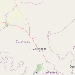
Map view of Sierra de Órganos National Park

Use this park location map to pinpoint Sierra de Órganos National Park in Mexico, understand its exact geographic position, and read its mapped placement within the surrounding landscape more clearly.

Pigeon | © OpenStreetMap contributors

Location context for Sierra de Órganos National Park

Sombrerete MunicipalityZacatecas
Park atlas

Trace the mapped geography and protected-area context of parks across the Sierra Madre Occidental region, extending beyond Sierra de Órganos National Park.

Explore National Parks and Protected Areas Near Sierra de Órganos National Park, Discovering Adjacent Landscapes

Continue your exploration beyond Sierra de Órganos National Park by browsing other national parks and protected areas across the surrounding Zacatecas region of Mexico. Compare diverse protected landscapes, trace regional park geography, and understand the broader conservation context of these critical natural zones.
State or regional parkDurango
About 160 km away#1 closest

North

Cañon de Fernández State Park: A Protected Wetland and Canyon Landscape in Durango

Geography and riparian forest mapping in northern Mexico

Cañon de Fernández State Park is an ecologically vital protected area in Durango, defined by the Nazas River corridor. Spanning desert canyons and ancient riparian forests, this site serves as a crucial Ramsar wetland in the Chihuahuan Desert. Learn about its unique geographic boundaries and the centuries-old cypress trees that define this rare northern Mexican landscape.

Area
170.19 km²
Established
2004
Relief
Mixed relief
Climate
Arid
Protected areaAguascalientes
About 209 km away#2 closest

Southeast

Cuenca Alimentadora del Distrito Nacional de Riego 01 Pabellón Protected Area Overview

Highland watershed and Sierra Fría landscape geography

Spanning two distinct blocks in the Sierra Fría, this reserve protects a vital ecological mosaic of matorral shrublands and pine oak forests. As a central watershed, it serves both as a habitat for golden eagles and pumas and as a source for regional irrigation, representing a key managed landscape in the Mexican highlands.

Area
977 km²
Established
2002
IUCN
VI
Relief
Mountain
Protected areaMexico
About 229 km away#3 closest

South

Cuenca Alimentadora del Distrito Nacional de Riego 043 Estado de Nayarit: Atlas Overview

Watershed reserve and montane forest geography

This extensive protected area spans the Sierra Madre Occidental, featuring a fragmented landscape of high mountain ridges separated by river valleys. It safeguards critical pine and oak forest ecosystems that supply the Irrigation District 043, serving as a vital natural resource hub in west-central Mexico.

Area
23,290.3 km²
Established
1949
IUCN
VI
Relief
Mountain
Biosphere reserveNayarit
About 284 km away#4 closest

Southwest

Sierra de San Juan Biosphere Reserve: Geographic Overview and Protected Area Mapping

Volcanic terrain and forest ecosystems in Nayarit, Mexico

Explore the volcanic landforms and layered forest communities of Sierra de San Juan Biosphere Reserve. This protected area in Nayarit spans distinct ecological zones from dry coastal lowlands to mountain cloud forests, providing essential habitat and unique biodiversity at the convergence of major Mexican mountain systems.

Area
198.01 km²
Established
2003
Relief
Mountain
Scope
Terrestrial
Wildlife reserveSinaloa
About 296 km away#5 closest

West

Meseta de Cacaxtla Flora and Fauna Protection Area: Sinaloa Protected Landscape Overview

Mapping dry forests and Pacific coastal ecosystems

Meseta de Cacaxtla Flora and Fauna Protection Area is a significant wildlife reserve in Sinaloa, characterized by its transition from an elevated inland plateau to a complex coastal fringe of mangroves and lagoons. Spanning 508 square kilometers, this protected area preserves an essential blend of arid tropical ecosystems and marine habitats along the Mexican Pacific coast, providing a clear geographic view of regional conservation efforts.

Area
508.62 km²
Established
2000
IUCN
VI
Relief
Lowland
National parkNayarit
About 305 km away#6 closest

Southwest

Isla Isabel National Park: Protected Island Landscape within Nayarit's Geography

Explore its mapped boundaries and distinct geography.

Isla Isabel National Park represents a crucial protected area within the broader geographic framework of Nayarit. This national park offers a focused lens for exploring a unique island landscape, its specific mapped boundaries, and its place within the regional atlas. Understanding its ecological and geographic context is key to appreciating this distinct natural landscape.

Area
1.94 km²
Established
1980
IUCN
II
Regional parkSinaloa
About 323 km away#7 closest

West

Ceuta Regional Park: Coastal Geography and Protected Nesting Habitats in Sinaloa

Coastal protection and agricultural valley landscape analysis.

Ceuta Regional Park stands as a key protected area on the Sinaloa coast of Mexico, noted for its long-standing sea turtle conservation initiatives and importance to migratory shorebirds. The park geography spans low-lying coastal plains and beach environments, framed by the agricultural heart of the Elota municipality. This entry provides a structural overview of the terrain, boundaries, and ecological context defining this coastal reserve.

Area
15 km²
Established
2002
Relief
Lowland
Access
Access unknown
Protected areaCoahuila
About 335 km away#8 closest

Northeast

Serranía de Zapalinamé: Protected Mountain Geography and Watershed in Coahuila

Ecological transition zone within the Sierra Madre Oriental

The Serranía de Zapalinamé forms a dramatic mountain corridor rising over Saltillo, Coahuila. This state natural reserve protects a vital watershed and biodiversity hotspot where Chihuahuan Desert scrub meets pine and oak montane forests. Its steep canyons and high ridges offer a significant case study in regional landscape conservation and natural water security.

Area
253.74 km²
Established
1996
Relief
Mountain
Climate
Arid

Common questions about visiting, size, designation, and location context for Sierra de Órganos National Park

Sierra de Órganos National Park FAQs for park facts, access, geography, and protected area context

Find quick answers about Sierra de Órganos National Park, including protected-area facts, park geography, trail and visitor context, and how the park fits into its surrounding country and regional landscape.
MoriAtlas Explorer

Continue Your Protected Areas Search Across the Global Atlas

Deepen your exploration by continuing the structured search for national parks and protected areas worldwide. Utilize the comprehensive filtering capabilities to compare different conservation landscapes and refine your understanding of global park geography. Discover more about the distribution and characteristics of protected natural areas.

Global natural geography