Mori Atlas logo
Biosphere reserveŠimonių giria

Exploration of post glacial sandy ridges, peatland clusters, and protected river corridors in northern Lithuania

Šimonių Giria Biosphere Reserve: A Mapped Analysis of Protected Forests and Landscape Geography

Šimonių giria represents a significant, compact forest massif characterized by its unique post glacial topography and integrated biosphere monitoring network. The terrain features a complex mosaic of undulating sandy ridges, dense pine stands, and secluded peatlands across the Anykščiai District Municipality. This protected area acts as a vital ecological corridor, defined by the hydrological influence of the Šventoji and Pelyša rivers and a high density of forest lakes.

pine forestboreal woodlandbiosphere polygonNatura 2000 sitepeatlandglacial landscape

Šimonių giria

Biosphere reserve

Park overview

Structured park overview, official facts, and landscape profile for Šimonių giria

Šimonių giria park facts, protected area profile, and essential visitor context

Review the core facts for Šimonių giria, including designation, size, terrain, visitor scale, habitats, and operating context in one park-focused overview.

About Šimonių giria

Šimonių giria is a sizeable forest massif in the northern Lithuanian landscape, occupying parts of the Anykščiai and Kupiškis districts. It forms a clearly delimited block of woodland roughly 16 kilometers across from west to east and about 10 kilometers from north to south, set in a belt of countryside west of Svėdasai and south of the village of Šimonys from which it takes its name. To the southwest, the forest merges with the neighboring Akmenos forest, reinforcing its character as part of a continuous wooded region rather than an isolated stand.

Physically, the forest rests on post-glacial deltaic sands, and around 70 percent of the territory sits on sandy or loamy soils traceable to that origin. The resulting terrain is gently rolling and occasionally ridged, interspersed with peatlands such as Iženo and Uogšilis peat bogs, and dotted with lakes including Apvalainis, Denionių, Ešerinis, Iženas, Juodeglynis, Kuojinis, Pailgabradys, Skaistis, Skvarbinis, Uzinas, Varležeris, and Vožupis. Hydrologically, the Šventoji River runs along the southern edge of the forest, while the Pelyša, a tributary of the Šventoji, follows the northwestern and western margins, joined inside the massif by the Aluotis, a tributary of the Jara, and other small streams.

Compositionally, Šimonių giria is overwhelmingly a coniferous landscape. Pine stands account for the majority of the forest cover, while birch and spruce stands together provide a substantial secondary layer, and smaller patches of black alder, white alder, and aspen occupy the remainder. Age-class data from 2008 show a balanced structure, with young, middle-aged, maturing, and mature stands each contributing meaningfully to the forest's vertical and structural diversity. The mix of habitat types supports both common northern Lithuanian woodland species and several more sensitive fauna, making the forest a useful reference site for regional biodiversity monitoring.

Šimonių giria has been formally integrated into Lithuania's system of protected areas through the designation of the Šimonių girios biosferos poligonas, established to preserve the forest's ecosystem and to allow systematic monitoring of natural changes over time. The polygon, larger than the forest massif itself, is part of the national ecological and biodiversity monitoring framework and contributes to the European Natura 2000 network. It is administered in connection with the Anykščiai Regional Park directorate, which coordinates observation of protected species and reporting to the State Service for Protected Areas under the Ministry of Environment. Management rules restrict cutting in sensitive seasons, require retention of old and dead trees, encourage protection of anthills and prescribed burning of clearcut litter, and set a minimum share of open area within the polygon to maintain habitat variety. These measures give the forest a stronger regulatory profile than a typical commercial woodland while still functioning as a living, working landscape.

Quick facts and research context for Šimonių giria

Šimonių giria lies in the Anykščiai and Kupiškis districts of northeastern Lithuania, with the village of Šimonys to the north and Svėdasai to the east. The massif as a whole covers 13,500 hectares, while the biosphere polygon delineated within it totals 23,261 hectares, of which 19,209 hectares belong to Anykščiai district and 4,052 hectares to Kupiškis district.

Pine stands make up around 60 percent of the forested area, birch stands about 24 percent, and spruce stands roughly 13 percent, with alder, white alder, and aspen filling out the remainder. The forest is administered in connection with the Anykščiai Regional Park, and the biosphere polygon serves as a component of Lithuania's national ecological and biodiversity monitoring system, as well as part of the European Natura 2000 ecological network.

Protection and recognition

Documented terrestrial protection scope and international recognition records

Šimonių Giria Protection Status and Natura 2000 Recognition

Terrestrial protection records establish the management scope and official Natura 2000 designation framework for Šimonių giria. Structured conservation data details the documented recognition history associated with this protected natural landscape.

International recognition

Protection details

Protection scope
Terrestrial
Transboundary protection
No
Park context

Deeper park guide and search-rich context for Šimonių giria

Šimonių giria history, landscape, wildlife, and travel context

Explore Šimonių giria through its history, landscape character, ecosystems, wildlife, conservation priorities, cultural context, and seasonal travel timing in a structured park guide built for atlas discovery and search intent.

Why Šimonių giria stands out

Šimonių giria is best known as a large, compact pine-dominated forest massif in northern Lithuania that doubles as a formally designated biosphere monitoring polygon. Its landscape character is defined by post-glacial sandy ridges, undulating terrain, numerous small lakes, and peatlands, all wrapped around a network of protected reserves including the Iženo telmological reserve and the Šventoji landscape reserve. The forest is also notable for hosting breeding populations of several conservation-relevant bird species, including the black stork, lesser spotted eagle, Eurasian nightjar, black woodpecker, wood lark, and European roller. It contains a protected stand of Veratrum lobelianum found in the biosphere polygon in 2012, a record cranberry bog, three known black grouse lek sites, and a stretch of the Šventoji River that defines much of its southern boundary, giving Šimonių giria a recognizable identity within Lithuania's protected-area system.
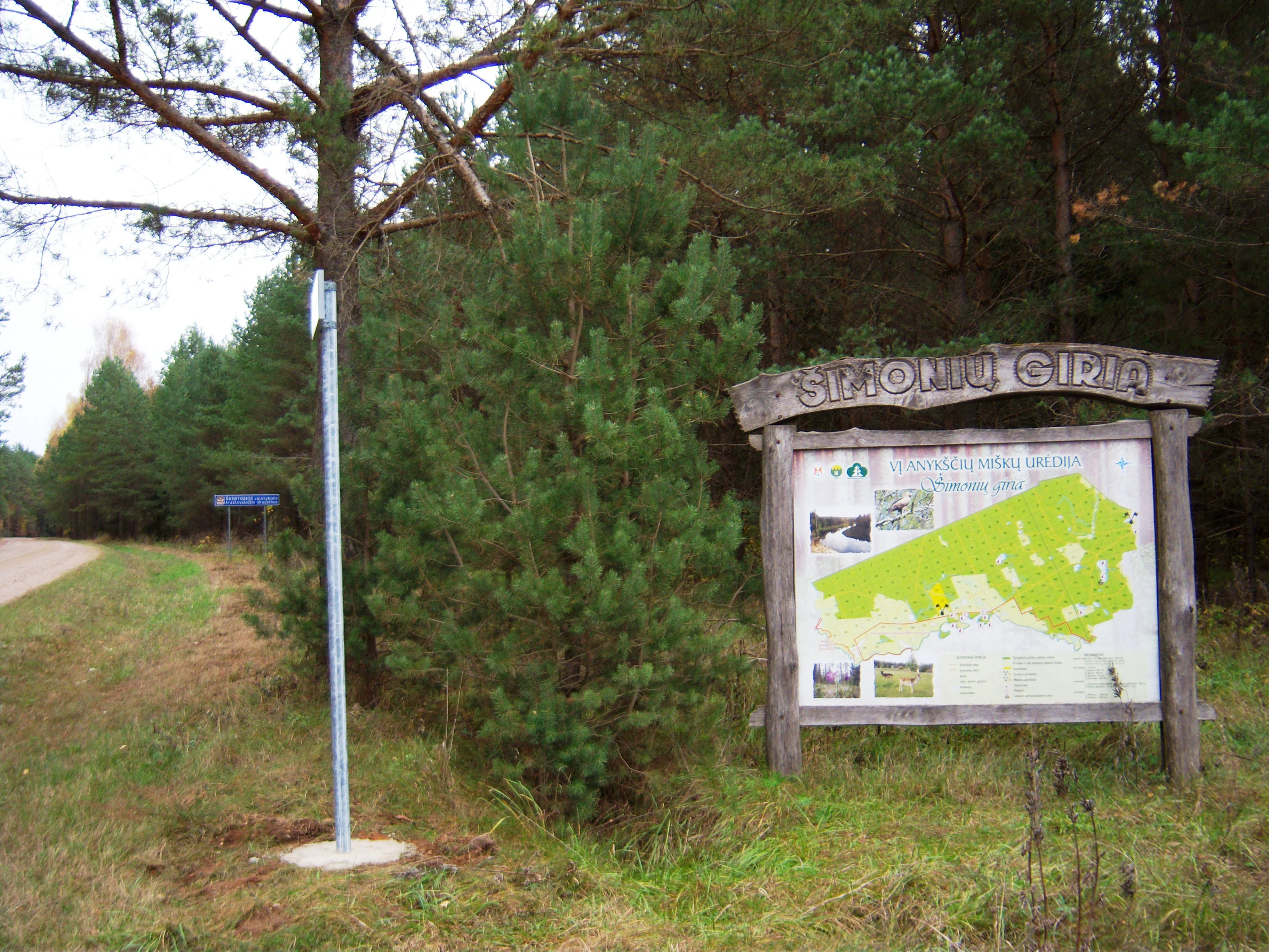
A wooden informational sign displaying a map of the Šimonių giria forest, situated at the edge of a road in a pine forest setting.
An informational kiosk at the entrance of Šimonių giria forest, featuring a map and details about the protected area.

Šimonių giria history and protected-area timeline

The forest's institutional history is closely tied to the modern Lithuanian system of nature protection rather than to any single dramatic founding event. The forested massif took its present protected profile with the establishment of the Šimonių girios biosferos poligonas, a designated monitoring and conservation area intended to safeguard the forest's ecosystem and serve as a long-term observation site within Lithuania's national ecological and biodiversity monitoring framework.

The polygon, established under regulations confirmed in 2004, was conceived as a component of the broader European Natura 2000 ecological network. Its management has been linked from the outset with the Anykščiai Regional Park directorate, which coordinates protected species observations and reports to the State Service for Protected Areas under the Ministry of Environment. The forest also contains older layers of natural and cultural significance: recorded archaeological, historical, and natural monuments, as well as traces of the postwar Lithuanian partisan movement, when fighters of the Algimantas district operated within the forest. In 2014, a cognitive route was created along the trails of those partisan fighters, layering a more recent commemorative landscape onto a forest whose ecological protections continue to define its central identity.

Šimonių giria landscape and geographic character

Šimonių giria is shaped by a geology shaped in the post-glacial period, when deltaic sands accumulated into the continental ridges on which the forest now sits. Around 70 percent of the terrain is built on these sandy and loamy soils, and the resulting topography is undulating, with low ridges and gentle slopes alternating with flatter, wetter depressions. The interplay produces a varied ground surface even within a relatively compact forest block.

The hydrology strongly defines the landscape's edges and interior. The Šventoji River runs along the southern forest boundary, while the Pelyša, a tributary of the Šventoji, follows the northwestern and western margins. Inside the massif, the Aluotis, joining the Jara system via the Iženas, and several other small streams weave through the forest. Peatlands, particularly Iženo peat bog and Uogšilys peat bog, punctuate the interior, contributing to the visual variety of open wetland alongside closed forest.

The forest's water features also include a notable concentration of lakes of various sizes, among them Apvalainis, Denionių, Ešerinis, Iženas, Juodeglynis, Kuojinis, Pailgabradys, Skaistis, Skvarbinus, Uzinas, Varležeris, and Vožupis. These lakes, combined with the boggy depressions and sandy ridges, give Šimonių giria the layered, gently varied topography typical of northern Lithuanian forest landscapes, while still standing out for the density and spatial arrangement of its water bodies within a single forested massif.

Šimonių giria ecosystems, habitats, and plant life

Šimonių giria's natural character is defined first by its dominant pine forest, which forms the backbone of the massif and shapes much of its light, soil, and understory conditions. Pine stands cover roughly 60 percent of the forest area and create the open, dry, sandy-soil habitats typical of Lithuania's northern woodlands. Birch stands add about 24 percent, often occupying transitional and more disturbed sites, while spruce covers another 13 percent, generally favoring moister microhabitats along slopes and lower ground.

Small but ecologically meaningful shares of black alder, white alder, and aspen stands fill out the remainder, contributing wetland and edge habitat to the overall forest mosaic. Peatlands within the massif, especially Iženo and Uogšilys, host distinct wetland vegetation, and a recorded cranberry bog adds a characteristic northern bog flora. Mushrooms, medicinal plants, and berry-bearing species are abundant, reflecting a forest that has retained much of its traditional multi-use character.

In 2012, a stand of Lobelian corn lily (Veratrum lobelianum), a species listed in the 0(ex) category of the Lithuanian Red Data Book, was documented within the biosphere polygon, highlighting the forest's capacity to support rare or relict flora alongside its more typical woodland vegetation. The combination of coniferous forest, broadleaf patches, peatlands, lakes, and riparian corridors gives Šimonių giria a layered ecological identity typical of northern European mixed-forest landscapes.

Šimonių giria wildlife and species highlights

The wildlife of Šimonių giria covers a broad spectrum of northern Lithuanian forest species, reflecting the forest's mix of coniferous stands, peatlands, lakes, and rivers. Among large mammals, the forest hosts moose, red deer, roe deer, and wild boar, as well as predators and smaller carnivores such as the red fox, the raccoon dog, the European badger, the Eurasian lynx, the pine marten, and the stoat. Brown hare and red squirrel complete the picture of common woodland mammals.

Birdlife is a particular point of ecological interest. The forest holds populations of black grouse and, notably, three known capercaillie lek sites, giving the area real significance for grouse conservation in the Lithuanian context. Among the forest's protected bird species are several of clear European conservation concern, including the black stork (Ciconia nigra), the lesser spotted eagle (Aquila pomarina), the Eurasian nightjar (Caprimulgus europaeus), the black woodpecker (Dryocopus martius), the wood lark (Lullula arborea), and the European roller (Coracias garrulus).

Aquatic and semi-aquatic wildlife adds another dimension. Lakes and peatlands support wild ducks, while the rivers and streams sustain brown trout, native crayfish, muskrats, otters, and beavers. Together, the forest's combination of mammal, bird, and aquatic fauna gives Šimonių giria a representative, well-balanced wildlife profile for the northern Lithuanian lowlands while still preserving populations of species that command higher conservation attention.

Šimonių giria conservation status and protection priorities

Šimonių giria carries significant conservation weight within Lithuania's protected-area system, primarily through the establishment of the Šimonių girios biosferos poligonas. The polygon was created specifically to safeguard the forest's ecosystem and to serve as a long-term monitoring site for natural change, and it has been formally incorporated into Lithuania's national complex ecological and biodiversity monitoring framework as well as into the European Natura 2000 ecological network.

The polygon encompasses 23,261 hectares, of which 19,209 hectares lie in Anykščiai district and 4,052 hectares in Kupiškis district. Management within the polygon, codified in 2004, restricts logging during sensitive breeding months, protects cavity-bearing and decaying trees, requires the retention of stuobriai, dead wood, and windthrown trees per hectare (with limited exceptions for green spruce), encourages the protection of anthills, and promotes prescribed burning of clearcut litter. Clear-cutting layout is also regulated to ensure a minimum share of open habitat per 100 hectares, supporting habitat diversity at the landscape scale.

Inside the broader forest, additional reserves reinforce ecological value: the Iženo telmological reserve, the Šventoji landscape reserve, and the Pelyšos geological reserve all protect specific hydrological, scenic, and geological features. The presence of protected bird species such as the black stork, lesser spotted eagle, Eurasian nightjar, black woodpecker, wood lark, and European roller, alongside a documented Lobelian corn lily population within the polygon, gives Šimonių giria a tangible conservation profile that extends beyond generic forest protection into species- and habitat-level significance.

Šimonių giria cultural meaning and human context

Šimonių giria is more than an ecological unit; it sits within a landscape marked by long-standing rural settlement and more recent layers of national memory. The forest is bordered and interspersed by a network of small villages and hamlets, including Šimonys, Mikieriai, Sedeikiai, Pelyšiai, Šilagaliai, Juodeglynis, and Ertėjai, each contributing to the traditional cultural setting of Lithuania's northern countryside.

Within the forest, several archaeological, historical, and natural monuments are recognized, weaving an older human story into the wooded landscape. A more recent and emotionally resonant layer comes from the postwar period, when Lithuanian partisans belonging to the Algimantas district operated within the forest. In 2014, an educational and commemorative route was opened along the paths of those partisan fighters, transforming part of the forest into a place of remembrance as well as a natural area. The interplay of everyday village life, recorded monuments, and partisan-era memory gives Šimonių giria a cultural depth that complements its ecological role.

Top sights and standout views in Šimonių giria

Šimonių giria offers a rare combination of substantial pine-dominated woodland, well-developed peatland and lake systems, and formally recognized monitoring status within both Lithuanian and European conservation frameworks. Its biosphere polygon ensures that ecological processes, bird species of European concern, and rare plants such as the Lobelian corn lily are subject to long-term observation and active protection.

The forest also distinguishes itself through three recorded capercaillie lek sites, a documented cranberry bog, and intersecting river corridors along the Šventoji, Pelyša, and Aluotis watercourses. Layered onto this ecological richness is a tangible cultural legacy: villages around the forest edges, recognized archaeological and historical monuments within the woodland, and a partisan-era memory route that connects today's visitors to the postwar resistance history of northern Lithuania.

Best time to visit Šimonių giria

Šimonių giria has the kind of seasonal rhythm typical of northern Lithuanian pine forests, and visiting intentions tend to shape which season feels most rewarding. Late spring and early summer bring the forest to life with active bird breeding and the best chances of observing protected species such as the black stork, the lesser spotted eagle, the Eurasian nightjar, the wood lark, and the European roller, along with wetland waterfowl on the lakes and bogs. Management restrictions on logging in spring months also mean the forest is comparatively undisturbed during this period.

Late summer and early autumn are traditionally associated with mushroom, berry, and cranberry gathering in Lithuanian forests, and the abundance of fungi, medicinal plants, and berries recorded in Šimonių giria makes this an especially atmospheric time to explore the forest's quieter interior. Winter, with snow cover and frozen peatland edges, gives the lakes and ridges a stark, sculptural quality and offers clear views across the open bog and lake surfaces; this is also when animal tracks and grouse activity are easier to read. Each season presents a different way of engaging with the forest's landscape and wildlife, and the area's protected status means visitors can plan around broad seasonal character rather than around specific operational schedules.
Monthly climate preview

Track measured temperature ranges and precipitation rhythm across twelve months

Šimonių giria Climate and Long-Term Monthly Weather Normals Preview

Representative coordinate records show average temperatures moving from winter lows below negative twenty degrees Celsius to summer highs approaching twenty-nine degrees Celsius alongside steady precipitation rates. Reviewing complete monthly climate normals for Šimonių giria reveals detailed long-term averages for every month of the year.
Annual mean6 °C
-6 °C18 °C
Jan-6°
Feb-5°
Mar-1°
Apr
May12°
Jun16°
Jul18°
Aug17°
Sep12°
Oct
Nov
Dec-4°
Warmest month
July

17.8 °C

Coolest month
January

-5.8 °C

Wettest month
July

3 mm/day

Driest month
March

1.6 mm/day

Park location guide

Geography guide, regional context, and park location map for Šimonių giria

Šimonių giria park geography, regions, and map view in Lithuania

Understand where Šimonių giria sits in Lithuania through a broader geographic reading of the surrounding landscape, nearby location context, and its mapped position within the national park landscape.

How Šimonių giria fits into Lithuania

Lithuania is a unitary semi-presidential republic and one of three Baltic states in Northern Europe. It lies on the eastern coast of the Baltic Sea, with Vilnius as its capital and largest city. The country regained independence in 1990 after Soviet occupation and joined the European Union in 2004. Lithuania has a population of about 2.9 million and covers an area of 65,300 km².

Wider geography shaping Šimonių giria in Lithuania

Lithuania is situated on the eastern shore of the Baltic Sea in Northern Europe. It borders Latvia to the north, Belarus to the east and south, Poland to the south, and Russia's Kaliningrad Oblast to the southwest. The country also has a maritime border with Sweden to the west. The terrain is largely flat with rolling hills, numerous lakes, and rivers. The Nemunas River is the longest river in the country.

Map view of Šimonių giria

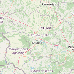
Use this park location map to pinpoint Šimonių giria in Lithuania, understand its exact geographic position, and read its mapped placement within the surrounding landscape more clearly.

Pigeon | © OpenStreetMap contributors

Location context for Šimonių giria

Anykščiai District MunicipalityKupiškis District Municipality

Examine protected forest terrain, glacial ridges, and wetland habitats across the biosphere polygon.

Šimonių giria Photos and Landscape Scenery: Visualizing Northern Lithuanian Boreal Woodlands

Visual records capture the distinctive pine stands, undulating sandy terrain, and remote peatlands that define the protected forest environment. Studying these natural habitats reveals the varied topography and ecological character of the northern Lithuanian biosphere reserve.

A wooden informational sign displaying a map of the Šimonių giria forest, situated at the edge of a road in a pine forest setting.

Park atlas

Compare surrounding forest reserves, glacial terrain, and regional conservation landscapes

Explore Protected Areas and Parks Near Šimonių Giria in Northern Lithuania

Visitors browsing Šimonių giria can uncover other protected natural areas across the surrounding northern Lithuanian region. Extending the geographic review helps map connected boreal woodlands, river corridors, and lake district ecosystems for deeper comparison.
Biosphere reserveLithuania
About 30 km away#1 closest

Southwest

Taujėnų, Užulėnio miškų biosferos poligonas: Protected Forest Landscapes of Lithuania

Central Baltic lowland conservation territory

Spanning central Lithuania, this biosphere reserve preserves a vast mosaic of deciduous, coniferous, and mixed forest lands. The territory supports high-quality bird habitats through disciplined forestry practices and the protection of complex wetland and peatland systems, making it a reference site for lowland forest conservation.

Area
44.19 km²
Established
2004
Relief
Lowland
Climate
Temperate
Watercolor painting of a lake surrounded by trees with a sunset sky
National parkLithuania
39 km away#2 closest

Southeast

Aukštaitija National Park: Lithuania's Oldest National Park and Protected Landscape Exploration

Mapped geography and lake district atlas for this Baltic region park.

Delve into Aukštaitija National Park, Lithuania's pioneering national park and a key protected area in the Baltic region. This detailed atlas entry highlights its defining geography: an extensive mosaic of over 120 lakes interwoven with ancient pine forests across undulating highlands. Understand the park's protected landscape, its mapped boundaries, and its ecological significance within Eastern Europe's natural terrain.

Area
410.56 km²
Established
1974
IUCN
II
Relief
Upland
Biosphere reserveUkmergė District Municipality
About 51 km away#3 closest

Southwest

Viliukų, Karpių miškai Biosphere Reserve: Regional Protected Area Geography and Maps

Broadleaved forests and wetland ecosystems in central Lithuania

Gain insights into the protected landscape of Viliukų, Karpių miškai in the Ukmergė District. This biosphere reserve provides a detailed view of lowland forest ecosystems, characterized by spruce and birch dominance within an undulating terrain that sustains rare insect and plant communities.

Area
7.772 km²
Established
2012
Relief
Lowland
Scope
Terrestrial
Nature reserveŠvenčionys District Municipality
About 53 km away#4 closest

Southeast

Kiauneliškio gamtinis rezervatas: Ancient Forest Landscapes and Protected Terrain Mapping

Nature reserve geography in Švenčionys District Municipality

Kiauneliškio gamtinis rezervatas protects 283 hectares of moist, sandy pine woodland characterized by glacial ridges and historic old-growth specimens. This site acts as an ecological reference for the Labanoro forest landscape, offering clear insights into the undulating lowland topography and rare interior habitats of eastern Lithuania.

Area
2.83 km²
IUCN
Ia
Relief
Lowland
Climate
Temperate
Nature reserveŠvenčionys District Municipality
About 59 km away#5 closest

Southeast

Girutiškio gamtinis rezervatas Protected Area: Geographic Overview and Wetland Mapping

Labanoras Forest wetland complex in the Švenčionys District Municipality

Girutiškio gamtinis rezervatas is a strictly protected nature reserve occupying 1,400 hectares in eastern Lithuania. Defined by the Girutiškis and Beržalotas raised bogs, the area features a series of relict thermokarst lakes and dense pine forests. It remains a key site for boreal peatland conservation and hydrological study within the Baltic region, offering a rare glimpse into preserved wetland terrain.

Area
14 km²
IUCN
Ia
Biosphere reserveKauno rajonas
About 101 km away#6 closest

Southwest

Babtų-Varluvos miškų biosferos poligonas: Protected Forest Landscapes and Geographic Mapping

Essential woodland corridors in Kaunas district, Lithuania

Babtų-Varluvos miškų biosferos poligonas functions as a significant biosphere reserve focused on mature lowland forest conservation. This protected area offers a look at continuous woodland structures, research-focused biodiversity monitoring, and the spatial significance of forest corridors within central Lithuanian geography.

Area
44.19 km²
Established
2004
IUCN
VI
Relief
Lowland
Watercolor illustration of a wooden boardwalk path winding through a flat landscape with scattered trees, soft grasses, and muted natural colors.
Nature reserveKauno rajono savivaldybė
About 103 km away#7 closest

Southwest

Dubravos rezervatinė apyrubė: Protected Nature Reserve and Baltic Forest Geography

Central Lithuania protected landscape and wetland mapping

This nature reserve in the Kaunas district protects a rare combination of mature pine forest and open raised bog habitats. By preserving long term undisturbed ecological processes, it provides a stable reference point for forest dynamics in the region. Explore the structural complexity of these coniferous stands and the distinct wetland characteristics of this protected Baltic landscape.

Area
1.2 km²
Established
1994
IUCN
Ia
Relief
Lowland
Watercolor painting showing a lake surrounded by trees and rolling hills
National parkBelarus
About 109 km away#8 closest

East

Braslaw Lakes National Park: Protected Glacial Lake Landscape Atlas

Mapped boundaries and terrain of a key Belarusian protected area.

Braslaw Lakes National Park presents a fascinating protected landscape defined by its extensive glacial lake chain, lush forests, and vital wetland ecosystems. As a significant natural region in northern Belarus, it offers valuable insights into lacustrine environments and glacially formed terrain. This park serves as a prime example of protected land within the Vitebsk Region, ideal for exploring its mapped geography, understanding its ecological importance, and appreciating the unique character of Eastern Europe's lake districts through a structured atlas lens.

IUCN
II

Common questions about visiting, size, designation, and location context for Šimonių giria

Šimonių giria FAQs for park facts, access, geography, and protected area context

Find quick answers about Šimonių giria, including protected-area facts, park geography, trail and visitor context, and how the park fits into its surrounding country and regional landscape.
MoriAtlas Explorer

Continue Your Protected Areas Search Across the Global Atlas

Deepen your exploration by continuing the structured search for national parks and protected areas worldwide. Utilize the comprehensive filtering capabilities to compare different conservation landscapes and refine your understanding of global park geography. Discover more about the distribution and characteristics of protected natural areas.

Global natural geography