
Mori Atlas logo
Natural monumentSkalní sruby Jizery

Geographic analysis of the Jizera River sandstone rock shelters and protected riparian corridor

Skalní sruby Jizery Natural Monument: Mapped Sandstone Geomorphology and Riparian Landscape

(Přírodní památka Skalní sruby Jizery)

Skalní sruby Jizery is a significant natural monument located in the Central Bohemian Region, encompassing a distinctive one-kilometer stretch of sandstone cliffs along the Jizera River. This protected area illustrates deep-weathering geomorphology, specifically a 315-meter lateral rock shelter carved by river erosion. The site functions as a vital riparian habitat for diverse plant species and nesting birds, offering a concentrated look at Bohemian Cretaceous sandstone terrain.

sandstone cliffrock shelterpseudokarstriver erosionfluvial landformJizera River
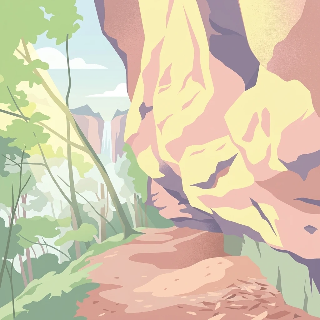
A stylized digital illustration of a dirt hiking trail winding beside a large, layered rock face with forest trees and a distant waterfall in the background.

Skalní sruby Jizery

Natural monument

Park overview

Structured park overview, official facts, and landscape profile for Skalní sruby Jizery

Skalní sruby Jizery park facts, protected area profile, and essential visitor context

Review the core facts for Skalní sruby Jizery, including designation, size, terrain, visitor scale, habitats, and operating context in one park-focused overview.

About Skalní sruby Jizery

Skalní sruby Jizery sits along the right bank of the Jizera River in the Central Bohemian Region, just before the river is joined by the Zábrdka stream. The protected area covers approximately two hectares of cliff and riverside habitat within the cadastral territory of Ptýrov, a small settlement near Klášter Hradiště nad Jizerou.

The defining feature of the site is a roughly one-kilometer-long sandstone cliff face that has been undercut by lateral river erosion. Over time, this process has produced a continuous rock shelter, or "skalní srub," extending along the cliff for about 315 meters, reaching up to five meters deep and typically two to three meters high. Within these shelters, secondary weathering has created small pseudokarst niches and hollows, giving the cliff a layered, deeply sculpted appearance. A narrow footpath follows the entire length of the shelter along the rock ledge.

The site is regarded as one of the most illustrative locations in the Czech Republic for studying deep-weathering forms in Cretaceous sandstones. Botanical surveys have recorded 78 species of higher plants on the property, while zoological work has documented 16 beetle species, 25 butterfly species, native amphibians including the common toad, common frog, and marsh frog, the sand lizard among reptiles, and ten spider species. Ornithological surveys have confirmed twenty songbird species and two non-passerines, with the grey heron observed hunting along the river and the grey wagtail breeding in numbers that give the locality regional ornithological significance.

Although small in area, Skalní sruby Jizery integrates geological, ecological, and scenic values within a single compact riverside monument, and it is managed as a nature monument of regional and educational importance.

Quick facts and research context for Skalní sruby Jizery

Skalní sruby Jizery is a Czech přírodní památka (natural monument) declared on 29 May 1979 by the Středočeský Regional National Committee.

It is a small, approximately two-hectare protected site situated in the Central Bohemian Region (Středočeský kraj), Mladá Boleslav district, on the cadastral territory of Ptýrov near Klášter Hradiště nad Jizerou. Management of the area falls under the Středočeský Regional Authority.

The site is a geological and geomorphological feature of national interest, characterized by sandstone rock shelters and pseudokarst hollows shaped by lateral erosion of the Jizera River, and it carries IUCN management category III.

Protection and recognition

Examining documented conservation parameters and terrestrial management frameworks for Skalní sruby Jizery.

Skalní sruby Jizery Protection Status and Designated Terrestrial Scope

Terrestrial protection status records for Skalní sruby Jizery outline the foundational framework governing this natural landscape. Structured designation parameters provide reliable context regarding administrative management scope and conservation tracking.

Protection details

Protection scope
Terrestrial
Park context

Deeper park guide and search-rich context for Skalní sruby Jizery

Skalní sruby Jizery history, landscape, wildlife, and travel context

Explore Skalní sruby Jizery through its history, landscape character, ecosystems, wildlife, conservation priorities, cultural context, and seasonal travel timing in a structured park guide built for atlas discovery and search intent.

Why Skalní sruby Jizery stands out

Skalní sruby Jizery is best known for its showcase example of "skalní srub" sandstone morphology, a deep lateral rock shelter eroded by the Jizera River into Cretaceous sandstone bedrock. The accompanying pseudokarst hollows make it one of the most instructive examples of deep-weathering sandstone forms in the Czech Republic. The protected site is also recognized for its ecological value along the Jizera, particularly for breeding populations of the grey wagtail (Motacilla cinerea) and a richly inventoried community of invertebrates, amphibians, and reptiles on a very compact riverside cliff habitat.
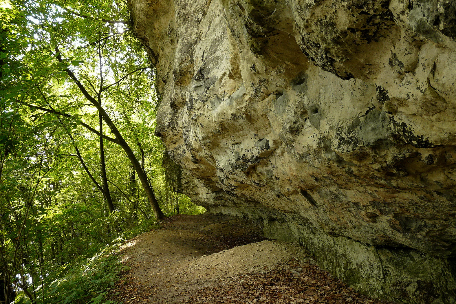
A dirt hiking path runs alongside the base of a tall, light-colored, craggy sandstone cliff, with dense green forest trees growing on the left side of the frame.
A narrow dirt trail passing beneath a large, weathered sandstone rock formation at Skalní sruby Jizery.

Skalní sruby Jizery history and protected-area timeline

Skalní sruby Jizery was declared a přírodní památka (natural monument) on 29 May 1979 by the Středočeský krajský národní výbor (Central Bohemian Regional National Committee), the regional authority responsible for nature protection at the time. The designation was made to secure the long-term conservation of the sandstone cliff and its associated erosion forms along the Jizera River.

Since its establishment, the monument has been administered by the Středočeský kraj (Central Bohemian Region), with day-to-day care of the site handled by the regional authority. The site's protected status was driven by its geological value as a representative example of fluvial erosion in Cretaceous sandstones, and by the biological communities that have colonized the cliff and riverside ledge.

In more recent years, the monument has also drawn attention for conservation management challenges, particularly damage to the sandstone surfaces caused by artificially cemented climbing holds, which has prompted concern about the integrity of the protected geological feature.

Skalní sruby Jizery landscape and geographic character

The landscape of Skalní sruby Jizery is defined by a single dramatic geological element: a steep sandstone cliff rising above the right bank of the Jizera River. The cliff runs for roughly one kilometer along the river, marking the transition between the watercourse and the surrounding Bohemian lowland terrain.

Lateral erosion from the Jizera has undercut the base of the cliff, carving a continuous rock shelter that stretches for about 315 meters. The shelter reaches a maximum depth of about five meters and typically rises two to three meters above the ledge. Within the protective overhang, secondary weathering has shaped small pseudokarst niches and hollows, giving the rock face a deeply sculpted character.

Above the cliff, the terrain transitions into the wooded slopes typical of Bohemian sandstone landscapes, while below, the narrow riverside ledge runs parallel to the Jizera as it flows toward its confluence with the Zábrdka. A small footpath traces this ledge for the full length of the shelter, allowing close access to the rock face and the river margin.

Skalní sruby Jizery ecosystems, habitats, and plant life

Skalní sruby Jizery combines a compact set of habitats within a very small area: exposed sandstone cliff, a shaded rock-shelter microclimate, a narrow riverside ledge, and the adjacent waters of the Jizera. The interplay of dry sun-exposed rock surfaces, cool crevices, damp riverside soil, and overhanging vegetation creates a series of distinct microhabitats along the cliff.

Botanical surveys on the property have identified 78 species of higher plants, reflecting this mosaic of conditions and the presence of both dry sandstone-favoring vegetation on the cliff face and more mesic communities along the river margin. The sheltered ledges and crevices also provide refuges for invertebrates adapted to rocky and damp environments.

Although the site is small, its ecological character is shaped strongly by the river itself. The water's edge supports amphibian breeding habitat, while the rock face and surrounding woodland provide nesting and foraging sites for birds that exploit the cliff-forest-river interface. The combination of geological and biological values within such a confined footprint is part of what makes the monument ecologically distinctive.

Skalní sruby Jizery wildlife and species highlights

Despite its very small size, Skalní sruby Jizery supports a remarkably diverse fauna for its area. Zoological inventories have recorded 16 beetle species and 25 butterfly species, alongside ten spider species inhabiting the cliff and ledge microhabitats.

Amphibians documented at the site include the common toad (Bufo bufo), the common frog (Rana temporaria), and the marsh frog (Pelophylax ridibundus), which use the river and damp margins for breeding. Reptile records include the sand lizard (Lacerta agilis), which favors the warmer open rock and sandy areas along the cliff base.

Birdlife is also a defining feature. Ornithological surveys confirmed twenty songbird species and two non-passerines, and the grey heron (Ardea cinerea) has been observed hunting along the river. The site's particular ornithological importance lies in its breeding population of the grey wagtail (Motacilla cinerea), a species associated with fast-flowing rocky rivers, with at least two pairs nesting on the cliff and along the watercourse.

Skalní sruby Jizery conservation status and protection priorities

Skalní sruby Jizery is protected primarily for its geomorphological significance: the sandstone cliff and its associated rock shelters are considered one of the most instructive examples of deep-weathering sandstone forms in the Czech Republic, shaped by the lateral erosive force of the Jizera River. Conservation of the area aims to preserve these landforms, which are vulnerable to physical alteration.

Biological conservation is a secondary but important dimension. The narrow riverside and cliff-edge habitats support breeding amphibians, reptiles, and specialized birds such as the grey wagtail, and the continuity of these microhabitats depends on maintaining undisturbed rock surfaces and natural river dynamics along the Jizera.

Management of the monument is the responsibility of the Středočeský kraj (Central Bohemian Region). Issues of concern include damage caused by artificially cemented climbing holds on the sandstone, highlighting the ongoing need to balance outdoor recreation with the preservation of the protected geological feature.

Top sights and standout views in Skalní sruby Jizery

Skalní sruby Jizery's principal highlight is its 315-meter sandstone rock shelter, one of the most distinctive examples of river-carved "skalní srub" morphology along the Jizera, paired with pseudokarst hollows that illustrate deep sandstone weathering.

The site also stands out for packing substantial ecological diversity into a tiny footprint, including 78 plant species, 25 butterfly species, breeding amphibians and reptiles, and a regionally significant nesting population of the grey wagtail along the riverside cliff.

Best time to visit Skalní sruby Jizery

The site can be appreciated at any time of year, but spring and early summer tend to be the most rewarding seasons for visitors, when breeding birds such as the grey wagtail are active along the river and vegetation along the ledge and cliff is at its most lush.

Late spring and summer also offer the best conditions for observing butterflies and other invertebrates along the warm sandstone exposures. Autumn brings quieter conditions and clearer views of the cliff textures, while winter, with reduced foliage, makes the sculpted shape of the rock shelter easier to read against the bare trees and lower river levels.

Monthly climate preview

Long term representative temperature and precipitation averages by month

Skalní sruby Jizery Climate Normals and Annual Weather Patterns

Representative coordinate measurements reveal the annual temperature and precipitation rhythm across Skalní sruby Jizery from 1991 to 2020. Examining the full monthly climate profile provides deeper context for long term meteorological patterns at this specific elevation.
Annual mean8 °C
-3 °C19 °C
Jan-3°
Feb-2°
Mar
Apr
May13°
Jun17°
Jul19°
Aug18°
Sep13°
Oct
Nov
Dec-2°
Warmest month
July

18.7 °C

Coolest month
January

-3.1 °C

Wettest month
July

2.9 mm/day

Driest month
April

1.3 mm/day

Park location guide

Geography guide, regional context, and park location map for Skalní sruby Jizery

Skalní sruby Jizery park geography, regions, and map view in Czechia

Understand where Skalní sruby Jizery sits in Czechia through a broader geographic reading of the surrounding landscape, nearby location context, and its mapped position within the national park landscape.

How Skalní sruby Jizery fits into Czechia

Czech Republic is a landlocked Central European country with a population of approximately 10.9 million people. The nation was established as an independent state on January 1, 1993, following the dissolution of Czechoslovakia. Its capital and largest city is Prague, with other major urban centers including Brno, Ostrava, Plzeň, and Liberec.

Wider geography shaping Skalní sruby Jizery in Czechia

The Czech Republic is a landlocked country in Central Europe. It is bordered by Germany to the west, Austria to the south, Poland to the northeast, and Slovakia to the southeast. The landscape is predominantly hilly, with the territory covering 78,871 square kilometers.

Map view of Skalní sruby Jizery

Use this park location map to pinpoint Skalní sruby Jizery in Czechia, understand its exact geographic position, and read its mapped placement within the surrounding landscape more clearly.

Pigeon | © OpenStreetMap contributors

Location context for Skalní sruby Jizery

Central Bohemian Region

Visual reference of sandstone cliffs, rock shelters, and protected river habitats

Skalní sruby Jizery Photos and Landscape Scenery

Visual documentation captures the dramatic sandstone cliff formations, sculpted pseudokarst niches, and riparian habitats defining the protected natural monument. Examining these detailed landscape photographs provides a clearer understanding of the geological morphology and river-carved terrain along the Jizera.

A dirt hiking path runs alongside the base of a tall, light-colored, craggy sandstone cliff, with dense green forest trees growing on the left side of the frame.

Park atlas

Compare surrounding regional geography and connected protected landscapes.

Other Parks and Protected Areas Near Skalní sruby Jizery

Continue exploring protected areas near Skalní sruby Jizery to discover adjacent sandstone formations, river corridors, and woodland habitats across the surrounding region. Comparing nearby natural monuments provides deeper context on Bohemian geological features and regional ecological diversity.
Natural monumentCentral Bohemian Region
About 4.5 km away#1 closest

Northeast

Vrch Káčov Natural Monument: Mapped Geological Features in Central Bohemia

Volcanic rock formations and regional terrain context

Vrch Káčov is a designated natural monument preserving a unique volcanic hill and rock suk in the Central Bohemian Region. Its landscape is defined by contact metamorphism and porcelanite formations, offering a concentrated look at the geological evolution of the Jičínská pahorkatina hill country. The site provides a valuable reference for analyzing protected Bohemian terrain and its surrounding geographic characteristics.

Area
0.019 km²
Established
1953
IUCN
III
Relief
Upland
Natural monumentStředočeský kraj
About 6.3 km away#2 closest

West

Valcha Natural Monument: Mapping Protected Wetland Ecosystems in Středočeský Kraj

A rare mosaic of forest ponds and mire habitats

Situated in the Středočeský kraj region, Valcha Natural Monument protects a distinctive silting pond and marshland ecosystem. This site demonstrates the ecological significance of small, hydrologically active ravine landscapes nestled within the broader Jizerská tabule plateau terrain, providing critical refuge for rare wetland species.

Area
0.024 km²
Established
2013
IUCN
III
Relief
Lowland
Natural monumentCentral Bohemian Region
About 8.7 km away#3 closest

West

Velký Radechov Natural Monument: Geography and Protected Habitat Mapping

Neovolcanic upland terrain within the Central Bohemian Region

Explore the mapped boundaries and natural features of Velký Radechov. This protected site in the Central Bohemian Region serves as an ecological mosaic, showcasing how neovolcanic hill slopes and formerly managed habitats provide refuge for a wide range of flora and fauna in the Czech landscape.

Area
0.22 km²
Established
1999
IUCN
IV
Relief
Upland
Natural monumentStředočeský kraj
About 9.9 km away#4 closest

East

V Dubech Natural Monument: Protected Wetland Landscapes and Geography in Czech Republic

A compact wetland mosaic in the Středočeský kraj region

V Dubech is a protected natural monument situated at the base of the Příhrazské skály sandstone formations in the Czech Republic. This site preserves a valuable wetland mosaic, including base-rich peat meadows and alder woodlands that support rare species. The park provides an essential look at the localized, water-dominated geography within the broader context of the Bohemian Paradise protected landscape.

Area
0.047 km²
Established
1998
IUCN
III
Relief
Lowland
Natural monumentSemily District
About 13 km away#5 closest

East

Vústra Natural Monument: Mapping the Protected Wetland Landscapes of the Semily District

A concentrated botanical and geological sanctuary in the Bohemian Paradise

Vústra is a highly localized natural monument in the Semily District that preserves a vital wetland complex including a pond and calcareous fen. Surrounded by characteristic sandstone rock towers and alder-spruce forests, the site serves as a vital ecological anchor within the wider Bohemian landscape. This detail page traces the specific boundaries and topographical features that define this protected monument.

Area
0.023 km²
Established
1996
IUCN
IV
Relief
Lowland
Natural monumentKrálovéhradecký kraj
About 13 km away#6 closest

East

Meziluží Natural Monument: Mapping Protected Landscape Geography in Královéhradecký Kraj

A study of sandstone terrain and historic conservation within the Bohemian Paradise

Meziluží provides a detailed look at the geography of small-scale protected sites in the Czech Republic. By analyzing its steep sandstone slopes and traditional orchard-pasture land use, users gain a clearer understanding of the complex relationship between regional geology and botanical conservation history in the Bohemian Paradise area.

Area
0.015 km²
Established
1997
Relief
Upland
Scope
Terrestrial
A watercolor painting showing a panoramic view of a wetland area with reeds in the foreground and a forested ridge in the background.
Protected landscapeMladá Boleslav District
About 14 km away#7 closest

South

Přírodní park Chlum: Exploring the Geography of a Protected Czech Woodland Ridge

Mladá Boleslav District protected landscape analysis

Examine the structural character of Přírodní park Chlum, an asymmetric horst ridge in the Czech Republic that serves as a vital ecological corridor. This protected landscape preserves rare forest communities and geological features, providing essential habitat continuity across the surrounding agricultural lowlands of the Mladá Boleslav District.

Area
13.19 km²
Established
2000
Relief
Upland
Climate
Temperate
Watercolor painting showing a river, grassy banks, scattered trees, and distant hills
Protected landscapeCzechia
About 15 km away#8 closest

East

Bohemian Paradise Protected Landscape: Discover Czech Republic's Sandstone Geology and Park Boundaries

Mapped sandstone formations and historic regional geography.

Delve into Bohemian Paradise, a protected landscape in the Czech Republic celebrated for its dramatic sandstone rock formations and ancient castles. This detailed entry provides context on its unique geological character, the extent of its protected boundaries, and its significant position within the regional geography. Explore the mapped terrain and understand the atlas value of this historic protected area.

Area
181.17 km²
Established
1955
IUCN
V
Relief
Upland

Common questions about visiting, size, designation, and location context for Skalní sruby Jizery

Skalní sruby Jizery FAQs for park facts, access, geography, and protected area context

Find quick answers about Skalní sruby Jizery, including protected-area facts, park geography, trail and visitor context, and how the park fits into its surrounding country and regional landscape.
MoriAtlas Explorer

Continue Your Protected Areas Search Across the Global Atlas

Deepen your exploration by continuing the structured search for national parks and protected areas worldwide. Utilize the comprehensive filtering capabilities to compare different conservation landscapes and refine your understanding of global park geography. Discover more about the distribution and characteristics of protected natural areas.

Global natural geography