
Mori Atlas logo
Natural monumentSkryjsko-týřovické kambrium

A vital protected monument for Barrandian geological heritage and Paleozoic sediment research.

Skryjsko-týřovické kambrium: Investigating the Cambrian Fossil Landscapes of the Berounka Valley

Skryjsko-týřovické kambrium represents a specialized protected landscape in the Středočeský kraj region, serving as a critical repository for early Paleozoic fossil fauna within the Barrandian. This natural monument preserves essential rock outcrops along the Berounka River, offering researchers and geologically focused visitors a window into sedimentary records that have influenced paleontological science for nearly two centuries. Situated within the broader Křivoklátsko protection zone, the site safeguards an irreplaceable geological history defined by ancient marine strata rather than surface vegetation.

paleontological siteCambrian fossilsnatural monumentBarrandian geologyrock outcropsBerounka valley
A stylized illustration of a mountain landscape featuring a waterfall cascading down a cliff into a winding river, surrounded by green and pink hills and coniferous trees under a sunny sky.

Skryjsko-týřovické kambrium

Natural monument

Park overview

Structured park overview, official facts, and landscape profile for Skryjsko-týřovické kambrium

Skryjsko-týřovické kambrium park facts, protected area profile, and essential visitor context

Review the core facts for Skryjsko-týřovické kambrium, including designation, size, terrain, visitor scale, habitats, and operating context in one park-focused overview.

About Skryjsko-týřovické kambrium

Skryjsko-týřovické kambrium is a small protected natural monument in the central Bohemian part of the Czech Republic, designed specifically around the protection of geological and paleontological heritage. Its territory is divided into two distinct components on either side of the Berounka River, covering the cadastral territories of Hřebečníky, Skryje, and Týřovice. The monument lies entirely within the larger Křivoklátsko Protected Landscape Area and within the boundaries of the Křivoklátsko Bird Protection Area, placing it within a wider framework of landscape and wildlife protection in central Bohemia.

The reason for protection is tightly focused: the site safeguards scientifically important outcrops of Cambrian sedimentary rocks that contain fossils of early marine animals. These outcrops are part of the larger Barrandian geological region, a name derived from the 19th-century geologist Joachim Barrande, whose studies of Paleozoic fossils around Skryje and the surrounding hills laid the foundation for Bohemian paleontology. The Cambrian rocks here are among the most studied of their kind in Central Europe and continue to be referenced in international paleontological research.

Despite its modest size, the protected area combines multiple layers of protection. It is administered under Czech natural monument status, sits within a protected landscape area, and overlaps with a designated bird protection area. This nesting of statuses signals that the surrounding landscape, while not the primary reason for the monument's designation, also contributes ecological values such as riverine habitats along the Berounka and the forested slopes of the Křivoklátsko hills. The monument's full identity, however, is inseparable from its role as a guardian of Cambrian fossil heritage, one of the few protected areas in the Czech Republic established almost exclusively for paleontological reasons.

Quick facts and research context for Skryjsko-týřovické kambrium

Skryjsko-týřovické kambrium was established as a natural monument on 21 September 2011 by the administration of the Křivoklátsko Protected Landscape Area, with management now handled by the Czech Agency for Nature Conservation and Landscape Protection.

The protected site covers roughly 30 hectares across two separate sections in the cadastral areas of Hřebečníky, Skryje, and Týřovice, in the Středočeský region and Rakovník district. Elevations within the area range from about 260 to 366 meters above sea level, and the monument lies within an IUCN Category IV framework focused on species or habitat occurrence.

The protected area falls inside the Křivoklátsko Protected Landscape Area and the Křivoklátsko Bird Area, and its defining conservation purpose is the safeguarding of Cambrian fossil localities rather than living ecosystems, making it one of the more geologically specialized small protected areas in the Czech Republic.

Protection and recognition

Documented terrestrial protection scope, designation history, and recognition data

Skryjsko-týřovické kambrium Protection Status and Territorial Management Records

Terrestrial protection status, management scope, and recognition records for Skryjsko-týřovické kambrium are detailed across structured environmental datasets. Official conservation listings provide foundational baseline data for tracking territorial management frameworks and geographic boundaries.

Protection details

Protection scope
Terrestrial
Transboundary protection
No
Park context

Deeper park guide and search-rich context for Skryjsko-týřovické kambrium

Skryjsko-týřovické kambrium history, landscape, wildlife, and travel context

Explore Skryjsko-týřovické kambrium through its history, landscape character, ecosystems, wildlife, conservation priorities, cultural context, and seasonal travel timing in a structured park guide built for atlas discovery and search intent.

Why Skryjsko-týřovické kambrium stands out

The natural monument is best known for its outstanding Cambrian fossil localities within the Skryje-Týřovice portion of the Barrandian, the classic Paleozoic fossil region of central Bohemia first made famous by the work of Joachim Barrande. Rock outcrops in the area expose sedimentary layers containing Cambrian fauna, including trilobites and other early marine organisms, and have been a reference site for Cambrian paleontology since the mid-19th century. Visitors and researchers associate the site with exposed fossil-bearing strata along the Berounka valley, where weathered rocks reveal ancient marine life preserved in stone. The monument thus represents a tangible geological heritage of international scientific interest rather than a typical scenic park experience.
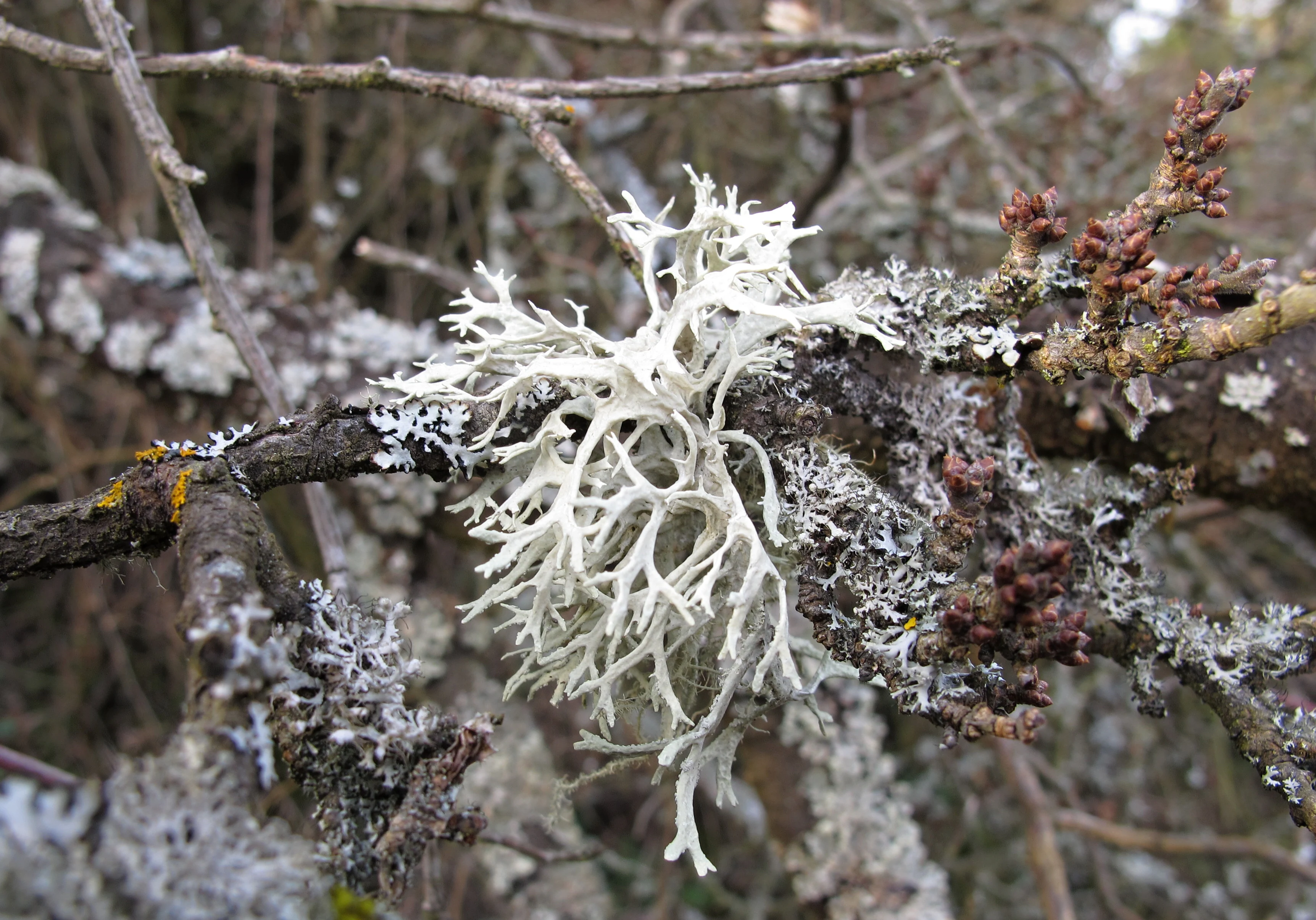
Close-up photograph of white branching lichen growing on dark tree branches, with other grey and brown lichens visible on surrounding twigs
White fruticose lichen growing on tree branches within the Skryjsko-týřovické kambrium natural monument

Skryjsko-týřovické kambrium history and protected-area timeline

The Skryjsko-Týřovice area has been recognized for its paleontological importance since the 19th century, when Joachim Barrande conducted his foundational studies of Paleozoic fossils in the Barrandian. The Cambrian rocks around Skryje became a classic reference point for early Paleozoic paleontology in Central Europe.

Despite this long scientific history, formal legal protection of the specific Cambrian outcrops is comparatively recent. Skryjsko-týřovické kambrium was declared a natural monument on 21 September 2011 by the administration of the Křivoklátsko Protected Landscape Area. The designation brought the fossil localities under a clear legal framework and placed them under the ongoing management responsibility of the Czech Agency for Nature Conservation and Landscape Protection, specifically its Central Bohemia regional office, ensuring that the exposed rock faces and their fossil content would be actively monitored and protected.

Skryjsko-týřovické kambrium landscape and geographic character

The protected landscape of Skryjsko-týřovické kambrium is defined by hilly terrain along the middle Berounka valley in central Bohemia. Elevations across the site range from roughly 260 to 366 meters above sea level, with moderately incised valleys and forested slopes typical of the broader Křivoklátsko region.

The defining geological feature is the presence of Cambrian sedimentary rock layers that outcrop at the surface, forming exposures where ancient marine sediments can be directly examined. The two protected sections are separated by the Berounka River, which has cut through the surrounding terrain and exposed these ancient rocks along its banks. The broader visual character combines the wooded ridges and river scenery of the Křivoklátsko hills with the sharp geological interest of the fossil-bearing outcrops themselves.
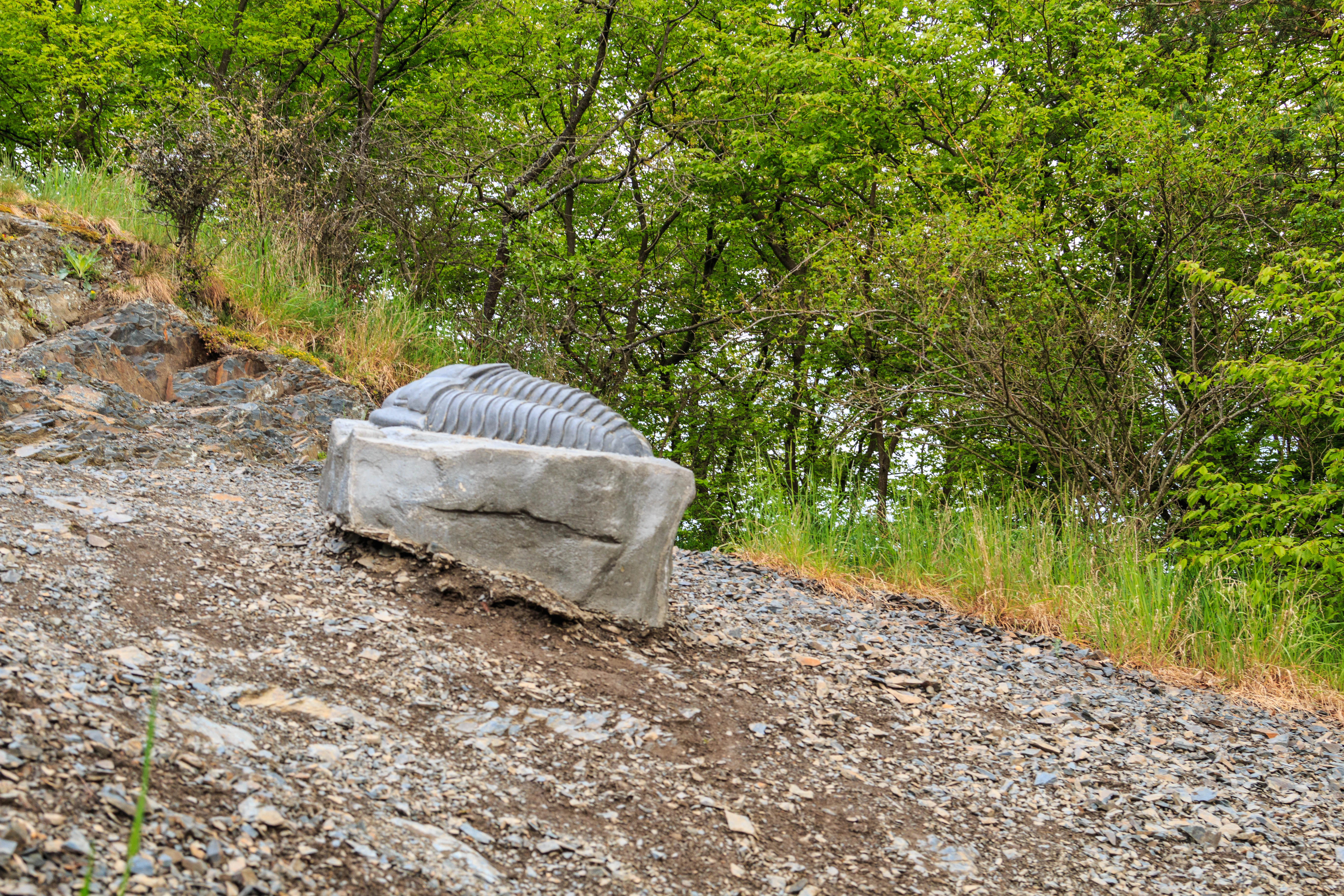
A gray stone sculpture of a trilobite resting on a rocky gravelly slope with green trees and vegetation in the background
Stone sculpture of a trilobite resting on a rocky slope within the Skryjsko-tyrovicke kambrium natural monument

Skryjsko-týřovické kambrium ecosystems, habitats, and plant life

The ecological character of the monument is shaped less by the fossil outcrops themselves and more by the surrounding valley and forest environment of the Křivoklátsko hills. Mixed forests typical of central Bohemia cover much of the terrain, while the Berounka riverbanks and valley slopes provide varied microhabitats.

The site's location within the Křivoklátsko Bird Protection Area reflects the broader ecological importance of the surrounding landscape, supporting birdlife associated with riverine valleys, deciduous and mixed woodland, and rocky exposures. Lichens colonize exposed rock surfaces and are part of the living biological character of the outcrops. Within the monument, the natural value is best understood as the combination of the geological exposures and the surrounding central Bohemian forest and river ecosystem that frames them.
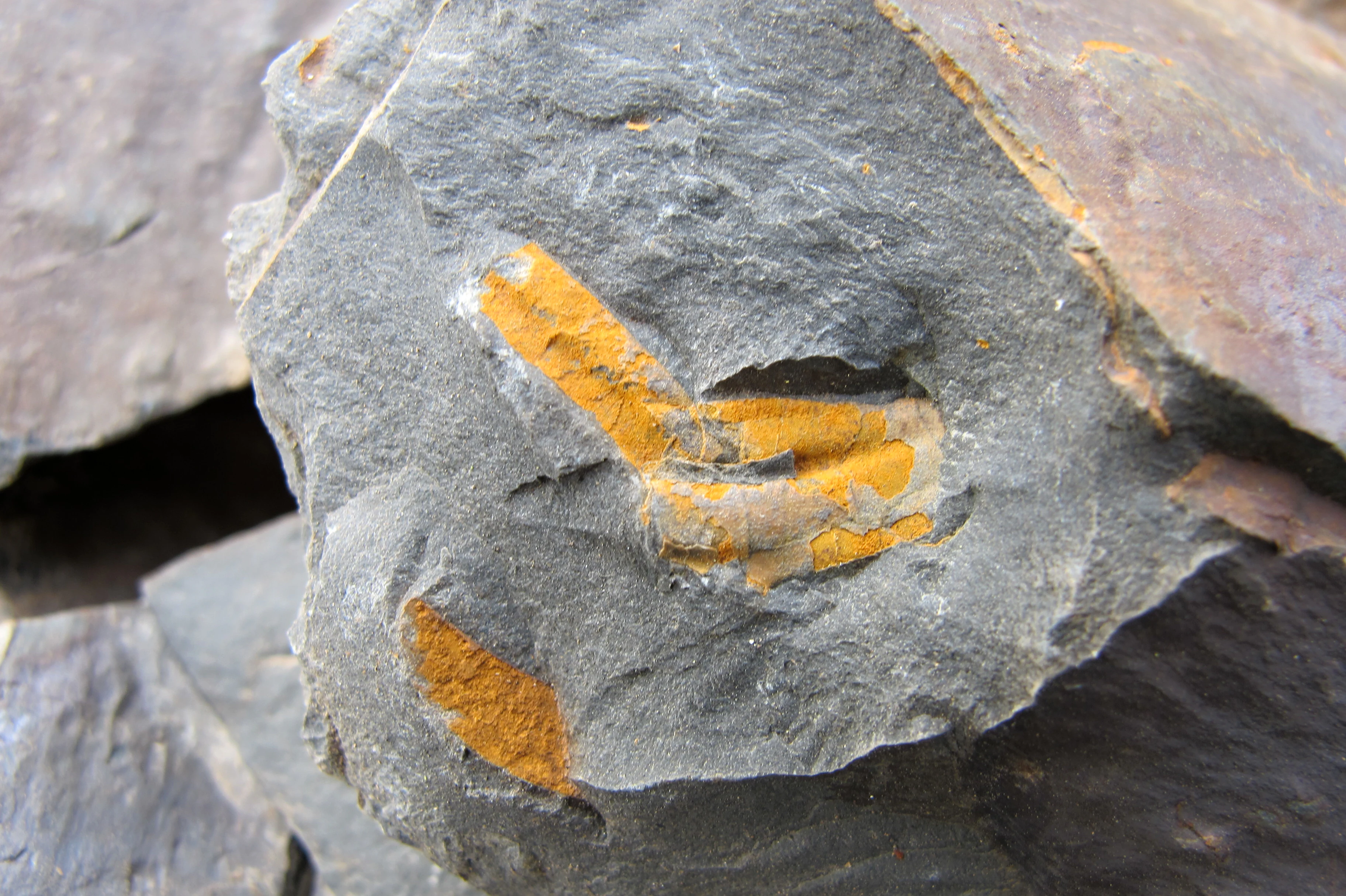
Close-up photograph of a grey rock slab with bright orange and yellow mineral staining on its surface, surrounded by other dark grey rock fragments.
Close-up of a grey rock surface with orange mineral deposits, representative of the geological character of the Skryjsko-týřovické kambrium natural monument.

Skryjsko-týřovické kambrium wildlife and species highlights

Wildlife interest within the monument is primarily contextual rather than central. The site is not established for fauna conservation, but the broader Křivoklátsko Protected Landscape Area in which it sits supports a wide range of forest and riverine wildlife.

Birds associated with riverine valleys, mixed woodland, and rocky habitats are a particular focus of the surrounding Křivoklátsko Bird Protection Area. Lichens are a noted biological presence on the outcrops themselves, and small-scale fauna typical of central Bohemian deciduous and mixed forests can be expected in the wider mosaic. The monument's main ecological contribution is therefore its role in protecting the natural setting in which world-famous Cambrian fossils sit embedded.
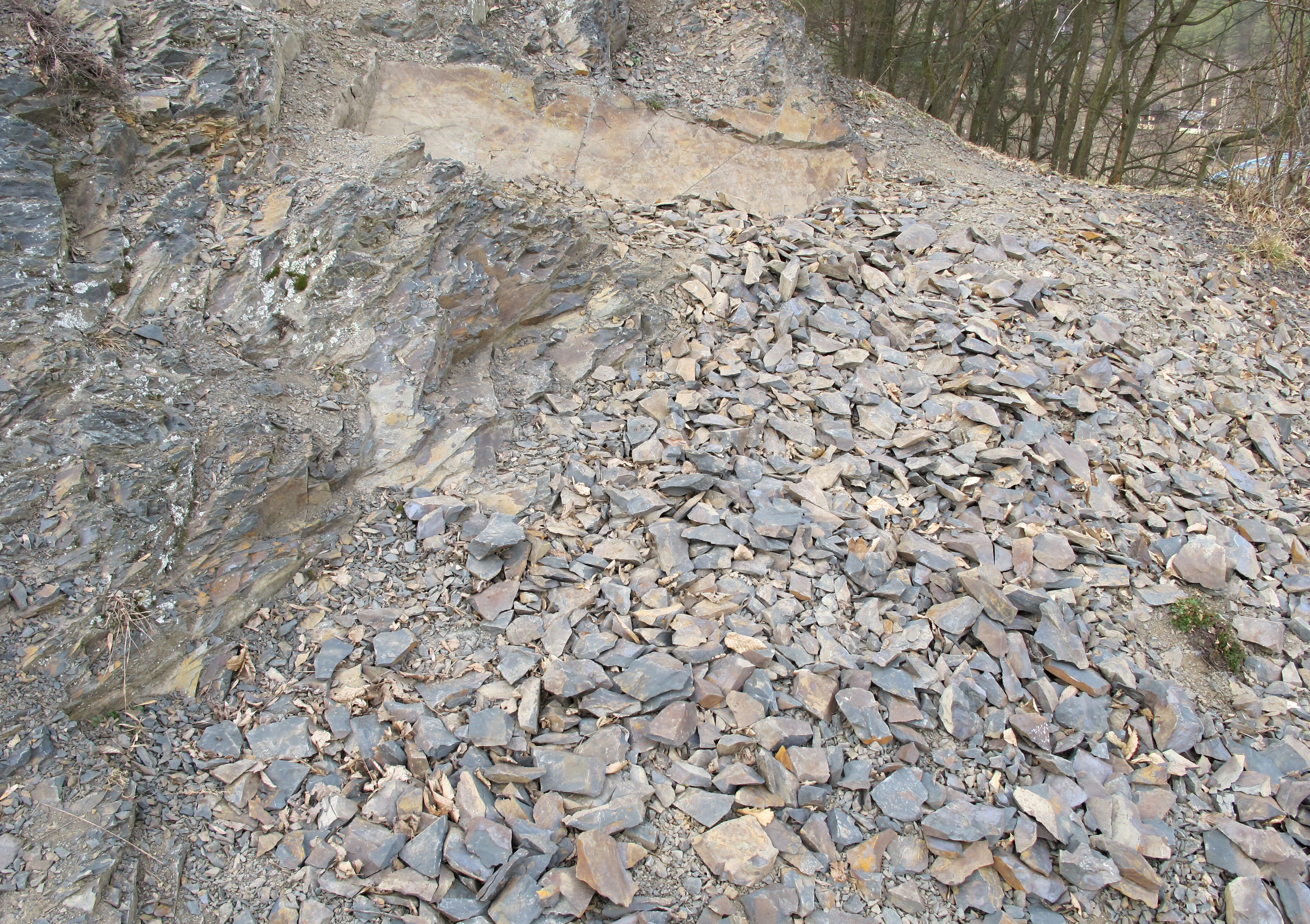
A view of a rocky slope covered in loose grey stones and shale fragments, with a rocky outcrop on the left and bare trees in the background.
Rocky slope with loose stones and a cliff face, part of the Skryjsko-týřovické kambrium natural monument.

Skryjsko-týřovické kambrium conservation status and protection priorities

Conservation significance of Skryjsko-týřovické kambrium lies primarily in its role as a legally protected custodian of internationally important Cambrian fossil localities. By formalizing protection under natural monument status, the site ensures that its rock outcrops and the fossils they contain are safeguarded against disturbance, collection, and degradation.

The monument lies within IUCN Category IV, a designation focused on the protection of specific species or habitats, in this case applied to a geological and paleontological resource. Its inclusion within the Křivoklátsko Protected Landscape Area and the Křivoklátsko Bird Protection Area adds ecological and ornithological protection layers to the surrounding landscape, creating a stacked system of conservation designations.

Management is carried out by the Czech Agency for Nature Conservation and Landscape Protection through its Central Bohemia regional office, integrating the monument into the broader monitoring, habitat care, and research programs of the Křivoklátsko region. The underlying conservation value is fundamentally geological: the Cambrian sedimentary record of the Barrandian is a non-renewable scientific resource, and the monument exists to keep it intact for current and future research.

Top sights and standout views in Skryjsko-týřovické kambrium

The defining feature of Skryjsko-týřovické kambrium is its Cambrian fossil heritage, embedded in the rock outcrops of the Skryje-Týřovice area within the historically celebrated Barrandian fossil region of central Bohemia.

The monument also offers layered protection status, combining natural monument designation with the broader Křivoklátsko Protected Landscape Area and a designated Bird Protection Area, situating a very small, geologically focused site within one of the most important landscape protection zones in central Bohemia.

Monthly climate preview

Track multi-year monthly temperature averages and precipitation rates across representative terrain elevations.

Skryjsko-týřovické kambrium Climate Normals and Long-Term Temperature Rhythms

Long-term data records reveal distinct seasonal temperature shifts alongside steady precipitation distribution patterns across sampled park coordinates. Deeper monthly comparisons provide full statistical breakdowns for every recorded climatological interval.
Annual mean8 °C
-2 °C19 °C
Jan-2°
Feb-1°
Mar
Apr
May13°
Jun17°
Jul19°
Aug19°
Sep14°
Oct
Nov
Dec-1°
Warmest month
July

19.2 °C

Coolest month
January

-2.4 °C

Wettest month
June

2.6 mm/day

Driest month
February

1.1 mm/day

Park location guide

Geography guide, regional context, and park location map for Skryjsko-týřovické kambrium

Skryjsko-týřovické kambrium park geography, regions, and map view in Czechia

Understand where Skryjsko-týřovické kambrium sits in Czechia through a broader geographic reading of the surrounding landscape, nearby location context, and its mapped position within the national park landscape.

How Skryjsko-týřovické kambrium fits into Czechia

Czech Republic is a landlocked Central European country with a population of approximately 10.9 million people. The nation was established as an independent state on January 1, 1993, following the dissolution of Czechoslovakia. Its capital and largest city is Prague, with other major urban centers including Brno, Ostrava, Plzeň, and Liberec.

Wider geography shaping Skryjsko-týřovické kambrium in Czechia

The Czech Republic is a landlocked country in Central Europe. It is bordered by Germany to the west, Austria to the south, Poland to the northeast, and Slovakia to the southeast. The landscape is predominantly hilly, with the territory covering 78,871 square kilometers.

Map view of Skryjsko-týřovické kambrium

Use this park location map to pinpoint Skryjsko-týřovické kambrium in Czechia, understand its exact geographic position, and read its mapped placement within the surrounding landscape more clearly.

Pigeon | © OpenStreetMap contributors

Location context for Skryjsko-týřovické kambrium

Středočeský kraj

Visualizing rock outcrops, river valleys, and protected terrain in central Bohemia

Skryjsko-týřovické kambrium Photos and Geological Landscapes

Visual records reveal the rugged rock outcrops and river valley terrain that define Skryjsko-týřovické kambrium. Detailed imagery provides clear spatial context for examining ancient geological formations across the protected landscape.

Close-up photograph of white branching lichen growing on dark tree branches, with other grey and brown lichens visible on surrounding twigs

A wide landscape view of densely forested hills with mixed green and budding trees under an overcast sky, with a small portion of a river visible on the left edge.

A gray stone sculpture of a trilobite resting on a rocky gravelly slope with green trees and vegetation in the background

Close-up photograph of a grey rock slab with bright orange and yellow mineral staining on its surface, surrounded by other dark grey rock fragments.

A view of a rocky slope covered in loose grey stones and shale fragments, with a rocky outcrop on the left and bare trees in the background.

Park atlas

Compare nearby regional geography and connected protected areas across central Bohemia

Other Parks Near Skryjsko-týřovické kambrium and Surrounding Protected Landscapes

Browse protected areas and regional reserves located close to Skryjsko-týřovické kambrium along the Berounka valley. Expanding the geographic view helps place specialized geological monuments into the broader context of central Bohemian conservation landscapes.
Natural monumentCentral Bohemian Region
About 5.2 km away#1 closest

North

Valachov Natural Monument: Geological and Historical Landscape Analysis in Central Bohemia

Mineralogical type locality and industrial-archaeological protected area.

Valachov is a small yet significant natural monument located in the Central Bohemian Region, serving as the primary type locality for the mineral slavíkit. Beyond its mineralogical importance, the hill preserves physical evidence of medieval lead and nineteenth-century pyrite mining, including shafts and adits embedded within a diverse forested ecosystem of the Křivoklátsko protected landscape area.

Area
0.03 km²
Established
1977
IUCN
III
Relief
Upland
A minimalist watercolor painting depicting a winding river through green rolling hills and meadows on a white background.
Protected landscapePlzeňský kraj
About 20 km away#2 closest

Southwest

Přírodní park Berounka: Protected Landscape Mapping and Geography in Plzeňský kraj

Western Bohemia river canyon and protected corridor

Přírodní park Berounka defines a large, unified protected landscape following the upper course of the Berounka River. The area encompasses dramatic valley scenery, including steep cliff sections, wooded slopes, and a mosaic of fields and historic villages throughout the Plzeňský kraj. Gain insight into the regional geography and the network of connected nature reserves that define this distinctive Bohemian river corridor.

Area
131 km²
Established
2021
Relief
Upland
Water
Major water bodies
A soft, painterly watercolor illustration of a wetland scene with gentle green fields, faint distant hills, and low-growing vegetation in the foreground against a white background.
Natural monumentStředočeský kraj
About 21 km away#3 closest

North

Na Novém rybníce Natural Monument: Wetland Geography and Protected Area Atlas

A diverse protected mosaic of meadows and pond basins

Examine the detailed landscape of Na Novém rybníce, an ecologically rich natural monument in the Středočeský kraj. This protected area showcases a compact assemblage of pond, reed marsh, and rare fen meadow vegetation that illustrates the unique character of lowland Bohemian wetlands.

Area
0.054 km²
Established
1990
IUCN
III
Relief
Lowland
A horizontal watercolor illustration depicting rolling green hills, scattered trees, and foreground flowers with soft mountains in the distance.
Nature reserveStředočeský kraj
About 23 km away#4 closest

Southeast

Na horách Nature Reserve: Geographic Context and Protected Landscape Discovery

Středočeský kraj, Czech Republic

Na horách serves as a protected landmark for thermophilous vegetation within the Brdy Highlands. This nature reserve provides a clear window into how skeletal soils and historic land management sustain unique dry-grassland plant assemblages across a sloping, varied Bohemian terrain.

Area
0.049 km²
Established
1997
IUCN
IV
Relief
Upland
A soft watercolor painting of a rolling, hilly landscape with hints of forest, rendered in muted green, pink, and yellow tones on a white background.
Natural monumentCentral Bohemia Region
About 23 km away#5 closest

Northwest

Malý Uran Natural Monument: Protected Rocky Valley Slopes in the Central Bohemia Region

Geological and Botanical Conservation Area

Malý Uran represents a compact but significant natural monument defined by its steep valley slopes and Precambrian bedrock. The site protects a localized juniper habitat flourishing on skeletal soils above the Kosobodský stream, providing a clear example of how rare geological substrates influence regional plant life and landscape structure.

Area
0.159 km²
Established
1996
IUCN
IV
Water
Minor water
Watercolor painting of a rolling Czech landscape featuring meadow flowers in the foreground, forest in the midground, and distant hazy hills.
Natural monumentStředočeský kraj
About 26 km away#6 closest

East

Markův mlýn Natural Monument: Exploring the Geography and Protected Flora of Central Bohemia

A rare botanical reserve featuring unique rock-steppe plant communities

Markův mlýn is a protected natural monument situated in the Středočeský kraj region, characterized by its rare combination of dry, thin-soil hillside meadows and stream-influenced valley terrain. The area serves as a critical habitat for specialized steppe flora, including the protected Bohemian pasqueflower. This record offers a detailed look at the site's compact geography and the specific environmental conditions that sustain its unusual plant communities.

Area
0.001 km²
Established
1987
IUCN
III
Relief
Lowland
Natural monumentCzechia
About 26 km away#7 closest

Southeast

Vinice Natural Monument: Geological Heritage and Cambrian Stratigraphy in Central Czechia

Protected xeric woodlands and ancient marine sedimentary records

Vinice serves as a vital protected area in the Příbram district, safeguarding one of the world's most important Cambrian fossil sites. Its steep, south-facing slope above the Litavka River offers a visual map of geological history, where exposed rock sequences meet diverse forest and grassland habitats. This site remains a key reference for understanding Bohemian natural heritage and the long-term evolution of local terrain.

Area
0.423 km²
Established
1999
Relief
Upland
Climate
Temperate
A watercolor illustration of a rolling, green landscape with distant, faint hills and small ponds or water bodies in the foreground.
Natural monumentPlzeňský kraj
About 28 km away#8 closest

Southwest

Rokycanská stráň Natural Monument: Geological Exposures and Regional Protected Landscapes

Stratigraphic reference site in the Plzeňský kraj, Czech Republic

Rokycanská stráň represents a key geological protected area situated on the outskirts of Rokycany. The site protects the Klabava Formation stratotype and fossil-rich shales, functioning as a benchmark for Ordovician geology in the Barrandian area. Its four distinct parcels illustrate the interface between urban development and important paleontological research sites in the Plzeň region.

Area
0.208 km²
Established
1981
IUCN
IV
Relief
Upland

Common questions about visiting, size, designation, and location context for Skryjsko-týřovické kambrium

Skryjsko-týřovické kambrium FAQs for park facts, access, geography, and protected area context

Find quick answers about Skryjsko-týřovické kambrium, including protected-area facts, park geography, trail and visitor context, and how the park fits into its surrounding country and regional landscape.
MoriAtlas Explorer

Continue Your Protected Areas Search Across the Global Atlas

Deepen your exploration by continuing the structured search for national parks and protected areas worldwide. Utilize the comprehensive filtering capabilities to compare different conservation landscapes and refine your understanding of global park geography. Discover more about the distribution and characteristics of protected natural areas.

Global natural geography