
Mori Atlas logo
Nature reserveSoutherberg

Examining the ecological mosaic of wet woodlands, reedbeds, and meadows within a compact urban basin.

Southerberg Nature Reserve: A Detailed Geographic Atlas of a Protected Landscape in Nordrhein-Westfalen

(Naturschutzgebiet Southerberg)

Southerberg represents a significant fifteen-hectare nature reserve located within the urban framework of Leverkusen, Nordrhein-Westfalen. Positioned on the edge of the Bergische Sand terrace, this protected area preserves the region's only remaining wet birch-oak woodland. The terrain is characterized by a moist valley basin and northward-facing slopes, creating a sophisticated habitat mosaic that includes alder forests, reedbeds, and damp meadows vital for local connectivity.

urban nature reservewet birch-oak woodlandwetland forestreedbedscrubhedgerow
A flat-style digital illustration depicting a mountainous landscape with a small waterfall, green trees, ferns in the foreground, and a pale sunset sky.

Southerberg

Nature reserve

Park overview

Structured park overview, official facts, and landscape profile for Southerberg Nature Reserve

Southerberg Nature Reserve park facts, protected area profile, and essential visitor context

Review the core facts for Southerberg Nature Reserve, including designation, size, terrain, visitor scale, habitats, and operating context in one park-focused overview.

About Southerberg Nature Reserve

Southerberg is a small, strictly protected nature reserve in the northern core of Leverkusen, in the German state of North Rhine-Westphalia. Although it covers only about fifteen hectares, the reserve holds an unusually diverse patchwork of damp woodland, moist meadows, reedbeds, hedgerows, and small wetland features, all squeezed between major transportation corridors. Despite the industrial and urban surroundings of its host city, the site functions as a refuge for wet woodland plant communities that have largely disappeared from the rest of Leverkusen.

The reserve occupies a triangular piece of land bounded by the A 3 motorway to the west and a freight railway line toward Düsseldorf to the northeast. A drainage network brings water from the west under the autobahn, channels it through a central ditch running east, and eventually carries it out beneath the railway. The resulting hydrology sustains the moist valley basin and the associated vegetation that gives the site its character.

The vegetation is dominated by a wet birch-oak forest that is interspersed with damp meadows and grey willow scrub. A reedbed forms a clear eastern boundary, while a small alder stand sits within the oak-wooded interior in the western part of the reserve. On the drier, south-facing slopes, the landscape transitions into tall herb meadows, partly enclosed by hedgerows. The combination of wet forest, open meadow, scrub, and structured edge habitat gives the site a small-scale habitat complexity that is unusual in this urban part of the Bonn Lowland.

Southerberg also plays an important connecting role within the regional habitat network (Biotopverbund). Positioned on the edge of the Bergische Sand terrace, it links the Further Moor nature reserve further north with the Bürgerbusch reserve to the south, providing continuity for moisture-loving plant and animal communities across an otherwise heavily built-up landscape. This ecological bridge function, combined with the rarity of wet birch-oak woodland in Leverkusen, makes Southerberg a disproportionately important protected area for its modest size.

Quick facts and research context for Southerberg Nature Reserve

Southerberg is a Naturschutzgebiet (strictly protected nature reserve) of about 14.92 hectares located in the northern core of Leverkusen in North Rhine-Westphalia, Germany. The reserve lies in a triangle framed by the A 3 motorway to the west and a freight railway line toward Düsseldorf to the northeast, with the southern boundary near the Reusrather Heide rest area.

Designated as a nature reserve in 1987 under code LEV-013 and classified within the IUCN Category IV framework for habitat and species management, the site sits on the edge of the Bergische Sand terrace at elevations between about 60 and 78 meters above sea level. It functions as a small but structurally diverse habitat island within an otherwise urban and industrial landscape, connecting the Further Moor and Bürgerbusch reserves in the regional habitat network. The primary conservation objective is the preservation of the moist to wet grassland-and-forest complex.

Protection and recognition

Terrestrial conservation framework and documented protection details

Southerberg Protection Status and International Recognition Records

Terrestrial protection records for Southerberg assemble verified management scope and international designation data into a structured format. Conservation researchers examine these official parameters to evaluate territorial governance and protected landscape boundaries.

Protection details

Protection scope
Terrestrial
Transboundary protection
No
WDPA ID
165604
Park context

Deeper park guide and search-rich context for Southerberg Nature Reserve

Southerberg Nature Reserve history, landscape, wildlife, and travel context

Explore Southerberg Nature Reserve through its history, landscape character, ecosystems, wildlife, conservation priorities, cultural context, and seasonal travel timing in a structured park guide built for atlas discovery and search intent.

Why Southerberg Nature Reserve stands out

Southerberg is best known for being Leverkusen's only remaining wet birch-oak woodland, a habitat that has become vanishingly rare in the urbanized landscape of the Rhine-Ruhr region. The reserve combines that woodland with wet meadows, reedbeds, dwarf willow scrub, hedgerows, and a small alder forest arranged across a damp valley basin and its adjoining slope. It also stands out for its compact richness of habitat types. Despite occupying only about fifteen hectares, the site combines forest, open grassland, scrub, reed, and wet ditches, producing one of the most structurally varied habitat mosaics in the local area. Within Leverkusen's protected-area network, Southerberg plays a connecting role between the larger Further Moor to the north and Bürgerbusch to the south.
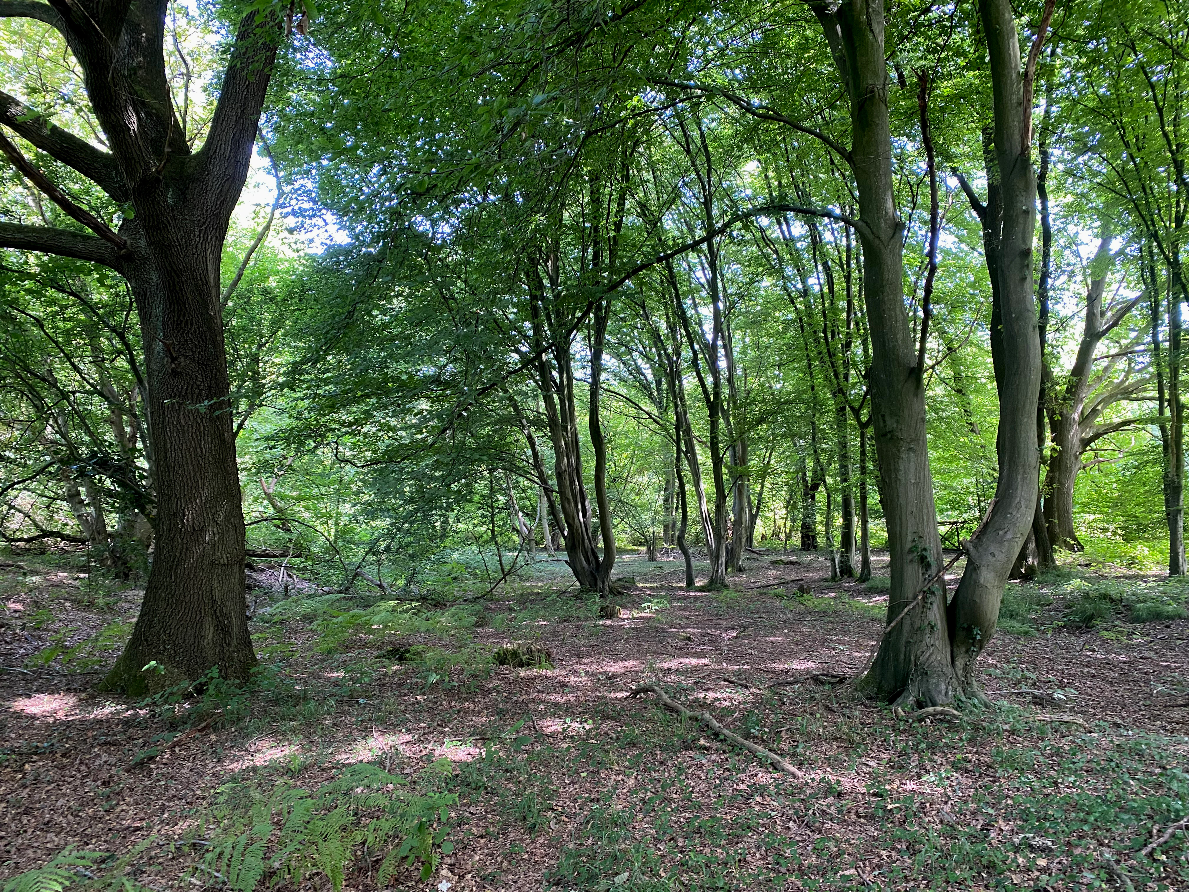
A view into a lush green forest with large mature trees and a forest floor covered in scattered leaves.
Dense, lush forest interior within the Southerberg nature reserve.

Southerberg Nature Reserve history and protected-area timeline

Southerberg was formally designated as a Naturschutzgebiet (strictly protected nature reserve) in 1987 under the Landschaftsplan, or landscape plan, of the city of Leverkusen. Its official reference number within the North Rhine-Westphalian nature reserve system is LEV-013, and it is recorded in international databases such as the World Database on Protected Areas under WDPA ID 165604.

The reserve's protection stems from the broader German tradition of landscape planning, which assigns legal protection to ecologically valuable sites under regional landscape plans adopted by municipalities. In Leverkusen's case, that plan is administered by the city's Untere Landschaftsbehörde (lower landscape authority). The 1987 designation recognized Southerberg as a site of local conservation importance, particularly because of its surviving moist birch-oak woodland, a habitat that was already rare in the intensively used landscape of the city at the time.

Since designation, the reserve has been documented by the North Rhine-Westphalian state agency for nature, environment, and consumer protection (Landesamt für Natur, Umwelt und Verbraucherschutz) and surveyed in detail by the Biologische Station in 2015. That survey highlighted a strong presence of notable and partially rare plant species, reinforcing the site's continuing scientific and conservation value within Leverkusen's network of reserves.

Southerberg Nature Reserve landscape and geographic character

Southerberg lies on the edge of the Bergische Sand terrace, where sandy deposits left by ancient Rhine terraces meet the immediate surroundings of Leverkusen's urban core. The terrain is gentle but ecologically expressive, with a moist valley basin in the lower parts of the site and a northward-exposed slope rising along its southern edge. Elevations across the reserve range only from about 60 to 78 meters above sea level, yet this modest topographic variation is enough to produce a sharp contrast between damp valley habitats and drier slope meadows.

The drainage system shapes the visual character of the site. Water enters from the west under the A 3 motorway through a series of drainage ditches, converges in a central ditch that runs east, and exits underneath the freight rail line to Düsseldorf. This hydrological pattern keeps the valley floor persistently wet, sustaining reedbeds and wet woodland, while the sloping terrain above supports drier grassland vegetation.

The result is a finely textured landscape mosaic rather than a uniform habitat block. Within a compact footprint of about fifteen hectares, the reserve juxtaposes multi-layered forest, open meadows, hedgerow boundaries, reed-fringed edges, scrub patches, and small water features.
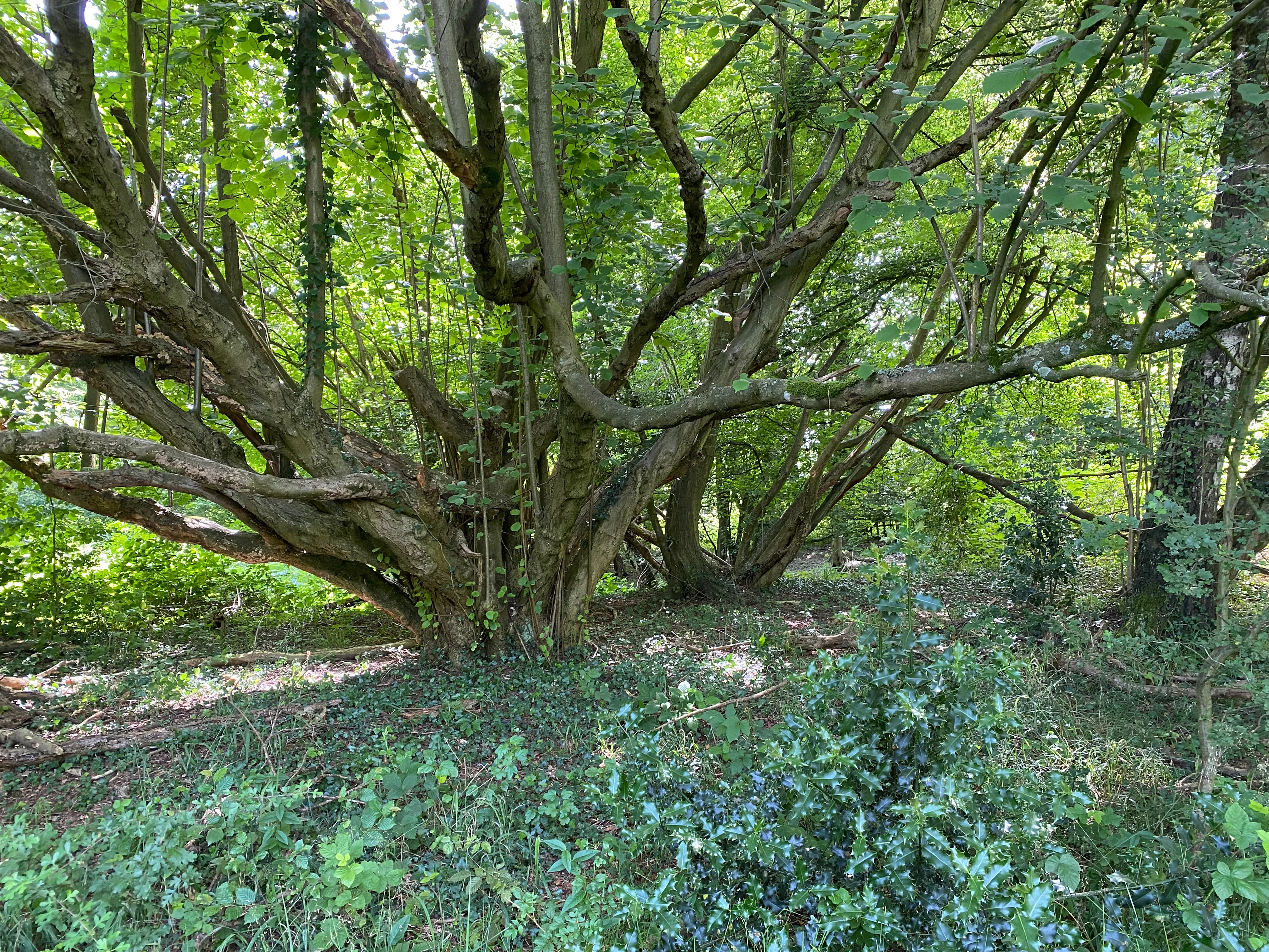
A large, multi-trunked tree with many spreading branches stands in a lush green forest, with ground covered in low-lying vegetation.
A dense, mature tree with branching trunks in the Southerberg nature reserve.

Southerberg Nature Reserve ecosystems, habitats, and plant life

Southerberg's ecological significance lies in its compact combination of wetland and forest habitats in a strongly urbanized setting. The principal habitat is a wet birch-oak woodland that flourishes across the damp valley floor, with birch (Betula) and oak (Quercus) species forming the main canopy. This is the only site in Leverkusen where such moist birch-oak woodland survives, making it a key reference habitat in the city.

Around and within this woodland, other habitat types enrich the ecological character of the reserve. Grey willow scrub and reedbeds occupy the wetter edges and eastern boundary, while a small alder forest grows in the western part of the interior, providing additional canopy diversity. The southern slopes are dominated by tall herb-rich meadows, partly enclosed by hedgerows, which mark the transition to drier conditions.

A 2015 biological survey by the Biologische Station confirmed the conservation value of this habitat mosaic. Notable plant species recorded include the yew (Taxus baccata), the common twayblade (Listera ovata), the broad-leaved helleborine (Epipactis helleborine), the heath spotted orchid (Dactylorhiza maculata), the ragged robin (Lychnis flos-cuculi), and the sneezewort (Achillea ptarmica). Several of these species carry Red List status in North Rhine-Westphalia, underscoring the site's importance for rare flora in the Lower Rhine area.
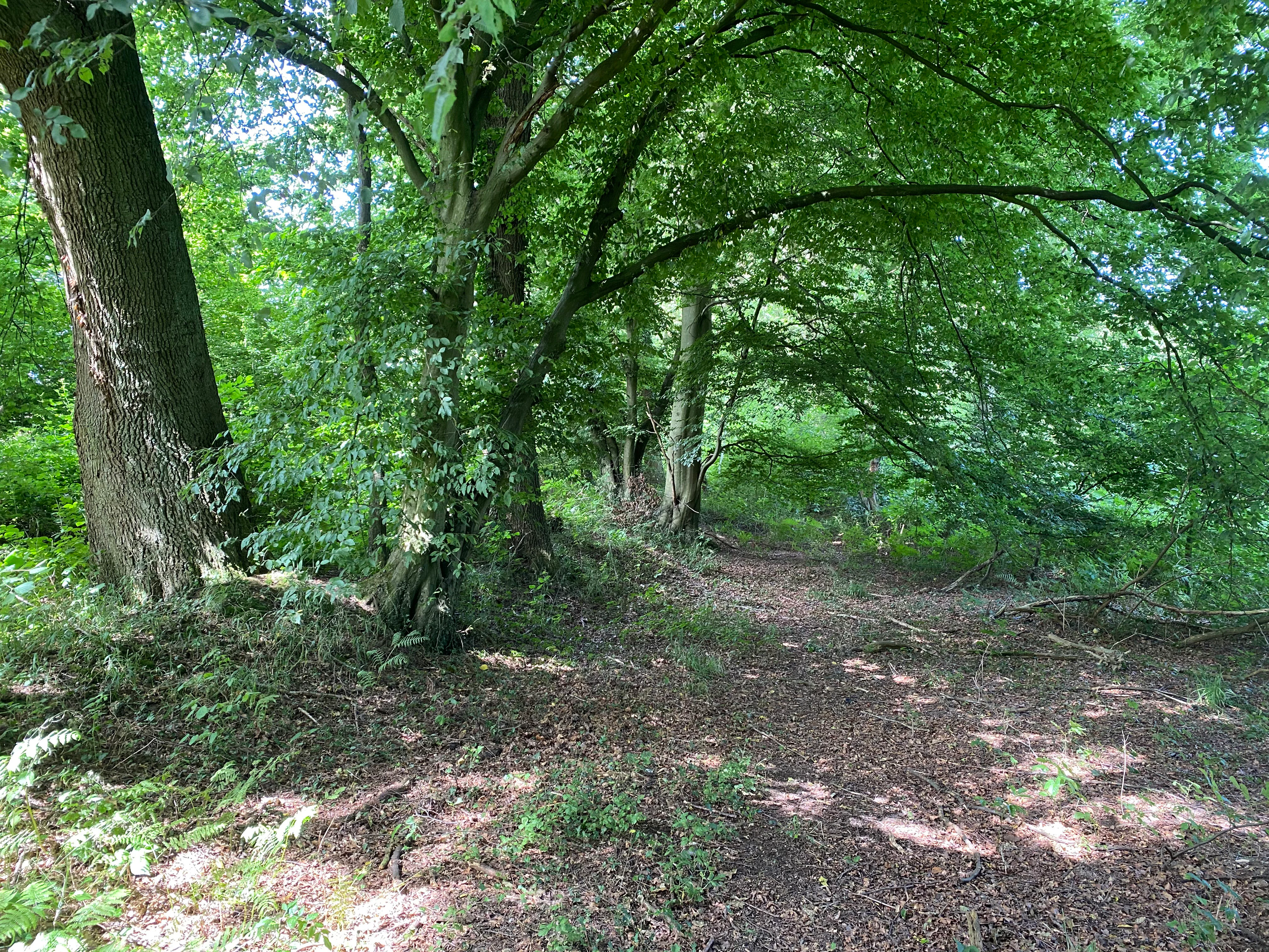
A dirt trail winds through a dense, green forest with mature, broad-leafed trees casting dappled shade over the ground.
A shaded forest path within the Southerberg nature reserve.

Southerberg Nature Reserve wildlife and species highlights

The wildlife content of the source material focuses primarily on the botanical richness of Southerberg rather than on its animal species. The most ecologically distinctive faunal value of the site is closely tied to its wet birch-oak woodland, alder stands, reedbeds, scrub patches, and meadow mosaic, all of which together support a small-scale habitat structure favorable to woodland, wetland, and edge-species invertebrates, amphibians, and birds typical of damp deciduous forest in the Lower Rhine region.

The reedbed along the eastern boundary and the willow scrub across the wetter edges are particularly characteristic habitats for wetland-associated fauna, while the hedgerows and oak-dominated canopy offer nesting and foraging resources for typical central European woodland birds. Because the source documentation does not provide detailed species lists for animals, this section is kept at the level of habitat-supported wildlife themes rather than named species.
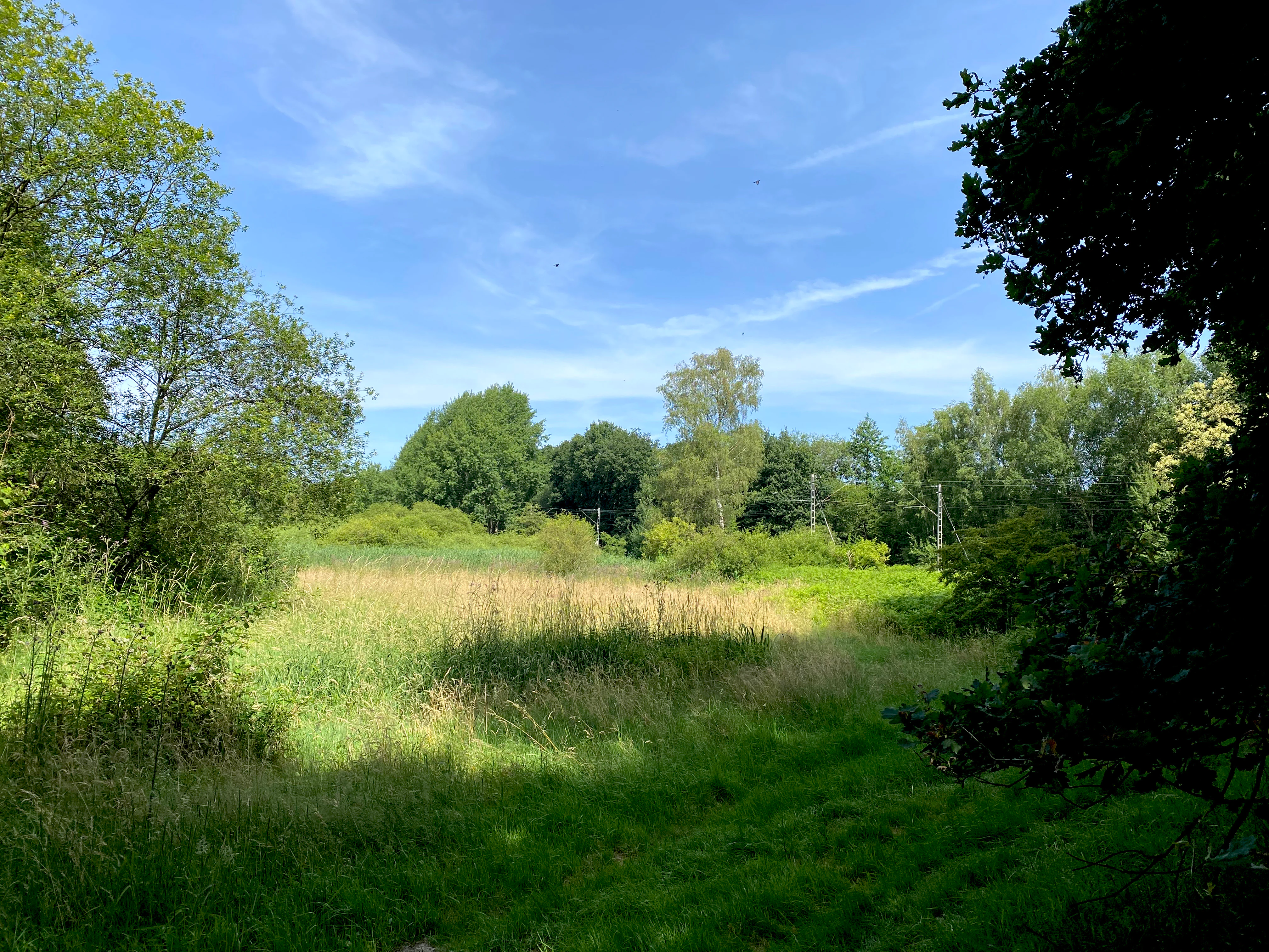
A sunny summer view of a grassy meadow and reed bed surrounded by deciduous trees in a nature reserve.
The moist valley depression at the Southerberg nature reserve.

Southerberg Nature Reserve conservation status and protection priorities

Southerberg was formally designated in 1987 as a strictly protected nature reserve under the Leverkusen landscape plan, with the conservation objective of preserving a moist to wet grassland-and-forest complex. Within the international framework, it is treated under IUCN Category IV (Habitat/Species Management Area), reflecting its role in actively maintaining a particular habitat type rather than being left as a strict wilderness reserve.

The reserve is recognized locally as ecologically significant because it holds Leverkusen's only remaining wet birch-oak woodland, an indicator habitat that depends on stable, moist soil conditions. Its position on the edge of the Bergische Sand terrace and between the Further Moor and Bürgerbusch reserves gives it an additional conservation role as a linking element in the regional habitat network (Biotopverbund), helping maintain landscape connectivity in a heavily built-up part of the Lower Rhine.

Standard management actions include maintaining the wet soil conditions that sustain the woodland and meadows, using the meadows extensively rather than intensively, and carrying out occasional cutting of the hedgerows to keep them in good structural condition. The forest itself is generally left to develop on its own, a strategy that supports the development of mature trees and deadwood habitat features characteristic of older oak woodland.

Southerberg Nature Reserve cultural meaning and human context

Southerberg is firmly embedded in the landscape and planning tradition of North Rhine-Westphalia. As a nature reserve declared under a municipal Landschaftsplan, it reflects the German regional approach of designating and managing ecologically important sites within urban and peri-urban areas through formal landscape planning instruments. The reserve sits within Leverkusen, a city strongly shaped by the chemical industry along the Rhine, which gives small protected sites such as Southerberg an added cultural and historical relevance as surviving natural fragments within an intensively used industrial region.
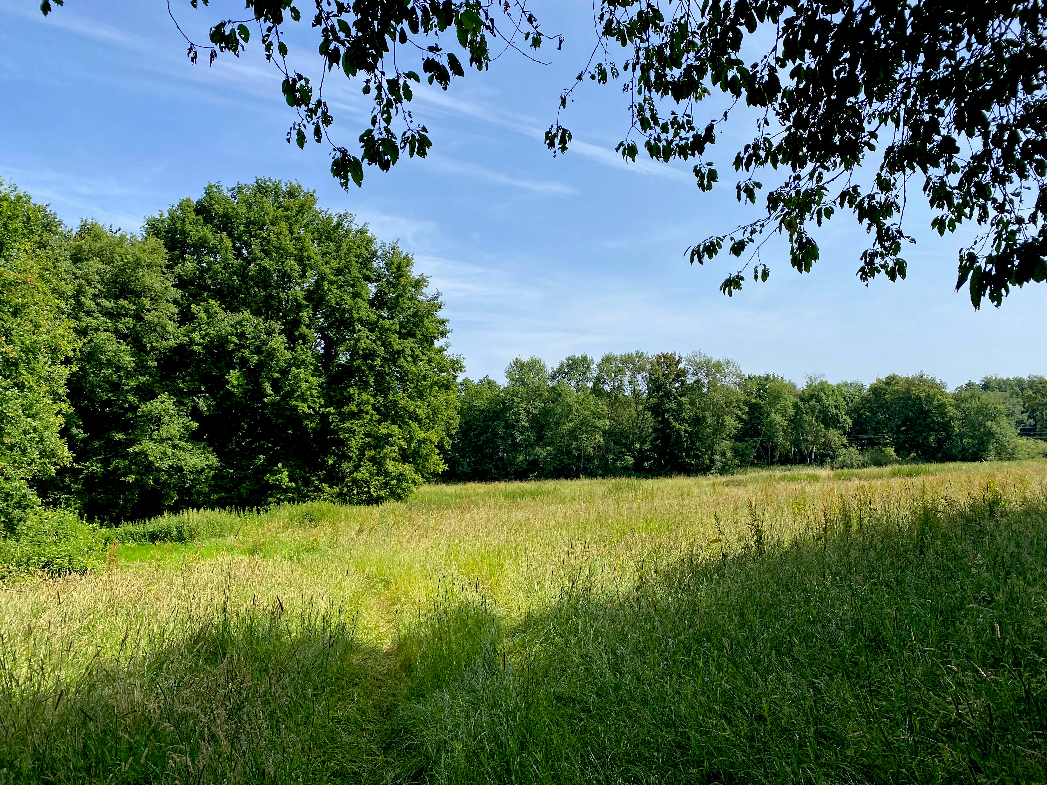
A wide, sunlit meadow filled with tall grasses bordered by a dense line of mature green deciduous trees under a clear blue sky, with overhanging tree branches in the foreground.
A grassy meadow at the edge of a forest in Southerberg Nature Reserve.

Top sights and standout views in Southerberg Nature Reserve

Within just fifteen hectares, Southerberg combines wet birch-oak woodland, alder forest, reedbeds, willow scrub, hedgerows, and tall herb meadows, producing one of the most structurally varied habitat mosaics in the local area. It is the sole remaining wet birch-oak woodland in Leverkusen, an ecological standout in a city otherwise dominated by industrial and residential land use.

Its position on the Bergische Sand terrace, between the Further Moor and Bürgerbusch reserves, gives Southerberg a distinctive role as a habitat connector across an urban landscape. The reserve also offers an interesting botanical inventory: the 2015 Biologische Station survey recorded several Red List plant species, including yew and the heath spotted orchid among confirmed site records.
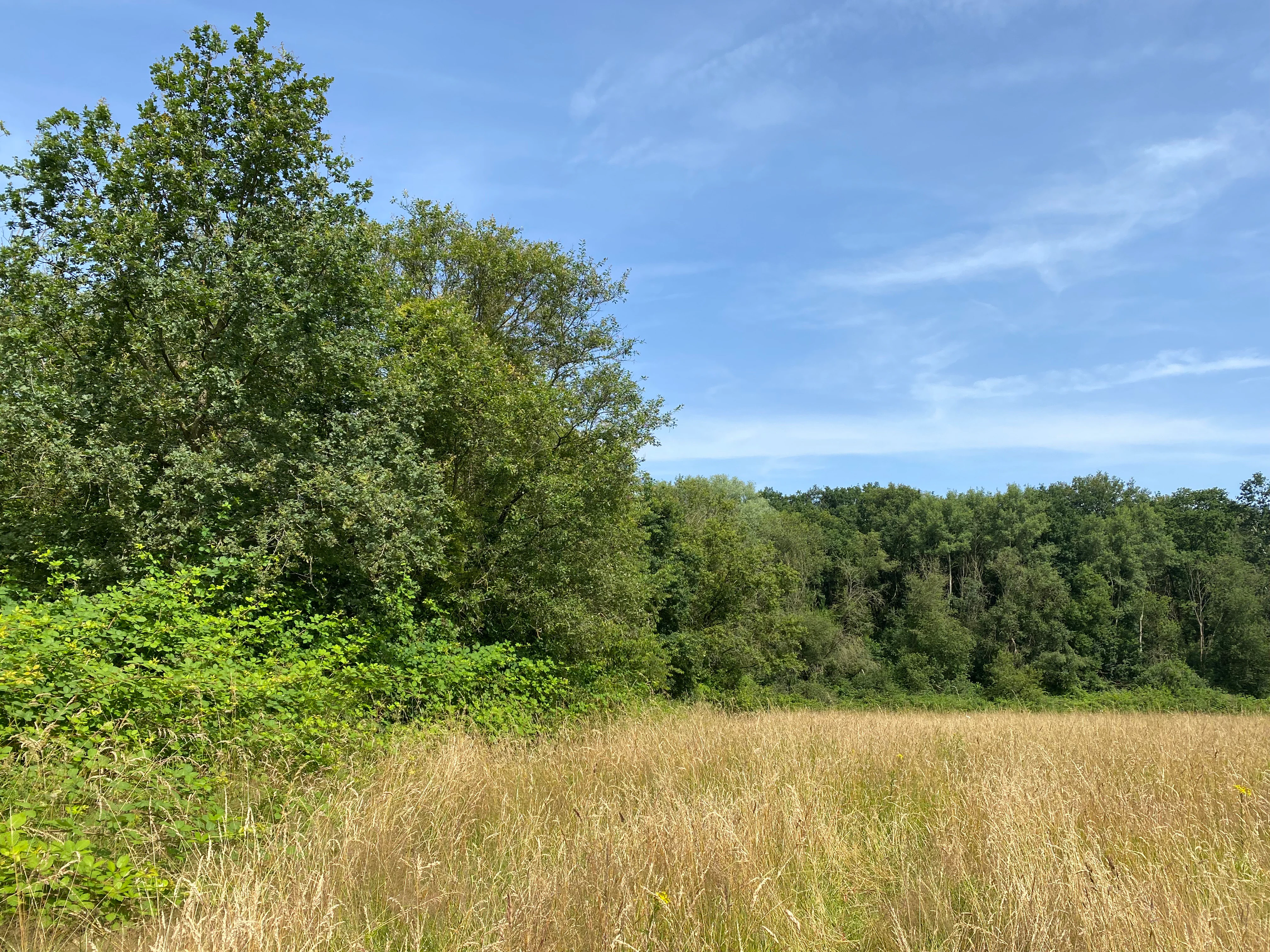
A wide meadow of tall, dried grasses bordered by dense green trees and shrubs under a clear blue sky.
A meadow bordered by deciduous forest and hedgerows within Southerberg nature reserve.

Best time to visit Southerberg Nature Reserve

Southerberg's wet meadows, reedbeds, and hedgerows gain their strongest visual and ecological expression during the late spring and summer months, when meadow plants such as ragged robin and sneezewort come into flower and the reedbed and willow scrub along the eastern boundary are fully leafed. Late spring into early summer is also typically the best time to observe the orchid species recorded on site, including the heath spotted orchid and common twayblade, in flower.

The deciduous woodland of the reserve, dominated by birch and oak, is most visually striking from late spring through autumn, with the broad seasonal variation typical of temperate European broadleaf forest. Because the source material does not document visitor access or seasonal closures, visits should be planned with local guidance and respect for the protected status of the small reserve.

Monthly climate preview

Long-term monthly temperature averages and precipitation patterns for Southerberg

Southerberg Climate Normals, Annual Temperature and Precipitation Rhythm

Southerberg records documented monthly temperature fluctuations alongside stable daily precipitation rates across the sampled coordinate. Examining complete monthly climate normals reveals deeper variations in average maximum and minimum temperatures throughout the year.
Annual mean10 °C
1 °C19 °C
Jan
Feb
Mar
Apr
May13°
Jun17°
Jul19°
Aug19°
Sep15°
Oct10°
Nov
Dec
Warmest month
July

19.2 °C

Coolest month
January

1.3 °C

Wettest month
December

2.6 mm/day

Driest month
April

1.6 mm/day

Park location guide

Geography guide, regional context, and park location map for Southerberg Nature Reserve

Southerberg Nature Reserve park geography, regions, and map view in Germany

Understand where Southerberg Nature Reserve sits in Germany through a broader geographic reading of the surrounding landscape, nearby location context, and its mapped position within the national park landscape.

How Southerberg Nature Reserve fits into Germany

Germany is a federal republic in Western and Central Europe with a population of over 83 million across sixteen constituent states. It is Europe's largest economy by nominal GDP and a major global exporter and importer. The capital is Berlin, and the country borders Denmark, Poland, Czech Republic, Austria, Switzerland, France, Luxembourg, Belgium, and the Netherlands.

Wider geography shaping Southerberg Nature Reserve in Germany

Germany is located in Western and Central Europe, spanning 357,022 km². It borders Denmark to the north, Poland and the Czech Republic to the east, Austria and Switzerland to the south, and France, Luxembourg, Belgium, and the Netherlands to the west. The country has coastlines on the Baltic Sea and North Sea to the north, with the Alps located in the southern region.

Map view of Southerberg Nature Reserve

Use this park location map to pinpoint Southerberg Nature Reserve in Germany, understand its exact geographic position, and read its mapped placement within the surrounding landscape more clearly.

Pigeon | © OpenStreetMap contributors

Location context for Southerberg Nature Reserve

Nordrhein-Westfalen

Visual reference of wetland habitats, valley terrain, and forest mosaics

Southerberg Photos, Scenery, and Protected Landscape Views

Visual documentation captures the diverse terrain, wet birch-oak woodland, and moist valley meadows defining the protected area. Examining these environmental photographs reveals the intricate habitat structure and landscape character preserved within the reserve.

A view into a lush green forest with large mature trees and a forest floor covered in scattered leaves.

A sunny summer view of a grassy meadow bordered by dense green trees and shrubs in the Southerberg nature reserve.

A large, multi-trunked tree with many spreading branches stands in a lush green forest, with ground covered in low-lying vegetation.

A dirt trail winds through a dense, green forest with mature, broad-leafed trees casting dappled shade over the ground.

A sunny summer view of a grassy meadow and reed bed surrounded by deciduous trees in a nature reserve.

A close up of a spiky, unopened flower bud of a wild carrot plant, showing intricate green bracts and pale flower heads set against a blurred green meadow background.

A wide, sunlit meadow filled with tall grasses bordered by a dense line of mature green deciduous trees under a clear blue sky, with overhanging tree branches in the foreground.

A wide meadow of tall, dried grasses bordered by dense green trees and shrubs under a clear blue sky.

A tall, slender Rampion bellflower plant with delicate, light purple, star-shaped flowers and pointed buds growing in a lush green meadow.

Park atlas

Compare regional habitat networks and connected natural reserves

Exploring Parks Near Southerberg and Surrounding Protected Landscapes

Visitors exploring Southerberg can browse adjacent protected areas to evaluate wider regional habitat networks and wetland reserves. Examining these neighboring conservation zones provides a broader geographical perspective on local valley ecosystems.
Nature reserveNordrhein-Westfalen
About 2.4 km away#1 closest

East

Wupperhang mit Henkensiepen und Hüscheider Bachtal Protected Area and Geographic Atlas

Forested river valleys and slopes in Nordrhein-Westfalen

Investigate the detailed geography of Wupperhang mit Henkensiepen und Hüscheider Bachtal, a nature reserve showcasing prime Hainsimsen beech forest and riparian habitats. The area represents a key ecological corridor along the Wupper River, featuring rugged side valleys, calcareous springs, and diverse floodplain vegetation that defines this protected woodland segment of the Bergisches Land.

Area
34.65 km²
Established
1985
IUCN
IV
Nature reserveNordrhein-Westfalen
About 2.9 km away#2 closest

South

Wupperinsel Nature Reserve: Mapped Protected Landscapes in Nordrhein-Westfalen

Riparian woodland, floodplain islands, and meadow habitats.

Discover the geographic role of Wupperinsel as a designated nature reserve within the Wupper River corridor. This site features a rare Glatthafer meadow, mature poplar lines, and mixed-woodland groves that provide essential habitat connectivity. Analyze the protected island boundaries and the layered floodplain terrain that characterize this significant ecological fragment in urban Germany.

Area
0.054 km²
Established
1987
IUCN
IV
Nature reserveLeverkusen
About 4.5 km away#3 closest

West

Krapuhlsee Nature Reserve: Protected Wetland and Gravel Lake Geography in Leverkusen

Exploring post-industrial habitat mosaics and conservation terrain

Krapuhlsee is a protected nature reserve in Leverkusen, North Rhine-Westphalia, known for its unique concentration of post-mining gravel lakes and nutrient-poor grassland habitats. Managed to support rare wild bee populations and ground-nesting birds, the reserve acts as a critical stepping-stone for ecological connectivity across the heavily industrialized Rhine corridor.

Area
0.082 km²
Established
1986
IUCN
IV
Relief
Lowland
Watercolor illustration of a peaceful lake with trees on a small island and flowering meadows in the foreground.
Nature reserveNordrhein-Westfalen
About 5.5 km away#4 closest

West

Monheimer Baggersee Nature Reserve: Geographic Overview and Protected Landscape Mapping

Located within the Lower Rhine terrace of Nordrhein-Westfalen

Monheimer Baggersee represents a vital protected landscape shaped from a former gravel quarry. This reserve provides a comprehensive geographic look at mineral-substrate habitats, irregular lake shorelines, and specialized avian breeding grounds within the urbanized Mettmann district.

Area
0.712 km²
Established
1981
IUCN
IV
Relief
Lowland
Watercolor painting of a tranquil, marshy landscape with soft green trees, grass, and a winding path, rendered in a pale, minimalist style.
Nature reserveNordrhein-Westfalen
About 7 km away#5 closest

North

Krüdersheide und Götsche Nature Reserve: Geographic Mapping and Protected Land Data

Wetland mosaic and bog forest habitats in Nordrhein-Westfalen

Located in Solingen, the Krüdersheide und Götsche nature reserve protects essential bog woodland, peat cushions, and stream habitats on the Bergische Heideterrasse. This 55-hectare site serves as an important ecological corridor for moisture-dependent flora and fauna within an urbanized region of Nordrhein-Westfalen. Study its mapped boundaries and terrain context through our specialized atlas database.

Area
0.547 km²
Established
2005
IUCN
IV
Relief
Lowland
Nature reserveNorth Rhine-Westphalia
About 8.5 km away#6 closest

Southwest

Worringer Bruch Nature Reserve: A Relict Rhine Floodplain in North Rhine-Westphalia

Ancient oxbow meander and vital inner-city wetland landscape.

Worringer Bruch stands as one of the best-preserved, silted-up oxbow meanders along the Lower Rhine. Spanning roughly 164 hectares, this nature reserve integrates floodplain forests, traditional orchards, and marshy meadows into a cohesive wetland mosaic. Serving as a low-lying ecological refuge near Cologne, the area remains deeply connected to the groundwater dynamics of the historic Rhine river corridor.

Area
1.64 km²
Established
1991
Relief
Lowland
Climate
Temperate
Watercolor illustration showing a wide landscape with rolling hills in soft pink and purple tones, a line of green conifer and deciduous trees, and a grassy foreground with a winding path or stream
Nature reserveNordrhein-Westfalen
About 9.7 km away#7 closest

North

Hildener Heide, Schönholz Nature Reserve: Geography and Protected Area Context

A preserved mosaic of inland heath and bog forest habitats.

Hildener Heide, Schönholz provides a critical window into the rare wetland ecosystems of the Bergische Heideterrasse. This nature reserve in North Rhine-Westphalia retains a distinct mosaic of peat-moss-dominated bog woodland, wet heath, and alder-ash floodplain forest, offering a high density of threatened habitats within a protected geographic framework.

Area
0.36 km²
Established
1938
IUCN
IV
Relief
Lowland
A soft watercolor painting of a small grove of trees standing near a body of water, featuring pale green and yellow tones.
Nature reserveNordrhein-Westfalen
About 9.8 km away#8 closest

North

Naturschutzgebiet Hildener Heide, südlich Sandberg: Protected Area and Landscape Atlas

Bog woodland and wet heathland geography in North Rhine-Westphalia.

Examine the topography and habitat mosaic of Naturschutzgebiet Hildener Heide, südlich Sandberg. This nature reserve serves as an important ecological anchor on the Bergische Heideterrasse, preserving rare wetland, alder bog forest, and heath vegetation within a compact and structurally diverse geographic footprint.

Area
0.08 km²
Established
1938
IUCN
IV
Relief
Lowland

Common questions about visiting, size, designation, and location context for Southerberg Nature Reserve

Southerberg Nature Reserve FAQs for park facts, access, geography, and protected area context

Find quick answers about Southerberg Nature Reserve, including protected-area facts, park geography, trail and visitor context, and how the park fits into its surrounding country and regional landscape.
MoriAtlas Explorer

Continue Your Protected Areas Search Across the Global Atlas

Deepen your exploration by continuing the structured search for national parks and protected areas worldwide. Utilize the comprehensive filtering capabilities to compare different conservation landscapes and refine your understanding of global park geography. Discover more about the distribution and characteristics of protected natural areas.

Global natural geography