


Mori Atlas logo
Wildlife reserveSpiers Lake National Wildlife Area

A vital protected wildlife reserve safeguarding rare fescue prairie and grassland bird habitats.

Spiers Lake National Wildlife Area: Preserving Native Prairie Landscapes in Central Alberta

Spiers Lake National Wildlife Area serves as a critical conservation site for remnants of the original prairie landscape in central Alberta. This wildlife reserve protects undisturbed Hall's fescue prairie and associated wetland margins, providing a sanctuary for provincially uncommon plant species and grassland-dependent birds. The area acts as an authentic window into the ecological character of native plains, offering insight into prairie biodiversity preservation.

prairiegrasslandfescue prairienative grasslandwildlife refugebirdwatching
A flat vector-style illustration of a dramatic canyon landscape with a central waterfall, coniferous forest, and tall grasses in the foreground.

Spiers Lake National Wildlife Area

Wildlife reserve

Park overview

Structured park overview, official facts, and landscape profile for Spiers Lake National Wildlife Area

Spiers Lake National Wildlife Area park facts, protected area profile, and essential visitor context

Review the core facts for Spiers Lake National Wildlife Area, including designation, size, terrain, visitor scale, habitats, and operating context in one park-focused overview.

About Spiers Lake National Wildlife Area

Spiers Lake National Wildlife Area sits in the rolling prairie landscape of central Alberta, within the County of Stettler No. 6. It is a federally designated wildlife reserve managed by the Canadian Wildlife Service, and it was formally established in 1982 with the clear and narrow purpose of conserving a piece of native prairie that was rapidly disappearing from the surrounding region.

The reserve is a comparatively small site by area, but its ecological value far outweighs its footprint. Its central importance lies in the protection of Hall's fescue prairie, a native grassland vegetation type that was historically widespread across this part of Alberta but has been heavily reduced by cultivation, grazing intensification, and other land uses. By holding an intact example of this community, the area provides a reference point for understanding the original character of the regional prairie and a seed source potential for native grassland recovery.

In addition to its broader prairie conservation role, the reserve is notable for hosting several plant species that are considered rare within Alberta, including few-flowered aster, marsh felwort, and northern blue-eyed grass. The combination of native upland grassland and wetter transitional zones also creates habitat for a rich community of grassland-associated birds, several of which face population declines across their range. The reserve therefore represents a combined effort to conserve both the native plant community and the wildlife that depends on it, within one of Canada's most altered biomes.

Quick facts and research context for Spiers Lake National Wildlife Area

Spiers Lake National Wildlife Area is a federally administered wildlife reserve in the County of Stettler No. 6 in central Alberta, Canada. It was established in 1982 under the Canadian Wildlife Service and is classified as a strict nature reserve in the IUCN protected-area framework.

The reserve's defining ecological role is the protection of a remaining stand of Hall's fescue prairie, a native grassland type that has largely disappeared from the surrounding prairie landscape. It is also recognized for supporting several plant species considered rare in Alberta and for hosting breeding and migrating grassland birds, some of which are of conservation concern.

Protection and recognition

Documented terrestrial protection scope, designation context, and verified database records

Spiers Lake National Wildlife Area Protection Status and International Recognition Facts

Spiers Lake National Wildlife Area maintains a documented terrestrial protection scope cataloged within official global conservation registers. Structured records compile the verified administrative status and international recognition details associated with the protected landscape.

Protection details

Protection scope
Terrestrial
WDPA ID
18192
Park context

Deeper park guide and search-rich context for Spiers Lake National Wildlife Area

Spiers Lake National Wildlife Area history, landscape, wildlife, and travel context

Explore Spiers Lake National Wildlife Area through its history, landscape character, ecosystems, wildlife, conservation priorities, cultural context, and seasonal travel timing in a structured park guide built for atlas discovery and search intent.

Why Spiers Lake National Wildlife Area stands out

Spiers Lake National Wildlife Area is best known for safeguarding a remnant stand of Hall's fescue prairie, one of the native grassland communities that once dominated central Alberta but have become scarce as the prairie landscape was converted to cropland and pasture. The reserve preserves both the plant community itself and the open grassland habitat conditions that sustain it. It is also recognized as a stronghold for several rare plant species in Alberta, including few-flowered aster, marsh felwort, and northern blue-eyed grass. Together with its role as habitat for vulnerable grassland birds, the reserve has a tight focus on the conservation of native prairie ecosystems rather than a broad mixed landscape.
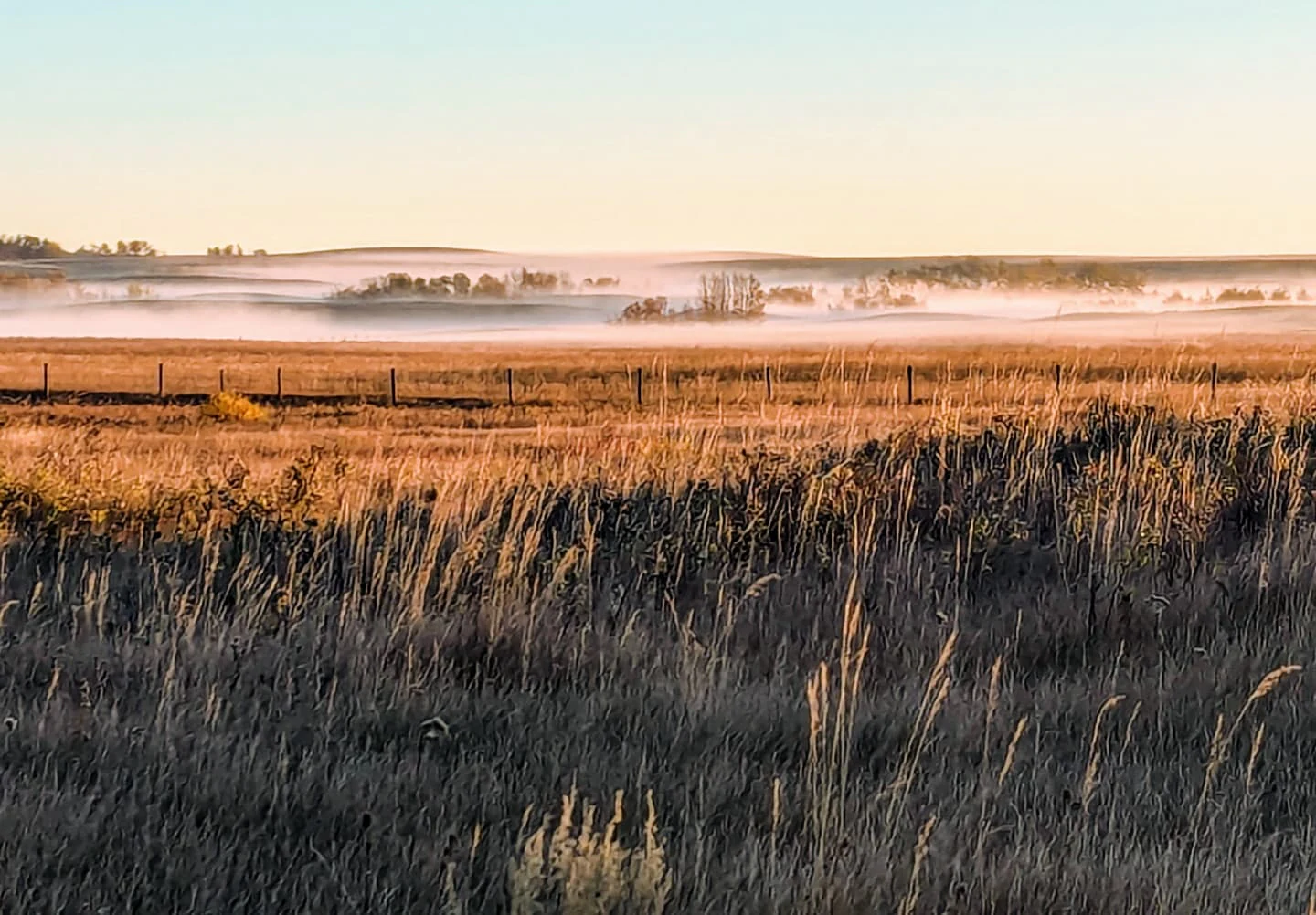
A wide, golden-hour view of open grasslands with a light layer of morning mist settling over rolling terrain, featuring a wire fence stretching across the midground.
Morning light and mist over the grassland at Spiers Lake National Wildlife Area.

Spiers Lake National Wildlife Area history and protected-area timeline

Spiers Lake National Wildlife Area was established in 1982 as a federal protected area under the administration of the Canadian Wildlife Service. Its creation was motivated by the recognition that native fescue prairie, the historical dominant vegetation across much of central Alberta, had been drastically reduced by agricultural land conversion and was increasingly difficult to find in an undisturbed state.

The reserve was set aside specifically to preserve a representative fragment of Hall's fescue prairie together with the rare plant species that occur within it, recognizing both the ecological and the botanical heritage value of the site. A formal management plan for the area was later produced by Environment Canada, providing the framework for ongoing stewardship of the grassland community and its associated wildlife. The area therefore reflects an early example of targeted federal action to conserve disappearing native prairie ecosystems in Alberta.

Spiers Lake National Wildlife Area landscape and geographic character

Spiers Lake National Wildlife Area lies within the central Alberta prairie landscape, a region characterized historically by open grasslands, gentle rolling terrain, and seasonal wet zones along low-lying areas and lake margins. The reserve occupies a modest parcel within this broader setting and centers on a native upland prairie community rather than a dramatic or mountainous landform.

The defining feature of the landscape is its unbroken native grassland cover, representing Hall's fescue prairie in a relatively undisturbed condition. Around this core, transitional habitats associated with the nearby lake and lower ground add moisture-dependent vegetation, contributing textural and ecological variety to an otherwise open prairie matrix. The result is a landscape that reads as a small but intact sample of the original central Alberta prairie rather than a modified agricultural landscape.

Spiers Lake National Wildlife Area ecosystems, habitats, and plant life

Ecologically, Spiers Lake National Wildlife Area is defined by its native fescue grassland community, with Hall's fescue as the characteristic graminoid. This vegetation type once formed the backbone of central Alberta's native prairie and supports a specialized suite of associated forbs, graminoids, and soil-dwelling organisms adapted to semi-arid grassland conditions.

The reserve also includes wetter microhabitats associated with the lake margin and low areas, which extend the ecological gradient from upland prairie into transitional moisture-loving plant communities. This juxtaposition of dry upland grassland and moist margin vegetation gives the site disproportionate botanical richness for its size. Several plant species found here are classified as rare within the province, including few-flowered aster, marsh felwort, and northern blue-eyed grass, highlighting the site's importance for prairie biodiversity conservation.

Spiers Lake National Wildlife Area wildlife and species highlights

Spiers Lake National Wildlife Area is notable primarily for its birdlife, with the reserve recording around sixty bird species within or near its boundaries. Among these are several species of conservation concern that depend on intact native prairie and prairie-margin habitats for breeding and foraging.

Species of particular interest include the piping plover, the long-billed curlew, the short-eared owl, the common nighthawk, Sprague's pipit, and the chestnut-collared longspur. The presence of these species reflects the continuing value of the site for grassland-dependent birds, many of which have undergone significant population declines elsewhere on the Canadian prairies. Beyond birds, the native grassland and its associated forb community also support the broader prairie food web, including small mammals and invertebrates typical of intact fescue prairie.

Spiers Lake National Wildlife Area conservation status and protection priorities

The conservation significance of Spiers Lake National Wildlife Area lies in its role as one of the remaining protected strongholds for Hall's fescue prairie in Alberta, a vegetation type that has been heavily reduced through cultivation and pasture improvement across the central prairie region. By maintaining an intact example of this community, the reserve serves both as a refuge for native prairie biodiversity and as a baseline against which changes in the surrounding landscape can be measured.

The site's strict nature reserve classification under the IUCN framework reflects a conservation objective focused on ecological integrity rather than recreation or resource use. Its designation under the National Wildlife Area program and administration by the Canadian Wildlife Service give it long-term federal protection, while the presence of several provincially rare plant species and multiple threatened or declining bird species underscores its biodiversity value. In the broader picture of Canadian prairie conservation, Spiers Lake represents a small but meaningful piece of the effort to preserve native fescue grassland and the species that depend on it.

Top sights and standout views in Spiers Lake National Wildlife Area

Spiers Lake National Wildlife Area stands out for the concentration of conservation value it holds within a very small footprint. Its native Hall's fescue prairie, its rare plant species, and its community of threatened grassland birds come together to make the site a multi-layered refuge for Alberta's diminished prairie biodiversity.

The reserve is also notable as a clear example of targeted federal conservation policy in action, with its establishment, ongoing management, and formal management plan all reflecting a deliberate effort to preserve a vanishing native plant community. For visitors interested in prairie natural heritage, Spiers Lake offers an unusually focused window into the original grassland character of central Alberta.

Monthly climate preview

Long-term representative temperature ranges and monthly precipitation rhythm for Alberta

Spiers Lake National Wildlife Area Climate Normals and Annual Weather Patterns

Spiers Lake National Wildlife Area exhibits a recorded annual temperature rhythm spanning severe sub-zero winter minimums to warm summer maximums alongside varying monthly precipitation rates. Analyzing the complete twelve-month climatology profile provides deeper insight into long-term environmental averages across the protected area.
Annual mean4 °C
-10 °C18 °C
Jan-10°
Feb-8°
Mar-2°
Apr
May11°
Jun15°
Jul18°
Aug17°
Sep12°
Oct
Nov-3°
Dec-9°
Warmest month
July

18.3 °C

Coolest month
January

-10.5 °C

Wettest month
June

2.8 mm/day

Driest month
February

0.5 mm/day

Park location guide

Geography guide, regional context, and park location map for Spiers Lake National Wildlife Area

Spiers Lake National Wildlife Area park geography, regions, and map view in Canada

Understand where Spiers Lake National Wildlife Area sits in Canada through a broader geographic reading of the surrounding landscape, nearby location context, and its mapped position within the national park landscape.

How Spiers Lake National Wildlife Area fits into Canada

Canada is a federal parliamentary constitutional monarchy spanning North America from the Atlantic to the Pacific and Arctic Oceans. With a population of over 41 million, it is officially bilingual in English and French at the federal level. The country gained independence from the United Kingdom through a gradual process culminating in 1982.

Wider geography shaping Spiers Lake National Wildlife Area in Canada

Canada occupies the northern portion of North America, sharing its longest international border with the United States. The country extends from the Atlantic Ocean to the Pacific Ocean and northward into the Arctic Ocean, giving it the longest coastline of any nation.

Map view of Spiers Lake National Wildlife Area

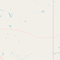
Use this park location map to pinpoint Spiers Lake National Wildlife Area in Canada, understand its exact geographic position, and read its mapped placement within the surrounding landscape more clearly.

Pigeon | © OpenStreetMap contributors

Location context for Spiers Lake National Wildlife Area

Alberta

Visualizing native prairie habitats and protected central Alberta park environments

Spiers Lake National Wildlife Area Photos and Landscape Scenery

Visual documentation of Spiers Lake National Wildlife Area reveals the intact structure of rare Hall's fescue prairie and associated wetland margins. Protected area imagery provides a clear window into native grassland plant communities and vanishing regional ecosystems.

A wide, golden-hour view of open grasslands with a light layer of morning mist settling over rolling terrain, featuring a wire fence stretching across the midground.

Park atlas

Compare regional grassland reserves and surrounding central Alberta habitats

Explore Protected Areas and Parks Near Spiers Lake National Wildlife Area

Browse nearby national parks and protected areas sharing similar native prairie geography and wildlife conservation traits. Comparing these regional reserves reveals broader ecological patterns across the surrounding central Alberta landscape.
Wildlife reserveAlberta
About 112 km away#1 closest

West

Red Deer Migratory Bird Sanctuary: Geographic Overview and Protected Wetland Map

Aspen Parkland terrain in central Alberta, Canada

The Red Deer Migratory Bird Sanctuary preserves a key wetland corridor defined by the Gaetz Lakes oxbows. This protected reserve offers a look at the native Aspen Parkland ecoregion, blending shrubland and forest patches that provide essential sanctuary for migratory waterfowl. The mapped area illustrates how this federal reserve maintains a natural landscape mosaic amidst the surrounding urban geography of central Alberta.

Area
1.3 km²
Established
1924
Water
Major water bodies
A soft watercolor illustration of a low lying river valley with trees and distant hills against a white background.
Wildlife reserveAlberta
About 158 km away#2 closest

Southwest

Inglewood Migratory Bird Sanctuary: Federal Wildlife Reserve and Riparian Corridor Map

Protected riparian ecosystems along the Bow River in Alberta.

Analyze the geography of the Inglewood Migratory Bird Sanctuary, a federal wildlife reserve in Calgary, Alberta. This site preserves rare cottonwood floodplain forest and river habitats that serve as a critical stopover for migratory birds, offering a unique look at how protected landscapes persist within urban environments.

Area
1.11 km²
Established
1929
Relief
Lowland
Scope
Terrestrial
National parkAlberta
About 181 km away#3 closest

North

Elk Island National Park: National Park Protected Landscape and Alberta Geography

Discover the mapped terrain and protected boundaries.

Elk Island National Park, a designated national park in Alberta, Canada, offers a distinct protected landscape for geographic exploration. This detail page focuses on its mapped boundaries, regional setting within Western Canada, and the specific natural terrain that constitutes its protected area. Users can gain a structured understanding of Elk Island National Park's role as a conserved natural entity, ideal for atlas-based discovery and geographic context.

Area
194 km²
Established
1913
IUCN
II
Visitors
401.9K annual
National parkCanada
About 215 km away#4 closest

West

Banff National Park: Exploring Canada's Iconic National Park Protected Landscape and Geography

Mapped park boundaries and regional geographic context for Banff National Park.

Gain a structured understanding of Banff National Park as a key protected area within Canada. This resource details its identity as a national park, providing insights into its geographic setting and mapped landscape. It serves as a vital point for atlas-based discovery, helping to contextualize Banff National Park's significance within Canada's protected lands and natural terrain.

Area
6,641 km²
Established
1885
IUCN
II
Visitors
4.1M annual
Wildlife reserveSaskatchewan
About 243 km away#5 closest

Southeast

Great Sandhills National Wildlife Area: Saskatchewan Protected Dune and Prairie Landscapes

Mapping the natural features and protected boundaries of this significant wildlife reserve.

The Great Sandhills National Wildlife Area represents a vital contemporary conservation effort in southwestern Saskatchewan. It encompasses a compact but biologically dense mosaic of stabilized dune fields, native mixed-grass prairie, and alkaline wetland basins. This protected area stands as a representative example of Canada's evolving strategy to preserve the most ecologically significant parcels of the prairie landscape, offering deep insights into the region's specific terrain and habitat patterns.

Area
4.7 km²
Established
2025
IUCN
IV
Relief
Lowland
National parkBritish Columbia
About 268 km away#6 closest

West

Kootenay National Park: National Park Protected Landscape and Geographic Context

Explore Kootenay National Park's mapped terrain and regional geography.

Kootenay National Park is a protected national park located in British Columbia, Canada. This dedicated detail page provides an atlas-style exploration of its geographic identity, focusing on its mapped boundaries and the surrounding natural terrain. Understand how Kootenay National Park fits into the larger regional geography, offering rich context for protected landscape discovery and analysis.

Area
1,406 km²
Established
1920
IUCN
II
Visitors
574.1K annual
National parkBritish Columbia
About 284 km away#7 closest

West

Yoho National Park: Mapped Protected Area in British Columbia's Geography

Exploring the park's protected boundaries and terrain.

Yoho National Park is presented here as a distinct national park within British Columbia's vast geographic framework. This page provides a structured view of its protected land status, allowing for detailed exploration of its mapped boundaries and surrounding natural landscapes. Understand Yoho National Park's place in the Canadian atlas through its specific geographic features and protected area context.

Area
1,313 km²
Established
1886
IUCN
II
Visitors
663.9K annual
Wildlife reserveSaskatchewan
About 299 km away#8 closest

Northeast

Scent Grass Lake Migratory Bird Sanctuary: Regional Geography and Wetland Protected Area Maps

Key waterfowl breeding and molting ground in Saskatchewan.

Examine the ecological significance of Scent Grass Lake Migratory Bird Sanctuary, a critical wildlife reserve within the Saskatchewan Aspen Parkland. This protected area offers essential open water and sedge marsh environments for migratory waterfowl, serving as a vital staging and breeding site that maintains regional habitat stability in the Canadian prairies.

Area
6.47 km²
Established
1948
IUCN
IV
Relief
Lowland

Common questions about visiting, size, designation, and location context for Spiers Lake National Wildlife Area

Spiers Lake National Wildlife Area FAQs for park facts, access, geography, and protected area context

Find quick answers about Spiers Lake National Wildlife Area, including protected-area facts, park geography, trail and visitor context, and how the park fits into its surrounding country and regional landscape.
MoriAtlas Explorer

Continue Your Protected Areas Search Across the Global Atlas

Deepen your exploration by continuing the structured search for national parks and protected areas worldwide. Utilize the comprehensive filtering capabilities to compare different conservation landscapes and refine your understanding of global park geography. Discover more about the distribution and characteristics of protected natural areas.

Global natural geography