
Mori Atlas logo
Nature reserveSpreeler Bachtal

A study of stream valley habitats, wet meadows, and deciduous woodland corridors in North Rhine-Westphalia.

Spreeler Bachtal Nature Reserve: Mapped Protected Landscapes in the Bergisches Land Region

(Naturschutzgebiet Spreeler Bachtal)

The Spreeler Bachtal nature reserve forms a mosaic of near-natural stream corridors and slope forests within the Bergisches Land region of North Rhine-Westphalia. Spanning the valley of the Spreeler Bach, this protected area captures a complex transition from spring-influenced wet grasslands to acidic oak-beech woodland on the surrounding slopes. As an essential part of the Wupper watershed, the reserve preserves a compact upland landscape defined by slate-derived terrain and traditional low-intensity land management.

stream valleybrook habitatwet meadowsoak-beech forestdeciduous woodlandnature reserve
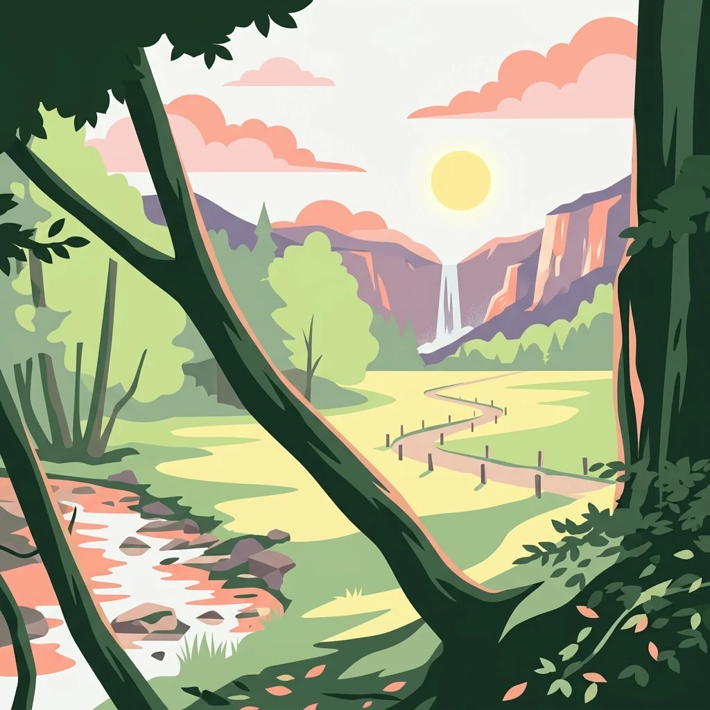
A digital illustration showing a tranquil valley at sunset; a winding stream runs through the foreground, a path cuts through the meadow, and a waterfall cascades down a distant cliffside framed by forest trees.

Spreeler Bachtal

Nature reserve

Park overview

Structured park overview, official facts, and landscape profile for Spreeler Bachtal Nature Reserve

Spreeler Bachtal Nature Reserve park facts, protected area profile, and essential visitor context

Review the core facts for Spreeler Bachtal Nature Reserve, including designation, size, terrain, visitor scale, habitats, and operating context in one park-focused overview.

About Spreeler Bachtal Nature Reserve

Spreeler Bachtal is one of many small but ecologically focused nature reserves in the Oberbergischer Kreis, a part of the Bergisches Land characterized by deeply incised stream valleys, mixed deciduous forests, and centuries of low-intensity land use. The reserve captures a representative cross-section of this landscape, protecting both the watercourse itself and the varied valley habitats that depend on it.

The valley morphology is typical of the Bergisches Land: a wide, flat valley floor flanked by steeper, often west-facing slopes. The valley bottom is a working mosaic of grassland, wet meadow, and moist fallow land, while the slopes are dominated by forest. Much of the woodland is acidic oak-beech forest on poor soils, with isolated older trees and patches of beech-oak forest. In places the canopy opens enough for a continuous understory of wavy hair grass and bilberry to develop, and small sections of the lower slope have been replanted with conifers, reflecting past forestry practice.

The Spreeler Bach itself is the central ecological feature of the reserve. It has near-natural structure throughout much of its length, with sections that meander through gravelly beds up to five meters wide. The course has been moved toward the valley edge in many places, and an old fringe of alder trees accompanies the open stretches. Near Sprinnerwiese, a fish pond surrounded by tall herb communities and alder-willow scrub adds still-water habitat, while downstream a larger mill pond associated with a long-standing industrial operation marks the transition toward the Wupper valley.

Beyond its ecological content, the reserve is integrated into the regional trail network. A section of the Wappenweg, a circular hiking route around Ennepetal, passes through the valley, mostly along the right bank of the stream from the Beyenburger Stausee via Griesensiepen toward the Heilenbecker Talsperre, with additional paths on the left bank, making the area accessible to walkers while keeping much of the surrounding woodland undisturbed.

Quick facts and research context for Spreeler Bachtal Nature Reserve

Spreeler Bachtal is a designated Naturschutzgebiet (nature reserve) with the official code GM-132, located in Radevormwald in North Rhine-Westphalia and extending partly into neighboring Ennepetal. The reserve occupies roughly 21 hectares along the valley of the Spreeler Bach between the locality of Griesensiepen in the east and a mill pond associated with an industrial facility in the west, immediately above the stream's confluence with the Wupper at the Beyenburger Stausee. It lies between about 218 and 250 meters above sea level and is classified as IUCN Category IV, recognizing its focus on habitat and species management. It was formally designated on 13 August 2019 and is administered by the lower landscape authority of the Oberbergischer Kreis.

Protection and recognition

Documented protection metrics and official conservation status records

Spreeler Bachtal Protection Status and International Recognition Data

Spreeler Bachtal protection status details compile verified designation records and international recognition sources for conservation analysis. Structured protected area data aggregates official administrative frameworks without assuming management outcomes.

Protection details

WDPA ID
555754879
Park context

Deeper park guide and search-rich context for Spreeler Bachtal Nature Reserve

Spreeler Bachtal Nature Reserve history, landscape, wildlife, and travel context

Explore Spreeler Bachtal Nature Reserve through its history, landscape character, ecosystems, wildlife, conservation priorities, cultural context, and seasonal travel timing in a structured park guide built for atlas discovery and search intent.

Why Spreeler Bachtal Nature Reserve stands out

The reserve is best known for its broad, near-natural stream valley, where the Spreeler Bach meanders through a five-meter-wide gravel bed fringed by old alders and bordered by wet, spring-fed grasslands. Equally distinctive are the surrounding slopes clothed in acidic oak-beech woodland, often derived from historically coppiced low forest, and the mosaic of small open habitats, including a near-natural angling pond at Sprinnerwiese and stock-poor mountain meadows on the steeper westerly exposures that bear the marks of long-standing grazing.
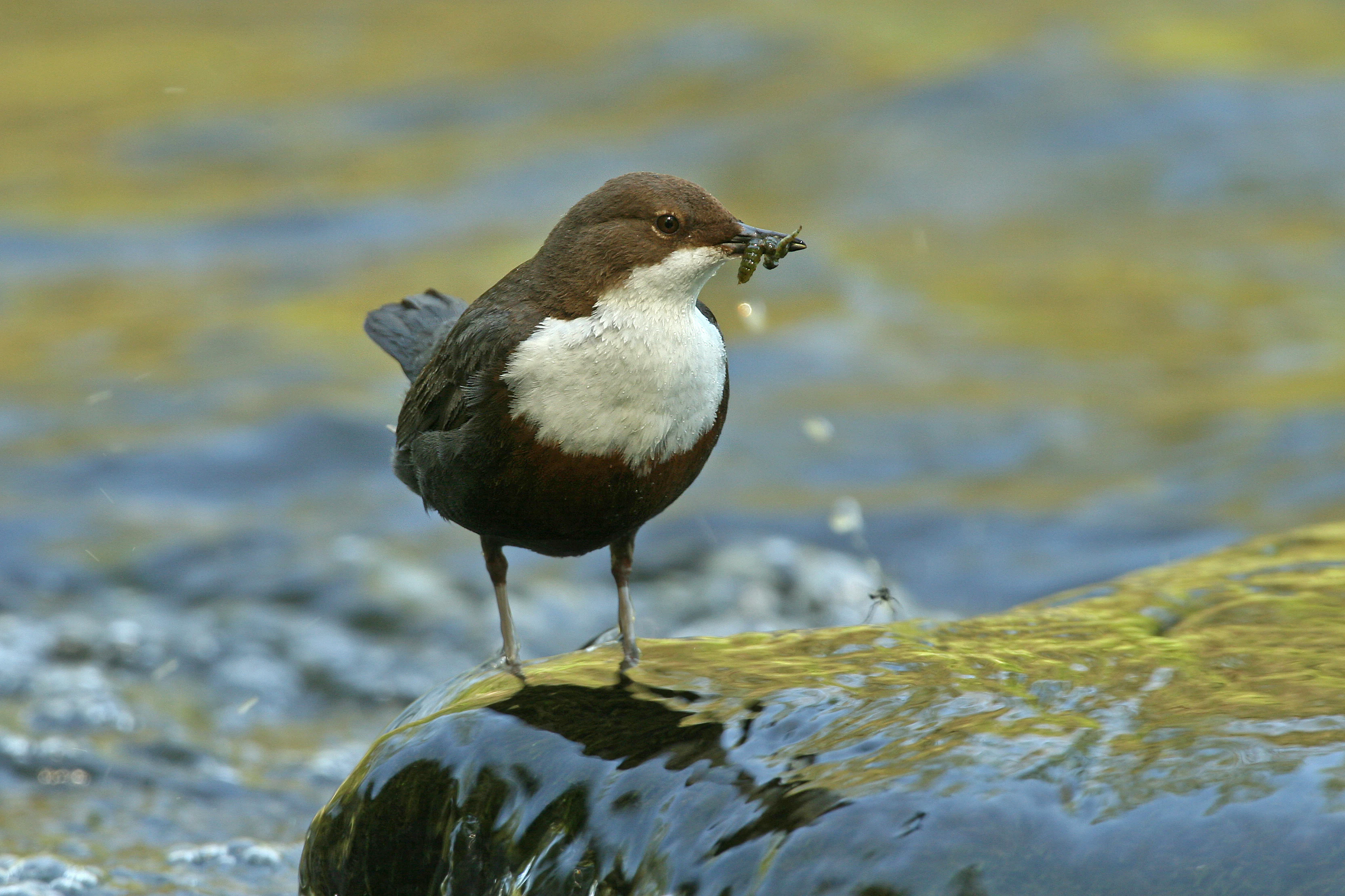
A white-throated dipper bird with dark brown plumage and a distinct white chest standing on a wet, mossy rock in a stream, carrying a small insect in its beak.
A white-throated dipper, characteristic of clean, flowing streams, perched on a rock in the nature reserve.

Spreeler Bachtal Nature Reserve history and protected-area timeline

The Spreeler Bachtal was formally designated as a Naturschutzgebiet on 13 August 2019, under a binding landscape plan administered by the lower landscape authority of the Oberbergischer Kreis. As with many small German nature reserves, its designation followed a longer period of recognition of the valley's ecological value: the stream, its wet meadow fringes, and its slope forests had previously been catalogued in North Rhine-Westphalia's official habitat register, the Biotopkataster, prepared by the State Office for Nature, Environment and Consumer Protection.

The conservation logic behind the designation drew on the area's combination of near-natural stream structures, well-developed wet grasslands, and largely traditional land use, including extensive grazing of the steeper slopes and the persistence of older coppice-grown deciduous forest on the valley sides. Its inscription fixed existing uses, including grazing and the long-standing mill pond, within a framework aimed at safeguarding habitat quality rather than initiating a fundamentally new land management regime.

The reserve is one of several protected valleys clustered around Radevormwald and the broader Oberbergische region, sitting alongside the protected Brebachtal and Baumer Berg, the Upper Freebachtal, the Uelfetal with its tributaries, and the Wupper itself as it passes through Radevormwald, contributing to a regionally connected network of stream and forest habitats in the Bergisches Land.

Spreeler Bachtal Nature Reserve landscape and geographic character

The physical setting of Spreeler Bachtal is a moderately wide, slate-derived valley cut by the Spreeler Bach into the upland of the Bergisches Land. Elevations within the reserve range from about 218 meters near the downstream mill pond to roughly 250 meters at higher points, with an average around 234 meters above sea level. The valley floor is broad and relatively flat, while the flanking slopes rise more steeply, especially on the west-facing exposure, creating a clear asymmetry that shapes both light and land use across the site.

The floor of the valley carries a mosaic of open habitats: meadows, moist and spring-influenced grassland, and lower down small patches of wet fallow land. Near Sprinnerwiese, a near-natural angling pond introduces a still-water element into an otherwise running-water landscape. The slopes above are forested, with acidic oak-beech woodland dominating the poorer soils and richer beech-oak communities appearing where conditions improve. In the mid-valley, a section of the lower slope has been replanted with conifers, marking a break in the otherwise broadleaf-dominated canopy.

Downstream, the reserve ends where the Spreeler Bach drops into a substantial mill pond associated with an industrial property on the Wuppertalstraße, just above its confluence with the Wupper at the Beyenburger Stausee. Upstream, the protected section begins near Griesensiepen and continues westward along the stream. The boundary effectively captures both the open valley floor and the forested slopes that enclose it, defining a compact landscape unit where the shape of the valley and the character of the stream strongly influence the habitats present.
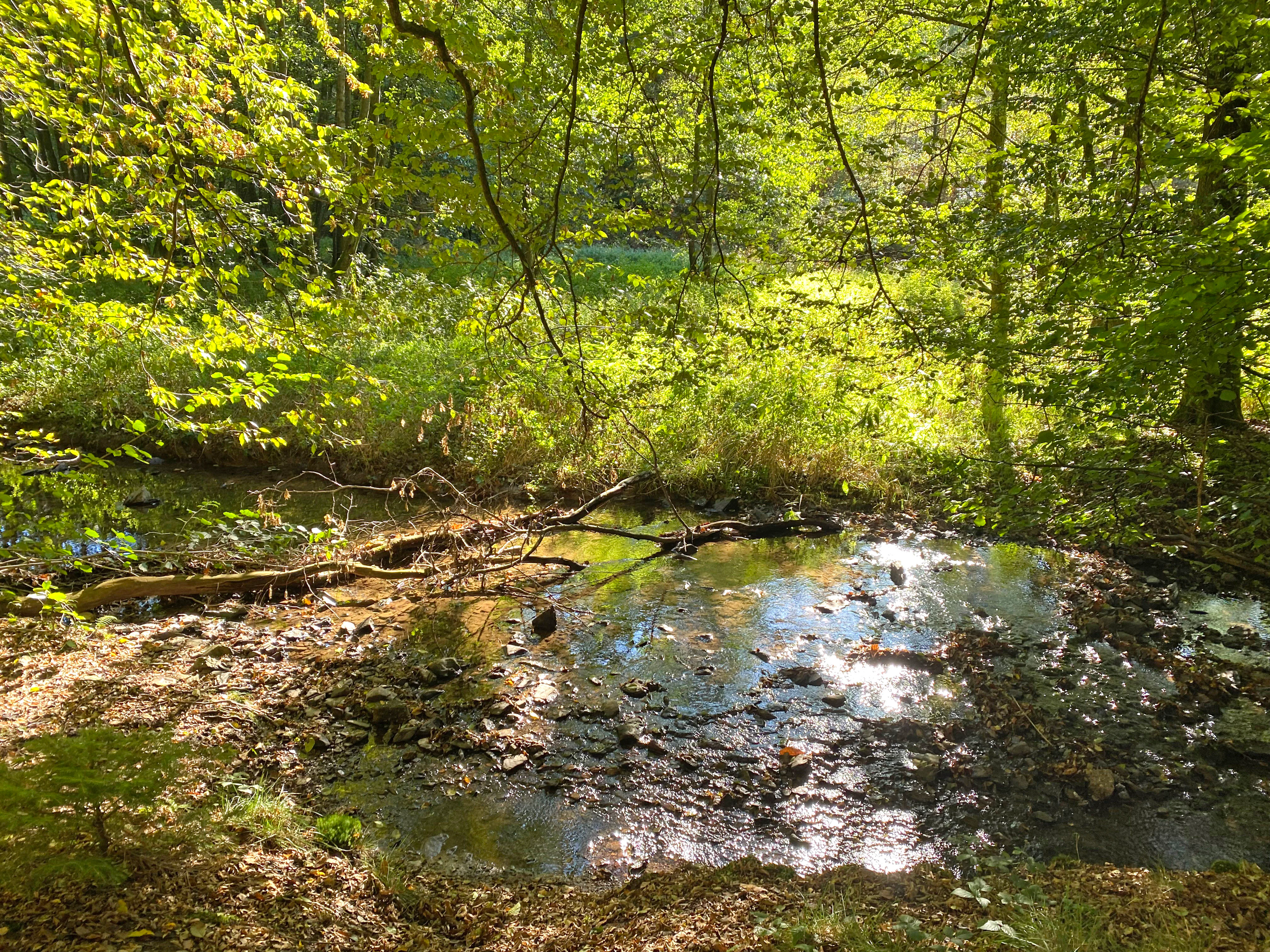
A small, shallow stream meanders through a sun-dappled green forest, with a fallen tree branch partially submerged in the water and green foliage in the background.
A small stream flowing through the lush riparian forest of the Spreeler Bachtal nature reserve.

Spreeler Bachtal Nature Reserve ecosystems, habitats, and plant life

Ecologically, Spreeler Bachtal is a textbook example of a near-natural low-mountain stream valley in the Bergisches Land. The combination of running water, wet meadows, and acidic deciduous forest produces a habitat mosaic that supports a distinctive and locally characteristic set of species.

The valley floor is shaped by water. Sections of the Spreeler Bach meander through a gravel bed up to five meters wide, generally following near-natural patterns. The brook is flanked in open stretches by an old fringe of alders, and around it lie moist and spring-fed grasslands that grade downstream into larger expanses of wet fallow. These wet habitats carry characteristic species such as ragged robin, marsh thistle and common butterbur, alongside marsh skullcap, sneezewort and the distinctive yellow flag iris.

The wooded slopes are equally central to the reserve's natural character. Acidic oak-beech forest covers much of the valley sides, with patches of beech-oak forest and occasional veteran trees. Wavy hair grass and bilberry form a continuous ground layer in the more open stands, reflecting the poor, acidic soils typical of the region. In places, the forest structure descends from a long history of coppice management, which has produced a varied age structure still visible in the present woodland.
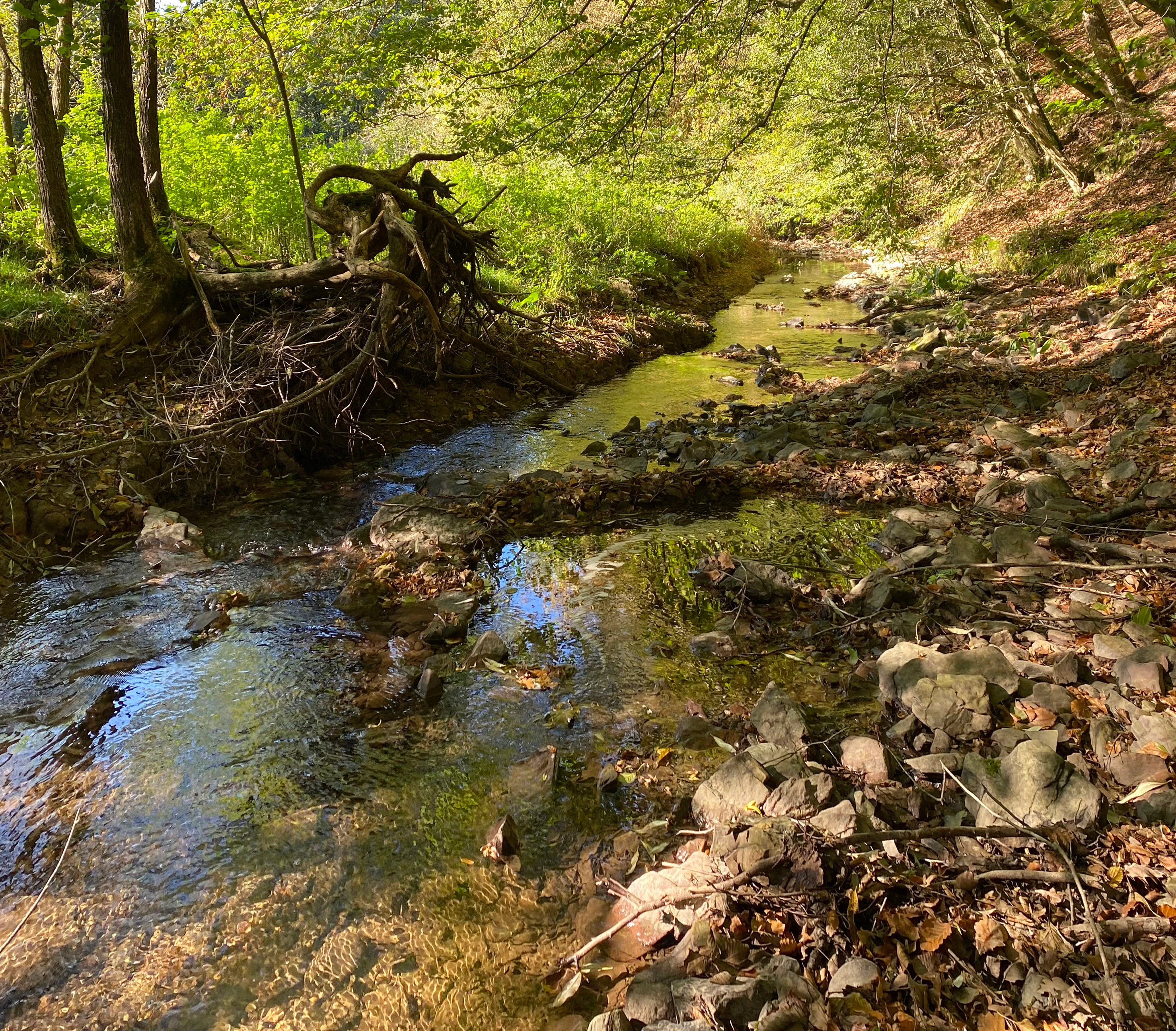
A narrow, shallow stream flows through a forest with exposed tree roots and a rocky bank.
A tranquil, shallow stream flowing through the forested landscape of Spreeler Bachtal.

Spreeler Bachtal Nature Reserve wildlife and species highlights

The wildlife interest of the reserve is closely tied to the brook and the wet valley floor. The white-throated dipper is recorded along the Spreeler Bach, where it depends on the fast-flowing, gravel-bedded sections typical of upland streams. The valley's wet meadows and moist fallow land support common amphibians, including the common frog and the common toad, both of which are documented within the protected area.

Among invertebrates, the variegated grasshopper is noted from the site. Its presence is ecologically significant: although a widespread species, it sits on the pre-warning list of North Rhine-Westphalia's Red List, indicating that even relatively common species merit attention in the regional context. The mix of grazed meadow, wet fallow, and woodland edge creates a varied structure that benefits insect communities more broadly.

Birdlife beyond the dipper, and the broader fauna tied to the oak-beech forest and conifer plantations on the slopes, is not individually documented in detail, but the persistence of old and varied deciduous woodland on the slopes provides important habitat for woodland birds, bats, and other forest-dependent species typical of the Bergisches Land region.
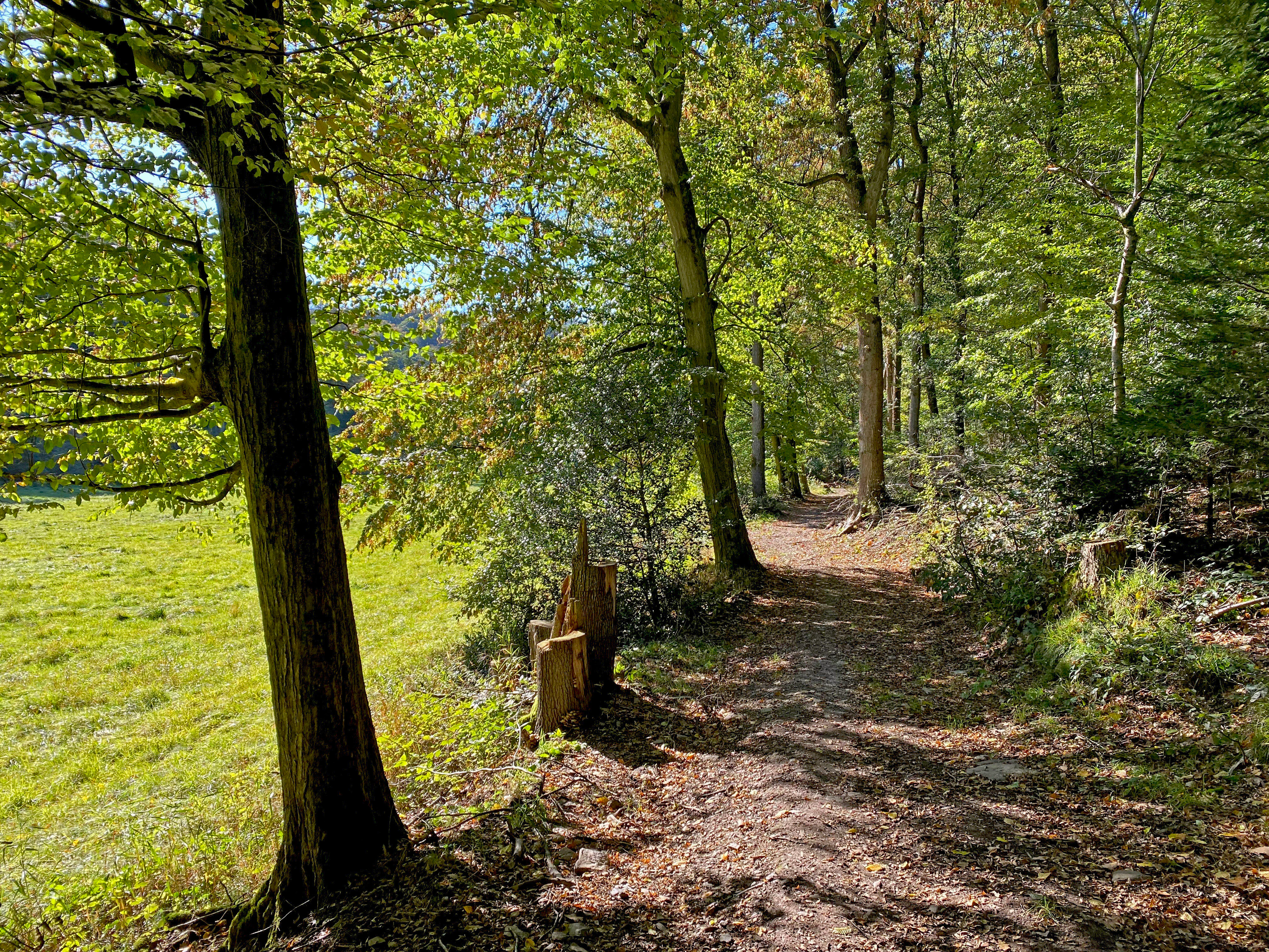
A dirt hiking trail leads through a deciduous forest with a bright green grassy meadow visible on the left side.
A woodland trail following the edge of a meadow in Spreeler Bachtal.

Spreeler Bachtal Nature Reserve conservation status and protection priorities

The conservation significance of Spreeler Bachtal lies in its compact but high-quality representation of a near-natural Bergisches Land stream valley, encompassing both aquatic and terrestrial habitats. Its IUCN Category IV designation frames it explicitly as a habitat and species management area, focused on maintaining and improving the ecological condition of the brook, its associated wet grasslands, and the surrounding oak-beech forests.

Protection draws on the valley's intact stream morphology, meandering gravel beds, and the persistence of traditional land uses such as low-intensity grazing on the steeper slopes. These factors combine to maintain a habitat mosaic that would be difficult to recreate if lost, including spring-influenced meadows and alder-lined brook corridors. The reserve also functions as a node within a wider network of protected valleys and stream corridors in the Oberbergischer Kreis, linking ecological values downstream toward the Wupper and the Beyenburger Stausee.

Long-term conservation depends on continuing the careful balance between traditional grazing, limited forestry interventions, and the protection of the brook's near-natural dynamics. The designation under a binding landscape plan provides a stable legal framework, while the existing habitat register records its importance as a regionally valued landscape unit.

Spreeler Bachtal Nature Reserve cultural meaning and human context

The protected landscape of the Spreeler Bachtal reflects the long-standing rural and industrial character of the Bergisches Land. The valley's wet meadows and steep, lightly grazed slopes are vestiges of centuries of small-scale agricultural use, while the older deciduous woodland carries the imprint of historical coppice management, a traditional forest practice that shaped much of the region's oak-beech forests. The presence of a long-established mill pond and an associated industrial operation downstream underscores the valley's role in the broader economic history of the Wupper watershed, where small-scale waterpower once supported a wide range of local industries. A section of the Wappenweg, a circular hiking trail around Ennepetal, now threads through the reserve, linking the site's natural heritage to the regional tradition of walking in the Bergisches Land.
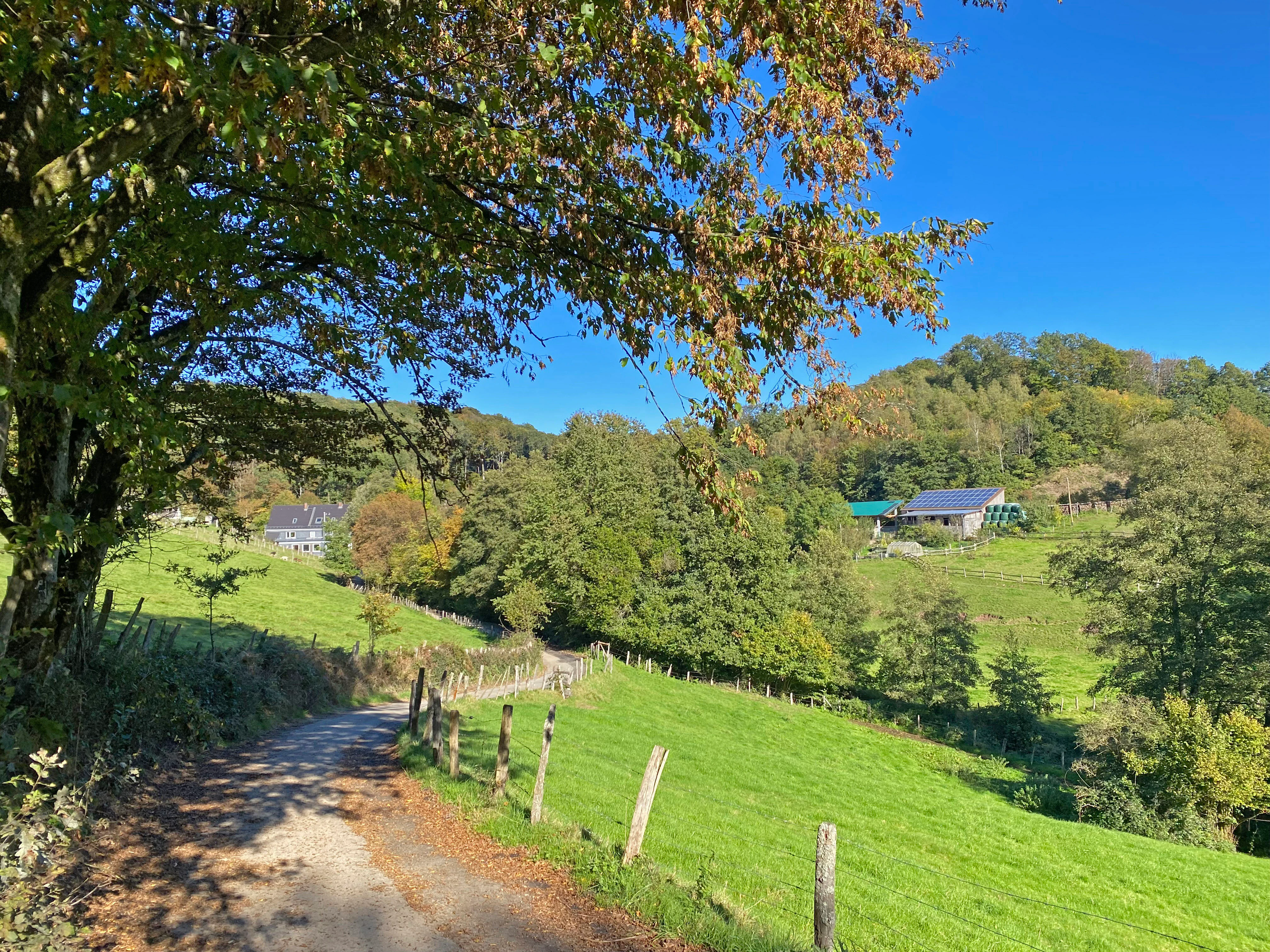
A dirt trail curves into a grassy hillside under a clear blue sky, with a deciduous tree in the foreground and farm buildings nestled among trees in the distance.
A rural trail winds through the hilly landscape of the Spreeler Bachtal nature reserve.

Top sights and standout views in Spreeler Bachtal Nature Reserve

A compact protection of a near-natural brook valley in the Bergisches Land, ideal as a case study of small-scale, habitat-focused conservation in the densely protected landscapes of North Rhine-Westphalia. Highlights include the meandering gravel-bedded Spreeler Bach with its old alder fringe, the transition from spring-influenced meadows to wet fallow land along the valley floor, the near-natural angling pond at Sprinnerwiese, and the surrounding slope forests of acidic oak-beech woodland with a bilberry and wavy hair grass understory. The reserve is unusual in straddling two administrative districts, Radevormwald in the Oberbergischer Kreis and Ennepetal in the Ennepe-Ruhr-Kreis, with the stream itself largely marking the boundary between the two.
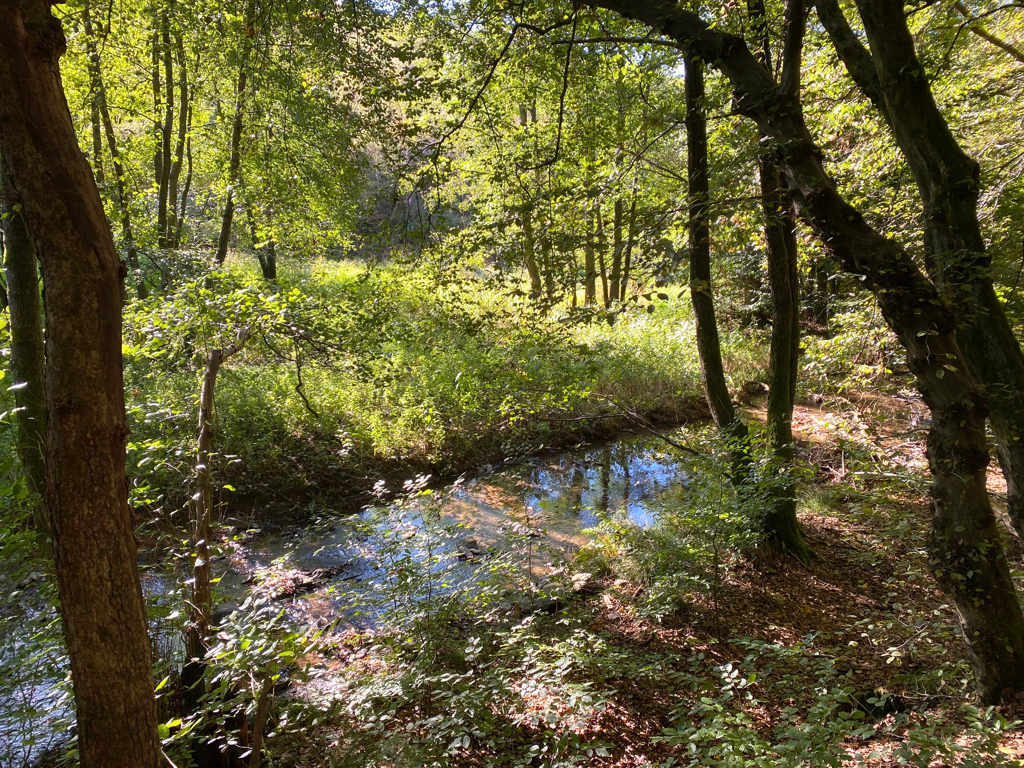
A small stream flows through a lush, green riparian forest in Spreeler Bachtal, with sunlight filtering through dense tree canopies.
A shaded riparian forest path alongside a stream in the Spreeler Bachtal nature reserve.

Best time to visit Spreeler Bachtal Nature Reserve

Spreeler Bachtal is most rewarding in late spring and early summer, when the wet meadows and brook margins come into flower, with ragged robin, marsh thistle and yellow flag iris visible along the stream and moist fallow land. Early morning visits in this season offer the best chance of encountering dippers along the brook and amphibians in the wetter parts of the valley floor. Autumn brings color to the oak and beech stands on the slopes and a quieter atmosphere on the Wappenweg hiking route, while winter highlights the structural contrast between the bare deciduous canopy and the evergreen sections of conifer planting. Visitors should be prepared for muddy ground along the valley trails after rain, and should respect grazing livestock on the steeper slopes.

Monthly climate preview

Long-term temperature ranges and precipitation rhythm across twelve recorded months

Spreeler Bachtal Climate Normals and Measured Annual Weather Patterns

Historical climate data from 1991 to 2000 reveals the measured average temperature and monthly precipitation cycle recorded at a representative coordinate within Spreeler Bachtal. Detailed monthly breakdowns provide deeper insight into long-term thermal variations and precipitation distribution across the protected landscape.
Annual mean9 °C
0 °C18 °C
Jan
Feb
Mar
Apr
May13°
Jun16°
Jul18°
Aug18°
Sep14°
Oct
Nov
Dec
Warmest month
July

18.3 °C

Coolest month
January

0.3 °C

Wettest month
December

3 mm/day

Driest month
April

1.8 mm/day

Park location guide

Geography guide, regional context, and park location map for Spreeler Bachtal Nature Reserve

Spreeler Bachtal Nature Reserve park geography, regions, and map view in Germany

Understand where Spreeler Bachtal Nature Reserve sits in Germany through a broader geographic reading of the surrounding landscape, nearby location context, and its mapped position within the national park landscape.

How Spreeler Bachtal Nature Reserve fits into Germany

Germany is a federal republic in Western and Central Europe with a population of over 83 million across sixteen constituent states. It is Europe's largest economy by nominal GDP and a major global exporter and importer. The capital is Berlin, and the country borders Denmark, Poland, Czech Republic, Austria, Switzerland, France, Luxembourg, Belgium, and the Netherlands.

Wider geography shaping Spreeler Bachtal Nature Reserve in Germany

Germany is located in Western and Central Europe, spanning 357,022 km². It borders Denmark to the north, Poland and the Czech Republic to the east, Austria and Switzerland to the south, and France, Luxembourg, Belgium, and the Netherlands to the west. The country has coastlines on the Baltic Sea and North Sea to the north, with the Alps located in the southern region.

Map view of Spreeler Bachtal Nature Reserve

Use this park location map to pinpoint Spreeler Bachtal Nature Reserve in Germany, understand its exact geographic position, and read its mapped placement within the surrounding landscape more clearly.

Pigeon | © OpenStreetMap contributors

Location context for Spreeler Bachtal Nature Reserve

Nordrhein-Westfalen

Visual reference of protected brook valleys, oak-beech forests, and stream habitats

Spreeler Bachtal Photos and Landscape Scenery Visual Exploration Guide

Photographic records capture the meandering stream corridors, wet grasslands, and steep forested slopes defining Spreeler Bachtal. Visual documentation reveals the distinct terrain and habitat mosaics characterizing this protected landscape.

A white-throated dipper bird with dark brown plumage and a distinct white chest standing on a wet, mossy rock in a stream, carrying a small insect in its beak.

A small natural pond framed by dense green trees and shrubs, with tall reeds growing along the water edge, viewed from a shaded grassy bank.

A small, shallow stream meanders through a sun-dappled green forest, with a fallen tree branch partially submerged in the water and green foliage in the background.

A narrow, shallow stream flows through a forest with exposed tree roots and a rocky bank.

A dirt hiking trail leads through a deciduous forest with a bright green grassy meadow visible on the left side.

A small, shallow stream meanders through a valley floor lined with dense deciduous trees and bright green grassy clearings.

A dirt trail curves into a grassy hillside under a clear blue sky, with a deciduous tree in the foreground and farm buildings nestled among trees in the distance.

A small stream flows through a lush, green riparian forest in Spreeler Bachtal, with sunlight filtering through dense tree canopies.

A close-up view of a yellow iris flower with distinct dark markings in the center, surrounded by tall green grasses.

A brown common frog partially submerged in shallow, dark, plant-filled water.

Park atlas

Discover related reserves, stream valleys, and connected protected landscapes nearby.

Parks Near Spreeler Bachtal: Exploring Protected Areas in the Bergisches Land Region

Browsing parks near Spreeler Bachtal reveals a wider network of protected stream valleys and forested uplands across the surrounding regional landscape. Comparing these neighboring nature reserves provides deeper geographic context into the upland habitats and conservation patterns typical of North Rhine-Westphalia.
Nature reserveOberbergischer Kreis
About 3.9 km away#1 closest

South

Wupper bei Radevormwald: Protected River Valley and Riparian Woodland Geography

Nature reserve landscape in the Oberbergischer Kreis region

Wupper bei Radevormwald serves as a critical protected area within the Wupper river corridor, featuring a mosaic of beech-oak forests and floodplain alder stands. The reserve highlights the contrast between calm, impounded reaches and energetic, meandering water sections, providing an essential study of river valley morphology and natural recovery in the Bergisches Land.

Area
1.208 km²
Established
2003
IUCN
IV
Relief
Upland
Nature reserveNordrhein-Westfalen
About 4.6 km away#2 closest

Southwest

Wilhelmsthaler und Haller Bachtal Nature Reserve: Bergisches Land Landscape and Map

A study of protected stream valleys and habitat mosaics in North Rhine-Westphalia.

Located in Remscheid, the Wilhelmsthaler und Haller Bachtal nature reserve protects a diverse array of interconnected stream-side and grassland habitats. This area demonstrates the ecological value of traditional valley landscapes in the Bergisches Land, providing essential connectivity for rare flora and local stream ecosystems through its unique relief and water corridors.

Area
0.103 km²
Established
2003
IUCN
IV
Relief
Upland
A soft watercolor illustration of a green valley with a central stream or river winding through meadows towards distant hills.
Nature reserveOberbergischer Kreis
About 8.7 km away#3 closest

South

Leiverbachtal und Talhänge: Protected Stream Valley and Forest Habitat in Oberbergischer Kreis

Examining the geography of a Bergisches Land nature reserve

Leiverbachtal und Talhänge stands as a significant nature reserve within the Oberbergischer Kreis, defined by its near-natural meandering stream and diverse riparian ecosystem. The site offers a detailed look at floodplain meadows, slope forest transitions, and the ongoing shift toward broadleaf woodland within the German Mittelgebirg landscape.

Area
0.92 km²
Established
2006
IUCN
IV
Relief
Upland
A wide watercolor illustration showing a winding river flowing through a green valley with pink and purple flowers in the foreground and soft yellow hills in the background.
Nature reserveNordrhein-Westfalen
About 8.9 km away#4 closest

Southwest

Leyerbachtal Nature Reserve: A Protected Valley and Industrial Heritage Site in Remscheid

An alluvial landscape and low-mountain stream corridor in Germany

Leyerbachtal serves as a vital protected corridor featuring a meandering brook, expansive gravel banks, and species-rich wet meadows. Located in the heart of the Bergisches Land, this nature reserve integrates high-value ecological habitats with the historic industrial remnants of Remscheid's water-powered past.

Area
0.151 km²
Established
2003
IUCN
IV
Watercolor painting of a rolling rural landscape with distant purple hills, green meadows, and trees, with a soft yellow sky.
Nature reserveNordrhein-Westfalen
About 11 km away#5 closest

Southwest

Naturschutzgebiet Oelingrather und Grunder Bachtal: Regional Valley Conservation Atlas

Deep-dive into the stream networks of Nordrhein-Westfalen

Naturschutzgebiet Oelingrather und Grunder Bachtal is defined by its two parallel V-shaped valleys and diverse aquatic habitats. This reserve preserves a vital mosaic of wet meadows, nutrient-poor grasslands, and deciduous forests that function as an essential stepping-stone within the regional ecological network of the Bergisches Land.

Area
0.222 km²
Established
2003
IUCN
IV
Relief
Upland
Nature reserveNorth Rhine-Westphalia
About 12 km away#6 closest

South

Wupperaue bei Westenbrücke Nature Reserve Landscape and Geographic Mapping

Protected riparian floodplain in the Oberbergischer Kreis

This nature reserve protects a vital 2.3 kilometer segment of the Wupper river valley. Its landscape is characterized by a mosaic of wet meadows, alder and willow stands, and riparian corridors, providing a crucial stepping-stone habitat within the Hückeswagen area of North Rhine-Westphalia.

Area
0.318 km²
Established
2013
IUCN
IV
A watercolor painting showing a soft landscape with a stream winding through green meadows toward distant hills, framed by trees on the left.
Nature reserveNordrhein-Westfalen
About 13 km away#7 closest

North

Naturschutzgebiet Oberes Sprockhöveler Bachtal: Protected Valley and Stream Geography

A nature reserve in the Ruhr foothills of Nordrhein-Westfalen

Examine the mapped boundaries and natural terrain of Naturschutzgebiet Oberes Sprockhöveler Bachtal, a compact reserve featuring a near-natural lowland brook. This habitat supports wet grassland, alder-willow galleries, and beech forest slopes that together form a protected ecological unit within the regional landscape of Nordrhein-Westfalen.

Area
0.158 km²
Established
1995
IUCN
IV
A watercolor painting showing a soft, stylized landscape of a meadow with low rolling hills in the background.
Nature reserveNordrhein-Westfalen
About 14 km away#8 closest

Southwest

Naturschutzgebiet Orchideenwiese bei Heintjeshammer: Regional Nature Reserve and Landscape Atlas

Examining meadow diversity and protected habitats in North Rhine-Westphalia

Spanning roughly 4.3 hectares on a hillside above the Eschbach valley, this nature reserve protects a rare assemblage of wetland, heathland, and wooded siefen habitats. It remains a key focus for understanding the distribution of species-rich grassland ecosystems that persist in the rolling topography of the Bergische Hochfläche.

Area
0.043 km²
Established
2000
IUCN
IV
Relief
Upland

Common questions about visiting, size, designation, and location context for Spreeler Bachtal Nature Reserve

Spreeler Bachtal Nature Reserve FAQs for park facts, access, geography, and protected area context

Find quick answers about Spreeler Bachtal Nature Reserve, including protected-area facts, park geography, trail and visitor context, and how the park fits into its surrounding country and regional landscape.
MoriAtlas Explorer

Continue Your Protected Areas Search Across the Global Atlas

Deepen your exploration by continuing the structured search for national parks and protected areas worldwide. Utilize the comprehensive filtering capabilities to compare different conservation landscapes and refine your understanding of global park geography. Discover more about the distribution and characteristics of protected natural areas.

Global natural geography