
Mori Atlas logo
Protected landscapeSt. Blasien

A preserved mosaic of classic glacial landforms, trough valleys, and alpine meadows.

St. Blasien Protected Landscape: Glacial Geography and Southern Black Forest Mapping

(Landschaftsschutzgebiet „St. Blasien")

The St. Blasien Protected Landscape spans roughly 3,575 hectares within the southern Black Forest of Baden-Württemberg, Germany. This protected area preserves a unique collection of Pleistocene glacial features, including trough valleys, rocky cirques, roches moutonnées, and moraine deposits. The terrain serves as a vital ecological bridge between the Feldberg region and broader conservation networks, maintaining a distinct cultural landscape where traditional alpine pastures and mixed forests define the rugged topography.

protected landscapeBlack Forestsouthern Black Forestglacial landscapetrough valleyglacial cirques
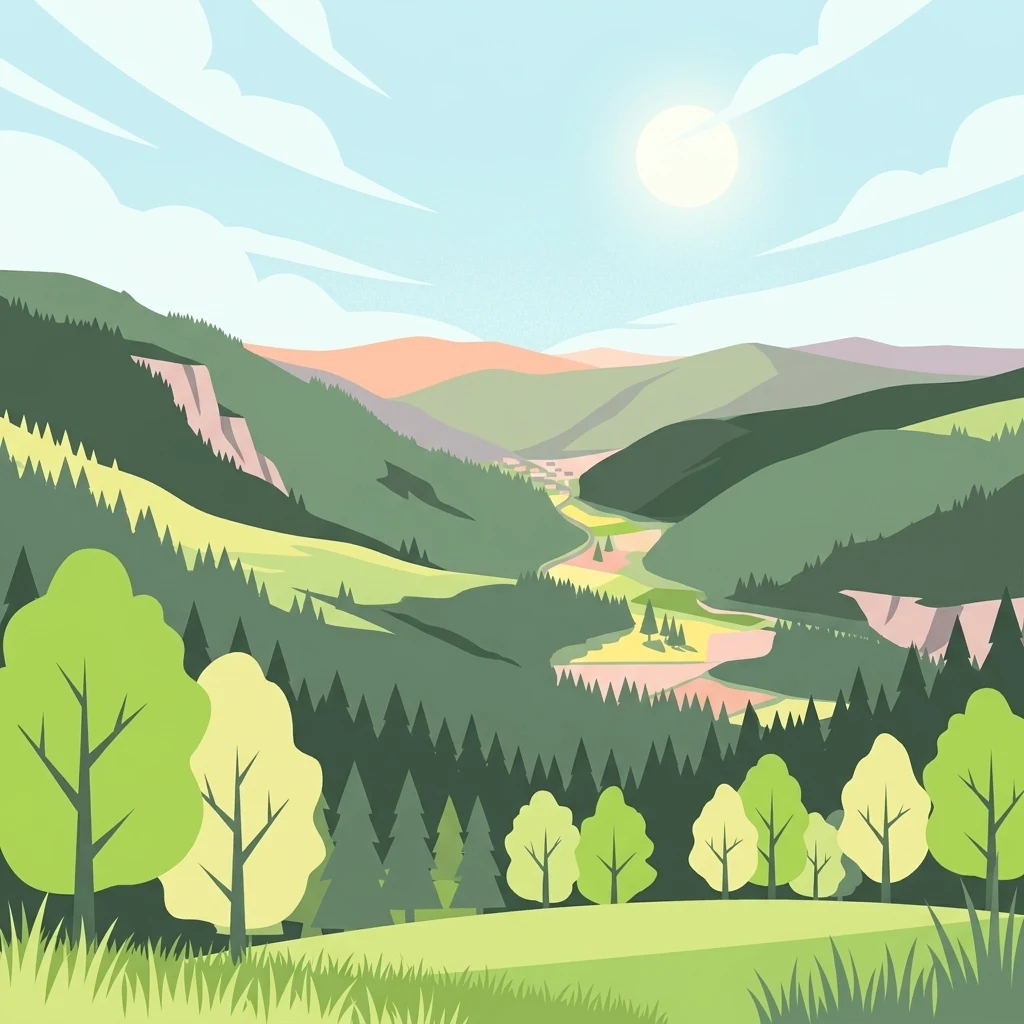
A flat-style digital illustration of a green mountain valley with forested slopes, rolling hills, and a clear sun in a blue sky.

St. Blasien

Protected landscape

Park overview

Structured park overview, official facts, and landscape profile for St. Blasien Protected Landscape

St. Blasien Protected Landscape park facts, protected area profile, and essential visitor context

Review the core facts for St. Blasien Protected Landscape, including designation, size, terrain, visitor scale, habitats, and operating context in one park-focused overview.

About St. Blasien Protected Landscape

St. Blasien Protected Landscape occupies a substantial tract of forested highland between St. Blasien and Menzenschwand in the Landkreis Waldshut district. The area lies on the southern rim of the Black Forest, where Pleistocene glaciers carved distinctive valleys, leaving behind rounded whaleback ridges, terminal moraines, and broad cirques that define much of the present-day scenery. These landforms combine with acidic mountain soils to support the forests, meadows, and rocky habitats typical of the region.

The protection area was formally designated on 23 September 2002 through an ordinance issued by the lower nature protection authority at the Waldshut district office. The designation reflects both the scenic and ecological value of the landscape, as well as its importance for public recreation in a region where tourism, forestry, and traditional Alpine farming have long coexisted. The reserve is registered as IUCN Category V, recognizing it as a protected landscape rather than a strict nature reserve.

Ecologically, the reserve plays an important role in connecting the larger Feldberg protection area to the broader Black Forest conservation network. Portions of the protected landscape fall within the Natura 2000 site Alb zum Hochrhein, one of the key contiguous habitat complexes in the southern Black Forest. The northeastern portion of the Südschwarzwald bird protection area also lies within its boundaries, adding an ornithological dimension to its conservation significance.

From a land-use perspective, the protected landscape encompasses a working cultural landscape, where active Alpine pastures, hay meadows, and managed forests sit alongside wild rocky slopes and stream valleys. This blend of traditional use and natural character is one of the defining features of the protected area and a major reason for its designation under German landscape protection law.

Quick facts and research context for St. Blasien Protected Landscape

The reserve sits within the Landkreis Waldshut in Baden-Württemberg, between St. Blasien and the higher-elevation village of Menzenschwand. It was established through an ordinance of the lower nature protection authority on 23 September 2002, giving it a formal institutional foundation under German protected-area law.

Its IUCN protection category is V, the Protected Landscape or Seascape designation, indicating a focus on maintaining characteristic cultural and natural scenery rather than strict natural reserve conditions. A large share of the terrain is shaped by Pleistocene glaciation, creating valleys, cirques, and moraine ridges typical of the southern Black Forest.

Protection and recognition

Examine official designation history, management scope, and conservation records for St. Blasien.

St. Blasien Protection Status and Documented Protected Area Records

St. Blasien maintains documented protection status and structured conservation records within the global protected area registry. Official designation history, management parameters, and international recognition sources organize the baseline geography of the protected landscape.

Protection details

WDPA ID
324744
Park context

Deeper park guide and search-rich context for St. Blasien Protected Landscape

St. Blasien Protected Landscape history, landscape, wildlife, and travel context

Explore St. Blasien Protected Landscape through its history, landscape character, ecosystems, wildlife, conservation priorities, cultural context, and seasonal travel timing in a structured park guide built for atlas discovery and search intent.

Why St. Blasien Protected Landscape stands out

St. Blasien Protected Landscape is best known for preserving a coherent, glacially shaped southern Black Forest landscape that combines dramatic glacial landforms with traditional cultural land use such as Alpine pastures and hay meadows. The reserve is also notable for protecting connected habitat types within the larger Alb zum Hochrhein Natura 2000 site, including flowing streams, wet tall-herb communities, rocky slopes, mixed ravine forests, and riparian alder woodlands. Its proximity to the Feldberg area strengthens its role as part of a continuous high-elevation Black Forest conservation network.
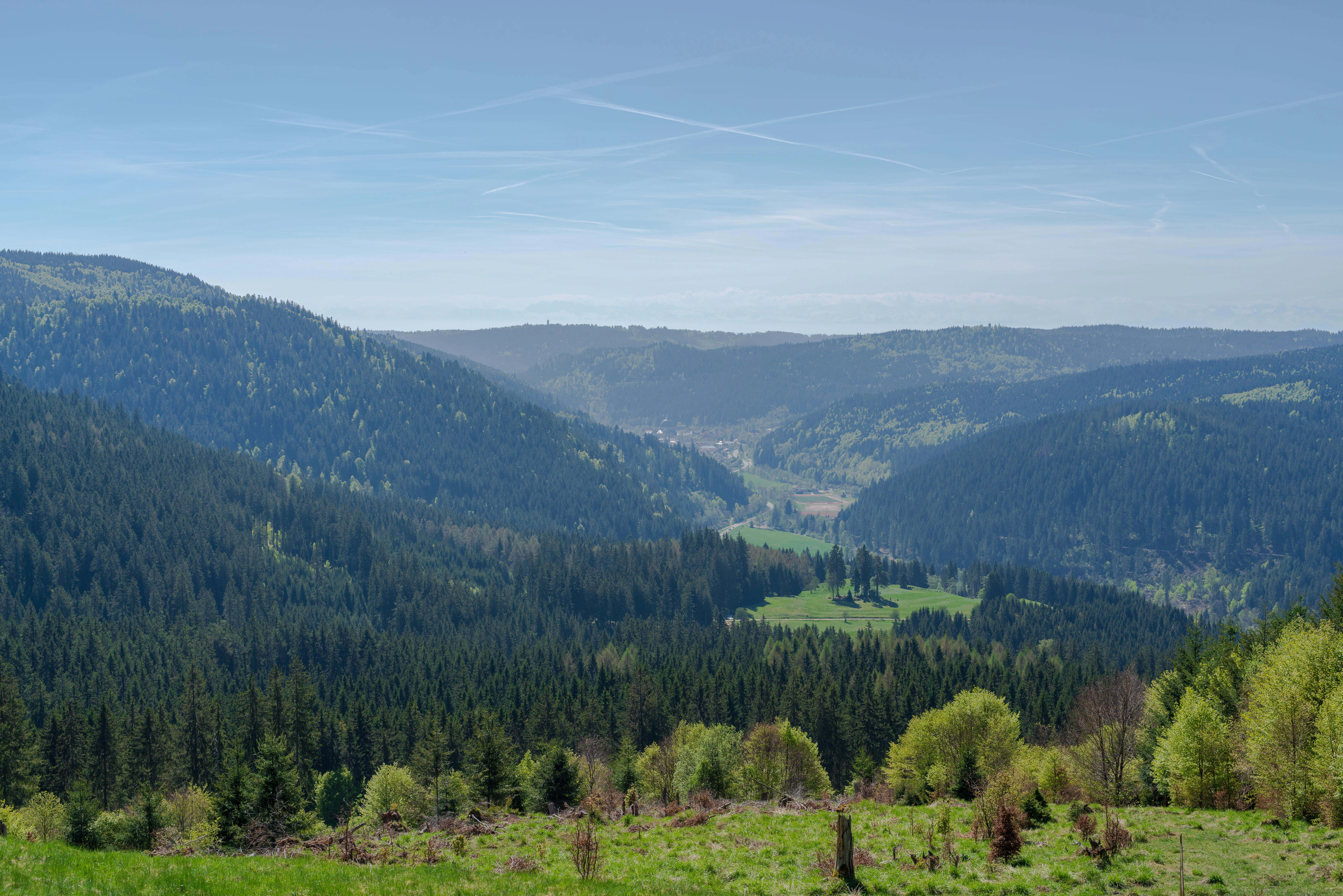
A wide, elevated view of a valley surrounded by dense coniferous forests and green hills under a bright sky.
A scenic view over the glaciated valley and wooded hills near St. Blasien.

St. Blasien Protected Landscape history and protected-area timeline

The St. Blasien Protected Landscape has a comparatively short formal history, having been officially designated only on 23 September 2002. The underlying ordinance was issued by the lower nature protection authority within the Waldshut district office, integrating the area into the regional framework of German protected landscape conservation.

Its establishment reflects the broader late-twentieth- and early twenty-first-century efforts across Baden-Württemberg to formally recognize the value of glacially shaped Black Forest landscapes outside strict nature reserves. By being designated as a Protected Landscape, rather than a stricter nature reserve, it acknowledges the long-standing interaction of local communities with the area through Alpine farming, forestry, and recreation.

The later inclusion of parts of the area within the Natura 2000 site Alb zum Hochrhein and the Südschwarzwald bird protection area has added an international conservation dimension to the original district-level designation, positioning the reserve within the wider European ecological network.

St. Blasien Protected Landscape landscape and geographic character

The landscape of the St. Blasien Protected Landscape is dominated by clear evidence of repeated Pleistocene glaciation, which sculpted much of the visible terrain. Visitors encounter classic glacial features, including steep-sided trough valleys, basin-like cirques on higher slopes, broad fields of roches moutonnées, and rocky ridges formed by resistant bedrock. Ground moraine and terminal moraine deposits further shape the surface, producing hummocky ground and isolated knolls scattered across the terrain.

Numerous forest-covered hilltops rise above the valleys, often with exposed rocky crests and blockfields. Between these wooded heights lie flatter areas where traditional Alpine pastures and hay meadows have been maintained for centuries. The mix of open grasslands and forested slopes gives the area a characteristic southern Black Forest appearance, with strong contrasts between dark conifer stands, lighter broadleaf patches, and open green pastures.

Rivers and streams cut through the valleys, shaping narrow ravine-like sections, particularly along the Alb valley downstream of St. Blasien. Wet flushes, peat-influenced seeps, and small alluvial flats add further variety to a landscape that alternates between rugged glacial relief and gently cultivated basin floors.

St. Blasien Protected Landscape ecosystems, habitats, and plant life

Ecologically, the St. Blasien Protected Landscape encompasses a wide range of habitat types linked to both glacial relief and traditional land use. Mixed mountain forests, dominated by spruce but enriched with beech, fir, and other broadleaf species, cover a large portion of the area. Steeper slopes and ravines host more structurally complex forests, including ravine and slope mixed woodlands that provide important habitat continuity between the higher Black Forest elevations and the warmer Alb valley below.

Along the streams and small watercourses that traverse the protected area, gallery forests of alder, ash, and willow thrive, with grey alder stands being particularly characteristic. These riparian corridors contrast with the surrounding fir and spruce forests, creating distinct vegetation zones along the valley floors. Wet tall-herb communities and flushes along the watercourses add further botanical diversity and provide habitat for moisture-dependent species.

Rock outcrops and blockfield slopes contribute open, rocky habitats that stand in sharp contrast to the closed forest canopy. These areas support specialized vegetation adapted to thin soils and exposed conditions, and they connect the landscape visually and ecologically to the larger Feldberg conservation area to the south. The combination of closed forests, open pastures, rocky habitats, and riparian environments gives the protected landscape a richly layered ecological character.

St. Blasien Protected Landscape wildlife and species highlights

The varied habitat mosaic of the St. Blasien Protected Landscape supports a broad community of forest, edge, and open-country wildlife. Mixed mountain forests provide habitat for typical Black Forest mammals such as red deer, roe deer, and wild boar, along with smaller carnivores and a wide range of forest birds. The altitudinal gradient and the alternation of dense forest and open pasture increase habitat diversity across relatively short distances.

Streams, wet flushes, and alder-dominated riparian forests host characteristic aquatic and semi-aquatic species, including various fish, amphibians, and invertebrates typical of clear Black Forest waters. Wet tall-herb communities along the streams offer additional shelter and food resources for both invertebrates and birds.

Ravens, owls, and other cliff- and rock-associated species benefit from the forested rocky ridges and blockfield slopes scattered through the reserve. Inclusion of the northeastern edge of the Südschwarzwald bird protection area reinforces the importance of the landscape for breeding and foraging birds in the southern Black Forest.

St. Blasien Protected Landscape conservation status and protection priorities

From a conservation perspective, St. Blasien Protected Landscape plays a strategic role as a buffer and connector in the wider southern Black Forest conservation network. Bordering the Feldberg nature and landscape protection area to the south, it helps maintain ecological continuity across one of the highest and most ecologically valuable portions of the Black Forest.

A significant portion of the protected area falls within the Natura 2000 site Alb zum Hochrhein, ensuring that key habitat types, including flowing streams with submerged vegetation, wet tall-herb communities, rocky slopes and blockfields, ravine and slope mixed forests, and alder riparian forests, are protected under European ecological law. This overlap connects district-level landscape protection to the broader European conservation framework.

The reserve's designation as an IUCN Category V Protected Landscape reflects its combined ecological, scenic, and recreational values. By regulating land use while allowing traditional Alpine farming, forestry, and outdoor recreation, the protection status is designed to maintain both the natural and cultural character of the landscape over the long term.

St. Blasien Protected Landscape cultural meaning and human context

The protected landscape incorporates a long-standing cultural landscape shaped by centuries of forestry, Alpine pasture use, and mountain hay-meadow agriculture. Pastoral traditions continue to influence the visible character of the area, with Weidfelder (Alpine grazing fields) and Mähwiesen (hay meadows) interspersed among the forests. These land-use patterns are part of what gives the protected landscape its distinct identity as a working southern Black Forest cultural-ecological system.

Top sights and standout views in St. Blasien Protected Landscape

St. Blasien Protected Landscape spans roughly 3,575 hectares of glacially sculpted southern Black Forest terrain between St. Blasien and Menzenschwand.

The reserve preserves a connected block of classic Pleistocene glacial landforms, including trough valleys, cirques, roches moutonnées, and moraine ridges, alongside forested rocky ridges and traditionally managed Alpine pastures.

It functions as a critical connector between the Feldberg protection area and the broader Black Forest conservation network, while also overlapping with the Natura 2000 site Alb zum Hochrhein and the Südschwarzwald bird protection area.

Its IUCN Category V status balances ecological protection with the continuation of traditional land uses such as summer grazing, hay-making, and sustainable forestry.

Best time to visit St. Blasien Protected Landscape

The landscape offers different atmospheric qualities through the seasons, though without dramatic seasonal extremes. Late spring and early summer tend to highlight the green Alpine pastures and wildflower-rich hay meadows, while also providing the most comfortable conditions for longer walks between St. Blasien and Menzenschwand.

Autumn brings strong color contrasts as mixed mountain forests turn, and cooler, clearer air improves visibility across the glacial valleys and ridgelines. Winters add a quieter, more austere character, with snow highlighting the slopes, blockfields, and rocky crests typical of the reserve, though visitors should be prepared for typical Black Forest winter conditions on higher elevations.

Monthly climate preview

Long term temperature and precipitation records measured at reference coordinates in Baden-Württemberg

St. Blasien Climate Normals and Representative Monthly Temperature Rhythms

Representative coordinate data reveals measured long term temperature swings and steady monthly precipitation values across the protected landscape. Examining the complete twelve month profile provides deeper insight into annual weather patterns recorded for St. Blasien.
Annual mean8 °C
-2 °C17 °C
Jan-2°
Feb-1°
Mar
Apr
May12°
Jun15°
Jul17°
Aug17°
Sep12°
Oct
Nov
Dec-1°
Warmest month
July

16.8 °C

Coolest month
January

-1.5 °C

Wettest month
May

4 mm/day

Driest month
April

2.6 mm/day

Park location guide

Geography guide, regional context, and park location map for St. Blasien Protected Landscape

St. Blasien Protected Landscape park geography, regions, and map view in Germany

Understand where St. Blasien Protected Landscape sits in Germany through a broader geographic reading of the surrounding landscape, nearby location context, and its mapped position within the national park landscape.

How St. Blasien Protected Landscape fits into Germany

Germany is a federal republic in Western and Central Europe with a population of over 83 million across sixteen constituent states. It is Europe's largest economy by nominal GDP and a major global exporter and importer. The capital is Berlin, and the country borders Denmark, Poland, Czech Republic, Austria, Switzerland, France, Luxembourg, Belgium, and the Netherlands.

Wider geography shaping St. Blasien Protected Landscape in Germany

Germany is located in Western and Central Europe, spanning 357,022 km². It borders Denmark to the north, Poland and the Czech Republic to the east, Austria and Switzerland to the south, and France, Luxembourg, Belgium, and the Netherlands to the west. The country has coastlines on the Baltic Sea and North Sea to the north, with the Alps located in the southern region.

Map view of St. Blasien Protected Landscape

Use this park location map to pinpoint St. Blasien Protected Landscape in Germany, understand its exact geographic position, and read its mapped placement within the surrounding landscape more clearly.

Pigeon | © OpenStreetMap contributors

Location context for St. Blasien Protected Landscape

Baden-Württemberg

Explore glacial terrain, mixed forests, and traditional alpine pastures through detailed park imagery.

St. Blasien Landscape Photos and Scenery: Visualizing the Southern Black Forest Protected Area

Visual documentation reveals the distinctive glacial landforms, trough valleys, and forested ridges that define the protected terrain of St. Blasien. Examining these field photographs helps researchers and visitors understand the complex topography and habitat mosaic of the southern Black Forest.

A wide, elevated view of a valley surrounded by dense coniferous forests and green hills under a bright sky.

Park atlas

Compare adjacent glacial landscapes, high-elevation reserves, and connected regional habitats.

Explore Parks Near St. Blasien and Protected Areas Across the Southern Black Forest

Browse nearby national parks and protected areas surrounding St. Blasien to examine shared glacial terrain and forest reserves. Comparing adjacent conservation zones reveals broader regional ecological patterns across the southern Black Forest.
A soft watercolor illustration of rolling hills, forested slopes, and meadow vegetation with a light, airy aesthetic.
Nature reserveBaden-Württemberg
About 14 km away#1 closest

West

Belchen Nature Reserve: Exploring the Mountain Geography of the High Black Forest

A diverse protected landscape in Baden-Württemberg

Belchen represents an essential protected area in the southern Black Forest, known for its compressed ecological profile ranging from lowland beech forests to exposed subalpine summits. The site maps a complex mosaic of scree slopes, mires, and rocky habitats that sustain specialized bat species and rare montane flora, offering a detailed perspective on central European highland ecosystems.

Area
29.072 km²
Established
2019
Relief
Mountain
Climate
Temperate
Nature reserveBaden-Württemberg
About 16 km away#2 closest

East

Blumberger Pforte und Mittlere Wutach: Protected Landscape and Gorge Geography

Nature reserve terrain and ecological atlas in Baden-Württemberg

This protected area captures the dramatic transition where the Wutach river cuts through limestone strata. Discover a rugged landscape mosaic featuring canyon forests, juniper heaths, and karst cave systems across the Swabian Alb and Black Forest fringe. The site offers significant value for understanding regional ecological gradients and limestone-dependent plant communities within the broader southern German geography.

Area
63.25 km²
Established
2019
Protected landscapeBaden-Württemberg
About 19 km away#3 closest

North

Titisee-Neustadt Protected Landscape: Mapping the Black Forest Terrain and Boundaries

Regional geography and protected area coverage in Baden-Württemberg

Gain insight into the Titisee-Neustadt protected landscape, a representative high Black Forest area defined by its mix of forested ridges and river-fed valley basins. This detailed geographic overview highlights the physical features, water systems, and structural conservation status that define this landmark site within the southern German state of Baden-Württemberg.

Area
83.17 km²
Established
2003
IUCN
V
Relief
Highland
Protected landscapeBaden-Württemberg
About 21 km away#4 closest

North

Wagensteigtal-Höllental Protected Landscape: Geography and Terrain of the Black Forest

A bridge between regional natural zones in Baden-Württemberg

Wagensteigtal-Höllental serves as a quintessential example of protected Black Forest geography. Stretching across the Breisgau-Hochschwarzwald district, this area features the steep Rotbach gorge, dense forest ridges, and the prominent Hirschsprung rock formation. It provides a foundational look at how historical transport corridors and natural river breakthrough channels shape the modern landscape identity of southwestern Germany.

Area
29.118 km²
Established
1975
IUCN
V
Relief
Mountain
Nature reserveAargau
About 21 km away#5 closest

South

Klingnauer Stausee Nature Reserve: Aargau Wetland and Aare River Floodplain Landscapes

Protected riparian habitat in the northern Swiss Jura

Klingnauer Stausee stands as a primary example of integrated hydropower and conservation. This artificial reservoir and its surrounding wetlands, located in the Aargau region, encompass a variety of protected habitats ranging from open still waters to alluvial forests. These landscapes provide essential refuge for migratory waterbirds and preserve unique remnants of the historical Aare River floodplain structure.

Area
1.16 km²
Established
1935
Relief
Lowland
Climate
Temperate
Watercolor painting of a river landscape with lush green riverbanks, patches of grass in the foreground, and gentle rolling hills in the background.
Protected landscapeAargau
About 24 km away#6 closest

South

Aarelandschaft bei Klingnau: A Protected Riverine Landscape in Northern Switzerland

Wetland geography, alluvial forests, and floodplain corridors

The Aarelandschaft bei Klingnau preserves a unique riverine mosaic where the Aare River meets the Rhine in northern Aargau. This protected landscape encompasses the Klingnauer Stausee reservoir, rich alluvial forests, and remnant oxbows. It serves as a vital migratory node for avian populations and provides a structured look at the interplay between human-engineered power infrastructure and protected natural river channels.

Area
3.6 km²
Established
1996
IUCN
V
Relief
Lowland
Protected landscapeBaden-Württemberg
About 25 km away#7 closest

Southwest

Südwestlicher Dinkelberg Protected Landscape and Dinkelberg Plateau Geography

Karst terrain and forest habitats in Baden-Württemberg

Located in the Lörrach district, Südwestlicher Dinkelberg protects a diverse mix of ravine forests, dry grasslands, and mires. The area preserves essential ecological corridors within the Lörrach-Basel region, showcasing complex geological features such as stream sinks and dry valleys that define the plateau edge.

Area
13.89 km²
Established
2013
IUCN
V
Relief
Upland
A watercolor painting showing a panoramic view of rolling golden hills, a line of green trees, and soft purple mountain silhouettes in the distance.
Protected landscapeBaden-Württemberg
About 25 km away#8 closest

North

St. Peter, St. Märgen Protected Landscape: Geography and Regional Context in the Black Forest

Detailed atlas view of the High Black Forest plateau and valleys.

This protected landscape in Baden-Württemberg represents a classic cultural geography of the High Black Forest. It encompasses a vast area surrounding the villages of St. Peter and St. Märgen, where the terrain shifts between steep-sided valleys and elevated plateaus. The protected status secures a varied mosaic of meadows, old-growth hedgerows, and forest tracts that maintain the regional ecological integrity of this significant southwestern German landscape.

Area
67.199 km²
Established
2003
IUCN
V

Common questions about visiting, size, designation, and location context for St. Blasien Protected Landscape

St. Blasien Protected Landscape FAQs for park facts, access, geography, and protected area context

Find quick answers about St. Blasien Protected Landscape, including protected-area facts, park geography, trail and visitor context, and how the park fits into its surrounding country and regional landscape.
MoriAtlas Explorer

Continue Your Protected Areas Search Across the Global Atlas

Deepen your exploration by continuing the structured search for national parks and protected areas worldwide. Utilize the comprehensive filtering capabilities to compare different conservation landscapes and refine your understanding of global park geography. Discover more about the distribution and characteristics of protected natural areas.

Global natural geography