
Mori Atlas logo
Protected areaStarodub w Pełkiniach

A detailed geographic focus on meadow-based protected habitats in the Lower San River valley

Starodub w Pełkiniach Protected Area: Mapping the Meadow Landscapes of Subcarpathian Poland

Starodub w Pełkiniach represents a significant protected meadow complex in south-eastern Poland, serving as a critical habitat for rare wetland-dependent plant species. Situated within the Subcarpathian Voivodeship at the transition between the Podgórze Rzeszowskie foothills and the Lower San River valley, this site provides a cohesive ecological landscape. The area spans approximately 574 hectares of traditionally managed grassland, characterized by a mix of fresh meadows and specialized Molinia caerulea meadow habitats.

Natura 2000Site of Community Importancemeadow habitatfresh meadowsMolinia caerulea meadowsAngelica palustris
A flat-style digital illustration depicting a mountainous landscape with a waterfall feeding into a winding river surrounded by forests and open fields under a bright sun.

Starodub w Pełkiniach

Protected area

Park overview

Structured park overview, official facts, and landscape profile for Starodub w Pełkiniach

Starodub w Pełkiniach park facts, protected area profile, and essential visitor context

Review the core facts for Starodub w Pełkiniach, including designation, size, terrain, visitor scale, habitats, and operating context in one park-focused overview.

About Starodub w Pełkiniach

Starodub w Pełkiniach is a meadow-based Natura 2000 site in the Podkarpackie Voivodeship, in the south-eastern part of Poland near the San River lowlands. Designated in 2011 under the Natura 2000 framework and recorded in official databases under the code PLH180050, it functions as an Obszar mający znaczenie dla Wspólnoty, a Site of Community Importance, and forms part of the planning track toward becoming a Special Area of Conservation for habitat types listed in Annex I of the Habitats Directive.

The protected area is a relatively compact block of about 574.82 hectares of continuous, traditionally managed meadows. It extends across three communes in the lowlands east of Rzeszów and north of the Przeworsk and Jarosław area, taking in land between the small rural settlements of Chałupki, Jagiełła, Wólka Pełkińska, Pełkinie, Ujezna, and Rozbórz. Its territory is wedged into the contact zone between the Podgórze Rzeszowskie physical-geographical mesoregion and the Dolina Dolnego Sanu, the Lower San River valley, so the soils, hydrology, and vegetation reflect a mix of sub-Carpathian foothill conditions and floodplain dynamics.

Ecologically, the site is unusually focused. Its principal conservation target is Angelica palustris, the starodub łąkowy, a marsh-dependent plant listed in Annex II of the EU Habitats Directive. The site is reported to hold a major share of the Polish population of that species, which is one of the key justifications for its inclusion in the Natura 2000 network. The Annex I habitat types associated with it are fresh meadows, that is, łąki świeże, and the more specialised Molinia caerulea meadows of the łąki trzęślicowe type.

Because the designation is ecological rather than landscape-oriented, the site's significance is best understood through its habitat integrity, its long continuity of grassland management, and the conservation status of its plant community rather than through dramatic scenery. The statutory bibliographical source for the area is the contribution by R. Krawczyk in the 2012 volume Obszary Natura 2000 na Podkarpaciu, published by the Regional Directorate for Environmental Protection in Rzeszów, which gives the site its detailed botanical and habitat context.

Quick facts and research context for Starodub w Pełkiniach

Starodub w Pełkiniach carries the Natura 2000 site code PLH180050 and is classified as a Site of Community Importance under the EU Habitats Directive. It was designated in 2011 and covers approximately 574.82 hectares of contiguous meadows in the Podkarpackie Voivodeship of south-eastern Poland. The protected territory spans three rural communes: Tryńcza, Jarosław, and Przeworsk.

The area lies within two physical-geographical mesoregions: the Podgórze Rzeszowskie foothills and the Dolina Dolnego Sanu, the Lower San River valley. Its protection profile centers on a single Annex II species, Angelica palustris, alongside two Annex I meadow habitat types.

Protection and recognition

Documented conservation designations and official international recognition records

Starodub w Pelkiniach Protection Status and Natura 2000 Recognition Data

Starodub w Pelkiniach holds documented Natura 2000 recognition within European ecological networks. Verified administrative records establish the official conservation status and boundary frameworks for this protected area.
Park context

Deeper park guide and search-rich context for Starodub w Pełkiniach

Starodub w Pełkiniach history, landscape, wildlife, and travel context

Explore Starodub w Pełkiniach through its history, landscape character, ecosystems, wildlife, conservation priorities, cultural context, and seasonal travel timing in a structured park guide built for atlas discovery and search intent.

Why Starodub w Pełkiniach stands out

The site is known internationally for hosting one of the most important Polish populations of Angelica palustris, commonly known in Polish as starodub łąkowy. This rare and strongly localised species depends on the mosaic of fresh and Molinia caerulea meadows that the site protects, and it is the primary reason the area was included in the Natura 2000 network. The combination of large, contiguous, traditionally managed meadow habitat with a regionally significant population of a Habitats Directive Annex II plant gives the site a focused botanical and ecological identity rather than a scenic or geomorphological one.
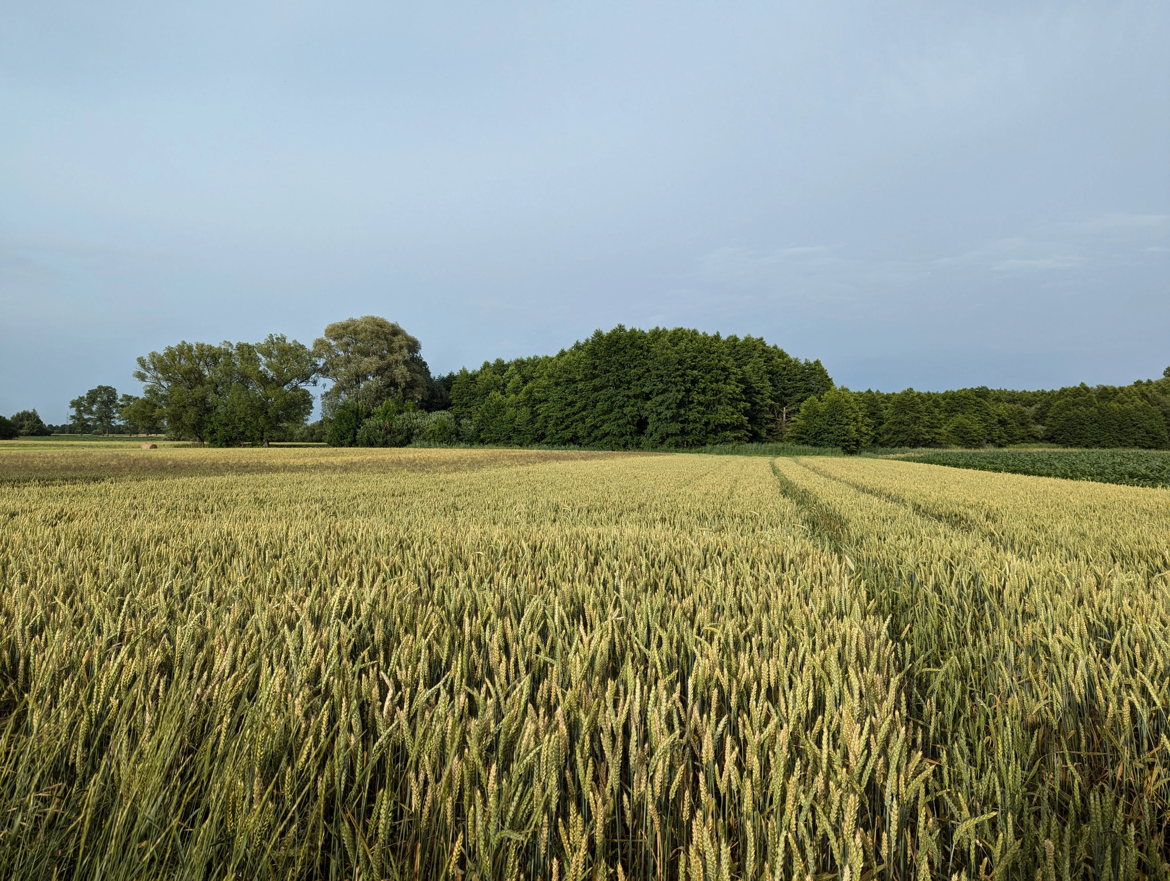
A wide view of a ripening grain field in the foreground, with dense green trees and a hedgerow in the midground under a light blue sky.
A view of the agricultural landscape within the protected area of Starodub w Pełkiniach.

Starodub w Pełkiniach history and protected-area timeline

Starodub w Pełkiniach entered the formal Natura 2000 system in 2011, the year the European Commission adopted the Polish national list that designated it as a Site of Community Importance. At the Polish domestic level this corresponds to its status as an obszar mający znaczenie dla Wspólnoty, currently on the planning track toward designation as a Special Area of Conservation, a specjalny obszar ochrony siedlisk.

Its inclusion was motivated specifically by the botanical and habitat value of its meadow complex, and by the need to secure habitat for Angelica palustris in one of its strongest remaining Polish strongholds. Documentation for the site in its early years was consolidated in the 2012 regional Natura 2000 volume Obszary Natura 2000 na Podkarpaciu, edited by D. Rogała and A. Marcela and published by the Regional Directorate for Environmental Protection in Rzeszów, where R. Krawczyk authored the chapter dedicated to Starodub w Pełkiniach. The site is also registered in Poland's Central Register of Forms of Nature Protection maintained by the General Directorate for Environmental Protection.

Starodub w Pełkiniach landscape and geographic character

The site occupies a lowland meadow landscape shaped by the contact between two physical-geographical mesoregions. To the south and west the terrain rises into the Podgórze Rzeszowskie, part of the Subcarpathian foothill belt east of Rzeszów, while the northern and eastern parts of the area are part of the Dolina Dolnego Sanu, the Lower San River valley, where flatter, hydrologically richer floodplain habitats prevail.

The actual surface of the protected area is essentially flat to gently undulating, dominated by a continuous, unbroken block of open meadows rather than fields, woods, or settlement. The compactness of this meadow complex is one of its key physical landscape features and supports its function as a coherent habitat island for the meadow-dependent species it protects. Coordinates near 50.078° N and 22.577° E place the site east of the San River in the rolling agricultural countryside of the lower Subcarpathians.

Starodub w Pełkiniach ecosystems, habitats, and plant life

The natural character of Starodub w Pełkiniach is defined almost entirely by its semi-natural grassland habitats. Two Annex I habitat types underpin its ecological value. The first, łąki świeże, is the fresh-meadow type derived from long-standing, low-intensity mowing and grazing. These are typically species-rich, moderately moist grasslands with a mixture of grasses, herbs, and legumes.

The second habitat type, łąki trzęślicowe, is the Molinia caerulea meadow community, a more specialised and ecologically sensitive wet grassland type associated with specific hydrological conditions and characterised by the dominance or strong presence of purple moor grass and a particularly rich herb layer. These two habitats together create the structural and ecological framework that supports Angelica palustris, the starodub łąkowy, whose persistence depends on the continued openness, traditional management, and specific hydrology of these meadows. The site's protected value lies as much in this habitat mosaic and in traditional management continuity as in any single species.

Starodub w Pełkiniach conservation status and protection priorities

The site's conservation profile is tightly focused on the European and national protection of a single plant species and the meadow habitats it depends on. Its primary subject of protection is the population of Angelica palustris, listed in Annex II of the EU Habitats Directive, an umbrella designation that obliges Poland to maintain or restore the species to a favourable conservation status.

At the habitat level, the site contributes to the conservation of two Annex I habitat types: fresh meadows, classified as łąki świeże, and Molinia caerulea meadows, classified as łąki trzęślicowe. As a Site of Community Importance, the area is part of the pan-European Natura 2000 ecological network and is on the planning track toward becoming a Special Area of Conservation, which would bring binding species and habitat protection obligations. In Polish domestic law, the site is recorded in the Central Register of Forms of Nature Protection maintained by the General Directorate for Environmental Protection, ensuring that land-use decisions likely to affect it are subject to environmental assessment.

The site's value to conservation is therefore less about representing a wide spectrum of habitats and more about securing one of the country's key populations of a rare, meadow-dependent plant, and about anchoring the traditional management regime that keeps the supporting habitat mosaic intact.

Starodub w Pełkiniach cultural meaning and human context

The area lies within a deeply agricultural rural region of the lower Subcarpathians, where small villages such as Chałupki, Jagiełła, Wólka Pełkińska, Pełkinie, Ujezna, and Rozbórz have historically maintained a mixed pattern of arable land, meadows, and pasture. The presence of a large, unbroken meadow complex of the kind protected at Starodub w Pełkiniach is itself a cultural indicator, reflecting a long tradition of low-intensity mowing and grazing rather than intensified crop cultivation.

Such traditionally managed open meadows are an inseparable part of the regional rural identity of the Lower San valley and of the transition zone into the foothills east of Rzeszów, and their persistence supports both the local agricultural economy and the ecological value that justified the Natura 2000 designation.

Top sights and standout views in Starodub w Pełkiniach

Starodub w Pełkiniach offers a notably focused conservation picture: a single, large, continuous block of traditionally managed meadow protecting one of the most important Polish populations of Angelica palustris in Annex II habitat, with the supporting mosaic of fresh meadows and Molinia caerulea meadows reinforcing the site's ecological coherence.

Its strengths are its compactness, the unbroken character of the grassland, the law-based protection regime of the Natura 2000 system, and the combination of a strategically rare plant with the habitat types that maintain it. The site's significance lies in maintaining long-term, traditional meadow management at a landscape scale.

Monthly climate preview

Long-term monthly temperature and precipitation patterns sampled from representative coordinates.

Starodub w Pelkiniach Climate Normals and Annual Temperature Rhythm

Recorded monthly climate data for Starodub w Pelkiniach charts long-term average temperature ranges alongside precipitation metrics across representative points. Examining the complete twelve-month normals provides detailed context on annual environmental variations.
Annual mean8 °C
-4 °C20 °C
Jan-4°
Feb-2°
Mar
Apr
May14°
Jun18°
Jul20°
Aug20°
Sep14°
Oct
Nov
Dec-2°
Warmest month
July

20 °C

Coolest month
January

-3.9 °C

Wettest month
July

2.9 mm/day

Driest month
January

1.2 mm/day

Park location guide

Geography guide, regional context, and park location map for Starodub w Pełkiniach

Starodub w Pełkiniach park geography, regions, and map view in Poland

Understand where Starodub w Pełkiniach sits in Poland through a broader geographic reading of the surrounding landscape, nearby location context, and its mapped position within the national park landscape.

How Starodub w Pełkiniach fits into Poland

Poland, officially the Republic of Poland, is a Central European country spanning from the Baltic Sea in the north to the Carpathian Mountains in the south. It borders Germany, Czech Republic, Slovakia, Ukraine, Belarus, Lithuania, and Kaliningrad Oblast. The country has a temperate climate, diverse landscapes, and is known for its rich history, cultural heritage, and strong economic position within the EU.

Wider geography shaping Starodub w Pełkiniach in Poland

Poland occupies 312,696 km2 in Central Europe, extending from the Baltic Sea coast in the north to the Sudetes and Carpathian Mountains in the south. It borders Germany to the west, Czech Republic and Slovakia to the south, Ukraine and Belarus to the east, and Lithuania and Kaliningrad Oblast to the northeast. The landscape includes lowland plains, uplands, and mountain ranges.

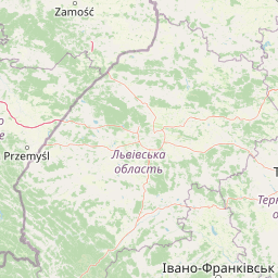
Map view of Starodub w Pełkiniach

Use this park location map to pinpoint Starodub w Pełkiniach in Poland, understand its exact geographic position, and read its mapped placement within the surrounding landscape more clearly.

Pigeon | © OpenStreetMap contributors

Location context for Starodub w Pełkiniach

Subcarpathian Voivodeship

Visual reference for wetland habitats and regional river valley terrain

Starodub w Pełkiniach Photos and Protected Meadow Landscapes

Photographic records document the expansive meadow complex and rare botanical habitats that define Starodub w Pełkiniach. Visual exploration reveals the flat grassland terrain and transitional wetland character found across the Subcarpathian foothills.

A wide view of a ripening grain field in the foreground, with dense green trees and a hedgerow in the midground under a light blue sky.

Park atlas

Discover related wetland reserves and floodplain meadow landscapes across the surrounding Subcarpathian region.

Other Parks and Protected Areas Near Starodub w Pełkiniach for Regional Comparison

Browse protected areas and regional reserves located near Starodub w Pełkiniach to compare contiguous meadow habitats and wetland ecosystems. Evaluating adjacent conservation zones expands geographic context across the Lower San River valley and foothill terrain.
Nature reservePodkarpackie Voivodeship
9 km away#1 closest

South

Rzeka San Nature Reserve: Mapped Geographic Overview and Protected Riverine Corridor

Protected landscape geography in Podkarpackie Voivodeship

Rzeka San is a significant river-based nature reserve that defines a crucial ecological passage through southeastern Poland. By focusing on the aquatic and riparian habitats along the San River, this protected area provides vital support for diverse freshwater species. Its strategic position within the Podkarpackie Voivodeship and its integration with larger landscape parks showcase a complex, multi-layered approach to regional environmental conservation and riverine terrain management.

Area
13.75 km²
Established
2009
Scope
Terrestrial
Water
Water-dominated
Protected areaPodkarpackie Voivodeship
29 km away#2 closest

East

Łukawiec Protected Area Mapping and Landscape Context in the Podkarpackie Voivodeship

Fragmented forest and wetland habitats in southeastern Poland

Łukawiec represents a vital ecological intersection in the Podkarpackie Voivodeship, preserving rare forest types and wetland systems on the Płaskowyż Tarnogrodzki plateau. This site is defined by its complex mosaic of riparian woodlands, Molinia meadows, and boggy coniferous patches that sustain a variety of protected animal species.

Area
22.702 km²
Established
2011
Relief
Upland
Scope
Terrestrial
Nature reservePodkarpackie Voivodeship
About 35 km away#3 closest

East

Rezerwat przyrody Moczary: Geographic Overview and Protected Forest Reserve Mapping

Botanical sanctuary and lowland forest habitat in Podkarpackie.

Rezerwat przyrody Moczary represents a focused, twelve-hectare protected forest area known for its exceptional concentration of glacial relicts and diverse herbaceous understory. Located within the Natura 2000 Łukawiec site, this reserve offers a detailed look at lowland oak-hornbeam ecology and sub-Carpathian botanical signatures across the Płaskowyż Tarnogrodzki mesoregion.

Area
0.124 km²
Established
2004
Relief
Lowland
Scope
Terrestrial
Nature reservePodkarpackie Voivodeship
40 km away#4 closest

Southwest

Wisłok Środkowy z Dopływami Protected Nature Reserve in the Podkarpackie Voivodeship

River corridor geography and riparian ecosystem analysis

Wisłok Środkowy z Dopływami serves as a crucial Natura 2000 site, safeguarding the middle course of the Wisłok River and the Stobnica tributary. This nature reserve provides essential habitat for various protected fish species and butterfly populations within a terrain shaped by the transition between the Jasielsko-Krośnieńska Basin and the Carpathian foothills. The area represents a significant riparian landscape, offering a window into the natural freshwater geography of southeastern Poland.

Area
10.646 km²
Established
2011
Relief
Upland
Scope
Terrestrial
A watercolor illustration showing a landscape with a calm body of water, grassy banks, and rolling hills in the background.
Nature reservePodkarpackie Voivodeship
About 41 km away#5 closest

Southwest

Mójka Nature Reserve: A Detailed Atlas View of Carpathian Foothill Protected Landscapes

Examining beech-fir forest and wetland habitats in Podkarpackie

Mójka Nature Reserve protects a 288 hectare forest environment within the Hyżnieńsko-Gwoźnicki Protected Landscape Area. This geographic entity showcases a mosaic of moist forest and aquatic habitats, documenting 340 vascular plant species and significant beaver-influenced hydrology in the rolling terrain of the Pogórze Dynowskie foothills.

Area
2.884 km²
Established
1997
Relief
Upland
Climate
Temperate
Nature reservePoland
41 km away#6 closest

Northeast

Uroczyska Puszczy Solskiej: Protected Forest and Peatland Landscape in Eastern Poland

Natura 2000 nature reserve encompassing diverse lowland forest mosaics

Uroczyska Puszczy Solskiej spans over 34,000 hectares of eastern Poland, forming a vital protected mosaic of raised bogs, transitional mires, and varied forest communities. This area provides a crucial reference for peatland and wetland ecology, supporting a wide range of forest-dependent species within a landscape shaped by glacial and fluvial processes.

Area
346.715 km²
Established
2009
Relief
Lowland
Climate
Temperate
Protected areaPodkarpackie Voivodeship
44 km away#7 closest

South

Ostoja Góry Słonne: Geographic Analysis of Protected Carpathian Forest and Foothills

Mapping natural boundaries in the Podkarpackie Voivodeship

Ostoja Góry Słonne represents a significant protected area within the Polish Carpathians, characterized by its dense beech forest cover and high biodiversity. This site serves as a vital refuge for large mammals and diverse riparian species, with its landscape of forested ridges and river valleys providing essential habitat connectivity across the Słonne Mountains and Przemyskie Foothills.

Area
460.715 km²
Established
2009
Relief
Mountain
Climate
Temperate
Protected areaPoland
55 km away#8 closest

North

Uroczyska Lasów Janowskich: Protected Forest and Wetland Geography in Eastern Poland

Mapping the extensive Natura 2000 lowland forest and peatland complexes

Spanning the Biłgoraj Plain and San River valley, Uroczyska Lasów Janowskich is a notable lowland forest complex in Poland. Its terrain integrates mature oak-hornbeam woods with diverse peatland systems, offering a clear look at how layered conservation strategies protect rare European habitats within a single continuous geographic block.

Area
345.443 km²
Established
2009
Relief
Lowland
Climate
Temperate

Common questions about visiting, size, designation, and location context for Starodub w Pełkiniach

Starodub w Pełkiniach FAQs for park facts, access, geography, and protected area context

Find quick answers about Starodub w Pełkiniach, including protected-area facts, park geography, trail and visitor context, and how the park fits into its surrounding country and regional landscape.
MoriAtlas Explorer

Continue Your Protected Areas Search Across the Global Atlas

Deepen your exploration by continuing the structured search for national parks and protected areas worldwide. Utilize the comprehensive filtering capabilities to compare different conservation landscapes and refine your understanding of global park geography. Discover more about the distribution and characteristics of protected natural areas.

Global natural geography