Why Stavns Fjord, Samsø Østerflak og Nordby Hede stands out
Stavns Fjord is best known as a large, shallow Danish coastal lagoon with small islands, surrounded by bird-rich shallow marine waters and flanked by dune, heath, and salt meadow landscapes. The wider Natura 2000 site is recognized for its mosaic of European-level marine and coastal habitats, including sandbanks, reefs, lagoons, coastal dunes, dune heaths, and calcareous dry grasslands that support priority habitat types under the EU Habitats Directive. The area is also strongly associated with seabirds, waterbirds, and seals. It hosts one of the cormorant colonies in its inner islets and includes a dedicated seal reserve around the Bossern area, where harbour seals breed. The mix of protected shallow sea, lagoon, islands, and adjacent cultural coastline at Kanhave gives the area a distinctive combination of marine, coastal, and inland habitat values in a single site.
Stavns Fjord, Samsø Østerflak og Nordby Hede history and protected-area timeline
The protection history of the area begins in 1981, when the entire Habitat Area, together with the land tongue containing the Kanhave canal, was designated as a nature conservation area, with only a narrow coastal stretch of dunes in the far northwestern part excluded. The Kanhave canal itself is a notable historical feature: a Viking-era canal cut across a neighboring land tongue on Samsø, demonstrating that humans have shaped the landscape around Stavns Fjord for many centuries.
In 1999, Stavns Fjord and its adjacent marine waters to the east were additionally designated as a wildlife reserve, strengthening protection across the lagoon and the open marine areas. Under the Natura 2000 framework, the site was formally adopted as EU Habitat Area H51 and Bird Protection Area F31, and the marine parts were also recognized as Ramsar area R14. The first Natura 2000 plan for the area was adopted in 2011, after which the municipal council of Samsø Kommune and the Danish Nature Agency (Naturstyrelsen) developed binding action plans to implement it. The plan has since been continued and further developed in later planning periods, and it is coordinated with the water plan for the Aarhus Bay main catchment area. Of the area's 15,663 hectares, about 517 hectares are additionally protected under Section 3 of the Danish Nature Protection Act, including salt meadows, heath, calcareous dry grass, and small areas of freshwater meadow, bog, and ponds.
Stavns Fjord, Samsø Østerflak og Nordby Hede landscape and geographic character
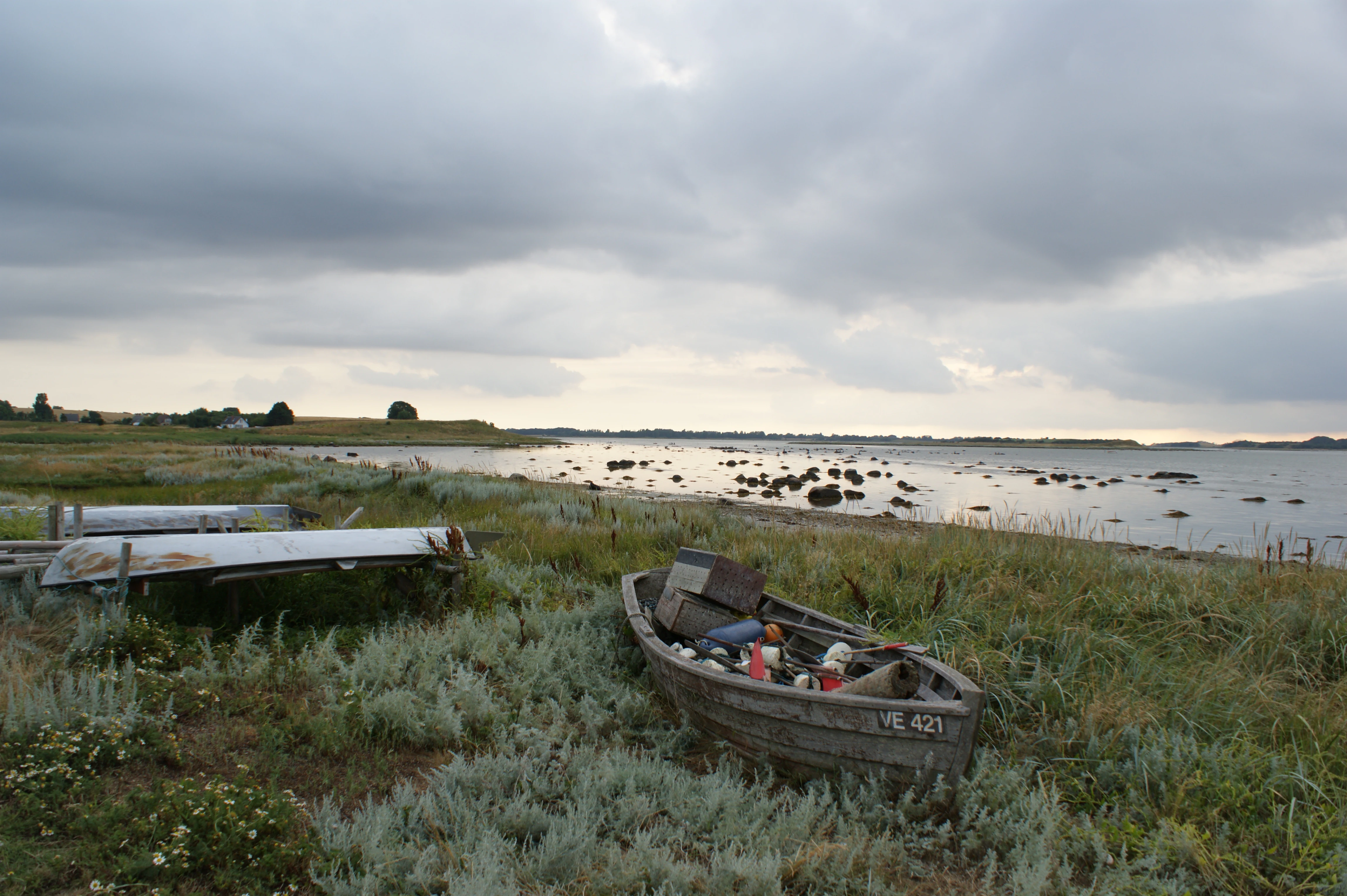
The landscape of Stavns Fjord, Samsø Østerflak og Nordby Hede is a transition zone between the flat, low-lying land of northern Samsø and the marine waters of the Kattegat. The terrestrial surface is largely open and flat, shaped by long-term inundation during the Mesolithic and later coastal processes, and it is punctuated by a few characteristic hills that also form the small islets inside Stavns Fjord. This flat land, combined with Nordby Hede and the coastal fringes around the fjord, gives the inland character of the area an understated, low horizon quality.
The coastal landscape is strongly varied. Sheltered shorelines are framed by salt meadows and coastal grasslands, while more wave-exposed stretches feature beach ridges, coastal cliffs, and a dune system that ranges from white foredunes through grey-green dunes to older dune heath. Inland fringe habitats include calcareous sand dunes, calcareous grasslands, acidic dry grasslands, temporarily wet meadows, and rich fens, all embedded within a small but ecologically dense terrestrial component.
The marine landscape is dominated by Stavns Fjord itself, a wide and shallow coastal lagoon with small islets and a cormorant colony on Yderste Holm. Beyond the fjord, the waters of Nordby Bugt and Lindholm Dyb contain sandbanks, reefs, lagoons, and shallow permanent seawater cover, while the eastern islands including Kyholm, Lindholm, and Vejrø form part of a wider complex of holms, sandbanks, reefs, and skerries. The Bossern area is managed as a seal reserve, with Hatter Rev a free-standing stone reef where large stones are normally visible above the water, both reflecting a seascape with strong glacial and post-glacial features.
Stavns Fjord, Samsø Østerflak og Nordby Hede ecosystems, habitats, and plant life
Ecologically, this Natura 2000 area is a mosaic of coastal, marine, and near-coastal terrestrial habitats of clear European importance. Under the EU Habitats Directive, the site supports a wide range of habitat types, including sandbanks (1110), coastal lagoons (1150), marine bays and inlets such as Nordby Bugt and Lindholm Dyb (1160), reefs (1170), several types of beach ridge vegetation with annual and perennial plants (1210 and 1220), coastal cliffs (1230), annual strandline vegetation (1310), and salt meadows (1330). The terrestrial side is equally diverse, with embryonic shifting dunes (2110), white dunes (2120), grey-green dunes (2130), and dune heath (2140), alongside several lake types, including stonewort lakes, eutrophic lakes, and dystrophic lakes (3140, 3150, 3160).
Semi-natural grassland habitats include dry calcareous sand grassland (6120), calcareous grassland (6210), acidic grassland (6230), temporarily wet meadows (6410), and rich fens (7230), collectively creating a varied mix of open, low-intensity habitats dependent on traditional land use and natural coastal dynamics. Several of these, marked as priority habitats in the Natura 2000 designation, are key conservation targets and reflect the area's combination of dynamic coastal processes, calcareous substrates, and moisture gradients near the coast.
Stavns Fjord, Samsø Østerflak og Nordby Hede wildlife and species highlights
The wildlife value of the area sits at the intersection of marine, coastal, and inland faunas. The marine part of the site is designated as a Bird Protection Area, reflecting its importance for waterbirds and seabirds. Breeding species include avocet, Sandwich tern, common tern, little tern, and cormorant, while whooper swan, common eider, velvet scoter, and common scoter are recorded as migratory visitors. The cormorant colony on Yderste Holm in Stavns Fjord is a notable breeding concentration inside the protected area.
On land, the area also supports great crested newt, recorded for the area under the Habitats Directive, alongside typical coastal and heathland fauna of northern Samsø. Around the islands and reefs, the Bossern area is a dedicated seal reserve, where harbour seals breed, while grey seals are also listed as a qualifying species for the site. The combination of protected shallow sea, lagoon, islands, and adjacent terrestrial habitats makes the area particularly significant for bird life and seals, with the seasonal access restrictions on many of the small islands and reefs serving to reduce disturbance during the most sensitive breeding months.
Stavns Fjord, Samsø Østerflak og Nordby Hede conservation status and protection priorities
Stavns Fjord, Samsø Østerflak og Nordby Hede is one of the larger and more multi-layered protected nature sites in the Danish Natura 2000 network. Its significance lies in the combination of multiple European-level designations on a single site: EU Habitat Area H51, Bird Protection Area F31, and Ramsar area R14 across the marine parts. This layered status reflects high international recognition of the area's habitats and species, and several of its habitat types are marked as priority habitats under the Habitats Directive.
The conservation approach combines statutory nature conservation with active planning. The whole habitat area, plus the Kanhave canal land tongue, has been protected by conservation order since 1981, and Stavns Fjord and the adjacent waters have been a wildlife reserve since 1999. Within this framework, the first Natura 2000 plan was adopted in 2011, followed by binding municipal and national action plans and subsequent planning cycles. Practical conservation measures include year-round access restrictions on most small islands and seasonal breeding-season closures on islands and reefs such as Besser Rev, Lindholm, Ægholm, and Sværm, alongside specific protection for the seal reserve around the Bossern area. Stone reef habitats, which were historically reduced by stone fishing, are now protected within the Natura 2000 area, helping preserve what remains of these glacial and post-glacial marine structures.
Stavns Fjord, Samsø Østerflak og Nordby Hede cultural meaning and human context
The cultural context of the area is anchored in the long human relationship with Samsø and its surrounding waters. The most tangible visible cultural element is the Kanhave canal, a Viking-era canal cut across a neighboring land tongue on Samsø that lies within the broader protected zone. The canal reflects the strategic maritime importance of the area and the long history of human modification of the coastal landscape around Stavns Fjord.
The current low-lying flat terrain around the fjord, including parts of Nordby Hede, emerged from seas that covered the landscape during the Mesolithic hunter-gatherer period. Subsequent millennia of coastal change, agriculture, and grazing have shaped the present-day mix of heath, dry grassland, salt meadows, and fens, much of which depends on traditional low-intensity land management. Today, the protected area is administered within Samsø Kommune in Region Midtjylland, and its nature plan is coordinated with regional water planning under the Aarhus Bay catchment, placing the site within a wider framework of Danish coastal and marine governance.
Top sights and standout views in Stavns Fjord, Samsø Østerflak og Nordby Hede
Stavns Fjord is one of Denmark's most significant coastal Natura 2000 sites, where a shallow lagoon, an archipelago of glacial origin, dunes, heaths, and salt meadows come together across more than 15,600 hectares. Several of its habitat types, including sandbanks, coastal lagoons, dune heath, calcareous sand grassland, and acidic grassland, are priority habitats under the EU Habitats Directive, giving the site notable international importance. The area also supports important breeding populations of terns, avocets, and cormorants, alongside grey seals and harbour seals in the designated seal reserve around the Bossern area.
Beyond its natural features, the site combines strong statutory protection, having been a designated nature conservation area since 1981 and a wildlife reserve since 1999, with active Natura 2000 planning since 2011. Its low-lying coastal landscape, geological origin as a marginal moraine of the last ice age, and coexistence with a Viking-era cultural feature at Kanhave give it a layered sense of place, making it a meeting point of marine, terrestrial, and cultural value in the Kattegat.
Best time to visit Stavns Fjord, Samsø Østerflak og Nordby Hede
Stavns Fjord and the surrounding marine and coastal areas are most attractive for visitors during the warmer months, roughly from late spring through early autumn, when longer daylight hours make it easier to experience the open coastal landscape, heath, and dune areas around northern Samsø. The warmer season also tends to be when waterbirds, terns, and other breeding species are most active around the lagoon and the small islands. That said, many of the small islands and reefs have year-round or seasonal access restrictions to protect breeding birds and seals, and visitors planning a trip should expect that some areas, especially the islands inside Stavns Fjord and offshore reefs like Besser Rev, Lindholm, Ægholm, and Sværm, will have limited access during the breeding season.