
Mori Atlas logo
Nature reserveStruth

A diverse mosaic of alder swamp woodland, wet meadows, and rare habitat patches within the Hunsruck uplands.

Struth Nature Reserve: Mapped Protected Landscapes and Geographic Context in Rhein-Hunsruck-Kreis

(Naturschutzgebiet Struth)

Struth represents one of the largest protected nature reserves in Rhineland-Palatinate, spanning more than 870 hectares of ecologically significant terrain. Situated between Perscheid and Wiebelsheim, the reserve protects a complex interplay of deciduous forests, spring-fed ponds, and alder swamp woodlands that provide critical refuge for rare species. The area serves as a key reference point for wetland conservation and archaeological heritage in the Hunsruck highland system.

nature reserveHunsrückwet meadowsalder swamp woodlandmixed forestheath
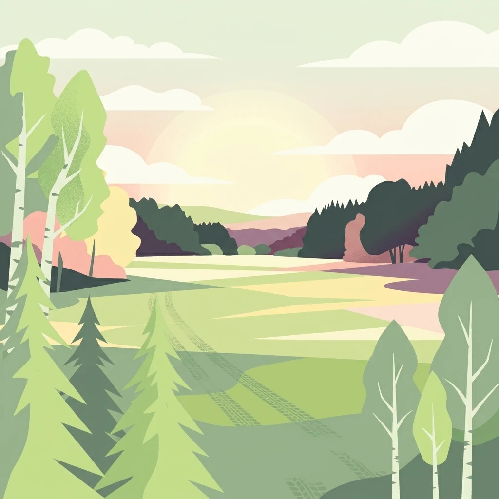
A flat-style digital illustration depicting a gentle landscape of green meadows, deciduous and coniferous trees, and rolling hills under a soft sunset sky.

Struth

Nature reserve

Park overview

Structured park overview, official facts, and landscape profile for Struth Nature Reserve

Struth Nature Reserve park facts, protected area profile, and essential visitor context

Review the core facts for Struth Nature Reserve, including designation, size, terrain, visitor scale, habitats, and operating context in one park-focused overview.

About Struth Nature Reserve

Struth Nature Reserve occupies a hill and valley mosaic within the northern Hunsrück, just inland from the dramatic slopes that descend toward the Upper Middle Rhine Valley, a UNESCO World Heritage Site. The protection order in place since 1987 reflects decades of recognition of the area's ecological and cultural importance, and today it functions as both a local conservation cornerstone and a node within the broader European Natura 2000 ecological network.

The protected landscape merges forested terrain with extensive open wetland zones. Deciduous and coniferous stands, some of which have developed into mature alder swamp woodland, frame wet meadows, small heath patches, and a web of near-natural spring streams, ponds, and pools. This mosaic creates transitional habitats that are increasingly rare in central European landscapes, where drainage and forestry intensification have reduced similar wetlands elsewhere.

Ecologically, the reserve offers a refuge for species that depend on intact, structurally rich wetland-forest ecotones. Bats, including the protected Bechstein's bat, use the older, hollow-bearing trees as roosting habitat, while invertebrates such as the Breitrandkäfer rely on damp, undisturbed woodland soil and deadwood. The combination of these features has positioned Struth as a recognized conservation reference site at both state and EU levels.

The reserve's location also places it within easy reach of the adjacent Hochwildschutzpark Hunsrück, a substantial wildlife park, and within the wider cultural geography of the Middle Rhine. The presence of Celtic burial mounds points to deep human history on this terrain, reinforcing the sense of Struth as a place where natural and cultural heritage overlap across long timescales.

Quick facts and research context for Struth Nature Reserve

Struth Nature Reserve sits in the Rhein-Hunsrück-Kreis of Rhineland-Palatinate, in the Hunsrück highlands south of the Middle Rhine. It spans southwestern parts of the Perscheid municipal area and northwestern areas of Wiebelsheim, within the Verbandsgemeinde Hunsrück-Mittelrhein.

It is among the largest nature reserves in Rhineland-Palatinate and is formally integrated into the Natura 2000 network as part of the FFH core area DE 5911-301. The reserve is bounded in the south by the Hochwildschutzpark Hunsrück, a large wildlife park, and is governed under a legal protection order issued by the Rhein-Hunsrück-Kreis.

Protection and recognition

Terrestrial protected area records, management framework, and official designation tracking for Struth

Struth Protection Status and Documented Conservation Scope

Struth maintains a documented terrestrial protection scope within official conservation databases, recording foundational administrative parameters and protected area data. Official tracking provides verified baseline details regarding the landscape management framework without assigning external designation metrics.

Protection details

Protection scope
Terrestrial
Transboundary protection
No
WDPA ID
165772
Park context

Deeper park guide and search-rich context for Struth Nature Reserve

Struth Nature Reserve history, landscape, wildlife, and travel context

Explore Struth Nature Reserve through its history, landscape character, ecosystems, wildlife, conservation priorities, cultural context, and seasonal travel timing in a structured park guide built for atlas discovery and search intent.

Why Struth Nature Reserve stands out

Struth is best known for its extensive wetland and bog woodland complex, which combines wet meadows, spring brooks, ponds, and naturally developed alder swamp forest. This habitat mosaic supports a notable concentration of threatened species, particularly the protected Bechstein's bat and the ground beetle commonly referenced as the Breitrandkäfer, both of which are formally listed in the Natura 2000 standard data form for the area. The reserve is also distinguished by its archaeological depth, with Celtic-period burial mounds attesting to long-standing human use of the landscape. Its combination of cultural heritage overlay and ecologically intact wetland-forest mosaic gives Struth a layered identity that sets it apart from typical forest-only reserves in the region.
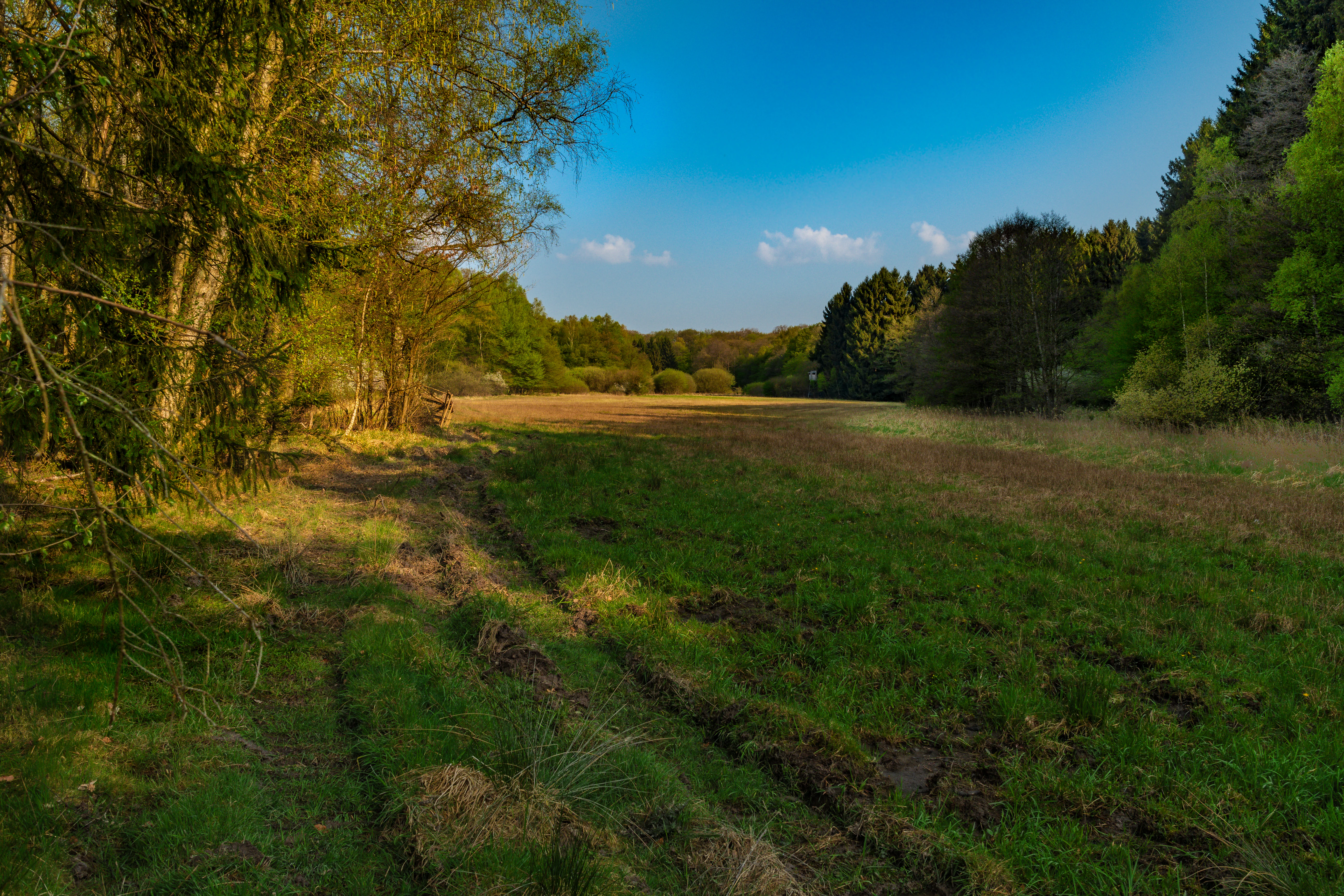
A wide landscape shot of a grassy meadow with tire tracks in the foreground, flanked by deciduous and coniferous trees under a clear blue sky.
A scenic view of a meadow bordered by mixed forest within the Struth nature reserve.

Struth Nature Reserve history and protected-area timeline

Human presence in the Struth area reaches back at least to the Celtic period, when burial mounds were constructed in what is now the reserve. These archaeological features underline that the Hunsrück plateau around Perscheid and Wiebelsheim has been inhabited and shaped by human land use for more than two millennia, before Struth ever became a formally protected area.

The reserve itself was established under a legal decree of the Rhein-Hunsrück-Kreis dated 8 January 1987, formalizing the protection of approximately 871 hectares and setting the framework for the conservation of its wetland, woodland, and heath habitats. The designation was a regional acknowledgment that the site held exceptional biodiversity value that warranted active protection.

Struth's integration into the Natura 2000 network followed broader European conservation priorities for habitat-rich forest and wetland complexes. As part of the FFH site known formally as NSG Struth (DE 5911-301), the reserve entered pan-European ecological planning, and its standard data form lists species such as the Bechstein's bat and the Breitrandkäfer as reference species for the site’s conservation assessment.

In more recent years, the reserve has been at the center of local controversy over proposed wind energy development along its boundary. A 2013 application for two wind turbines near the southeastern Wiebelsheim area raised conflicts over minimum distance requirements to settlements, impacts on the Upper Middle Rhine Valley UNESCO World Heritage status, threats to archaeological sites, and potential disturbance to protected species and habitats, debates that continue to shape ongoing planning decisions around the reserve.

Struth Nature Reserve landscape and geographic character

The Struth reserve sits within the rolling uplands of the Hunsrück, a low mountain range of folded slate and quartzite that rises between the Mosel, Nahe, and Middle Rhine valleys. The terrain is characterized by gentle ridges, small valleys, and a mix of wooded slopes interspersed with flatter wet ground, giving the area a varied but unobtrusive topography typical of the northern Hunsrück.

Water is the dominant visual and ecological motif of the reserve. Near-natural spring brooks feed slow-moving channels and ponds that sustain expansive wet meadows, while pockets of alder swamp woodland occupy the lowest, wettest ground. Small heath openings and drier clearings contrast with these damp depressions, producing a patchwork of color and structure across the landscape.

The reserve's southern boundary meets the Hochwildschutzpark Hunsrück, transitioning from closed woodland and wetland into open wildlife park scenery. This edge, combined with the proximity of the Middle Rhine valley, places Struth within a broader cultural and scenic corridor where natural, agricultural, and historic landscapes remain tightly interwoven.

Struth Nature Reserve ecosystems, habitats, and plant life

Struth’s ecological identity rests on its rich combination of forest, wetland, and heath habitats. Mixed deciduous woodland, with oak and other broadleaves, sits alongside coniferous stands, and the wettest zones have developed into alder swamp woodland, a habitat type highly valued for its ability to support moisture-loving specialist species.

Open spaces within the reserve are equally important. Wet meadows form large, flower-rich clearings that serve as pollinator habitat and feeding grounds for invertebrates, birds, and bats. Small heath patches add structural variety and support distinctive plant communities adapted to drier, more acidic soils. Together with the network of spring brooks, ponds, and pools, these open zones create a dense biotope mosaic within the forested matrix.

This habitat diversity underlies the area's conservation significance. The combination of mature, structurally complex woodland and uninterrupted wetland habitat is comparatively rare in modern central European landscapes, where drainage and forest simplification have reduced similar mosaics elsewhere, making sites like Struth important reservoirs of ecological continuity.

Struth Nature Reserve wildlife and species highlights

The varied habitats of Struth support a community of woodland and wetland species typical of high-quality central European forest reserves. Mature trees with cavities and loose bark provide essential roosting sites for forest bats, with the protected Bechstein's bat being one of the most characteristic species of the area.

Wetland fauna benefits from the near-natural springs, pools, and brook systems within the reserve. Amphibians, dragonflies, and other moisture-dependent invertebrates thrive in these conditions, while wet meadows and their fringes provide feeding habitat for a wide range of insects that in turn support birds and bats higher up the food chain.

The Breitrandkäfer, a ground beetle species sensitive to disturbance, is among the formally recognized reference species for the reserve. Its persistence here signals that the woodland floor remains relatively undisturbed, with continuous cover and intact deadwood resources. Birdlife associated with such diverse woodland and wetland edges, including typical woodland and water-associated species, complements these invertebrate and mammal communities, giving Struth a well-rounded faunal profile.

Struth Nature Reserve conservation status and protection priorities

Struth is one of the largest nature reserves in Rhineland-Palatinate, and its protected status formalizes the safeguarding of an exceptional wetland-and-forest mosaic in the Hunsrück. The reserve operates under a legal protection order issued by the Rhein-Hunsrück-Kreis, with management implications for forestry, water management, and land use within and adjacent to the protected zone.

Its inclusion in the European Natura 2000 network as the FFH site DE 5911-301 gives the reserve transboundary significance. The site's standard data form lists Species of Community Interest such as the Bechstein's bat and the Breitrandkäfer as conservation reference taxa, anchoring Struth within European biodiversity monitoring and protection frameworks.

Conservation planning around the reserve has had to grapple with external pressures as well, most notably proposed wind turbine development along the edge of the protected zone, where concerns have been raised about potential impacts on protected bat populations, ground beetles, archaeological sites, and the wider integrity of the Upper Middle Rhine Valley World Heritage setting. These debates highlight Struth's role as an active site of contemporary conservation policy, not just a static protected landscape.

Struth Nature Reserve cultural meaning and human context

The Struth area has been part of human settlement and land use since at least the Celtic period, as attested by burial mounds scattered across the terrain. These archaeological remains connect the modern reserve to older cultural layers of the Hunsrück and underline that today's wilderness perceptions overlay a much longer history of human presence.

The reserve also sits within a regional cultural landscape shaped by the proximity of the Upper Middle Rhine Valley, a UNESCO World Heritage Site. The relationship between protected nature, historic settlement patterns, and regional identity is repeatedly invoked in local discussions about land use, with Struth often discussed alongside nearby villages such as Perscheid and Wiebelsheim as a piece of community heritage.

Traditional rural land uses, including meadow management and small-scale woodland use, have shaped the open-versus-forest mosaic that now forms part of the reserve’s ecological value. This continuity between past human management and current conservation interest gives Struth an added cultural dimension beyond purely natural heritage.

Top sights and standout views in Struth Nature Reserve

Struth stands out for being among the largest nature reserves in Rhineland-Palatinate, with more than 870 hectares of formally protected wetland, woodland, and heath. The alder swamp woodland is one of the reserve's defining features, representing a habitat type that has become scarce across much of central Europe.

The reserve's Natura 2000 status and its official recognition of species like the Bechstein's bat and the Breitrandkäfer confirm its standing as more than a local site. It is a reference point for forest-wetland conservation in the region and holds archaeological as well as natural heritage value, from Celtic burial mounds to its place within the wider Hunsrück–Middle Rhine cultural geography.

Best time to visit Struth Nature Reserve

Spring and early summer tend to be especially rewarding in wetland reserves of this character, when wet meadows are most diverse and breeding activity among amphibians, insects, and songbirds is at its peak. The forest interior retains interest later in the year, with bats becoming more conspicuous around dusk in midsummer evenings.

Late spring through to early autumn generally offers the most accessible conditions for exploring the landscape on foot, given the typical mild climate of the Hunsrück. Autumn brings quieter atmosphere and shifting forest color, while winter visits, though more demanding, can still showcase the reserve's bog woodland and open meadow structure in a more austere form.

Monthly climate preview

Monthly temperature ranges and precipitation patterns for Struth in Rhein Hunsrück Kreis

Struth Climate Normals and Long Term Temperature Rhythms

Historical data records monthly temperature averages alongside steady precipitation rates across the landscape of Struth. Detailed weather by month breakdowns provide complete long term climate normals for further geographic analysis.
Annual mean9 °C
0 °C19 °C
Jan
Feb
Mar
Apr
May13°
Jun16°
Jul19°
Aug19°
Sep14°
Oct
Nov
Dec
Warmest month
July

18.9 °C

Coolest month
January

-0.1 °C

Wettest month
December

2.3 mm/day

Driest month
April

1.5 mm/day

Park location guide

Geography guide, regional context, and park location map for Struth Nature Reserve

Struth Nature Reserve park geography, regions, and map view in Germany

Understand where Struth Nature Reserve sits in Germany through a broader geographic reading of the surrounding landscape, nearby location context, and its mapped position within the national park landscape.

How Struth Nature Reserve fits into Germany

Germany is a federal republic in Western and Central Europe with a population of over 83 million across sixteen constituent states. It is Europe's largest economy by nominal GDP and a major global exporter and importer. The capital is Berlin, and the country borders Denmark, Poland, Czech Republic, Austria, Switzerland, France, Luxembourg, Belgium, and the Netherlands.

Wider geography shaping Struth Nature Reserve in Germany

Germany is located in Western and Central Europe, spanning 357,022 km². It borders Denmark to the north, Poland and the Czech Republic to the east, Austria and Switzerland to the south, and France, Luxembourg, Belgium, and the Netherlands to the west. The country has coastlines on the Baltic Sea and North Sea to the north, with the Alps located in the southern region.

Map view of Struth Nature Reserve

Use this park location map to pinpoint Struth Nature Reserve in Germany, understand its exact geographic position, and read its mapped placement within the surrounding landscape more clearly.

Pigeon | © OpenStreetMap contributors

Location context for Struth Nature Reserve

Rhein-Hunsrück-KreisRhineland-Palatinate

Examine the rolling terrain, wetland habitats, and natural features defining the reserve.

Visual Exploration of Struth Photos, Landscapes, and Protected Scenery

Browse detailed photography showcasing the protected forests, wet meadows, and spring-fed wetlands characterizing the Struth nature reserve. Visual documentation reveals the diverse topography and ecological mosaic shaping the Hunsrück highland landscape.

A wide landscape shot of a grassy meadow with tire tracks in the foreground, flanked by deciduous and coniferous trees under a clear blue sky.

A man with a backpack stands in a forest in the Struth nature reserve, using a camera to photograph a large, partially fallen, and decaying tree trunk.

Park atlas

Compare regional upland reserves and connected wetland landscapes across the Hunsrück region.

Explore Parks Near Struth and Surrounding Protected Natural Areas

Browse other protected areas and nature reserves situated near Struth within the surrounding Hunsrück highlands. Comparing adjacent forest and wetland habitats provides deeper context for regional conservation geography.
A soft, painterly watercolor illustration of a rolling landscape with patches of forest, light green fields, and distant hazy hills.
Protected landscapeRheinland-Pfalz
About 10 km away#1 closest

South

Soonwald Protected Landscape: Mapped Quartzite Ridges and Forested Massifs in Rhineland-Palatinate

Geographic analysis of the Hunsrück ridge system and protected natural terrain

The Soonwald is a significant quartzite-dominated ridge system within the German Hunsrück. This protected landscape encompasses 40 kilometers of uninterrupted crestlines, deep valley incisions, and ecological forest reserves. It offers a detailed study in mountain geography and ridge-dominated topography for those interested in the structural layout of the Rhineland-Palatinate natural environment.

Area
276.6 km²
Relief
Mountain
Climate
Temperate
Access
Easy access
A watercolor painting showing a soft, atmospheric landscape with a river flowing through green hills and gentle, misty mountains.
Nature reserveRhineland-Palatinate
About 11 km away#2 closest

East

Inselrhein Nature Reserve, Rhineland-Palatinate: A Geographic and Protected-Area Atlas

River islands, floodplain forests, and Upper Rhine wetlands

Inselrhein features a chain of natural river islands and side channels forming a critical wetland habitat. The terrain transition from soft-wood to hardwood forest communities creates a layered landscape. Examine the protected boundaries and geographic significance of this river corridor between Mainz and Bingen, documented within the Rhineland-Palatinate atlas.

Relief
Lowland
Climate
Temperate
Access
Easy access
Scope
Terrestrial
A horizontal watercolor painting showing a river winding through lush green islands and low hills in the background.
Nature reserveHesse
About 11 km away#3 closest

East

Lorcher Werth Nature Reserve: Protected Rhine Island Geography and Floodplain Forest

An ecologically significant island pair in the Middle Rhine, Hesse.

Lorcher Werth is a unique river island complex in Hesse, Germany, designated as a nature reserve and European Habitats Directive site. These uninhabited islands act as a vital refuge for floodplain habitats, currently undergoing a transformation toward natural Auwald forest. This site provides a rare, flat fluvial counterpoint to the surrounding steep and narrow landscapes of the Middle Rhine corridor.

Area
0.129 km²
Relief
Lowland
Climate
Temperate
Access
Highly restricted
A horizontal watercolor painting showing a serene valley landscape with distant rolling mountains, a central winding river or stream, and grassy banks in soft muted colors.
Nature reserveGermany
About 15 km away#4 closest

Southeast

Morgenbachtal Nature Reserve: A Geographic Atlas of the Middle Rhine Slate Cliffs

Exploration of the Binger Wald protected valley and its geological terrain.

Morgenbachtal presents a unique geographic profile characterized by two distinct ridge lines of crystalline slate cliffs. This protected area in Germany balances strict conservation with a complex landscape of narrow ravines, mixed forests, and historical landmarks like the Steckeschlääferklamm gorge and medieval castle ruins along the Rhine.

A pale, minimalist watercolor painting of a rolling green landscape with distant hills and a small group of trees on the right.
Nature reserveRhineland-Palatinate
About 17 km away#5 closest

North

Hintere Dick-Eisenbolz Nature Reserve: Geographic Context and Protected Landscape Data

Orchard meadows and invertebrate conservation in western Germany.

Situated in the Rhineland-Palatinate region of western Germany, Hintere Dick-Eisenbolz protects a 54-hectare expanse of traditional orchard meadows. This cultural landscape mosaic, characterized by fruit trees and grassland, supports high levels of insect diversity near the Rhine valley. The reserve remains an essential site for understanding the intersection of human-influenced agricultural land and critical biodiversity protection.

Area
0.546 km²
Established
1998
Watercolor painting of a river landscape with rolling green hills, distant slopes, and soft vegetation in shades of green and pink against a white background.
Nature reserveRheingau-Taunus-Kreis
About 21 km away#6 closest

Southeast

Rüdesheimer Aue Nature Reserve and Upper Rhine Protected Landscape

Riverine geography and protected floodplain forest

Rüdesheimer Aue represents a rare, uninhabited island refuge along the Upper Rhine. Its geography features shifting sediment bars, mudflats, and softwood floodplain forest cover, offering an essential staging ground for migratory waterbirds within the Rheingau-Taunus district of Hesse.

Area
0.057 km²
Relief
Lowland
Climate
Temperate
Access
Remote access
A watercolor illustration of a calm body of water with a single tree in the center; distant rolling hills are visible in the background under a soft, pastel-colored sky.
Nature reserveLower Saxony
About 24 km away#7 closest

East

Fulder Aue, Ilmen Aue Nature Reserve: Mapped Protected Landscapes and Floodplain Geography

Alluvial river islands and wetland ecosystems in the Rhine valley.

The Fulder Aue, Ilmen Aue nature reserve serves as an vital example of an active Rhine floodplain. This area preserves a mosaic of islands, connecting channels, and soft-wood forest habitats. Learn about the geographic and hydrological dynamics that shape this protected space near Bingen am Rhein, showcasing its importance within the Rhine lowland system.

Area
3.38 km²
Established
1995
Relief
Lowland
Scope
Terrestrial
Nature reserveRhineland-Palatinate
About 28 km away#8 closest

Northwest

Ausoniusstein Nature Reserve: Protected Landscape and Geographic Identity in Germany

A geological and ecological refuge in the Rhineland-Palatinate countryside.

Ausoniusstein is a protected nature reserve in western Germany recognized for its unique geological and morphological character. Spanning 31 hectares, the site features rocky slopes and varied volcanic substrates that support uncommon plant life and the rare Apollo butterfly. The terrain represents the transitional landscape between the Moselle river corridor and the Eifel foothills.

Area
0.31 km²
Established
1984
Relief
Upland
Water
Minor water

Common questions about visiting, size, designation, and location context for Struth Nature Reserve

Struth Nature Reserve FAQs for park facts, access, geography, and protected area context

Find quick answers about Struth Nature Reserve, including protected-area facts, park geography, trail and visitor context, and how the park fits into its surrounding country and regional landscape.
MoriAtlas Explorer

Continue Your Protected Areas Search Across the Global Atlas

Deepen your exploration by continuing the structured search for national parks and protected areas worldwide. Utilize the comprehensive filtering capabilities to compare different conservation landscapes and refine your understanding of global park geography. Discover more about the distribution and characteristics of protected natural areas.

Global natural geography