Mori Atlas logo
Nearby park discovery

Explore surrounding conservation landscapes and regional park boundaries in the Hunsrück

Geographic Distribution of Protected Natural Areas and Nature Reserves Near Struth

Identify the regional network of protected environments and nature reserves located in the vicinity of Struth. This geographic overview highlights neighboring conservation sites within the Rhein-Hunsrück-Kreis, providing a spatial perspective on the distribution of forests, wetlands, and protected habitat mosaics across the Hunsrück landscape.

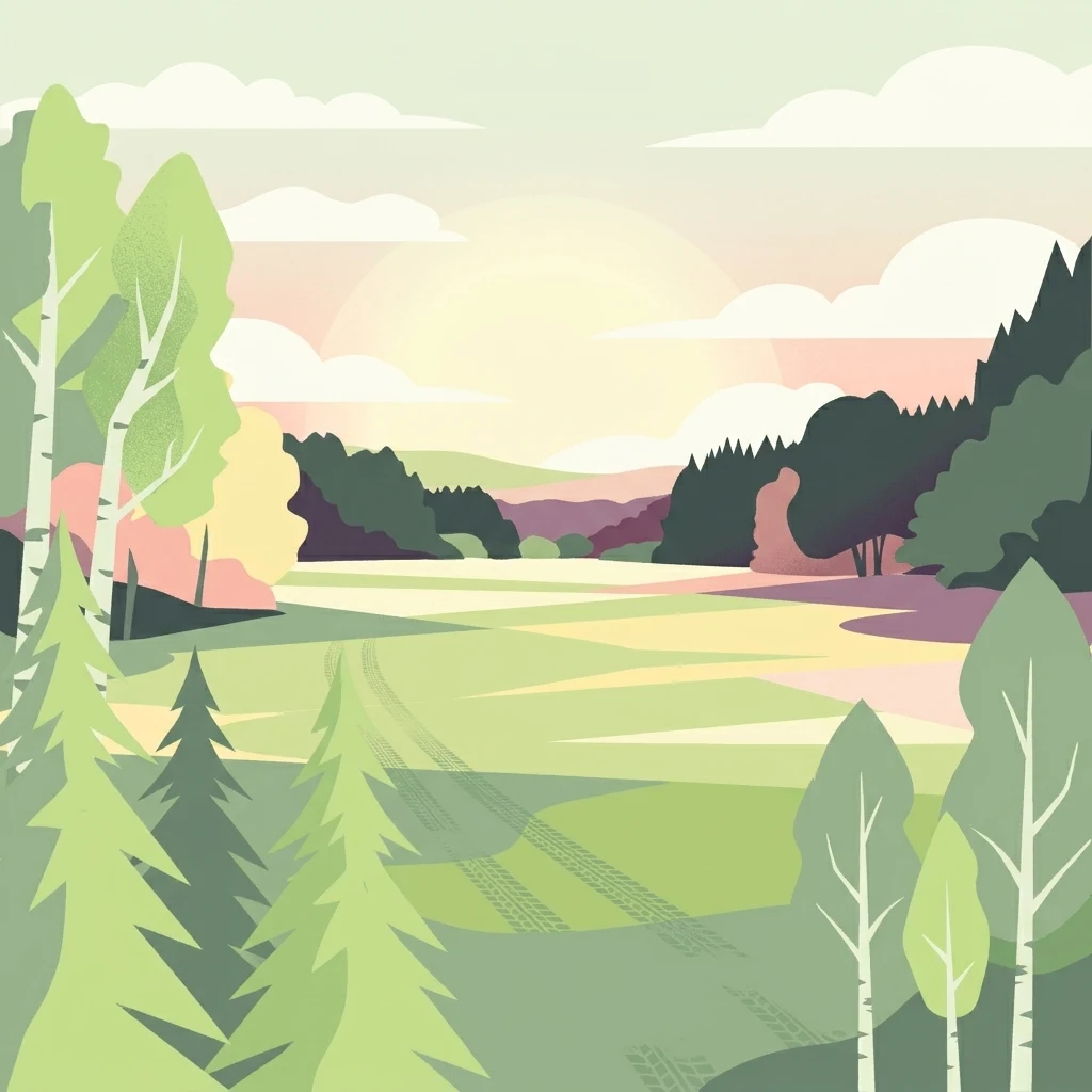
A flat-style digital illustration depicting a gentle landscape of green meadows, deciduous and coniferous trees, and rolling hills under a soft sunset sky.

A large protected wetland and forest mosaic in the Hunsrück hills, anchored by rare Bechstein's bat habitat.

Struth Nature Reserve

Struth is one of the largest nature reserves in Rhineland-Palatinate, covering roughly 871 hectares within the Rhein-Hunsrück-Kreis. It lies between the municipalities of Perscheid and Wiebelsheim in the Hunsrück region of western Germany, where the landscape transitions between forested uplands and the Middle Rhine valley. The reserve protects a diverse mosaic of mixed deciduous and coniferous forests, wet meadows, heath patches, and naturally formed wetland features such as springs, ponds, pools, and alder swamp woodland. It is an important refuge for threatened flora and fauna, including protected bat species and rare beetles whose presence formally links the reserve to the European Natura 2000 network. Beyond its ecological value, Struth also holds archaeological traces of prehistoric land use going back to the Celtic period. Its location at the edge of the Hunsrück highland system gives it both scientific importance for conservation and landscape-level significance for the surrounding region.

Location
Germany
Park type
Nature reserve
Established
1987
Area
8.7 km²
Struth Nature Reserve Geography and Maps
Regional park map

See the ranked park cluster in its geographic setting

Nearby parks around Struth Nature Reserve

This regional map shows the same 20 nearby parks ranked below around Struth Nature Reserve. Select a ranked marker to highlight that park’s boundary where boundary data is available.
Reference park: Struth Nature ReserveRanked nearby park20 nearby parks shown
20 nearby parks

Analyze surrounding regional park geography and protected landscape patterns around Struth

Ranked Protected Areas and Parks Near Struth by Geographic Distance

Examine the ranked collection of protected areas situated within geographic proximity to Struth by evaluating spatial separation and directional context. Compare recorded environmental characteristics across neighboring reserves to understand wider regional conservation patterns.
A soft, painterly watercolor illustration of a rolling landscape with patches of forest, light green fields, and distant hazy hills.
Protected landscapeRheinland-Pfalz
About 10 km away#1 closest

South

Soonwald Protected Landscape: Mapped Quartzite Ridges and Forested Massifs in Rhineland-Palatinate

Geographic analysis of the Hunsrück ridge system and protected natural terrain

The Soonwald is a significant quartzite-dominated ridge system within the German Hunsrück. This protected landscape encompasses 40 kilometers of uninterrupted crestlines, deep valley incisions, and ecological forest reserves. It offers a detailed study in mountain geography and ridge-dominated topography for those interested in the structural layout of the Rhineland-Palatinate natural environment.

Area
276.6 km²
Relief
Mountain
Climate
Temperate
Access
Easy access
A watercolor painting showing a soft, atmospheric landscape with a river flowing through green hills and gentle, misty mountains.
Nature reserveRhineland-Palatinate
About 11 km away#2 closest

East

Inselrhein Nature Reserve, Rhineland-Palatinate: A Geographic and Protected-Area Atlas

River islands, floodplain forests, and Upper Rhine wetlands

Inselrhein features a chain of natural river islands and side channels forming a critical wetland habitat. The terrain transition from soft-wood to hardwood forest communities creates a layered landscape. Examine the protected boundaries and geographic significance of this river corridor between Mainz and Bingen, documented within the Rhineland-Palatinate atlas.

Relief
Lowland
Climate
Temperate
Access
Easy access
Scope
Terrestrial
A horizontal watercolor painting showing a river winding through lush green islands and low hills in the background.
Nature reserveHesse
About 11 km away#3 closest

East

Lorcher Werth Nature Reserve: Protected Rhine Island Geography and Floodplain Forest

An ecologically significant island pair in the Middle Rhine, Hesse.

Lorcher Werth is a unique river island complex in Hesse, Germany, designated as a nature reserve and European Habitats Directive site. These uninhabited islands act as a vital refuge for floodplain habitats, currently undergoing a transformation toward natural Auwald forest. This site provides a rare, flat fluvial counterpoint to the surrounding steep and narrow landscapes of the Middle Rhine corridor.

Area
0.129 km²
Relief
Lowland
Climate
Temperate
Access
Highly restricted
A horizontal watercolor painting showing a serene valley landscape with distant rolling mountains, a central winding river or stream, and grassy banks in soft muted colors.
Nature reserveGermany
About 15 km away#4 closest

Southeast

Morgenbachtal Nature Reserve: A Geographic Atlas of the Middle Rhine Slate Cliffs

Exploration of the Binger Wald protected valley and its geological terrain.

Morgenbachtal presents a unique geographic profile characterized by two distinct ridge lines of crystalline slate cliffs. This protected area in Germany balances strict conservation with a complex landscape of narrow ravines, mixed forests, and historical landmarks like the Steckeschlääferklamm gorge and medieval castle ruins along the Rhine.

A pale, minimalist watercolor painting of a rolling green landscape with distant hills and a small group of trees on the right.
Nature reserveRhineland-Palatinate
About 17 km away#5 closest

North

Hintere Dick-Eisenbolz Nature Reserve: Geographic Context and Protected Landscape Data

Orchard meadows and invertebrate conservation in western Germany.

Situated in the Rhineland-Palatinate region of western Germany, Hintere Dick-Eisenbolz protects a 54-hectare expanse of traditional orchard meadows. This cultural landscape mosaic, characterized by fruit trees and grassland, supports high levels of insect diversity near the Rhine valley. The reserve remains an essential site for understanding the intersection of human-influenced agricultural land and critical biodiversity protection.

Area
0.546 km²
Established
1998
Watercolor painting of a river landscape with rolling green hills, distant slopes, and soft vegetation in shades of green and pink against a white background.
Nature reserveRheingau-Taunus-Kreis
About 21 km away#6 closest

Southeast

Rüdesheimer Aue Nature Reserve and Upper Rhine Protected Landscape

Riverine geography and protected floodplain forest

Rüdesheimer Aue represents a rare, uninhabited island refuge along the Upper Rhine. Its geography features shifting sediment bars, mudflats, and softwood floodplain forest cover, offering an essential staging ground for migratory waterbirds within the Rheingau-Taunus district of Hesse.

Area
0.057 km²
Relief
Lowland
Climate
Temperate
Access
Remote access
A watercolor illustration of a calm body of water with a single tree in the center; distant rolling hills are visible in the background under a soft, pastel-colored sky.
Nature reserveLower Saxony
About 24 km away#7 closest

East

Fulder Aue, Ilmen Aue Nature Reserve: Mapped Protected Landscapes and Floodplain Geography

Alluvial river islands and wetland ecosystems in the Rhine valley.

The Fulder Aue, Ilmen Aue nature reserve serves as an vital example of an active Rhine floodplain. This area preserves a mosaic of islands, connecting channels, and soft-wood forest habitats. Learn about the geographic and hydrological dynamics that shape this protected space near Bingen am Rhein, showcasing its importance within the Rhine lowland system.

Area
3.38 km²
Established
1995
Relief
Lowland
Scope
Terrestrial
Nature reserveRhineland-Palatinate
About 28 km away#8 closest

Northwest

Ausoniusstein Nature Reserve: Protected Landscape and Geographic Identity in Germany

A geological and ecological refuge in the Rhineland-Palatinate countryside.

Ausoniusstein is a protected nature reserve in western Germany recognized for its unique geological and morphological character. Spanning 31 hectares, the site features rocky slopes and varied volcanic substrates that support uncommon plant life and the rare Apollo butterfly. The terrain represents the transitional landscape between the Moselle river corridor and the Eifel foothills.

Area
0.31 km²
Established
1984
Relief
Upland
Water
Minor water
A horizontal watercolor painting of a river landscape with lush green trees, grasses, and a winding waterway under a soft light.
Nature reserveHessen
About 28 km away#9 closest

East

Mariannenaue Nature Reserve: Protected River Island Geography and Landscape Atlas

Rhine river island and floodplain forest in Hessen, Germany.

Mariannenaue serves as a prominent example of a protected inland island in the Upper Rhine. Its geography encompasses a complex mix of veteran floodplain forest, still-water habitats, and centuries-old vineyard cultivation. This detail page provides insights into the park boundaries, the surrounding riverine terrain, and the ecological network that connects this site to the broader Rheingau landscape.

Area
1.96 km²
Established
1972
Relief
Lowland
Climate
Temperate
A horizontal watercolor painting depicting a wide, jagged rock cliff face with green hills, set against a plain background.
Nature reserveRheinland-Pfalz
About 29 km away#10 closest

Southeast

Rotenfels Nature Reserve: A Geographical Portrait of the Nahe Valley Rhyolite Cliff

Geological landscape and protected habitat in Rheinland-Pfalz.

The Rotenfels nature reserve is anchored by a massive 200 meter high rock wall formed from red rhyolite. This protected landscape is recognized for its vertical drop into the Nahe River valley, creating a distinct microclimate that supports specialized cliff vegetation and raptor habitats within a traditionally farmed viticultural region.

Area
0.91 km²
Established
1939
Relief
Mountain
Climate
Temperate
A minimalist watercolor painting showing a winding river, distant hills, and a small grove of trees on the bank.
Nature reserveRheinland-Pfalz
About 30 km away#11 closest

North

Ruppertsklamm Nature Reserve: Geography and Protected Landscape Mapping in Rheinland-Pfalz

A steep, forested gorge within the Niederwesterwald

Ruppertsklamm stands as a distinctive nature reserve where extreme elevation changes and narrow valley walls create a dense, intimate habitat. The site integrates into the broader Natura 2000 network, offering a window into the complex geological and natural history of the Lahn valley slopes through its mossy rock formations and protected forest ecosystems.

Area
0.148 km²
Established
1936
Relief
Upland
Climate
Temperate
A horizontal watercolor illustration of a natural landscape featuring a small body of water or pond in the foreground, surrounded by grassy banks, low hills in the distance, and soft-colored vegetation.
Nature reserveRhineland-Palatinate
About 32 km away#12 closest

East

Sandgrube am Weilersberg Nature Reserve and Protected Landscape Map

Rhineland-Palatinate, Germany protected area

Sandgrube am Weilersberg is a protected nature reserve in Rhineland-Palatinate, Germany, known for its compact mosaic of calcareous sand slopes and wet meadows. Part of the Natura 2000 network, the site preserves rare steppe flora and wetland ecosystems that emerged following former sand extraction. The terrain supports significant entomological, botanical, and bryological diversity maintained through active grazing.

Area
0.095 km²
Established
1986
Relief
Lowland
Climate
Temperate
Nature reserveRhineland-Palatinate
About 32 km away#13 closest

East

Hangflächen um den Heidesheimer Weg: Nature Reserve Geography and Protected Landscape Context

Mainz-Bingen, Rhineland-Palatinate Nature Reserve

Hangflächen um den Heidesheimer Weg contains an unusual ecological convergence of sand dunes, open flats, and calcareous grasslands near Ingelheim am Rhein. This nature reserve provides critical protection for a fragmented yet highly structured landscape where springs and wetland zones intersect with warm, dry slopes. The area preserves a significant biotope complex of national importance within the Upper Rhine Plain.

Area
3.348 km²
Established
2003
Protected landscapeRheinland-Pfalz
About 33 km away#14 closest

North

Naturpark Nassau: Protected Landscape Map and Regional Geography Analysis

Rheinland-Pfalz protected area exploration

Discover the intricate geography of Naturpark Nassau, a protected area stretching across the Rhenish Slate Mountains. The terrain offers a detailed study of German low-mountain landscapes, featuring river-carved valleys, expansive forested ridges, and historic cultural sites. This atlas entry provides essential context on the physical boundaries and regional connections between the Lahn and Middle Rhine river corridors.

Area
561.71 km²
Established
1963
Relief
Mountain
Climate
Temperate
Watercolor painting of a gentle green valley with scattered trees and a winding path, featuring soft pastel tones.
Nature reserveHessen
About 34 km away#15 closest

Northeast

Pohlbachtal bei Adolfseck Nature Reserve: Geography and Protected Area Profile

Western Hintertaunus mosaic landscape in Hessen

Pohlbachtal bei Adolfseck protects a near-natural brook valley and surrounding slopes within the Rhein-Taunus Nature Park. This reserve sustains diverse habitats, from wet meadow floodplains to deciduous forest fringes, while preserving historical layers like the Roman Limes along its valley edges in Hessen.

Area
0.226 km²
Established
1990
IUCN
IV
A horizontal watercolor illustration of a natural valley scene, featuring an open meadow in the foreground, forest edges in the midground, and rolling hills in the background.
Nature reserveHesse
About 34 km away#16 closest

East

Rechtebachtal bei Georgenborn Nature Reserve: Geographic Profile and Protected Landscape

A mapped stream valley ecosystem in the Hesse Taunus foothills

The Rechtebachtal bei Georgenborn nature reserve protects a two-part valley corridor along the Rechtebach stream near Georgenborn and Martinsthal. This site preserves rare habitat mosaics of meadows and woodland that characterize the transitional zone between the Taunus highlands and the Rhine valley, offering a distinct study in regional conservation geography.

Area
0.185 km²
Established
1989
IUCN
IV
Relief
Upland
A horizontal watercolor painting depicting a soft green landscape with rolling hills and trees against a pale yellow and white sky.
Nature reserveRhineland-Palatinate
About 35 km away#17 closest

Northwest

Dortebachtal Nature Reserve: Mapping the Alpine Erosion Valley of the Mosel Region

A historic protected landscape in Rhineland-Palatinate.

Dortebachtal is a distinct, deeply incised nature reserve carved by a tributary of the Mosel. Its mapped terrain includes steep, dry western rock walls and a sheltered, forested eastern slope, creating a striking contrast in natural habitats. As a protected area since 1930, it remains a vital geographic marker and a significant segment of the regional hiking network through the Mosel valley.

Established
1930
Relief
Upland
Scope
Terrestrial
Water
Minor water
Watercolor painting of a green landscape with a winding river, forest patches, and soft hills in the background.
Nature reserveRheinland-Pfalz
About 35 km away#18 closest

West

Brauselay Nature Reserve: Mapping the Quartzite Cliffs of the Mosel Valley, Rheinland-Pfalz

A protected landscape featuring steep rock faces and dry grassland ecosystems.

Brauselay stands as a prominent protected nature reserve in the Mosel valley, characterized by a striking 65-meter quartzite cliff. The site supports a specialized Mediterranean-style flora and rare wildlife species adapted to its sun-warmed, heat-retaining slate and sandstone terrain. Its proximity to the Mosel River and integration with regional trail networks make it a landmark for studying the intersection of river valley geography and protected ecological habitats.

Area
0.133 km²
Established
1941
Watercolor painting of a misty river landscape with green trees, reeds, and soft hills in the background.
Nature reserveHesse
About 37 km away#19 closest

East

Niederwallufer Bucht Nature Reserve: Rhine Floodplain Landscape and Geographic Context

Protected riparian habitat in the state of Hesse

Niederwallufer Bucht represents a key example of a conserved Rhine riverbank environment. This nature reserve protects a delicate mix of soft-wood forests, sheltered backwater bays, and riparian meadows. By maintaining these wetlands against the backdrop of the heavily settled Rheingau, the site provides a vital node of ecological continuity and a clear look at floodplain terrain within central Germany.

Area
0.13 km²
Established
2000
IUCN
IV
A horizontal watercolor painting depicting a soft-focus landscape with rolling green hills, distant light-yellow mountains, and forested slopes.
Protected landscapeHesse
About 37 km away#20 closest

East

Naturpark Rhein-Taunus: Mapped Protected Landscapes and Geographic Features in Hesse

Discover the forests, river valleys, and cultural sites of this significant German nature park.

Naturpark Rhein-Taunus encompasses 81,000 hectares of forested ridges and valley systems in the Taunus low mountain range. The area is defined by its near-natural woodland, including the extensive Hinterlandswald, and its unique integration with the Roman Limes and the Rhine wine region, offering a distinct study in protected area geography.

Area
810 km²
Established
1968
Relief
Mountain
Climate
Temperate
Distance methodology

Geographic measurements, not driving distances

How nearby park distances are calculated

Distances use park boundaries whenever the available geometry allows it. When one or both boundaries are missing, the mapped park locations provide a clearly labelled estimate. Every value represents straight-line geographic separation and does not use roads or routing.

Boundary distance

Calculated between the nearest points of both park boundaries.

Location-to-boundary estimate

Estimated from one mapped park location to the nearest boundary of the other park.

Mapped-location estimate

Estimated between the mapped locations of both parks.

MoriAtlas Explorer

Discover the Mapped Geography and Protected Landscapes of Struth Nature Reserve

Deepen your knowledge of the Struth Nature Reserve through our structured MoriAtlas data. Visualize the reserve's unique wetland corridors and forest mosaic, understanding its role as a key conservation site within the Rhein-Hunsruck-Kreis regional geography.