Mori Atlas logo
Protected landscapeSuchedniowsko-Oblęgorski Park Krajobrazowy

Analyzing the forest-dominated terrain, industrial heritage, and regional watershed patterns

Geographic and Protected Landscape Identity of Suchedniowsko-Oblęgorski Park Krajobrazowy

Suchedniowsko-Oblęgorski Park Krajobrazowy encompasses a significant protected landscape within the Świętokrzyskie Voivodeship of central southern Poland. This area features a terrain defined by the Suchedniowski Plateau, rolling hill ranges, and a dense forest canopy that spans over ninety percent of its territory. Beyond its ecological value, the region serves as a historic hub for the Staropolskie Industrial District, integrating remnants of early metallurgical history with natural landmarks such as the Bart Oak and unique sandstone outcrops.

landscape parkŚwiętokrzyskiecentral Polandprotected forestforestsPolish larch

Suchedniowsko-Oblęgorski Park Krajobrazowy

Protected landscape

Park overview

Structured park overview, official facts, and landscape profile for Suchedniowsko-Oblęgorski Landscape Park

Suchedniowsko-Oblęgorski Landscape Park park facts, protected area profile, and essential visitor context

Review the core facts for Suchedniowsko-Oblęgorski Landscape Park, including designation, size, terrain, visitor scale, habitats, and operating context in one park-focused overview.

About Suchedniowsko-Oblęgorski Landscape Park

Suchedniowsko-Oblęgorski Landscape Park is one of the largest landscape parks in the Świętokrzyskie region, covering approximately 19,895 hectares of hilly terrain in central southern Poland. It lies across parts of several gminas, including Strawczyn, Mniów, Miedziana Góra, Zagnańsk, Bliżyn, Łączna, Stąporków, and Suchedniów, with its buffer zone extending into the city of Skarżysko-Kamienna. The topography blends the relatively flat Suchedniowski Plateau with the more pronounced Kołomańskie, Tumlińskie, and Oblęgorskie ranges, the last of which contains the park's highest point, Siniewska Góra at about 448.8 meters.

The park was established in 1988 specifically to preserve the natural and cultural assets of a region that had been shaped for centuries by iron mining and smelting. Today nearly the entire area is forested, and the woods grow on unusually fertile soils that support stands of Polish larch, a regionally rare native conifer. The area also functions as an important hydrographic node, collecting the headwaters of the Krasna, Bobrza, and Kamionka rivers that fan out into the wider Świętokrzyskie river system.

Alongside its ecological role, the park functions as an open-air museum of early Polish metallurgy. Remains of large ironworks, blast furnaces, and support structures from the former Staropolskie Industrial District survive at Samsonów, Bobrza, and Kuźniaki, while historic sacred and secular architecture is scattered through the surrounding villages. The Oblęgorek landscape and park complex houses a museum devoted to the Nobel Prize-winning novelist Henryk Sienkiewicz, adding a literary and aristocratic dimension to the area's heritage. Management of the park is overseen by the Zespół Świętokrzyskich i Nadnidziańskich Parków Krajobrazowych, which coordinates its protection alongside neighboring landscape parks in the region.

Quick facts and research context for Suchedniowsko-Oblęgorski Landscape Park

Suchedniowsko-Oblęgorski Landscape Park lies in Świętokrzyskie Voivodeship in central southern Poland and is managed by the Zespół Świętokrzyskich i Nadnidziańskich Parków Krajobrazowych. Established on 10 June 1988 by a resolution of the Voivodeship National Council in Kielce, it protects roughly 19,895 hectares of land plus a 27,514-hectare buffer zone.

The park encompasses parts of the Suchedniowski Plateau together with the Kołomańskie, Tumlińskie, and Oblęgorskie hill ranges. Forests cover about 91 percent of the area, and the park is a regional source zone for the rivers Krasna, Bobrza, and Kamionka. Seven strict nature reserves are associated with the park and its buffer zone, and the landscape also preserves relics of the historic Staropolskie Industrial District, including old iron smelting sites and the Oblęgorek estate linked to Henryk Sienkiewicz.

Protection and recognition

Examine terrestrial conservation metrics, management parameters, and official recognition data.

Suchedniowsko-Oblęgorski Park Krajobrazowy Protection Status and Regional Designation Records

Terrestrial conservation records for Suchedniowsko-Oblęgorski Park Krajobrazowy outline documented management parameters and territorial protection scope. Conservation data aggregates administrative designation metrics and formal recognition frameworks for geographic analysis.

Protection details

Protection scope
Terrestrial
Transboundary protection
No
Buffer area
275.14 km²
Park context

Deeper park guide and search-rich context for Suchedniowsko-Oblęgorski Landscape Park

Suchedniowsko-Oblęgorski Landscape Park history, landscape, wildlife, and travel context

Explore Suchedniowsko-Oblęgorski Landscape Park through its history, landscape character, ecosystems, wildlife, conservation priorities, cultural context, and seasonal travel timing in a structured park guide built for atlas discovery and search intent.

Why Suchedniowsko-Oblęgorski Landscape Park stands out

The park is best known for its high proportion of fertile lowland and hill forests that harbor rare native stands of Polish larch, a tree considered one of the signature natural treasures of the area. Its forest cover, reaching roughly 91 percent of the territory, sets it apart as one of the most heavily wooded landscape parks in the Świętokrzyskie region. Equally distinctive is the cultural overlay of industrial archaeology from the historical Staropolskie Industrial District. Ruins of blast furnaces and ironworks at Samsonów, Bobrza, and Kuźniaki sit within the same landscape as the Oblęgorek estate associated with Henryk Sienkiewicz, and the famous Bart Oak in Zagnańsk. This combination of dense forest, river sources, and centuries-old industrial heritage defines the park's identity.
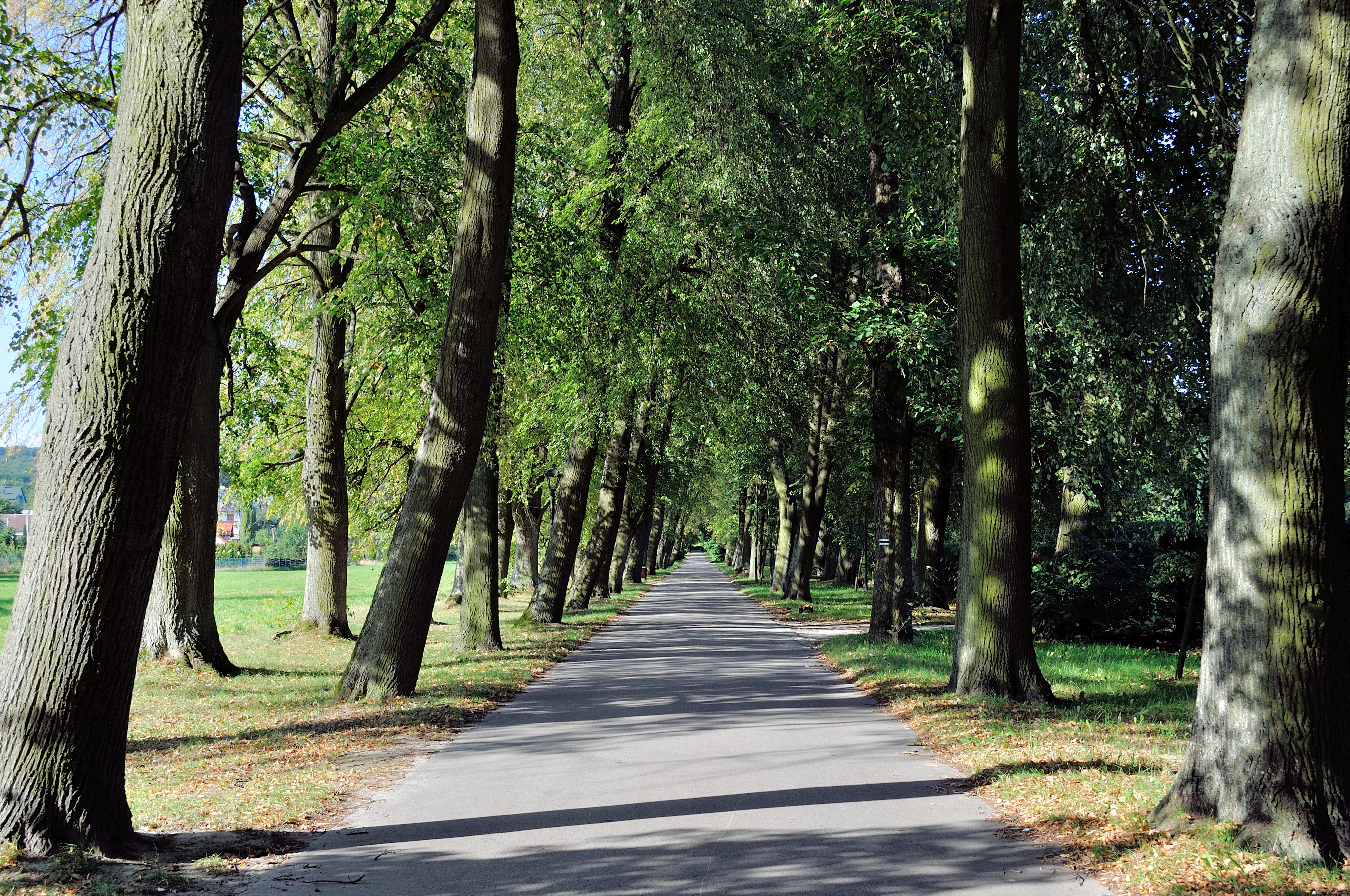
A straight paved path lined with tall, mature linden trees creating a canopy over the walkway.
A shaded linden tree alley in Oblegorek, within the Suchedniowsko-Oblegorski landscape park.

Suchedniowsko-Oblęgorski Landscape Park history and protected-area timeline

The Suchedniowsko-Oblęgorski Landscape Park was formally established on 10 June 1988 through Resolution No. XXVIII/279/88 of the Voivodeship National Council in Kielce. Its creation reflected a long-standing recognition that the forests, river sources, and industrial relics of the western Suchedniowski Plateau and the surrounding hill ranges deserved unified protection.

The underlying cultural reason for the park's protection is older than the designation itself. The territory lies at the heart of the Staropolskie Industrial District, one of the earliest centers of iron and non-ferrous metal metallurgy in Poland. From the medieval period onward, local smelters and mining operations reshaped forests, watercourses, and settlement patterns, leaving behind a distinctive archaeological layer of blast furnaces, ironworks, and supporting infrastructure at sites such as Samsonów, Bobrza, and Kuźniaki.

Set against that industrial legacy, the 1988 park designation reframed the area as a place where natural values, hydrological importance, and industrial heritage could be managed together. Strict nature reserves had already been created to safeguard the most outstanding forest stands, including those at Świnia Góra, Dalejów, Bliżyńskie Lasy Naturalne, Górna Krasna, and others. The resulting park preserves a landscape where centuries of human industry coexist with native woodlands, river headwaters, and cultural landmarks such as the Oblęgorek estate linked to the novelist Henryk Sienkiewicz.

Suchedniowsko-Oblęgorski Landscape Park landscape and geographic character

The park's terrain is shaped by the meeting of plateau and hill country in the northern part of the Świętokrzyskie region. The western Suchedniowski Plateau contributes broad, gently undulating uplands, while the Kołomańskie, Tumlińskie, and Oblęgorskie ranges introduce more pronounced ridges and valleys. Siniewska Góra, reaching about 448.8 meters above sea level within the Oblęgorskie Range, is the highest point and provides a visible landmark above the surrounding forests.

Sandstone geology is locally important, expressed in the tumlińskie sandstone exposures at Ciosowa, where erosion has revealed layered rock faces of interest to geologists and visitors. River valleys cut through the plateau and ranges, draining a network of small streams whose headwaters converge around the park. Forests close the visual envelope across most of the area, giving the landscape a heavily wooded character broken by clearings around villages, former metallurgical sites, and historic estates such as Oblęgorek.

Suchedniowsko-Oblęgorski Landscape Park ecosystems, habitats, and plant life

Forests define the ecological identity of Suchedniowsko-Oblęgorski Landscape Park, covering roughly 91 percent of its surface. They grow on fertile soils that support a rich mixture of tree species and a multilayered understory. Among the most prized elements are native stands of Polish larch, a tree treated as a particular natural treasure of this part of Poland and protected within the park's forest communities.

The ground layer hosts many species of vascular plants that benefit from full or partial legal protection, reflecting the combination of fertile habitats, varied topography, and long continuity of forest cover. Several nature reserves, including Świnia Góra, Dalejów, Bliżyńskie Lasy Naturalne, Bliżyn - Kopalnia Ludwik, Górna Krasna, Perzowa Góra, and Barania Góra, capture the most valuable forest fragments, while reserves in the buffer zone extend protection to additional woodland and geological sites. The result is a landscape park whose ecological value rests primarily on the richness and quality of its forest habitats rather than on open or alpine environments.

Suchedniowsko-Oblęgorski Landscape Park wildlife and species highlights

The dense, largely continuous forest cover of the park provides habitat for forest-interior bird species, mammals typical of central European mixed and coniferous woodlands, and a wide range of understory invertebrates supported by the rich vascular plant flora. Highlight sites such as the reserves at Świnia Góra, Dalejów, Górna Krasna, and Barania Góra concentrate some of the most ecologically valuable woodland communities, where species composition, age structure, and deadwood presence favor conservation-sensitive fauna.

River headwaters of the Krasna, Bobrza, and Kamionka add aquatic and riparian elements to the wildlife profile, supporting fish, amphibians, and invertebrates in narrow, shaded stream corridors. Although the park is not primarily known for charismatic megafauna, its combination of extensive native woodland, protected reserves, and protected plant species gives it strong biodiversity value within the regional context of central Poland.

Suchedniowsko-Oblęgorski Landscape Park conservation status and protection priorities

The park's principal conservation significance lies in its large, connected blocks of native forest on fertile soils, including rare stands of Polish larch that have been recognized as a special natural asset. By placing close to 19,900 hectares under landscape-level protection and adding a buffer zone of more than 27,500 hectares, the designation secures ecological continuity across the Suchedniowski Plateau and the adjacent hill ranges.

Hydrologically, the park acts as a source protection area for the Krasna, Bobrza, and Kamionka rivers, helping to safeguard water quality and flow regimes at the headwaters of these regional streams. Strict reserves within and around the park concentrate protection on the most valuable forest fragments and geological features, while the broader landscape park status regulates land use across the surrounding gminas. Managed by the Zespół Świętokrzyskich i Nadnidziańskich Parków Krajobrazowych, the area forms an important node in the regional network of protected landscapes in Świętokrzyskie.

Suchedniowsko-Oblęgorski Landscape Park cultural meaning and human context

The park's cultural identity is inseparable from the legacy of the Staropolskie Industrial District, one of the earliest centers of iron and non-ferrous metallurgy in Poland. The landscape holds visible reminders of this past in the form of ruined blast furnaces and ironworks at Samsonów, the remains of a large smelting complex at Bobrza with its imposing retaining wall, and the surviving furnace structures at Kuźniaki. These industrial-archaeological sites sit within an otherwise forested setting, illustrating the long interaction between human industry and forest resources in the region.

Sacred and secular architecture complements the industrial heritage across the villages within and around the park. The Oblęgorek landscape and park complex in the Oblęgorskie Range is perhaps the most prominent cultural landmark, housing a museum dedicated to Henryk Sienkiewicz, the Nobel Prize-winning novelist who once owned the estate. Natural monuments such as the Bart Oak near Zagnańsk and the tumlińskie sandstone outcrop at Ciosowa further enrich the cultural and natural heritage associated with the protected area.

Top sights and standout views in Suchedniowsko-Oblęgorski Landscape Park

Nearly 91 percent forest cover on fertile soils, including valued native Polish larch stands, sets this park apart within Świętokrzyskie. A network of seven associated strict nature reserves concentrates protection on the most valuable woodland and geological sites, including Świnia Góra, Dalejów, Górna Krasna, and Barania Góra.

Cultural highlights are equally distinctive: ruins of the historic Staropolskie iron industry at Samsonów, Bobrza, and Kuźniaki, the Oblęgorek estate museum of Henryk Sienkiewicz, and the celebrated Bart Oak near Zagnańsk give the protected landscape a layered human story. The park's role as a source area for the Krasna, Bobrza, and Kamionka rivers adds a quiet but important hydrological dimension.

Best time to visit Suchedniowsko-Oblęgorski Landscape Park

Late spring and early summer are favorable for experiencing the park's broadleaf and mixed forests in full leaf, when herbaceous plants in the forest floor are most visible and larch stands show fresh growth. Early autumn brings color change across the deciduous woodlands and generally stable weather for walking the longer trails that connect the Oblęgorskie Range reserves, the industrial heritage sites, and the Oblęgorek estate.

Winter visits can also have their own character, when deciduous trees drop their leaves and the outlines of ridges like the Oblęgorskie Range and the higher slopes such as Siniewska Góra become more visible above the snow line. Because the park is heavily forested and locally hilly, visitors planning to explore on foot should generally favor mild, dry conditions regardless of season.

Monthly climate preview

Long-term temperature ranges and monthly precipitation patterns across representative terrain

Suchedniowsko-Oblęgorski Park Krajobrazowy Climate Normals and Weather by Month

Suchedniowsko-Oblęgorski Park Krajobrazowy exhibits a measured annual temperature and precipitation rhythm spanning long-term averages from NASA observations. Detailed monthly data profiles supply comprehensive temperature minimums and precipitation totals across the protected landscape.
Annual mean8 °C
-4 °C20 °C
Jan-4°
Feb-2°
Mar
Apr
May14°
Jun17°
Jul20°
Aug19°
Sep14°
Oct
Nov
Dec-2°
Warmest month
July

19.8 °C

Coolest month
January

-3.8 °C

Wettest month
July

2.9 mm/day

Driest month
January

1.3 mm/day

Park location guide

Geography guide, regional context, and park location map for Suchedniowsko-Oblęgorski Landscape Park

Suchedniowsko-Oblęgorski Landscape Park park geography, regions, and map view in Poland

Understand where Suchedniowsko-Oblęgorski Landscape Park sits in Poland through a broader geographic reading of the surrounding landscape, nearby location context, and its mapped position within the national park landscape.

How Suchedniowsko-Oblęgorski Landscape Park fits into Poland

Poland, officially the Republic of Poland, is a Central European country spanning from the Baltic Sea in the north to the Carpathian Mountains in the south. It borders Germany, Czech Republic, Slovakia, Ukraine, Belarus, Lithuania, and Kaliningrad Oblast. The country has a temperate climate, diverse landscapes, and is known for its rich history, cultural heritage, and strong economic position within the EU.

Wider geography shaping Suchedniowsko-Oblęgorski Landscape Park in Poland

Poland occupies 312,696 km2 in Central Europe, extending from the Baltic Sea coast in the north to the Sudetes and Carpathian Mountains in the south. It borders Germany to the west, Czech Republic and Slovakia to the south, Ukraine and Belarus to the east, and Lithuania and Kaliningrad Oblast to the northeast. The landscape includes lowland plains, uplands, and mountain ranges.

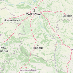
Map view of Suchedniowsko-Oblęgorski Landscape Park

Use this park location map to pinpoint Suchedniowsko-Oblęgorski Landscape Park in Poland, understand its exact geographic position, and read its mapped placement within the surrounding landscape more clearly.

Pigeon | © OpenStreetMap contributors

Location context for Suchedniowsko-Oblęgorski Landscape Park

Świętokrzyskie Voivodeship
Natural feature types

Browse the Natural Landscape Collection for Suchedniowsko-Oblęgorski Park Krajobrazowy

Investigate the detailed geography of Suchedniowsko-Oblęgorski Park Krajobrazowy by browsing its documented natural features. This MoriAtlas resource provides insight into the plateau, hilly ridges, and river headwaters that define the ecological identity of this protected area.
Recorded earthquake history

Review Recorded Seismic Activity for Suchedniowsko-Oblęgorski Park Krajobrazowy

Examine the historical earthquake catalogue for Suchedniowsko-Oblęgorski Park Krajobrazowy through MoriAtlas. Browse event records including magnitude and epicentre distance to understand the documented seismic context of this protected landscape.

Suchedniowsko-Oblęgorski Park Earthquake History

Catalogued events

12 events

Strongest magnitude

Magnitude 3.3

Most recent event

Aug 21, 1996

This history includes earthquakes recorded inside the park or within 50 km of its borders

Visual exploration of plateau forests, hill ranges, and protected terrain

Suchedniowsko-Oblęgorski Park Krajobrazowy Photos and Landscapes

Visual records capture the dense forest canopies, sandstone formations, and rugged hill terrain that define Suchedniowsko-Oblęgorski Park Krajobrazowy. Detailed photography reveals the unique ecological character and historical industrial remnants preserved across the protected landscape.

A straight paved path lined with tall, mature linden trees creating a canopy over the walkway.

Park atlas

Compare adjacent plateau terrain and woodland reserves across central southern Poland

Other Parks Near Suchedniowsko-Oblęgorski Park Krajobrazowy and Surrounding Protected Landscapes

Browsing nearby protected areas allows visitors to evaluate similar plateau topography, forest ecosystems, and regional river headwaters found around Suchedniowsko-Oblęgorski Park Krajobrazowy. Expanding the geographic comparison provides a clearer picture of the wider Świętokrzyskie natural and industrial heritage landscape.
Watercolor illustration of rolling hills with green forests in the foreground and purple, green, pink, and yellow mountain ranges in the background
National parkŚwiętokrzyskie Voivodeship
4.6 km away#1 closest

Southeast

Świętokrzyski National Park: Protected Mountain Terrain in Świętokrzyskie Voivodeship

Geography and landscape mapping for Poland's oldest mountain range

Świętokrzyski National Park encompasses the highest ridges of the Świętokrzyskie Mountains, showcasing a landscape defined by expansive granite boulder fields and primeval fir forests. This atlas entry provides a detailed look at the park's topography, ranging from the prominent Łysica peak to the protected valley floors, highlighting the geological and biological diversity preserved within this central Polish sanctuary.

Area
76.26 km²
Established
1950
IUCN
II
Visitors
168K annual
National parkŚwiętokrzyskie Voivodeship
4.6 km away#2 closest

Southeast

Świętokrzyski Park Narodowy: Protected Forests and Mountain Geography in Central Poland

A preserved landscape of ancient fir forests and rubble fields

Situated within the Świętokrzyskie Voivodeship, this protected area guards the Łysogóry range and its rare forest associations. The landscape is characterized by its dramatic gołoborza rubble fields and dense mixed-woodland terrain, providing a unique look into the natural geography of the region.

Area
76.26 km²
Established
1950
Visitors
168K annual
Relief
Mountain
Nature reserveświętokrzyskie
8 km away#3 closest

South

Ostoja Wierzejska Nature Reserve: Protected Forest and Ridge Geography in Świętokrzyskie

Ecological corridors and rare fir forest habitat mapping

Uncover the landscape characteristics of Ostoja Wierzejska, a protected area in Poland featuring quartzite ridges and diverse forest ecosystems. The reserve acts as a crucial ecological link within the Masłowskie Range, sheltering mature tree stands, rare fungi, and specialized invertebrates that define the unique phytosociology of the Świętokrzyskie Mountains.

Area
2.25 km²
Established
2011
Relief
Mountain
Climate
Temperate
Protected landscapeŚwiętokrzyskie Voivodeship
8.3 km away#4 closest

Southwest

Chęcińsko-Kielecki Park Krajobrazowy: Protected Landscapes and Geological Atlas

Geographical overview of the Świętokrzyskie foothills in Poland

Located in the Świętokrzyskie Voivodeship, this protected area features a unique concentration of rocky hill summits, limestone caves, and forested corridors. The landscape serves as a vital transition zone, linking the regional capital of Kielce with traditional agricultural valleys and historic cultural landmarks. Map the terrain and understand the protected features that define this significant Polish landscape park.

Area
197.816 km²
Established
1996
Relief
Upland
Climate
Temperate
Nature reserveŚwiętokrzyskie Voivodeship
About 10 km away#5 closest

Southwest

Rezerwat przyrody Moczydło Nature Reserve: Geological and Mining Landscape in Poland

Documenting protected limestone ridges and mining heritage

This protected area safeguards a distinct 317-meter limestone hill that preserves both ancient mining remnants and rare xerothermic grasslands. Located within the Chęcińsko-Kielecki Landscape Park, the site provides a concentrated view of the regional geological identity and industrial past of the Holy Cross Mountains, documented here through its specific mapped boundaries and natural terrain features.

Area
0.164 km²
Established
1995
Relief
Mountain
Scope
Terrestrial
Protected areaŚwiętokrzyskie Voivodeship
15 km away#6 closest

East

Wzgórza Kunowskie: Geographic Atlas of an Essential Polish Protected Area and Habitat Mosaic

Mapping riparian forests and inland dunes in Świętokrzyskie

Wzgórza Kunowskie serves as a crucial Natura 2000 site in Poland, blending sand grasslands, oak-hornbeam forests, and riverine floodplains within a compact landscape. This overview analyzes the topographical gradients and habitat distribution that define the area, from elevated dunes to the moisture-rich valley floors of the Świętokrzyskie region, reflecting the interplay between sandy substrate and river regulation.

Area
18.687 km²
Water
Major water bodies
Nature reserveświętokrzyskie
About 16 km away#7 closest

Southwest

Rezerwat przyrody Milechowy: Protected Nature Reserve and Karst Landscape Atlas

Exploration of forested ridges and rocky karst terrain in świętokrzyskie, Poland

Rezerwat przyrody Milechowy is a significant nature reserve located in the świętokrzyskie voivodeship, home to diverse ecological habitats ranging from dense woodland ridges to exposed rocky slopes. The area is defined by its karst landscape, featuring multiple caves and rock shelters, alongside rare xerothermic vegetation that flourishes in the warm, sun-exposed terrain of the Holy Cross Mountains region.

Area
1.323 km²
Established
1978
Relief
Upland
Climate
Temperate
Protected landscapeŚwiętokrzyskie Voivodeship
21 km away#8 closest

Southeast

Cisowsko-Orłowiński Park Krajobrazowy: Protected Landscape and Geological Atlas

Mapping biodiversity and Paleozoic formations in Świętokrzyskie, Poland

Cisowsko-Orłowiński Park Krajobrazowy stands as a center for biodiversity in southeastern Poland, protecting rare peat-bog forests and 200-year-old tree stands. This atlas profile highlights the park's distinct geological character, from the volcanic rock exposures at Sieraków to the fossil-rich sandstone cliffs at Zalesie, offering insight into the complex mosaic of the Góry Świętokrzyskie foothills.

Area
206.93 km²
Established
1988
Relief
Mountain
Climate
Temperate

Common questions about visiting, size, designation, and location context for Suchedniowsko-Oblęgorski Landscape Park

Suchedniowsko-Oblęgorski Landscape Park FAQs for park facts, access, geography, and protected area context

Find quick answers about Suchedniowsko-Oblęgorski Landscape Park, including protected-area facts, park geography, trail and visitor context, and how the park fits into its surrounding country and regional landscape.
MoriAtlas Explorer

Continue Your Protected Areas Search Across the Global Atlas

Deepen your exploration by continuing the structured search for national parks and protected areas worldwide. Utilize the comprehensive filtering capabilities to compare different conservation landscapes and refine your understanding of global park geography. Discover more about the distribution and characteristics of protected natural areas.

Global natural geography