
Mori Atlas logo
Nature reserveSüdliche Burgberghänge, Weinberge bei Holenberg und Rühle

Examining the calcareous beech forests and rare orchid habitats of the Solling foothills

Südliche Burgberghänge, Weinberge bei Holenberg und Rühle: A Protected Landscape in Holzminden

(Südliche Burgberghänge, Weinberge bei Holenberg und Rühle (Naturschutzgebiet NSG HA 166))

Südliche Burgberghänge, Weinberge bei Holenberg und Rühle encompasses a distinctive mosaic of calcareous grasslands, old-growth beech forests, and riparian corridors within the Holzminden district. This protected area showcases a complex substrate transition from Lower Muschelkalk limestone to Röt-formation sandstone, supporting diverse orchid flora and woodland specialists like the European wildcat and rare bat species. The reserve acts as a critical link in regional conservation, maintaining habitat integrity across its small-scale, high-biodiversity terrain.

nature reservecalcareous beech forestdry grasslandsemi-dry grasslandorchid habitatlime soil
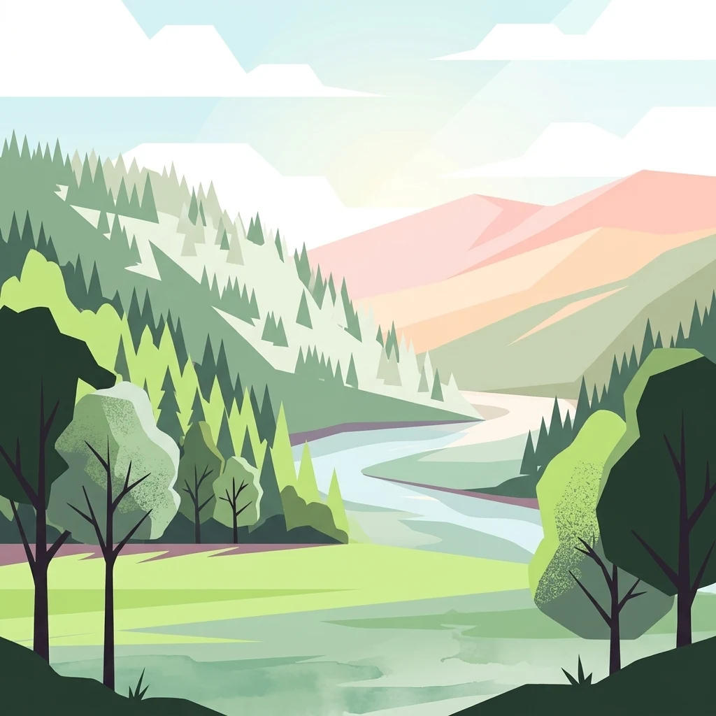
A flat-design, vector-style illustration of a river valley with forested hills, meadows, and mountains in the distance, rendered in soft green and pink tones.

Südliche Burgberghänge, Weinberge bei Holenberg und Rühle

Nature reserve

Park overview

Structured park overview, official facts, and landscape profile for Südliche Burgberghänge, Weinberge bei Holenberg und Rühle

Südliche Burgberghänge, Weinberge bei Holenberg und Rühle park facts, protected area profile, and essential visitor context

Review the core facts for Südliche Burgberghänge, Weinberge bei Holenberg und Rühle, including designation, size, terrain, visitor scale, habitats, and operating context in one park-focused overview.

About Südliche Burgberghänge, Weinberge bei Holenberg und Rühle

Südliche Burgberghänge, Weinberge bei Holenberg und Rühle is a small but ecologically rich nature reserve in the southern Solling foreland of Lower Saxony. Its three component areas form a chain of south-facing slopes and associated valleys along the northern fringe of the Weser Uplands, resting mainly on calcareous Lower Muschelkalk bedrock. The combination of limestone soils, warm exposures, and a long history of traditional, low-intensity land use has produced the kind of small-scale mosaic of woodland, shrubby margins, calcareous grassland, and extensively managed meadows that has become rare across much of lowland Germany.

The woodland communities are dominated by European beech, with oak-hornbeam stands on slightly wetter or more nutrient-rich ground. These stands carry unusually rich herb layers, particularly in the orchid-rich limestone beech variant, where characteristic ground flora includes common cowslip, hollowroot, sweet woodruff, yellow wood anemone, hepatica, wood violet, and several Solomon's seal and sedge species. Along the Bremke brook, narrow strips of alder-ash floodplain woodland add a different structural and floristic element to the otherwise dry, exposed habitats.

Around and between the woodland blocks, the reserve preserves significant areas of dry calcareous grassland, semi-dry grassland, and juniper- and shrub-encroached dry grassland on shallow soils. The dry grasslands are of particular importance for orchids and for grassland-specialist butterflies and reptiles. Less steep lower slopes retain hay meadows and extensively grazed pastures rich in typical meadow species. Because the habitats are tightly interwoven and lie within a single planning unit, the reserve has a strong profile as a refuge for species that depend on this exact combination of woodland, edge, and open calcareous habitat.

Quick facts and research context for Südliche Burgberghänge, Weinberge bei Holenberg und Rühle

Südliche Burgberghänge, Weinberge bei Holenberg und Rühle is a Lower Saxon Naturschutzgebiet (designation code NSG HA 166) in the Holzminden district, northeast of Holzminden within the Naturpark Solling-Vogler. The full reserve covers about 177 ha and was formally designated on 10 December 2020, joining three formerly independent protected sites into a single management unit.

The reserve sits within the Solling foreland (Sollingvorland) and is primarily underlain by Lower Muschelkalk limestone, with Röt sandstone influences on parts of the largest sub-area. It is integrated into the EU Habitats Directive site Burgberg, Heinsener Klippen, Rühler Schweiz and partly overlaps the EU Birds Directive site Sollingvorland, giving it both national and European-level conservation recognition.

Protection and recognition

Documented terrestrial protection scope and established designation records for conservation geography

Protection Status and Designation History for Südliche Burgberghänge, Weinberge bei Holenberg und Rühle

Terrestrial protection status for Südliche Burgberghänge, Weinberge bei Holenberg und Rühle dates to the established designation year of 2020. Conservation records outline the recorded management framework without international recognition sources.

Protection details

Protection scope
Terrestrial
Designated year
2020
Transboundary protection
No
Park context

Deeper park guide and search-rich context for Südliche Burgberghänge, Weinberge bei Holenberg und Rühle

Südliche Burgberghänge, Weinberge bei Holenberg und Rühle history, landscape, wildlife, and travel context

Explore Südliche Burgberghänge, Weinberge bei Holenberg und Rühle through its history, landscape character, ecosystems, wildlife, conservation priorities, cultural context, and seasonal travel timing in a structured park guide built for atlas discovery and search intent.

Why Südliche Burgberghänge, Weinberge bei Holenberg und Rühle stands out

The reserve is best known for its calcareous beech forests of the Waldmeister and Orchideen-Kalk-Buchenwald types, which clothe the south-facing Muschelkalk slopes, and for its open dry and semi-dry grasslands that host an exceptional concentration of wild orchids, including bee orchid, fly orchid, musk orchid, and several orchid species of regional rarity. It is also recognized for its high proportion of old and dead wood in the woodland stands, supporting specialist fauna such as the European wildcat, hazel dormouse, Greater Mouse-eared Bat, and woodland bird species including black stork, black woodpecker, grey-headed woodpecker, red and black kites, and Eurasian eagle-owl.
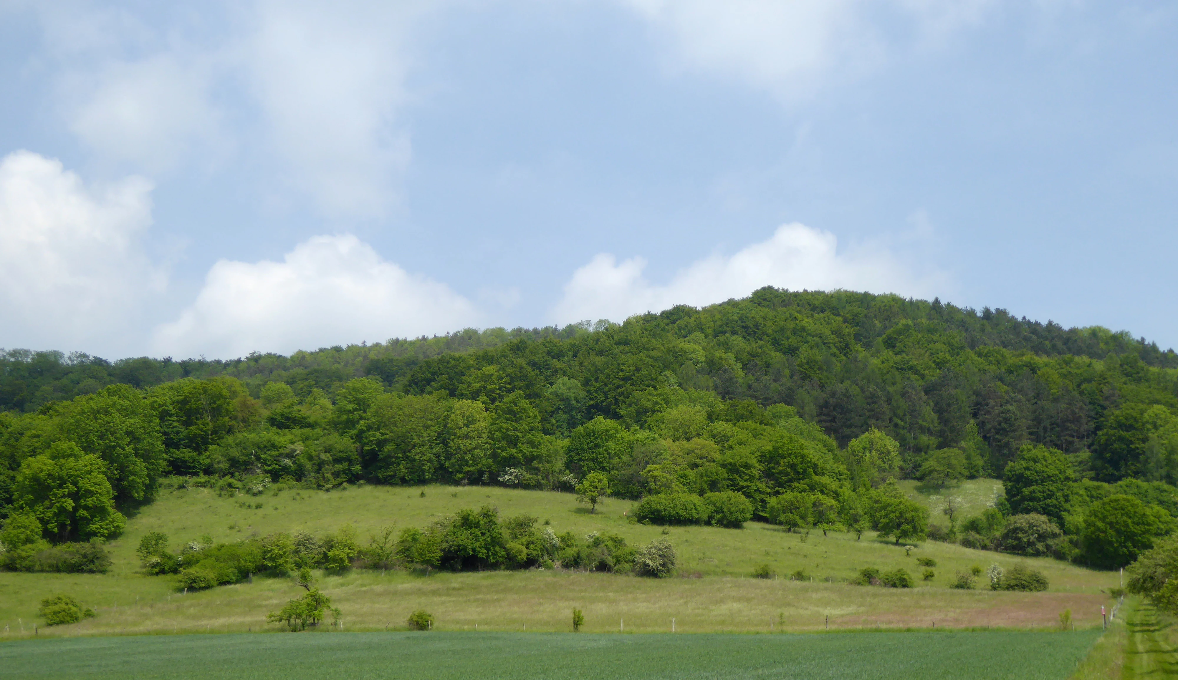
A wide landscape view of rolling green hills covered in forests and meadows under a blue sky with soft clouds.
A scenic view of the hillside meadows and forest slopes at the Südliche Burgberghänge nature reserve.

Südliche Burgberghänge, Weinberge bei Holenberg und Rühle history and protected-area timeline

The present nature reserve was formally designated on 10 December 2020 under Lower Saxony's nature conservation framework, with the responsible authority being the Holzminden district as the lower nature conservation authority. It was created by merging three previously independent protected sites: the larger Südliche Burgberghänge reserve, the vineyard-like Weinberg bei Holenberg, and the smaller Weinberg bei Rühle, which had previously been managed as separate entities despite their geographic and ecological continuity.

The current protected designation is the institutional continuation of earlier recognition: the site is already part of the EU Habitats Directive area Burgberg, Heinsener Klippen, Rühler Schweiz, and parts of it are included in the EU Birds Directive site Sollingvorland. The 2020 consolidation brought the national nature reserve status into alignment with the area's existing European-level designations and standardized it under a single code, NSG HA 166, covering about 177 hectares. Schloss Bevern is referenced on one of the local sub-area pages, and the broader cultural fabric of the landscape is shaped by centuries of vineyard and traditional woodland use on limestone and sandstone slopes around Bevern, Golmbach, Holenberg, and Bodenwerder.

Südliche Burgberghänge, Weinberge bei Holenberg und Rühle landscape and geographic character

The reserve sits in gently to moderately sloping terrain of the Solling foreland, characterized by south- to southwest-facing hillsides and small incised valleys. The dominant geological substrate is Lower Muschelkalk limestone, producing shallow, stony, base-rich soils on the upper slopes; in the largest sub-area, parts of the woodland on north-facing slopes shift to the red-colored Röt-Formation of the Upper Buntsandstein, giving a clearly visible substrate transition within the same hillside.

The western edge of the Weinberg bei Holenberg sub-area follows the Bremke brook, fed by a spring rising beneath the Weinberg hill, and this small stream corridor introduces a narrow alluvial strip into an otherwise dry, exposed landscape. The topography creates a strong microclimatic gradient: the steep, sunny, dry slopes favor open grassland and thermophilic woodland, while the shallower lower slopes, the shaded valley floor, and the northwest-facing sandstone slopes retain more mesic woodland. Within the surrounding Naturpark Solling-Vogler, the reserve forms a small but distinctive calcareous pocket in a region whose name is more typically associated with deeper, acidic forest soils.

Südliche Burgberghänge, Weinberge bei Holenberg und Rühle ecosystems, habitats, and plant life

Ecologically, the reserve is defined by the interplay between calcareous woodland, dry open grassland, and extensive meadow habitats on a shared base-rich substrate. The woodland mosaic is dominated by near-natural beech forests of the Waldmeister-Buchenwald type and Orchideen-Kalk-Buchenwald type, interspersed with oak-hornbeam stands carrying ash, wild cherry, sycamore maple, small-leaved lime, wild service tree, field maple, and scattered yew. These stands are notable for their high volume of old and dead wood, a structural feature that strongly shapes the reserve's fauna.

The open dry and semi-dry grasslands (Trocken- und Magerrasen) form a second pillar of the reserve's identity. They host a remarkable orchid flora and a typical ensemble of calcareous grassland herbs and grasses, including several gentian species, mountain germander, dropwort, and a range of sedges and fescues. Some of the drier stands are encroaching into juniper scrub with hawthorn, blackthorn, dog rose, and wayfaring shrub, creating the kind of edge-rich structure that supports many specialist invertebrates. On less steep ground, species-rich flat-country hay meadows (magere Flachland-Mähwiesen) and extensively grazed pastures contribute a third, more mesic grassland layer, with typical meadow species such as oxeye daisy, devil's-bit scabious, meadow clary, great burnet, and cowslip.

Südliche Burgberghänge, Weinberge bei Holenberg und Rühle wildlife and species highlights

The reserve supports a fauna that mirrors its habitat mosaic. Woodland species of note include the European wildcat and the hazel dormouse, both of which depend on the structural complexity and old-growth character of the beech and oak-hornbeam stands. Bats are well represented, with the Greater Mouse-eared Bat specifically recorded alongside other bat species that use old trees and roost in mature woodland stands or nearby structures.

Birds are a particularly prominent component: breeding or regularly occurring species include Eurasian eagle-owl, red and black kites, peregrine falcon, black stork, black woodpecker, grey-headed woodpecker, and red-backed shrike, together with a broader community of woodland and edge specialists. The dry grasslands are important for reptiles such as the sand lizard and the smooth snake, and for butterflies, where the reserve's combination of host plants and warm microclimate supports species like the scarce swallowtail, the marsh fritillary relatives on knapweeds and scabiouses, the gentian blue, the small blue, and the cowslip chequered blue. The amphibian fauna is documented by the northern crested newt, reflecting the wetter microhabitats along the Bremke brook.

Südliche Burgberghänge, Weinberge bei Holenberg und Rühle conservation status and protection priorities

The reserve's main conservation value lies in its integrated protection of a small but unusually diverse calcareous habitat complex. As a designated Naturschutzgebiet, it carries the strongest national-level protection available under Lower Saxon law, and as part of the EU Habitats Directive site Burgberg, Heinsener Klippen, Rühler Schweiz and the EU Birds Directive site Sollingvorland, it contributes to internationally important habitat and species networks.

Its specific conservation significance rests on the preservation of two habitat types that have become scarce in lowland Germany: near-natural beech forests with high deadwood volumes, and calcareous dry and semi-dry grasslands rich in orchids and butterflies. The 2020 designation, by merging three earlier reserves, strengthens this conservation value by creating a coherent management unit that can handle the ecological gradients between forest, edge, dry grassland, and meadow rather than treating them as isolated fragments. The high deadwood content of the woodlands, the presence of key species such as wildcat and Greater Mouse-eared Bat, and the orchid richness of the open habitats together mark the area as an important reference site for calcareous woodland and dry-grassland conservation in northwestern German lowlands.

Südliche Burgberghänge, Weinberge bei Holenberg und Rühle cultural meaning and human context

The area's cultural landscape carries long traces of human land use. The sub-area names Weinberg bei Holenberg and Weinberg bei Rühle refer to historical vineyards on these south-facing, limestone-rich slopes, reminding visitors that this landscape was once partly shaped by viticulture before climate and economics shifted land use toward woodland, grassland, pasture, and small-scale forestry. The location within the Naturpark Solling-Vogler places the reserve in a region where traditional lower-mountain landscapes, older farming patterns, and small village communities such as Bevern, Golmbach, Holenberg, and Bodenwerder remain closely tied to the surrounding countryside.

The reserve also has a strong heritage setting: Schloss Bevern, a baroque residence, is referenced on one of the local sub-area pages and exemplifies how castle sites, villages, and the surrounding forested hilly slopes belong to the same historical settlement framework. The fields and parcels of the protected area reflect centuries of grazing, hay-cutting, and selective woodland management that continue to influence the structure of both the forests and the grasslands seen today.

Top sights and standout views in Südliche Burgberghänge, Weinberge bei Holenberg und Rühle

A notable concentration of calcareous beech forest variants, including the orchid-rich Orchideen-Kalk-Buchenwald, on shallow Lower Muschelkalk soils forms the backbone of the reserve's woodland identity. The integration of Sollingvorland lies in the EU Habitats Directive site and partially in the EU Birds Directive site, linking national protection to a wider European conservation framework. A real feature of the area is the unusually high old- and deadwood share in the forests, which supports a specialist fauna including European wildcat, Greater Mouse-eared Bat, and several bat species, alongside breeding woodland birds such as black stork, black woodpecker, and grey-headed woodpecker.

The dry and semi-dry calcareous grasslands host a remarkable orchid flora, with species such as bee orchid, fly orchid, musk orchid, and several others of regional rarity, and an associated butterfly community that ties the site to broader calcareous grassland conservation in Germany. The Bremke brook corridor adds narrow alluvial woodland and amphibian habitat, including the northern crested newt, completing an unusually complete small-scale mosaic for a reserve of this size.

Best time to visit Südliche Burgberghänge, Weinberge bei Holenberg und Rühle

The reserve's appeal shifts with the seasons in ways that reflect the flowering rhythms of its two main habitat types. In late winter and early spring, the beech forests come alive with spring geophytes such as hollowroot, yellow wood anemone, hepatica, common cowslip, and wild garlic, and the woodland ground layer is at its most visually striking. Late spring and early summer, roughly from May into June, is the prime period for the calcareous grasslands, when many of the orchid species flower and when the heat-loving butterfly species become most active on the warm south-facing slopes.

High summer brings the richest array of meadow flowers in the hay meadows and extensively grazed pastures, while the dry grasslands take on warmer, more tawny tones as grasses and herbs set seed. Late summer and autumn lighting over the south-facing slopes can be particularly atmospheric for landscape appreciation, although the conservation value of the open habitats is greatest earlier in the season. The reserve is not a tourist destination in the conventional sense and is experienced primarily as a quiet, low-traffic area for nature observation on foot.

Monthly climate preview

Long term annual temperature ranges and monthly precipitation patterns across representative terrain

Südliche Burgberghänge, Weinberge bei Holenberg und Rühle Climate and Weather Normals

Historical measurements record average monthly temperatures ranging from subzero minimums to warm summer maximums alongside steady daily precipitation across the representative coordinate. Examining the complete twelve month profile provides deeper insight into measured long term climate norms for this protected area.
Annual mean9 °C
0 °C18 °C
Jan
Feb
Mar
Apr
May12°
Jun16°
Jul18°
Aug18°
Sep14°
Oct
Nov
Dec
Warmest month
July

17.8 °C

Coolest month
January

0 °C

Wettest month
July

2.6 mm/day

Driest month
April

1.6 mm/day

Park location guide

Geography guide, regional context, and park location map for Südliche Burgberghänge, Weinberge bei Holenberg und Rühle

Südliche Burgberghänge, Weinberge bei Holenberg und Rühle park geography, regions, and map view in Germany

Understand where Südliche Burgberghänge, Weinberge bei Holenberg und Rühle sits in Germany through a broader geographic reading of the surrounding landscape, nearby location context, and its mapped position within the national park landscape.

How Südliche Burgberghänge, Weinberge bei Holenberg und Rühle fits into Germany

Germany is a federal republic in Western and Central Europe with a population of over 83 million across sixteen constituent states. It is Europe's largest economy by nominal GDP and a major global exporter and importer. The capital is Berlin, and the country borders Denmark, Poland, Czech Republic, Austria, Switzerland, France, Luxembourg, Belgium, and the Netherlands.

Wider geography shaping Südliche Burgberghänge, Weinberge bei Holenberg und Rühle in Germany

Germany is located in Western and Central Europe, spanning 357,022 km². It borders Denmark to the north, Poland and the Czech Republic to the east, Austria and Switzerland to the south, and France, Luxembourg, Belgium, and the Netherlands to the west. The country has coastlines on the Baltic Sea and North Sea to the north, with the Alps located in the southern region.

Map view of Südliche Burgberghänge, Weinberge bei Holenberg und Rühle

Use this park location map to pinpoint Südliche Burgberghänge, Weinberge bei Holenberg und Rühle in Germany, understand its exact geographic position, and read its mapped placement within the surrounding landscape more clearly.

Pigeon | © OpenStreetMap contributors

Location context for Südliche Burgberghänge, Weinberge bei Holenberg und Rühle

HolzmindenLower Saxony

Visual exploration of calcareous beech forests, dry grasslands, and Solling terrain

Südliche Burgberghänge, Weinberge bei Holenberg und Rühle Photos and Landscapes

Visual documentation of Südliche Burgberghänge, Weinberge bei Holenberg und Rühle reveals the complex mosaic of calcareous beech woodland, sun-exposed dry grassland, and limestone substrate shaping the Solling foothills. Detailed photography allows researchers to examine habitat structures, old-growth deadwood distribution, and regional protected-area characteristics without travel context.

A wide landscape view of rolling green hills covered in forests and meadows under a blue sky with soft clouds.

Park atlas

Compare surrounding regional parks and connected protected landscapes

Other Protected Areas Near Südliche Burgberghänge, Weinberge bei Holenberg und Rühle

Browsing other protected areas near Südliche Burgberghänge, Weinberge bei Holenberg und Rühle reveals broader ecological patterns across the Solling foothills. Extending the geographical comparison helps place local limestone ridges and forest mosaics into wider regional context.
Nature reserveLandkreis Holzminden
About 8.9 km away#1 closest

South

Teiche am Erz- und Finkenbruch im Solling: Protected Nature Reserve and Wetland Geography

Mapped forest ponds and bog-margin habitat in Landkreis Holzminden

Teiche am Erz- und Finkenbruch im Solling comprises a network of forest ponds and peat-moss communities protected within a two-zone nature reserve. Its sheltered position in the Solling range preserves critical habitat for rare dragonfly populations, serving as an essential wetland segment within the larger Solling-Vogler landscape protection area.

Area
0.03 km²
Established
2016
Nature reserveLower Saxony
About 11 km away#2 closest

South

Stuckenstein-Eichen Nature Reserve: Historic Oak Pasture and Beech Forest Landscapes

A preserved woodland territory within the Solling hill range of Lower Saxony

Stuckenstein-Eichen serves as a vital nature reserve and protected landscape in Germany. It is defined by its striking internal contrast between a southern oak pasture woodland, characterized by historic planting grids, and a northern beech forest developing through natural succession. The site provides a compact yet detailed look at the coexistence of cultural history and forest ecology within the broader Solling region.

Area
0.2 km²
Established
1988
IUCN
IV
Relief
Upland
Watercolor painting of a rolling, forested ridge landscape in shades of green, yellow, and soft pink.
Protected areaLower Saxony
About 13 km away#3 closest

North

Ith Protected Area: Mapped Limestone Ridge Geography and Geological Features

Continuous limestone cliff formations in the Lower Saxony uplands

The Ith stands as a major geological landmark in Lower Saxony, featuring a 22 kilometer spine of Upper Jurassic limestone. This protected area preserves a unique collection of cliff crags, dense beech forests, and limestone-dependent plant communities that span the districts of Hameln-Pyrmont and Holzminden.

Relief
Mountain
Climate
Temperate
Access
Access unknown
Scope
Terrestrial
Nature reserveLower Saxony
About 13 km away#4 closest

North

Weserniederung am Heiligenberg: Geography and Protected Area Overview

A rare calcareous spring system in Lower Saxony

Weserniederung am Heiligenberg protects a critical mosaic of spring-fed mires, gallery forests, and riverine woodlands in the Weserbergland of Lower Saxony. This nature reserve serves as an important hub for specialized biodiversity, preserving a rare spring horizon and high-quality floodplain forest habitats that provide nesting grounds for eagle owls and black storks.

Area
0.07 km²
Established
2016
Relief
Upland
Climate
Temperate
Nature reserveLower Saxony
About 19 km away#5 closest

Southeast

Wälder im östlichen Solling Nature Reserve: Regional Geography and Forest Landscape

Protected beech woodland in the Lower Saxony eastern Solling range

Wälder im östlichen Solling is a specialized nature reserve in the German state of Lower Saxony, covering a vast landscape of broadleaf high forest and historical wood-pasture. This atlas entry focuses on its mapped terrain, featuring mature beech stands, alder-ash spring forests, and intact stream ecosystems along the Riepenbach and Wolfsbach, providing a clear view of its ecological boundaries.

Area
14.79 km²
Established
2020
Nature reserveNiedersachsen
About 19 km away#6 closest

South

Wälder im südlichen Solling Nature Reserve: A Detailed Atlas of German Protected Woodlands

Ecological mapping of Niedersachsen's southern Solling forest complexes.

Navigate the protected boundaries and landscape character of Wälder im südlichen Solling. This nature reserve provides an essential study in forest conservation, highlighting the intersection of traditional wood-pasture management and steep, near-natural slope forest ecosystems within the Solling-Vogler upland.

Area
10.16 km²
Established
2020
Relief
Upland
Climate
Temperate
A soft watercolor painting depicting a gentle, winding river flowing through a forested landscape with rolling hills in the background.
Protected landscapeLower Saxony
About 19 km away#7 closest

Southeast

Naturpark Solling-Vogler Protected Landscape: Regional Geography and Mapped Terrain

Extensive forested low-mountain region in Lower Saxony

Naturpark Solling-Vogler acts as a core protected region within the Weserbergland of Lower Saxony. This atlas entry details its dual landscape identity, bridging the wide upland Solling plateau with the sharp, narrow Vogler ridge. Explore the mapped river valleys and woodland habitats that define this important German nature park.

Relief
Mountain
Climate
Temperate
Scope
Terrestrial
Water
Major water bodies
Nature reserveLower Saxony
About 20 km away#8 closest

Southeast

Wälder im Solling bei Lauenberg Nature Reserve: Geographic and Landscape Analysis

Protected oak pasture remnants in the Lower Saxony Solling

Analyze the mapped parcels of Wälder im Solling bei Lauenberg. This protected site integrates old growth oak forest with open meadows and brook corridors, showcasing the unique cultural and ecological legacy of the Solling region in southern Lower Saxony.

Area
3.22 km²
Established
2020

Common questions about visiting, size, designation, and location context for Südliche Burgberghänge, Weinberge bei Holenberg und Rühle

Südliche Burgberghänge, Weinberge bei Holenberg und Rühle FAQs for park facts, access, geography, and protected area context

Find quick answers about Südliche Burgberghänge, Weinberge bei Holenberg und Rühle, including protected-area facts, park geography, trail and visitor context, and how the park fits into its surrounding country and regional landscape.
MoriAtlas Explorer

Continue Your Protected Areas Search Across the Global Atlas

Deepen your exploration by continuing the structured search for national parks and protected areas worldwide. Utilize the comprehensive filtering capabilities to compare different conservation landscapes and refine your understanding of global park geography. Discover more about the distribution and characteristics of protected natural areas.

Global natural geography