
Why Südhänge des Neckartales, Berghänge des Haugenloches, Alte Bildechinger Steige, Altheimer Tal und angrenzende Hochflächen stands out
The protected area is best known for preserving a fine-grained mosaic of forested south-facing slopes and open agricultural land along the upper Neckar valley near Horb. It protects a landscape where woodland, orchards, juniper heaths, and nutrient-poor grasslands interlock across a relatively compact territory, giving a clear picture of the traditional Obere Gäue countryside. It is also recognized for retaining remnants of older, semi-natural land use forms. Juniper heaths (Wacholderheiden) and lean meadows (Magerrasen) that were once maintained through sheep grazing are still present in parts of the area. These elements link the current landscape to broader cultural and ecological patterns of the southwestern German uplands and complement nearby protected sites such as the Wacholderheide Rauschbart landscape protection area and the Kugler Hang nature reserve.
Südhänge des Neckartales, Berghänge des Haugenloches, Alte Bildechinger Steige, Altheimer Tal und angrenzende Hochflächen history and protected-area timeline
The landscape protection area was formally established on 26 July 1965 by order of the Landratsamt Horb. At the time of designation, Horb was administered as a separate district, and the ordinance created one of the many Landschaftsschutzgebiete across Baden-Württemberg under the framework of the federal and state nature conservation laws for protecting visually and ecologically valuable cultural landscapes.
Administrative responsibility for the area was later folded into the larger Landkreis Freudenstadt, and management now rests with the Landratsamt Freudenstadt. The 1965 designation remains the foundational act that ties the area together. It did not arise from a single dramatic conservation event but rather from a recognition that the upper Neckar slopes near Horb retained a high-quality, well-balanced mix of forest and farmland worth preserving from incompatible development.
Since its establishment, the area has functioned less as a strictly regulated reserve and more as a buffer zone of protected countryside. It overlaps in part with the FFH (Flora-Fauna-Habitat) area Horber Neckarhänge and lies alongside nature reserves such as Kugler Hang and Osterhalde, situating the landscape protection area within an evolving regional network of protected sites that has grown more integrated over time.
Südhänge des Neckartales, Berghänge des Haugenloches, Alte Bildechinger Steige, Altheimer Tal und angrenzende Hochflächen landscape and geographic character
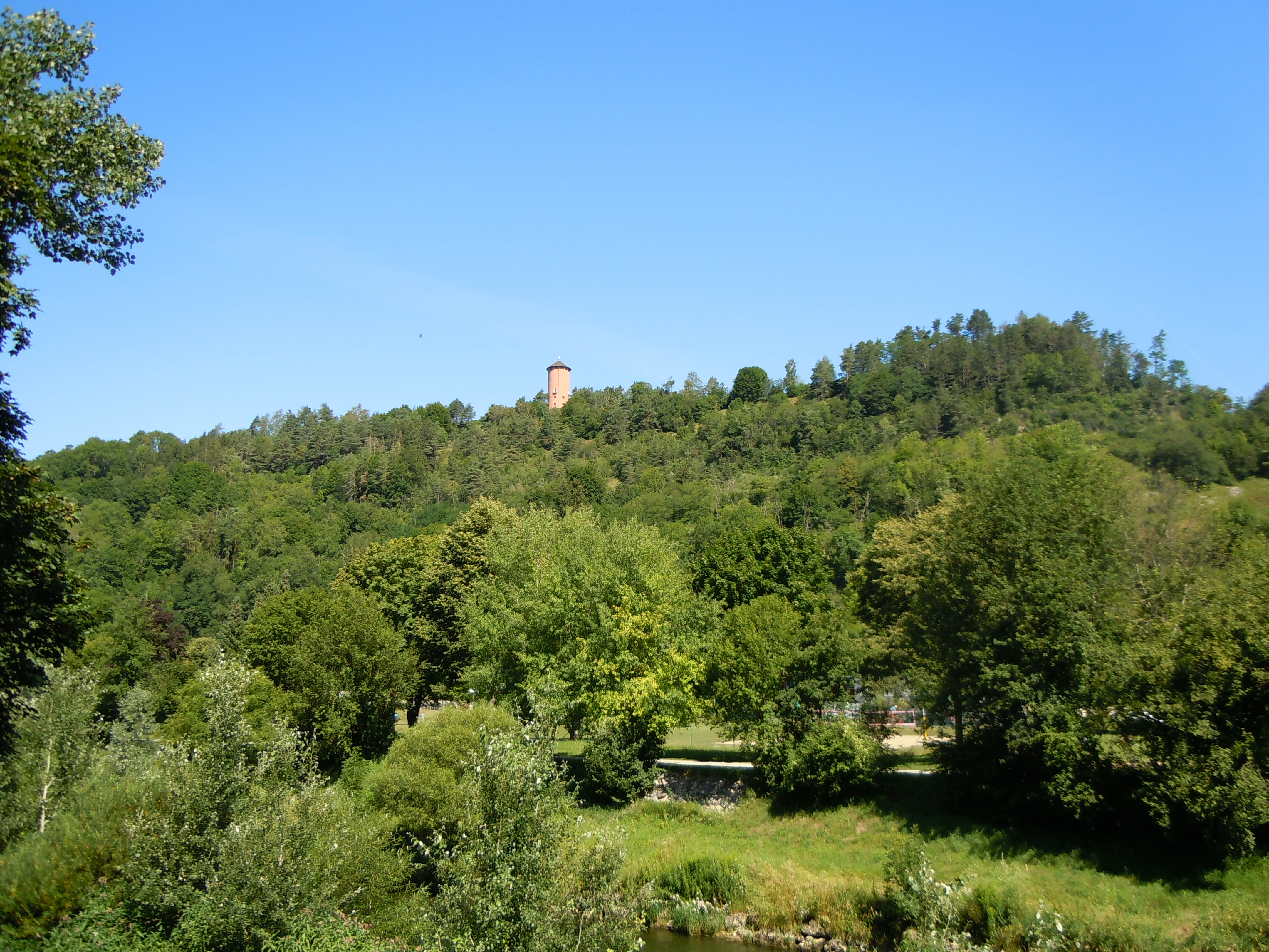
The landscape of Südhänge des Neckartales, Berghänge des Haugenloches, Alte Bildechinger Steige, Altheimer Tal und angrenzende Hochflächen is shaped by the upper Neckar valley and the adjacent high plateaus of the Obere Gäue natural region. Its terrain rises from the river corridor of the Neckar through south-facing slopes, including the hillsides around the Haugenloche, up onto the broader upland surface that frames the valley.
The slopes are the dominant visual element of the area. Moderately steep and dissected by small valleys and historic paths such as the Alte Bildechinger Steige, they are largely forested, giving the protected landscape a heavily wooded character in its lower and middle sections. Above the slopes, the land flattens out into the Altheimer Tal and other plateau areas where soils and terrain have historically supported mixed agriculture.
At the edges of the forest and across the open plateau, the cultural landscape takes over. Fields, meadows, orchards, and pastures create a patchwork of small parcels, while isolated patches of juniper heath and thin, grass-rich soils break up the otherwise cultivated land. In the southern part of the area, a campsite marks a more user-facing feature of the landscape, indicating that the protected countryside also includes accessible, recreation-oriented sites.
Südhänge des Neckartales, Berghänge des Haugenloches, Alte Bildechinger Steige, Altheimer Tal und angrenzende Hochflächen ecosystems, habitats, and plant life
Ecologically, the protected area functions as a representative sample of the upper Neckar valley landscape in the Obere Gäue. The south-facing valley slopes support a mosaic of mixed forest stands, which often include conifers such as pine alongside broadleaf trees. These woodlands anchor the area's ecological structure and provide habitat continuity across steeper terrain where agricultural use is limited.
On the plateau and in less steep sections of the protected area, the habitat pattern shifts toward semi-open countryside. Meadows, pastures, traditional Streuobstwiesen (orchard meadows), and arable fields dominate, producing an interwoven landscape of grassland and small-scale cultivation. Among these cultivated areas are remnants of older, more specialized habitats: juniper heaths (Wacholderheiden) and nutrient-poor, grass-rich Magerrasen, which historically depended on grazing to persist. Maintaining these elements is crucial because they host species that are now uncommon in more intensively farmed countryside.
The protected landscape also intersects ecologically with neighboring natural areas. Part of the area overlaps with the FFH site Horber Neckarhänge, strengthening its role as part of a broader network of protected slopes along the Neckar. A summer linden (Sommerlinde) and a pine are individually designated as natural monuments within the area, highlighting the role of specific, long-standing trees in the local landscape and biodiversity.
Südhänge des Neckartales, Berghänge des Haugenloches, Alte Bildechinger Steige, Altheimer Tal und angrenzende Hochflächen wildlife and species highlights
While the area is primarily valued as a cultural landscape, the variety of habitats within it supports a range of wildlife typical of the upper Neckar slopes and surrounding Obere Gäue. The wooded slopes around the Haugenloche and along the Neckar valley provide habitat for forest-dwelling birds, small mammals, and invertebrates associated with mixed deciduous-coniferous woodland, including older-growth features on sunny, south-facing hillsides.
The open areas support a different set of species. Meadows, orchard pastures, juniper heaths, and nutrient-poor grasslands provide habitat structure for insects, including pollinators, and for ground-nesting or scrub-loving birds. These open-ground and edge habitats are particularly important for species that have retreated from intensified farmland elsewhere, as the traditional mosaic structure offers nesting sites, food, and shelter in close proximity.
Because the protected area overlaps with the FFH area Horber Neckarhänge and sits between the Kugler Hang nature reserve, Osterhalde nature reserve, and Wacholderheide Rauschbart landscape protection area, the wildlife value of the area is best understood as part of a wider ecological network of Neckar slopes and associated uplands rather than as a stand-alone stronghold for any single species.
Südhänge des Neckartales, Berghänge des Haugenloches, Alte Bildechinger Steige, Altheimer Tal und angrenzende Hochflächen conservation status and protection priorities
The protection designation, issued in 1965, was created to preserve the upper Neckar valley landscape around Horb am Neckar from inappropriate change. As a Landschaftsschutzgebiet classified under IUCN Category V, the area is primarily a protected cultural landscape, where the objective is to maintain the balance of forest, agriculture, and historical land-use features rather than to set aside strict nature reserve conditions.
Conservation significance lies in the area's role as a buffer and connective landscape. By regulating land use across the south-facing Neckar slopes and connected plateau surfaces, the designation helps maintain the visual integrity of the valley, protects forest cover, and secures traditional open habitats such as juniper heaths and lean grasslands from conversion. The overlap with the Horber Neckarhänge FFH area extends its relevance into the European network of protected habitats.
The area also gains conservation weight through its integration with neighboring protected sites. Kugler Hang lies between the protected area's two component parts, while Osterhalde borders it to the south, and Wacholderheide Rauschbart lies to the northeast. Together, these designations form a broader protected corridor along the Neckar, in which this landscape protection area plays a stabilizing role for ecological connectivity as well as for cultural landscape identity.
Südhänge des Neckartales, Berghänge des Haugenloches, Alte Bildechinger Steige, Altheimer Tal und angrenzende Hochflächen cultural meaning and human context
The landscape carries strong traces of long-term human use of the Neckar valley slopes. The very name of the protection area incorporates historic cultural elements: the Alte Bildechinger Steige refer to old steep paths between Bildechingen and the surrounding slopes, routes that shaped how villagers moved across this terrain for centuries. The Altheimer Tal and Hochflächen bring in additional village and valley identities that still define the locality.
Land-use traditions are visible in the landscape itself. Streuobstwiesen (traditional orchard meadows), Wacholderheiden (juniper heaths), and Magerrasen (nutrient-poor grasslands) reflect a system in which pasture, hay production, fruit cultivation, and field crops shared the same valley-and-plateau setting. Sheep grazing on the heath was once a defining economic activity of these uplands; its remnants are preserved today as much for their cultural and historical value as for their ecological content.
The presence of a campsite near the southern edge of the area also signals the continuing role of the landscape as a place of leisure and local recreation. This blending of heritage, working land, and outdoor use gives the protection area a distinctly regional cultural profile rooted in the Obere Gäue and the upper Neckar valley near Horb.
Top sights and standout views in Südhänge des Neckartales, Berghänge des Haugenloches, Alte Bildechinger Steige, Altheimer Tal und angrenzende Hochflächen
The protected landscape is a compact but diverse slice of the upper Neckar valley, where forests on the slopes and agricultural land on the plateaus coexist in close proximity. Its thoroughness as a cultural landscape, supporting meadows, orchards, juniper heaths, and lean grasslands, is one of its most distinguishing features.
Another highlight is its position within a broader protected corridor that includes the Kugler Hang nature reserve, Osterhalde nature reserve, Wacholderheide Rauschbart landscape protection area, and the Horber Neckarhänge FFH site. The presence of individually protected natural monuments, including a notable summer linden and a pine, adds further weight to the area's identity as a small but ecologically and culturally meaningful piece of the Baden-Württemberg protected-area system.
Best time to visit Südhänge des Neckartales, Berghänge des Haugenloches, Alte Bildechinger Steige, Altheimer Tal und angrenzende Hochflächen
As a small protected landscape integrated into the working countryside around Horb am Neckar, the area can be experienced throughout much of the year. Spring and early summer typically bring out the most vivid character of the meadows and orchard sections, while the wooded Neckar slopes offer cooler, shaded walking conditions in midsummer. Autumn highlights the mixed forests on the slopes and traditional orchard meadows on the plateau, while winter reveals the broader topographic structure of the valley and the openness of the high plateau surfaces. The presence of a campsite near the southern edge of the area also makes summer the most practical season for longer, multi-day explorations of the surroundings.