
Streams
Park geography
A structural atlas of Western Cape coastal geography, peak distribution, and park span.
Table Mountain National Park: Comprehensive Geographic Profile and Mapped Boundaries
This geographic profile details the physical scope and mapped extent of Table Mountain National Park within the Western Cape of South Africa. Examine the 221 km² area, including mountain peaks like Constantiaberg and Lion's Head, coastal bays, and inland wetlands. The data provides a technical look at the park's mediterranean terrain, coastal relief, and documented spatial boundaries.
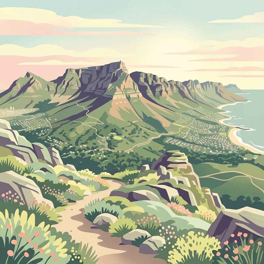
Coastal mountain wilderness protecting one of Earth's most biodiverse plant kingdoms
Table Mountain National Park
Table Mountain National Park is a coastal protected area spanning the mountainous spine of the Cape Peninsula in South Africa, wrapping around the city of Cape Town. Established in 1998 and managed by South African National Parks, the park encompasses the iconic Table Mountain, Lion's Head, Devil's Peak, and extends south to the Cape of Good Hope, one of the most historically significant geographic points in the world. The park covers approximately 221 square kilometers across three disconnected sections, making it unique among national parks in how it intertwines with urban development. What makes this park extraordinary is its ecological significance: it forms the heart of the Cape Floristic Region, a UNESCO World Heritage Site and one of the world's six floral kingdoms, containing more plant species than the entire United Kingdom despite its relatively small size.
- Location
- South Africa
- Park type
- National park
- Established
- 1998
- Area
- 221 km²
Location overview
Regional placement and coastal status in the Western Cape province
Geographic Setting and Location of Table Mountain National Park
Table Mountain National Park is located within the Western Cape province of South Africa. The preserved territory is officially recognized for its coastal and marine status within the regional network.
- Countries
- South Africa
- Regions
- Western Cape
- Primary location
- Western Cape
- Geographic setting
- Coastal · Marine
Boundary and coordinates
Table Mountain’s mapped park boundary spans 221 km²
Table Mountain National Park mapped boundary and 221 km² area
Table Mountain National Park has stored geometry defining the outline of its 221 km² protected area. The record contains only the combined area, with no distinct land and marine measurements or a perimeter.
- Boundary area
- 249.8 km²
- Boundary perimeter
- 324 km
- Northernmost point
- 33.9118° S
- Southernmost point
- 34.3583° S
- Easternmost point
- 18.498° E
- Westernmost point
- 18.3072° E
- Geographic centre
- 34.1377° S, 18.4066° E
- North–south span
- 49.5 km
- East–west span
- 17.6 km
Terrain and natural features
Explore recorded streams, caves, and physical features across the landscape
Table Mountain National Park Terrain Classification and Named Natural Features
Mountain park terrain classifications organize the protected landscape and its recorded physical formations. Associated feature cards detail names, types, and spatial relationships within the protected area boundaries.
Selected named natural features
Cave entrances
Rendezvous Cave
Streams
Kasteelpoort Stream
Cave entrances
Avernus Cave
Viewpoints
Dam View
Cave entrances
White Dome Grotto
Environmental setting
Mediterranean climate zones, mountain relief, and coastal marine habitats
Table Mountain National Park Environmental Settings and Mapped Classifications
Recorded landscape features, habitat types, and relief classifications form complementary interpretations of physical settings across Table Mountain National Park. Connected atlas destinations link these environmental categories directly to related protected areas.
- Relief
- Mountain
- Climate
- Mediterranean
- Water
- Water-dominated
- Forest cover
- Partial forest
- Seasonality
- Year-round
Landscape features
Mountains · Cliffs · Forest · Woodland · Grassland · Coast · Beach
Habitat types
Shrubland · Temperate broadleaf forest · Marine habitat · Coastal habitat
Park atlas
Trace connected protected landscapes, compare unique mountain parks, and map regional conservation efforts across South Africa.
Explore Nearby National Parks and Protected Areas Beyond Table Mountain National Park
Continue your atlas-style exploration from Table Mountain National Park to browse a curated list of geographically relevant protected areas and national parks. This allows for deeper regional comparison, highlighting the diverse ecological zones and conservation efforts surrounding the Cape Peninsula and beyond.
Biosphere reserveWestern Cape
Mapped location lies within the park boundary#1 closest
South

Cape Floristic Region
Mapped protected biosphere reserve and fynbos landscapes
Cape Floristic Region, in Western Cape, South Africa.
- Area
- 78,555 km²
- Established
- 2004

Nature reserveCape Town
About 14 km away#2 closest
Northeast
Tygerberg Nature Reserve: Geographic Mapping of a Cape Town Protected Landscape
Renosterveld shale ridges and urban conservation context
Tygerberg Nature Reserve stands as a compact, high-value protected area within Cape Town, safeguarding hundreds of plant species and threatened Renosterveld habitats. The park landscape features a recognizable chain of shale hills punctuated by historic termite mounds known as heuweltjies, offering a window into the regional ecology and natural history of the Western Cape.
- Area
- 3 km²
- Established
- 1973
- Relief
- Upland
- Climate
- Mediterranean
Nature reserveWestern Cape
About 29 km away#3 closest
North
Koeberg Nature Reserve: A Geographical Overview of Coastal Protected Landscapes
Lowland fynbos, dune thicket, and aquifer geography in the Western Cape
Situated north of Cape Town, Koeberg Nature Reserve acts as a vital sanctuary for threatened plant communities and diverse bird populations. Its unique terrain combines sandy coastal dunes with seasonal pans and wetland complexes, providing a distinct study in protected area conservation and regional ecological management.
- Area
- 26.81 km²
- Established
- 1991
- Relief
- Lowland
- Climate
- Mediterranean
Nature reserveWestern Cape
About 38 km away#4 closest
Southeast
Kogelberg Nature Reserve: Protected Mountain Geography in the Western Cape, South Africa
Coastal mountain fynbos and protected river ecosystems
Situated in the Western Cape of South Africa, Kogelberg Nature Reserve protects an exceptional concentration of fynbos vegetation and rugged sandstone terrain. The area spans coastal mountain ridges, riparian corridors, and forest-filled ravines, serving as a landmark for botanical diversity and protected-landscape mapping in the region.
- Area
- 30 km²
- Relief
- Mountain
- Scope
- Terrestrial
- Water
- Major water bodies
Nature reserveWestern Cape
About 43 km away#5 closest
East
Jonkershoek Nature Reserve: A Detailed Atlas of Mountain Catchment and Fynbos Ecology
Protected mountain geography near Stellenbosch, Western Cape
Jonkershoek Nature Reserve serves as a primary water source for the surrounding Western Cape landscape. This profile outlines the reserve's role in the Cape Floral Region, detailing its complex mountain topography, river headwaters, and significant fynbos plant communities that characterize the terrain.
- Area
- 110 km²
- Relief
- Mountain
- Climate
- Mediterranean
- Access
- Easy access
Biosphere reserveWestern Cape
About 54 km away#6 closest
Northeast
Cape Winelands Biosphere Reserve: Geographic Overview and Protected Area Mapping
Western Cape mountain terrain and sustainable landscape integration
The Cape Winelands Biosphere Reserve serves as a model for integrated landscape management in South Africa. Situated along the Cape Fold Belt, this reserve protects crucial water catchments and endemic floral habitats while encompassing a globally recognized wine-producing region. Access detailed mapping of its core, buffer, and transition zones to see how conservation persists within a working agricultural environment.
- Area
- 1,243.4 km²
- Established
- 2007
- Relief
- Mountain
- Climate
- Mediterranean

Nature reserveWestern Cape
60 km away#7 closest
Northwest
Dassen Island Nature Reserve: Atlantic Geography and Protected Area Overview
Coastal refuge and protected granite-based Atlantic island
Located in the cold waters off the Western Cape, Dassen Island is a proclaimed nature reserve and Ramsar wetland. This flat Atlantic landmass is characterized by its granitic reef structure and long-established role as a sanctuary for African penguins and other seabird populations. The island represents a convergence of maritime history and marine conservation, offering a unique geographic perspective on South Africa's coastal wilderness.
- Area
- 2.6 km²
- Established
- 2019
- Relief
- Lowland
- Climate
- Mediterranean

National parkWestern Cape
69 km away#8 closest
North
West Coast National Park: A National Park's Mapped Boundaries and Geographic Identity
Explore its protected landscape within the Western Cape region.
West Coast National Park is a protected national park situated in the Western Cape province of South Africa. This dedicated page provides a structured view of its geographic scope, emphasizing its mapped boundaries and its significance as a protected landscape within the region's broader atlas context. Gain insight into the park's distinct natural terrain and regional geography.
- Area
- 362.59 km²
- Established
- 1985
- Climate
- Mediterranean
- Access
- Easy access
MoriAtlas Explorer
Continue Your Geographic Discovery of Table Mountain National Park's Landscape
Deepen your understanding of Table Mountain National Park by exploring its specific geographic features and protected land context. This destination provides crucial insights into the park's mapped boundaries and its significance within the Western Cape's diverse regional geography. Continue to investigate its unique landscape characteristics, contributing to a comprehensive atlas-based appreciation of South Africa's protected areas and natural terrain.
Browse next
Global natural geography
Explore related park routes
Explore MoriAtlas Global ParksBrowse All MoriAtlas ParksGlobal Park Map DiscoveryMoriAtlas: Browse All CountriesBrowse All MoriAtlas ContinentsNational Park Environment AtlasGrand Canyon National Park AtlasYellowstone National Park AtlasYosemite National Park Atlas and GeographySerengeti National Park AtlasGalápagos National Park Protected LandscapeBanff National Park Geography and AtlasKruger National Park Atlas EntryExplore Uluru-Kata Tjuta National Park GeographyPlitvice Lakes National Park AtlasFiordland National Park Protected LandscapeGreat Smoky Mountains National Park AtlasZion National Park Protected Landscape AtlasAfghanistan National Parks and Protected AreasAlbania National Parks and Protected AreasAlgeria National Parks and Protected AreasAmerican Samoa National Parks and Protected AreasAndorra National Parks and Protected AreasAngola National Parks and Protected AreasAntarctica National Parks and Protected AreasAntigua and Barbuda Park List