
Mori Atlas logo
Nature reserveTempler Park

Examining the complex stream valleys, tiered waterfalls, and ecological terrain of this protected reserve.

Templer Park Nature Reserve: A Mapped Exploration of Selangor's Mature Hill Forest Landscape

(Hutan Lipur Templer)

Templer Park represents a significant 1,214-hectare forest reserve situated in the Gombak District of Selangor, Malaysia. This protected landscape preserves mature lowland and hill forest environments, characterized by cool jungle streams, multi-tiered waterfalls, and a dense, mossy understory. The area serves as a vital ecological anchor, providing a documented habitat for rare species including the spine-jawed snake and trapdoor spiders in its limestone caves, while tracing the rugged contours of the surrounding ridges.

forest reservehill forestwaterfallsjungle streamslowland forestwildlife sanctuary
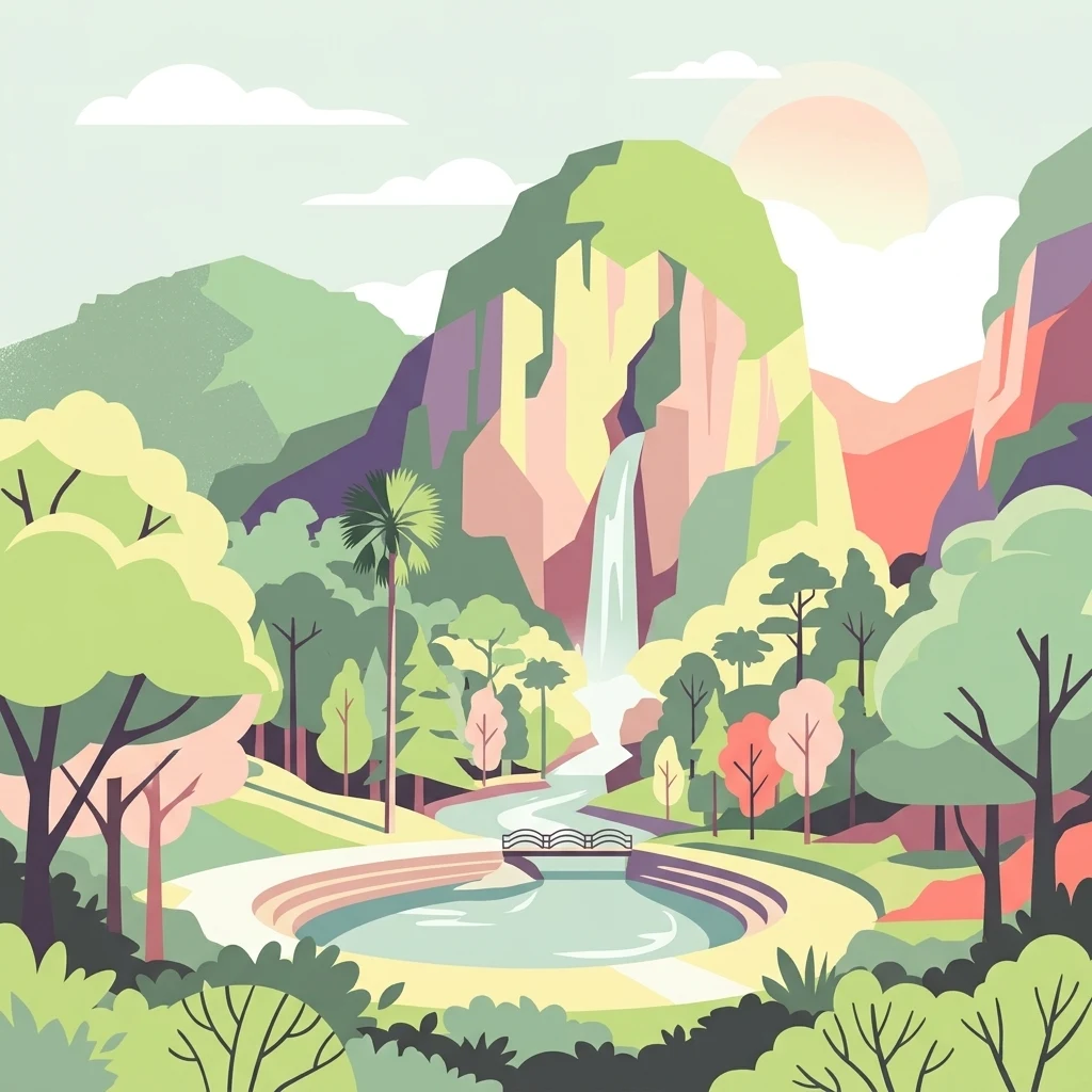
A stylized digital illustration of a multi-tiered landscape featuring a central waterfall falling into a circular pond, surrounded by lush green trees, mountains, and a small bridge.

Templer Park

Nature reserve

Park overview

Structured park overview, official facts, and landscape profile for Templer Park

Templer Park park facts, protected area profile, and essential visitor context

Review the core facts for Templer Park, including designation, size, terrain, visitor scale, habitats, and operating context in one park-focused overview.

About Templer Park

Templer Park occupies a stretch of forested hills between Rawang and Kuala Lumpur, forming one of the most prominent green corridors on the northern fringe of the capital. At about 1,214 hectares, the reserve represents a substantial block of lowland and hill dipterocarp forest in a region otherwise dominated by housing estates, plantations, and infrastructure. Its proximity to the city, combined with a road and river network that threads through the forest, has made it a long-standing destination for recreation as well as an important refuge for wildlife displaced by surrounding development.

The reserve's identity is closely tied to its multi-tiered waterfalls and cool jungle streams, which cascade down from the higher ground and supply pools that visitors use for bathing and picnicking. Trails and small bridges link the waterfalls and picnic clearings, while a soft carpet of moss, ground ferns, and mature canopy trees creates a shaded, damp atmosphere typical of Malaysian hill forests. The combination of mossy understory, twisted lianas, and tall emergent trees gives the park a distinctly old-growth feel, even though it sits within easy reach of metropolitan Kuala Lumpur.

Ecologically, the reserve is more than a recreational space. Gua Anak Takun, a cave system associated with the park, harbors the rare trapdoor spider Liphistius batuensis, a species of particular interest to arachnologists. The park is also the formal type locality for the Malaysian spine-jawed snake Xenophidion schaeferi, a primitive nonvenomous species described from a single specimen collected within the reserve in 1988. Wider fauna includes monkeys, a variety of forest birds such as hawk-cuckoos and serpent eagles, reptiles, amphibians, and the goat-antelope serow, whose continued presence has been confirmed by the Malaysian Nature Society.

Visitor amenities, including picnic grounds, changing rooms, food stalls, campsites, and chalet-style accommodation, are arranged so that even casual day visitors can experience the forest without specialized gear. This accessibility is part of the park's character, though it also creates the long-running tension between heavy recreational use and the conservation of an increasingly pressured forest edge.

Quick facts and research context for Templer Park

Templer Park is a forest reserve in Rawang, Gombak District, Selangor, Malaysia, about 21 kilometers north of central Kuala Lumpur. It covers 1,214 hectares and was created on 8 September 1954, when the Sultan of Selangor formally dedicated the area as a wildlife refuge and meeting place for nature lovers. The forest was subsequently gazetted in 1955 as a Botanical Garden and Public Park.

The reserve blends recreational amenities such as picnic grounds, campsites, changing rooms, and roadside food stalls with a still-thick natural forest crossed by streams and waterfalls. It is named after Sir Gerald Templer, the British High Commissioner in Malaya during the early 1950s, and has since become one of the most popular day-trip forest destinations in the greater Kuala Lumpur region.

Protection and recognition

Explore documented terrestrial protection parameters and conservation designations for Templer Park.

Templer Park Protection Status and International Recognition Details

Terrestrial protection status and designation records outline the regulatory framework governing Templer Park. Structured conservation facts provide verified insights into management scope and international recognition parameters.

Protection details

Protection scope
Terrestrial
Transboundary protection
No
Park context

Deeper park guide and search-rich context for Templer Park

Templer Park history, landscape, wildlife, and travel context

Explore Templer Park through its history, landscape character, ecosystems, wildlife, conservation priorities, cultural context, and seasonal travel timing in a structured park guide built for atlas discovery and search intent.

Why Templer Park stands out

Templer Park is best known as a sizeable mature forest reserve unusually close to Kuala Lumpur, offering city residents immediate access to waterfalls, jungle streams, and dense hill forest in a single day trip. Its tiered waterfalls and cool streams flowing down from the forested ridges are among the defining features that draw visitors. The reserve is also recognized in scientific circles for its unusual fauna, including a confirmed serow population, the rare trapdoor spider Liphistius batuensis in Gua Anak Takun, and the type locality for the primitive spine-jawed snake Xenophidion schaeferi. These ecological associations give the park significance well beyond its role as a local picnic ground.
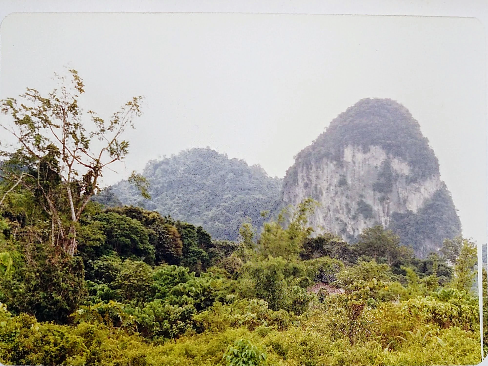
A 1986 photograph showing steep, jungle-covered limestone hills rising above a lush, green forest canopy in Malaysia.
A historical 1986 view of the limestone hills and dense forest landscape within Templer Park.

Templer Park history and protected-area timeline

Templer Park was formally created on 8 September 1954, when the Sultan of Selangor, Sultan Hishamuddin Alam Shah, dedicated the area in the name of Sir Gerald Templer, the British High Commissioner in Malaya. The dedication framed the forest as 'a refuge and a sanctuary for wildlife and a meeting-place for all who love and respect the beauty of nature,' explicitly linking the reserve's founding purpose to both conservation and public enjoyment.

The following year, in 1955, the Selangor government gazetted the area as a Botanical Garden and Public Park under the land enactment through Notification 104-1955. This status formalized the park's dual role as a managed green space for the public and as a protected natural area. Over the decades that followed, the reserve became a popular weekend destination for residents of nearby Kuala Lumpur and Rawang, with infrastructure gradually expanded to include picnic grounds, campsites, and supporting amenities.

In the modern era, the park's history has been shaped increasingly by development pressure on its borders. Adjoining former parkland has been sold to private interests, and significant areas near the reserve have been cleared for high-end housing, towers, golf courses, and road projects. These changes have reduced the effective buffer around the reserve and intensified concerns about long-term habitat fragmentation, even as the core forest area itself remains in public hands.

Templer Park landscape and geographic character

Templer Park sits in the forested hill country immediately north of Kuala Lumpur, where the terrain rolls in low ridges and stream-cut valleys draped in dense vegetation. Its most distinctive physical features are the multi-tiered waterfalls that step down through the forest, fed by cool streams descending from the higher ground. These cascades, combined with broad pools and shaded riverbanks, give the reserve an unusually varied small-scale topography within a relatively compact area.

The ground beneath the canopy is typically damp and shaded. A soft layer of moss spreads across the forest floor, interrupted by stands of ground ferns, tree ferns, and the buttressed roots of mature trees. Fallen branches and decaying logs contribute to the textured, layered look of older forest, while lianas and vines link the understory to the canopy overhead. Small wooden bridges and footpaths cross the streams near popular picnic spots, integrating visitor infrastructure into the natural contours rather than dominating them.

The wider landscape around the reserve has changed sharply over recent decades. Former parkland on the edges has been replaced by residential estates and project developments, while new roads cut through the buffer zone. Within the reserve itself, however, the impression remains one of a continuous, well-vegetated hill forest, with the waterfalls and stream valleys providing the central scenic anchors.
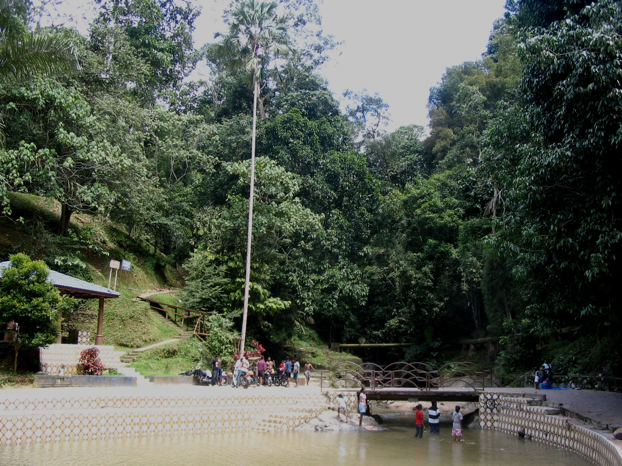
A group of people standing in and near a stream at the edge of a dense tropical forest with a small bridge and a stone-lined pool.
A shaded stream and swimming area at Templer Park in Selangor, Malaysia.

Templer Park ecosystems, habitats, and plant life

Templer Park protects a representative block of lowland and hill forest on the outskirts of Kuala Lumpur, a habitat type that has been heavily reduced elsewhere in Peninsular Malaysia. The canopy is dominated by mature broadleaved trees typical of Malaysian hill forests, creating a shaded interior where light reaches the forest floor only in scattered patches. This mature canopy, together with the damp microclimate near the streams, supports a rich layer of mosses, ferns, and other moisture-loving plants.

Streams and waterfalls cut through the reserve, creating a network of wet microhabitats along the valley floors and steeper slopes. These riparian zones are particularly important for amphibians, insects, and small forest creatures, and they also help sustain the spider fauna of the area's limestone cave systems. Gua Anak Takun, with its distinctive cave environment, adds a separate habitat dimension to the reserve's broader forest ecosystem.

The altitudinal range and the mix of ridge forest, stream valleys, and cave environments mean that the park preserves several ecological niches within a relatively small area. This habitat diversity supports a correspondingly varied fauna, even as the surrounding landscape has become more fragmented by development.

Templer Park wildlife and species highlights

Wildlife in Templer Park includes the full range of generalists commonly found in Malaysian hill forests, from long-tailed macaques and other monkeys at the picnic areas to a wide variety of birds, reptiles, amphibians, and insects in the deeper forest. Birdlife is particularly diverse, with regular sightings of hawk-cuckoos, crested serpent eagles, emerald doves, forest wagtails, malkohas, barbets, woodpeckers, flycatcher-shrikes, and blue-winged leafbirds. Lizards such as earless agamids and the Malaysian crested lizard are among the more visible reptile residents.

Among the park's more unusual mammals is the serow, a goat-antelope that is increasingly rare in Peninsular Malaysia. Studies by the Malaysian Nature Society have confirmed that a population still lives in and around the reserve, making Templer Park one of the few forested areas near Kuala Lumpur where this shy animal continues to survive.

The reserve is also of strong scientific interest because of its invertebrate and herpetological rarities. Gua Anak Takun is home to Liphistius batuensis, a primitive trapdoor spider found in only a handful of localities. The forest is the type locality for Xenophidion schaeferi, a rare spine-jawed snake in the family Xenophidiidae, known from a single specimen collected in the park in 1988. The park's documented role in harboring such unusual species has added significantly to its ecological profile.

Templer Park conservation status and protection priorities

Templer Park's principal conservation value lies in protecting a sizeable block of mature forest just outside Kuala Lumpur, in a region where remaining natural habitat is increasingly fragmented. By retaining a connected canopy, continuous riparian corridors, and a cave system, the reserve provides refuge for species that have been squeezed out of the surrounding urban and suburban matrix, including shy mammals like the serow and a suite of forest-dependent birds and reptiles.

The reserve's formal dedication in 1954 as a wildlife sanctuary and public park, followed by its 1955 gazetting as a Botanical Garden and Public Park, gave it an early institutional foundation. In practice, however, conservation outcomes have been mixed. While visitors enjoy relatively easy access to waterfalls and picnic grounds, the park's edges have come under sustained pressure from development. Former parkland adjacent to the reserve has been sold for housing projects, towers, golf courses, and road infrastructure, shrinking the effective buffer around the protected core.

These adjacent developments have led to local reports of wildlife dispersing away from the park's edges, with some bird species becoming harder to observe. The tension between the reserve's recreational popularity, its proximity to a growing metropolitan area, and the ecological value of its core forest continues to define its conservation profile today.

Templer Park cultural meaning and human context

Templer Park sits in a part of Selangor with a layered history of indigenous, Malay, and British colonial presence. The reserve's name itself reflects its mid-twentieth-century colonial context: it honors Sir Gerald Templer, the British High Commissioner in Malaya during the period leading up to the end of the Malayan Emergency. The 1954 dedication by the Sultan of Selangor tied the forest into the local royal heritage while also placing it within a broader narrative of post-war Malayan nation-building.

For residents of Kuala Lumpur and Rawang, the park has long held a different kind of cultural significance. Generations have visited its waterfalls for picnics, school outings, and family weekends, while caving at Gua Anak Takun has been a long-standing adventure pastime. As the surrounding districts have urbanized, the reserve has increasingly served as a cultural marker of a greener, more forested era on Kuala Lumpur's doorstep, even as the landscape around it continues to change.

Top sights and standout views in Templer Park

Templer Park's strongest points of distinction are its tiered waterfalls and cool streams, which provide one of the closest-to-Kuala Lumpur experiences of mature hill forest in Selangor. The dense canopy, mossy understory, and shaded picnic clearings give day visitors a surprisingly immersive forest experience without leaving the metropolitan region.

Equally distinctive is the reserve's scientific profile. From the confirmed serow population to the rare trapdoor spider of Gua Anak Takun and the type locality of the primitive spine-jawed snake, Templer Park punches well above its weight in terms of biodiversity interest. These features, combined with its accessibility and historical dedication as both a wildlife sanctuary and a public park, give the reserve a layered identity that blends recreation, history, and genuine conservation value.

Best time to visit Templer Park

Templer Park is most enjoyable in the cooler, wetter parts of the year, when the streams and waterfalls carry more water and the forest understory is at its greenest. These conditions typically bring out the mossy, lush character of the reserve and support active amphibian and insect life along the stream banks. Early morning visits during these periods often combine quieter trails with active birdlife.

Drier periods reduce the flow of the cascades and can make some sections feel considerably more exposed, while weekends throughout the year tend to be busy with picnickers and campers regardless of season. Visitors seeking a quieter experience generally benefit from arriving outside major holiday weekends, when the forest's atmosphere, sounds, and wildlife viewing opportunities are at their best.
Monthly climate preview

Long-term representative point measurements tracking monthly temperature and precipitation cycles

Templer Park Climate Normals, Annual Temperature and Precipitation Rhythm

Templer Park sustains steady mean temperatures ranging from 23.7 degrees Celsius to 25.4 degrees Celsius alongside measured daily precipitation rates. Analyzing the complete twelve-month climatology profile reveals comprehensive variations in long-term temperature and moisture patterns across the protected coordinate.
Annual mean25 °C
24 °C25 °C
Jan24°
Feb24°
Mar25°
Apr25°
May25°
Jun25°
Jul24°
Aug24°
Sep25°
Oct25°
Nov24°
Dec24°
Warmest month
May

25.4 °C

Coolest month
January

23.7 °C

Wettest month
November

10.4 mm/day

Driest month
June

4.6 mm/day

Park location guide

Geography guide, regional context, and park location map for Templer Park

Templer Park park geography, regions, and map view in Malaysia

Understand where Templer Park sits in Malaysia through a broader geographic reading of the surrounding landscape, nearby location context, and its mapped position within the national park landscape.

How Templer Park fits into Malaysia

Malaysia is a federal constitutional monarchy located in Southeast Asia. The country consists of 13 states and three federal territories, divided by the South China Sea into Peninsular Malaysia on the Indochinese Peninsula and East Malaysia on the island of Borneo. With a population of over 34 million, it achieved independence from Britain in 1957 and became a modern federation in 1963. The country is recognized for its multicultural population, tropical climate, and significant economic role in the region.

Wider geography shaping Templer Park in Malaysia

Malaysia occupies a strategic position in Southeast Asia, split by the South China Sea into two distinct regions. Peninsular Malaysia lies on the Indochinese Peninsula, sharing a land border with Thailand to the north and maritime borders with Singapore, Vietnam, and Indonesia. East Malaysia occupies the northern portion of Borneo, sharing land borders with Brunei and Indonesia, and maritime borders with the Philippines and Vietnam. The country's terrain includes coastal plains, mountain ranges such as the Titiwangsa in the peninsula, and extensive tropical rainforests.

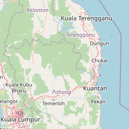
Map view of Templer Park

Use this park location map to pinpoint Templer Park in Malaysia, understand its exact geographic position, and read its mapped placement within the surrounding landscape more clearly.

Pigeon | © OpenStreetMap contributors

Location context for Templer Park

Selangor

Explore protected area views, tiered waterfalls, and dense hill forest habitats in Selangor.

Templer Park Photos and Scenery: Visualizing the Forest Reserve Landscapes

Visual records capture the cascading streams, mossy forest floors, and rugged terrain that define the interior of Templer Park. Photographic documentation provides a clear reference for understanding the mature tropical rainforest habitats and protected landscape character within this regional hill sanctuary.

A 1986 photograph showing steep, jungle-covered limestone hills rising above a lush, green forest canopy in Malaysia.

A view of a park area with a shallow, concrete-lined pool in the foreground, a small bridge, and dense forest in the background with people gathering near the water.

A group of people standing in and near a stream at the edge of a dense tropical forest with a small bridge and a stone-lined pool.

Park atlas

Compare nearby hill forests, wildlife reserves, and regional protected landscapes

Explore Other Parks Near Templer Park and Surrounding Protected Areas

Continue browsing parks near Templer Park to compare mature hill forests, stream networks, and protected landscapes across the surrounding region. Expanding your geographic comparison reveals how similar forest reserves and regional conservation areas protect local biodiversity.
State or regional parkSelangor
About 6.6 km away#1 closest

Northeast

Selangor State Park: Protected Rainforest and Geological Landscape Discovery

Highland water catchment and quartz ridge geography in Selangor

Selangor State Park forms a massive block of continuous tropical rainforest serving as the principal water supply for the Klang Valley. This protected area features rugged slopes, diverse river basins, and the dramatic 14-kilometer Klang Gates Quartz Ridge. Use this map-integrated record to understand the park's critical role in regional hydrological regulation and its significance as a research-anchored highland ecosystem.

Area
914.41 km²
Established
2007
Relief
Highland
Climate
Tropical
Nature reserveSelangor
About 41 km away#2 closest

South

Kuala Langat North Forest Reserve: Mapped Boundaries and Ecological Terrain Overview

Ancient lowland peat swamp geography in Selangor, Malaysia

Kuala Langat North Forest Reserve is an ecologically vital peat swamp remnant that shelters a range of endemic species within its 8,000 year old forest canopy. Located in the lowland terrain of Selangor, the reserve exists as a critical forest island surrounded by a matrix of development. This overview provides mapped context for the reserve's internal landscape and its role as a protected area within the shifting geography of the Klang Valley.

Area
9.576 km²
Established
1927
Relief
Lowland
Climate
Tropical
A watercolor painting showing a winding river flowing through green wetlands and forests with distant rolling hills.
Nature reserveSelangor
About 54 km away#3 closest

West

Kuala Selangor Nature Park: Mapping the Coastal Wetland and Forest Mosaic of Selangor

A Managed Nature Reserve at the Selangor River Estuary

Kuala Selangor Nature Park represents a key protected landscape in Malaysia, where secondary forest meets an intricate system of estuarine wetlands. This atlas provides a detailed look at the park, focusing on the interplay between its freshwater ponds, mangrove fringes, and the coastal bunds that govern the habitat. It serves as an essential site for understanding coastal restoration and wetland ecology in the region of Selangor.

Area
2.4 km²
Established
1987
Relief
Lowland
Climate
Tropical
Wildlife reservePahang
About 76 km away#4 closest

Northeast

Tengku Hassanal Wildlife Reserve: Protected Forest and Mountain Geography in Pahang

Mapping a vast lowland dipterocarp forest sanctuary.

Spanning over 600 square kilometers, Tengku Hassanal Wildlife Reserve stands as a core protected area within Pahang. Its landscape includes riverine valleys and the steep montane terrain of the Benom Complex, supporting unique biodiversity and active wildlife conservation. This overview traces the park's geographic footprint and its role as an ecological corridor within the broader Titiwangsa mountain system.

Area
605.52 km²
Established
1923
Relief
Mountain
Climate
Tropical
Nature reserveMalaysia
About 82 km away#5 closest

Southeast

Pasoh Forest Reserve: Lowland Dipterocarp Protected Area in Peninsular Malaysia

Mapping tropical rainforest boundaries and ecological research zones

Situated in the interior of Peninsular Malaysia, Pasoh Forest Reserve protects a vital fragment of lowland dipterocarp rainforest. The reserve is globally recognized for its long-term forest dynamics plot, which tracks hundreds of thousands of trees to inform modern understanding of rainforest ecology. The mapped landscape displays clear boundaries between the dense protected forest and surrounding agricultural plantations, offering a distinct view of land use and tropical conservation.

Area
24.5 km²
Established
1987
Relief
Upland
Scope
Terrestrial
Wildlife reserveMalacca
About 101 km away#6 closest

South

Tanjung Tuan Wildlife Reserve: Coastal Geography and Forested Cape Mapping

Coastal dipterocarp forest and raptor sanctuary in Malacca.

This forested coastal cape is an essential protected landscape situated along the Strait of Malacca. Characterized by its dense lowland dipterocarp forest, rocky headlands, and offshore islets, the reserve provides a crucial ecological connection for migratory birds and preserves a rich history of colonial maritime navigation and defense. Its geography offers a compact view of diverse coastal environments, ranging from mangrove fringes to the elevated ridge of Batu Putih.

Area
0.607 km²
Established
1921
Relief
Upland
Climate
Tropical
A soft watercolor painting of a serene lake scene with rolling hills in the background, green vegetation along the banks, and pale pink blooms, likely lotus flowers, in the water.
Biosphere reservePahang
About 143 km away#7 closest

East

Chini Lake Biosphere Reserve: Protected Freshwater Geography in Pahang, Malaysia

Examining the interconnected lake basins and tropical wetland terrain

Chini Lake is an essential protected freshwater system in Pahang, Malaysia, comprising a series of twelve connected lake basins and tropical forest margins. This landscape is a recognized UNESCO Biosphere Reserve, characterized by seasonal lotus blooms, peat-influenced wetlands, and deep cultural connections to the indigenous Jakun communities. Discover the geography and environmental context of this river-fed ecosystem.

Area
50.85 km²
Established
2019
Relief
Lowland
Climate
Tropical
National parkPahang
About 181 km away#8 closest

Northeast

Taman Negara National Park: Pahang Protected Area with Mapped Boundaries for Geographic Discovery

Explore the unique landscape context within Pahang, Malaysia.

Delve into Taman Negara National Park, a significant protected area situated in Pahang, Malaysia. This detailed view highlights the park's mapped boundaries and its contribution to the regional geography. Understand the protected landscape and its place within the natural terrain of Peninsular Malaysia, essential for atlas-based geographic exploration.

Area
4,343 km²
Established
1938
IUCN
II
Relief
Mixed relief

Common questions about visiting, size, designation, and location context for Templer Park

Templer Park FAQs for park facts, access, geography, and protected area context

Find quick answers about Templer Park, including protected-area facts, park geography, trail and visitor context, and how the park fits into its surrounding country and regional landscape.
MoriAtlas Explorer

Continue Your Protected Areas Search Across the Global Atlas

Deepen your exploration by continuing the structured search for national parks and protected areas worldwide. Utilize the comprehensive filtering capabilities to compare different conservation landscapes and refine your understanding of global park geography. Discover more about the distribution and characteristics of protected natural areas.

Global natural geography