
Mori Atlas logo
Wildlife reserveTerres d'oiseaux

Mapped natural terrain and migratory bird habitats along the Gironde estuary geography

Terres d'oiseaux Wildlife Reserve: Protected Estuarine Wetlands in Nouvelle-Aquitaine, France

Terres d'oiseaux functions as a vital 120-hectare wildlife reserve set within the expansive Blayais marshes of the Gironde estuary. This protected landscape features a diverse mosaic of wet meadows, reedbeds, and ponds that serve as an essential stopover on the Atlantic migratory flyway. Visitors and researchers gain access to a unique avian environment where tidal dynamics and river flow create a distinct, managed natural habitat for numerous waterbird species.

ornithological reserveestuarine wetlandsGironde estuarymigratory birdsbirdwatchingwetland mosaic
A flat vector-style illustration of a natural marshy landscape with a white heron in the foreground, a wooden boardwalk path, a meandering river, and mountains under a soft sun.

Terres d'oiseaux

Wildlife reserve

Park overview

Structured park overview, official facts, and landscape profile for Terres d'oiseaux

Terres d'oiseaux park facts, protected area profile, and essential visitor context

Review the core facts for Terres d'oiseaux, including designation, size, terrain, visitor scale, habitats, and operating context in one park-focused overview.

About Terres d'oiseaux

Terres d'oiseaux is a managed natural area and ornithological reserve in the Gironde estuary, in southwestern France. Covering approximately 120 hectares near the towns of Braud-et-Saint-Louis and Saint-Ciers-sur-Gironde, the reserve occupies part of the historic Nouvelles Possessions lands within the Blayais marshes, where the estuary meets the Charente-Maritime border. The protected area lies within a Natura 2000 zone, underscoring its recognized value at the European level for the conservation of estuarine and wetland habitats.

The site's character is defined by its estuarine environment. A mosaic of wet meadows, ponds, reedbeds, and open water creates a rich patchwork of habitats that supports an exceptionally diverse bird community. The Gironde estuary lies on a major migratory axis between Northern Europe and southern wintering grounds, and the wetlands of Terres d'oiseaux provide essential resting and feeding habitat for birds during their long seasonal journeys. More than 125 wild bird species are recorded each year, ranging from conspicuous waterbirds such as herons, egrets, and storks to more discreet marshland songbirds such as the bluethroat.

The reserve also plays an important role in bird research and monitoring. It is recognized as the foremost French ringing site for the common snipe, a species closely tied to wetland habitats and one whose migration patterns depend heavily on healthy estuarine systems. By combining conservation, scientific study, and public discovery, Terres d'oiseaux functions both as a refuge for wildlife and as a place where visitors can encounter wild birds in a carefully managed natural setting.

Opened to the public in its current configuration in July 2010, the reserve is owned by the commune of Braud-et-Saint-Louis and is managed by the Communauté de communes de l'Estuaire in partnership with the Office national de la chasse et de la faune sauvage and the Conservatoire des races rustiques d'Aquitaine. Three themed walking trails, named for first-feathers, discovery, and exploration, allow visitors to move through the different habitats, with traditional ornithological hides supplemented by landscape-viewing platforms overlooking the estuary.

Quick facts and research context for Terres d'oiseaux

Terres d'oiseaux is a 120-hectare ornithological reserve in the Gironde department, within the Nouvelle-Aquitaine region of France, near the towns of Braud-et-Saint-Louis and Saint-Ciers-sur-Gironde. It lies in the Blayais marshes on the edge of the Gironde estuary, a Natura 2000 area, and is classified as an IUCN Category IV protected landscape.

The reserve sits on a major migratory corridor and annually records more than 125 wild bird species, ranging from herons, egrets, and storks to wetland passerines such as the bluethroat. Established on the Nouvelles Possessions lands and opened to the public in its current configuration in July 2010, it is managed jointly by the Communauté de communes de l'Estuaire, the French national hunting and wildlife office (ONCFS), and a regional heritage breed conservatory.

Protection and recognition

Terrestrial protected area classification, management scope, and status details

Terres d'oiseaux Protection Status and Conservation Recognition Data

Terres d'oiseaux maintains a documented terrestrial protection scope within the global conservation framework. Official records outline the established designation framework and administrative management parameters.

Protection details

Protection scope
Terrestrial
Transboundary protection
No
Park context

Deeper park guide and search-rich context for Terres d'oiseaux

Terres d'oiseaux history, landscape, wildlife, and travel context

Explore Terres d'oiseaux through its history, landscape character, ecosystems, wildlife, conservation priorities, cultural context, and seasonal travel timing in a structured park guide built for atlas discovery and search intent.

Why Terres d'oiseaux stands out

Terres d'oiseaux is best known as a mosaic of estuarine wetlands on the Gironde estuary that serves as a critical stopover for migratory birds. Its reedbeds, wet meadows, ponds, and open water habitats support a wide range of waterbirds, including herons, egrets, storks, and wetland passerines such as the bluethroat. The reserve also holds a special distinction in European ornithology as the leading French ringing site for the common snipe, reflecting both the quality of its wetland habitats and its role in long-term monitoring of migratory waterbirds along the Atlantic flyway.
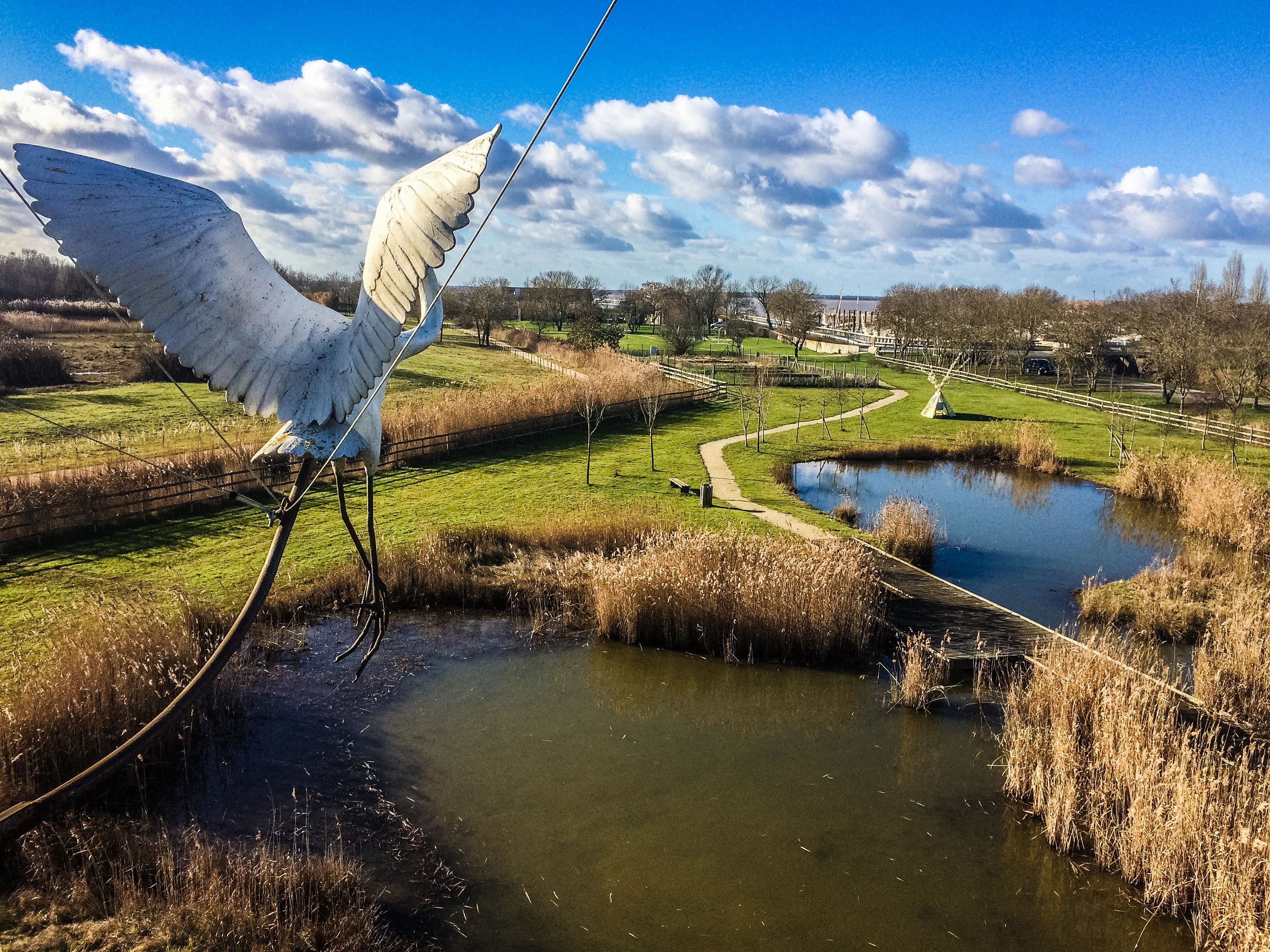
A high-angle view of a wetland reserve with ponds, grassy paths, and a prominent metal sculpture of a large bird in flight in the foreground.
A scenic view of the Terres d'oiseaux wildlife reserve in the Gironde estuary.

Terres d'oiseaux history and protected-area timeline

Terres d'oiseaux was developed on the Nouvelles Possessions lands within the Blayais marshes, an area historically shaped by the dynamics of the Gironde estuary. While the surrounding wetlands had long supported local agriculture, hunting, and seasonal grazing, the formal transformation of part of this landscape into a dedicated ornithological reserve reflects a more recent conservation effort focused on the ecological value of estuarine wetlands.

The reserve in its current form was opened to the public in July 2010, marking the start of its role as an accessible natural area designed for both wildlife conservation and public engagement with wild birds. Property of the commune of Braud-et-Saint-Louis, its creation was underpinned by intercommunal cooperation, with management shared between the Communauté de communes de l'Estuaire and national and regional partners such as the Office national de la chasse et de la faune sauvage and the Conservatoire des races rustiques d'Aquitaine.

Terres d'oiseaux landscape and geographic character

The landscape of Terres d'oiseaux is shaped by its position at the edge of the Gironde estuary, France's largest estuary, where freshwater and marine influences meet to create a distinctive estuarine environment. The reserve lies within the broader Blayais marshes, a traditionally low-lying area whose ground patterns reflect centuries of interaction between tidal dynamics, river flow, and human land management.

Within the reserve itself, the terrain is defined by a mosaic of wetland habitats. Open water surfaces, ponds, and channels alternate with wet meadows and dense reedbeds, creating a varied topography of flooded basins, vegetated margins, and transitional zones. Some areas are slightly elevated, providing dry ground for paths and observation structures, while much of the site remains closely tied to seasonal water levels.

Viewing platforms and observation towers allow visitors to appreciate the broader scale of the estuarine landscape, including the wide horizons of the Gironde itself. The result is a working landscape that reads simultaneously as a managed natural area and as a recognizable fragment of the larger Blayais marsh system.

Terres d'oiseaux ecosystems, habitats, and plant life

The ecological identity of Terres d'oiseaux is rooted in the estuarine wetlands of the Gironde. The reserve preserves a typical mosaic of habitats associated with the outer reaches of the estuary: wet meadows, ponds, reedbeds, and open water create a complex environmental mosaic in which different bird and plant communities can coexist in close proximity.

Reedbeds are a particularly important structural element, providing nesting and roosting habitat for numerous marshland species as well as shelter for invertebrates and small vertebrates. The wet meadows and shallow water margins offer feeding grounds for wading birds, while the open water attracts ducks, herons, and other waterbirds. The integration of these habitats within a relatively compact area gives the reserve a high habitat density that supports both resident and migratory birdlife throughout much of the year.

The reserve's location within a Natura 2000 zone reflects the broader recognition that such estuary-edge wetlands are priority habitats for European conservation, particularly in the context of migratory flyways along the Atlantic coast.

Terres d'oiseaux wildlife and species highlights

Terres d'oiseaux is fundamentally a bird-focused reserve, and its wildlife section is dominated by the rich birdlife of the Gironde estuary. The site lies on a major migratory flyway, and the estuarine wetlands of the Gironde play an important role for migrating birds, providing an essential stopover during their long journeys between northern breeding areas and southern wintering grounds.

More than 125 wild bird species are recorded each year. Among the most visible are herons, egrets, and storks, which use the wet meadows, ponds, and reedbeds for foraging and resting. Paludicole passerines, including the bluethroat, thrive in the marshland vegetation and represent a quieter but ecologically important component of the bird community.

A particular highlight is the reserve's status as the leading French ringing site for the common snipe, a marsh-nesting wader closely tied to wetland habitats. This focus reflects not only the abundance of the species locally but also the role the site plays in tracking migratory populations along the Atlantic flyway.

Terres d'oiseaux conservation status and protection priorities

Terres d'oiseaux holds recognized conservation value at multiple scales. Its location within a Natura 2000 zone places it within the European network of protected areas, underlining the importance of its estuarine wetland habitats for migratory birds and other species of conservation concern. The site is also classified as an IUCN Category IV protected area, consistent with its role in conserving particular habitats and species through active management.

The reserve's conservation work focuses on maintaining the diversity of estuarine habitats and supporting the broader ecological function of the Gironde estuary as a staging area on the Atlantic flyway. By protecting reedbeds, wet meadows, ponds, and open water in a single managed landscape, the site contributes to safeguarding both resident wetland species and the many migratory birds that depend on the estuary during seasonal movements.

Beyond habitat protection, the site contributes to active monitoring and research, particularly through its bird-ringing activities for the common snipe, and to broader public engagement with estuarine conservation through its trails and observation infrastructure.

Terres d'oiseaux cultural meaning and human context

Terres d'oiseaux sits on lands historically known as the Nouvelles Possessions within the Blayais marshes, an area whose identity has long been tied to the rhythms of the Gironde estuary. The surrounding region has a tradition of marshland use, including grazing, hunting, and other activities that have shaped the local landscape over generations, and the reserve reflects an evolution of these relationships toward wetland conservation and ecological management.

The site's partnership with the Conservatoire des races rustiques d'Aquitaine also highlights the connection between the reserve and regional agricultural heritage, linking the conservation of wild birds with the preservation of traditional land-use practices that continue to influence the character of the Blayais marshes.

Top sights and standout views in Terres d'oiseaux

Standout features of Terres d'oiseaux include the diversity of estuarine habitats within a compact 120-hectare area, the role of the site as a major stopover on the Atlantic migratory flyway, and the annual presence of more than 125 wild bird species ranging from herons, egrets, and storks to marshland passerines such as the bluethroat.

Equally distinctive is the reserve's scientific contribution: it is the foremost French ringing site for the common snipe, reflecting its importance for monitoring migratory waterbirds. Visiting infrastructure, including three themed trails, observation hides, and dedicated landscape-viewing platforms, allows visitors to encounter these features in a setting specifically designed to bring people into close, quiet contact with wild birds.

Best time to visit Terres d'oiseaux

The character of a visit to Terres d'oiseaux varies with the seasons in ways typical of an estuarine wetland reserve. Spring and autumn are particularly significant periods, as the Gironde estuary serves as a major stopover for migratory birds; in these seasons, waterbird numbers rise and the reserve offers some of its richest birdwatching opportunities. Winter months can also be rewarding, when many waterbirds remain on the estuary and the open landscapes and clear skies of the Blayais marshes make wildlife easier to observe.

Summer brings warmer conditions and active breeding birdlife in the reedbeds and meadows, though the lush vegetation can make some species more difficult to see. Across all seasons, the reserve's combination of habitats and bird hides means that meaningful wildlife encounters are possible whenever water levels and weather permit access.
Monthly climate preview

Long-term representative point measurements of monthly temperature and precipitation rhythm

Terres d'oiseaux Climate Normals and Measured Annual Temperature Patterns

Representative coordinates record measured monthly averages spanning low winter temperatures and higher summer maximums alongside consistent precipitation rates. Examining the full twelve-month profile provides complete historical climate data for Terres d'oiseaux without live forecasts.
Annual mean13 °C
6 °C21 °C
Jan
Feb
Mar
Apr12°
May16°
Jun19°
Jul21°
Aug21°
Sep18°
Oct14°
Nov
Dec
Warmest month
August

21.5 °C

Coolest month
January

5.8 °C

Wettest month
November

3.2 mm/day

Driest month
July

1.4 mm/day

Park location guide

Geography guide, regional context, and park location map for Terres d'oiseaux

Terres d'oiseaux park geography, regions, and map view in France

Understand where Terres d'oiseaux sits in France through a broader geographic reading of the surrounding landscape, nearby location context, and its mapped position within the national park landscape.

How Terres d'oiseaux fits into France

France is a unitary semi-presidential republic and one of the world's largest economies. It borders Belgium, Luxembourg, Germany, Switzerland, Italy, Monaco, Andorra, and Spain, with a maritime border to the United Kingdom. The country is known for its cultural influence, art, cuisine, and political history spanning centuries.

Wider geography shaping Terres d'oiseaux in France

France is located in Western Europe. Metropolitan France extends from the Rhine to the Atlantic Ocean and from the Mediterranean Sea to the English Channel and North Sea. The country borders Belgium, Luxembourg, Germany, Switzerland, Italy, Monaco, Andorra, Spain, and has a maritime border with the United Kingdom.

Map view of Terres d'oiseaux

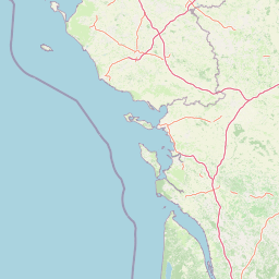
Use this park location map to pinpoint Terres d'oiseaux in France, understand its exact geographic position, and read its mapped placement within the surrounding landscape more clearly.

Pigeon | © OpenStreetMap contributors

Location context for Terres d'oiseaux

Nouvelle-Aquitaine

Explore the estuarine habitats, reedbeds, and open water views that shape the protected landscape character.

Terres d'oiseaux Photos and Protected Area Scenery: Visualizing the Gironde Estuary Wetland Mosaic

Visual documentation captures the complex terrain of wet meadows, tidal channels, and marshlands across the reserve. Photographic reference material reveals the natural environment and estuarine scenery that sustain migratory waterbirds along the flyway.

A high-angle view of a wetland reserve with ponds, grassy paths, and a prominent metal sculpture of a large bird in flight in the foreground.

Park atlas

Compare adjacent estuarine reserves and regional conservation zones

Explore Parks Near Terres d'Oiseaux and Surrounding Protected Wetland Landscapes

Browse other protected areas near Terres d'oiseaux to examine similar estuarine wetland habitats and regional marsh ecosystems. Extending the geographic comparison reveals broader ecological patterns across southwestern France and connected river basins.
Protected areaNouvelle-Aquitaine
About 50 km away#1 closest

East

Vallée de la Tude Protected Area: Regional Geography and Alluvial Landscape Map

Exploring the river valley networks of Nouvelle-Aquitaine

The Vallée de la Tude is a significant protected area located in the Charente department of southwestern France. This site features a series of wet meadows, lowland brooks, and woodland fragments that form an essential ecological network. Our atlas entry provides a detailed look at the geographic distribution and landscape composition of this unique alluvial valley.

Area
15.57 km²
Established
2006
Relief
Upland
Climate
Temperate
Nature reserveNouvelle-Aquitaine
About 52 km away#2 closest

North

Vallée de l'Antenne: A Protected River Valley and Alluvial Landscape in Nouvelle-Aquitaine

Mapping riparian ecosystems and rare wetland habitats

Trace the course of the Antenne river as it meanders through a finely textured mosaic of ash and alder forests, poplar plantations, and floodplains. As a designated Natura 2000 site, this nature reserve acts as a critical refuge for biodiversity in western France, offering a textbook example of a low-energy river system that descends gently through the landscape of the Charente departments.

Area
12.08 km²
Established
1999
Relief
Lowland
Climate
Mediterranean
Nature reserveNouvelle-Aquitaine
About 64 km away#3 closest

Northwest

Réserve naturelle régionale de la Massonne: Geographic Atlas and Protected Area Map

Mapped ecosystems within the Nouvelle-Aquitaine marshlands

Réserve naturelle régionale de la Massonne serves as a significant ecological corridor in western France, defined by its abrupt transition from coastal Brouage marshes to acidic heath. This atlas entry provides essential data on the reserve boundaries, mapped terrain types, and the structural diversity of its protected wetlands and shrublands, highlighting its role as a sanctuary for diverse nocturnal fauna.

Area
2.023 km²
Established
1997
IUCN
IV
Relief
Lowland
Nature reserveNouvelle-Aquitaine
About 65 km away#4 closest

South

Réserve naturelle nationale géologique de Saucats et la Brède: Geological Nature Reserve Atlas

Protected strata and Miocene fossil landscapes in Nouvelle-Aquitaine

This protected area serves as a primary European reference site for Cenozoic geology. It features distinct Miocene marine sand outcrops, fossil-rich faluns, and stream-cut sections that reveal the complex history of the Aquitaine Basin across multiple geographic sectors.

Area
0.755 km²
Established
1982
IUCN
III
Nature reserveNouvelle-Aquitaine
About 69 km away#5 closest

East

Vallée de la Nizonne Nature Reserve: Mapped Geography and Protected Wetland Landscapes

A critical river corridor and Natura 2000 conservation zone in Nouvelle-Aquitaine.

Discover the geographic structure of the Vallée de la Nizonne, a protected area shaped by the flow of the Nizonne and Lizonne rivers. This landscape mosaic features peatlands, wet meadows, and alluvial forests that serve as a refuge for rare species. Gain insight into the regional terrain and conservation boundaries that define this important French wetland corridor.

Area
33.91 km²
Established
2016
Relief
Upland
Climate
Temperate
Nature reserveGironde
About 76 km away#6 closest

Southwest

Réservoirs de Piraillan Nature Reserve: Mapping the Coastal Ecology of the Cap Ferret Peninsula

A protected mosaic of saltwater basins and pine-forested islets in Gironde.

Explore the structured geography of Réservoirs de Piraillan, a forty-hectare classified natural reserve situated on the Cap Ferret peninsula in southwestern France. This site offers a rare contrast between historical fish reservoirs and dense maritime pine forest, providing a protected habitat for diverse bird and insect populations adjacent to the Bassin d'Arcachon. Understand the interplay between these saltwater pools and the wider coastal terrain of the Gironde department through detailed mapping and landscape data.

Area
0.4 km²
Established
1943
Relief
Lowland
Climate
Mediterranean
Nature reserveCharente
About 100 km away#7 closest

Northeast

Val de Tardoire Nature Reserve: Geography and Protected Area Mapping in Charente

A detailed river valley landscape in Nouvelle-Aquitaine, France.

This protected area centers on the Tardoire river valley, featuring a high density of wet meadows, broadleaf forests, and rocky escarpments. The site represents a crucial node for European-interest habitats and diverse fauna, offering an in-depth look at the natural terrain and ecological composition of the Charente department.

Area
31.49 km²
Established
1999
Relief
Upland
Climate
Temperate
Nature reserveNouvelle-Aquitaine
About 104 km away#8 closest

Northeast

Réserve naturelle régionale de la vallée de la Renaudie Protected Landscape and Map Atlas

A geological crossroads in the heart of Nouvelle-Aquitaine.

Trace the 6 kilometer stretch of the Réserve naturelle régionale de la vallée de la Renaudie. This protected area showcases an unusual geological interface between limestone and granite, creating a compact mosaic of riparian woodland, dry rocky cliffs, and meadows that support significant regional biodiversity.

Area
0.73 km²
Established
2012
IUCN
IV
Relief
Mixed relief

Common questions about visiting, size, designation, and location context for Terres d'oiseaux

Terres d'oiseaux FAQs for park facts, access, geography, and protected area context

Find quick answers about Terres d'oiseaux, including protected-area facts, park geography, trail and visitor context, and how the park fits into its surrounding country and regional landscape.
MoriAtlas Explorer

Continue Your Protected Areas Search Across the Global Atlas

Deepen your exploration by continuing the structured search for national parks and protected areas worldwide. Utilize the comprehensive filtering capabilities to compare different conservation landscapes and refine your understanding of global park geography. Discover more about the distribution and characteristics of protected natural areas.

Global natural geography