
Lakes
Park geography
A detailed look at regional distribution, wetland systems, and terrain measurements.
The Broads National Park: Comprehensive Geographic Profile and Mapped Regional Boundaries
Examine the physical geography of The Broads, spanning Norfolk and Suffolk in the United Kingdom. This profile covers the recorded 303 square kilometer boundary, lowland terrain characteristics, and significant internal features including rivers, lakes, and wetland habitats.

Britain's largest protected wetland network of rivers, lakes, and peat-carved broads in Norfolk and Suffolk
The Broads
The Broads is a unique network of navigable rivers and shallow lakes in the English counties of Norfolk and Suffolk, forming Britain's largest protected wetland. Unlike typical national parks, the broads were not formed by natural processes but originated from medieval peat excavations that flooded when sea levels rose, creating the distinctive landscape of today with its reedbeds, grazing marshes, and historic drainage windmills. The area was formally protected in 1989 under the Norfolk and Suffolk Broads Act 1988, establishing the Broads Authority as a special statutory body with powers equivalent to a national park authority while also serving as the third-largest inland navigation authority in the UK. The Broads spans approximately 303 square kilometres with over 200 kilometres of navigable waterways, featuring seven main rivers and sixty-three individual broads, many of which remain only a few metres deep.
- Location
- United Kingdom
- Park type
- National park
- Established
- 1989
- Area
- 303 km²
Location overview
Regional positioning within Norfolk, Suffolk, and East of England
Geographic Profile of The Broads in the United Kingdom
The Broads lies within the United Kingdom, spanning parts of Norfolk, Suffolk, and the East of England. Factual records confirm the protected area maintains inland status with no transboundary or marine overlap.
- Countries
- United Kingdom
- Regions
- East of England, Norfolk, Suffolk
- Primary location
- United Kingdom
- Geographic setting
- Inland
Boundary and coordinates
A complex 473.13 km outline sits beside separate 303 km² area records
The Broads’ mapped boundary covers 301.306 km²
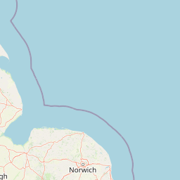
The Broads has matching entity and fact areas of 303 km², while its stored polygon calculates to 301.306 km²; the geometry centres near 52.61638° N, 1.56874° E and spans 1.28800°–1.72813° E by 52.45066°–52.81082° N. Its calculated perimeter is 473.13 km; these atlas dimensions support geographic orientation and are not a cadastral survey.
- Boundary area
- 301.3 km²
- Boundary perimeter
- 473.1 km
- Northernmost point
- 52.8108° N
- Southernmost point
- 52.4507° N
- Easternmost point
- 1.7281° E
- Westernmost point
- 1.288° E
- Geographic centre
- 52.6164° N, 1.5687° E
- North–south span
- 40.1 km
- East–west span
- 29.8 km
Terrain and natural features
Recorded waterways, lakes, and forests within the protected landscape
The Broads Terrain Atlas, Mapped Natural Features and Lowland Landscape
This protected area features a stored lowland terrain classification alongside recorded lakes, rivers, and forests located within the boundary. Linked feature cards supply official names, types, and spatial relationships for every cataloged natural landmark.
Selected named natural features
Streams
Chainbridge Beck
Streams
Heckington Beck
Forests
Wagonhill Plantation
Lakes
Ranworth Broad
Rivers
Lackford Run
Environmental setting
Temperate lowland terrain, wetland habitats, and major river systems
Environmental Setting and Landscape Classifications of The Broads
Recorded landscape features and habitat types outline the physical setting and temperate climate profile of the protected area. Linked categories connect observed terrain traits to broader atlas destinations across the region.
- Relief
- Lowland
- Climate
- Temperate
- Water
- Major water bodies
- Forest cover
- Sparse forest
- Seasonality
- Year-round
Landscape features
Wetland · Rivers · Lakes
Habitat types
Wetland · Riverine habitat
Park atlas
Compare England's diverse protected areas, tracing regional geography and interconnected conservation landscapes.
Find Other National Parks and Protected Areas Near The Broads Wetland Landscape
After exploring The Broads, continue your geographic journey by browsing other national parks and protected areas across England, including nearby wetland reserves and distinctive coastal landscapes. Discover how these conservation areas fit into the broader regional geography, allowing for comparative exploration of diverse natural and cultural heritage sites.
Marine protected areaNorfolk
About 18 km away#1 closest
Northwest

Cromer Shoal Chalk Beds: A Major Marine Protected Area Off the Norfolk Coastline
Subtidal chalk reefs and biodiverse marine landscapes.
Spanning roughly 320 square kilometres of seabed, the Cromer Shoal Chalk Beds form a remarkable marine environment known for its massive chalk reef structures. This protected zone preserves a complex mosaic of marine life, including unique sponge species and diverse invertebrates that thrive on the rare hard chalk substrate found beneath the southern North Sea waters.
- Area
- 321 km²
- Established
- 2016
- Relief
- Lowland
- Climate
- Temperate
Nature reserveSuffolk
About 43 km away#2 closest
South
Martlesham Wilds Nature Reserve: Suffolk Wetland and Protected Landscape Geography
Examining the ecological corridor along the River Deben estuary
Martlesham Wilds represents a significant lowland rewilding effort in eastern England. The 117 hectare reserve, managed by the Suffolk Wildlife Trust, creates a vital connection between ancient woodlands, tidal marshes, and freshwater wetland scrapes. Explore the geographic layout and protected boundaries of this developing sanctuary on the Deben Estuary.
- Area
- 1.17 km²
- Established
- 2023
- Relief
- Lowland
- Climate
- Temperate
Nature reserveEssex
73 km away#3 closest
Southwest
Colne Estuary Nature Reserve: Geography and Protected Landscapes of the Essex Coast
Coastal wetlands, saltmarsh zones, and geological formations
Colne Estuary represents a massive tidal landscape in Essex characterized by the interaction between fluvial and marine systems. Covering over 2,900 hectares, this site protects diverse habitats including intertidal mudflats, active saltmarshes, and transitional zones that support wintering waterbirds. The area remains a key reference for studying coastal accretion and Quaternary geology in the East of England.
- Area
- 29.152 km²
- Established
- 1989
- Relief
- Lowland
- Climate
- Temperate
Nature reserveEssex
77 km away#4 closest
Southwest
Abberton Reservoir: Mapped Landscape and Protected Area Context in Essex, England
Freshwater reservoir, wetland, and historic site
Abberton Reservoir stands as a landmark of regional geography in Essex. This entry maps the site's transition from an engineered water-supply facility to a mosaic of reedbeds, marshes, and open water, providing essential habitat for migratory wildfowl and wintering bird populations.
- Area
- 7 km²
- Established
- 1939
- Relief
- Lowland
- Climate
- Temperate
Marine protected areaEssex
About 87 km away#5 closest
Southwest
Blackwater, Crouch, Roach and Colne Estuaries Marine Conservation Zone Geography and Map
A comprehensive look at England's largest inshore marine protected area.
Covering 284 square kilometers of the Essex coast, this marine conservation zone integrates four tidal estuaries and North Sea coastal frontage into a single protected system. Recognized for its unique native oyster beds and vast intertidal mudflats, the area provides essential habitat for waterfowl. Explore the mapped terrain and overlapping conservation boundaries that define this vital estuarine landscape.
- Area
- 284 km²
- Relief
- Lowland
- Climate
- Temperate
- Scope
- Marine
Nature reserveNorthamptonshire
About 141 km away#6 closest
West
Summer Leys Nature Reserve: Geographic Context and Mapped Wetland Boundaries in Northamptonshire
Wetland ecosystems and industrial land reclamation in the Upper Nene Valley
Summer Leys is an important nature reserve and protected wetland complex in Northamptonshire. Defined by its history as a gravel extraction site, the landscape now features open lagoons, reed-fringed pools, and vital grassland habitats. This site provides a critical study in how former industrial terrain is repurposed for ecological conservation and avian biodiversity within the regional landscape of the English East Midlands.
- Area
- 0.5 km²
- Relief
- Lowland
- Climate
- Temperate
- Access
- Easy access
Nature reservePas-de-Calais
163 km away#7 closest
South

Réserve naturelle nationale du Platier d'Oye: Protected Coastal Landscape and Wetland Geography
Coastal dunes and migratory bird habitats in Pas-de-Calais
Located along the Opal Coast, the Réserve naturelle nationale du Platier d'Oye represents a complex mosaic of tidal flats, mobile sand dunes, and humid polder meadows. This protected area offers unique insight into the ecological intersection of maritime forces and terrestrial environments, functioning as a primary staging ground for diverse migratory species within the Hauts-de-France coastal region.
- Area
- 3.91 km²
- Established
- 1987
- IUCN
- IV
- Relief
- Lowland
National parkZeeland
164 km away#8 closest
Southeast

Oosterschelde National Park: A Dynamic Tidal Marine Ecosystem in Zeeland, Netherlands
Explore the geography of Netherlands' largest protected tidal landscape.
Oosterschelde National Park represents a unique intersection of natural dynamism and human engineering within the Zeeland province. As the Netherlands' largest national park, it safeguards a vast tidal lagoon system characterized by its profound tidal flats and sandbanks that transform landscape twice daily. This protected area offers a remarkable case study in coastal geography and marine conservation, with its rich ecosystems supporting diverse wildlife and providing excellent opportunities for sport diving and birdwatching. Delve into the mapped context of this significant Dutch protected landscape.
- Area
- 370 km²
- Established
- 2002
- IUCN
- II
- Relief
- Lowland
MoriAtlas Explorer
Continue Atlas Exploration of The Broads' Protected Wetland Geography
Deepen your understanding of The Broads by continuing your exploration of its unique geography and protected landscape features. MoriAtlas provides structured data to map its waterways, analyze its wetland ecosystems, and comprehend its place within the broader regional context. Discover the full geographic profile of this significant protected area and its distinctive mapped terrain.
Browse next
Global natural geography
Explore related park routes
Explore MoriAtlas Global ParksBrowse All MoriAtlas ParksGlobal Park Map DiscoveryMoriAtlas: Browse All CountriesBrowse All MoriAtlas ContinentsNational Park Environment AtlasGrand Canyon National Park AtlasYellowstone National Park AtlasYosemite National Park Atlas and GeographySerengeti National Park AtlasGalápagos National Park Protected LandscapeBanff National Park Geography and AtlasKruger National Park Atlas EntryUluṟu-Kata Tjuṯa National Park AtlasExplore Uluru-Kata Tjuta National Park GeographyPlitvice Lakes National Park AtlasFiordland National Park Protected LandscapeGreat Smoky Mountains National Park AtlasAfghanistan National Parks and Protected AreasAlbania National Parks and Protected AreasAlgeria National Parks and Protected AreasAmerican Samoa National Parks and Protected AreasAndorra National Parks and Protected AreasAngola National Parks and Protected AreasAntarctica National Parks and Protected AreasAntigua and Barbuda Park List