
Mori Atlas logo
Protected areaThree Parallel Rivers of Yunnan Protected Areas

A detailed look at the unique river confluence, mountain terrain, and regional biodiversity corridors

Three Parallel Rivers of Yunnan Protected Areas: Geographic Mapping and Protected Landscape Analysis

The Three Parallel Rivers of Yunnan Protected Areas stand as a massive ecological corridor within the Hengduan Mountains, where the Yangtze, Mekong, and Salween rivers carve deep, parallel gorges across the landscape. This site serves as a vital refuge for biodiversity, featuring extreme vertical climate zones that range from arid subtropical river valleys to glacial alpine peaks. Within these rugged boundaries, the convergence of diverse ecosystems and distinct cultural traditions creates a complex, high-altitude landscape of global significance.

World Heritage Siteriver gorgesHengduan Mountainsbiodiversity hotspotalpine scenerysnow-capped peaks
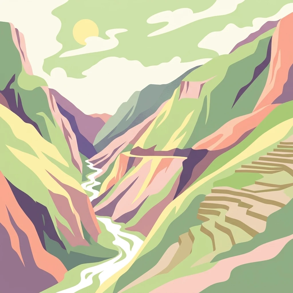
A graphic illustration of a deep, winding river gorge flanked by steep mountains, with terraced fields visible on the right slope and a stylized sun in the sky.

Three Parallel Rivers of Yunnan Protected Areas

Protected area

Park overview

Structured park overview, official facts, and landscape profile for Three Parallel Rivers of Yunnan Protected Areas

Three Parallel Rivers of Yunnan Protected Areas park facts, protected area profile, and essential visitor context

Review the core facts for Three Parallel Rivers of Yunnan Protected Areas, including designation, size, terrain, visitor scale, habitats, and operating context in one park-focused overview.

About Three Parallel Rivers of Yunnan Protected Areas

The Three Parallel Rivers of Yunnan Protected Areas is one of the most geologically and ecologically distinctive World Heritage Sites in Asia. It sits at the collision zone where the Indian plate pushed northward into the Eurasian plate roughly 40 million years ago, lifting and slicing the Hengduan Mountains into a tightly packed series of north-south ranges. Three of the continent's longest rivers, originating on the Tibetan Plateau, descend through this jumble of mountains in deep, nearly parallel gorges. The Jinsha, or upper Yangtze, runs at its closest only about 66 kilometers from the Lancang, the upper Mekong, while the Nu, or upper Salween, comes within less than 19 kilometers of the Lancang in the most compressed section. They never converge, despite flowing side by side for hundreds of kilometers.

This unusual drainage pattern has powerful ecological consequences. Because the mountains run north to south and the region escaped full glaciation during the Quaternary ice ages, the river valleys served as migration corridors and refuges for flora and fauna. Plants and animals moved both northward and southward along the valleys, and the steep topography produced rapid changes over short distances, from semi-arid hot valleys up through broadleaf and conifer forests into alpine meadows and finally permanent snow. Roughly 20 percent of China's higher plant species and about 25 percent of its vertebrate species occur inside this small region.

The protected area is also a cultural landscape shaped by the river valleys themselves. Twenty-two officially recognized ethnic minorities live in the park's three-component prefectures, including the Naxi around Lijiang, Tibetans of Diqing, the Lisu and Nu along the Salween, and smaller groups such as the Bai, Yi, Pumi, and Derung. Each group has adapted to a different elevation belt and developed its own language, religion, agriculture, and architecture, creating a layered human geography that mirrors the vertical layering of the natural environment. The deliberate protection of both natural and cultural values is central to the site's World Heritage significance.

The UNESCO inscription in 2003 includes eight distinct protected areas grouped together, with a defined core zone and buffer zone. The site satisfies all four natural heritage criteria: it represents major stages of Earth's history, ongoing geological and biological processes, exceptional natural beauty, and critical habitat for rare and endangered species.

Quick facts and research context for Three Parallel Rivers of Yunnan Protected Areas

The Three Parallel Rivers of Yunnan Protected Areas lies in northwestern Yunnan Province, spanning the prefectures of Diqing Tibetan Autonomous Prefecture, Nujiang Lisu Autonomous Prefecture, and Lijiang City. It encompasses nine nature reserves and ten scenic zones, covering roughly 1.7 million hectares, making it one of the largest World Heritage Sites in China. The protected area was inscribed on the UNESCO World Heritage List in 2003 under natural criteria and is recognized for its geological, ecological, and cultural importance. The region also represents the meeting point of East Asia, South Asia, and the Tibetan Plateau, an unusually compressed intersection of three major biogeographic realms.

Protection and recognition

Explore documented terrestrial protection scope and UNESCO World Heritage recognition.

Three Parallel Rivers of Yunnan Protected Areas Protection Status

Three Parallel Rivers of Yunnan Protected Areas maintains documented terrestrial protection status within its regional conservation landscape. Official records outline designated international recognition, including verified UNESCO World Heritage listing.

International recognition

Protection details

Protection scope
Terrestrial
Transboundary protection
No
Core area
9,400 km²
Buffer area
7,600 km²
Park context

Deeper park guide and search-rich context for Three Parallel Rivers of Yunnan Protected Areas

Three Parallel Rivers of Yunnan Protected Areas history, landscape, wildlife, and travel context

Explore Three Parallel Rivers of Yunnan Protected Areas through its history, landscape character, ecosystems, wildlife, conservation priorities, cultural context, and seasonal travel timing in a structured park guide built for atlas discovery and search intent.

Why Three Parallel Rivers of Yunnan Protected Areas stands out

The protected area is internationally renowned for the rare geological phenomenon of three major rivers, the upper Yangtze, upper Mekong, and upper Salween, running parallel for over 170 kilometers through deep gorges cut into the Hengduan Mountains without merging. The park is equally distinguished for sharing an extraordinary share of China's biodiversity within a tiny fraction of its land area, holding more than a fifth of China's higher plant species and a quarter of its vertebrate species. Its dramatic vertical ecological zones, from dry hot river valleys to snow-capped alpine peaks a short distance apart, make it a classic example of complete mountain climatic zonation. The area is further known for being a center of ethnic and cultural diversity in southwest China, where more than twenty minority groups have historically shared the same rugged landscape and developed distinct languages, religions, and land-use traditions adapted to high mountains and deep valleys.
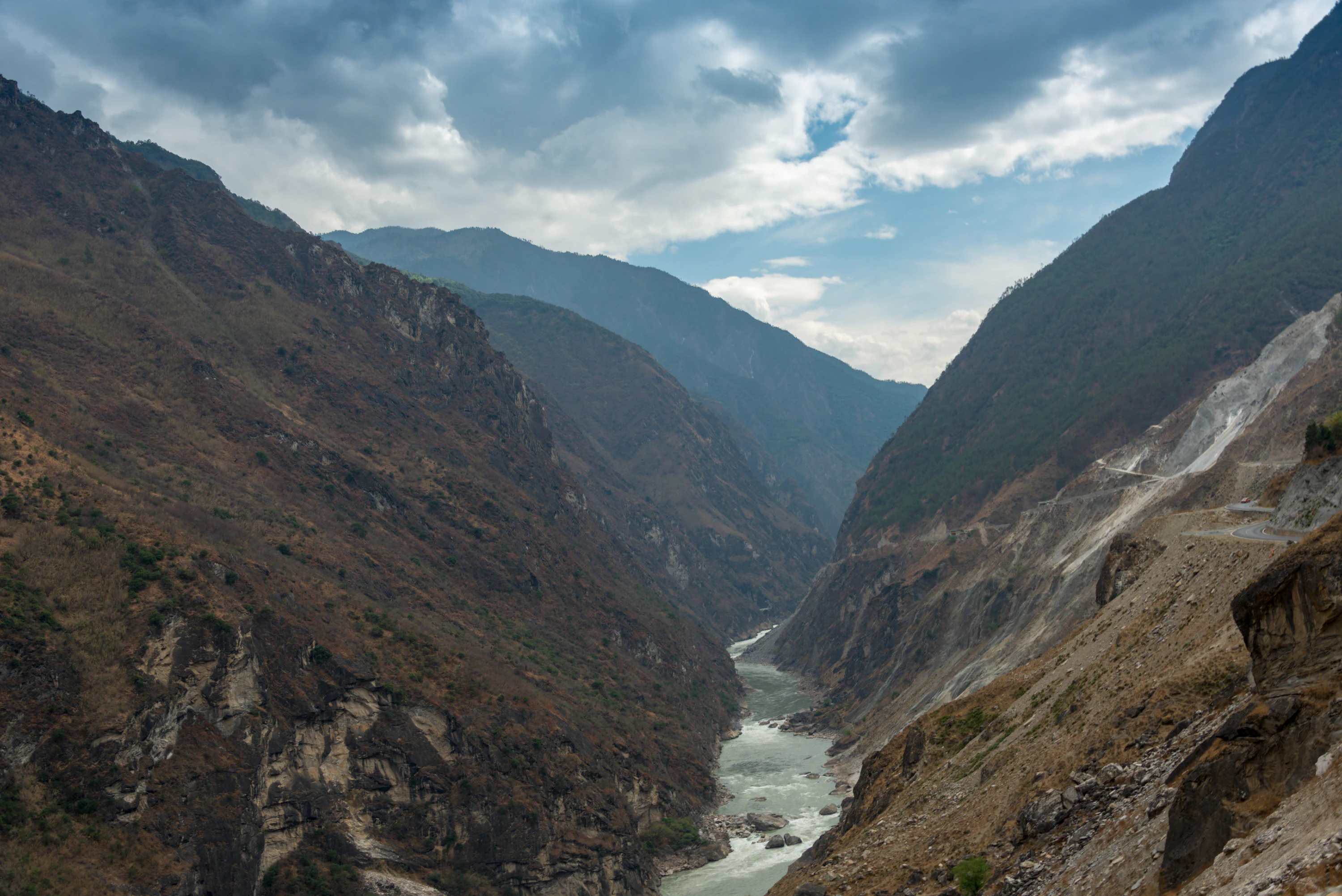
A wide angle shot looking down a steep, rocky canyon with a river flowing through the center. Large, rugged mountains rise on both sides under a cloudy sky.
A view of a river cutting through deep mountain gorges in the Three Parallel Rivers region.

Three Parallel Rivers of Yunnan Protected Areas history and protected-area timeline

The Three Parallel Rivers of Yunnan Protected Areas was inscribed on the UNESCO World Heritage List on 2 July 2003 during the 27th session of the World Heritage Committee in Paris. The site was recognized under all four natural criteria, an unusual distinction that reflected both its geological uniqueness and its biodiversity importance.

Shortly after inscription, however, the park drew international attention for reasons unrelated to its conservation record. A hydropower plan revealed in 2002 had not been disclosed during the nomination, calling for the construction of 13 large dams on the Nu River, one of them within the protected area and twelve others in close proximity. The Nu River had been celebrated as one of China's last great free-flowing rivers. An international campaign against the dam project emerged, and the World Heritage Committee issued a formal warning in 2004, placing the site under close monitoring for three consecutive years. Following high-level intervention by China's State Council, the dam-building program was suspended, easing the immediate threat to the property.

In 2007, at the 31st session of the World Heritage Committee in Christchurch, New Zealand, the Committee reviewed the management response of the site and accepted the corrective measures taken. The episode marked a turning point in how large-scale infrastructure planning was weighed against World Heritage values in China, and the park has since stood as a reference case for reconciling conservation with regional development.

Three Parallel Rivers of Yunnan Protected Areas landscape and geographic character

The defining landscape of the Three Parallel Rivers area is the parallel gorges of the Jinsha, Lancang, and Nu rivers as they cut southward through the Hengduan Mountains. The rivers originate on the Qinghai-Tibet Plateau and descend through a tight stack of mountain ranges, including the Dandanglika Mountains, the Gaoligong Mountains, the Nu Mountains, and the Yunling Mountains. Between the channels lie towering peaks and ridges, with the shortest cross-valley distance between the Nu and Lancang rivers measuring only a few kilometers, while the cliffs above the rivers rise several thousand meters on either side.

The vertical scale of the terrain is extraordinary. Vegetation and climate change from dry subtropical conditions in the river bottoms to alpine tundra and glaciers within walking distance of the valley floor. Snow-capped massifs such as the Meili Snow Mountains (Kawakarpo), the Baima Snow Mountains, the Haba Snow Mountains, the Hongshan Snow Mountains, and Laojun Mountain anchor the upper elevations and feed tributary streams with meltwater. Between the peaks, the Nu River Grand Canyon is among the deepest in the world.

The river valleys themselves are linear corridors of high humidity and dense vegetation, while the dry sheltered slopes create stark contrasts. The result is a landscape where high mountain, deep canyon, dry valley, alpine meadow, and glacier coexist within a single day's travel, a structural compression that has few parallels on Earth.

Three Parallel Rivers of Yunnan Protected Areas ecosystems, habitats, and plant life

Ecologically, the Three Parallel Rivers region functions as both a refuge and a corridor. Its north-south orientation meant that during cold glacial periods, plant and animal populations could shift up and down slope and along valleys without crossing hostile east-west climatic barriers, which the east-west mountain ranges of central China imposed. The result is that the park contains a disproportionately rich sample of the northern temperate and southern Asian floras packed into a small area. Tropical, subtropical, temperate, and boreal plant communities can occur in vertical sequence on a single mountain.

The lower elevations support hot, dry valleys with sparse, hardy shrub vegetation, while mid-elevations are clothed in broadleaf evergreen and mixed forests, gradually giving way to conifer-dominated forests and then alpine shrublands. Forests of fir, spruce, and fir-spruce mixtures give way to meadows, rhododendron thickets, and rocky fellfields above the treeline. Lakes such as those of the Qianhu Mountain area add isolated wetland habitats that further enrich diversity.

The parks' nine nature reserves and ten scenic zones together cover approximately 1.7 million hectares and form a mosaic of natural habitats, including temperate broadleaf mixed forest, montane coniferous forest, alpine meadow, dry-hot valley, and high-mountain wetland. This habitat diversity supports a rich and largely intact food web despite long-standing human presence.

Three Parallel Rivers of Yunnan Protected Areas wildlife and species highlights

The Three Parallel Rivers Protected Areas support an unusually dense concentration of China's wildlife. The site is home to 77 nationally protected animal species, including some of Asia's most charismatic and endangered mammals. The Yunnan snub-nosed monkey, an iconic and globally rare primate endemic to this part of the Hengduan Mountains, is among the most emblematic species. Other large mammals present include the snow leopard in the higher altitudes, the Bengal tiger in the lower forests, and various antelope species on the alpine meadows. The endangered black-necked crane, a high-altitude breeder, uses parts of the park's plateau wetlands.

Birds are abundant and varied, with both Himalayan and Indo-Burmese elements overlapping in the river valleys. Mammals such as the clouded leopard, Asiatic black bear, takin, and wild boar share the forests with smaller carnivores, ungulates, and primates. Reptiles, amphibians, and freshwater fish in the three river systems add further layers of diversity, with many species restricted to single river basins.

The vertical compression of habitats means that a relatively short excursion can take a visitor through ecological zones that on other continents are separated by hundreds of kilometers of latitude. This makes the park especially notable for wildlife observation across very different climatic regimes within a small geographic footprint.

Three Parallel Rivers of Yunnan Protected Areas conservation status and protection priorities

As a UNESCO World Heritage Site inscribed in 2003 under all four natural criteria, the Three Parallel Rivers of Yunnan Protected Areas is internationally recognized as one of the most important conservation priorities in Asia. The park was nominated because it represents an outstanding example of ongoing geological processes, contains exceptional natural beauty, harbors a very high proportion of China's biodiversity, and provides vital habitat for rare and endangered species. Its World Heritage status gives the site an international conservation profile and obligates China to manage it according to UNESCO guidelines.

Conservation management involves a layered system. The park is divided into a core area of roughly 0.94 million hectares and a buffer zone of approximately 0.76 million hectares, ensuring that the most sensitive zones are shielded from intensive human activity. Logging, mining, large-scale tourism infrastructure, and dam construction are subject to strict review. The 2004 to 2006 World Heritage monitoring period resulting from the proposed Nu River dams led to significant strengthening of oversight and eventually a freeze on those dam plans.

Locally, conservation efforts are intertwined with community development. Provincial authorities in Yunnan have worked to support alternative livelihoods such as sustainable tourism, walnut and herb cultivation, and small-scale herding, reducing pressure on the natural habitats. The integration of cultural and natural values recognized in the site's designation means that safeguarding the cultural traditions of local minority groups is also treated as part of the broader conservation mission.

Three Parallel Rivers of Yunnan Protected Areas cultural meaning and human context

The Three Parallel Rivers region is one of the most ethnically varied landscapes in China. Twenty-two officially recognized minority nationalities live within the protected area's three component prefectures. The Naxi people have historically centered on Lijiang, where they developed a distinctive traditional architecture, Dongba religion, and a historically important caravan trade along the ancient Tea Horse Road. Tibetan communities inhabit the higher elevations of Diqing and the Meili Snow Mountain area, where mountaineering and pilgrimage traditions involve sacred peaks such as Kawagebo. The Lisu, Nu, and Derung live in the steep valleys of the Nujiang Prefecture, their livelihoods shaped by swidden agriculture, hunting, and dense networks of community ties.

These communities coexist alongside the Bai in the Lijiang basin, the Yi and Pumi in upland villages, and smaller groups that maintain distinct languages, religious practices, costumes, and agricultural calendars. Across the park, religious life can include Tibetan Buddhism, folk Dongba practices, Christianity (introduced by missionaries in the 19th and 20th centuries among the Lisu), and various syncretic animist and Daoist traditions.

The deep cultural mosaic of the area is not incidental to its World Heritage value. UNESCO recognized the cultural importance of the park's peoples as part of the broader significance of the unique natural environment. Local festivals, architectural styles, agricultural terraces, traditional villages, and pastoral practices are considered part of the same living heritage system as the rivers and mountains themselves, and many cultural sites are explicitly included within the protected zones.

Top sights and standout views in Three Parallel Rivers of Yunnan Protected Areas

The Three Parallel Rivers of Yunnan Protected Areas' defining highlights include the unparalleled parallel-river landscape itself, complete with the dramatic Nu River Grand Canyon, a series of snow-capped massifs, including the Meili Snow Mountains, Baima Snow Mountains, Haba Snow Mountains, and Laojun Mountain, and a vertical concentration of biodiversity that delivers tropical valley ecosystems, temperate broadleaf forests, alpine meadows, and glacial zones within the same horizontal frame. The meeting of three major geographic realms, East Asia, South Asia, and the Tibetan Plateau, makes the park one of the richest biogeographic crossroads on the continent.

Equally important is the area's significance as a refuge for endangered species such as the Yunnan snub-nosed monkey, snow leopard, Bengal tiger, and black-necked crane, and as a cultural landscape where more than twenty ethnic minorities maintain distinct religious, linguistic, and agricultural traditions. The combination of World Heritage status, high conservation oversight, and living cultural diversity makes the park a rare example of a protected area linking natural and cultural heritage at an international level.

Best time to visit Three Parallel Rivers of Yunnan Protected Areas

The climate of the Three Parallel Rivers Protected Areas varies sharply with elevation, so the ideal season depends largely on which part of the park visitors want to experience. Spring and autumn are generally the most rewarding seasons for most travelers. In spring, from roughly April to June, the rivers swell with snowmelt and rain, slopes and meadows burst into bloom, and high-altitude passes become accessible. Autumn, from September to early November, traditionally brings the most stable weather, clear skies over the snow peaks, and richly colored forests in the mid-elevations.

Winter, from December to February, is dry and cold but offers dramatic snowy scenery, especially around the Meili and Baima Snow Mountains, when the summits are most visible and the valleys are at their clearest. The monsoon season, from July to August, brings heavy rain, landslides, and challenging road conditions in some valleys, although the deep green landscapes and abundant water flows do have their own appeal. Given the park's vertical zonation, visitors can effectively experience different climate conditions by moving up or down just a few hundred meters at almost any time of year.

Monthly climate preview

Trace long-term monthly temperature and precipitation rhythms across representative coordinate data

Three Parallel Rivers of Yunnan Protected Areas Climate Normals and Weather by Month

Long-term representative records track measured average temperature and monthly precipitation patterns across the elevation point at Three Parallel Rivers of Yunnan Protected Areas. Opening the complete monthly climate profile reveals full twelve-month statistical variations for deeper geographic analysis.
Annual mean8 °C
0 °C14 °C
Jan
Feb
Mar
Apr
May11°
Jun14°
Jul14°
Aug14°
Sep12°
Oct
Nov
Dec
Warmest month
July

14.3 °C

Coolest month
January

-0.5 °C

Wettest month
July

4.7 mm/day

Driest month
December

0.2 mm/day

Park location guide

Geography guide, regional context, and park location map for Three Parallel Rivers of Yunnan Protected Areas

Three Parallel Rivers of Yunnan Protected Areas park geography, regions, and map view in China

Understand where Three Parallel Rivers of Yunnan Protected Areas sits in China through a broader geographic reading of the surrounding landscape, nearby location context, and its mapped position within the national park landscape.

How Three Parallel Rivers of Yunnan Protected Areas fits into China

China is a unitary communist state in East Asia, governed by the Chinese Communist Party. The country's capital is Beijing, while Shanghai is the largest city by urban population. China has 33 province-level divisions including provinces, autonomous regions, municipalities, and special administrative regions. The nation has a long history spanning thousands of years, with achievements including the invention of gunpowder, paper, printing, and the compass.

Wider geography shaping Three Parallel Rivers of Yunnan Protected Areas in China

China is located in East Asia, bordering fourteen countries: Russia, North Korea, Vietnam, Laos, Myanmar, India, Bhutan, Nepal, Pakistan, Afghanistan, Tajikistan, Kyrgyzstan, Kazakhstan, and Mongolia. The country spans diverse terrain including deserts, mountains, plateaus, and river valleys. Major river systems include the Yellow River and Yangtze River. The coastline stretches along the East China Sea, South China Sea, and Yellow Sea.

Map view of Three Parallel Rivers of Yunnan Protected Areas

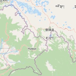
Use this park location map to pinpoint Three Parallel Rivers of Yunnan Protected Areas in China, understand its exact geographic position, and read its mapped placement within the surrounding landscape more clearly.

Pigeon | © OpenStreetMap contributors

Location context for Three Parallel Rivers of Yunnan Protected Areas

Yunnan

Visual reference of parallel river gorges, alpine peaks, and protected mountain habitats

Three Parallel Rivers of Yunnan Protected Areas Photos, Scenery, and Landscapes

Visual documentation captures the rugged vertical zonation and parallel river gorges defining Three Parallel Rivers of Yunnan Protected Areas. Examining terrain photographs and protected-area scenery reveals the dramatic scale of snow-capped massifs and deep alpine valleys.

A wide angle shot looking down a steep, rocky canyon with a river flowing through the center. Large, rugged mountains rise on both sides under a cloudy sky.

A wide canyon landscape with a winding river flowing between steep, rugged mountain slopes, featuring terraced agricultural land on the right side.

Park atlas

Compare surrounding mountain ecosystems, deep river gorges, and connected regional reserves

Parks Near Three Parallel Rivers of Yunnan Protected Areas and Regional Protected Landscapes

Visitors exploring Three Parallel Rivers of Yunnan Protected Areas can compare adjacent mountain reserves and protected landscapes across the surrounding region. Reviewing nearby terrain corridors provides broader geographic context for the complex river systems and alpine ecology of southwest China.
National parkKachin State
About 59 km away#1 closest

Northwest

Hkakaborazi National Park: National Park Protected Landscape and Map Explorer

Explore its mapped boundaries and regional geography in Kachin State.

Hkakaborazi National Park serves as a critical protected area within Kachin State, offering a unique geographic profile for atlas and map exploration. This dedicated entry focuses on its identity as a national park, detailing its mapped landscape context and its role within the broader protected areas network. Understand the specific geographic features and boundaries that define this important natural landscape, essential for any detailed cartographic or regional study.

Area
3,810 km²
Established
1998
IUCN
II
Relief
Mountain
National parkMyanmar
About 179 km away#2 closest

South

Emawbum National Park: Myanmar's Protected National Park Landscape Identity

Explore the geography and mapped boundaries.

Emawbum National Park offers a distinct focus for understanding protected areas within Myanmar. This detail page facilitates an exploration of its unique geographic setting and the mapped extent of its protected landscape. Discover what makes this national park a vital component of regional geographic context for atlas-based discovery and conservation insights.

IUCN
II
A minimalist watercolor painting featuring soft, abstract layers of rolling green hills in the midground and pale, hazy mountain peaks in the background, set against a light background.
Nature reserveSichuan
About 187 km away#3 closest

East

Sichuan Yading National Nature Reserve: Mapped Protected Landscapes in Western Sichuan

High altitude terrain, glaciated peaks, and alpine geography.

Sichuan Yading National Nature Reserve is a significant protected area in the Garzê Tibetan Autonomous Prefecture, home to the Three Holy Mountains and extensive glacial features. This entry details the reserve geography, focusing on the distribution of alpine meadows, high elevation forests, and the dramatic vertical landscape carved by the Litang River tributaries.

Area
3,815.06 km²
Established
1996
Relief
Mountain
Climate
Alpine
National parkArunachal Pradesh
About 205 km away#4 closest

West

Namdapha National Park: A National Park Detailed Entry for Geographic and Atlas Exploration

Explore mapped boundaries and regional landscape context in Arunachal Pradesh.

Namdapha National Park serves as a key protected area, offering a unique opportunity for structured geographic discovery. This entry focuses on its designation as a national park, providing detailed information about its mapped landscape, regional setting within Arunachal Pradesh, and overall protected territory context. It is designed to assist users in understanding the park's boundaries and its significance within a broader atlas framework.

Area
1,985 km²
Established
1983
IUCN
II
Relief
Mountain
Wildlife reserveArunachal Pradesh
About 244 km away#5 closest

West

Mehao Wildlife Sanctuary: Geography and Protected Habitat Mapping in Northeast India

A diverse reserve within the Eastern Himalaya biodiversity hotspot.

Mehao Wildlife Sanctuary protects an expansive landscape featuring rare orchid-rich forests and high-altitude lake ecosystems. By preserving terrain that spans subtropical valleys to temperate coniferous ridges, this reserve provides essential habitat for iconic species like the Mishmi takin and red panda. Examine the complex forest layers and geographic features that define this significant Indian protected area.

Area
281.5 km²
Established
1980
IUCN
II
Relief
Mountain
Wildlife reserveArunachal Pradesh
About 286 km away#6 closest

Northwest

Dibang Wildlife Sanctuary: Protected Landscape and Geography in Arunachal Pradesh

A vast eastern Himalayan wildlife reserve in the Mishmi Hills

Located in the Upper Dibang Valley, this wildlife reserve occupies an expansive mosaic of montane forests and steep gorges. As a key segment of the Dihang-Dibang Biosphere Reserve, the sanctuary provides vital habitat continuity across elevation gradients ranging from river valleys to high temperate slopes, forming a major unit of protected land in the Indian Himalayas.

Area
4,149 km²
Established
1992
IUCN
IV
Relief
Mountain
National parkAssam
About 291 km away#7 closest

West

Dehing Patkai National Park: Assam's Extensive Lowland Tropical Rainforest Atlas

Explore mapped boundaries and critical primate habitat.

Dehing Patkai National Park is a vital protected area in Assam, renowned as India's largest contiguous lowland rainforest. This park provides a crucial habitat for diverse species, notably featuring seven primate species including the Hoolock gibbon, and serves as a key elephant reserve. Explore the mapped geography of this unique four-layered tropical forest ecosystem, understanding its ecological significance and protected landscape identity within northeastern India.

Area
231.65 km²
Established
2004
IUCN
II
Relief
Lowland
Wildlife reserveArunachal Pradesh
About 291 km away#8 closest

West

D'Ering Memorial Wildlife Sanctuary: Mapped Grassland and Floodplain Geography

A vital wildlife reserve within the Arunachal Pradesh landscape.

Spanning 190 square kilometers in the eastern Himalayas, D'Ering Memorial Wildlife Sanctuary is a distinct floodplain reserve characterized by open grasslands and riverine forest patches. The sanctuary serves as a key ecological anchor in the Siang river system, offering a look at managed, low-lying habitats that support predators and small mammals across the plains of Arunachal Pradesh.

Area
190 km²
Established
1978
IUCN
IV
Scope
Terrestrial

Common questions about visiting, size, designation, and location context for Three Parallel Rivers of Yunnan Protected Areas

Three Parallel Rivers of Yunnan Protected Areas FAQs for park facts, access, geography, and protected area context

Find quick answers about Three Parallel Rivers of Yunnan Protected Areas, including protected-area facts, park geography, trail and visitor context, and how the park fits into its surrounding country and regional landscape.
MoriAtlas Explorer

Continue Your Protected Areas Search Across the Global Atlas

Deepen your exploration by continuing the structured search for national parks and protected areas worldwide. Utilize the comprehensive filtering capabilities to compare different conservation landscapes and refine your understanding of global park geography. Discover more about the distribution and characteristics of protected natural areas.

Global natural geography