Mori Atlas logo
Nearby park discovery

Mapping the natural landscapes and protected terrain in the vicinity of this river corridor

Regional Protected Areas and Geographic Surroundings of Three Parallel Rivers of Yunnan

Examine the geographic distribution of protected areas adjacent to the Three Parallel Rivers of Yunnan in northwest Yunnan. This regional overview highlights the spatial context of surrounding mountain ecosystems, deep gorges, and high-altitude terrain. Gain a clearer understanding of how these protected lands are situated within the broader physical geography of the Hengduan Mountains.

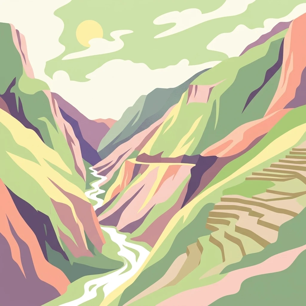
A graphic illustration of a deep, winding river gorge flanked by steep mountains, with terraced fields visible on the right slope and a stylized sun in the sky.

Where the Yangtze, Mekong, and Salween flow side by side through the Hengduan Mountains.

Three Parallel Rivers of Yunnan Protected Areas

The Three Parallel Rivers of Yunnan Protected Areas is a UNESCO World Heritage Site in the mountainous northwest of Yunnan Province, China. The park protects a striking section of the Hengduan Mountains where three of Asia's great rivers, the Yangtze (Jinsha), the Mekong (Lancang), and the Salween (Nu), descend from the Tibetan Plateau and run for more than 170 kilometers in parallel deep gorges without ever merging. This unusual confluence of geography makes the area one of the most dramatic river landscapes in the world. Beyond its sheer scenic power, the protected area is exceptional for its ecological richness. The combination of north-south mountain corridors and the absence of full Pleistocene glaciation allowed the region to act as a refuge and dispersal route for plants and animals across the Eurasian continent. As a result, an unusually high concentration of China's biodiversity is concentrated in a land area of less than half a percent of the national territory, supporting rare species from black-necked cranes and snow leopards to the endemic Yunnan snub-nosed monkey. The site is also one of China's most culturally diverse regions. Within its bounds live more than twenty ethnic minority groups, including Naxi, Lisu, Tibetan, Bai, Yi, Pumi, Nu, and Derung communities, each preserving distinct languages, religious traditions, and ways of life that are closely tied to the surrounding river valleys and alpine pastures. Altogether, the landscape, biodiversity, and human cultures combine into a World Heritage Site whose significance extends well beyond its regional setting.

Location
China
Park type
Protected area
Established
2003
Area
17,000 km²
Three Parallel Rivers of Yunnan Protected Areas Atlas
Regional park map

See the ranked park cluster in its geographic setting

Nearby parks around Three Parallel Rivers of Yunnan Protected Areas

This regional map shows the same 20 nearby parks ranked below around Three Parallel Rivers of Yunnan Protected Areas. Select a ranked marker to highlight that park’s boundary where boundary data is available.
Reference park: Three Parallel Rivers of Yunnan Protected AreasRanked nearby park20 nearby parks shown
20 nearby parks

Ranked distance metrics, directional positioning, and regional conservation environments

Parks and Protected Areas Geographically Near Three Parallel Rivers of Yunnan Protected Areas

Geographic distance measurements rank surrounding protected areas by spatial separation and directional orientation relative to Three Parallel Rivers of Yunnan Protected Areas. Country context and recorded environmental metrics provide structured comparison signals for analyzing regional park geography and protected landscape patterns.
National parkKachin State
About 59 km away#1 closest

Northwest

Hkakaborazi National Park: National Park Protected Landscape and Map Explorer

Explore its mapped boundaries and regional geography in Kachin State.

Hkakaborazi National Park serves as a critical protected area within Kachin State, offering a unique geographic profile for atlas and map exploration. This dedicated entry focuses on its identity as a national park, detailing its mapped landscape context and its role within the broader protected areas network. Understand the specific geographic features and boundaries that define this important natural landscape, essential for any detailed cartographic or regional study.

Area
3,810 km²
Established
1998
IUCN
II
Relief
Mountain
National parkMyanmar
About 179 km away#2 closest

South

Emawbum National Park: Myanmar's Protected National Park Landscape Identity

Explore the geography and mapped boundaries.

Emawbum National Park offers a distinct focus for understanding protected areas within Myanmar. This detail page facilitates an exploration of its unique geographic setting and the mapped extent of its protected landscape. Discover what makes this national park a vital component of regional geographic context for atlas-based discovery and conservation insights.

IUCN
II
A minimalist watercolor painting featuring soft, abstract layers of rolling green hills in the midground and pale, hazy mountain peaks in the background, set against a light background.
Nature reserveSichuan
About 187 km away#3 closest

East

Sichuan Yading National Nature Reserve: Mapped Protected Landscapes in Western Sichuan

High altitude terrain, glaciated peaks, and alpine geography.

Sichuan Yading National Nature Reserve is a significant protected area in the Garzê Tibetan Autonomous Prefecture, home to the Three Holy Mountains and extensive glacial features. This entry details the reserve geography, focusing on the distribution of alpine meadows, high elevation forests, and the dramatic vertical landscape carved by the Litang River tributaries.

Area
3,815.06 km²
Established
1996
Relief
Mountain
Climate
Alpine
National parkArunachal Pradesh
About 205 km away#4 closest

West

Namdapha National Park: A National Park Detailed Entry for Geographic and Atlas Exploration

Explore mapped boundaries and regional landscape context in Arunachal Pradesh.

Namdapha National Park serves as a key protected area, offering a unique opportunity for structured geographic discovery. This entry focuses on its designation as a national park, providing detailed information about its mapped landscape, regional setting within Arunachal Pradesh, and overall protected territory context. It is designed to assist users in understanding the park's boundaries and its significance within a broader atlas framework.

Area
1,985 km²
Established
1983
IUCN
II
Relief
Mountain
Wildlife reserveArunachal Pradesh
About 244 km away#5 closest

West

Mehao Wildlife Sanctuary: Geography and Protected Habitat Mapping in Northeast India

A diverse reserve within the Eastern Himalaya biodiversity hotspot.

Mehao Wildlife Sanctuary protects an expansive landscape featuring rare orchid-rich forests and high-altitude lake ecosystems. By preserving terrain that spans subtropical valleys to temperate coniferous ridges, this reserve provides essential habitat for iconic species like the Mishmi takin and red panda. Examine the complex forest layers and geographic features that define this significant Indian protected area.

Area
281.5 km²
Established
1980
IUCN
II
Relief
Mountain
Wildlife reserveArunachal Pradesh
About 286 km away#6 closest

Northwest

Dibang Wildlife Sanctuary: Protected Landscape and Geography in Arunachal Pradesh

A vast eastern Himalayan wildlife reserve in the Mishmi Hills

Located in the Upper Dibang Valley, this wildlife reserve occupies an expansive mosaic of montane forests and steep gorges. As a key segment of the Dihang-Dibang Biosphere Reserve, the sanctuary provides vital habitat continuity across elevation gradients ranging from river valleys to high temperate slopes, forming a major unit of protected land in the Indian Himalayas.

Area
4,149 km²
Established
1992
IUCN
IV
Relief
Mountain
National parkAssam
About 291 km away#7 closest

West

Dehing Patkai National Park: Assam's Extensive Lowland Tropical Rainforest Atlas

Explore mapped boundaries and critical primate habitat.

Dehing Patkai National Park is a vital protected area in Assam, renowned as India's largest contiguous lowland rainforest. This park provides a crucial habitat for diverse species, notably featuring seven primate species including the Hoolock gibbon, and serves as a key elephant reserve. Explore the mapped geography of this unique four-layered tropical forest ecosystem, understanding its ecological significance and protected landscape identity within northeastern India.

Area
231.65 km²
Established
2004
IUCN
II
Relief
Lowland
Wildlife reserveArunachal Pradesh
About 291 km away#8 closest

West

D'Ering Memorial Wildlife Sanctuary: Mapped Grassland and Floodplain Geography

A vital wildlife reserve within the Arunachal Pradesh landscape.

Spanning 190 square kilometers in the eastern Himalayas, D'Ering Memorial Wildlife Sanctuary is a distinct floodplain reserve characterized by open grasslands and riverine forest patches. The sanctuary serves as a key ecological anchor in the Siang river system, offering a look at managed, low-lying habitats that support predators and small mammals across the plains of Arunachal Pradesh.

Area
190 km²
Established
1978
IUCN
IV
Scope
Terrestrial
Illustration of a landscape with green mountains, a river, bare trees, and a waterfall under a colorful sky
National parkAssam
About 299 km away#9 closest

West

Dibru-Saikhowa National Park: Mapped Protected Landscape and Regional Geography

Explore Assam's protected natural terrain and park boundaries.

Dibru-Saikhowa National Park represents a key protected area, providing valuable insight into the natural geography and landscape context of Assam. As a designated national park, its mapped boundaries and distinct regional setting are crucial for understanding the distribution of conservation lands in northeastern India. Explore the geographic specifics and atlas relevance of Dibru-Saikhowa National Park for a structured view of this protected landscape.

Area
350 km²
Established
1999
IUCN
II
Relief
Lowland
Wildlife reserveAssam
About 302 km away#10 closest

West

Bherjan-Borajan-Padumoni Wildlife Sanctuary: Regional Geography and Protected Forest Map

A fragmented tropical reserve in the Tinsukia district of Assam.

Delve into the geography of Bherjan-Borajan-Padumoni Wildlife Sanctuary, a reserve spanning three distinct forest blocks. Learn how these managed lands function as a vital arboreal refuge in the broader Brahmaputra valley landscape, offering a detailed look at the protected terrain and habitat structure of this northeastern Indian sanctuary.

Area
7.22 km²
Established
1999
IUCN
IV
Relief
Lowland
Wildlife reserveArunachal Pradesh
About 337 km away#11 closest

West

Yordi Rabe Supse Wildlife Sanctuary: Protected Forest Landscapes and Himalayan Geography

A detailed map and atlas overview of West Siang district terrain

Spanning elevations between 1,500 and 2,500 meters, this wildlife reserve in Arunachal Pradesh acts as a crucial refuge for high-altitude ungulates and rare mammals. The sanctuary offers a unique look at continuous vegetation gradients ranging from tropical canopy to coniferous pine forest, defining the ecological character of this eastern Himalayan mountainous region.

Area
397 km²
Established
1996
IUCN
IV
Relief
Mountain
National parkArunachal Pradesh
About 356 km away#12 closest

West

Mouling National Park: Explore Arunachal Pradesh National Park Geography and Protected Landscape

Mapped protected areas and regional geographic context.

Mouling National Park in Arunachal Pradesh offers a unique opportunity to explore the mapped boundaries and geographic characteristics of a significant protected landscape. This page provides structured insights into its role as a national park, detailing its regional setting and contributing to a broader atlas of protected areas. Understand the distinct natural terrain and landscape context that define this protected area within India.

Area
483 km²
Established
1986
IUCN
II
Relief
Mountain
Wildlife reserveArunachal Pradesh
About 371 km away#13 closest

West

Kane Wildlife Sanctuary: Geography, Forest Mosaics, and Protected Himalayan Terrain

A vital wildlife reserve located in the West Siang district of Arunachal Pradesh.

Kane Wildlife Sanctuary presents a compact yet meaningful protected area defined by its unique transition of tropical evergreen and temperate broadleaf forest types. This Himalayan reserve serves as a critical habitat for large mammals and diverse bird populations, offering a focused look at the varied terrain and regional biodiversity found within the foothills of northeastern India.

Area
31 km²
Established
1991
IUCN
IV
Relief
Upland
National parkChina
About 385 km away#14 closest

Northeast

Giant Panda National Park: China's Premier Panda Habitat and Protected Landscape

Mapped terrain and conservation significance in the mountains of western China.

Giant Panda National Park is a critically important protected area in China, established to conserve the primary habitat for the giant panda. This national park, spanning a vast mountainous region across Sichuan, Gansu, and Shaanxi, integrates numerous former reserves into a unified landscape. It serves as a vital sanctuary, protecting approximately 80 percent of the world's wild panda population and offering deep insights into the geographic distribution and ecological requirements of these endangered animals.

Area
27,134 km²
Established
2020
IUCN
II
Relief
Mountain
Wildlife reserveArunachal Pradesh
About 446 km away#15 closest

West

Talle Valley Wildlife Sanctuary, Arunachal Pradesh: Protected Area and Forest Map

A vital Himalayan sanctuary of vertical forest gradients

Spanning from 1,200 to 3,000 meters in elevation, Talle Valley Wildlife Sanctuary contains a dense mosaic of broadleaf and conifer forests. This reserve in the Subansiri basin provides essential habitat for clouded leopards, hornbills, and various rare Himalayan plants, representing a significant study in biogeographic transition zones.

Area
337 km²
Established
1995
IUCN
IV
Relief
Mountain
National parkQinghai
About 448 km away#16 closest

North

Sanjiangyuan National Park: Qinghai's High-Altitude Headwater Protected Landscape

Mapped geography of the Yellow, Yangtze, and Mekong river sources.

Sanjiangyuan National Park, situated in the high-altitude Qinghai region of China, is a crucial protected area established to safeguard the headwaters of three of Asia's most significant rivers: the Yellow, Yangtze, and Mekong. Covering an immense area with an average elevation exceeding 4,700 meters, the park preserves vital alpine wetlands, grasslands, and the source ecosystems that sustain hundreds of millions downstream. Its protected landscape identity is defined by its extreme elevation, vast marshlands, and its role as a critical water source, offering unparalleled opportunities for geographic and atlas-style exploration of pristine high-altitude terrain.

Area
190,700 km²
Established
2021
IUCN
II
Relief
Highland
Nature reserveZhaotong
About 484 km away#17 closest

East

Dashanbao Black-necked Crane National Nature Reserve Geographic and Atlas Overview

Protected highland wetlands within the Zhaotong regional geography.

Dashanbao Black-necked Crane National Nature Reserve is a nationally significant protected area in Zhaotong, representing a rare high-elevation wintering habitat for migratory cranes. This rugged plateau landscape features shallow marshlands, alpine grasslands, and an interconnected system of lakes that support delicate highland ecological zones. Use this atlas resource to understand the park terrain and its formal conservation boundaries within the broader context of northeast Yunnan.

Area
192 km²
Established
1990
Relief
Mountain
Climate
Subtropical
Wildlife reserveArunachal Pradesh
About 486 km away#18 closest

West

Itanagar Wildlife Sanctuary: Hill Forest Reserve and Protected Landscape in Arunachal Pradesh

Exploring the dense evergreen geography of a key Indian wildlife reserve

Spanning 140 square kilometres, Itanagar Wildlife Sanctuary preserves a vital mosaic of tropical semi-evergreen and wet evergreen forest within the foothills of Arunachal Pradesh. Bounded by the Pachin, Pam, Neorochi, and Chingke streams, this protected area offers a unique juxtaposition of dense hill forest and urban edges, functioning as a significant biodiversity habitat in northeastern India.

Area
140.3 km²
Established
1978
IUCN
IV
Relief
Upland
Watercolor painting of green hills, fields, and a body of water
National parkAssam
About 495 km away#19 closest

West

Kaziranga National Park National Park: Protected Landscape and Geographic Atlas

Mapped boundaries and regional landscape context for this Assam natural area.

Delve into the detailed geographic profile of Kaziranga National Park, a prominent National Park located in Assam, India. This section focuses on its mapped protected area extent, its unique landscape characteristics within the Brahmaputra valley, and its role as a key natural landmark in northeastern India's atlas. Understand the structured geographic data and protected land identity that makes Kaziranga National Park a distinct entity for exploration.

Area
1,090 km²
Established
1905
IUCN
II
Relief
Lowland
Nature reserveSichuan
About 539 km away#20 closest

Northeast

Wolong National Nature Reserve: Mapping Sichuan's Rugged Mountain Protected Lands

A critical mountain nature reserve in the Qionglai range.

Delve into the geography of Wolong National Nature Reserve, a cornerstone of China's protected areas. This site offers insight into the vertical ecology of the eastern Qionglai Mountains, where steep river valleys and extensive bamboo forests characterize the transition toward the Tibetan Plateau. Access map-based insights into this essential wildlife corridor and its role in the larger regional landscape.

Area
2,000 km²
Established
1963
Relief
Mountain
Climate
Alpine
Distance methodology

Geographic measurements, not driving distances

How nearby park distances are calculated

Distances use park boundaries whenever the available geometry allows it. When one or both boundaries are missing, the mapped park locations provide a clearly labelled estimate. Every value represents straight-line geographic separation and does not use roads or routing.

Boundary distance

Calculated between the nearest points of both park boundaries.

Location-to-boundary estimate

Estimated from one mapped park location to the nearest boundary of the other park.

Mapped-location estimate

Estimated between the mapped locations of both parks.

MoriAtlas Explorer

Analyze the Three Parallel Rivers of Yunnan Protected Areas Landscape

Deepen your understanding of the Three Parallel Rivers of Yunnan Protected Areas by examining its mapped mountain corridors and river gorge systems. This MoriAtlas resource provides a structured look at the terrain, ecological zones, and geographic boundaries that define this protected Chinese landscape.