Why Thunder Basin National Grassland stands out
Thunder Basin is best known as a large, contiguous shortgrass and sagebrush steppe where Great Plains prairie wildlife meets Rocky Mountain and intermountain West ecosystems. The grassland's prairie dog colonies and burned patches create distinctive patches of habitat that differ markedly from the surrounding matrix, drawing in mountain plovers, burrowing owls, and many other ground-nesting birds. It is also recognized for its vast sagebrush landscapes, which remain important for sage-grouse conservation, and for the way its burrowing mammals engineer the landscape. Black-tailed prairie dogs, in particular, dramatically increase local habitat heterogeneity, and their colonies have become a focal point for understanding biodiversity, disturbance ecology, and grassland management across the northern plains.
Thunder Basin National Grassland history and protected-area timeline
Thunder Basin National Grassland was formally established on June 23, 1960, as part of a broader mid-twentieth-century effort in the United States to address soil erosion, abandoned farmland, and degraded rangelands through federal conservation programs. The grassland was created from lands that had come into federal ownership through a mix of homestead failure, public land exchanges, and Great Depression-era acquisition programs, all of which left behind a patchwork of parcels in what had once been open ranching country. From its earliest years, the emphasis has been on restoring and maintaining productive grassland cover while allowing continuing use by working ranchers.
Administration of the grassland has always been integrated with the surrounding national forest system. Today it is managed together with the Medicine Bow-Routt National Forests by the U.S. Forest Service, with the supervisor's office in Laramie, Wyoming, and a local ranger district in Douglas. This shared administration is intended to coordinate management across the broader landscape, treating the national grassland as a contiguous working piece of the same ecological region rather than as an isolated reserve.
Over the decades, the management philosophy at Thunder Basin has evolved alongside broader grassland science. Early priorities focused on stabilizing soils and supporting grazing, while more recent efforts have emphasized biodiversity conservation, native plant communities, and the role of natural disturbances like fire and prairie dog activity. The grassland has become an important outdoor laboratory for studying disturbance-based management in the northern plains, a legacy that continues to shape funding, research, and planning decisions on the ground.
Thunder Basin National Grassland landscape and geographic character
The landscape of Thunder Basin National Grassland is defined by the rolling and broken topography of the Powder River Basin, a vast sedimentary basin that stretches across northeastern Wyoming and into Montana. Elevations vary from about 3,600 feet along the lower drainages and breaks to roughly 5,200 feet on the higher plateau divides, creating subtle but ecologically important elevation gradients. Between the Big Horn Mountains and the Black Hills, the country feels expansive, with long sight lines, deeply incised creek bottoms, and broad upland flats that give the basin its characteristic mix of openness and hidden detail.
The terrain reflects millions of years of sediment accumulation, uplift, and erosion, with sequence of sandstones, siltstones, and shales shaping the characteristic badland-like bluffs along drainages. Wind and water erosion have carved channels and gullies into the soft sedimentary layers, producing rugged little canyons that contrast with the otherwise smooth skyline of the surrounding plains. Soils tend to be shallow in many areas, reinforcing the dry, windswept feel of the place and limiting the kinds of vegetation that can establish a hold on steeper slopes.
Vegetation on the visible landscape is dominated by two intermingling communities: warm-season shortgrasses and midgrasses typical of the Great Plains, and woody sagebrush steppe characteristic of the intermountain West. Where soils are shallower and slopes face south or west, sagebrush is often more prominent; where soils are deeper and moisture slightly higher, blue grama and other shortgrass species form nearly continuous cover. Small draws and drawsides may host juniper, greasewood, or riparian thickets, adding structural variety to an otherwise open and treeless landscape overall.
Thunder Basin National Grassland ecosystems, habitats, and plant life
The natural environment at Thunder Basin is shaped by its semi-arid climate, its position between two major grassland systems, and a long history of ecological disturbance from drought, grazing, fire, and burrowing animals. As a result, the area supports an unusually dynamic mosaic of plant communities in which no single type dominates the whole landscape, but rather patches of sagebrush, mixed-grass prairie, and disturbed open ground interact to produce high local biodiversity.
Among the most ecologically influential processes is the activity of burrowing mammals, particularly black-tailed prairie dogs. Their colonies open up dense grass cover, expose bare soil, and create structurally distinctive patches that contrast with surrounding intact sagebrush and grassland. These disturbed areas function as habitat for plants and animals that would otherwise be rare in the closed-canopy matrix, and they have become a focal point for biodiversity management in the grassland overall.
Fire plays a complementary role, with historical wildfires having influenced plant community composition long before any modern management regime. Researchers have observed that, in contrast to the Great Basin, wildfires at Thunder Basin do not generally promote the invasion of cheatgrass, and natural fire return intervals in this region remain part of an ongoing discussion about restoration, fuels management, and the maintenance of native plant communities. Climate patterns, especially the region's multi-year droughts, interact with both fire and grazing to drive vegetation change across the basin.
Thunder Basin National Grassland wildlife and species highlights
Thunder Basin National Grassland supports a rich array of grassland wildlife typical of the northern Great Plains and adjacent sagebrush steppe. More than one hundred species of birds have been recorded on the grassland, including ground-nesting species such as mountain plovers, burrowing owls, and various grassland songbirds whose populations have declined elsewhere in their range. Large herbivores are a notable presence, with pronghorn moving through the area seasonally and mule deer using the rougher breaks and drainage systems as cover.
Among small mammals, black-tailed prairie dogs are among the most ecologically important residents, with their colonies serving as habitat creators for a wide range of other species. White-tailed jackrabbits, cottontails, kangaroo rats, thirteen-lined ground squirrels, and several bat species round out the small mammal community. Predators are well represented, including swift fox, badger, coyote, and red fox, all of which depend on the combination of vegetative cover and open prey-rich habitat that the patchwork mosaic of the grassland provides.
On the larger ungulate side, pronghorn in particular are emblematic of the open, rolling vistas of Thunder Basin, and their seasonal movements link the grassland to surrounding sagebrush and prairie landscapes in Wyoming and Montana. Greater sage-grouse also depend on the larger contiguous sagebrush stands of the area for lekking and nesting habitat, making the conservation of those stands a core concern. The presence of both Great Plains species and intermountain West species living side by side is one of the very features that makes the wildlife community at Thunder Basin especially noteworthy.
Thunder Basin National Grassland conservation status and protection priorities
Conservation at Thunder Basin National Grassland is centered on maintaining the complex mosaic of disturbances, vegetation types, and land uses that supports the area's distinctive biodiversity. The U.S. Forest Service manages the grassland for multiple objectives simultaneously, including wildlife habitat, grazing, recreation, watershed health, and landscape connectivity. Because the area sits between two major grassland systems, management must address species whose ranges straddle this transition, including sage-grouse, pronghorn, mountain plover, and black-tailed prairie dog.
A core conservation concern is the fate of prairie dog colonies and the species that depend on them. Plague outbreaks, such as the sylvatic plague event that reduced one of the area's largest prairie dog complexes from roughly 25,000 acres to about 125 acres in 2017, can rapidly collapse the structure of the grassland's wildlife community. Planned objectives, like the 2002 grassland plan's proposal to provide about 50,000 acres of prairie dog habitat, reflect an effort to maintain a minimum viable network of colonies that can continue to support species such as the mountain plover across the landscape.
Conservation of sagebrush-dependent species is equally important. Large, contiguous blocks of sagebrush are required for sage-grouse persistence, and managing for a shifting mosaic of disturbances is increasingly viewed as a way to balance the needs of sagebrush-obligate species with those of disturbance-dependent species like prairie dogs and mountain plovers. Landownership complexity, with intermingled federal, state, and private parcels, means that effective conservation depends heavily on coordination across ownerships, including grazing permits, voluntary agreements, and partnerships with neighboring landowners, energy developers, and conservation organizations.
Thunder Basin National Grassland cultural meaning and human context
Thunder Basin has long been a working ranching landscape, and ranching families remain central to its cultural identity. Sheep and cattle grazing have shaped the way the vegetation looks and the way the land is managed for over a century, and the rhythms of seasonal grazing, branding, and shipping still influence daily life in the surrounding communities. The grassland sits near the Powder River Basin, a region historically associated with open-range ranching and more recently with significant coal and energy development, giving the cultural landscape of the area a strong working, rural character.
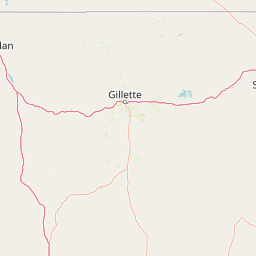
The surrounding communities, including Douglas, Gillette, Lusk, and Newcastle, reflect a regional identity shaped by cattle culture, energy industries, and proximity to the western plains. Outfitting, hunting traditions, and seasonal roundups still play a significant role in how local residents relate to the landscape)
The grasslands also carry echoes of older histories, including homestead-era settlement and later community abandonment as homesteaders failed to make a living on the semi-arid soils. The federal lands that became Thunder Basin National Grassland began, in many cases, as failed homesteads and eroded parcels, and that history is an important part of understanding how the landscape came into public ownership and how it has been managed since.
Top sights and standout views in Thunder Basin National Grassland
The most striking qualities of Thunder Basin are scale, openness, and ecological contrast. Large, unbroken vistas of mixed-grass prairie and sagebrush steppe unfold between the Big Horn Mountains and the Black Hills, and the sky often dominates the landscape. Within that sea of grass and brush, the dynamic patchwork of prairie dog colonies, recently burned areas, and undisturbed plant communities provides much of the area's most distinctive wildlife viewing.
Thunder Basin is especially notable for the way prairie dogs and other burrowing mammals shape habitat for birds, small mammals, and predators, and for the importance of large sagebrush blocks for sage-grouse. The grassland's mosaic of disturbances, plant communities, and land uses makes it one of the more ecologically complex national grasslands in the system, while still functioning as a working landscape for ranching families and recreation
Best time to visit Thunder Basin National Grassland
Spring and early summer are often the most rewarding times to experience Thunder Basin, when wildflowers, pronghorn activity, and breeding birds bring the landscape to life. As the snow melts and temperatures rise, the sagebrush steppe and shortgrass prairie come into fresh green growth, and the long daylight hours of spring make wildlife viewing easier. Mountain plovers, burrowing owls, and other grassland birds arrive to nest during this period, so birdwatchers often find these months particularly productive.
Late summer into early fall tends to bring drier, hotter conditions with frequent thunderstorms that can affect travel on unpaved roads, but also offer dramatic skies and golden grass. Late fall can be quieter and colder, with the first snowfalls often transforming the look of the breaks and the surrounding ranges. Access is generally easier in late spring and early summer, while winter conditions can require preparation for cold weather and unpredictable road conditions, especially on the more remote drainages and ridges.