
Mori Atlas logo
Nature reserveTidbinbilla Nature Reserve

Understanding the terrain, boundaries, and conservation geography of this essential Australian Capital Territory nature reserve.

Tidbinbilla Nature Reserve: A Detailed Geographic Atlas of Protected Valley Landscapes

Tidbinbilla Nature Reserve encompasses a expansive valley floor framed by the rugged slopes of Tidbinbilla Mountain and the Gibraltar Range within the Australian Capital Territory. This protected area serves as a critical site for regional conservation, preserving layered histories of Indigenous occupation and European land use alongside diverse native bushland. The surrounding geography features a distinct mix of granite-strewn ridgelines, creeks, and open valley flats that provide essential habitat for threatened species.

valley reserveAustralian Capital Territorygrass treesgranite landscapenative wildlifekangaroos
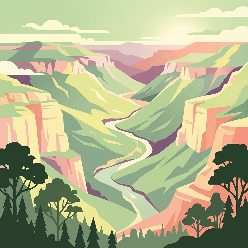
A stylized digital illustration of a winding river flowing through a canyon with high cliffs and forested edges.

Tidbinbilla Nature Reserve

Nature reserve

Park overview

Structured park overview, official facts, and landscape profile for Tidbinbilla Nature Reserve

Tidbinbilla Nature Reserve park facts, protected area profile, and essential visitor context

Review the core facts for Tidbinbilla Nature Reserve, including designation, size, terrain, visitor scale, habitats, and operating context in one park-focused overview.

About Tidbinbilla Nature Reserve

Tidbinbilla Nature Reserve is a protected valley landscape in the Australian Capital Territory, lying on the south-western fringe of Canberra and adjacent to the much larger Namadgi National Park. Covering about 54.5 square kilometres, it combines steep mountain terrain with a broad valley floor, creating a varied bushland setting that has drawn both Aboriginal peoples and European settlers for thousands of years.

The reserve sits on the traditional country of the Ngunnawal people, and its very name, derived from the Aboriginal word Jedbinbilla, refers to a place where boys become men, traditionally associated with initiation ceremonies on Tidbinbilla Mountain. Aboriginal occupation of the broader area is documented at sites such as the Birrigai Rock Shelter, where artefacts have been dated back roughly 25,000 years, and at a nearby site where evidence of fire use dates back some 20,000 years, linking the landscape to the last ice age.

European land use added another layer to the reserve's character. Nineteenth-century homesteads such as Nil Desperandum and Rock Valley, built in rammed earth in the 1890s, still stand within the reserve and tell of more than a century of pastoral and settlement history. Both buildings were severely damaged in the 2003 Canberra bushfires, with Nil Desperandum later rebuilt to its original design.

Today, Tidbinbilla is valued as a place of recreation, education, conservation breeding, and cultural heritage. The Australian Capital Territory and the broader Australian Alps system recognise the reserve as part of the Australian Alps National Parks and Reserves, and the site was added to the Australian National Heritage List in 2008. Its network of walking tracks, ranging from short family-friendly loops to the demanding Gibraltar Peak climb, gives visitors a direct view of how Aboriginal, European, and ecological histories overlap in a single valley.

Quick facts and research context for Tidbinbilla Nature Reserve

Tidbinbilla Nature Reserve is a roughly 54.5 square kilometre protected area in the southern part of the Australian Capital Territory, positioned on the edge of Namadgi National Park. It was officially gazetted in 1971 and now forms part of the Australian Alps National Parks and Reserves, listed on the Australian National Heritage List in 2008.

The reserve protects a valley system dominated by Tidbinbilla Mountain and the Gibraltar Range, on the traditional country of the Ngunnawal people. It functions as both a conservation site for threatened native species and a heritage landscape, holding Aboriginal sites dating back tens of thousands of years alongside late nineteenth-century European homesteads.

Protection and recognition

Terrestrial protected area designation history established in 2008

Tidbinbilla Nature Reserve Protection Status and Designation Records

Tidbinbilla Nature Reserve maintains documented terrestrial protection status established in the year 2008. Verified designation records provide structured oversight details regarding management scope and recognition parameters.

Protection details

Protection scope
Terrestrial
Designated year
2008
Transboundary protection
No
Park context

Deeper park guide and search-rich context for Tidbinbilla Nature Reserve

Tidbinbilla Nature Reserve history, landscape, wildlife, and travel context

Explore Tidbinbilla Nature Reserve through its history, landscape character, ecosystems, wildlife, conservation priorities, cultural context, and seasonal travel timing in a structured park guide built for atlas discovery and search intent.

Why Tidbinbilla Nature Reserve stands out

Tidbinbilla is best known for its easy access to native Australian wildlife in a natural valley setting just outside Canberra, where visitors can encounter eastern grey kangaroos, wallabies, platypus, koalas, lyrebirds, and emus. The reserve is equally recognised for its deep Aboriginal heritage, particularly the Birrigai Rock Shelter, one of the oldest sites of Indigenous occupation in the Australian Capital Territory. Its conservation breeding programs are another defining feature. Tidbinbilla plays a leading role in captive breeding for the critically endangered northern corroboree frog, the brush-tailed rock-wallaby, and the eastern bettong, making it a working conservation site rather than just a scenic reserve.
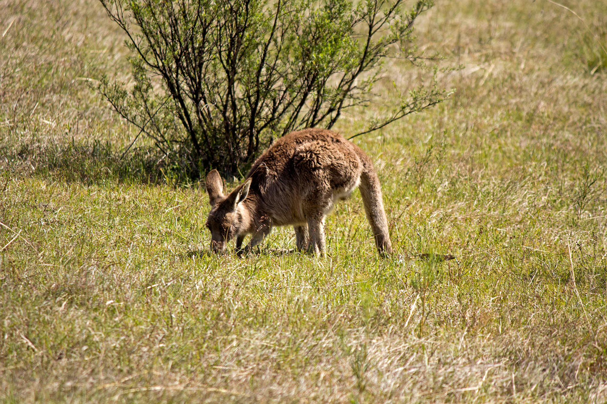
An Eastern grey kangaroo foraging on grass with a small shrub in the background.
An Eastern grey kangaroo grazing in a grassy field in Tidbinbilla Nature Reserve.

Tidbinbilla Nature Reserve history and protected-area timeline

Aboriginal people have inhabited the Tidbinbilla area since antiquity. Archaeological work at sites around the reserve has documented very long human use of the landscape, with excavations at Hanging Rock placing occupation at roughly 16,000 years ago, and broader finds linking the area to fire use as far back as 20,000 years. The Birrigai Rock Shelter remains a particularly important cultural site, valued for artefacts and evidence of continuous occupation, while Bogong Rocks preserves evidence of Aboriginal use of bogong moth resting sites. The name Tidbinbilla itself comes from the Aboriginal word Jedbinbilla, meaning a place where boys become men, and the mountain is traditionally associated with initiation ceremonies. A corroboree was held at Tidbinbilla as late as 1904.

European presence in the valley stretches back more than a century. The rammed-earth homesteads Nil Desperandum and Rock Valley were built by George Green and George Hatcliff in the 1890s. Nil Desperandum was first occupied by Henry French Gillman, while Rock Valley became the home of the Green family, later lived in by Elsie Jane Green and her husband Eric Blewitt from the early 1930s to the early 1950s. A commercial camellia plantation and one of the best-preserved eucalyptus distilleries in the Australian Capital Territory also survive within the reserve.

As an institution, the reserve began as a small public reserve of about 8 square kilometres in 1936 and grew significantly in 1962 when the government acquired additional land to establish a national park and fauna reserve. The first koala enclosure was built in 1939 by the Institute of Anatomy. In 1966, ranger David Bruce Kerr began a long period of development, building bushwalking tracks, enclosures, waterfowl areas, and roads, and establishing the Cape Barren goose enclosure and conservation scheme that became important for the species' survival. He also oversaw the importation of Victorian koalas and the creation of the first wildlife displays. The reserve was officially gazetted as the Tidbinbilla Nature Reserve in 1971, the year before Kerr moved on to help establish Namadgi National Park.

The 2003 Canberra bushfires were the most destructive event in the reserve's modern history. Roughly 99 percent of Tidbinbilla was burnt out, the Manager's Residence was lost, the historic homesteads were severely damaged, and most captive animals perished. The reserve has since recovered through replanting, the rebuilding of Nil Desperandum, and renewed conservation breeding programs. In 2008, Tidbinbilla was added to the Australian National Heritage List as part of the broader Australian Alps National Parks and Reserves.

Tidbinbilla Nature Reserve landscape and geographic character

Tidbinbilla's landscape is shaped around a long valley bowl bordered by two dominant highland features, Tidbinbilla Mountain and the Gibraltar Range. The upper slopes and ridgelines are steep and have remained relatively undisturbed, giving the reserve a rugged edge of granite boulders, rocky outcrops, and exposed ridgelines where hardy Australian bushland vegetation takes hold.

The valley floor opens into broader, gentler terrain crossed by walking tracks and watered by creeks such as Hurdle Creek. Lower slopes show a patchwork of cleared and partially cleared country, the legacy of more than a century of pastoral, homestead, and plantation use. The contrast between open grassy flats, regenerating bush, and the steeper escarpments gives the reserve a layered visual character. From elevated viewpoints such as Gibraltar Peak, visitors can take in 360-degree views across the reserve, towards Canberra, and out to landmarks including Black Mountain Tower. The proximity of the Canberra Deep Space Communication Complex also adds a striking modern element to an otherwise strongly natural landscape.
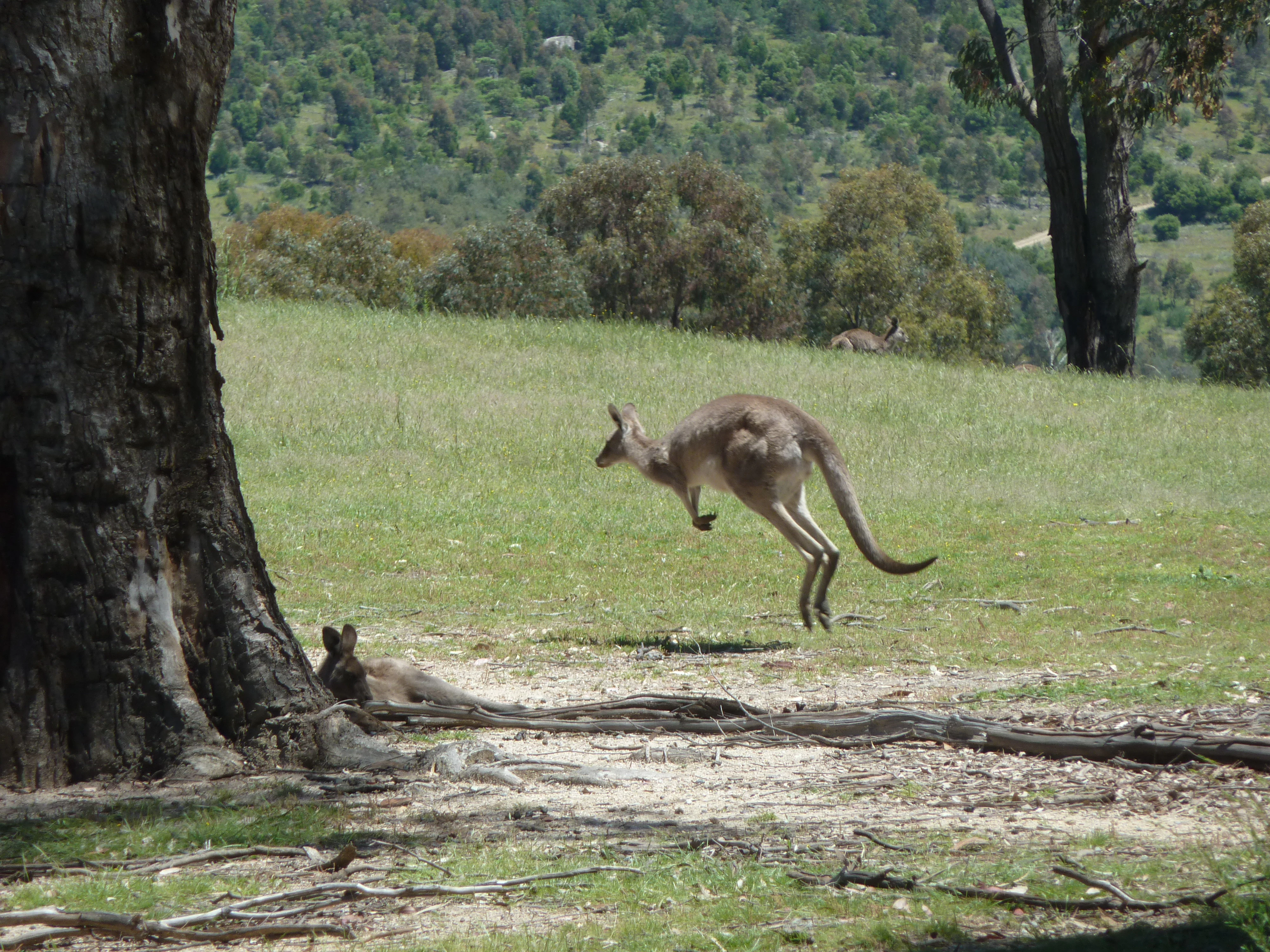
A wild Eastern grey kangaroo in mid-air leap across an open, grassy clearing with another kangaroo resting at the base of a large tree trunk in the foreground.
An Eastern grey kangaroo leaping across a grassy field at Tidbinbilla Nature Reserve.

Tidbinbilla Nature Reserve ecosystems, habitats, and plant life

The reserve sits within the broader Australian Alps bioregion, where eucalypt woodland, dry sclerophyll forest, and grassy understorey dominate the hill slopes, while the valley floor supports a mix of open grassland, regenerating bush, and damper creekline vegetation. Granite boulders and rocky outcrops shape much of the terrain, and characteristic Australian flora such as Xanthorrhoea grass trees are common enough to lend their name to one of the reserve's walking loops.

Habitats within the reserve range from dry open woodland and ridgeline scrub to wetter areas along creeks and around the constructed waterfowl ponds, creating a network of ecological zones within a relatively small area. The interlinked Sanctuary habitats in particular bring visitors into contact with wetland, woodland, and rocky environments in quick succession. The combination of valley soils, granite outcrops, and elevation changes supports a rich variety of plant communities typical of the southern Australian Capital Territory.
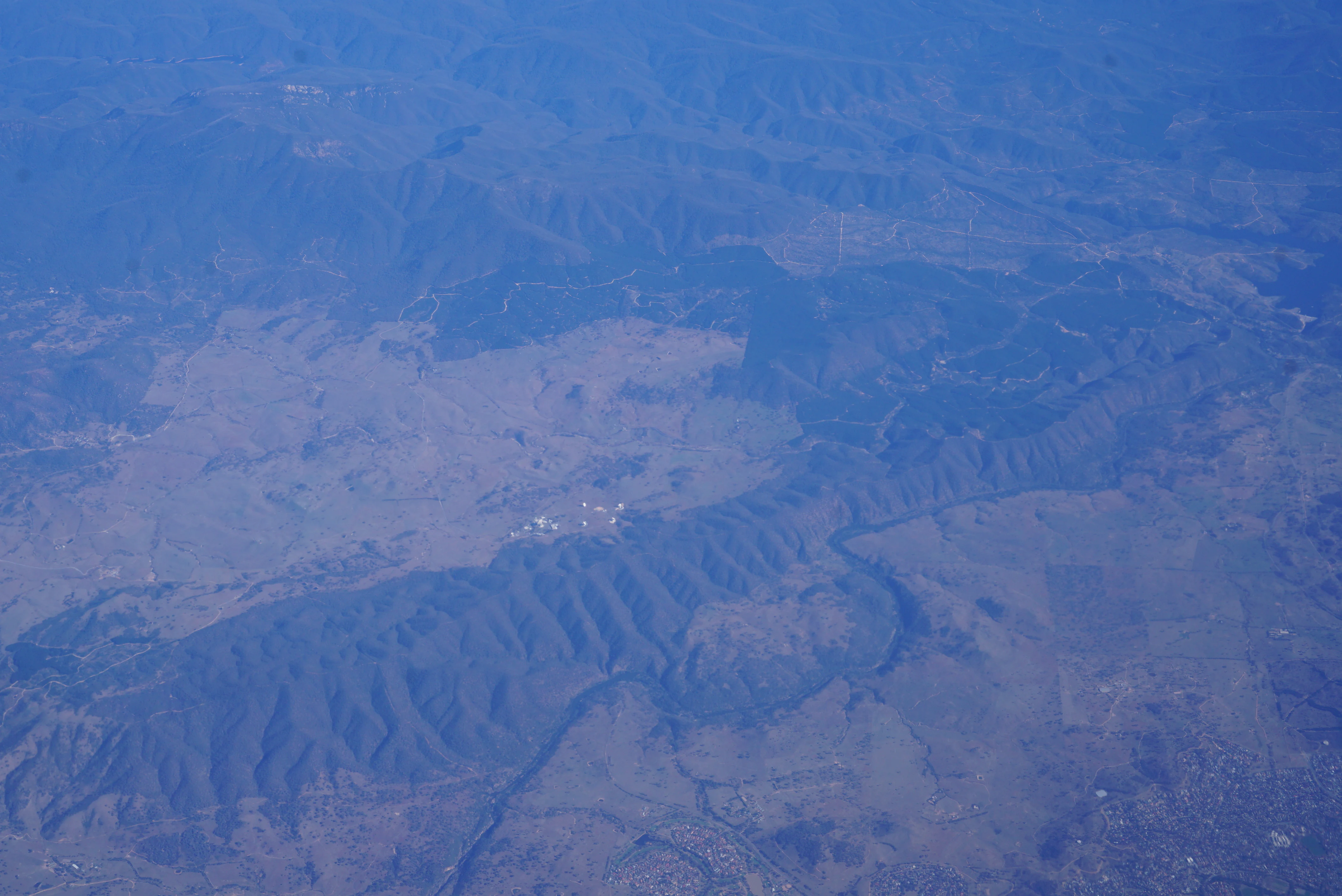
High altitude aerial view of the Australian landscape featuring mountain ridges, forested areas, and the white antennae of the Canberra Deep Space Communication Complex.
An aerial view of the Tidbinbilla Nature Reserve landscape including the Canberra Deep Space Communication Complex.

Tidbinbilla Nature Reserve wildlife and species highlights

Tidbinbilla is home to many of the iconic Australian species that visitors hope to see in the wild. Eastern grey kangaroos graze on the open grasslands and along trails including the Gibraltar Peak route, while wallabies, emus, koalas, platypus, and lyrebirds are all present in the reserve. Birdlife includes magpie geese and other waterfowl that gather around the reserve's wetland areas, and the Cape Barren goose has been a particular focus of long-running conservation work here since the 1960s.

The 2003 Canberra bushfires devastated the reserve's wildlife, burning out about 99 percent of its area and wiping out most captive animals. Only one koala, six rock wallabies, five potoroos, four freckled ducks, and nine black swans survived from the captive collection at the time. Recovery has been gradual, but the reserve today again supports healthy populations of kangaroos and other native fauna, while continuing to breed threatened species. Platypus, echidnas, and brush-tailed rock-wallabies can be observed in their natural habitats within the Sanctuary Loop area, where carefully designed enclosures and viewing points allow close but unobtrusive encounters.
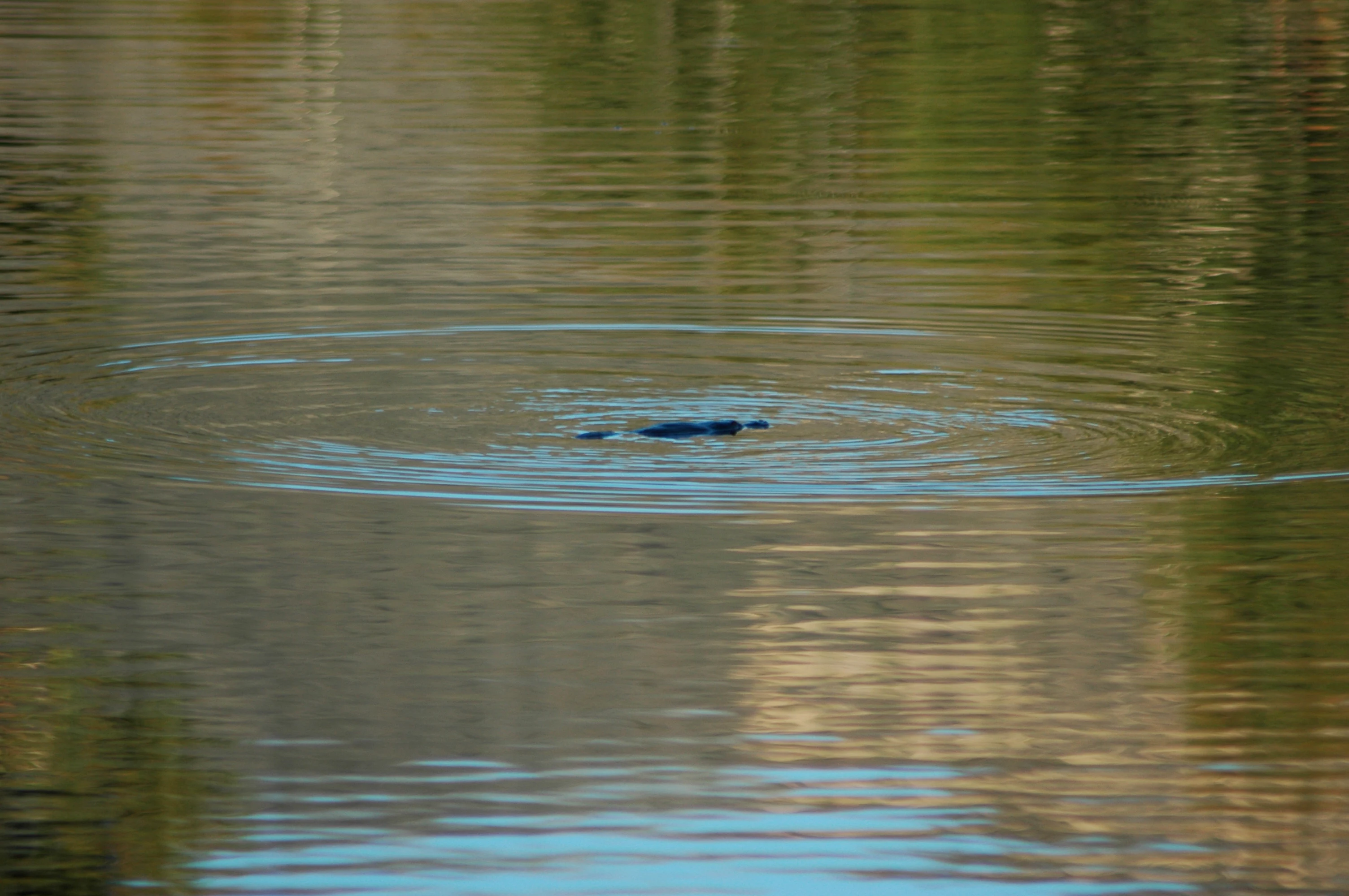
A platypus partially visible on the surface of calm water, surrounded by circular ripples.
A platypus swimming in the waters of Tidbinbilla Nature Reserve, creating ripples on the surface.

Tidbinbilla Nature Reserve conservation status and protection priorities

Tidbinbilla plays an active role in the conservation of several threatened Australian species. Since 2011, the reserve has run breeding programs for the critically endangered northern corroboree frog, the brush-tailed rock-wallaby, and the eastern bettong, all on behalf of the ACT Government, and these efforts have contributed meaningfully to the survival prospects of each species.

The reserve's conservation story extends back much further. From the late 1960s, ranger David Bruce Kerr established the Cape Barren goose conservation programme, which is credited with significantly improving the outlook for the species, as well as the first koala enclosures, kangaroo enclosures, and waterfowl habitats at the reserve. The site's formal protection status as an IUCN Category II protected area, its inclusion in the Australian Alps National Parks and Reserves, and its listing on the Australian National Heritage List in 2008 underscore its ecological and cultural importance on a national scale. Recovering from the catastrophic 2003 fires has also shaped the reserve's ongoing role as a demonstration site for landscape-scale bushfire recovery.

Tidbinbilla Nature Reserve cultural meaning and human context

Tidbinbilla is a place of profound and layered cultural significance. It is the traditional country of the Ngunnawal people, and the reserve's name, derived from the Aboriginal word Jedbinbilla, literally means a place where boys become men, reflecting its role as a landscape associated with initiation. Sites such as the Birrigai Rock Shelter, whose name comes from the Ngunnawal word for laughter, preserve evidence of occupation stretching back around 25,000 years, while nearby excavations have documented fire use dating to the last ice age.

European cultural heritage is equally visible. Late nineteenth-century rammed-earth homesteads, a commercial camellia plantation, a historic eucalyptus distillery, and rock paintings at Gibraltar Peak together create a record of more than a century of settler activity layered over the Aboriginal landscape. Walking trails such as the Birrigai Time Trail and the Church Rock Heritage Loop deliberately bring this combined heritage into focus, recognising both Aboriginal and European histories without privileging one over the other.

Top sights and standout views in Tidbinbilla Nature Reserve

Tidbinbilla's combination of accessibility, scenery, heritage, and wildlife makes it one of the most rewarding natural sites in the Australian Capital Territory. The valley setting at the foot of Tidbinbilla Mountain and the Gibraltar Range, the panoramic views from Gibraltar Peak, and the rich presence of kangaroos, platypus, lyrebirds, and other native species define its outdoor appeal.

Equally distinctive are the reserve's working conservation programs for threatened species such as the northern corroboree frog, brush-tailed rock-wallaby, and eastern bettong, and its cultural depth, including the Birrigai Rock Shelter and historic homesteads. Those layers of biodiversity, heritage, and science together make Tidbinbilla stand out from a typical city-adjacent reserve.

Best time to visit Tidbinbilla Nature Reserve

Tidbinbilla is an all-season reserve, and each part of the year offers a different character. Spring and early summer tend to be a rewarding time for wildlife viewing, with active birdsong from lyrebirds and other species, regenerating growth following the wet season, and generally mild conditions for walking the longer trails such as Gibraltar Peak.

Autumn brings cooler, stable weather that is well suited to longer walks like the Birrigai Time Trail and Church Rock Heritage Loop, while winter can bring crisper views from the higher viewpoints and quieter conditions for spotting wildlife. Summer is the most variable period, with warmer temperatures and a higher bushfire risk; the reserve itself was catastrophically affected by the 2003 fires, so visitors planning summer trips should be mindful of seasonal conditions and any fire-related access changes.


Monthly climate preview

Long-term representative temperature ranges and precipitation rhythm for Tidbinbilla

Tidbinbilla Nature Reserve Climate Normals and Monthly Weather Patterns

Representative coordinates outline a measured annual rhythm of shifting mean temperatures and steady precipitation across the reserve. Reviewing the complete twelve-month profile clarifies long-term meteorological averages for the protected landscape.
Annual mean11 °C
3 °C19 °C
Jan19°
Feb18°
Mar15°
Apr11°
May
Jun
Jul
Aug
Sep
Oct10°
Nov13°
Dec16°
Warmest month
January

18.5 °C

Coolest month
July

3.5 °C

Wettest month
November

2.8 mm/day

Driest month
April

1.4 mm/day

Park location guide

Geography guide, regional context, and park location map for Tidbinbilla Nature Reserve

Tidbinbilla Nature Reserve park geography, regions, and map view in Australia

Understand where Tidbinbilla Nature Reserve sits in Australia through a broader geographic reading of the surrounding landscape, nearby location context, and its mapped position within the national park landscape.

How Tidbinbilla Nature Reserve fits into Australia

Australia is a constitutional monarchy and federal parliamentary democracy comprising six states and ten territories. With a population of nearly 28 million, it is one of the world's most urbanised countries, with most people concentrated on the eastern seaboard. The country has a high Human Development Index and is known for its cultural diversity, ancient Aboriginal heritage, and unique wildlife.

Wider geography shaping Tidbinbilla Nature Reserve in Australia

Australia occupies the entire Australian continent, the island of Tasmania, and numerous smaller islands. It is the world's flattest and driest inhabited continent, featuring vast deserts in the interior (the Outback), tropical rainforests along the eastern coast, and a coastline bordering the Indian and Pacific Oceans.

Map view of Tidbinbilla Nature Reserve

Use this park location map to pinpoint Tidbinbilla Nature Reserve in Australia, understand its exact geographic position, and read its mapped placement within the surrounding landscape more clearly.

Pigeon | © OpenStreetMap contributors

Location context for Tidbinbilla Nature Reserve

Australian Capital Territory

Visual exploration of granite ridgelines, valley floors, and native wildlife habitats

Tidbinbilla Nature Reserve Photos and Landscape Scenery

Visual records capture the rugged granite escarpments, broad valley floors, and native bushland environments that define Tidbinbilla Nature Reserve. Examining these photographic perspectives helps researchers and visitors understand the protected terrain, native habitats, and diverse topography of the region.

An Eastern grey kangaroo foraging on grass with a small shrub in the background.

A group of magpie geese with black and white plumage wading and standing on a muddy bank beside a pond, reflected in the calm water.

A wild Eastern grey kangaroo in mid-air leap across an open, grassy clearing with another kangaroo resting at the base of a large tree trunk in the foreground.

High altitude aerial view of the Australian landscape featuring mountain ridges, forested areas, and the white antennae of the Canberra Deep Space Communication Complex.

A platypus partially visible on the surface of calm water, surrounded by circular ripples.

A small group of kangaroos graze on a grassy slope with large granite boulders and a dead tree in the background under an overcast, misty sky.

Park atlas

Compare regional valley reserves, highland terrain, and connected conservation areas

Explore Parks Near Tidbinbilla Nature Reserve and Surrounding Protected Landscapes

Browse protected areas near Tidbinbilla Nature Reserve to discover adjacent mountain parks and rugged Australian bushland reserves. Expanding the geographic view helps connect regional valley habitats with broader protected landscapes across the surrounding region.
National parkAustralian Capital Territory
About 3.7 km away#1 closest

Southeast

Namadgi National Park: Protected Landscape and Geographic Context in Australian Capital Territory

Explore the mapped boundaries and regional geography of this national park.

Namadgi National Park is a designated national park situated in the Australian Capital Territory. This dedicated page offers detailed information on its protected status, geographic features, and its role within the regional landscape atlas of Australia. Dive into the mapped terrain and understand the park's environmental significance and its contribution to the conservation landscape of the Australian Capital Territory.

Area
1,060.95 km²
Established
1984
IUCN
II
Relief
Mountain
Watercolor painting showing mountains, fields, and a river
National parkNew South Wales
About 15 km away#2 closest

Southwest

Kosciuszko National Park: Australia's Highest Alpine Terrain and Mapped Protected Landscape

Discover unique glacial landscapes and geographic context in New South Wales.

Kosciuszko National Park represents the pinnacle of Australia's alpine geography, preserving the continent's only true alpine ecosystems. This extensive national park in New South Wales features dramatic glacial landforms, including its namesake Mount Kosciuszko, Australia's highest peak. Users can explore the park's mapped boundaries, surrounding natural terrain, and unique landscape features for a comprehensive understanding of this significant protected area.

Area
6,900 km²
Established
1944
IUCN
II
Visitors
3.3M annual
National parkNew South Wales
About 15 km away#3 closest

Northwest

Brindabella National Park: A Protected Mountain Landscape in New South Wales' Australian Alps

Discover its mapped terrain and regional geographic context.

Brindabella National Park offers a unique perspective on the mountainous terrain of the Brindabella Range, forming a vital protected area within the Australian Alps. Located in New South Wales, its landscape features rugged ridgelines and diverse subalpine vegetation, recognized for its national environmental significance. This park serves as a key destination for understanding protected area geography and the mapped context of Australia's high country.

Area
184.54 km²
Established
1996
IUCN
II
Relief
Mountain
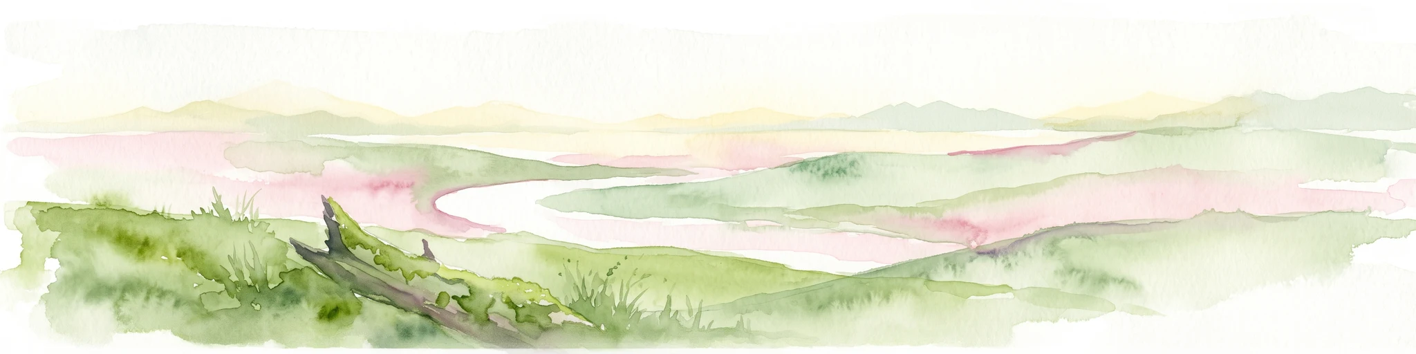
A soft watercolor painting of a serene landscape with rolling green hills, a winding river, and a fallen log in the foreground.
Nature reserveNew South Wales
About 20 km away#4 closest

Southwest

Bimberi Nature Reserve: Geographic Overview and Protected Alpine Terrain in New South Wales

High-country forests and Brindabella Range summits

Bimberi Nature Reserve represents a strategic conservation anchor within the Australian Alps. Covering a rugged stretch of the Brindabella Range, this reserve features significant elevation transitions from sheltered eucalypt forests to exposed subalpine zones. It remains a key point of reference for understanding the connectedness of protected landscapes bridging New South Wales and the Australian Capital Territory.

Area
108.68 km²
Established
1985
IUCN
II
Relief
Mountain
National parkAustralia
About 23 km away#5 closest

South

North East Island National Park: Australia's Protected Landscape Identity and Map Context

Discover mapped park boundaries and regional geographic setting.

North East Island National Park stands as a key protected area within Australia, offering users a detailed view of its geographic and landscape characteristics. This entry focuses on its designation as a national park, providing essential context for atlas-based exploration. Understand the specific mapped region and protected land attributes that contribute to its unique environmental geography, fostering a deeper appreciation for its place within the Australian continent.

Marine protected areaAustralia
About 27 km away#6 closest

Northeast

Australian Whale Sanctuary: Mapping the Scale of Australia's Marine Protected Area Jurisdictions

Oceanic landscape, maritime boundaries, and cetacean conservation zones.

Discover the expansive geographic reach of the Australian Whale Sanctuary, an oceanic conservation zone that encompasses the entire Australian exclusive economic zone. This protected landscape is defined by its immense scale, stretching across varied marine environments to provide a continuous refuge for whales and dolphins. Gain perspective on the sanctuary's role as both a legal framework and a massive, interconnected maritime atlas.

Established
1999
Access
Access unknown
Scope
Marine
Water
Water-dominated
Nature reserveAustralian Capital Territory
About 28 km away#7 closest

Northeast

Jerrabomberra Wetlands Nature Reserve: Protected Area Atlas and Geographic Landscape Overview

A vital wetland network on the Molonglo River floodplain.

Located in the Australian Capital Territory, Jerrabomberra Wetlands Nature Reserve comprises a unique concentration of permanent and ephemeral wetlands formed along ancient river courses. This protected area represents an essential habitat for migratory species and illustrates the intersection of urban geography, floodplain terrain, and intentional conservation efforts within the capital region.

Area
1.74 km²
Established
1990
Relief
Lowland
Climate
Temperate
Nature reserveNew South Wales
About 34 km away#8 closest

South

Scabby Range Nature Reserve: A Detailed Look at High Country Protected Landscapes and Terrain

Granite wilderness and subalpine ecology near the New South Wales border.

This reserve protects a dramatic 48 square kilometre block of the Kosciusko Uplands. Featuring boulder-strewn slopes, sphagnum-rich sedgelands, and tall montane eucalypt forests, the area represents a key node within the Australian Alps. Gain insight into the varied lithology and alpine flora that define this important nature reserve, from its granite pavements to the panoramic views at Mount Kelly.

Area
48.72 km²
Established
1982
IUCN
Ia
Relief
Mountain

Common questions about visiting, size, designation, and location context for Tidbinbilla Nature Reserve

Tidbinbilla Nature Reserve FAQs for park facts, access, geography, and protected area context

Find quick answers about Tidbinbilla Nature Reserve, including protected-area facts, park geography, trail and visitor context, and how the park fits into its surrounding country and regional landscape.
MoriAtlas Explorer

Continue Your Protected Areas Search Across the Global Atlas

Deepen your exploration by continuing the structured search for national parks and protected areas worldwide. Utilize the comprehensive filtering capabilities to compare different conservation landscapes and refine your understanding of global park geography. Discover more about the distribution and characteristics of protected natural areas.

Global natural geography