
Mori Atlas logo
Protected landscapeTuchola Landscape Park

A detailed look at the postglacial sandy plains and river valleys of the Bory Tucholskie forest region

Tuchola Landscape Park: Exploring Mapped Protected Landscapes and Riverine Geography

(Tucholski Park Krajobrazowy)

Tuchola Landscape Park serves as a central protected area within the Bory Tucholskie forest complex of northern Poland. The terrain is defined by the vast sandy outwash plain of the Sandr Brdy and the deeply meandering course of the Brda River, which creates varied riverine habitats and steep valley slopes across the region. Eight dedicated nature reserves protect internal fragments of old growth yew, wetlands, and peat bogs within this significant postglacial lowland landscape.

protected landscape parkpine forestpostglacial plainsandy outwashBrda Rivermeanders
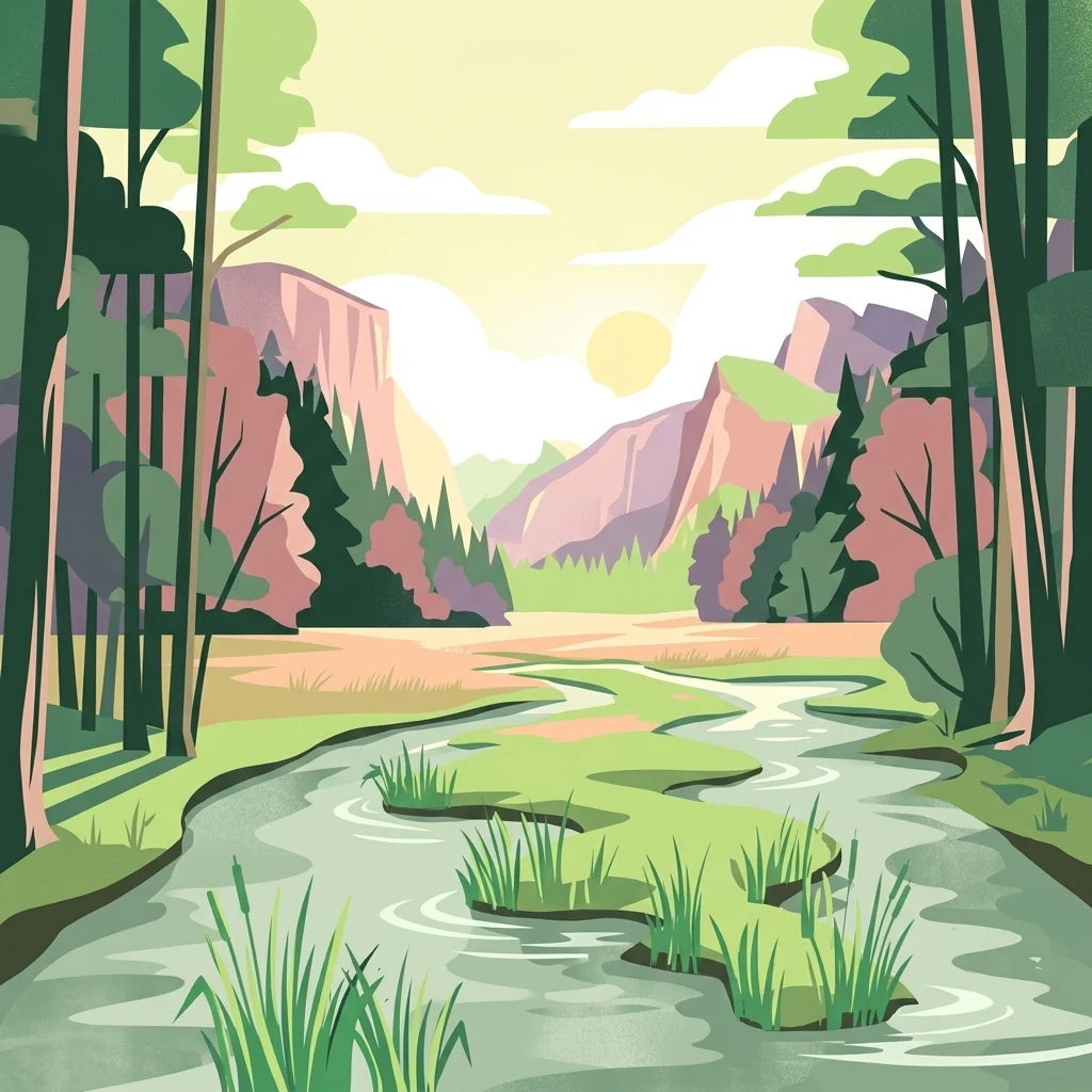
A flat-style digital illustration showing a meandering river winding through a valley framed by dense forest and pinkish cliffs under a golden sky.

Tuchola Landscape Park

Protected landscape

Park overview

Structured park overview, official facts, and landscape profile for Tuchola Landscape Park

Tuchola Landscape Park park facts, protected area profile, and essential visitor context

Review the core facts for Tuchola Landscape Park, including designation, size, terrain, visitor scale, habitats, and operating context in one park-focused overview.

About Tuchola Landscape Park

Tuchola Landscape Park protects a representative slice of one of Poland's largest lowland forest landscapes, the Bory Tucholskie, which extends across northern Poland as a continuous complex of pine-dominated sandy terrain. The park itself was created in 1985 to safeguard the ecological and scenic values of the central portion of this forest region, with particular emphasis on the Brda River and its surrounding outwash plain.

Physically, the park occupies part of the Bory Tucholskie mesoregion and the adjacent Brda Valley mesoregion. The terrain is shaped by glacial and postglacial processes: broad, flat sand plains left by retreating ice sheets, now covered almost entirely by managed and semi-natural pine forests, are interrupted by the incised, winding valley of the Brda, which cuts deep into the sandy substrate. This contrast between open pine forest on the flat sandr and the steep, meandering river valley gives the park much of its scenic character.

The park's administrative footprint spans two voivodeships, reflecting how the protected territory was assembled from municipal areas on both sides of the historic regional boundary. Its eight protected nature reserves, distributed across the park, point to the ecological richness hidden within what superficially appears to be a uniform pine forest landscape: peat bogs, spring-fed streams, old yew populations, and lake basins all occur within the same postglacial setting.

Quick facts and research context for Tuchola Landscape Park

Tuchola Landscape Park (Tucholski Park Krajobrazowy) was established in 1985 by resolution of the Provincial National Council in Bydgoszcz. Its area covers 369.83 square kilometers, with a buffer zone of 159.46 square kilometers, and is distributed between two voivodeships: Kuyavian-Pomeranian (256.60 square kilometers of park area) and Pomeranian (113.23 square kilometers of park area).

The park belongs physically to the Bory Tucholskie and Brda Valley mesoregions. Since 2010, it has been included in the buffer zone of the Bory Tucholskie Biosphere Reserve. Eight nature reserves lie within its boundaries, including Bagna nad Stążką, Bagno Grzybna, Dolina Rzeki Brdy, Jeziorka Kozie, Jezioro Zdręczno, Źródła Rzeki Stążki, Cisy nad Czerską Strugą, and Ustronie.

Protection and recognition

Examine the terrestrial protection scope and documented designation records for Tuchola Landscape Park.

Tuchola Landscape Park Protection Status and Designated Area Frameworks

Tuchola Landscape Park maintains a documented terrestrial protection scope within its regional conservation framework. Official records outline the established designation boundaries and management parameters governing the protected area.

Protection details

Protection scope
Terrestrial
Transboundary protection
No
Buffer area
159.46 km²
Park context

Deeper park guide and search-rich context for Tuchola Landscape Park

Tuchola Landscape Park history, landscape, wildlife, and travel context

Explore Tuchola Landscape Park through its history, landscape character, ecosystems, wildlife, conservation priorities, cultural context, and seasonal travel timing in a structured park guide built for atlas discovery and search intent.

Why Tuchola Landscape Park stands out

The park is best known for the Brda River corridor cutting through a vast pine-covered sandy outwash plain, and for its concentration of wetland and riverine nature reserves within the broader Bory Tucholskie forest complex. Its eight in-park reserves protect a notably diverse range of postglacial habitats: peat bogs, raised bog remnants, yew tree stands, headwaters of small rivers, and segments of the Brda River valley itself.
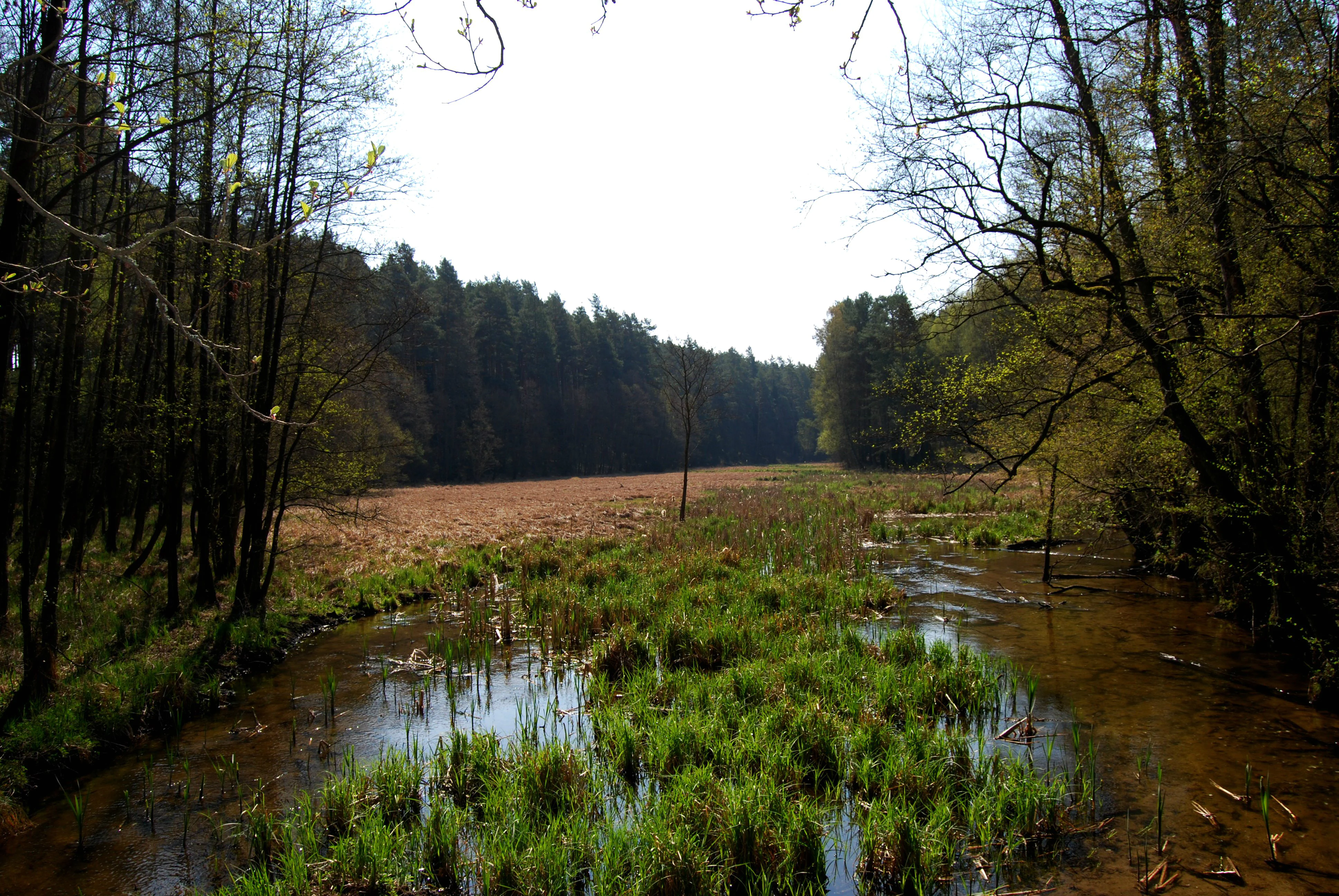
A view of a wetland area with a slow moving stream winding through green grassy patches, surrounded by dense forests under a bright sky.
A tranquil wetland area along the Stążka river in Tuchola Landscape Park.

Tuchola Landscape Park history and protected-area timeline

Tuchola Landscape Park was established in 1985 through Resolution No. 71/IX/85 of the Provincial National Council in Bydgoszcz, at a time when the Polish system of landscape parks was being actively expanded to protect representative regional landscapes beyond strictly national parks.

The park's designation reflected awareness of the unique character of the Bory Tucholskie pine forests and the Brda River valley, both of which had been subject to forestry use and tourism development. Since 2010, the park has additionally been recognized as part of the buffer zone of the Bory Tucholskie Biosphere Reserve, bringing its protection status into alignment with international UNESCO-designated biosphere frameworks and reinforcing its role as a transitional zone between intensive use and strictly protected core areas.

Tuchola Landscape Park landscape and geographic character

The landscape of Tuchola Landscape Park is dominated by the flat sandy outwash plain known as the Sandr Brdy, an extensive area of postglacial sands deposited by meltwater at the end of the last glaciation. This plain is covered almost entirely by pine forest, giving the park a visually consistent, low-canopy character broken only by clearings, wetlands, and small lakes.

Cutting through this landscape is the Brda River, which forms the park's hydrological backbone. The river's course through the loose sandy substrate has produced numerous meanders, rapids, and breakthroughs, and in places the river has eroded deeply into the surrounding plain, creating steep valley slopes and a markedly three-dimensional terrain in contrast to the otherwise flat surroundings. The combination of vast pine-clad plains and a deeply meandering river valley is the park's signature scenery.

Tuchola Landscape Park ecosystems, habitats, and plant life

Ecologically, the park represents the postglacial sandy lowland forest system of the Bory Tucholskie. Its dominant habitat is dry and mesic pine forest on poor sandy soils, but the inclusion of the Brda valley and numerous bog and lake sites introduces a much richer habitat mosaic beneath this uniform forest cover.

Among the protected habitats are ombrotrophic and transitional peat bogs (such as Bagna nad Stążką and Bagno Grzybna), headwater spring zones of the Stążka stream, the meandering Brda floodplain corridor, small kettle lakes, and remnant populations of yew (Taxus baccata) at the Cisy nad Czerską Strugą reserve. This combination of upland pine forest, valley wetlands, and relict tree communities makes the park ecologically more diverse than its predominantly coniferous appearance suggests.

Tuchola Landscape Park conservation status and protection priorities

The park's conservation significance lies primarily in its role as a protected buffer within one of Poland's most important lowland forest complexes. By safeguarding extensive pine forest cover together with the Brda valley, peat bogs, and lake basins, the park helps preserve the ecological integrity of the broader Bory Tucholskie system.

Recognition as part of the Bory Tucholskie Biosphere Reserve buffer zone in 2010 strengthened this role, embedding the park within an international framework for reconciling forest use, biodiversity protection, and research. The eight in-park nature reserves further concentrate protection on the most ecologically valuable sites, including bog complexes, old-growth features, and sensitive hydrological systems.

Top sights and standout views in Tuchola Landscape Park

Standout features of Tuchola Landscape Park include the meandering Brda River with its rapids and breakthroughs; the vast pine-dominated Sandr Brdy outwash plain; and the dense concentration of nature reserves, eight in total, which protect bog, riverine, lake, and yew habitats within a single landscape.

The park also offers a direct connection, via its biosphere reserve buffer zone status, to one of Poland's most recognized large-scale forest conservation frameworks.
Monthly climate preview

Long-term representative measurements outlining annual temperature and precipitation rhythm

Tuchola Landscape Park Climate Normals, Average Temperature and Precipitation

Representative coordinates record measured long-term temperature ranges spanning sub-zero winter minimums to warm summer maximums alongside steady monthly precipitation levels. Analyzing the full twelve-month profile provides complete historical averages for detailed temperature and precipitation comparisons.
Annual mean8 °C
-3 °C19 °C
Jan-3°
Feb-2°
Mar
Apr
May13°
Jun17°
Jul19°
Aug19°
Sep14°
Oct
Nov
Dec-1°
Warmest month
July

19.4 °C

Coolest month
January

-3 °C

Wettest month
July

2.6 mm/day

Driest month
April

1.2 mm/day

Park location guide

Geography guide, regional context, and park location map for Tuchola Landscape Park

Tuchola Landscape Park park geography, regions, and map view in Poland

Understand where Tuchola Landscape Park sits in Poland through a broader geographic reading of the surrounding landscape, nearby location context, and its mapped position within the national park landscape.

How Tuchola Landscape Park fits into Poland

Poland, officially the Republic of Poland, is a Central European country spanning from the Baltic Sea in the north to the Carpathian Mountains in the south. It borders Germany, Czech Republic, Slovakia, Ukraine, Belarus, Lithuania, and Kaliningrad Oblast. The country has a temperate climate, diverse landscapes, and is known for its rich history, cultural heritage, and strong economic position within the EU.

Wider geography shaping Tuchola Landscape Park in Poland

Poland occupies 312,696 km2 in Central Europe, extending from the Baltic Sea coast in the north to the Sudetes and Carpathian Mountains in the south. It borders Germany to the west, Czech Republic and Slovakia to the south, Ukraine and Belarus to the east, and Lithuania and Kaliningrad Oblast to the northeast. The landscape includes lowland plains, uplands, and mountain ranges.

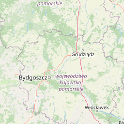
Map view of Tuchola Landscape Park

Use this park location map to pinpoint Tuchola Landscape Park in Poland, understand its exact geographic position, and read its mapped placement within the surrounding landscape more clearly.

Pigeon | © OpenStreetMap contributors

Location context for Tuchola Landscape Park

Kuyavian-Pomeranian VoivodeshipPomeranian Voivodeship

Explore detailed visual records of postglacial sandy plains, winding river corridors, and protected forest habitats.

Tuchola Landscape Park Photos and Scenery: Visualizing the Pine Forests and River Valleys

Visual documentation reveals the distinctive terrain of flat outwash plains and deeply carved river channels that define northern Poland. Examining these protected habitats provides clear insight into the complex ecology and persistent environmental character of the region.

A view of a wetland area with a slow moving stream winding through green grassy patches, surrounded by dense forests under a bright sky.

Park atlas

Compare adjacent forest reserves, river valleys, and postglacial lowland landscapes

Explore Protected Areas and Parks Near Tuchola Landscape Park in Northern Poland

Browse nearby national parks and protected landscapes connected to the extensive Bory Tucholskie forest complex. Continued comparison reveals regional conservation patterns across northern Poland's sandy outwash plains and river corridors.
Watercolor painting of a river flowing through a lush green valley with distant hills.
Nature reserveKuyavian-Pomeranian Voivodeship
Mapped location lies within the park boundary#1 closest

South

Dolina Rzeki Brdy Nature Reserve: Geomorphology and Protected Landscapes in Poland

Mapped river valley and riparian corridor

The Dolina Rzeki Brdy Nature Reserve encompasses a long, terrace-flanked stretch of the Brda River. Its protected boundaries contain a rugged mix of active meanders, boulder-strewn slopes, and shifting sandbars, creating a distinct lowland landscape of great geomorphological significance within the Tuchola Forest region.

Area
16.917 km²
Established
1994
Relief
Upland
Climate
Temperate
Nature reserveKuyavian-Pomeranian Voivodeship
Mapped location lies within the park boundary#2 closest

West

Rezerwat przyrody Jezioro Zdręczno: Mapped Wetland Landscapes and Protected Areas

Wetland habitat and peatland geography in Kuyavian-Pomeranian Voivodeship.

Delve into the geography of Rezerwat przyrody Jezioro Zdręczno, a nature reserve encompassing an overgrown forest lake and expansive peat-forming bogs. This area preserves a sensitive wetland gradient characteristic of the Bory Tucholskie region. The reserve functions as an isolated refuge for relict plant species, offering significant insight into the hydrologically complex landscape of the Kuyavian-Pomeranian Voivodeship.

Area
0.222 km²
Established
1982
Relief
Lowland
Scope
Terrestrial
Biosphere reserveKuyavian-Pomeranian Voivodeship
About 3.1 km away#3 closest

North

Rezerwat Biosfery Bory Tucholskie: Protected Forest and Regional Landscape Map

Key protected zones in the Kuyavian-Pomeranian Voivodeship

Rezerwat Biosfery Bory Tucholskie encompasses the largest continuous forest complex in Poland, structured into a formal UNESCO framework. The terrain features postglacial outwash plains, chain lakes, and rare yew reserves that create a distinct ecological mosaic. This overview details the park's geographic layout, surrounding landscape parks, and the connection between its core nature reserves and the wider regional basin.

Area
3,195 km²
Established
2010
Relief
Lowland
Climate
Temperate
Nature reservePomeranian Voivodeship
About 3.8 km away#4 closest

Northwest

Rezerwat przyrody Mętne: An Atlas View of Peatlands in the Pomeranian Voivodeship, Poland

A preserved mosaic of mires, bog ecosystems, and forest lake habitats.

Rezerwat przyrody Mętne is a specialized protected area in northern Poland, centered on the intricate peat-building processes of the Tuchola Forest. The reserve features rare dwarf birch populations and sensitive bog communities, functioning as a critical natural site for hydrological stability. Gain insights into the mapped extent of these mire habitats and their ecological integration within the wider Bory Tucholskie landscape.

Area
1.034 km²
Established
1963
Relief
Lowland
Scope
Terrestrial
Protected landscapePomeranian Voivodeship
5.7 km away#5 closest

Northwest

Zaborski Park Krajobrazowy: Geographic Profile of a Polish Protected Landscape Area

Tuchola Forest region, Pomeranian Voivodeship

Investigate the unique terrain of Zaborski Park Krajobrazowy, a protected landscape defined by its dense network of glacial lakes and sandy outwash plains. This territory provides a comprehensive view of northern Polish lowland geography, highlighting the ecological significance of its river valleys and relic forest habitats within the broader Tuchola Forest ecosystem.

Area
340.3 km²
Established
1990
Relief
Lowland
Climate
Temperate
Protected landscapeKuyavian-Pomeranian Voivodeship
6.2 km away#6 closest

East

Wdecki Park Krajobrazowy: Protected Landscape Atlas and Regional Geography

Forest and river basin terrain in Poland

Examine the geographic foundation of Wdecki Park Krajobrazowy, a protected landscape characterized by the Wda River drainage, glacial erratics, and extensive pine forests. The area supports a rich variety of wetland flora, mires, and managed reservoirs such as the Żur, making it a significant conservation landmark within the wider Bory Tucholskie region of northern Poland.

Area
191.77 km²
Established
1993
Relief
Lowland
Climate
Temperate
A minimalist watercolor painting showing a calm lake or wetland surrounded by soft green trees and gentle hills under a light sky.
Protected areaKuyavian-Pomeranian Voivodeship
8.8 km away#7 closest

East

Sandr Wdy Protected Area: Glacial Geography and Wetland Habitats in Northern Poland

An essential reference area for Bory Tucholskie forest ecology.

Sandr Wdy is a distinctive Natura 2000 protected area shaped by post-glacial processes. The landscape features a flat outwash plain punctuated by lake basins, river valleys, and diverse mire systems. With multiple strict nature reserves integrated into its boundaries, the site provides a comprehensive view of how hydrological and soil conditions influence habitat distribution within the broader forest landscape of Poland.

Area
63.21 km²
Established
2011
Relief
Lowland
Climate
Temperate
Protected areaPomeranian Voivodeship
8.9 km away#8 closest

Northwest

Sandr Brdy: Protected Glacial Landscapes and Hydrological Networks in Pomeranian Voivodeship

A vital reference site for lowland habitat conservation and post-glacial terrain.

Sandr Brdy spans 7,492 hectares of outwash plains in northern Poland. Its terrain hosts a complex mosaic of calcareous fens, acid oak forests, and lobelia lakes, established to preserve fragile aquatic and terrestrial species like the gray wolf and lady's slipper orchid within a unique glacial framework.

Area
74.926 km²
Scope
Terrestrial
Water
Major water bodies

Common questions about visiting, size, designation, and location context for Tuchola Landscape Park

Tuchola Landscape Park FAQs for park facts, access, geography, and protected area context

Find quick answers about Tuchola Landscape Park, including protected-area facts, park geography, trail and visitor context, and how the park fits into its surrounding country and regional landscape.
MoriAtlas Explorer

Continue Your Protected Areas Search Across the Global Atlas

Deepen your exploration by continuing the structured search for national parks and protected areas worldwide. Utilize the comprehensive filtering capabilities to compare different conservation landscapes and refine your understanding of global park geography. Discover more about the distribution and characteristics of protected natural areas.

Global natural geography