Mori Atlas logo
Nearby park discovery

Trace regional geography and compare protected land distributions across the surrounding area

Protected Areas and Natural Landscapes Near Tuchola Landscape Park in Northern Poland

Identify protected areas and natural landscapes situated in the geographical vicinity of Tuchola Landscape Park. This overview provides a regional perspective on the distribution of managed terrains, forest complexes, and postglacial landforms across the northern Polish landscape. Compare adjacent protected sites to understand the broader environmental context of the Bory Tucholskie region.

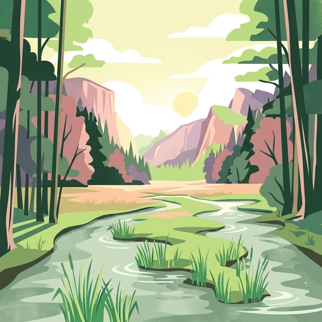
A flat-style digital illustration showing a meandering river winding through a valley framed by dense forest and pinkish cliffs under a golden sky.

Protected pine forest and river landscapes of the Bory Tucholskie region in northern Poland.

Tuchola Landscape Park

Tuchola Landscape Park is a protected area in northern Poland that sits within the larger Bory Tucholskie (Tuchola Forest) region, one of the largest continuous forest complexes in the country. The park stretches across parts of the Kuyavian-Pomeranian and Pomeranian voivodeships, covering an area of approximately 369 square kilometers and surrounded by a buffer zone of roughly 159 square kilometers. The defining landscape feature of the park is the Brda River, which winds through the terrain with numerous rapids, breakthroughs, and meanders. The surrounding flat sandy outwash plain, known as the Sandr Brdy, is dominated by extensive pine forests. The park functions as a buffer zone of the Bory Tucholskie UNESCO Biosphere Reserve since 2010. Within the park's boundaries, eight separate nature reserves protect particularly valuable fragments of the landscape, including peat bogs, old-growth yew stands, riverine habitats, and lakes. Together, the park offers a representative cross-section of the postglacial sandy lowland forests that characterize this part of Poland.

Location
Poland
Park type
Protected landscape
Established
1985
Area
369.8 km²
Tuchola Landscape Park Protected Area Atlas
Regional park map

See the ranked park cluster in its geographic setting

Nearby parks around Tuchola Landscape Park

This regional map shows the same 20 nearby parks ranked below around Tuchola Landscape Park. Select a ranked marker to highlight that park’s boundary where boundary data is available.
Reference park: Tuchola Landscape ParkRanked nearby parkSelected boundary: Tuchola Landscape Park20 nearby parks shown
20 nearby parks

Geographic proximity rankings and surrounding regional park comparisons

Protected Areas and Parks Near Tuchola Landscape Park in Northern Poland

Examine the ranked collection of protected areas situated geographically near Tuchola Landscape Park across northern Poland. Geographic separation metrics and recorded environmental attributes provide a structured basis for comparing regional lowland forest landscapes.
Watercolor painting of a river flowing through a lush green valley with distant hills.
Nature reserveKuyavian-Pomeranian Voivodeship
Mapped location lies within the park boundary#1 closest

South

Dolina Rzeki Brdy Nature Reserve: Geomorphology and Protected Landscapes in Poland

Mapped river valley and riparian corridor

The Dolina Rzeki Brdy Nature Reserve encompasses a long, terrace-flanked stretch of the Brda River. Its protected boundaries contain a rugged mix of active meanders, boulder-strewn slopes, and shifting sandbars, creating a distinct lowland landscape of great geomorphological significance within the Tuchola Forest region.

Area
16.917 km²
Established
1994
Relief
Upland
Climate
Temperate
Nature reserveKuyavian-Pomeranian Voivodeship
Mapped location lies within the park boundary#2 closest

West

Rezerwat przyrody Jezioro Zdręczno: Mapped Wetland Landscapes and Protected Areas

Wetland habitat and peatland geography in Kuyavian-Pomeranian Voivodeship.

Delve into the geography of Rezerwat przyrody Jezioro Zdręczno, a nature reserve encompassing an overgrown forest lake and expansive peat-forming bogs. This area preserves a sensitive wetland gradient characteristic of the Bory Tucholskie region. The reserve functions as an isolated refuge for relict plant species, offering significant insight into the hydrologically complex landscape of the Kuyavian-Pomeranian Voivodeship.

Area
0.222 km²
Established
1982
Relief
Lowland
Scope
Terrestrial
Biosphere reserveKuyavian-Pomeranian Voivodeship
About 3.1 km away#3 closest

North

Rezerwat Biosfery Bory Tucholskie: Protected Forest and Regional Landscape Map

Key protected zones in the Kuyavian-Pomeranian Voivodeship

Rezerwat Biosfery Bory Tucholskie encompasses the largest continuous forest complex in Poland, structured into a formal UNESCO framework. The terrain features postglacial outwash plains, chain lakes, and rare yew reserves that create a distinct ecological mosaic. This overview details the park's geographic layout, surrounding landscape parks, and the connection between its core nature reserves and the wider regional basin.

Area
3,195 km²
Established
2010
Relief
Lowland
Climate
Temperate
Nature reservePomeranian Voivodeship
About 3.8 km away#4 closest

Northwest

Rezerwat przyrody Mętne: An Atlas View of Peatlands in the Pomeranian Voivodeship, Poland

A preserved mosaic of mires, bog ecosystems, and forest lake habitats.

Rezerwat przyrody Mętne is a specialized protected area in northern Poland, centered on the intricate peat-building processes of the Tuchola Forest. The reserve features rare dwarf birch populations and sensitive bog communities, functioning as a critical natural site for hydrological stability. Gain insights into the mapped extent of these mire habitats and their ecological integration within the wider Bory Tucholskie landscape.

Area
1.034 km²
Established
1963
Relief
Lowland
Scope
Terrestrial
Protected landscapePomeranian Voivodeship
5.7 km away#5 closest

Northwest

Zaborski Park Krajobrazowy: Geographic Profile of a Polish Protected Landscape Area

Tuchola Forest region, Pomeranian Voivodeship

Investigate the unique terrain of Zaborski Park Krajobrazowy, a protected landscape defined by its dense network of glacial lakes and sandy outwash plains. This territory provides a comprehensive view of northern Polish lowland geography, highlighting the ecological significance of its river valleys and relic forest habitats within the broader Tuchola Forest ecosystem.

Area
340.3 km²
Established
1990
Relief
Lowland
Climate
Temperate
Protected landscapeKuyavian-Pomeranian Voivodeship
6.2 km away#6 closest

East

Wdecki Park Krajobrazowy: Protected Landscape Atlas and Regional Geography

Forest and river basin terrain in Poland

Examine the geographic foundation of Wdecki Park Krajobrazowy, a protected landscape characterized by the Wda River drainage, glacial erratics, and extensive pine forests. The area supports a rich variety of wetland flora, mires, and managed reservoirs such as the Żur, making it a significant conservation landmark within the wider Bory Tucholskie region of northern Poland.

Area
191.77 km²
Established
1993
Relief
Lowland
Climate
Temperate
A minimalist watercolor painting showing a calm lake or wetland surrounded by soft green trees and gentle hills under a light sky.
Protected areaKuyavian-Pomeranian Voivodeship
8.8 km away#7 closest

East

Sandr Wdy Protected Area: Glacial Geography and Wetland Habitats in Northern Poland

An essential reference area for Bory Tucholskie forest ecology.

Sandr Wdy is a distinctive Natura 2000 protected area shaped by post-glacial processes. The landscape features a flat outwash plain punctuated by lake basins, river valleys, and diverse mire systems. With multiple strict nature reserves integrated into its boundaries, the site provides a comprehensive view of how hydrological and soil conditions influence habitat distribution within the broader forest landscape of Poland.

Area
63.21 km²
Established
2011
Relief
Lowland
Climate
Temperate
Protected areaPomeranian Voivodeship
8.9 km away#8 closest

Northwest

Sandr Brdy: Protected Glacial Landscapes and Hydrological Networks in Pomeranian Voivodeship

A vital reference site for lowland habitat conservation and post-glacial terrain.

Sandr Brdy spans 7,492 hectares of outwash plains in northern Poland. Its terrain hosts a complex mosaic of calcareous fens, acid oak forests, and lobelia lakes, established to preserve fragile aquatic and terrestrial species like the gray wolf and lady's slipper orchid within a unique glacial framework.

Area
74.926 km²
Scope
Terrestrial
Water
Major water bodies
A pale, soft-toned watercolor painting of a calm lake shore with marshy grasses in the foreground and a line of green trees and rolling hills in the background.
National parkPomeranian Voivodeship
8.9 km away#9 closest

Northwest

Park Narodowy „Bory Tucholskie”: Geography of a Polish National Park and Protected Forest

Lowland pine ecosystems and glacial water networks

Located in the Pomeranian Voivodeship, Park Narodowy „Bory Tucholskie” protects a significant remnant of the Tuchola Forest. The terrain, characterized by postglacial sandy plains, inland dunes, and acidic lobelia lakes, provides a critical reference site for studying forest ecology and glacial geomorphology within the Polish national park system.

Area
46.13 km²
Established
1996
Visitors
33K annual
Relief
Lowland
Watercolor painting of a river flowing through a forested area with colorful fields
National parkPomeranian Voivodeship
8.9 km away#10 closest

Southwest

Tuchola Forest National Park: Explore Poland's Largest Protected Woodland and Glacial Lakes

Detailed maps and geographic context of unique forest ecosystems and terrain.

MoriAtlas offers a comprehensive geographic overview of Tuchola Forest National Park, a vital protected area in Pomeranian Voivodeship, Poland. This page delves into the park's identity as Poland's largest contiguous forest, distinguished by its post-glacial landscape. Users can explore the mapped boundaries of its extensive coniferous forests, numerous interconnected glacial lakes, dynamic dunes, and ecologically rich peatlands. It serves as a key entry point for understanding the park's unique terrain and its significant place within the broader regional geography and protected lands atlas.

Area
46.13 km²
Established
1996
IUCN
II
Visitors
33K annual
A horizontal watercolor illustration showing a calm lake surrounded by greenery and distant rolling hills, with reeds in the foreground.
Nature reserveKuyavian-Pomeranian Voivodeship
About 10 km away#11 closest

East

Rezerwat przyrody Jezioro Piaseczno: Nature Reserve and Regional Landscape Geography

Protected post-glacial lake habitats within the Bory Tucholskie region.

Located in the Kuyavian-Pomeranian Voivodeship, this nature reserve protects a rare, high-purity glacial lake and its dense woodland surroundings. The area offers a detailed view of post-glacial landscape formation, featuring a complex mix of mires, alder-ash riparian forests, and dry coniferous stands that define the natural character of the Polish northern lake district.

Area
1.59 km²
Established
2001
Relief
Lowland
Climate
Temperate
Nature reservePomeranian Voivodeship
About 11 km away#12 closest

Northwest

Rezerwat przyrody Moczadło: Protected Nature Reserve and Lobelia Lake in Pomeranian Voivodeship

Mapped ecological zone within the Bory Tucholskie lake region

Gain insight into the protected landscape of Rezerwat przyrody Moczadło, a nature reserve in Pomeranian Voivodeship defined by its exceptionally clear oligotrophic waters. This site offers valuable data for those studying post-glacial lake ecosystems, rare aquatic flora, and the sensitive transition zones between open water and peat-forming pine forest landscapes.

Area
0.262 km²
Established
2011
Water
Major water bodies
A watercolor painting showing a soft, atmospheric landscape with a winding body of water, green treelines, and patches of pinkish bog vegetation against a pale, warm sky.
Nature reserveKuyavian-Pomeranian Voivodeship
About 18 km away#13 closest

East

Dury Nature Reserve: Protected Wetland and Peatland Geography in Kuyavian-Pomeranian Voivodeship

Strictly protected dystrophic lake and bog habitats

Dury Nature Reserve is a specialized botanical and hydrological site in the Tuchola Forest. It preserves a distinct mosaic of four dystrophic lakes surrounded by peat bogs. The reserve is a core component of local wetland conservation, protecting rare bog species and maintaining the integrity of northern Polish forest ecosystems.

Area
0.13 km²
Established
1975
Relief
Lowland
Climate
Temperate
Nature reservePomeranian Voivodeship
About 18 km away#14 closest

West

Rezerwat przyrody Jezioro Małe Łowne: Protected Bog and Lake Landscape in Poland

A nature reserve in Pomeranian Voivodeship's wetland geography.

Located in the heart of the Bory Tucholskie forest region, this nature reserve protects a shallow post-glacial lake and its surrounding mire habitats. The protected area features a dynamic floating bog mat, boggy pine forests, and transitional peatlands, offering a clear look at the lowland hydrology and glacial topography that characterizes this specific part of northern Poland.

Area
0.378 km²
Established
1993
Relief
Lowland
Climate
Temperate
Nature reservePomeranian Voivodeship
About 19 km away#15 closest

West

Jezioro Sporackie Nature Reserve: Mapped Geography and Protected Area Context

Exploring the lobelia lake and peatland mosaic in Pomeranian Voivodeship

Jezioro Sporackie Nature Reserve protects a vital ecological gradient ranging from nutrient-poor aquatic habitats to wooded terrestrial margins. The site preserves Sporacz, a glacial lake recognized for its specialized flora, alongside the surrounding transitional mire and forest compartments that form its primary buffer zone in Northern Poland.

Area
0.176 km²
Established
1965
Relief
Lowland
Climate
Temperate
A panoramic watercolor illustration showing a calm lake bordered by pine trees and patches of pink shrubs under a pale sky.
Nature reservePoland
About 21 km away#16 closest

East

Rezerwat przyrody Miedzno: Wetland and Peatland Protected Area in Northern Poland

Geographic atlas of the Miedzno nature reserve and its glacial valley.

Rezerwat przyrody Miedzno represents a vital ecological corridor in Poland, defined by its flow-through lake, alder-birch swamp forests, and rare marshland flora. This nature reserve, situated within the Wdecki Landscape Park, provides a detailed view into the post-glacial topography and avian conservation landscapes of the Bory Tucholskie mesoregion.

Area
0.885 km²
Established
1968
Relief
Lowland
Climate
Temperate
Nature reserveKuyavian-Pomeranian Voivodeship
About 21 km away#17 closest

East

Rezerwat przyrody Jezioro Łyse: Protected Peatland and Bog Lake Geography in Poland

Wetland ecosystems of the Tuchola Forest region

Rezerwat przyrody Jezioro Łyse represents a preserved 20.55 hectare peatland basin in the Kuyavian-Pomeranian Voivodeship. This nature reserve highlights the intersection of open water, bog pine forests, and sphagnum-dominated peatlands, providing a critical study of lowland wetland terrain and protected plant communities in northern Poland.

Area
0.206 km²
Established
2006
Relief
Lowland
Climate
Temperate
Nature reservePomeranian Voivodeship
About 25 km away#18 closest

North

Mechowisko Krag Nature Reserve: Mapping the Protected Peatlands of the Pomeranian Voivodeship

A specialized alkaline fen within the Bory Tucholskie forest region

Mechowisko Krag Nature Reserve serves as a key site for wetland conservation in Poland. This protected landscape preserves a rare alkaline peatland that sustains diverse moss communities and rare vascular flora, including bog Saxifrage, while providing shelter for wetland birds within the expansive Bory Tucholskie forest region.

Area
0.038 km²
Established
2016
Relief
Lowland
Scope
Terrestrial
Protected landscapePomeranian Voivodeship
About 25 km away#19 closest

North

Wdzydzki Park Krajobrazowy: Protected Landscape and Post-Glacial Lakeland Geography

Explore glacial lake networks and Tuchola Forest woodlands

Wdzydzki Park Krajobrazowy preserves a major post-glacial lakescape, characterized by the irregular Lake Wdzydze and its dense surroundings of pine forests, bog islands, and river-linked basins. This protected area in the Pomeranian Voivodeship provides a critical look at the integration of freshwater ecosystems and coniferous terrain, offering an essential reference for understanding the geography of northern Poland.

Area
178.32 km²
Established
1983
Relief
Lowland
Climate
Temperate
Nature reservePomeranian Voivodeship
About 29 km away#20 closest

East

Rezerwat przyrody Jezioro Udzierz Nature Reserve Geographic and Ecological Overview

Wetland habitat mosaic in the Pomeranian Voivodeship

Rezerwat przyrody Jezioro Udzierz protects a compact yet biodiverse wetland mosaic centered on Lake Udzierz. Located in the heart of the Bory Tucholskie forest, the reserve integrates open water, reedbeds, peatlands, and wet meadows into a single, cohesive ecological unit. This detailed view examines the reserve's protected status, landscape composition, and its vital role as a refuge for bird species within the wider geography of northern Poland.

Area
2.299 km²
Established
2000
Relief
Lowland
Climate
Temperate
Distance methodology

Geographic measurements, not driving distances

How nearby park distances are calculated

Distances use park boundaries whenever the available geometry allows it. When one or both boundaries are missing, the mapped park locations provide a clearly labelled estimate. Every value represents straight-line geographic separation and does not use roads or routing.

Boundary distance

Calculated between the nearest points of both park boundaries.

Location-to-boundary estimate

Estimated from one mapped park location to the nearest boundary of the other park.

Mapped-location estimate

Estimated between the mapped locations of both parks.

MoriAtlas Explorer

Explore the Geography and Protected Boundaries of Tuchola Landscape Park

Examine the specific postglacial terrain and hydrological features of Tuchola Landscape Park, an essential protected area within the Bory Tucholskie forest. MoriAtlas provides detailed map data and landscape context to help researchers and enthusiasts understand the structural geography of this significant Polish forest region.