Mori Atlas logo
Wildlife reserveUlva Island

Mapping the ecological significance of this predator free sanctuary in Paterson Inlet

Ulva Island Wildlife Reserve: Geography, Protected Boundaries, and Temperate Rainforest Landscapes

Ulva Island serves as a critical open sanctuary within the Rakiura National Park landscape of southern New Zealand. Spanning approximately 2.7 square kilometres, this forested island features a terrain of low ridges, sheltered coastal coves, and dense temperate rainforest that supports significant native bird populations. The mapped boundaries of this protected area trace a history of intensive conservation, providing a stable, pest free environment that distinguishes its natural geography from the surrounding Stewart Island mainland.

bird sanctuarytemperate rainforestopen sanctuaryislandRakiura National ParkStewart Island

Ulva Island

Wildlife reserve

Park overview

Structured park overview, official facts, and landscape profile for Ulva Island

Ulva Island park facts, protected area profile, and essential visitor context

Review the core facts for Ulva Island, including designation, size, terrain, visitor scale, habitats, and operating context in one park-focused overview.

About Ulva Island

Ulva Island is a small forested island at the southern end of New Zealand, sheltered inside the broad tidal reaches of Paterson Inlet on the northeastern coast of Stewart Island, or Rakiura. Although it covers only around 2.7 square kilometres in area, it carries outsized significance because nearly all of its land area is part of Rakiura National Park and is managed as a near-pristine refuge for native wildlife.

The island's geography shapes its character: low forested ridges rise gently from the water, with bays such as Sydney Cove and Post Office Bay providing landing points. A short ferry ride from Golden Bay on Stewart Island makes Ulva one of the easiest places in New Zealand for visitors to step directly into a temperate rainforest ecosystem. Walking tracks through the bush lead past mature rimu, kamahi, and other native trees, and the relative quiet of the island allows close views of forest birds that would normally flee human presence.

Ulva Island's identity is deeply tied to conservation rather than to dramatic scenery alone. The island has been used over more than two decades as a place where bird species that disappeared from the surrounding mainland have been brought back, monitored, and protected. The presence of those populations, together with continued investment in predator control, makes Ulva Island one of the clearest examples of an open sanctuary concept working in practice in New Zealand. Its inclusion within Rakiura National Park reinforces its standing as an integral part of the wider Stewart Island protected landscape.

Quick facts and research context for Ulva Island

Ulva Island lies within Paterson Inlet on the northeastern side of Stewart Island / Rakiura and covers roughly 267 hectares, of which around 261 hectares are administered as part of Rakiura National Park. It is approximately 3.5 kilometres long and lies about 800 metres across the water from the Rakiura mainland.

The island is uninhabited, managed in its public areas by the New Zealand Department of Conservation, and serves as a long-running open sanctuary for native birds and plants. It was declared rat-free in 1997 following an eradication programme, and several extirpated bird species have since been reintroduced and monitored there, including South Island saddleback, yellowhead, and Stewart Island robin.

Protection and recognition

Terrestrial conservation framework, establishment year, and administrative scope.

Ulva Island Protection Status and Documented Designation History

Ulva Island holds a recorded terrestrial protection status established in the year 1992. Documented conservation records provide structured administrative details for geographical analysis and territory evaluation.

Protection details

Protection scope
Terrestrial
Designated year
1992
Transboundary protection
No
Park context

Deeper park guide and search-rich context for Ulva Island

Ulva Island history, landscape, wildlife, and travel context

Explore Ulva Island through its history, landscape character, ecosystems, wildlife, conservation priorities, cultural context, and seasonal travel timing in a structured park guide built for atlas discovery and search intent.

Why Ulva Island stands out

Ulva Island is best known as a flagship open sanctuary for New Zealand's rare forest birds, made possible by its history of predator eradication and ongoing pest control. The island's combination of accessible tracks, dense temperate rainforest, and thriving populations of saddleback, yellowhead, kiwi, robin, rifleman, parakeets, and kākā gives visitors exceptionally close encounters with species that are scarce or absent on the mainland. It is also recognised for the work of the University of Otago and the Department of Conservation in maintaining South Island saddleback populations on the island, and as a recovery site where locally extinct birds were deliberately reintroduced after 1997.
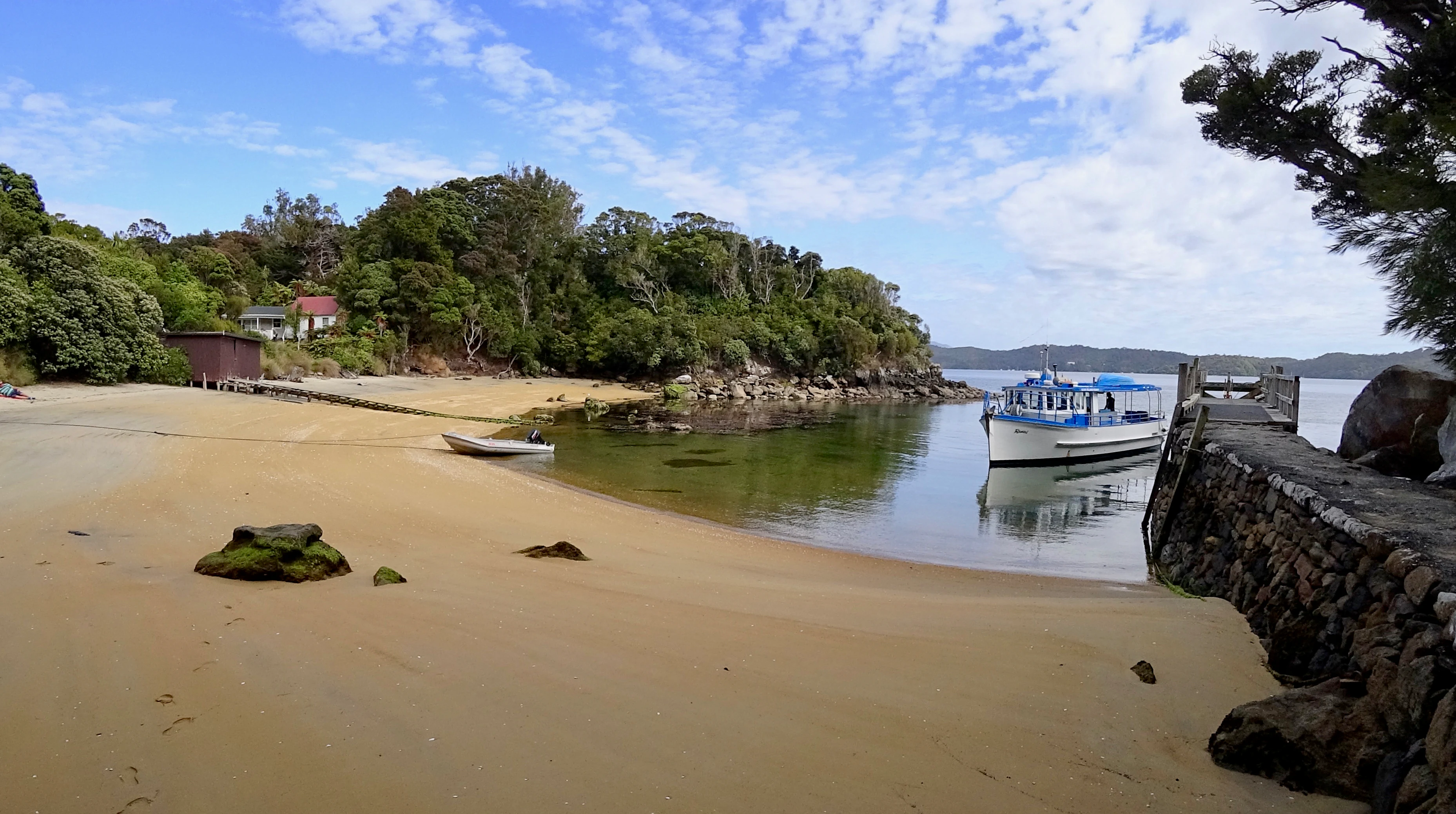
A sandy beach and stone wharf at Post Office Bay on Ulva Island, with a small passenger ferry anchored nearby and dense forest in the background.
The main wharf and ferry landing area at Post Office Bay on Ulva Island.

Ulva Island history and protected-area timeline

Ulva Island takes its name from the island of Ulva in the Inner Hebrides of Scotland, a naming link preserved from the era when sealers and settlers in this part of New Zealand came from or were connected to the Scottish Highlands and islands. Before that European name became established, the island was known as Coopers Island.

The conservation history of Ulva Island began in earnest in the late twentieth century. In 1997, following an intensive eradication programme, the island was declared rat-free. This pest-free status allowed the Department of Conservation and partner groups to reintroduce extirpated bird species whose populations had been lost from the surrounding region. Birds such as the South Island saddleback, yellowhead, and Stewart Island robin were returned to Ulva, and ongoing monitoring, particularly of the saddleback population by the University of Otago, has helped maintain those reintroduced populations.

The island's pest-free status has been tested repeatedly. Because the closest water crossing to the Rakiura mainland is only around 800 metres, well within the swimming range of Norway rats, more than twenty rat incursions were detected between 1997 and 2022. In early 2022 a new incursion in February spread before it could be contained, putting vulnerable species at renewed risk and prompting renewed calls, including from the Predator Free Rakiura trust, for landscape-scale predator eradication across the wider Rakiura region.

Ulva Island landscape and geographic character

The landscape of Ulva Island is gentle rather than dramatic. The island is roughly 3.5 kilometres long and consists of low, forested ridges and small sheltered bays nestled within Paterson Inlet. Its shoreline alternates between quiet coves such as Sydney Cove and Post Office Bay, where the public wharf is located, and more rugged sections fringed by coastal vegetation.

Inland, the terrain rises modestly into dense temperate rainforest. Mature native trees form a continuous canopy, with understorey of ferns, shrubs, and mosses typical of southern New Zealand's wet maritime climate. Streams and damp gullies add to the lush character of the bush, and the soft forest floor moderates the experience of walking the island's tracks.

Because Ulva lies within a sheltered inlet, the surrounding seascape is an important part of its setting: calm tidal waters, views across to Stewart Island, and the sense of being a forested island surrounded by inlet rather than open ocean shape the overall sense of place.
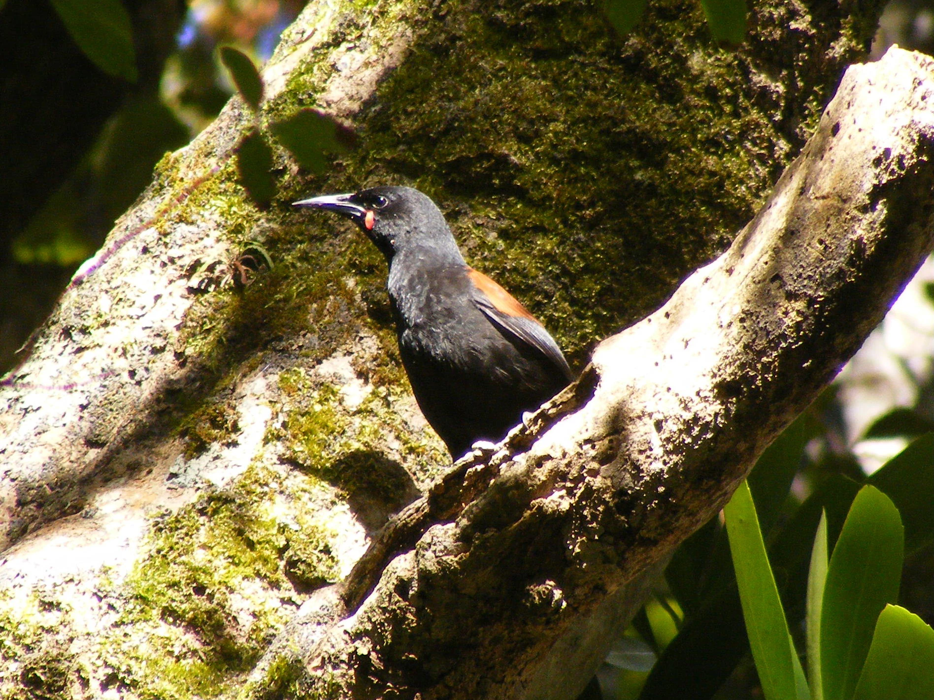
A South Island saddleback bird with black plumage and a chestnut-colored back perched on a moss-covered tree branch.
A South Island saddleback, or tieke, perched on a mossy branch on Ulva Island.

Ulva Island ecosystems, habitats, and plant life

Ulva Island supports a rich example of southern New Zealand's temperate rainforest ecosystem. The forest canopy is dominated by long-lived podocarps and broadleaf species typical of the Rakiura region, while the understorey and forest floor carry dense ferns, lichens, mosses, and liverworts that thrive in the island's wet, sheltered conditions. At least one liverwort species, Lophocolea mediinfrons, is thought to be endemic to the northeastern part of Ulva Island, highlighting the significance of even small forest refuges in this part of New Zealand.

The island's vegetation has benefited substantially from the absence of brows mammals since 1997. Without rats and other introduced predators damaging seed dispersal and seedling survival, plant communities on Ulva reflect patterns closer to pre-human conditions than is typical on the mainland. The forest acts not only as habitat for birds but as a living reservoir of southern coastal plant diversity within the wider Rakiura protected landscape.

Ulva Island wildlife and species highlights

Ulva Island is best understood as a bird sanctuary. Its predator-free status and dense forest make it a stronghold for many forest birds that are now rare, locally extinct, or in decline on mainland New Zealand.

Reintroduced species form the core of its birdlife: South Island saddleback (tīeke), first released on Ulva in 2000 and maintained there by the University of Otago; yellowhead (mohua); and the Stewart Island robin. The island also supports southern brown kiwi (tokoeka) of the Stewart Island subspecies, rifleman (tititipounamu), yellow-crowned and red-fronted parakeets, and South Island kākā, the forest parrot. The endangered yellow-eyed penguin uses parts of the island for breeding, extending the range of fauna present beyond the forest interior to coastal margins.

The combination of habituated but protected birds, low visitor pressure, and short walking tracks means that wildlife observation is one of the defining experiences of visiting Ulva Island.

Ulva Island conservation status and protection priorities

Ulva Island holds an important place in New Zealand conservation because it is one of the longest-running examples of an open sanctuary for native forest birds. Its history of rat eradication from 1997, followed by deliberate reintroductions of extirpated species, has turned a small offshore island into a recovery node for species that would otherwise be missing from the local mainland ecosystem.

The Department of Conservation maintains the public portion of the island and its predator-free status, and a small private section, around 8 hectares between Sydney Cove and Post Office Bay, sits alongside that publicly managed land. The island's ongoing vulnerability to rat reinvasion from the nearby Rakiura mainland underlines how fragile these sanctuaries remain without continued vigilance. The 2022 rat incursion, and the wider involvement of groups such as the Predator Free Rakiura trust, have strengthened arguments for predator eradication across the broader Rakiura landscape, of which Ulva is a key ecological component.

Ulva Island cultural meaning and human context

Ulva Island's cultural context reflects both its Scottish naming heritage and its place within the Rakiura environment. The island's English name derives from Scottish Gaelic, Eilean na Ulbha, taken from Ulva in the Inner Hebrides, and the earlier name Coopers Island marks its period of contact with European sealers and settlers in southern New Zealand. Today the island is uninhabited and managed primarily for conservation rather than habitation.

As part of Rakiura National Park and within the broader setting of Stewart Island / Rakiura, Ulva sits inside a region strongly associated with Māori place names and identity, even though the island itself is best known by its European-derived name. The combination of an internationally recognised open sanctuary with its place in the cultural landscape of southernmost New Zealand gives Ulva a layered sense of identity beyond its ecological role.

Top sights and standout views in Ulva Island

Ulva Island stands out as one of New Zealand's most rewarding open bird sanctuaries, combining easy access from Stewart Island with dense temperate rainforest and thriving populations of rare native birds. Its reintroduced saddleback, yellowhead, and robin populations, together with kiwi, parakeets, kākā, and breeding yellow-eyed penguins, give an unusually complete picture of what southern New Zealand's forest fauna can look like in the absence of introduced predators.

The island's importance is reinforced by its long-running partnership between the Department of Conservation and research institutions such as the University of Otago, its status as part of Rakiura National Park, and its role in shaping the Predator Free Rakiura conversation. For visitors, the highlight is the experience of walking short forest tracks while saddlebacks, robins, and other birds forage at close range.

Best time to visit Ulva Island

Ulva Island can be visited year-round, but the experience varies with the seasons. Summer months generally bring milder temperatures, more settled weather, and the long daylight hours that make walking forest tracks more comfortable, while also coinciding with peak breeding activity for several bird species. Autumn can be quieter and offers calmer conditions for the short ferry crossing from Stewart Island.

Winter brings cooler temperatures, more rain, and shorter days, but it is also a time of reduced visitor pressure and a chance to experience the rainforest in a quieter, more atmospheric state. Because the island is small and sheltered within Paterson Inlet, conditions tend to be less severe than on exposed parts of the Rakiura coast, though weather-appropriate clothing remains important at any time of year.
Monthly climate preview

Long-term monthly averages of temperature and precipitation for Ulva Island

Ulva Island Climate Normals and Annual Temperature Rhythm

Representative coordinates outline measured annual temperature variations alongside consistent daily precipitation patterns across the year. Reviewing the complete twelve-month sequence details the full range of historical weather normals recorded for this protected sanctuary.
Annual mean11 °C
8 °C13 °C
Jan13°
Feb13°
Mar13°
Apr11°
May10°
Jun
Jul
Aug
Sep
Oct10°
Nov11°
Dec12°
Warmest month
February

13.3 °C

Coolest month
July

8 °C

Wettest month
January

3.7 mm/day

Driest month
August

3 mm/day

Park location guide

Geography guide, regional context, and park location map for Ulva Island

Ulva Island park geography, regions, and map view in New Zealand

Understand where Ulva Island sits in New Zealand through a broader geographic reading of the surrounding landscape, nearby location context, and its mapped position within the national park landscape.

How Ulva Island fits into New Zealand

New Zealand is an island nation in the southwestern Pacific Ocean comprising two main islands and numerous smaller islands. Located east of Australia across the Tasman Sea, it features varied topography with the Southern Alps running along the South Island and volcanic terrain on the North Island. The country was settled by Maori people between 1280 and 1350, followed by European exploration beginning in 1642, and became a Dominion in 1907 before gaining full independence in 1947.

Wider geography shaping Ulva Island in New Zealand

New Zealand lies in the southwestern Pacific Ocean, east of Australia across the Tasman Sea. The country consists of two main islands, the North Island and South Island, plus over 600 smaller islands. The North Island features volcanic plateaus and hills while the South Island is dominated by the Southern Alps mountain range. The country has a long coastline and is surrounded by the Pacific Ocean.

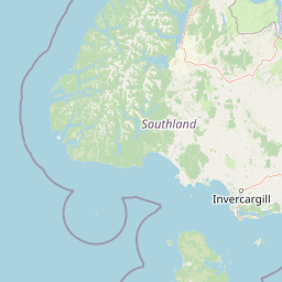
Map view of Ulva Island

Use this park location map to pinpoint Ulva Island in New Zealand, understand its exact geographic position, and read its mapped placement within the surrounding landscape more clearly.

Pigeon | © OpenStreetMap contributors

Explore detailed visual coverage of dense temperate rainforests, sheltered coves, and protected island habitats.

Ulva Island Photos and Landscapes: Visualizing New Zealand Sanctuary Scenery

Visual documentation captures the gentle forested ridges, quiet sheltered bays, and lush understorey of southern New Zealand's premier open bird sanctuary. Examining these natural environments provides a clearer understanding of the protected island's terrain, coastal waters, and native forest habitats.

A sandy beach and stone wharf at Post Office Bay on Ulva Island, with a small passenger ferry anchored nearby and dense forest in the background.

A dense, lush green temperate rainforest on Ulva Island featuring numerous tree ferns and mossy fallen logs.

A South Island saddleback bird with black plumage and a chestnut-colored back perched on a moss-covered tree branch.

Park atlas

Compare nearby national parks and regional conservation landscapes across Rakiura

Explore Parks Near Ulva Island and Connected Protected Areas in Southern New Zealand

Browse protected areas and forested island reserves located throughout the surrounding coastal region. Continued geographic comparison reveals how isolated sanctuaries connect to broader regional ecosystems.
National parkNew Zealand
Mapped location lies within the park boundary#1 closest

North

Rakiura National Park: New Zealand's Remote Protected Wilderness & Landscape Atlas

Explore its rugged terrain and unique subantarctic ecosystem.

Rakiura National Park encompasses the majority of Stewart Island, offering a unique glimpse into one of New Zealand's most remote and undisturbed natural environments. This protected landscape features rugged forested hills, extensive coastlines with isolated beaches, and is globally recognized for its abundant kiwi populations. Discover the park's geographic setting and its significance as a protected area for both wildlife and cultural heritage within the broader atlas of New Zealand's natural wonders.

Area
1,399.6 km²
Established
2002
IUCN
II
Relief
Lowland
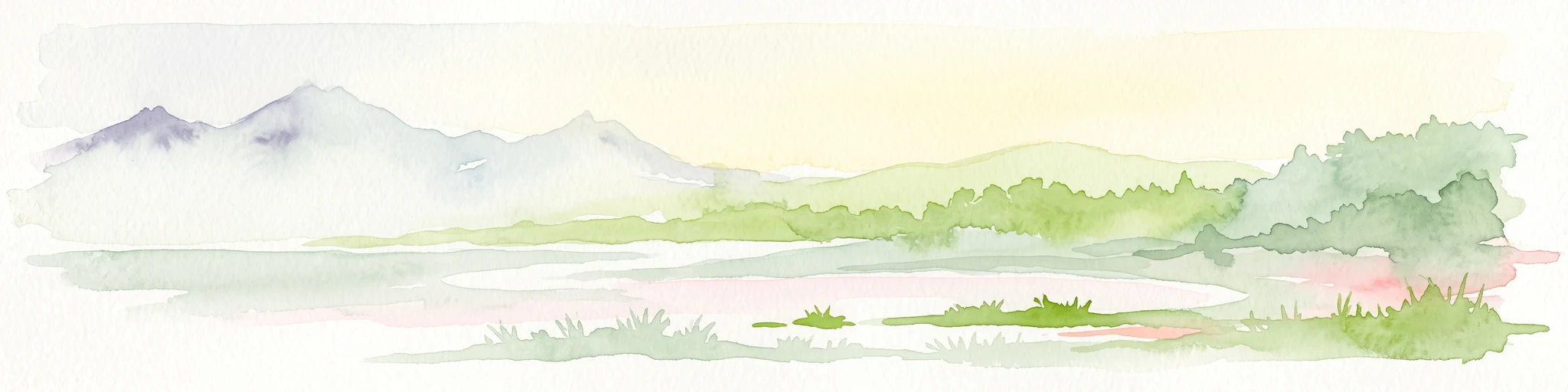
A soft watercolor illustration showing an island with green rolling hills rising from the water, with a line of trees along the shoreline in the foreground.
Nature reserveSouthland Region
About 42 km away#2 closest

Northwest

Codfish Island / Whenua Hou: A Protected Nature Reserve in the Southland Region

Coastal terrain and island geography in New Zealand

Located off the coast of Stewart Island, Codfish Island / Whenua Hou functions as an essential nature reserve. The island features moderate terrain, temperate coastal forests, and a protected landscape that preserves rare species and seabird colonies. Its geography is defined by a remote maritime setting, making it a globally significant site for predator-free wildlife conservation in the Tasman Sea.

Area
14 km²
Established
1987
Relief
Upland
Climate
Temperate
National parkSouthland Region
About 97 km away#3 closest

North

Fiordland National Park: A Protected Landscape of Glacier-Carved Fiords and Alpine Wilderness

Explore its vast boundaries and unique temperate rainforest.

Fiordland National Park, located in the Southland Region of New Zealand, is a testament to dramatic geological forces, featuring fifteen major fiords like Milford Sound, whose Mitre Peak rises majestically from the water. This protected national park encompasses an immense wilderness of alpine terrain, ancient beech forests, and numerous waterfalls, fueled by exceptional rainfall. Its inclusion in the Te Wāhipounamu World Heritage Area underscores its global significance for biodiversity and natural landscape preservation.

Area
12,607 km²
Established
1952
IUCN
II
Visitors
500K annual
Marine protected areaFiordland
About 172 km away#4 closest

Northwest

Moana Uta (Wet Jacket Arm) Marine Reserve: Mapped Protected Landscapes in Fiordland

Exploring unique fiord stratification and dense marine coral habitats

Located in the remote southwestern reaches of New Zealand, Moana Uta (Wet Jacket Arm) Marine Reserve preserves a complete fiord system. The area is notable for its exceptional physical conditions, including high black coral density and a distinct freshwater surface layer that sustains diverse underwater communities across steep rock walls, reefs, and deep basins.

Area
20.07 km²
Established
2005
Relief
Lowland
Climate
Temperate
Marine protected areaFiordland
About 183 km away#5 closest

Northwest

Taipari Roa (Elizabeth Island) Marine Reserve: Fiordland Marine Landscape and Atlas Map

Protected marine terrain and glacial fjord geography

Taipari Roa (Elizabeth Island) Marine Reserve is a protected marine area situated within the complex fjord network of Doubtful Sound. The reserve is characterized by steep underwater rock walls, deep kelp forests, and a unique freshwater cap that allows rare corals and glass sponges to thrive at shallow depths. This geographic overview examines the reserve's protected status and its structural role within the broader Fiordland ecosystem, highlighting the vertical aquatic terrain and surrounding islet environments.

Area
6.13 km²
Established
2005
Relief
Lowland
Climate
Temperate
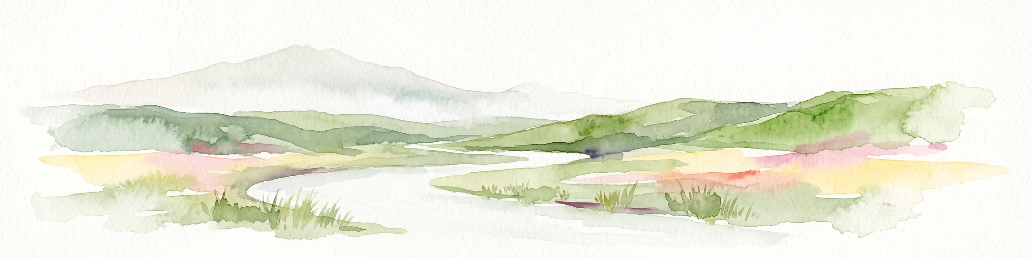
Watercolor painting of a green, hilly landscape with a winding river or inlet and pale, misty mountains in the background.
Marine protected areaFiordland
About 194 km away#6 closest

Northwest

Kutu Parera (Gaer Arm) Marine Reserve: Fiordland Protected Marine Landscape Atlas

Mapped marine boundaries, stratified fiord ecology, and coastal terrain analysis

Explore the structured geography of Kutu Parera (Gaer Arm) Marine Reserve, a 433-hectare protected area located within the steep, mountain-flanked fjords of New Zealand. Gain insight into its complex underwater features, including vertical rock walls, estuarine basins, and stratified water columns that define this unique marine environment within the Fiordland region.

Area
4.33 km²
Established
2005
Relief
Mixed relief
Climate
Temperate
Marine protected areaFiordland
About 211 km away#7 closest

North

Kahukura (Gold Arm) Marine Reserve: Marine Protected Area and Fiordland Geographic Atlas

Submerged rocky reefs and vertical rock wall landscapes

Located in the heart of New Zealand, Kahukura (Gold Arm) Marine Reserve provides a vital map of protected coastal terrain. Its unique environment features freshwater caps, tannin-stained deep water, and diverse marine topography ranging from sheltered basin ecosystems to vertical cliff structures. This marine area offers deep insight into the complex geology and conservation dynamics of the Fiordland region.

Area
4.64 km²
Established
2005
Relief
Mixed relief
Climate
Temperate
Marine protected areaFiordland
About 238 km away#8 closest

North

Hawea (Clio Rocks) Marine Reserve: Protected Marine Geography in Fiordland, New Zealand

Mapping vertical rock walls and stratified fiord water ecosystems.

Hawea (Clio Rocks) Marine Reserve is an ecologically significant marine protected area situated within the deep waters of Hāwea / Bligh Sound. The reserve is defined by its dramatic vertical rock walls, tidal current channels, and the complex water stratification that sustains diverse black coral and reef communities. It offers a unique window into the geological and marine processes that have shaped the rugged coastal landscape of New Zealand's Fiordland.

Area
4.11 km²
Established
2005
IUCN
Ia
Relief
Mountain

Common questions about visiting, size, designation, and location context for Ulva Island

Ulva Island FAQs for park facts, access, geography, and protected area context

Find quick answers about Ulva Island, including protected-area facts, park geography, trail and visitor context, and how the park fits into its surrounding country and regional landscape.
MoriAtlas Explorer

Continue Your Protected Areas Search Across the Global Atlas

Deepen your exploration by continuing the structured search for national parks and protected areas worldwide. Utilize the comprehensive filtering capabilities to compare different conservation landscapes and refine your understanding of global park geography. Discover more about the distribution and characteristics of protected natural areas.

Global natural geography