
Mori Atlas logo
Protected areaVallée de la Dordogne quercynoise

A linear conservation corridor traversing the limestone plateau and alluvial floodplains of the Lot department.

Vallée de la Dordogne quercynoise: Mapped Protected Area and Quercy River Valley Geography

The Vallée de la Dordogne quercynoise represents a significant Natura 2000 protected area that traces the Dordogne river as it cuts through the Quercy limestone plateau. This linear landscape features a shifting mosaic of alluvial forests, gravel bars, and dry calcareous slopes that provide essential habitats for rare migratory fish and specialized bat populations. Visitors can examine the topographic contrast between the active river channel, ancient karst caves, and the surrounding sunlit coteaux that define this southwestern French valley.

Natura 2000 siteDordogne river valleyQuercy limestone plateauLot departmentOccitanie regionalluvial forests
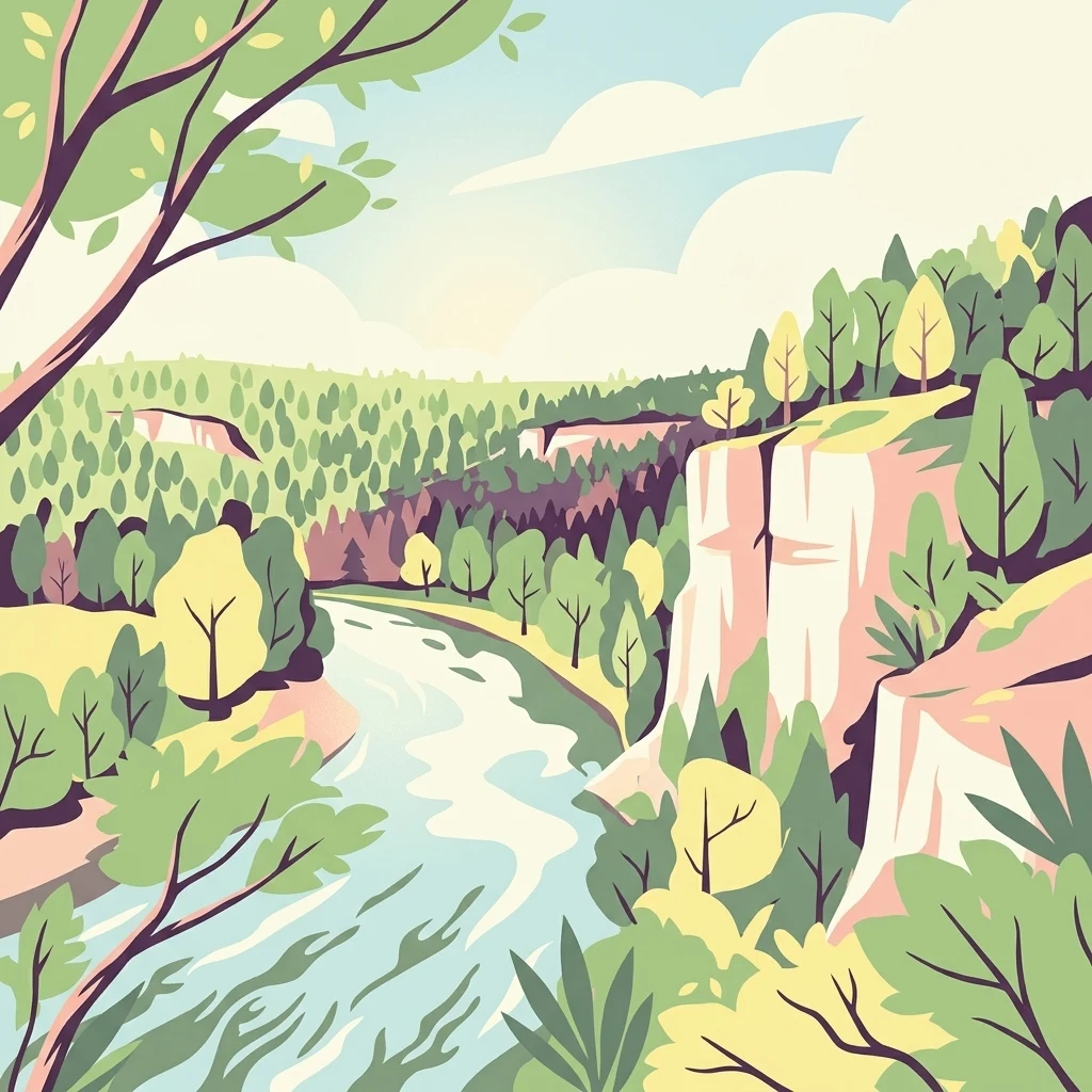
A stylized vector illustration of a river winding through a valley, flanked by tall limestone cliffs, dense forests, and a bright, soft sky.

Vallée de la Dordogne quercynoise

Protected area

Park overview

Structured park overview, official facts, and landscape profile for Vallée de la Dordogne quercynoise

Vallée de la Dordogne quercynoise park facts, protected area profile, and essential visitor context

Review the core facts for Vallée de la Dordogne quercynoise, including designation, size, terrain, visitor scale, habitats, and operating context in one park-focused overview.

About Vallée de la Dordogne quercynoise

The Vallée de la Dordogne quercynoise is a Natura 2000 protected site in southwestern France, centered on the Dordogne river as it flows through the Lot department in the historic Quercy region. Rather than a single contiguous block of wilderness, the site is a long, ribbon-like conservation corridor that integrates the river itself, its floodplain, and a selection of adjacent limestone hillslopes into one coherent ecological unit. This composite character is precisely what gives the site its conservation significance, because the Dordogne valley in Quercy contains a remarkable layering of habitats within a relatively confined geographic footprint.

At the heart of the site is the Dordogne river, whose flanks shift between slow meanders, gravel banks, and stretches lined with old trees. Around the river, alluvial forests dominated by alder and ash colonize the lowest terraces, while mixed forests of oak, elm, and ash create a richer woodland mosaic on slightly higher ground. Above these wooded zones, the landscape opens up into a patchwork of dry calcareous grasslands, juniper thickets, boxwood formations, and exposed rocky slopes, where thin soils and south-facing exposures favor orchids and other thermophilic flora. Caves and travertine-producing springs add a karst dimension to the site, linking surface ecology with the underground geology of the Quercy plateau.

Beyond its ecological content, the site is deeply integrated into the regional geography and cultural identity of the Lot. Many of the communes along the protected stretch, such as Souillac, Martel, and Carennac, are known for their medieval bridges, châteaux, and historic riverside settings, while the valley itself has long shaped patterns of settlement, agriculture, and travel in the region. The Natura 2000 designation, formalized in 2007, was intended not to replace these human uses but to frame them within a broader European commitment to maintaining the valley's biodiversity and natural heritage.

Quick facts and research context for Vallée de la Dordogne quercynoise

The Vallée de la Dordogne quercynoise is a Natura 2000 Site of Community Importance and Special Area of Conservation in the Lot department of France, in the Occitanie region. It follows the Dordogne river through the Quercy area, covering about 5,567 hectares across twenty communes. Elevation descends from around 270 meters at the northeastern entry point near Gagnac-sur-Cère to roughly 83 meters at the western exit near Le Roc.

The site protects seventeen Annex I habitat types, including alluvial alder and ash forests, lowland hay meadows, dry limestone grasslands famous for orchids, mixed riparian oak and elm forests, and petrifying springs with active travertine formation. Its fauna includes Annex II species such as the European otter, greater and lesser horseshoe bats, Atlantic salmon, sea lamprey, allis shad, marsh fritillary butterfly, and stag beetle.

Protection and recognition

Terrestrial conservation scope and established 2007 designation records.

Vallée de la Dordogne Quercynoise Protection Status and Designation History

Terrestrial protection status for Vallée de la Dordogne quercynoise outlines its established designation history from 2007. Structured records detail the documented management framework and conservation scope for this protected area.

Protection details

Protection scope
Terrestrial
Designated year
2007
Transboundary protection
No
Park context

Deeper park guide and search-rich context for Vallée de la Dordogne quercynoise

Vallée de la Dordogne quercynoise history, landscape, wildlife, and travel context

Explore Vallée de la Dordogne quercynoise through its history, landscape character, ecosystems, wildlife, conservation priorities, cultural context, and seasonal travel timing in a structured park guide built for atlas discovery and search intent.

Why Vallée de la Dordogne quercynoise stands out

The site is best known for protecting a continuous stretch of the Dordogne river corridor as it traverses the Quercy limestone plateau, a landscape defined by the contrast between the active river, its alluvial woodlands, and the dry calcareous coteaux rising above it. It is also notable for the unusually high concentration of European-protected habitats and species packed into a relatively narrow linear area. The valley harbors rare Annex I habitat types such as petrifying springs forming travertine and undisturbed caves, alongside Annex II species like the European otter, horseshoe bats, and migratory fish including Atlantic salmon and sea lamprey.
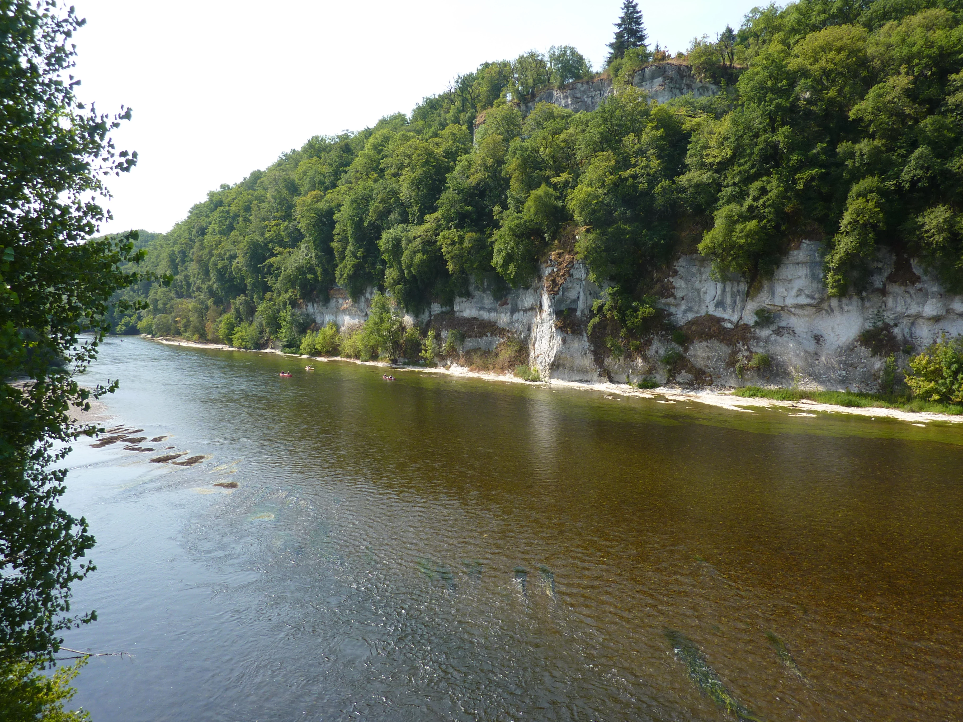
A wide river flows past a tall, forest-covered limestone cliff, with visible sandbars in shallow water during summer.
A summer view of the Dordogne River near Lanzac, showcasing the river valley and limestone cliffs.

Vallée de la Dordogne quercynoise history and protected-area timeline

The Vallée de la Dordogne quercynoise entered the European Natura 2000 network after being formally validated as a Special Area of Conservation by an order of the French Ministry of Ecology and Sustainable Development dated April 13, 2007. This designation recognized the valley as a Site of Community Importance, placing it within the framework of the European Union's Habitats Directive (Directive 92/43/CEE) and binding it to the conservation of the habitats and species listed in the directive's annexes.

The Natura 2000 perimeter is not the only ecological designation covering the valley. The broader area is also recognized through France's ZNIEFF inventory, including a type II zone of the same name covering about 8,758 hectares across twenty-eight communes, and a smaller type I zone called La Dordogne quercynoise covering roughly 2,081 hectares across twenty-four communes. These complementary designations underline that the valley's ecological interest was documented at multiple scales before and alongside its Natura 2000 status.

In human terms, the Dordogne valley has been continuously inhabited and worked for centuries. Medieval and later settlement patterns along the river, including bridge-towns such as Souillac, have shaped how the landscape is experienced today, while the upper coteaux retain patterns of traditional grazing and haymaking that are themselves part of the cultural mosaic the site now seeks to conserve.

Vallée de la Dordogne quercynoise landscape and geographic character

The landscape of the Vallée de la Dordogne quercynoise is defined by the river's transition through the Quercy limestone plateau. Where the Dordogne enters the Lot department near Gagnac-sur-Cère, the valley sits at roughly 270 meters of elevation; by the time the river exits the Lot near Le Roc and moves into the Dordogne department, it has fallen to about 83 meters. This drop in elevation across the protected stretch gives the valley a strong directional sense, with upstream sections feeling more enclosed by hills and downstream sections opening out as the river nears the wider Périgord plains.

The coteaux, or limestone hillslopes, are one of the defining features of the site. They rise on either side of the river, often steeply, and carry a distinctive mosaic of dry grasslands, juniper and box formations, rocky outcrops, and shallow soils that support thermophilic plant communities. In places, exposed calcareous cliffs host chasmophytic vegetation, while small caves and karst features add further structural diversity to the slopes.

The river corridor itself introduces a contrasting, wetter landscape. Braided channels, gravel bars, muddy banks, and old alluvial terraces produce a shifting mosaic of aquatic and riparian habitats. Viewpoints such as the Belvédère de Copeyre, between Floirac and Martel, reveal the layered character of this landscape: river below, wooded terraces in the middle distance, and the open, sunlit slopes of the coteaux above the tree line.
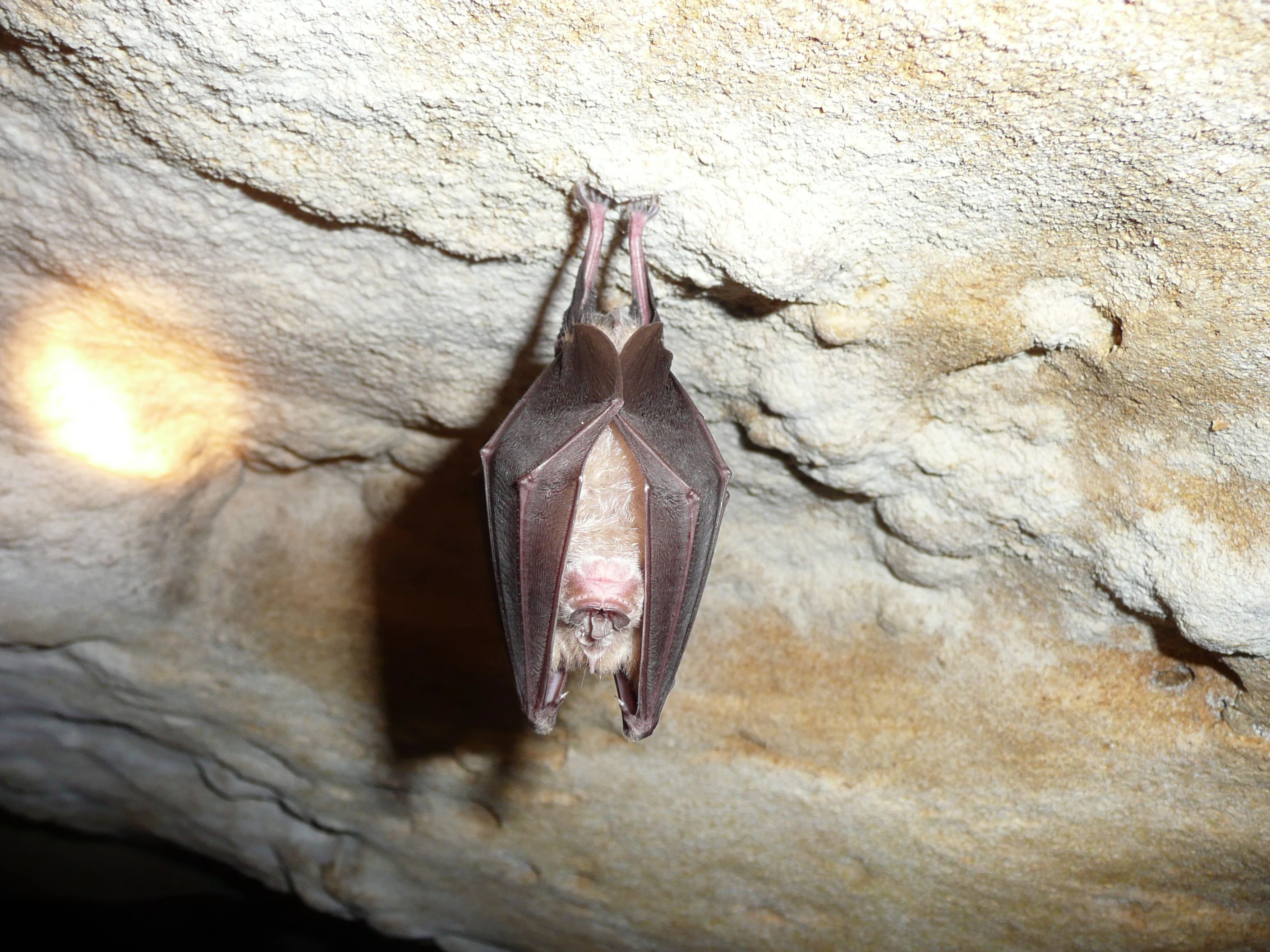
A Greater Horseshoe bat hanging upside down, wrapped in its wings, against a textured limestone cave ceiling.
A Greater Horseshoe bat hanging from the ceiling of a limestone cave in the Dordogne Valley.

Vallée de la Dordogne quercynoise ecosystems, habitats, and plant life

Ecologically, the Vallée de la Dordogne quercynoise is a textbook example of how European river valleys can concentrate habitat diversity. More than a third of the site area corresponds to seventeen habitat types listed in Annex I of the EU Habitats Directive. These habitats range from aquatic and wetland systems, including rivers with Ranunculion and Callitricho-Batrachion vegetation, muddy banks, eutrophic and oligotrophic standing waters, and petrifying springs, to terrestrial systems such as alluvial alder and ash forests, mixed riparian oak and elm forests, slope forests of the Tilio-Acerion type, dry limestone grasslands, juniper heaths, boxwood formations, and western Mediterranean screes.

The coexistence of these habitats within one valley is unusual. Where many protected sites emphasize a single dominant ecosystem, such as forest, wetland, or grassland, the Dordogne quercynoise combines all of these in a compact, repeating sequence along the river. This mosaic structure allows species with very different ecological requirements to find suitable habitat within the same protected perimeter, and it underpins the site's rich faunal diversity.

Plant communities reflect the same layered logic. Floating water-plantain (Luronium natans) is the single Annex II plant species documented on the site, while orchids of conservation interest appear in the dry calcareous grasslands, and a broader flora of steppic grasses, juniper formations, and Mediterranean-affinity thermophilic plants inhabits the warmer slopes and screes.
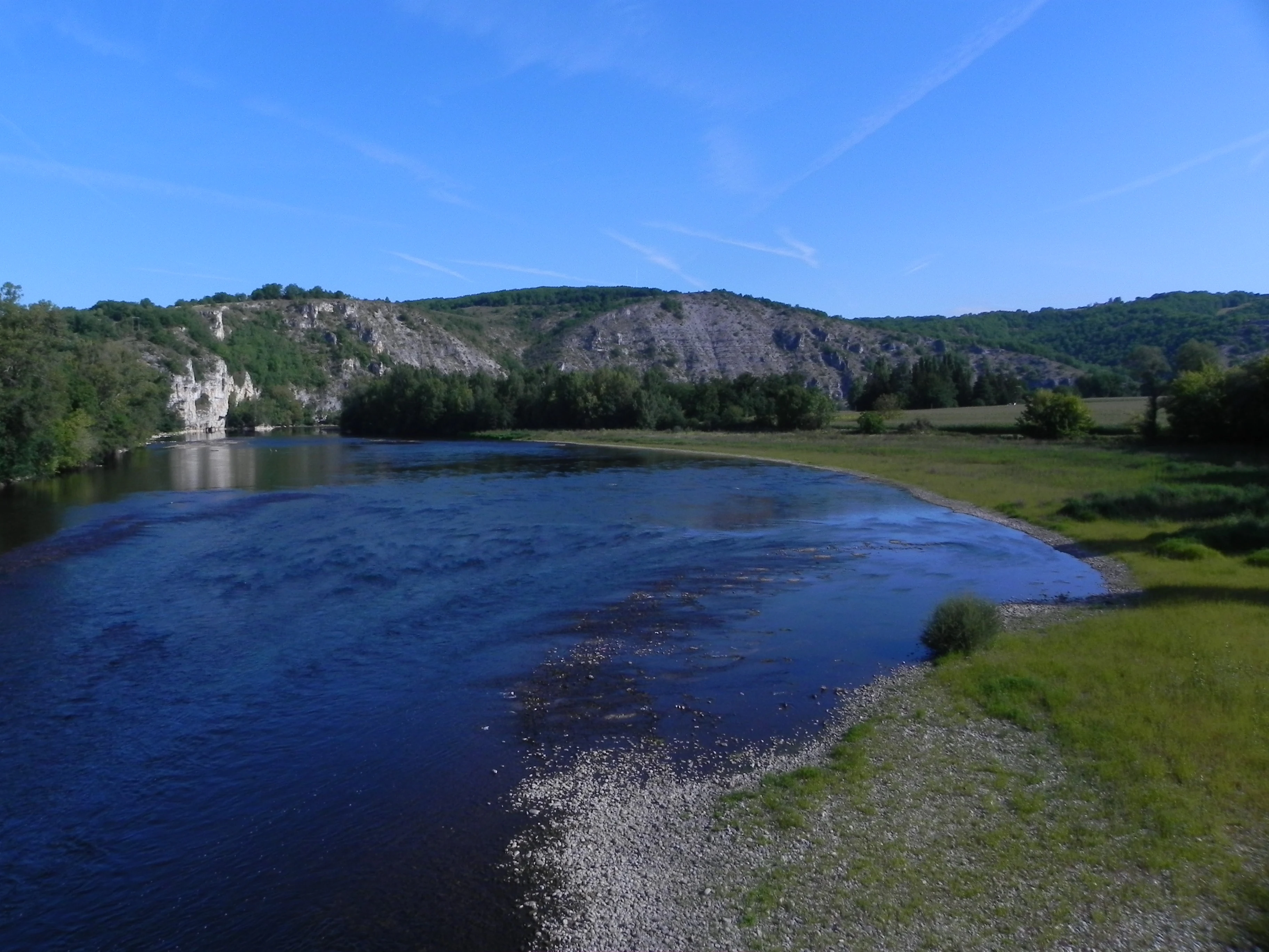
A wide, calm river bends through a valley lined with dense green forests and prominent light-colored limestone cliffs under a clear blue sky.
The Dordogne River flowing through the valley, characterized by rocky limestone cliffs and riparian greenery.

Vallée de la Dordogne quercynoise wildlife and species highlights

The site's wildlife profile reflects the same pattern of habitat diversity seen in its ecological structure. Fourteen animal species listed in Annex II of the EU Habitats Directive have been documented within the protected perimeter, distributed across insects, mammals, and fish, with the additional presence of sea trout, an important migratory species not itself listed in Annex II.

Among insects, four species stand out. The stag beetle, with its distinctive antler-like mandibles in males, and the marsh fritillary butterfly, which depends on specific meadow habitats, both indicate the presence of well-preserved deciduous woodland and wet grassland. The large copper butterfly, typically associated with damp meadows, and the rare orange-spotted emerald dragonfly, a species of conservation concern in Europe, round out this group.

Mammals are dominated by bats, with five Annex II species recorded, including the greater horseshoe bat, the lesser horseshoe bat, Geoffroy's bat, and the Mediterranean horseshoe bat. These species depend on the combination of undisturbed caves, mature woodland, and structured riverside vegetation that the valley provides. The European otter, another Annex II species, signals healthy river and bank conditions.

Fish communities are particularly striking for a French river system. The site hosts Atlantic salmon, sea lamprey, allis shad, sea trout, bullhead, and toxostome, a mix that includes both resident freshwater species and long-distance migrants tied to the broader ecological health of the Dordogne basin.
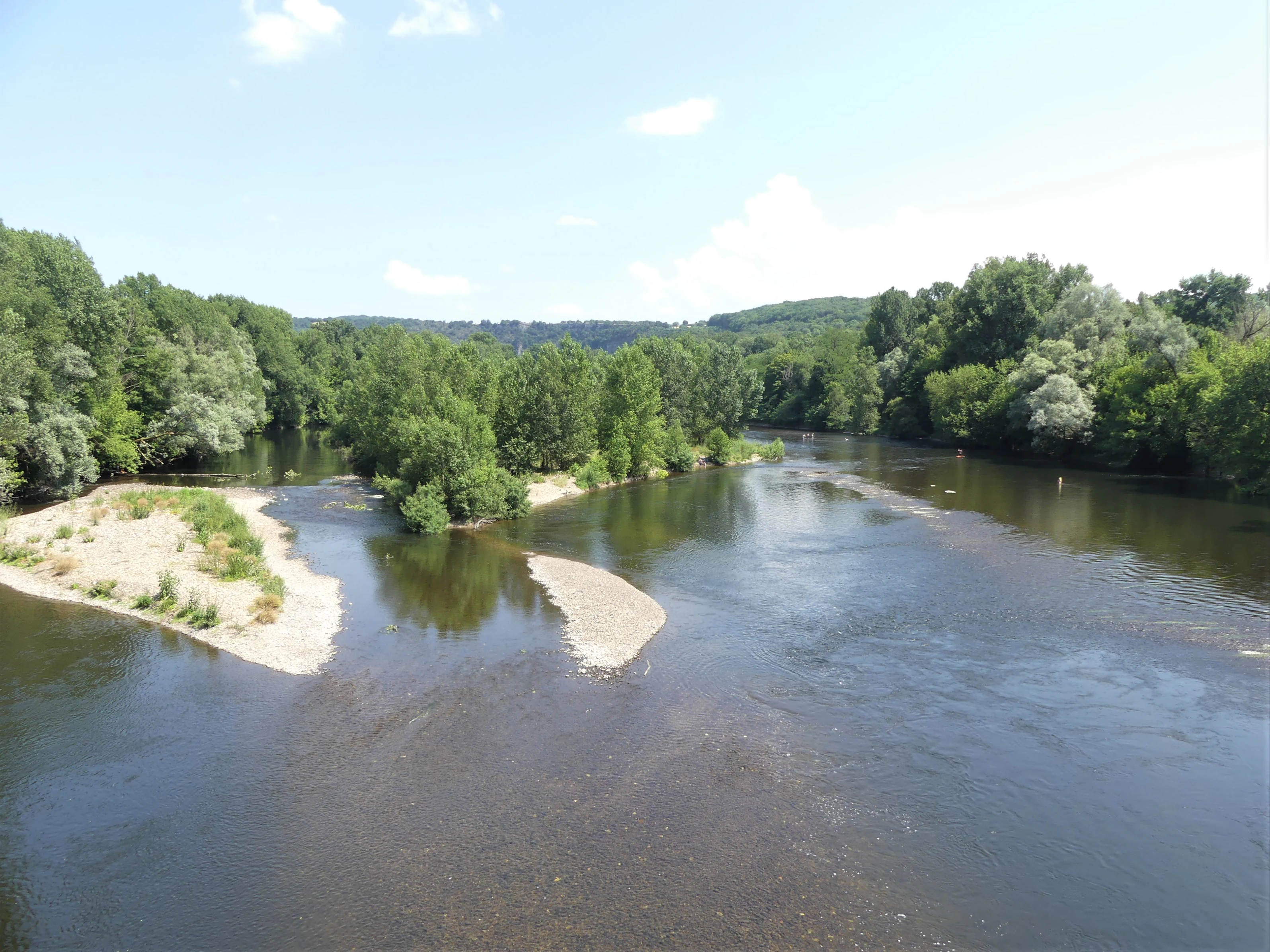
A wide, calm river winding through a dense green forest with small gravel bars visible in the water under a clear blue sky.
The Dordogne River flowing through the lush river valley near Gluges.

Vallée de la Dordogne quercynoise conservation status and protection priorities

The conservation significance of the Vallée de la Dordogne quercynoise lies in its role as a protected sanctuary within the European Natura 2000 network and as a critical node in the Dordogne basin's ecological connectivity. Designation as a Special Area of Conservation under the Habitats Directive commits the site to maintaining favorable conservation status for its Annex I habitats and Annex II species, including threatened bats, otters, migratory fish, and several rare invertebrates.

The site's value is amplified by its overlap with broader French ecological inventories. It sits within a ZNIEFF type II area of the same name covering about 8,758 hectares across twenty-eight communes, and partially within the narrower ZNIEFF type I area called La Dordogne quercynoise. Within the ZNIEFF type II area alone, inventories have recorded 83 determinant animal species and 80 determinant plant species, underscoring how the Natura 2000 designation captures only the core of a much larger ecological complex.

Its karst features, including caves not exploited by tourism and petrifying springs that lay down travertine, add a geomorphological dimension to its conservation profile. These features shelter hibernating bats and support specialized plant and invertebrate communities that depend on stable, undisturbed conditions over long timescales.

Vallée de la Dordogne quercynoise cultural meaning and human context

The Dordogne valley in Quercy is one of the culturally richest corridors in southwestern France. The valley floor is dotted with historic towns and villages whose development has been shaped directly by the river, including Souillac, known for its abbey and as a gateway between Quercy and Périgord; Martel, with its medieval character; Carennac, Pirac, and a succession of smaller communes whose names frequently appear on French heritage registers.

Medieval bridges such as the Gluges bridge between Martel and Montvalent, the Cieurac bridge at Lanzac, and the D43 bridge between Pinsac and Lacave are tangible reminders of how the river has shaped transport, trade, and settlement since well before modern conservation designations. Traditional land uses, including haymaking in the alluvial meadows and grazing on the drier coteaux, also continue to define the valley's working landscape and interact directly with the habitats protected under Natura 2000.
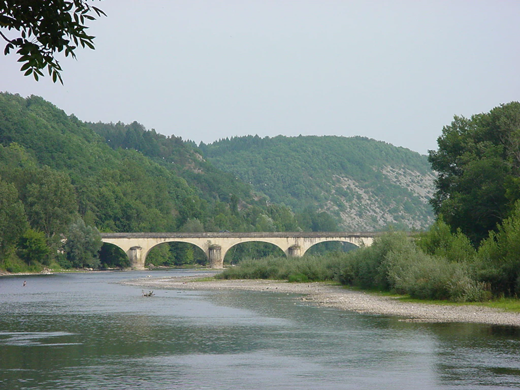
A wide shot of a multi-arched stone bridge crossing a calm river with wooded hills in the background.
A stone arched bridge spans the Dordogne river in the Lot department of France.

Top sights and standout views in Vallée de la Dordogne quercynoise

The site's strongest points of distinction are the combination of a free-flowing, ecologically rich river corridor with adjacent limestone slopes, karst caves, and travertine springs within a single Natura 2000 perimeter; the unusually high count of seventeen Annex I habitats; and the presence of emblematic species such as the European otter, four horseshoe bat species, Atlantic salmon, sea lamprey, and the rare orange-spotted emerald dragonfly.

Best time to visit Vallée de la Dordogne quercynoise

Seasonal character in the Dordogne quercynoise valley shifts between the green, high-water period of late spring, when meadows and alluvial forests are at their most lush and bats and dragonflies become active; the warm, dry tones of summer, when the calcareous coteaux glow with grassland color and orchids have finished flowering; autumn, when riverside foliage turns and salmon and trout runs peak along the Dordogne; and quieter winter months, when fog settles into the valley and bats roost in the undisturbed caves.
Monthly climate preview

Long-term representative point measurements tracking monthly temperature and precipitation patterns

Vallée de la Dordogne quercynoise Climate Normals and Annual Temperature Rhythm

Historical monitoring data records the annual temperature progression and monthly precipitation averages across representative coordinates in Vallée de la Dordogne quercynoise. Detailed monthly climate normals provide structured context for examining long-term meteorological rhythms within the protected landscape.
Annual mean11 °C
3 °C20 °C
Jan
Feb
Mar
Apr10°
May14°
Jun18°
Jul20°
Aug20°
Sep16°
Oct12°
Nov
Dec
Warmest month
August

20.5 °C

Coolest month
January

3 °C

Wettest month
November

3.2 mm/day

Driest month
July

1.9 mm/day

Park location guide

Geography guide, regional context, and park location map for Vallée de la Dordogne quercynoise

Vallée de la Dordogne quercynoise park geography, regions, and map view in France

Understand where Vallée de la Dordogne quercynoise sits in France through a broader geographic reading of the surrounding landscape, nearby location context, and its mapped position within the national park landscape.

How Vallée de la Dordogne quercynoise fits into France

France is a unitary semi-presidential republic and one of the world's largest economies. It borders Belgium, Luxembourg, Germany, Switzerland, Italy, Monaco, Andorra, and Spain, with a maritime border to the United Kingdom. The country is known for its cultural influence, art, cuisine, and political history spanning centuries.

Wider geography shaping Vallée de la Dordogne quercynoise in France

France is located in Western Europe. Metropolitan France extends from the Rhine to the Atlantic Ocean and from the Mediterranean Sea to the English Channel and North Sea. The country borders Belgium, Luxembourg, Germany, Switzerland, Italy, Monaco, Andorra, Spain, and has a maritime border with the United Kingdom.

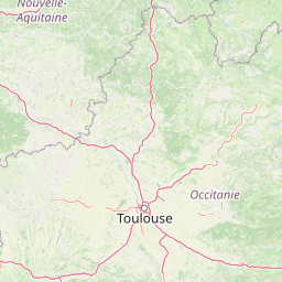
Map view of Vallée de la Dordogne quercynoise

Use this park location map to pinpoint Vallée de la Dordogne quercynoise in France, understand its exact geographic position, and read its mapped placement within the surrounding landscape more clearly.

Pigeon | © OpenStreetMap contributors

Location context for Vallée de la Dordogne quercynoise

LotOccitanie

Visualizing limestone coteaux, river corridors, and protected habitats across the Quercy plateau

Vallée de la Dordogne Quercynoise Landscape Photos and Protected Area Scenery

Examine detailed photographs of the Vallée de la Dordogne quercynoise to study the contrasting terrain of steep limestone hillslopes and active river channels. Visual records clarify the complex mosaic of alluvial woodlands, dry grasslands, and protected valley habitats defining the region.

A wide river flows past a tall, forest-covered limestone cliff, with visible sandbars in shallow water during summer.

A wide, high-angle landscape shot looking down at the dark blue Dordogne River flowing through a lush green valley with limestone cliffs in the background.

A Greater Horseshoe bat hanging upside down, wrapped in its wings, against a textured limestone cave ceiling.

A wide, calm river bends through a valley lined with dense green forests and prominent light-colored limestone cliffs under a clear blue sky.

A wide, calm river winding through a dense green forest with small gravel bars visible in the water under a clear blue sky.

A view of the Dordogne River winding past a dense green forest and blooming vegetation.

A wide shot of a multi-arched stone bridge crossing a calm river with wooded hills in the background.

Park atlas

Compare surrounding regional geography and adjacent river valley habitats

Parks Near Vallée de la Dordogne Quercynoise and Connected Protected Landscapes

Explore other protected areas near Vallée de la Dordogne quercynoise to examine similar river corridors and limestone plateau ecosystems. Comparing these regional landscapes reveals broader ecological patterns across southwestern France.
A soft, horizontal watercolor painting depicting a gentle, rolling landscape with green hills, sparse trees, and a hazy background in pale green and pink tones.
Regional parkOccitanie
About 3.9 km away#1 closest

South

Parc naturel régional des Causses du Quercy: Protected Karst Plateaus and River Valleys

Geographic atlas of the Causses du Quercy karst landscapes

An essential look at the geography of Parc naturel régional des Causses du Quercy. This protected area in Occitanie features an expansive network of limestone plateaus and carved river gorges. Learn about the karst terrain, sedimentary history, and the natural boundaries that define this French regional park and internationally recognized geopark.

Area
1,855 km²
Established
1999
IUCN
V
Nature reserveOccitanie
About 16 km away#2 closest

Southeast

Réserve naturelle régionale du marais de Bonnefont: Protected Wetland and Regional Atlas

Exploring the largest reedbed in the Lot department.

Situated in the heart of the Causses du Quercy, this protected nature reserve shelters the most significant reedbed in the Lot department of Occitanie. The site serves as a vital hydrological marker, demonstrating a rare transition between wetland habitats and the characteristic dry limestone plateaus of the region. This overview examines the geography, terrain, and structural importance of the reserve within the broader French protected lands network.

Area
0.42 km²
Established
2011
IUCN
IV
Relief
Lowland
Watercolor painting depicting a soft green landscape with rolling hills, riverbank vegetation, and a central waterway.
Nature reserveNouvelle-Aquitaine
About 40 km away#3 closest

Northeast

Réserve naturelle régionale des gorges de la Maronne et Tours de Merle: Protected Gorge Geography

Mapping the Maronne river basin and medieval towers in Nouvelle-Aquitaine

This protected area captures the distinct vertical relief of the Maronne river valley. The landscape profile includes steep rocky outcrops, narrow riparian corridors, and the historic site of the Tours de Merle. Exploring this regional reserve offers an understanding of how northern Massif Central ecosystems and medieval stone structures coexist within a protected framework in the heart of the Corrèze region.

Area
2.059 km²
Established
2025
IUCN
IV
Relief
Upland
A soft, light-toned watercolor painting showing rolling green hills and valley slopes under a pale sky.
Nature reserveOccitanie
About 75 km away#4 closest

East

Réserve naturelle régionale des coteaux du Fel, A Protected Landscape in Occitanie, France

Regional nature reserve in the Aveyron department.

Located along the Lot valley, the Réserve naturelle régionale des coteaux du Fel preserves a mosaic of sun-drenched oak and chestnut woodlands, heathlands, and historic meadows. This nature reserve provides a critical study of small-area conservation and dryland habitat management within the rural landscape of Occitanie. Use this resource to understand the park's terrain, mapped boundaries, and its ecological importance in the northern Aveyron region.

Area
123.38 km²
Established
2011
IUCN
IV
A soft watercolor painting of a wide, gently rolling landscape with green fields, forested hills in the distance, and native vegetation in the foreground.
Nature reserveHaute-Vienne
About 78 km away#5 closest

North

Lande de la Flotte et du Cluzeau: Geological Landscapes of Haute-Vienne, France

Nature reserve featuring rare serpentinite heathland habitats

Lande de la Flotte et du Cluzeau preserves a rare type of serpentine heathland on the Limousin plateau. By protecting stony outcrops that contrast with the local forest and farmland, this reserve maintains a significant botanical environment within Haute-Vienne, reflecting the complex metamorphic history of the region.

Area
132 km²
Established
1993
IUCN
IV
A horizontal watercolor illustration depicting a soft landscape with rolling hills, a body of water in the foreground, and pine trees on the right side.
Nature reserveNouvelle-Aquitaine
About 88 km away#6 closest

North

Réserve naturelle régionale de la haute vallée de la Vézère: Protected Highland Geography

Wetland ecosystems of the Corrèze and Plateau de Millevaches.

Representing a vital network of peatland and bog systems, this nature reserve in the Nouvelle-Aquitaine region preserves essential highland habitats. Its scattered parcels illustrate the complex wetland geography of the Massif Central, offering a focused look at how protected boundaries safeguard specialized ecosystems within the upper Vézère river catchment area.

Area
1.963 km²
Established
2015
IUCN
IV
Relief
Lowland
Nature reserveNouvelle-Aquitaine
About 99 km away#7 closest

Northwest

Vallée de la Nizonne Nature Reserve: Mapped Geography and Protected Wetland Landscapes

A critical river corridor and Natura 2000 conservation zone in Nouvelle-Aquitaine.

Discover the geographic structure of the Vallée de la Nizonne, a protected area shaped by the flow of the Nizonne and Lizonne rivers. This landscape mosaic features peatlands, wet meadows, and alluvial forests that serve as a refuge for rare species. Gain insight into the regional terrain and conservation boundaries that define this important French wetland corridor.

Area
33.91 km²
Established
2016
Relief
Upland
Climate
Temperate
Watercolor painting of a soft, hazy mountain landscape with rolling green fields and a distant forest, set against a light, warm, pale background.
Nature reserveAuvergne-Rhône-Alpes
About 100 km away#8 closest

East

Réserve naturelle régionale des tourbières du Jolan et de la Gazelle: Geographic Overview

A vital wetland protected area in the Auvergne volcanic highlands.

Located in the Cantal department, the Réserve naturelle régionale des tourbières du Jolan et de la Gazelle features a unique collection of peatland habitats, trembling mires, and acidic grasslands. This area sits within the broader volcanic terrain of the Parc naturel régional des Volcans d'Auvergne, offering a protected catchment for diverse marshland flora and fauna.

Area
1.558 km²
Established
2018
IUCN
IV
Relief
Highland

Common questions about visiting, size, designation, and location context for Vallée de la Dordogne quercynoise

Vallée de la Dordogne quercynoise FAQs for park facts, access, geography, and protected area context

Find quick answers about Vallée de la Dordogne quercynoise, including protected-area facts, park geography, trail and visitor context, and how the park fits into its surrounding country and regional landscape.
MoriAtlas Explorer

Continue Your Protected Areas Search Across the Global Atlas

Deepen your exploration by continuing the structured search for national parks and protected areas worldwide. Utilize the comprehensive filtering capabilities to compare different conservation landscapes and refine your understanding of global park geography. Discover more about the distribution and characteristics of protected natural areas.

Global natural geography