
Mori Atlas logo
Protected areaVallées de la Scarpe et de l'Escaut

Tracing the mapped boundaries and fluvial landscape of northern France's largest wetland complex

Vallées de la Scarpe et de l'Escaut: A Detailed Geographic Atlas of Protected Inland Wetlands

Vallées de la Scarpe et de l'Escaut represents a significant inland wetland mosaic located in the Nord department. The territory encompasses a network of river floodplains, alkaline peatlands, and large subsidence lakes formed by historical mining activity. This protected area supports complex hydrological functions and rare wetland biodiversity within a landscape shaped by both natural riparian systems and centuries of cultural water management.

wetlandsinland wetlandsRamsar siteNatura 2000peatlandsfloodplain
A flat-style digital illustration featuring a mountainous landscape with a waterfall flowing into a river in the foreground surrounded by trees.

Vallées de la Scarpe et de l'Escaut

Protected area

Park overview

Structured park overview, official facts, and landscape profile for Scarpe and Escaut Valleys

Scarpe and Escaut Valleys park facts, protected area profile, and essential visitor context

Review the core facts for Scarpe and Escaut Valleys, including designation, size, terrain, visitor scale, habitats, and operating context in one park-focused overview.

About Scarpe and Escaut Valleys

The Scarpe and Escaut Valleys represent one of the most significant inland wetland complexes in northern France, occupying a substantial portion of the Nord department between the cities of Douai and Valenciennes and continuing toward the Belgian frontier. Designated as a Ramsar site of international importance in February 2020, the area unites a wide diversity of freshwater habitats within a single protected framework, anchored in the floodplains of the Scarpe and the Escaut, also known internationally as the Scheldt.

At its core, the site is a true ecological mosaic. Open water, marshland, alkaline peatland, wet meadow, riparian forest, river, and main river channel come together to form a continually shifting tapestry of wetland environments. Some of the largest open water bodies originated as a direct consequence of past coal mining beneath the valley floor, where underground collapses caused the land surface to subside and fill with water. These resulting lakes have come to play a critical role in supporting waterbird populations, both resident breeders and seasonal migrants passing through the region.

The wetlands of the Scarpe and Escaut valleys also embody a long human story. Marshlands here were historically shaped by the labor of monastic communities, who established dense networks of drainage ditches, water channels, and managed meadows that continue to influence the hydrology of the site today. Over centuries, these landscapes have supported traditional activities including agriculture, fishing, and hunting; in the present day, they likewise accommodate outdoor recreation, nature tourism, and ecological study. This layered heritage of natural and cultural management contributes strongly to the area's identity.

Functionally, the wetland system serves several environmental roles that extend well beyond habitat conservation. It contributes to the regional drinking water cycle, provides hydrological support to river flows during periods of low water, sustains the production of high-quality fodder hay during droughts, and acts as a significant carbon reservoir through its peat-forming systems. The specific character of the wetlands is closely tied to the underlying chalk aquifer of the region, whose hydrological influences shape the unusual ecological complexity of the area, including the rare alkaline peatland communities found there.

Quick facts and research context for Scarpe and Escaut Valleys

The Scarpe and Escaut Valleys cover roughly 27,622 hectares in the Nord department of northern France, lying between Douai, Valenciennes, and the Belgian border. The site received international recognition under the Ramsar Convention in February 2020, with Ramsar site number 2405, and is part of the European Natura 2000 ecological network. It is administered in conjunction with the Scarpe-Escaut Regional Natural Park and is characterized by a hydrological system influenced by the underlying chalk aquifer.

Protection and recognition

Documented terrestrial protection scope and international Ramsar site records for Vallées de la Scarpe et de l'Escaut

Vallées de la Scarpe et de l'Escaut Protection Status and Ramsar Recognition

Vallées de la Scarpe et de l'Escaut maintains documented terrestrial protection status alongside verified international Ramsar site recognition records. Official records outline the conservation framework, management scope, and international designation details for this protected area.
Park context

Deeper park guide and search-rich context for Scarpe and Escaut Valleys

Scarpe and Escaut Valleys history, landscape, wildlife, and travel context

Explore Scarpe and Escaut Valleys through its history, landscape character, ecosystems, wildlife, conservation priorities, cultural context, and seasonal travel timing in a structured park guide built for atlas discovery and search intent.

Why Scarpe and Escaut Valleys stands out

The site is best known for being the largest inland wetland mosaic in the Hauts-de-France region, defined by a rare combination of large fluvial plains, alkaline peatlands, subsidence lakes, and a dense monastic-era network of drainage ditches. It is especially valued for hosting exceptional wetland species and large numbers of breeding and migratory waterbirds on its mining-subsidence lakes. Its peatlands are also a defining feature, functioning as uncommon alkaline mires within a major lowland river system and playing an important role in long-term carbon storage. The combination of cultural heritage water management and ecological significance gives the site a distinctive identity among French Ramsar wetlands.
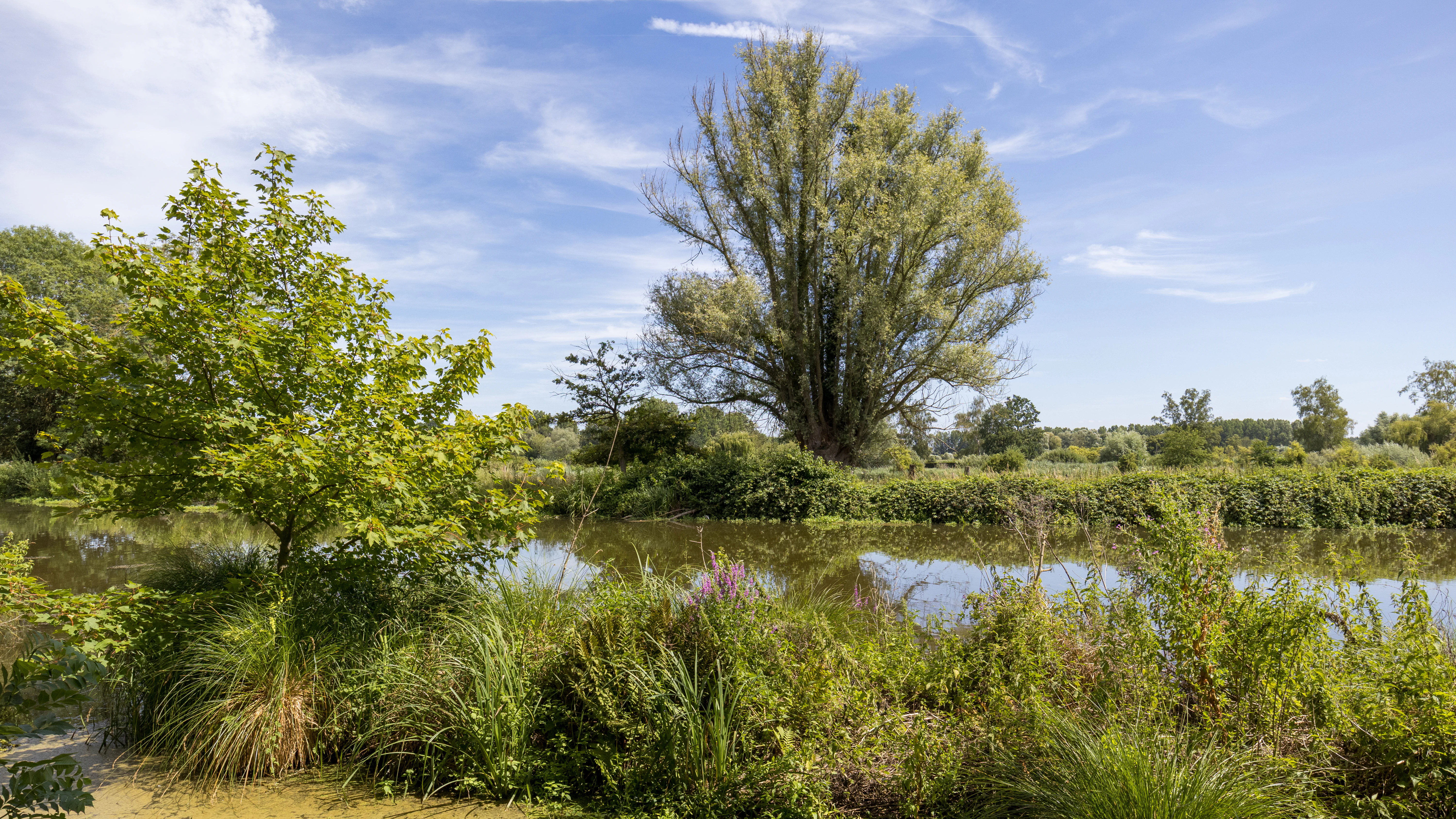
A pollard willow tree grows on the grassy bank of a calm river with lush riparian vegetation in the foreground under a blue sky.
A tranquil view of a pollard willow along the banks of the Scarpe river.

Scarpe and Escaut Valleys history and protected-area timeline

The wetland landscapes of the Scarpe and Escaut valleys have been shaped by centuries of human interaction with water. The earliest large-scale management of the marshlands is linked to monastic communities, whose work created the dense network of drainage ditches and managed water channels that still structures the site's hydrology today.

Over the following centuries, the area became central to traditional regional livelihoods. Wet meadows supported hay production and grazing, the rivers and marshes sustained fisheries, and the wildfowl populations supported seasonal hunting traditions. These uses remained compatible with the maintenance of the wetland mosaic and contributed to its ecological character.

A quieter but ecologically transformative chapter came with the history of coal mining in the Nord. As underground workings were abandoned, surface subsidences gradually filled with water, producing a series of large, open lakes across parts of the valley. Although unplanned, these new waterbodies became valuable habitat for waterbirds and altered the mosaic of the wetland landscape in ways that continue to shape its biodiversity today.

In recent decades, recognition of the area's ecological importance has grown steadily through its integration into the European Natura 2000 network and its inclusion within the perimeter of the Scarpe-Escaut Regional Natural Park. The most prominent formal recognition came on 2 February 2020, when the site was designated as a Ramsar Wetland of International Importance, listed as Ramsar site number 2405.

Scarpe and Escaut Valleys landscape and geographic character

The physical landscape of the Scarpe and Escaut Valleys is defined by broad, low-relief river plains typical of northern France. The two principal rivers, the Scarpe and the Escaut, meander across the valley floor, accompanied by an extensive system of smaller channels, drainage ditches, ditches inherited from monastic-era land management, and periodic floodplain meadows. The result is a continuous sinuous network of waterways bordered by wet vegetation.

A striking element of the present-day landscape is the presence of large open water bodies that originated as mining subsidence features. Where the surface collapsed above abandoned underground workings, basins filled with groundwater to form expansive lakes. These lakes are now integral to the visual character of the valley and, in many cases, are fringed by reedbeds, willow woodland, and floating marsh vegetation.

Forests and woodlands contribute to the landscape mosaic as well, with stands ranging from gallery woodland along the rivers to more extended wet woodland patches across the floodplain. Traditional landscape features such as pollarded willows along the Scarpe near Marchiennes and Vred endure as visible expressions of the long coexistence between people and the wet valley environment.

Scarpe and Escaut Valleys ecosystems, habitats, and plant life

The ecological identity of the Scarpe and Escaut Valleys rests on the exceptional diversity of wetland habitats concentrated within a single inland valley system. Open water, marshland, alkaline peatland, wet meadow, riparian woodland, and the river channels themselves combine to form a complete spectrum of lowland freshwater environments.

The peatlands are among the most distinctive features of the site. These are alkaline, or bas-rich, mires, a relatively uncommon wetland type in lowland European river systems. They are closely tied to the hydrological dynamics of the chalk aquifer beneath the valley, which supports the stable, base-rich conditions necessary for their persistence. Their functioning contributes to both biodiversity and long-term carbon storage.

The mosaic of habitats provides niches across the food web, from submerged aquatic vegetation and emergent reedbeds to wet meadows and woodland margins. This structural diversity is what enables the wetland complex to sustain multiple rare and specialist species simultaneously, and to maintain ecological functions such as water filtration, nutrient cycling, and hydrological regulation at the landscape scale. The integration of the site within the European Natura 2000 network reflects the broader European significance of these habitat patterns.

Scarpe and Escaut Valleys wildlife and species highlights

The Scarpe and Escaut Valleys are particularly significant for wildlife associated with freshwater and wetland environments. The expansive subsidence lakes and other open waters serve as staging and breeding sites for waterbirds, supporting both nesting populations and migratory species passing through the region. These open waters, combined with surrounding marshes and reedbeds, create ideal conditions for resident and seasonal avifauna.

Among the most exceptional species recorded at the site are several that are rare or threatened at the national scale. The field frog, a species of European conservation concern, occurs in the area, alongside the fen raft spider, also known as Dolomedes plantarius, one of Europe's rarest and most impressive wetland spiders. The pond bat, a bat species strongly tied to wetlands and wet woodland habitats, has been documented in the area, and the Mercury dragonfly, a delicate and uncommon damselfly, breeds in the slow-moving water channels.

The presence of ache rampante, a wild relative of celery and a plant associated with undisturbed wet meadow conditions, signals the persistence of high-quality traditional meadow habitats. Together, these species illustrate how the diversity of habitats across the valley sustains not only common wetland wildlife but also a notable set of specialist species whose conservation depends on the integrity of the mosaic as a whole.

Scarpe and Escaut Valleys conservation status and protection priorities

The primary conservation significance of the Scarpe and Escaut Valleys lies in the scale and completeness of the wetland mosaic it preserves. As the largest inland wetland complex in the Hauts-de-France region, the site concentrates habitat types that, individually, have become rare across much of lowland Europe. Its integration into the Natura 2000 network highlights its value within the broader European ecological framework, while Ramsar designation in 2020 placed it among the internationally recognized wetlands of importance under the Ramsar Convention.

From a functional perspective, the site performs several roles that extend well beyond species conservation. Its peatlands store significant quantities of carbon, contributing to climate regulation. The wetland system contributes to groundwater recharge and to the maintenance of river flows during low-water periods, supporting regional water security. It also supplies high-quality fodder hay during droughts, illustrating how ecological function and traditional land use can reinforce one another when managed at the landscape scale.

The conservation framework of the site, embedded within the broader management of the Scarpe-Escaut Regional Natural Park, emphasizes the integration of biodiversity protection with the continuation of traditional uses such as agriculture, fishing, and hunting, alongside modern uses including nature tourism and outdoor recreation. This blend of ecological, hydrological, cultural, and recreational values gives the site a strong conservation profile based on the long-term maintenance of its mosaic landscape rather than on isolated habitat fragments.

Scarpe and Escaut Valleys cultural meaning and human context

The Scarpe and Escaut Valleys carry a long cultural heritage associated with the management of water and wetland. Monastic communities historically shaped the marshlands through networks of ditches, channels, and managed meadows, and traces of this labor remain visible in the present-day hydrology and landscape.

Traditional rural livelihoods, including fishing, hunting, and the use of wet meadows for hay production, have been closely tied to the wetland environment for centuries. These activities are part of the regional identity of the Nord department and continue alongside contemporary forms of engagement with the valley, such as nature tourism and outdoor recreation.

Top sights and standout views in Scarpe and Escaut Valleys

The most distinctive features of the Scarpe and Escaut Valleys are the rare inland wetland mosaic, the large subsidence lakes of mining origin supporting waterbird life, and the alkaline peatlands that combine ecological rarity with significant carbon storage. The site's integration into Natura 2000 and its Ramsar designation in 2020 emphasize its international importance.

At the same time, the cultural dimension of the site is unusually rich: a monastic-era network of drainage ditches, centuries of farming, fishing, and hunting practice, and a heritage of pollarded willows along the riverbanks remain woven into the contemporary landscape. The combination of ecological function, hydrological services, and cultural heritage gives the site a layered identity that distinguishes it from many other French wetlands.

Best time to visit Scarpe and Escaut Valleys

The character of the Scarpe and Escaut Valleys changes meaningfully with the seasons, shaped largely by water levels, bird movements, and the flowering of meadow vegetation. Spring is typically the most rewarding period for observing breeding waterbirds and for appreciating the fresh green extent of meadows and woodland. Late spring and early summer also offer the best chance to see many of the dragonflies and aquatic plants for which the site is known.

Autumn and winter bring their own distinct appeal. Waterbird migration fills the lakes and marshes with seasonal visitors, and the bare outline of pollarded willows and wet woodland becomes more visible along the river channels. Cooler months can be a rewarding time for quiet observation of the wetland landscape, while summer droughts tend to highlight the role of the wetlands in sustaining water supply and quality forage across the valley.

Monthly climate preview

Long-term representative temperature and precipitation patterns across the protected landscape

Vallées de la Scarpe et de l'Escaut Climate Normals and Monthly Weather Data

Historical climate records from NASA Power define the measured annual temperature rhythm and daily precipitation averages across representative coordinates in Vallées de la Scarpe et de l'Escaut. Examining the complete twelve-month normals provides detailed monthly baseline data for comparing seasonal averages across the regional ecosystem.
Annual mean10 °C
3 °C18 °C
Jan
Feb
Mar
Apr
May13°
Jun16°
Jul18°
Aug18°
Sep15°
Oct11°
Nov
Dec
Warmest month
July

18 °C

Coolest month
January

2.9 °C

Wettest month
December

2.5 mm/day

Driest month
April

1.5 mm/day

Park location guide

Geography guide, regional context, and park location map for Scarpe and Escaut Valleys

Scarpe and Escaut Valleys park geography, regions, and map view in France

Understand where Scarpe and Escaut Valleys sits in France through a broader geographic reading of the surrounding landscape, nearby location context, and its mapped position within the national park landscape.

How Scarpe and Escaut Valleys fits into France

France is a unitary semi-presidential republic and one of the world's largest economies. It borders Belgium, Luxembourg, Germany, Switzerland, Italy, Monaco, Andorra, and Spain, with a maritime border to the United Kingdom. The country is known for its cultural influence, art, cuisine, and political history spanning centuries.

Wider geography shaping Scarpe and Escaut Valleys in France

France is located in Western Europe. Metropolitan France extends from the Rhine to the Atlantic Ocean and from the Mediterranean Sea to the English Channel and North Sea. The country borders Belgium, Luxembourg, Germany, Switzerland, Italy, Monaco, Andorra, Spain, and has a maritime border with the United Kingdom.

Map view of Scarpe and Escaut Valleys

Use this park location map to pinpoint Scarpe and Escaut Valleys in France, understand its exact geographic position, and read its mapped placement within the surrounding landscape more clearly.

Pigeon | © OpenStreetMap contributors

Location context for Scarpe and Escaut Valleys

Hauts-de-FranceNord
Recorded earthquake history

Explore Recorded Seismic History for Vallées de la Scarpe et de l'Escaut

Examine a curated list of recorded seismic events that occurred within proximity to the Vallées de la Scarpe et de l'Escaut. This MoriAtlas resource provides historical data for those researching regional geography and recorded seismic history around this wetland landscape.

Vallées de la Scarpe et de l'Escaut Earthquake Records

Catalogued events

14 events

Strongest magnitude

Magnitude 5.5

Most recent event

Jul 14, 2008

This history includes earthquakes recorded inside the park or within 50 km of its borders

Visual reference of lowland river plains, alkaline peatlands, and wetland habitats

Vallées de la Scarpe et de l'Escaut Photos and Landscape Scenery

Visual documentation of Vallées de la Scarpe et de l'Escaut reveals the complex terrain of northern France, featuring winding lowland rivers, alkaline peatlands, and expansive subsidence lakes. Photographic records provide clear spatial context for studying wetland habitats, floodplain vegetation, and regional protected landscapes.

A pollard willow tree grows on the grassy bank of a calm river with lush riparian vegetation in the foreground under a blue sky.

A wide view of a calm, reflective river surrounded by tall grasses, reeds, and trees under a clear blue sky.

Park atlas

Compare nearby regional protected areas, lowland river valleys, and connected wetland habitats.

Other Parks Near Vallées de la Scarpe et de l'Escaut and Surrounding Protected Landscapes

Browsing other parks near Vallées de la Scarpe et de l'Escaut reveals shared regional river basins, lowland floodplains, and protected habitats across northern France. Comparing adjacent natural areas helps place local wetland ecosystems, peatlands, and river corridors into a broader geographic perspective.
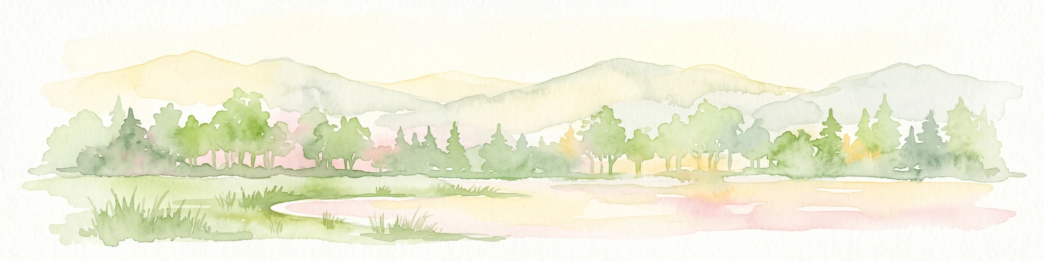
A panoramic watercolor painting showing a winding river in a green meadow, with a line of trees on the right and purple mountains in the background.
Nature reserveHauts-de-France
Mapped location lies within the park boundary#1 closest

West

Réserve naturelle régionale de la tourbière de Vred: Protected Peatbog and Wetland Map

Geographic landscape in the Hauts-de-France alluvial plain

Vred Peatbog is an ecologically significant protected site in northern France, known for its floating sphagnum-bearing peat formation. The reserve contains a mosaic of managed drainage channels, reedbeds, and woodlands that provide a critical sanctuary for wetland species within the Scarpe valley landscape. This mapping data provides a detailed look at the site's unique alluvial basin and regional conservation status.

Area
0.41 km²
Established
2008
IUCN
IV
Relief
Lowland
Watercolor painting of a soft, hazy landscape featuring low hills in the background and marshy wetlands in the foreground with pastel shades of green, yellow, and soft pink.
Nature reserveHauts-de-France
Mapped location lies within the park boundary#2 closest

West

Réserve naturelle régionale du pré des Nonnettes: Regional Nature Reserve and Wetland Atlas

Alluvial marshland and hay meadow terrain in the Hauts-de-France

The Réserve naturelle régionale du pré des Nonnettes preserves a rare wet hay meadow habitat within the Marais du Vivier. Located in the lower Scarpe river valley, this nature reserve integrates marshy ground, ponds, and riparian woods to support a concentrated mosaic of wetland biodiversity. MoriAtlas provides detailed geographic context for this protected site and its significance within the larger Hauts-de-France wetland conservation network.

Area
0.173 km²
Established
2008
IUCN
IV
Relief
Lowland
A watercolor painting of a pastoral landscape featuring a grassy foreground with a small pool of water, a line of trees, and soft hills in the background.
Protected landscapeHainaut
About 0.4 km away#3 closest

Northeast

Parc naturel des Plaines de l'Escaut: Geographic Overview of the Hainaut Protected Area

Scheldt valley wetlands, forested ridges, and historical landscape estates.

Located in the Hainaut province of Belgium, Parc naturel des Plaines de l'Escaut protects a complex mosaic of lowlands and heritage sites. This area integrates wetlands, heathland openings, and castle estates within a heavily humanized region. Learn about its role as a cross-border protected entity and its contribution to the pan-European ecological network through its varied terrain and water-dominated geography.

Area
465 km²
Established
1996
IUCN
V
Relief
Lowland
Nature reserveHauts-de-France
About 1.4 km away#4 closest

West

Réserve naturelle régionale des Annelles, Lains et Pont Pinnet: Protected Landscape Geography

A unique biodiversity refuge in the Hauts-de-France region of France.

The Réserve naturelle régionale des Annelles, Lains et Pont Pinnet showcases a dense patchwork of 26 natural habitats across a 14-hectare expanse. Its mapped boundaries reveal a mosaic of wet marshes, coal-shale terrils, and peat-forming ecosystems that support a significant variety of amphibians, dragonflies, and metallophyte flora. This protected area offers a clear look at how industrial landscapes can transition into essential botanical refuges within the northern French coal basin.

Area
0.146 km²
Established
2010
IUCN
IV
Relief
Lowland
Nature reserveHauts-de-France
About 3.7 km away#5 closest

West

Réserve naturelle régionale du marais de Wagnonville: Protected Wetland and Bog Geography

A resilient marshland ecosystem in the Douai urban landscape.

This reserve provides a comprehensive look at the surviving wetlands of the Escrebieux valley. Covering 20 hectares, the area hosts a dense variety of habitats from open ponds to rare sphagnum peat bogs, marking an essential node of biodiversity and ecological restoration within the northern French administrative landscape.

Area
0.2 km²
Established
1994
IUCN
IV
Relief
Lowland
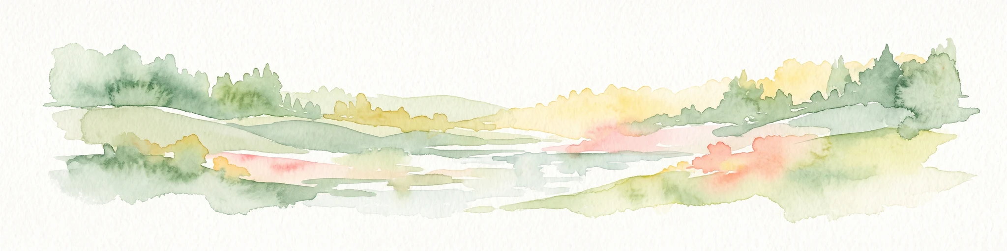
A wide watercolor illustration showing a calm river reflecting pink and yellow hues, bordered by green trees and vegetation on both banks.
Nature reserveHauts-de-France
9.4 km away#6 closest

East

Réserve naturelle régionale du bois d'Encade: Protected Woodland and Quarry Mosaic

Regional Nature Reserve in the Hauts-de-France river valley.

Spanning a compact stretch of the Hogneau valley, this nature reserve protects diverse habitats including fern-rich rock crevices and mature forest stands. The site represents a crucial ecological stepping stone that provides refuge for numerous bird, bat, and invertebrate species within a heavily cultivated agricultural corridor of northern France.

Area
0.021 km²
Established
2001
IUCN
IV
Relief
Lowland
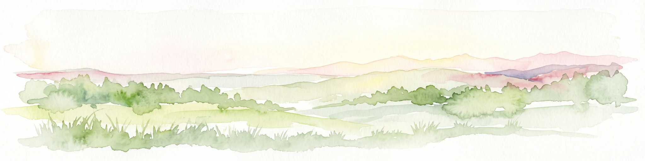
A pale, soft watercolor painting showing a rolling landscape with gentle green hills, grassy foreground, and distant hazy ridges under a white sky.
Nature reserveHauts-de-France
14 km away#7 closest

Southeast

Réserve naturelle régionale de la carrière des Nerviens, Protected Nature Reserve and Habitat Mosaic

Regional landscape context in Hauts-de-France, France

Spanning approximately three hectares, this nature reserve in the Hauts-de-France region serves as a dense habitat mosaic formed on former quarry lands. The site preserves regionally protected orchid species and rare plant formations through focused conservation management, offering a compelling look at post-industrial ecological succession and calcareous flora.

Area
0.031 km²
Established
2009
IUCN
IV
Relief
Lowland
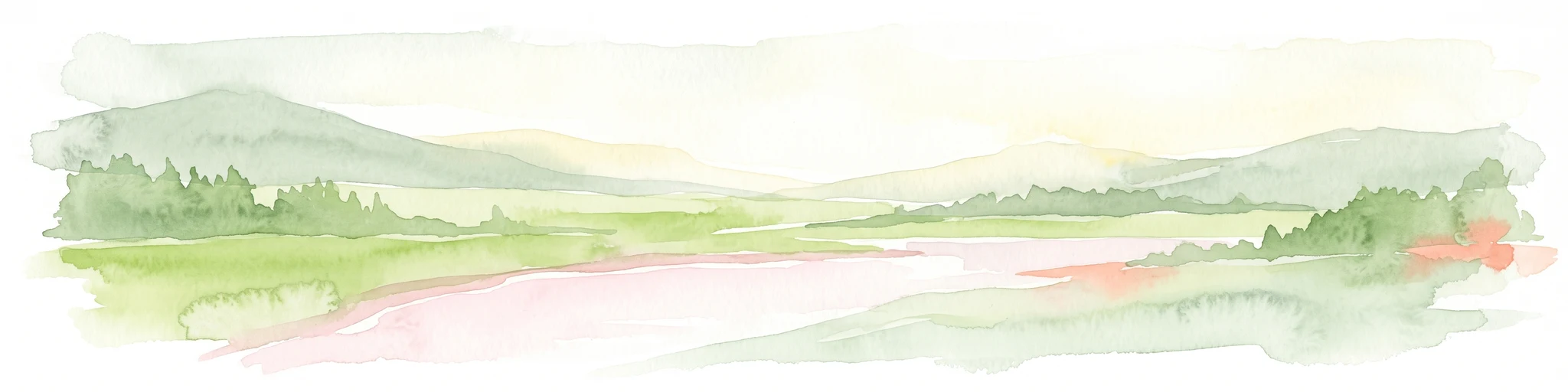
A horizontal watercolor illustration depicting rolling green hills, meadows, and a small stream or body of water.
Protected landscapeProvince de Hainaut
About 15 km away#8 closest

East

Parc naturel des Hauts-Pays: Geography and Protected Landscape Analysis

Tracing the forest corridors and river valleys of the Walloon region

Situated along the Franco-Belgian border, Parc naturel des Hauts-Pays offers a rare look at an intact bocage and forest landscape. The area is defined by the Grande Honnelle river valley, calcareous grasslands, and high-quality broadleaf woods. Its unique geographic location acts as a critical refuge for rare plant species and preserves a traditional rural identity that has survived across a complex watershed divide.

Area
157 km²
Established
2000
IUCN
V

Common questions about visiting, size, designation, and location context for Scarpe and Escaut Valleys

Scarpe and Escaut Valleys FAQs for park facts, access, geography, and protected area context

Find quick answers about Scarpe and Escaut Valleys, including protected-area facts, park geography, trail and visitor context, and how the park fits into its surrounding country and regional landscape.
MoriAtlas Explorer

Continue Your Protected Areas Search Across the Global Atlas

Deepen your exploration by continuing the structured search for national parks and protected areas worldwide. Utilize the comprehensive filtering capabilities to compare different conservation landscapes and refine your understanding of global park geography. Discover more about the distribution and characteristics of protected natural areas.

Global natural geography