Mori Atlas logo
Nature reserveVerloren Valei Nature Reserve

Mapping the montane grasslands and diverse wetland network of the Mpumalanga highveld.

Verloren Valei Nature Reserve: A High Altitude Highland Plateau and Protected Wetland Landscape

Verloren Valei Nature Reserve sits upon the elevated Steenkampsberg plateau, protecting an extensive mosaic of rolling montane grasslands and over thirty distinct wetlands. This highland sanctuary serves as a vital ecological corridor in the Mpumalanga province, providing essential breeding habitats for crane species and supporting rare grassland flora and fauna within its rocky, ridge-lined terrain.

wetlandsRamsar sitegrasslandhighland plateaucrane breedingbirdwatching

Verloren Valei Nature Reserve

Nature reserve

Park overview

Structured park overview, official facts, and landscape profile for Verloren Valei Nature Reserve

Verloren Valei Nature Reserve park facts, protected area profile, and essential visitor context

Review the core facts for Verloren Valei Nature Reserve, including designation, size, terrain, visitor scale, habitats, and operating context in one park-focused overview.

About Verloren Valei Nature Reserve

Verloren Valei Nature Reserve is a high-altitude protected landscape in Mpumalanga, South Africa, set on the Steenkampsberg plateau about 13 kilometres from the small town of Dullstroom. The reserve covers roughly 5,891 hectares of montane grassland, rocky ridges, and an interlinked network of more than thirty wetlands, giving it a character quite distinct from the bushveld and savanna reserves elsewhere in the country. Its Afrikaans name, Verloren Valei, simply translates as "Lost Valley," and the reserve continues to feel like a quiet, remote corner of Mpumalanga's high country.

The defining ecological identity of the reserve is the combination of rolling sourveld grasslands and sensitive wetlands at relatively high elevation. This rare South African estate supports a remarkably complete set of wetland-dependent and grassland-dependent species. Of particular importance is the reserve's status as one of the country's few breeding grounds for all three native crane species: the blue crane, South Africa's national bird; the wattled crane, a globally threatened species; and the grey crowned crane, known for its golden crown of feathers. Because all three breed on or near the reserve, Verloren Valei has become a focus of international wetland conservation effort.

The reserve was designated a Ramsar Wetland of International Importance in 2001, recognising the ecological value of its interconnected wetland system. Guided tours are offered by appointment and focus strongly on birdwatching, especially crane observation. The reserve's open grasslands host a variety of grassland birds, while rocky terrain attracts rock-loving species. In addition to birds, the reserve's fauna includes characteristic small antelope such as oribi and steenbok, brown hyena, caracal, serval, jackal, and otters, with wildebeest and blesbok having been reintroduced.

Plants include threatened species such as Eucomis vandermerwei, which is protected within the reserve's boundaries. The seasonal flowering of indigenous plants supports an unusually rich butterfly fauna, an aspect of Verloren Valei that has helped build its broader reputation as much more than a crane site. In short, Verloren Valei combines highland scenery, ecological importance, conservation programs, and watchable wildlife in a relatively compact protected area, and it remains one of Mpumalanga's most distinctive grassland reserves.

Quick facts and research context for Verloren Valei Nature Reserve

Verloren Valei Nature Reserve is a protected high-altitude grassland and wetland area in Mpumalanga, South Africa, located on the Steenkampsberg plateau near Dullstroom. Designated as a Ramsar Wetland of International Importance, the reserve is recognized for its role in supporting migratory, breeding, and range-restricted birdlife, particularly South Africa's three crane species.

Protection and recognition

Documented terrestrial protection scope, designation history, and Ramsar wetland status

Verloren Valei Nature Reserve Protection Status and Ramsar Recognition

Verloren Valei Nature Reserve maintains a documented terrestrial protection status established in 2001 alongside recognized Ramsar wetland listings. Structured records outline the official designation history and international recognition sources for this protected landscape.

International recognition

Protection details

Protection scope
Terrestrial
Designated year
2001
Transboundary protection
No
Park context

Deeper park guide and search-rich context for Verloren Valei Nature Reserve

Verloren Valei Nature Reserve history, landscape, wildlife, and travel context

Explore Verloren Valei Nature Reserve through its history, landscape character, ecosystems, wildlife, conservation priorities, cultural context, and seasonal travel timing in a structured park guide built for atlas discovery and search intent.

Why Verloren Valei Nature Reserve stands out

Verloren Valei Nature Reserve is best known for being a sanctuary for South Africa's three crane species: the blue crane, the wattled crane, and the grey crowned crane. The reserve's mosaic of more than thirty wetlands on the Steenkampsberg plateau provides the breeding habitat and food resources these iconic birds require, and the reserve plays a direct role in wattled crane conservation through a captive rearing and release program. The reserve is also recognized for its broader grassland bird diversity, red data bird presence, and rich invertebrate life, including butterflies that respond to the seasonal flower displays of the plateau. Together, these qualities have earned it Ramsar status and a strong reputation among birders, conservationists, and highland ecologists.

Verloren Valei Nature Reserve landscape and geographic character

The landscape of Verloren Valei Nature Reserve is formed by the Steenkampsberg plateau, a high-elevation portion of Mpumalanga that presents a topography of rolling grasslands interspersed with rocky outcrops, ridges, and shallow valleys. The reserve lies roughly 13 kilometres outside Dullstroom and derives its Afrikaans name, "Lost Valley," from this gently undulating highland terrain.

The most striking physical feature of the reserve is the network of more than thirty wetlands that thread through the grasslands. These include seepages, marshes, and open water surfaces that vary in size and character and that hold international ecological importance. The combination of open grassland, stone- and rock-rich ridges, and low-lying wet depressions gives the reserve a mosaic-like physical structure, where expansive views across the plateau suddenly give way to sheltered wetland pockets. This blend defines both the scenery and the ecological value of the area.

Verloren Valei Nature Reserve ecosystems, habitats, and plant life

Ecologically, Verloren Valei is a high-altitude grassland and wetland reserve rather than a forest or savanna system. Its montane sourveld grasslands are typical of the Steenkampsberg plateau and support a specialised assemblage of grasses and forbs, while the reserve's wetlands create a second ecological layer that benefits waterbirds, frogs, invertebrates, and specialized wetland plants.

One of the most notable botanical records within the reserve is the presence of the threatened species Eucomis vandermerwei, which is protected inside the reserve's boundaries. The seasonal flowering cycle of indigenous grassland plants also fuels a rich insect community, including a particularly noted butterfly fauna that responds to blooms across the warmer months. Together, these elements shape a highland ecosystem in which grassland, wetland, rock, and water converge into an unusually productive mosaic for a relatively limited area.

Verloren Valei Nature Reserve wildlife and species highlights

Wildlife is one of the reserve's defining strengths, and the reserve is especially recognised for its birdlife. It is one of the very few places in South Africa where all three native crane species, the blue crane, the wattled crane, and the grey crowned crane, breed together. Because the wattled crane is globally threatened, the reserve runs an ongoing conservation project that collects second eggs from breeding pairs for captive incubation. Chicks are reared in isolation by people wearing crane suits to prevent imprinting on humans, and once they are around six months old, they are released into the wild to bolster wild populations.

Beyond the cranes, the reserve's open grasslands host bald ibis, pipits, larks, cisticolas, magpie shrikes, red bishops, and various finches, several of which include red data species of conservation concern. The rockier parts of the reserve attract species such as the mountain chat, ground woodpecker, Cape rock thrush, and the localised grey-winged and red-winged francolins. Mammal fauna includes oribi and steenbok as native grassland antelope, plus brown hyena, caracal, serval, jackal, and otters, while wildebeest and blesbok have been reintroduced to complement the reserve's grazing community.

Verloren Valei Nature Reserve conservation status and protection priorities

Verloren Valei holds recognized international conservation importance, having been designated as a Ramsar Wetland of International Importance in 2001. This designation reflects the value of its wetland network for waterbirds, range-restricted species, and threatened ecological processes that depend on intact highland wetlands.

The reserve is also a working conservation site for the wattled crane, one of Africa's most threatened crane species. Through a dedicated egg collection, captive rearing, and release program, the reserve contributes directly to species recovery for the wattled crane population in South Africa. The reserve also protects threatened botanical species, notably Eucomis vandermerwei, and supports red data bird species across its grassland and wetland habitats. The combination of formal international recognition, active species recovery work, and habitat protection gives Verloren Valei a strong conservation profile well beyond its size.

Top sights and standout views in Verloren Valei Nature Reserve

Verloren Valei Nature Reserve stands out for the rare convergence of three South African crane species breeding on a single protected highland estate and for the formal recognition of its wetlands as internationally important. Its grasslands support red data birds, restricted-range francolins, and a strong butterfly fauna, while its rocky outcrops and more than thirty wetlands together create a distinctive Mpumalanga highland experience that contrasts sharply with the province's better known lowveld reserves.

Best time to visit Verloren Valei Nature Reserve

Verloren Valei's highland position gives it cooler temperatures than much of Mpumalanga, with misty, cold highland winters and greener, warmer summers. The warmer, wetter months typically bring the most active bird breeding, the richest displays of indigenous flowers, and the strongest butterfly activity, making that period particularly rewarding for visitors focused on birdwatching and natural history. Winter visits offer quieter conditions and crisp, open views across the plateau, but require preparation for cold highland weather. Because guided tours run by appointment, planning ahead is essential for any visitor interested in accessing the reserve.
Monthly climate preview

Long-term temperature ranges and precipitation rhythm from representative park coordinates

Verloren Valei Nature Reserve Climate Normals and Monthly Weather Patterns

Verloren Valei Nature Reserve exhibits a measured annual cycle of temperature variation and monthly precipitation based on historical coordinate records. Examining the complete twelve-month climate profile reveals detailed thermal ranges and moisture distribution across the protected landscape.
Annual mean15 °C
9 °C19 °C
Jan19°
Feb19°
Mar17°
Apr15°
May12°
Jun
Jul
Aug11°
Sep15°
Oct17°
Nov18°
Dec19°
Warmest month
January

18.7 °C

Coolest month
July

8.6 °C

Wettest month
December

4.9 mm/day

Driest month
July

0.2 mm/day

Park location guide

Geography guide, regional context, and park location map for Verloren Valei Nature Reserve

Verloren Valei Nature Reserve park geography, regions, and map view in South Africa

Understand where Verloren Valei Nature Reserve sits in South Africa through a broader geographic reading of the surrounding landscape, nearby location context, and its mapped position within the national park landscape.

How Verloren Valei Nature Reserve fits into South Africa

South Africa is the southernmost country in Africa, spanning 1.22 million km² with a population of over 63 million. The country operates with three capital cities, Pretoria (executive), Cape Town (legislative), and Bloemfontein (judicial), and is renowned for its biodiversity, national parks, and multicultural society.

Wider geography shaping Verloren Valei Nature Reserve in South Africa

South Africa occupies the southernmost region of Africa, with coastline along both the Atlantic Ocean to the west and the Indian Ocean to the east. The interior features elevated plateaus including the Highveld, with the Drakensberg escarpment marking the eastern highlands. The country shares borders with Namibia, Botswana, Zimbabwe, Mozambique, Eswatini, and Lesotho.

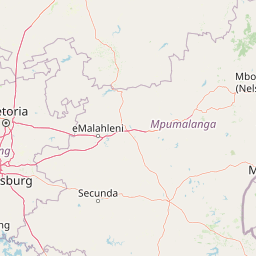
Map view of Verloren Valei Nature Reserve

Use this park location map to pinpoint Verloren Valei Nature Reserve in South Africa, understand its exact geographic position, and read its mapped placement within the surrounding landscape more clearly.

Pigeon | © OpenStreetMap contributors

Location context for Verloren Valei Nature Reserve

Mpumalanga
Park atlas

Compare regional highland terrain, wetland habitats, and connected conservation reserves

Explore Other Parks Near Verloren Valei Nature Reserve and Surrounding Protected Landscapes

Visitors exploring Verloren Valei Nature Reserve can extend their geographic inquiry into other regional protected areas and highland reserves. Comparing surrounding grassland terrain provides deeper context on South African highland ecosystems and regional conservation networks.
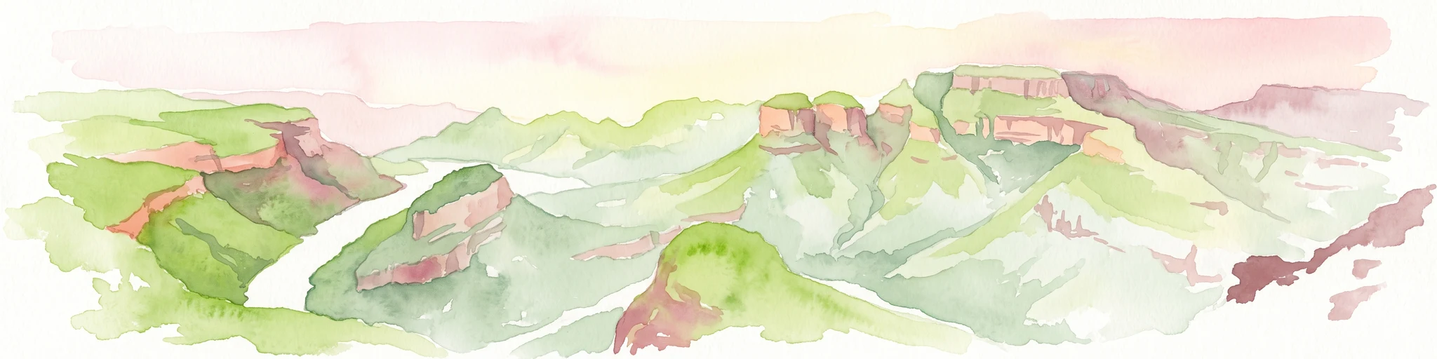
A horizontal watercolor painting depicting the Blyde River Canyon with green slopes, reddish cliff faces, and a winding river.
Nature reserveMpumalanga
About 99 km away#1 closest

Northeast

Blyde River Canyon Nature Reserve: Escarpment Geography and Protected Landscape Map

Mapping river-carved canyons and plateau ecosystems in Mpumalanga

Blyde River Canyon Nature Reserve protects a vast stretch of the Mpumalanga Drakensberg, characterized by vertical cliffs, rocky massifs, and deep river gorges. This atlas-focused resource highlights the reserve's geological landmarks, including the Three Rondavels and Bourke's Luck Potholes, offering a clear view of the complex terrain and protected natural boundaries defining this northeastern South African landscape.

Area
290 km²
Established
1965
Relief
Mountain
Climate
Subtropical
National parkSouth Africa
104 km away#2 closest

Northeast

Kruger National Park: South Africa's Iconic National Park for Geographic Discovery

Explore savanna landscapes and mapped protected area boundaries.

Kruger National Park serves as a paramount example of a protected landscape, offering a rich tapestry of savanna ecosystems and varied terrain across South Africa's Lowveld. This canonical entry details its vast geographic scope, approximately 19,623 square kilometres, and its status as the nation's first national park. Understand the park's environmental context, from the Lebombo Mountains to the Limpopo River, and its integral role within larger transfrontier conservation initiatives, providing critical insight for atlas-based geographic exploration.

Area
19,623 km²
Established
1926
IUCN
II
Visitors
1.7M annual
Protected areaMpumalanga
About 104 km away#3 closest

Southeast

Makhonjwa Mountains: Geologically Ancient Protected Landscape in Eastern South Africa

Atlas mapping of the Barberton Greenstone Belt and Mpumalanga terrain

Spanning 120 by 60 kilometres, the Makhonjwa Mountains represent a vital scientific archive of Paleoarchean history. This protected area offers a deep look into volcanic komatiite rocks, ancient meteor impact evidence, and complex highland ecosystems that define the geography of the Mpumalanga border region.

Established
2018
Relief
Mountain
Scope
Terrestrial
Water
Minor water
Wildlife reserveLimpopo
About 128 km away#4 closest

Northeast

Thornybush Game Reserve: A Protected Wildlife Landscape in Limpopo, South Africa

Mapped savanna corridors and riverine ecological zones

Located in the Limpopo province of South Africa, Thornybush Game Reserve is an essential private wildlife area known for its open savanna and rich riparian vegetation. By maintaining an unfenced boundary with the neighboring national park, it acts as a critical extension of the Greater Kruger wilderness. This entry details its geographical scope, terrain features, and its function as a managed, integrated component of the regional conservation landscape.

Area
140 km²
Water
Minor water
Wildlife reserveLimpopo
About 129 km away#5 closest

Northeast

Kapama Game Reserve: Geographic Atlas and Protected Landscape Map of Limpopo

Explore the diverse terrain and riverine ecosystems of this South African wildlife reserve

Kapama Game Reserve sits within the Limpopo Lowveld, featuring a complex mix of open savanna, mixed bushveld, and dense riverine corridors shaped by the Blyde River. This record provides a detailed look at the reserve as a functional piece of the greater regional conservation landscape, highlighting its topography and its role in protecting South Africa's native habitat.

Area
130 km²
Established
1993
Scope
Terrestrial
Protected areaLimpopo
About 132 km away#6 closest

North

Wolkberg Wilderness Area: Protected Mountain Geography and Quartzite Ridge Landscapes

Mapping the diverse Afromontane ecosystems of the Limpopo escarpment

Wolkberg Wilderness Area protects a high-altitude transition zone in South Africa, where quartzite massifs rise sharply above the surrounding plains. This reserve features a rugged, low-infrastructure environment defined by mist-influenced forests, clean mountain rivers, and steep boulder slopes. Analyze the geographic boundaries and terrain features that make this reserve a critical sanctuary for regional bird species and forest-loving plant communities.

Area
220 km²
Established
1977
Relief
Mountain
Climate
Subtropical
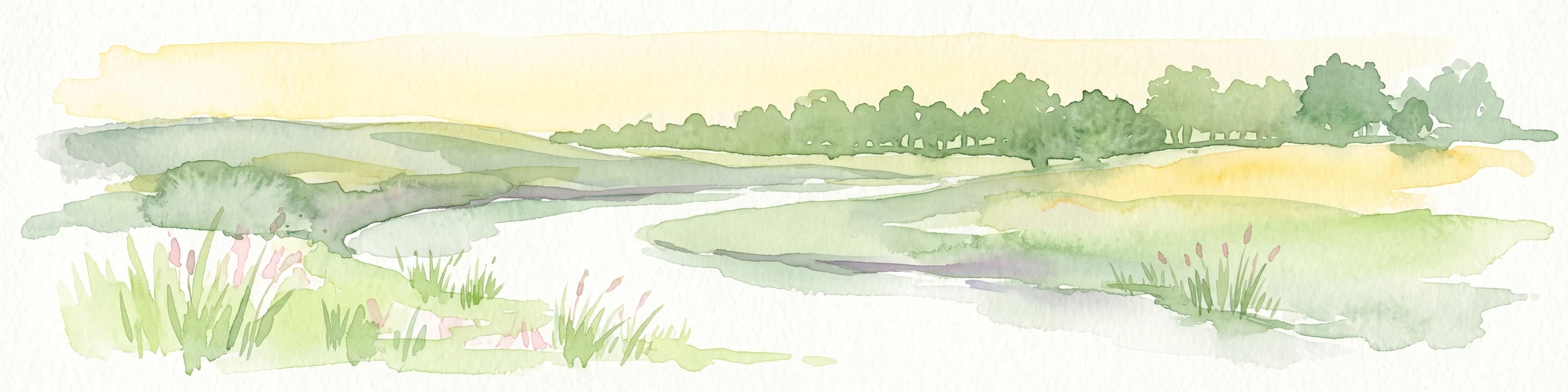
Watercolor illustration depicting a winding river through a grassy landscape with rolling hills and distant trees under a soft yellow sky.
Wildlife reserveGauteng
About 143 km away#7 closest

West

Dinokeng Game Reserve: Geographic Atlas and Protected Wildlife Area Profile

Savanna Landscapes and Riverine Corridors in Gauteng

Dinokeng Game Reserve functions as a primary wildlife sanctuary within Gauteng, South Africa, featuring a diverse mosaic of grassland and riverine bushveld. This atlas profile details the reserve geographic layout, from the Pienaars River watercourses to its integrated conservation zones, providing a clear overview of the terrain that supports its status as a significant regional protected area.

Area
210 km²
Established
2011
Relief
Upland
Climate
Subtropical
Nature reserveLimpopo
About 148 km away#8 closest

Northeast

Balule Nature Reserve: Mapping the Protected Lowveld Savannah and Olifants River Corridor

An open-system wilderness integral to the Greater Kruger ecological network.

Explore the geographic identity of Balule Nature Reserve, a vast protected area in South Africa characterized by its integration with the Greater Kruger wilderness. The terrain encompasses a rich mix of mopane-dominated woodland, riverine forest along the Olifants River, and open subtropical bushveld that supports significant wildlife migrations.

Area
400 km²
Relief
Lowland
Climate
Subtropical
Access
Moderate access

Common questions about visiting, size, designation, and location context for Verloren Valei Nature Reserve

Verloren Valei Nature Reserve FAQs for park facts, access, geography, and protected area context

Find quick answers about Verloren Valei Nature Reserve, including protected-area facts, park geography, trail and visitor context, and how the park fits into its surrounding country and regional landscape.
MoriAtlas Explorer

Continue Your Protected Areas Search Across the Global Atlas

Deepen your exploration by continuing the structured search for national parks and protected areas worldwide. Utilize the comprehensive filtering capabilities to compare different conservation landscapes and refine your understanding of global park geography. Discover more about the distribution and characteristics of protected natural areas.

Global natural geography