
Mori Atlas logo
Natural monumentVizerka

A rare fragment of thermophilic grasslands and shale geology within the urban Šárka Valley

Vizerka Natural Monument: Mapped Rocky Steppe Landscapes and Protected Terrain in Prague

(Přírodní památka Vizerka)

Vizerka serves as a distinct ecological refuge on the northern slopes of the Šárecké údolí in Prague. This natural monument encompasses a unique wedge of Proterozoic shale bedrock where shallow, sun-exposed soils support specialized xerothermic flora and fauna. By maintaining a miniature steppe-like environment amidst the urban fabric, this protected area preserves critical habitat for rare species that require dry, warm microclimates and rocky terrain.

natural monumentrocky steppexerothermic grasslandthermophilic floraPrague natureurban nature reserve
A flat-style digital illustration depicting a winding river flowing between steep, pinkish-toned rocky cliffs, surrounded by a forest of stylized pine and deciduous trees under a clear sky.

Vizerka

Natural monument

Park overview

Structured park overview, official facts, and landscape profile for Vizerka

Vizerka park facts, protected area profile, and essential visitor context

Review the core facts for Vizerka, including designation, size, terrain, visitor scale, habitats, and operating context in one park-focused overview.

About Vizerka

Vizerka occupies a small but ecologically distinctive corner of Prague, where the Šárecké údolí bends around the historic Vizerka homestead. Although the area is only about three hectares in size, it is unusually rich in character because it combines geological, botanical, and zoological features that allow warm-loving species to thrive. The protected site lies within the broader Šárka-Lysolaje natural park, which preserves a stretch of undeveloped valley environment on the edge of one of Central Europe's major urban centers.

From a geological perspective, Vizerka is built on Proterozoic shale bedrock belonging to the Barrandian sequence, with soils developing as protorankers, rankers, and shallow cambisols. These thin, dry soils are a key reason why the slopes support open xerothermic grasslands and rocky-steppe shrubs rather than dense forest, and they create conditions similar to natural steppe habitats that are otherwise rare in this part of Bohemia.

Ecologically, the slopes are characterized by dry-grassland species such as Centaurea stoebe, Potentilla argentea, Dianthus carthusianorum, Euphorbia cyparissias, and Teucrium chamaedrys, along with woody species including field maple (Acer campestre), hawthorn (Crataegus), blackthorn (Prunus spinosa), ash (Fraxinus excelsior), privet (Ligustrum), dogwood (Cornus sanguinea), and sessile oak (Quercus petraea). Because of its location, geological substrate, and species composition, Vizerka is often described as a relic of a warmer, more open landscape that has survived within the modern city.

Quick facts and research context for Vizerka

Vizerka is a Czech přírodní památka (natural monument) within the Šárka-Lysolaje natural park, situated on the left, northern side of the Šárecké údolí in Prague's Dejvice quarter. Covering approximately 3.09 hectares at elevations between 238 and 284 meters above sea level, the site protects two shale outcrops and their xerothermic vegetation. Protection was formally declared in 1988 by the National Committee of the City of Prague, and the protected area has been managed since by the Czech Agency for Nature Conservation and Landscape Protection.

Protection and recognition

Terrestrial protected area designation and international recognition data

Vizerka Protection Status and Documented Conservation Scope

Terrestrial protection status for Vizerka establishes the foundational framework for regional conservation management and boundary oversight. Available designation records track official recognition frameworks without assuming specific environmental outcomes.

Protection details

Protection scope
Terrestrial
Transboundary protection
No
Park context

Deeper park guide and search-rich context for Vizerka

Vizerka history, landscape, wildlife, and travel context

Explore Vizerka through its history, landscape character, ecosystems, wildlife, conservation priorities, cultural context, and seasonal travel timing in a structured park guide built for atlas discovery and search intent.

Why Vizerka stands out

Vizerka is best known for its unusual concentration of thermophilic and xerothermic habitats inside Prague, particularly the rocky-steppe flora and fauna that grow on shallow soils above Proterozoic shale outcrops. The presence of rare species such as the meadow pasqueflower (Pulsatilla pratensis) and the spider Eresus kollari gives the site a strong identity as a steppe-like refuge in an urban landscape.
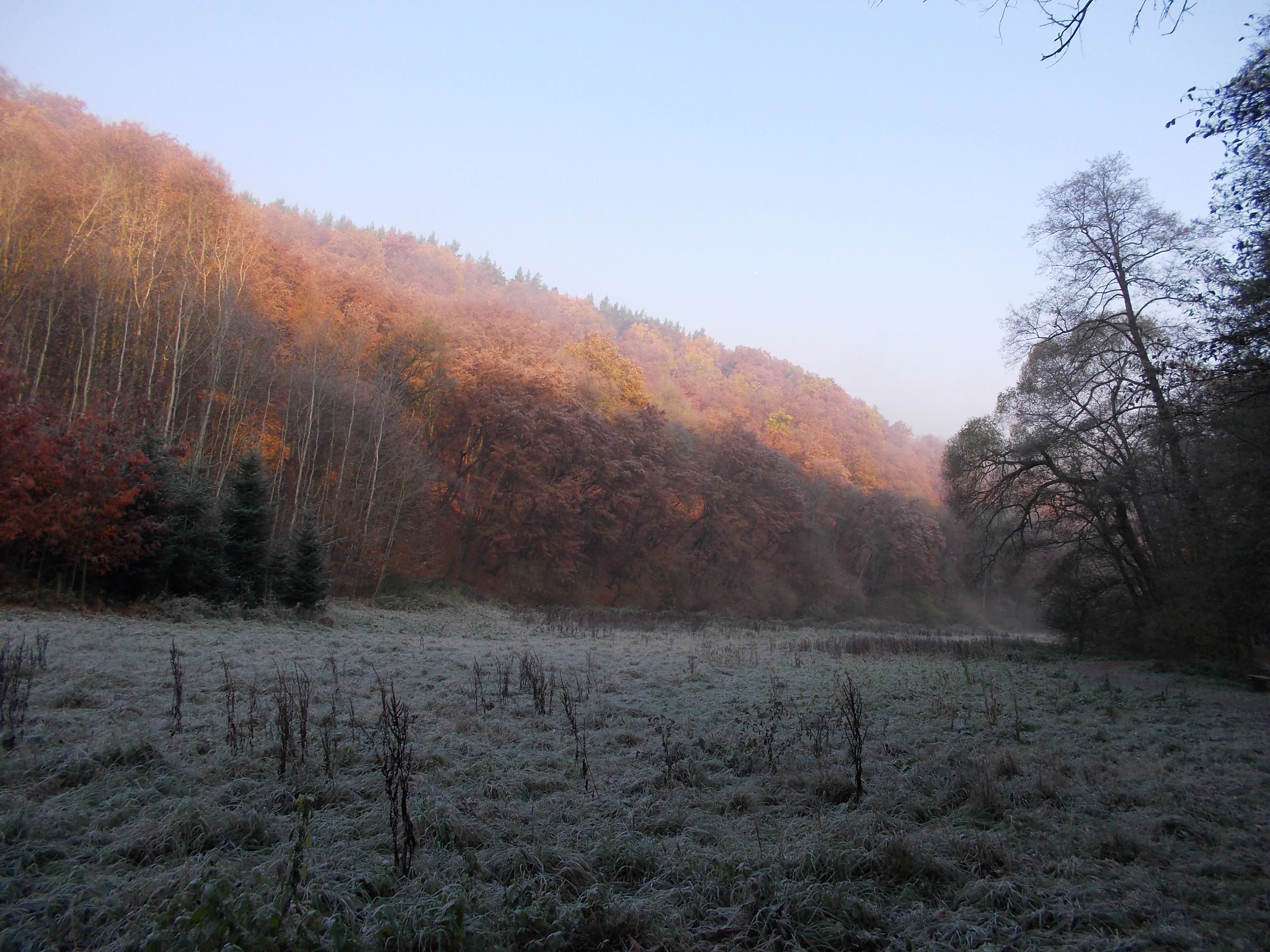
A wide, frost-covered meadow in the foreground with a densely wooded hillside rising in the background under soft morning light.
A frost-covered meadow at the edge of the forest in Vizerka.

Vizerka history and protected-area timeline

Vizerka's ecological history began long before its formal protection. In earlier centuries the slopes were kept open as pastureland used by the owners of the Vizerka homestead, where sheep and later orchards kept woody vegetation in check. As traditional land use declined, the abandonment of grazing allowed shrubs and trees to progressively colonize the slope, gradually transforming the open steppe habitats into more closed woodland.

The idea of protecting Vizerka was first discussed in the 1960s, but disagreements among conservationists about the appropriate management delayed any official action for decades. During the 1980s, occasional volunteer work brigades organized by the Faculty of Science of Charles University attempted to maintain the site, although later commentary suggested these efforts were not always sufficiently thorough.

Protection was finally declared on 4 July 1988 by the National Committee of the City of Prague, taking effect on 1 September 1988, separating Vizerka from the larger Šárecké údolí protected framework. After the establishment of formal protection, however, management was inconsistent: a long-term care plan was discussed from 1993 onwards, but a fully approved plan was not in place until 2000. Subsequent survey work in 2008 and 2009 led to the conclusion that active intervention, including grazing and mechanical removal of woody vegetation, was required to halt the spread of trees and shrubs and to preserve the open rocky-steppe habitats that justified the site's protection.

Vizerka landscape and geographic character

Vizerka's landscape is defined by a narrow, south-facing rocky slope on the northern side of the Šárecké údolí, just outside Prague's Dejvice quarter. The terrain rises from the valley floor of the Šárecký potok (Šárka stream) up toward the residential edge along Nebušická street, with elevations ranging from about 238 to 284 meters above sea level. The protected area essentially forms a wedge of natural slope inserted between the urban fabric of Vokovice, Nebušice, and Dejvice.

The visual character of the site is dominated by exposed shale outcrops interspersed with sparse vegetation and shrubs. The rock layers belong to the Barrandian Proterozoic sequence and consist largely of shale and siltstone fragments that were originally deposited on the floor of an ancient sea. After thousands of years of weathering, these sediments have fragmented into a surface of loose rocky debris on which only shallow, nutrient-poor soils have developed. This combination of rocky ground, thin soils, and a south-facing exposure creates a warm, dry microclimate unusual for this part of Central Europe.

As a result, the visible landscape at Vizerka resembles a miniature steppe more than a typical Bohemian woodland. Patches of bare rock, low grasses, and scattered shrubs are visible across most of the slope, while denser growth is confined to the moister, shadier edges. The contrast between this open, Mediterranean-feeling terrain and the surrounding city is one of the site's defining visual features.
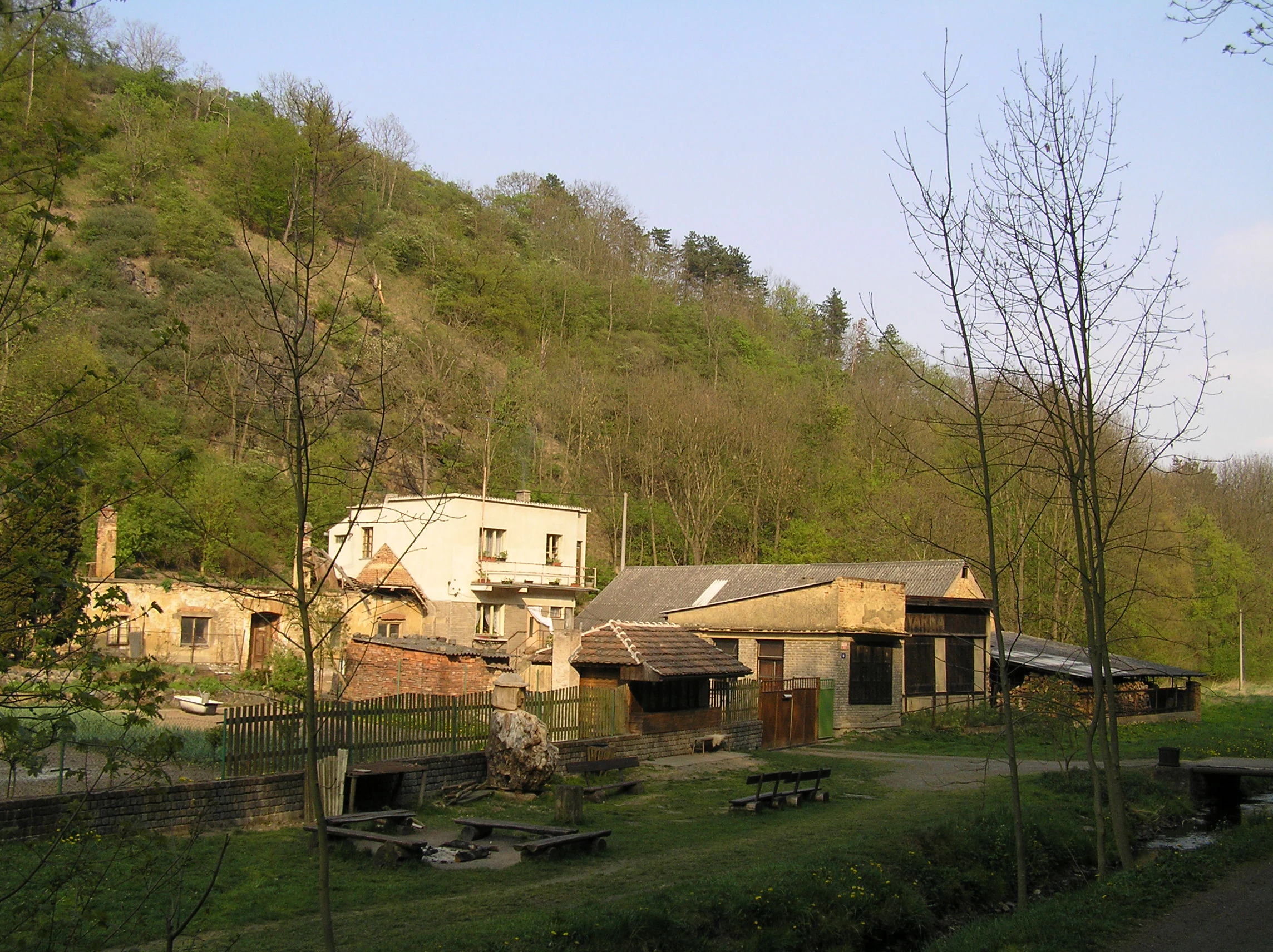
A sloped, forested hillside rising behind a collection of small, older buildings and a grassy area with outdoor seating in a rural setting.
A view of the landscape and buildings near Vizerka Natural Monument.

Vizerka ecosystems, habitats, and plant life

The natural character of Vizerka is shaped by the unusual combination of dry, rocky substrate, thin soils, and a warm microclimate, which together support a steppe-like community in the middle of Prague. Vegetation is dominated by xerothermic dry grasslands, rocky-steppe shrubs, and patches of open woodland dominated by field maple, hawthorn, blackthorn, ash, and sessile oak. The transition zone between grassland and shrub is particularly important, holding most of the site's botanical interest.

Among the characteristic plant species are Centaurea stoebe, Potentilla argentea, Potentilla arenaria, Dianthus carthusianorum, Euphorbia cyparissias, Hylotelephium maximum, Stachys recta, Sanguisorba minor, Erysimum crepidifolium, and Teucrium chamaedrys, as well as Galatella linosyris, Dictamnus albus, Rosa gallica, and Asplenium septentrionale growing in the rock crevices. These species form the typical community of narrow, dry grasslands that historically occurred on similar shale outcrops across the Bohemian uplands.

Of particular conservation interest is the presence of Pulsatilla pratensis, the meadow pasqueflower, which at Vizerka survives in only a single individual in a small rock crevice and is considered threatened by encroachment of woody vegetation. Other notable elements include orchid- and rose-rich communities, a population of Dictamnus albus with an apparently strengthening trend, and the continued presence of species such as Festuca pallens and Festuca rupicola, which are characteristic of true rocky steppes elsewhere in Central Europe.
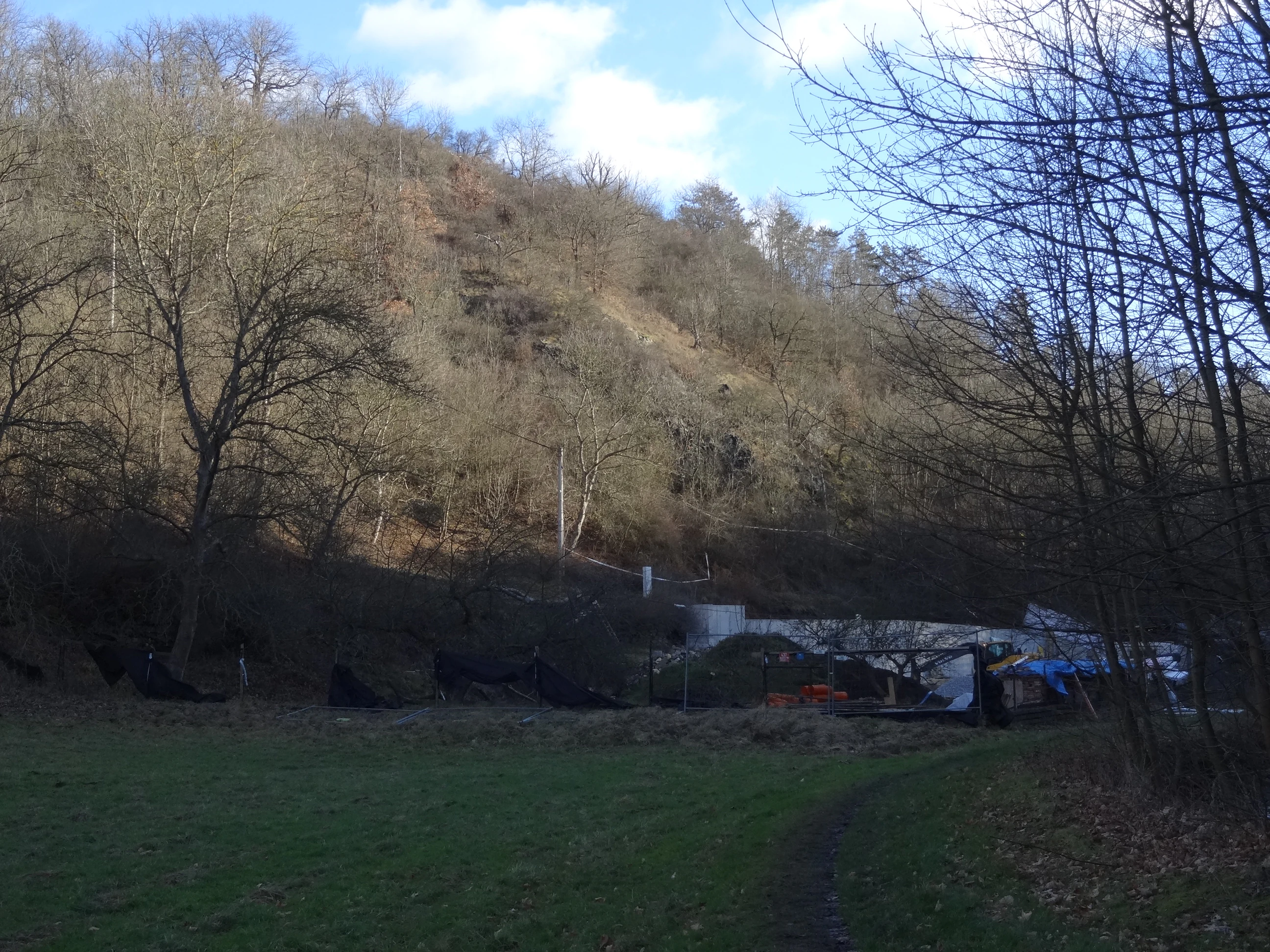
A sloped, deciduous wooded hillside rises above a field in winter, with a low cleared area and remnants of construction or demolition visible in the foreground.
A view of the Vizerka natural monument area, featuring the wooded hillside and cleared site following the demolition of the Vizerka homestead.

Vizerka wildlife and species highlights

Despite its very small size, Vizerka hosts a surprisingly diverse range of invertebrates and small vertebrates that reflect its warm, rocky-steppe character. The site is notable within Czech arachnology for the presence of Eresus kollari, a thermophilic spider considered one of the principal reasons for the area's original protection. This species has been observed on multiple occasions and remains one of the site's most distinctive faunal elements.

Among beetles, the site supports species such as Agonum marginatum, Carabus hortensis, Cryptocephalus pygmaeus, Choragus sheppardi, Rhynchites cupreus, and Capation pubescens, as well as several leaf-beetle species of the genus Chrysolina. Although historical records describe Vizerka as a notable refuge for butterflies, ongoing shrub encroachment has reduced habitat availability for many species, and only a few specialists, including Colias alfacariensis/australis and leaf-mining micromoths on hornbeam, continue to maintain populations there.

Reptiles include the smooth snake (Coronella austriaca), found on the rocky steppe, and the sand lizard (Lacerta agilis), which basks on the exposed rocks. The local populations of the common vole (Microtus arvalis) attract birds of prey, and the shrubby slopes also host nesting populations of several songbird species, including the lesser whitethroat (Sylvia curruca), the yellowhammer (Emberiza citrinella), and both the red-backed shrike (Lanius collurio) and the great grey shrike (Lanius excubitor).
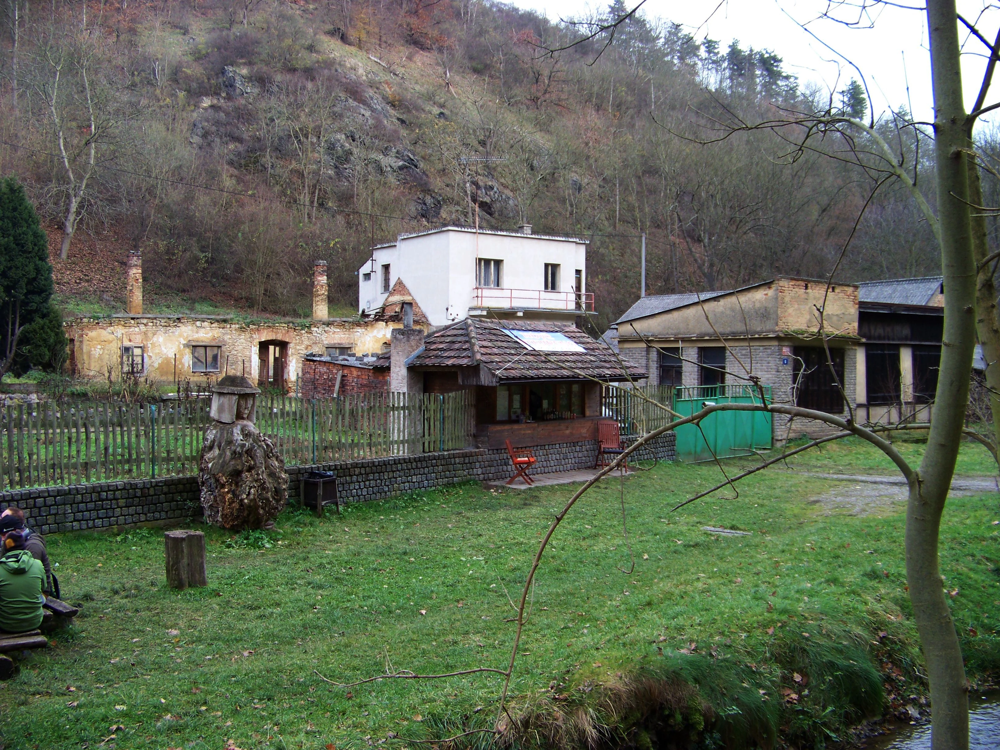
A view of low buildings and a small house set against a forested rocky hillside in the Ticha Sarka valley in Prague.
A view of the Vizerka site in the Ticha Sarka valley.

Vizerka conservation status and protection priorities

Vizerka's conservation significance lies in the preservation of one of the few remaining rocky-steppe habitats within the city of Prague. Although the area covers only around three hectares, it shelters species and ecological communities that are otherwise rare in the Bohemian landscape, including thermophilic plants, specialized beetles, the spider Eresus kollari, and reptile species such as the smooth snake. The combination of Proterozoic shale substrate, thin soils, and south-facing exposure produces conditions that mimic open steppe, allowing flora and fauna typical of warmer, drier regions to persist in a Central European urban context.

The main conservation challenge is the gradual encroachment of woody vegetation, especially field maple, hawthorn, blackthorn, ash, privet, dogwood, and sessile oak. As grazing lapsed and traditional management declined, the open character of the slope deteriorated, threatening the survival of species such as Pulsatilla pratensis. Conservation plans developed after 2000 therefore emphasize active intervention, including measures designed to prevent further afforestation of the non-forest biotopes, removal of invasive and competing woody species, and the restoration of grazing pressure, ideally through the occasional use of goats capable of negotiating the steep slope and rocky outcrops.

Because a portion of the site remains in private ownership linked to the historic Vizerka homestead, management requires ongoing cooperation with the landowner. Since the official protection declared in 1988, the area has been supervised by the Czech Agency for Nature Conservation and Landscape Protection. Surveys in 2008 and 2009 provided the basis for an updated management plan that continued through 2022 and that underlined the need for regular terrain surveys, mechanized shrub control, and the continuation of irregular sheep and goat grazing as essential elements in safeguarding the long-term ecological value of the site.

Vizerka cultural meaning and human context

Vizerka's cultural context is closely tied to the historic Vizerka homestead, a former rural settlement after which the protected slope is named. In former centuries the slope above the homestead was kept open through traditional land use: sheep grazing, and later a small orchard that maintained open conditions on what would otherwise have reverted to woodland. This traditional human-nature interaction shaped the very landscape that today justifies the site's protected status.

The area lies within the broader Šárecké údolí, a traditional recreational and culturally significant valley on Prague's northwestern edge. Vizerka is also included in the Šárka-Lysolaje natural park, which combines natural protection with public access and reflects the Czech tradition of establishing landscape parks that integrate nature conservation with nearby urban communities. Although much of the homestead has since been demolished, the surviving cultural memory of the valley's former rural character remains an important part of understanding the site's current ecological condition.

Top sights and standout views in Vizerka

Vizerka stands out as a miniature rocky steppe embedded in the urban fabric of Prague, with shale outcrops, shallow soils, and xerothermic grasslands that host unusually warm-loving flora and fauna. Highlights include the meadow pasqueflower (Pulsatilla pratensis), the thermophilic spider Eresus kollari, characteristic reptiles such as the smooth snake and the sand lizard, and shrubby slopes dominated by field maple, hawthorn, blackthorn, and sessile oak. The site's compact scale, distinctive geology, and ongoing conservation efforts focused on grazing and shrub control make it a meaningful inland example of a steppe-like habitat surviving within a major Central European capital.

Best time to visit Vizerka

The most favorable periods to experience Vizerka's character are late spring and early summer, when the thermophilic grasses, flowering perennials, and shrubs of the rocky steppe are most active and easy to observe. Warm, sunny days highlight the contrast between the dry, open slope and the surrounding city, and early morning or late afternoon visits are particularly rewarding for observing basking reptiles and the activity of steppe-associated invertebrates. Autumn can also be a pleasant time to visit, when lower vegetation makes the underlying shale outcrops more visible and the site is generally less overgrown.


Monthly climate preview

Long-term representative point measurements tracking monthly temperature and precipitation patterns

Vizerka Climate Normals and Measured Annual Temperature Rhythm

Vizerka exhibits measured monthly temperature variation alongside consistent precipitation patterns recorded across a multi-year climatology period. Examining the complete twelve-month record reveals deeper meteorological shifts across the representative coordinate.
Annual mean9 °C
-2 °C20 °C
Jan-2°
Feb-1°
Mar
Apr
May13°
Jun17°
Jul20°
Aug19°
Sep14°
Oct
Nov
Dec-1°
Warmest month
July

19.7 °C

Coolest month
January

-2.2 °C

Wettest month
June

2.6 mm/day

Driest month
February

1.1 mm/day

Park location guide

Geography guide, regional context, and park location map for Vizerka

Vizerka park geography, regions, and map view in Czechia

Understand where Vizerka sits in Czechia through a broader geographic reading of the surrounding landscape, nearby location context, and its mapped position within the national park landscape.

How Vizerka fits into Czechia

Czech Republic is a landlocked Central European country with a population of approximately 10.9 million people. The nation was established as an independent state on January 1, 1993, following the dissolution of Czechoslovakia. Its capital and largest city is Prague, with other major urban centers including Brno, Ostrava, Plzeň, and Liberec.

Wider geography shaping Vizerka in Czechia

The Czech Republic is a landlocked country in Central Europe. It is bordered by Germany to the west, Austria to the south, Poland to the northeast, and Slovakia to the southeast. The landscape is predominantly hilly, with the territory covering 78,871 square kilometers.

Map view of Vizerka

Use this park location map to pinpoint Vizerka in Czechia, understand its exact geographic position, and read its mapped placement within the surrounding landscape more clearly.

Pigeon | © OpenStreetMap contributors

Location context for Vizerka

Prague
Recorded earthquake history

Examine the Documented Earthquake History Associated with the Vizerka Natural Monument

Browse the historical record of seismic activity registered near Vizerka. This curated collection from MoriAtlas allows for the examination of documented event data, including magnitude and focal depth, to provide a clear view of past tremors recorded in the vicinity of this Prague landscape.

Vizerka Earthquake History

Catalogued events

2 events

Strongest magnitude

Magnitude 3.7

Most recent event

Oct 22, 1987

This history includes earthquakes recorded inside the park or within 50 km of its borders

Explore detailed imagery of shale outcrops, xerothermic grasslands, and urban conservation terrain.

Vizerka Photos and Rocky Steppe Landscapes: Visualizing the Protected Area

Visual documentation reveals the distinct topography and sparse vegetation defining Vizerka across its protected rocky slopes. Examining these habitat photographs provides clear insight into the rare steppe ecology surviving within the surrounding urban environment.

A wide, frost-covered meadow in the foreground with a densely wooded hillside rising in the background under soft morning light.

A narrow dirt path framed by bare, slender deciduous trees on a wooded hillside with rocky outcroppings visible on the right.

A sloped, forested hillside rising behind a collection of small, older buildings and a grassy area with outdoor seating in a rural setting.

A sloped, deciduous wooded hillside rises above a field in winter, with a low cleared area and remnants of construction or demolition visible in the foreground.

A view of low buildings and a small house set against a forested rocky hillside in the Ticha Sarka valley in Prague.

A small, narrow stream flows through a wooded area with trees and scattered autumn leaves on the ground.

Park atlas

Compare regional park geography and connected natural reserves

Explore Other Parks Near Vizerka and Surrounding Protected Landscapes

Browse nearby national parks and protected areas located throughout the surrounding region to expand your geographic comparison. Discover related terrain profiles and protected landscapes that share ecological characteristics with Vizerka.
A horizontal watercolor illustration showing a soft, dreamy landscape with rolling green hills, light purple and yellow tones, a winding path or stream, and a lone bare tree in the foreground.
Protected landscapePraha
About 0.8 km away#1 closest

East

Přírodní park Šárka-Lysolaje: Protected Landscape Mapping and Geographic Identity in Praha

A dense mosaic of stream valleys and protected natural monuments near the heart of Praha

Examine the detailed geography of Přírodní park Šárka-Lysolaje, an extensive protected landscape in Praha that functions as a critical green corridor. Its terrain, defined by deeply incised stream valleys and steep forested slopes, hosts a unique concentration of smaller nature reserves and monuments, creating a coherent ecological framework directly adjacent to the urban metropolitan environment.

Area
10.05 km²
Established
1990
Climate
Temperate
Scope
Terrestrial
Natural monumentPrague
About 5.4 km away#2 closest

South

Vidoule Natural Monument: Geological Profile and Protected Landscape Context in Prague

A table mountain remnant with exposed Cretaceous sandstone formations.

Vidoule stands as a significant natural monument in western Prague, defined by its flat-topped table mountain geometry and horizontal Cretaceous strata. The site offers a unique perspective on the regional geology of the Prague Plateau, where protected slopes guard rare dry grassland habitats and fossil-rich layers against a backdrop of dense urban development.

Area
0.087 km²
Established
1988
IUCN
III
Relief
Upland
Natural monumentPrague
About 6.4 km away#3 closest

East

Velká skála Natural Monument: Geological Protected Area within the Prague Plateau

A landmark siliceous rock outcrop in the Troja district

Velká skála offers a concentrated look at the geological heritage of central Bohemia. As a designated natural monument, the site protects a rare siliceous rock outcrop that contrasts with the rolling terrain of the surrounding Prague Plateau, serving as a vital reference for regional geomorphology.

Area
0.018 km²
Established
1968
IUCN
III
Relief
Upland
A pale watercolor painting showing a river winding through green hills and gentle slopes.
Protected landscapePrague
About 6.7 km away#4 closest

Northeast

Přírodní park Drahaň-Troja: Protected Landscape Geography and Mapped Terrain Analysis

Deep stream valleys and rocky steppe habitats in Prague

Přírodní park Drahaň-Troja represents a vital protected landscape characterized by its pronounced relief, including the Bohnické, Čimické, and Drahanské valleys. This area reveals the geological history of the Prague region through its exposed shales and volcanic rhyolite veins. Discover how this continuous green corridor integrates rare steppe ecosystems with the metropolitan urban edge.

Area
5.79 km²
Established
1990
Relief
Upland
Climate
Temperate
Nature reservePraha 5
6.9 km away#5 closest

South

Prokopské údolí Nature Reserve: Geological Mapping and Protected Area Discovery

A limestone karst landscape situated within the Praha 5 district

Prokopské údolí is an essential protected nature reserve in Praha 5, featuring a deep limestone valley that serves as a globally significant site for Paleozoic fossils and karst geography. This protected landscape encompasses a range of habitats including rock steppes, thermophilic woodlands, and volcanic outcrops, providing a unique look at urban-adjacent nature conservation and historical limestone quarrying within the Czech Republic.

Area
1.71 km²
Established
1978
IUCN
III
Relief
Upland
Natural monumentPrague
About 11 km away#6 closest

South

Zmrzlík Natural Monument: Geological Profile and Protected Landscape Map of Prague

Silurian stratotype sites and calcareous grassland ecosystems

Zmrzlík is a protected natural monument in Prague, defined by its rich Silurian geological sequences and fossil-bearing limestone deposits. The site offers a clear view into the Kopanina Formation, featuring distinct basaltic volcanic remains and rare xerothermic vegetation. This map-based resource details the terrain and ecological mosaic of the area, ranging from rocky ridges to the valleys of the Mlýnský potok.

Area
0.164 km²
Established
1988
IUCN
IV
Relief
Upland
A horizontal watercolor illustration of gentle, rolling green hills under a pale sky, with clusters of stylized trees in the foreground and faded distant mountains in the background.
Natural monumentPrague
About 13 km away#7 closest

South

Radotínské skály Natural Monument: Geological Mapping and Protected Landscapes in Prague

Geological profiles and steppe biodiversity near the capital.

Radotínské skály stands as a key protected area in Prague, showcasing an internationally significant stratigraphic record of the Prague Basin. From exposed rock walls to warm-loving forest-steppe communities, the site offers a detailed look at how geological heritage persists alongside urban development, making it an essential destination for those exploring the regional geography of the Czech Republic.

Area
0.277 km²
Established
1988
IUCN
III
Relief
Upland
Nature reservePrague
About 13 km away#8 closest

Southeast

V hrobech Nature Reserve: A Protected Botanical Island within the Urban Landscape of Prague

Rare dry-grassland habitats in the Kamýk district

V hrobech is a designated nature reserve in Prague featuring 1.3 hectares of southeast-facing slopes and species-rich grassland. This site is home to rare thermophilic plants and represents an important example of intensive conservation management in an urban environment. Its protected boundaries connect with local forest fragments to maintain ecological value amidst the residential developments of Lhotka and Libuš.

Area
0.013 km²
Established
1988
IUCN
IV
Relief
Lowland

Common questions about visiting, size, designation, and location context for Vizerka

Vizerka FAQs for park facts, access, geography, and protected area context

Find quick answers about Vizerka, including protected-area facts, park geography, trail and visitor context, and how the park fits into its surrounding country and regional landscape.
MoriAtlas Explorer

Continue Your Protected Areas Search Across the Global Atlas

Deepen your exploration by continuing the structured search for national parks and protected areas worldwide. Utilize the comprehensive filtering capabilities to compare different conservation landscapes and refine your understanding of global park geography. Discover more about the distribution and characteristics of protected natural areas.

Global natural geography