
Mori Atlas logo
Natural monumentVlašimská Blanice

Examining the mapped boundaries, riparian terrain, and floodplain ecology of a vital Czech river valley

Vlašimská Blanice Natural Monument: A Protected Meandering River Corridor in Jihočeský kraj

(Přírodní památka Vlašimská Blanice)

Vlašimská Blanice represents a significant protected corridor within the Jihočeský kraj, centered on a nine-kilometre stretch of the naturally meandering Blanice River. This natural monument preserves a structured mosaic of riparian woodland, gravel-rich riverbed features, and traditional floodplains. The site serves as a critical refuge for freshwater biodiversity in the Czech landscape, protecting an unregulated aquatic system that transitions through meadows, pastures, and wooded banks.

river valleynatural monumentfreshwater musselsmeandering riverunregulated riverriparian woodland
A flat, stylized illustration showing a view through trees into a valley with rolling hills and a river, rendered in pastel tones.

Vlašimská Blanice

Natural monument

Park overview

Structured park overview, official facts, and landscape profile for Vlašimská Blanice

Vlašimská Blanice park facts, protected area profile, and essential visitor context

Review the core facts for Vlašimská Blanice, including designation, size, terrain, visitor scale, habitats, and operating context in one park-focused overview.

About Vlašimská Blanice

Vlašimská Blanice is a Czech natural monument, a category of protection reserved for smaller sites of notable scientific or ecological value, dedicated to preserving a representative section of the Blanice River and its floodplain habitats. Covering about 30 hectares in a narrow strip along roughly nine kilometres of watercourse, the protected territory stretches between the northern edge of Mladá Vožice and the settlement of Skrýšov, passing through the cadastral areas of Běleč u Mladé Vožice, Mladá Vožice, and Šebířov in the Tábor District of the South Bohemian Region.

The site lies within the gently rolling terrain of the Vlašimská pahorkatina (Vlašim Uplands) and its sub-unit, the Mladovožická pahorkatina, where the river valley forms a natural boundary between the Blanická brázda (Blanice Furrow) and the neighbouring Načeradecká pahorkatina (Načeradec Uplands). Elevations within the protected area range from about 396 to 434 metres above sea level. Geologically, the underlying rocks are metamorphic gneisses and paragneisses of the Moldanubian zone, while the floodplain itself has developed gleyic fluvisols and typical gleys, characteristic moisture-influenced soils shaped by periodic flooding.

The river character is a defining aspect of the site. In contrast to many lowland Czech rivers, the Blanice here remains unregulated and free to develop natural channel features. Its bed of gravel and stones holds deep pools, calm stretches, gravel bars, and cut banks, and the course winds through numerous meanders. This dynamic hydromorphology supports a rich community of aquatic invertebrates, mussels, and fish, while also providing resting, feeding, and breeding conditions for birds, amphibians, and mammals that depend on the river corridor.

Around the watercourse, the landscape reflects a long history of human use. Since the nineteenth century the floodplain has been shaped by hay meadow management, grazing, and small-scale cropping, and modified mowing and grazing patterns continue today. A continuous strip of riverside trees, dominated by black alder and various willows, lines almost the entire protected section. The combination of open meadows, scattered trees and shrubs, and a winding, structurally diverse river makes the area an important ecological transition zone within an otherwise intensively managed agricultural region.

Protection and recognition

Analysis of terrestrial protected area boundaries and international designations

Vlašimská Blanice Protection Status and Documented Conservation Recognition

Terrestrial protection status for Vlašimská Blanice incorporates documented Natura 2000 recognition across established regional boundaries. Official records outline international conservation context and management scope without implying specific administrative outcomes.

International recognition

Protection details

Protection scope
Terrestrial
Transboundary protection
No
Park context

Deeper park guide and search-rich context for Vlašimská Blanice

Vlašimská Blanice history, landscape, wildlife, and travel context

Explore Vlašimská Blanice through its history, landscape character, ecosystems, wildlife, conservation priorities, cultural context, and seasonal travel timing in a structured park guide built for atlas discovery and search intent.

Why Vlašimská Blanice stands out

Vlašimská Blanice is best known for its protected section of an unregulated, meandering lowland river that shelters rare freshwater mussels, lampreys, otters, and the hermit beetle. The site is also recognised for its mosaic of meadows, pastures, and riverside woodland that sustain both aquatic and terrestrial biodiversity in an otherwise farmed landscape.
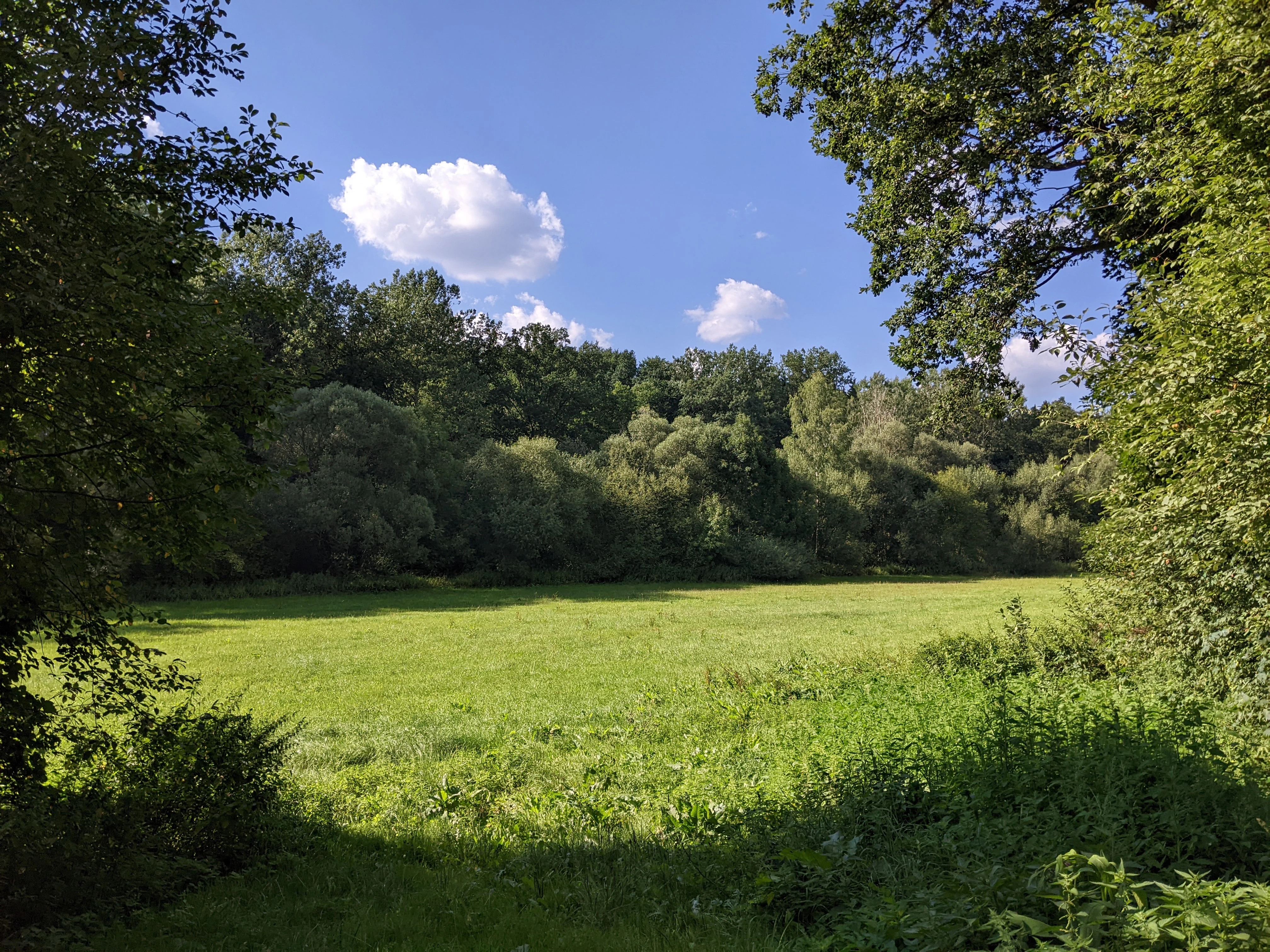
A wide, sunny meadow framed by leafy trees under a clear blue sky with light clouds, characteristic of the Blanice river valley.
A summer view of the meadows and riparian vegetation along the Blanice river in the Vlašimská Blanice nature monument.

Vlašimská Blanice history and protected-area timeline

During the first half of the nineteenth century, the land within the floodplain of the Blanice River was primarily used for hay production and pasturage. By the early twenty-first century the surrounding fields and meadows were still in agricultural use, with cut meadows, uncut meadows, pastures, and arable fields all present around the watercourse.

The site gained formal protection when the Regional Authority of the South Bohemian Region declared it a natural monument, a category used for smaller, scientifically valuable areas, with effect from 2 January 2014. The protection covers a defined portion of the river and the adjoining habitats that harbour threatened species. The natural monument overlaps partially with an earlier, larger Site of Community Importance of the same name, which was designated in 2005 and, at 402.6 hectares, extends much further north to reach the town of Vlašim in the Central Bohemian Region.

Vlašimská Blanice landscape and geographic character

The protected area follows a shallow river valley cut into the gently undulating terrain of the Vlašim Uplands. Elevations are modest, rising from around 396 to 434 metres above sea level, and the valley itself is largely shallow, with steep slopes and small rock exposures appearing only in a few places.

The Blanice River is the central landscape feature, and within the protected stretch it retains a fully natural, unregulated course. The channel meanders freely, with alternating pools, shallow riffles, gravel bars, and eroding cut banks. Gravelly and stony sediments are visible along the bed, and abandoned or temporary side channels create additional structural variety.

A continuous riparian woodland accompanies the river throughout the protected reach, dominated by black alder with a rich mixture of willow species. Beyond this wooded strip, the floodplain opens into a mosaic of meadows, both cut and uncut, pastures, and small patches of cultivated land. The river receives several small tributaries within the site, including the Slupský potok, Bzovský potok, Bělečský potok, and Noskovský potok, each contributing small side valleys and wet depressions that enlarge the diversity of the floodplain terrain.

Vlašimská Blanice ecosystems, habitats, and plant life

The natural monument protects a piece of lowland river valley whose ecological value rests on the interplay between aquatic habitats and traditional floodplain land use. The core of the protected system is the unregulated, meandering course of the Blanice, whose variable channel creates a wide range of microhabitats from fast-flowing gravelly riffles to quiet muddy pools.

The riparian vegetation forms a near-continuous corridor along the river, with black alder and willows providing shade, woody debris, and root systems that stabilise banks and create sheltered pockets of still water. The floodplain beyond this wooded strip is dominated by meadows that are regularly mown or grazed, with pastures and a few arable plots completing the mosaic.

Climate conditions across the protected area reflect its position on the boundary between two of the Czech Republic's moderately warm climatic zones. Average January temperatures lie between minus 2 and minus 3 °C, while July averages range from 16 to 18 °C depending on location, and annual precipitation falls between roughly 600 and 750 millimetres. Snow cover typically persists for sixty to eighty days a year. These conditions support both central European aquatic species and species associated with cool, moist floodplain habitats.

Vlašimská Blanice wildlife and species highlights

The river and its surroundings form a migration corridor and feeding ground for the European otter, whose droppings near the watercourse have been found to contain remains of the noble crayfish, a species once abundant in the Blanice. The protected reach also supports the threatened thick-shelled river mussel, which has been recorded in muddy sediments downstream of Skrýšov, alongside related mussels such as the duck mussel, the painter's mussel, and various pea mussels that occur throughout the channel.

Fish life in the protected reach has included occasional individual European eels, while the brook lamprey is among the formally protected species associated with the watercourse. The otter, the hermit beetle, and the thick-shelled river mussel, together with the lamprey, are the key threatened species listed in the protection decree for the site.

Birdlife uses both the waterside woodland and the broader surroundings. The common kingfisher and the European green woodpecker nest in the immediate riparian vegetation, while the wider floodplain and adjacent land attract the black stork, black woodpecker, common raven, marsh harrier, carrion crow, and eagle owl for feeding or breeding.

The floodplain's meadows and wet features also support a rich amphibian and reptile community. Pools and side channels serve as breeding habitat for frogs such as the common frog, the pool frog, and the common toad, while reptile species recorded in the area include the grass snake, the slow worm, the viviparous lizard, and the sand lizard on sunny parts of the floodplain. Among invertebrates, willows support the purple emperor butterfly, and aspen trees the poplar admiral. Several bumblebee species, wood ants, and various beetles, including the protected hermit beetle in isolated micro-populations, further characterise the fauna of the river valley.

Vlašimská Blanice conservation status and protection priorities

The natural monument focuses on protecting the threatened fauna of the river and its surrounding habitats, particularly the hermit beetle, the thick-shelled river mussel, the brook lamprey, and the European otter, along with the biotopes they depend upon. The site also overlaps with a larger European Site of Community Importance, giving it additional recognition within the European Union's Natura 2000 nature protection network.

Management efforts are directed at maintaining the natural character of the unregulated river, preserving its water quality, and restoring its migratory continuity. Attention is also given to the adjacent land, where the survival of the hermit beetle and other saproxylic insects depends on the retention of old trees containing cavities and rotting wood. Maintaining diverse floodplain land use patterns, including cut meadows, uncut meadows, pastures, and structurally varied riparian woodland, is essential for keeping the mosaic of habitats that supports the site's protected species.

Top sights and standout views in Vlašimská Blanice

Vlašimská Blanice stands out as a comparatively small, narrowly delimited natural monument whose value lies in the quality of its river habitats rather than its size. Its protected stretch preserves a free-flowing, meandering section of the Blanice River with diverse bed structures, gravel bars, and pools that are now uncommon in the Czech lowlands.

The combination of protected aquatic species such as the thick-shelled river mussel and the brook lamprey, riparian mammals like the otter, insect species such as the hermit beetle, and a traditional floodplain landscape of meadows, pastures, and riverside woodland gives the site a layered ecological significance. Overlapping with a larger European conservation designation, Vlašimská Blanice is an illustrative example of how a small river stretch can carry disproportionate importance for regional freshwater biodiversity.

Best time to visit Vlašimská Blanice

Late spring and early summer bring the meadows of the floodplain into full growth and are a good period for observing riverside birdlife and the flowering vegetation along the Blanice. Early autumn offers quieter conditions along the river corridor, when water levels are typically stable and the riparian woodland begins to change colour. Winter visits can provide a clear view of the river's meanders against the open floodplain, although snow cover, lasting on average sixty to eighty days in the area, can make some paths more difficult.

Monthly climate preview

Long term temperature and precipitation records across twelve recorded months

Vlašimská Blanice Climate Normals and Measured Annual Weather Patterns

Historical climatology data captures long term monthly temperature ranges and precipitation rates recorded at representative coordinates within Vlašimská Blanice. Detailed monthly normals provide precise statistical profiles for temperature fluctuations and precipitation totals across the protected area.
Annual mean8 °C
-3 °C19 °C
Jan-3°
Feb-2°
Mar
Apr
May12°
Jun16°
Jul19°
Aug18°
Sep13°
Oct
Nov
Dec-2°
Warmest month
July

18.6 °C

Coolest month
January

-3.1 °C

Wettest month
July

2.9 mm/day

Driest month
February

1.3 mm/day

Park location guide

Geography guide, regional context, and park location map for Vlašimská Blanice

Vlašimská Blanice park geography, regions, and map view in Czechia

Understand where Vlašimská Blanice sits in Czechia through a broader geographic reading of the surrounding landscape, nearby location context, and its mapped position within the national park landscape.

How Vlašimská Blanice fits into Czechia

Czech Republic is a landlocked Central European country with a population of approximately 10.9 million people. The nation was established as an independent state on January 1, 1993, following the dissolution of Czechoslovakia. Its capital and largest city is Prague, with other major urban centers including Brno, Ostrava, Plzeň, and Liberec.

Wider geography shaping Vlašimská Blanice in Czechia

The Czech Republic is a landlocked country in Central Europe. It is bordered by Germany to the west, Austria to the south, Poland to the northeast, and Slovakia to the southeast. The landscape is predominantly hilly, with the territory covering 78,871 square kilometers.

Map view of Vlašimská Blanice

Use this park location map to pinpoint Vlašimská Blanice in Czechia, understand its exact geographic position, and read its mapped placement within the surrounding landscape more clearly.

Pigeon | © OpenStreetMap contributors

Location context for Vlašimská Blanice

Jihočeský kraj

Visual reference collection highlighting meandering river habitats and valley terrain

Vlašimská Blanice Landscape Photography and Protected River Scenery

Photographic records reveal the unregulated river course, gravel bars, and riverside woodland characteristic of the protected valley. Visual documentation provides detailed insight into the floodplain meadows and riparian habitats supporting regional freshwater biodiversity.

A wide, sunny meadow framed by leafy trees under a clear blue sky with light clouds, characteristic of the Blanice river valley.

Park atlas

Discover adjacent river valleys and protected landscapes across the surrounding region

Explore Protected Areas and Parks Near Vlašimská Blanice for Regional Comparison

Visitors exploring the meandering river habitats of Vlašimská Blanice can continue comparing adjacent protected areas and regional conservation zones. Expanding the geographic view reveals broader patterns in lowland river valleys, riparian woodlands, and local protected landscapes.
Natural monumentStředočeský kraj
About 1.5 km away#1 closest

North

Roudný Natural Monument: Mapping Protected Mining Habitats in Středočeský Kraj

Explore the geography of this rare sandy sanctuary for invertebrates and fungi.

Roudný is a specialized natural monument protecting the sandy, nutrient-poor substrate of a former gold mine. The site stands as a significant biological island in Středočeský kraj, supporting species dependent on open, eroded sandy slopes that are now rare in the wider regional landscape. Its compact geography highlights the intersection of industrial history and conservation in the Czech Republic.

Area
0.025 km²
Established
1994
IUCN
IV
Relief
Lowland
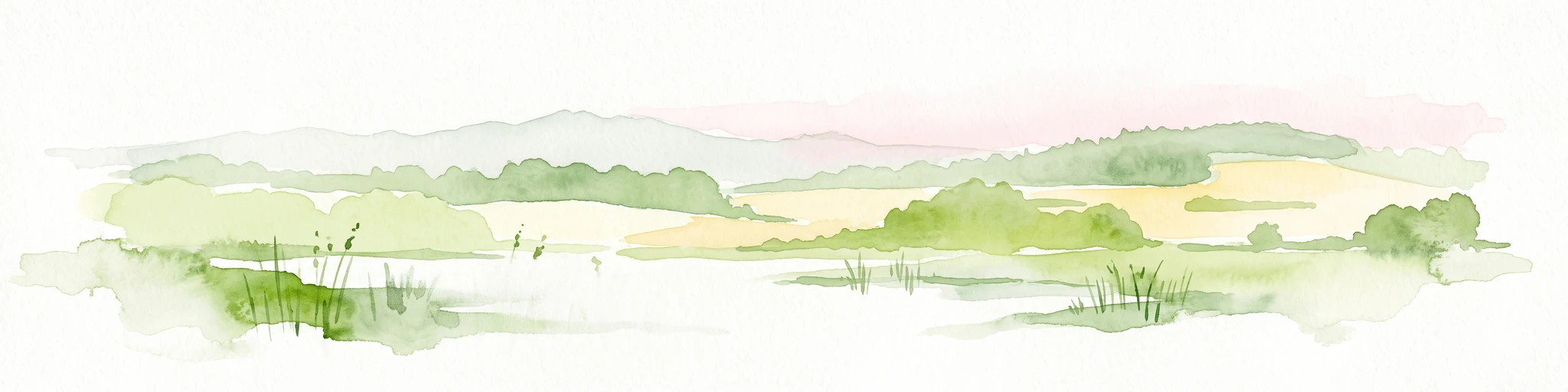
Watercolor painting of a peaceful wetland landscape with a pond, tall grasses, rolling hills, and a soft, muted color palette.
Natural monumentCentral Bohemia Region
About 2.1 km away#2 closest

Northeast

Rybník Louňov Natural Monument: Mapped Geography and Protected Wetland Ecosystems

Central Bohemia Region protected wetland and pond habitat

Rybník Louňov serves as a protected natural monument defined by its intimate mosaic of open water, emergent reed beds, and wet meadow patches. Located in the Central Bohemia Region, this site provides a critical refuge for rare flora and fauna, illustrating the role of small-scale landscape preservation in maintaining regional ecological health.

Area
0.019 km²
Established
2001
IUCN
IV
Relief
Lowland
Natural monumentStředočeský kraj
About 3.6 km away#3 closest

North

Na ostrově Natural Monument: Protected Juniper Habitats in Středočeský kraj, Czech Republic

Geographic landscape profile and ecological monument overview

Investigate the natural terrain and conservation value of Na ostrově, a protected site in the Benešov District. This area preserves a rare juniper-dominated hillside, offering insight into dry grassland and heath ecosystems maintained through traditional pastoral management.

Area
0.05 km²
Established
1972
IUCN
IV
Relief
Upland
A horizontal watercolor illustration of a gentle, rolling landscape with green fields, patches of forest, and faint pink floral accents in the foreground.
Protected landscapeBenešov District
About 9.6 km away#4 closest

Northwest

Přírodní park Džbány-Žebrák: Geography and Protected Area Landscape Map

Mapping the forests and meadows of the Benešov District

Přírodní park Džbány-Žebrák offers a distinct look into the central Bohemian uplands, marked by gentle ridges and spring-fed valleys. This protected area supports an interconnected web of small ponds, damp woodland clearings, and rural agricultural mosaics. Use this resource to trace the park boundaries and understand the regional significance of its protected waters, orchid-rich meadows, and varied, bird-populated forests.

Area
53 km²
Established
1996
Water
Major water bodies
Natural monumentStředočeský kraj
About 12 km away#5 closest

North

Na Stříbrné Natural Monument: A Geological and Forest Sanctuary in Central Bohemia

Protected woodland and historical mining terrain

Spanning less than five hectares, Na Stříbrné represents a dense mosaic of metamorphic geology and vibrant woodland habitat. This protected area in Středočeský kraj showcases the persistence of forest flora like mezereon amidst historic industrial relics, offering a clear window into the varied terrain of the Czech landscape.

Area
0.048 km²
Established
1972
IUCN
IV
Relief
Upland
A watercolor painting showing a soft, panoramic landscape with rolling hills, a line of trees, and a small pond or marshy area in the foreground.
Protected landscapeStředočeský kraj
About 24 km away#6 closest

Northwest

Hornopožárský les Nature Park: Atlas of Protected Landscapes in Středočeský kraj

Granite Bedrock and Forested Terrains in Central Bohemia

Trace the undulating ridges and rocky outcrops of Hornopožárský les Nature Park, where central Bohemian geography meets historical quarrying heritage. This protected area offers a deep look into the regional forests and river valley ecosystems characteristic of the lower Posázaví landscape.

Area
25 km²
Established
2002
Relief
Upland
Climate
Temperate
Nature reserveStředočeský kraj
About 27 km away#7 closest

Northwest

Vlčí rokle Nature Reserve: Geological Ravines and Ancient Beech Forests in Středočeský kraj

Mapping protected natural monument boundaries and ancient woodland remnants

Explore the geological and botanical features of Vlčí rokle, an exceptional nature reserve set within the Středočeský kraj. This protected area safeguards a fragment of ancient beech forest and a granite-boulder-strewn ravine, representing a classic example of central Bohemian geological and ecological heritage.

Area
0.085 km²
Established
1990
IUCN
III
Relief
Upland
Watercolor painting of a pastoral landscape featuring a tree, a large rock, and soft hills in the background with a pale sky.
Natural monumentStředočeský kraj
About 28 km away#8 closest

Northwest

Skalsko Natural Monument: Mapped Wetland Landscapes and Protected Meadow Geography

A representative habitat in the Středočeský kraj uplands

Focusing on the conservation of sensitive wet meadow ecosystems, Skalsko serves as a key reference for the biodiversity of the Říčany Plateau. This site showcases a mosaic of flora, including rare orchids, set against the backdrop of the geologically distinct Central Bohemian uplands, providing a structured look at one of the region's most important protected natural monuments.

Area
0.036 km²
Established
2008
IUCN
IV
Relief
Upland

Common questions about visiting, size, designation, and location context for Vlašimská Blanice

Vlašimská Blanice FAQs for park facts, access, geography, and protected area context

Find quick answers about Vlašimská Blanice, including protected-area facts, park geography, trail and visitor context, and how the park fits into its surrounding country and regional landscape.
MoriAtlas Explorer

Continue Your Protected Areas Search Across the Global Atlas

Deepen your exploration by continuing the structured search for national parks and protected areas worldwide. Utilize the comprehensive filtering capabilities to compare different conservation landscapes and refine your understanding of global park geography. Discover more about the distribution and characteristics of protected natural areas.

Global natural geography