Mori Atlas logo
Nature reserveNaturschutzgebiet Vogelwoog-Schmalzwoog

A diverse nature reserve defined by lakes, peat bogs, and sand grassland habitats.

Naturschutzgebiet Vogelwoog-Schmalzwoog: Protected Wetland and Mosaic Landscapes in Rheinland-Pfalz

(Naturschutzgebiet „Vogelwoog-Schmalzwoog“)

Located in the Hammerbach valley on the edge of Kaiserslautern, Naturschutzgebiet Vogelwoog-Schmalzwoog encompasses 22 hectares of rare and concentrated habitats. This protected area features a unique mosaic of alder swamp woodland, reed beds, and bog-influenced ecosystems nestled between infrastructure corridors. Discover the geographic composition of this peri-urban reserve, where water-influenced depressions and dry sandy ridges form a distinct ecological refuge.

urban-edge nature reservewetland habitatsbog ecosystemreed beds and sedge communitiessand grasslandmat-grass swards

Naturschutzgebiet Vogelwoog-Schmalzwoog

Nature reserve

Park overview

Structured park overview, official facts, and landscape profile for Naturschutzgebiet Vogelwoog-Schmalzwoog

Naturschutzgebiet Vogelwoog-Schmalzwoog park facts, protected area profile, and essential visitor context

Review the core facts for Naturschutzgebiet Vogelwoog-Schmalzwoog, including designation, size, terrain, visitor scale, habitats, and operating context in one park-focused overview.

About Naturschutzgebiet Vogelwoog-Schmalzwoog

Naturschutzgebiet Vogelwoog-Schmalzwoog is one of several small nature reserves within the urban area of Kaiserslautern, in the western part of the German state of Rhineland-Palatinate. Although it occupies only about 22 hectares, it has been recognized since 1996 as an important habitat island within the city's western fringe, where residential development, transport corridors, and industrial or commercial land use otherwise dominate the landscape.

The reserve is structured around two landmark features: the Vogelwoog, a small lake that gives the area much of its scenic character, and the Schmalzwoog, a name applied to the surrounding land parcels along the Hammerbach stream. Together these elements form the core of a habitat mosaic that the state of Rhineland-Palatinate designated with the stated purpose of preserving and developing the Hammerbach valley and its associated wetland environments. The valley's geomorphology has produced a layering of wet and dry conditions that support very different vegetation types within short distances of one another.

Ecologically, the Vogelwoog-Schmalzwoog reserve is significant because it maintains bog-related vegetation and peat-forming processes in an otherwise heavily modified part of the Palatinate region. Reeds, sedge communities, genuine peat bogs, wet and marshy meadows, dry sand grasslands, mat-grass swards, dwarf shrub heaths, bog heaths, alder swamp woodlands, and a variety of scrub and edge habitats can all be found within the protected boundary. This habitat diversity, in turn, supports rare plant species such as the round-leaved sundew and several species of cotton grass, alongside characteristic sphagnum mosses.

In parallel with its conservation role, the reserve functions as a key local recreation area for the people of Kaiserslautern. A network of walking paths, a designated forest experience path (Walderlebnispfad), an adventure playground, a forest classroom, a barefoot trail, and a small visitor hut known locally as an Erzhütte give the area a strong educational and family-friendly character. A restaurant sits on the eastern shore of the Vogelwoog, adding a further social dimension to visits. The combination of ecological value, educational infrastructure, and proximity to the city has helped make Vogelwoog-Schmalzwoog one of the more prominent small protected areas in Kaiserslautern's network of nature reserves.

Quick facts and research context for Naturschutzgebiet Vogelwoog-Schmalzwoog

The Vogelwoog-Schmalzwoog nature reserve lies within the city limits of Kaiserslautern in Rhineland-Palatinate, Germany, and was legally designated as a protected area on 13 February 1996. It encompasses about 22 hectares centred on the Vogelwoog lake and the Schmalzwoog area in the Hammerbach valley. The reserve sits between the A6 motorway and the Gewerbepark West commercial zone, making it a peri-urban green space rather than a remote wilderness. It is administered by the Rhineland-Palatinate state office for environment, water management, and commercial supervision, and serves both ecological protection and public recreation functions.

Protection and recognition

Explore documented terrestrial protection scopes and official registry data for this designated reserve.

Naturschutzgebiet Vogelwoog-Schmalzwoog Protection Status and International Recognition Records

Naturschutzgebiet Vogelwoog-Schmalzwoog holds documented terrestrial protection status within official registry records. Regular administrative tracking compiles designation scope and international recognition sources for detailed analysis.

Protection details

Protection scope
Terrestrial
Transboundary protection
No
WDPA ID
166087
Park context

Deeper park guide and search-rich context for Naturschutzgebiet Vogelwoog-Schmalzwoog

Naturschutzgebiet Vogelwoog-Schmalzwoog history, landscape, wildlife, and travel context

Explore Naturschutzgebiet Vogelwoog-Schmalzwoog through its history, landscape character, ecosystems, wildlife, conservation priorities, cultural context, and seasonal travel timing in a structured park guide built for atlas discovery and search intent.

Why Naturschutzgebiet Vogelwoog-Schmalzwoog stands out

The reserve is best known for the Vogelwoog lake and its surrounding wetland complex in the Hammerbach valley, which together pack a remarkable variety of habitat types into a very small urban-edge footprint. Visitors and ecologists alike value it for its mosaic of reed beds, sedge stands, peat bogs, wet meadows, sand grasslands, mat-grass swards, low shrub heath, bog heath, and alder swamp woodland. It is also recognized for hosting rare plant species such as the round-leaved sundew, cotton grasses (wool grasses), and various sphagnum mosses, which together signal the persistence of genuinely bog-influenced communities despite the area's proximity to motorway infrastructure and commercial development.
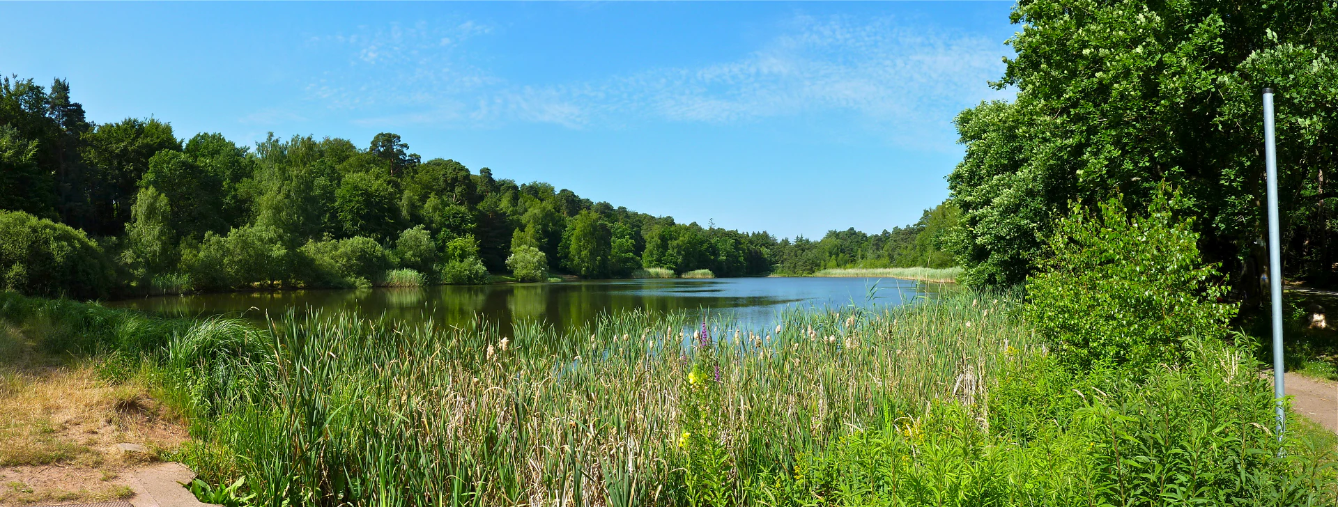
A wide, sunny, panoramic view of a calm lake surrounded by lush green forests and thick reeds along the shoreline.
A panoramic view of the Vogelwoog lake within the Naturschutzgebiet Vogelwoog-Schmalzwoog in Germany.

Naturschutzgebiet Vogelwoog-Schmalzwoog history and protected-area timeline

The Vogelwoog-Schmalzwoog reserve was formally established as a Naturschutzgebiet (nature reserve) on 13 February 1996 under Rhineland-Palatinate state law. The designation was driven by the need to protect the Hammerbach valley landscape and, in particular, the wetland habitats surrounding the Vogelwoog lake, which had been subject to increasing pressure from the surrounding urban and industrial development of Kaiserslautern.

The stated purpose of the designation was the preservation and development of the Hammerbach valley with its associated Vogelwoog lake. Since then, the reserve has been managed by the Rhineland-Palatinate state office responsible for environment, water management, and commercial oversight (Landesamt für Umwelt, Wasserwirtschaft und Gewerbeaufsicht), and it has gradually been enhanced with recreational and educational facilities to support its dual role as a conservation site and a local recreation area.

Naturschutzgebiet Vogelwoog-Schmalzwoog landscape and geographic character

The landscape of the Vogelwoog-Schmalzwoog reserve is defined by the Hammerbach valley, a shallow, water-influenced depression on the western edge of Kaiserslautern where small streams, wet depressions, and the Vogelwoog lake have shaped a fine-grained mosaic of landforms. The Vogelwoog itself, a small lowland lake, sits at the heart of the protected area and provides much of the visual identity of the reserve, with open water framed by reed beds and rising ground towards the surrounding slopes.

Beyond the lake, the terrain shifts between damp valley bottom and drier upland fragments. The reserve contains open meadows, marshy flats, peat-influenced hollows, dry sandy ridges that support sand grassland, and stony or nutrient-poor patches that favour mat-grass swards and low shrub heaths. These features are tightly interwoven, so that within a short walking distance visitors can move from open water through reed beds, wet meadows, and bog-like ground, and on into drier woodland and heath communities on slightly elevated ground.

Geographically, the reserve is bordered by the A6 motorway on one side and the Gewerbepark West commercial and industrial park on the other. This positioning makes it less a remote wilderness than an enclosed green valley between major infrastructure corridors. Despite this, the internal landscape remains visually quiet and natural in character, with the lake, the quiet stretches of the Hammerbach, and the surrounding woodland and meadows providing a strong sense of separation from the traffic and built environment just outside the reserve boundary.

Naturschutzgebiet Vogelwoog-Schmalzwoog ecosystems, habitats, and plant life

Ecologically, Vogelwoog-Schmalzwoog is unusually rich for its size because it preserves a compressed but complete cross-section of wetland, bog, dry grassland, and woodland habitats in a single small valley. The reserve contains reed beds (Röhrichte), sedge-dominated communities (Seggenriede), active peat bogs (Moore), wet and marshy meadows (Feucht- und Nasswiesen), sand grasslands (Sandrasen), mat-grass grasslands (Borstgrasrasen), low shrub heaths (Zwergstrauchheiden), bog heaths (Moorheiden), alder-dominated swamp woodlands (Bruchwälder), and a range of scrub and edge biotopes.

This habitat diversity supports a corresponding variety of plant communities. Bog and wet-zone species are particularly notable, with sphagnum mosses building up peat-like conditions in the wettest parts of the reserve, and characteristic bog flora such as cotton grasses (Wollgräser) marking the persistence of these communities. Dry, nutrient-poor sandy patches in turn support specialized sand grassland and mat-grass vegetation, while wetter ground supports reed- and sedge-dominated communities that grade into alder swamp woodland along the valley margins.

The vegetation pattern reflects a subtle interaction between water availability, soil chemistry, and historical land use along the Hammerbach. The combination of near-natural bog vegetation with adjacent dry, sandy, base-poor habitats within the same reserve is what gives Vogelwoog-Schmalzwoog its particular ecological value, especially in a region where such fine-scale habitat diversity has largely been lost to agriculture, forestry, or development.

Naturschutzgebiet Vogelwoog-Schmalzwoog wildlife and species highlights

Because the Vogelwoog-Schmalzwoog reserve is dominated by wetland, bog, and grassland habitats, its wildlife value lies more in its habitat structure and rare plant communities than in any single charismatic species. The reserve's combination of open water, reed beds, wet meadows, bog communities, and adjacent woodland supports a general abundance of invertebrates, amphibians, and birds typical of such habitat mosaics in the Palatinate region, even though detailed wildlife inventories are not the focus of the source material.

The presence of reed beds, sedge communities, and marshy meadows around the Vogelwoog lake provides nesting and feeding habitat for wetland-associated bird species, while the surrounding woodland, scrub, and edge habitats offer cover and food for more generalist forest species. Amphibians benefit from the combination of standing water, wet margins, and damp terrestrial habitat, and the bog-influenced areas, with their specialized flora such as round-leaved sundew and sphagnum mosses, support the invertebrate communities these plants depend on.

Naturschutzgebiet Vogelwoog-Schmalzwoog conservation status and protection priorities

From a conservation standpoint, Vogelwoog-Schmalzwoog is significant because it maintains a chain of increasingly rare habitat types in a region where such habitats have largely been lost to land-use change. Active peat bogs, bog heaths, wet meadows, sand grasslands, and alder swamp woodland are all included within its boundaries, and their continued presence is tied directly to the reserve's protected status under Rhineland-Palatinate nature conservation law.

The reserve's designation in 1996 was explicitly intended to preserve and develop the Hammerbach valley and the Vogelwoog lake, providing a legal framework against further drainage, conversion, or intensification of land use in the area. Its management by the Rhineland-Palatinate state environment office reflects this long-term protection role, and the reserve continues to act as a refuge for bog flora such as round-leaved sundew, cotton grasses, and sphagnum mosses, all of which have become uncommon in the surrounding landscape.

The fact that such a small area continues to support this range of bog and wetland habitats, despite being bordered by a motorway and a large commercial park, gives the reserve additional conservation value as a demonstration that even strongly urban-influenced landscapes can retain viable populations of rare habitat types when those habitats are formally protected and carefully managed.

Naturschutzgebiet Vogelwoog-Schmalzwoog cultural meaning and human context

Vogelwoog-Schmalzwoog plays an important role as local recreational and cultural space for the people of Kaiserslautern. The reserve functions as a familiar near-city escape, valued not just for its natural qualities but also for its association with everyday outdoor life: walking, family outings, school visits, and seasonal visitors using the lakeside restaurant on the eastern shore of the Vogelwoog.

The presence of a Walderlebnispfad (forest experience path), an adventure playground, a Waldklassenzimmer (forest classroom), a barefoot trail, and an Erzhütte shows that the area has been deliberately shaped to combine nature conservation with environmental education and cultural engagement. These facilities connect the reserve to broader German traditions of forest education and Naturerlebnis (nature experience), which are a recognizable part of the cultural landscape of Rhineland-Palatinate.

Top sights and standout views in Naturschutzgebiet Vogelwoog-Schmalzwoog

Vogelwoog-Schmalzwoog stands out for the unusual concentration of bog, wetland, dry grassland, and woodland habitats packed into roughly 22 hectares of valley landscape on the edge of a major city. Its Vogelwoog lake, reed beds, sedge stands, peat bogs, sand grasslands, heaths, and alder swamp woodlands together create an exceptionally diverse micro-landscape.

Equally notable is the reserve's combination of strict conservation purpose and active public use: rare plants such as round-leaved sundew and cotton grasses coexist with walking trails, a forest experience path, an adventure playground, a barefoot trail, and a lakeside restaurant, making the reserve a working example of small-scale, peri-urban nature protection in Rhineland-Palatinate.

Best time to visit Naturschutzgebiet Vogelwoog-Schmalzwoog

Vogelwoog-Schmalzwoog can be appreciated in any season, but late spring and early summer tend to bring out the widest range of the reserve's ecological and scenic highlights, when reed beds, wet meadows, and dry grasslands are at their most floristically visible and the surrounding woodland is fully leafed out.

Autumn offers a quieter, more contemplative atmosphere, with the bog and heath vegetation taking on warmer tones and the Vogelwoog lake reflecting the surrounding trees. Even in winter, the open water of the Vogelwoog and the structural contrast between bog pools, reed beds, and bare woodland can make for atmospheric walks, especially for visitors interested in habitat structure rather than flowering vegetation.

Monthly climate preview

Long-term temperature ranges and monthly precipitation recorded at representative park coordinates

Naturschutzgebiet Vogelwoog-Schmalzwoog Climate Normals and Annual Weather Patterns

Representative coordinate measurements reveal measured monthly temperature shifts alongside consistent precipitation rates throughout the year. Reviewing the complete twelve-month climatology dataset clarifies long-term thermal variations across the protected landscape.
Annual mean9 °C
0 °C19 °C
Jan
Feb
Mar
Apr
May13°
Jun17°
Jul19°
Aug19°
Sep14°
Oct
Nov
Dec
Warmest month
July

19.2 °C

Coolest month
January

-0.2 °C

Wettest month
December

2.4 mm/day

Driest month
April

1.5 mm/day

Park location guide

Geography guide, regional context, and park location map for Naturschutzgebiet Vogelwoog-Schmalzwoog

Naturschutzgebiet Vogelwoog-Schmalzwoog park geography, regions, and map view in Germany

Understand where Naturschutzgebiet Vogelwoog-Schmalzwoog sits in Germany through a broader geographic reading of the surrounding landscape, nearby location context, and its mapped position within the national park landscape.

How Naturschutzgebiet Vogelwoog-Schmalzwoog fits into Germany

Germany is a federal republic in Western and Central Europe with a population of over 83 million across sixteen constituent states. It is Europe's largest economy by nominal GDP and a major global exporter and importer. The capital is Berlin, and the country borders Denmark, Poland, Czech Republic, Austria, Switzerland, France, Luxembourg, Belgium, and the Netherlands.

Wider geography shaping Naturschutzgebiet Vogelwoog-Schmalzwoog in Germany

Germany is located in Western and Central Europe, spanning 357,022 km². It borders Denmark to the north, Poland and the Czech Republic to the east, Austria and Switzerland to the south, and France, Luxembourg, Belgium, and the Netherlands to the west. The country has coastlines on the Baltic Sea and North Sea to the north, with the Alps located in the southern region.

Map view of Naturschutzgebiet Vogelwoog-Schmalzwoog

Use this park location map to pinpoint Naturschutzgebiet Vogelwoog-Schmalzwoog in Germany, understand its exact geographic position, and read its mapped placement within the surrounding landscape more clearly.

Pigeon | © OpenStreetMap contributors

Location context for Naturschutzgebiet Vogelwoog-Schmalzwoog

Rheinland-Pfalz
Recorded earthquake history

View Historical Earthquake Records for Naturschutzgebiet Vogelwoog-Schmalzwoog

Consult the historical seismic catalogue for Naturschutzgebiet Vogelwoog-Schmalzwoog to review documented earthquake events, magnitudes, and epicentre locations. This MoriAtlas resource organizes recorded data to provide a clear geographic perspective on regional seismic activity.

Vogelwoog-Schmalzwoog Earthquake History

Catalogued events

8 events

Strongest magnitude

Magnitude 3.3

Most recent event

Dec 13, 2007

This history includes earthquakes recorded inside the park or within 50 km of its borders

Visual exploration of wetland habitats and protected valley terrain

Naturschutzgebiet Vogelwoog-Schmalzwoog Landscape Photos and Scenery

Visual documentation captures the varied habitats and protected terrain of Naturschutzgebiet Vogelwoog-Schmalzwoog across the Hammerbach valley. Field photography reveals the interplay between open water, reed beds, peat bogs, and surrounding woodland ecosystems.

A wide, sunny, panoramic view of a calm lake surrounded by lush green forests and thick reeds along the shoreline.

Park atlas

Compare nearby regional reserves and connected valley ecosystems across Rhineland-Palatinate

Parks Near Naturschutzgebiet Vogelwoog-Schmalzwoog And Surrounding Protected Landscapes

Browsing other protected areas near Naturschutzgebiet Vogelwoog-Schmalzwoog reveals a diverse regional spread of valley wetlands, woodland reserves, and lowland lake habitats. Extending geographic comparison beyond a single reserve provides essential context on how fragmented urban green spaces connect across the broader landscape.
Nature reserveRhineland-Palatinate
3.9 km away#1 closest

West

Westricher Moorniederung Nature Reserve: Protected Wetland and Moorland Atlas

Mapping low-lying basin landscapes and riparian corridors in the German Palatinate.

Spanning 40 kilometers between the Bliesaue and Kaiserslautern, the Westricher Moorniederung protects an intricate network of bogs, marsh zones, and alluvial forests. This lowland basin acts as a vital ecological link within Rhineland-Palatinate, defined by its drainage systems and diverse mire habitats. Gain insight into the regional geography and protected land boundaries that define this significant wetland system.

Area
21.52 km²
Established
1998
IUCN
IV
Nature reserveRheinland-Pfalz
About 5.6 km away#2 closest

Southwest

Täler und Verlandungszone am Gelterswoog: Nature Reserve and Wetland Geography

A mosaic of lakes, mires, and stream valleys in Rheinland-Pfalz

Located in the Palatinate Forest, this protected nature reserve centers on the western shores of the Gelterswoog lake. It conserves a rare assembly of habitats including peat-forming moorland, reeds, and narrow forested valleys that provide essential breeding grounds for protected dragonfly species.

Area
0.554 km²
Established
1997
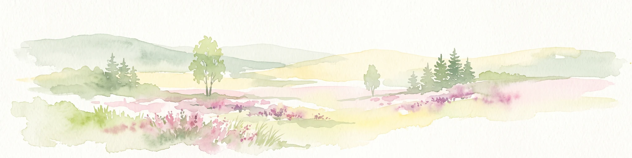
Watercolor painting of a heathland landscape with rolling hills, purple heather, and scattered pine trees.
Nature reserveRhineland-Palatinate
7.1 km away#3 closest

Northeast

Mehlinger Heide Nature Reserve: Geography and Protected Heathland Atlas of Rhineland-Palatinate

A rare mosaic of inland sandy heath and dry grassland habitats

Spanning over 400 hectares in Rhineland-Palatinate, Mehlinger Heide offers a distinctive protected area featuring inland dunes and dwarf-shrub heath. This nature reserve presents an unusual ecological environment within Germany, supporting specialised insect and bird populations through its open pioneer habitats and remnants of historic military training grounds. Explore the mapped terrain and natural boundaries of this significant conservation site.

Area
3.99 km²
Established
2001
IUCN
IV
Relief
Upland
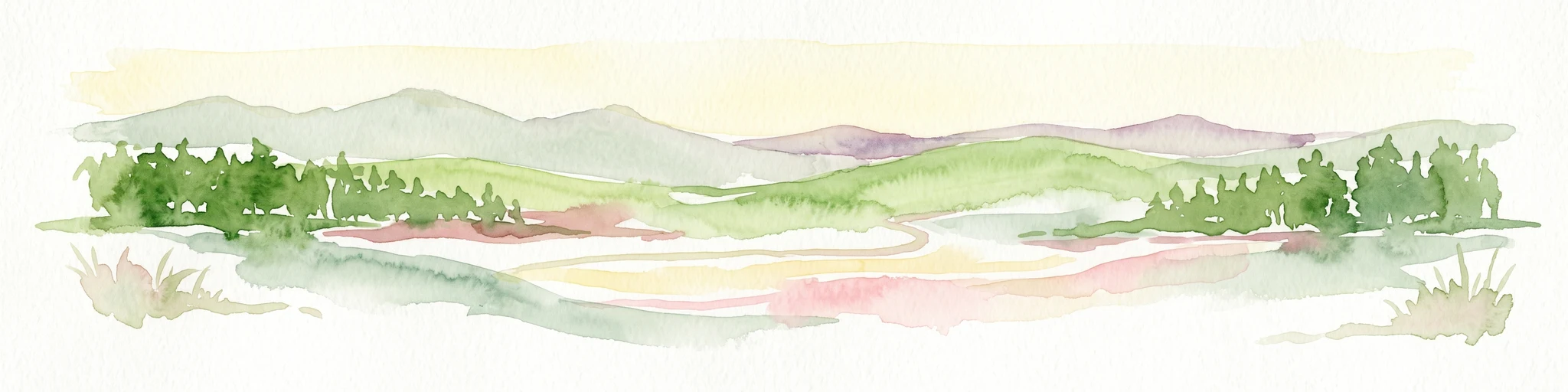
A horizontal watercolor painting of rolling green hills, a small stream, and forested slopes against a pale sky.
Protected areaRheinland-Pfalz
14 km away#4 closest

Northwest

Königsberg Protected Area: Geography, Forest Habitats, and Regional Landscape Identity

Examining the mountain ridges of the Nordpfälzer Bergland

Königsberg stands as a prominent mountain massif in the German state of Rheinland-Pfalz. This protected landscape is characterized by deep mixed beech-oak forests, significant geological scree formations, and an intricate history of mining. Its ridge-line terrain provides a critical study of upland geography, separating regional valleys while hosting a diverse array of protected natural habitats and medieval heritage sites.

Area
10.47 km²
Relief
Mountain
Climate
Temperate
Access
Moderate access
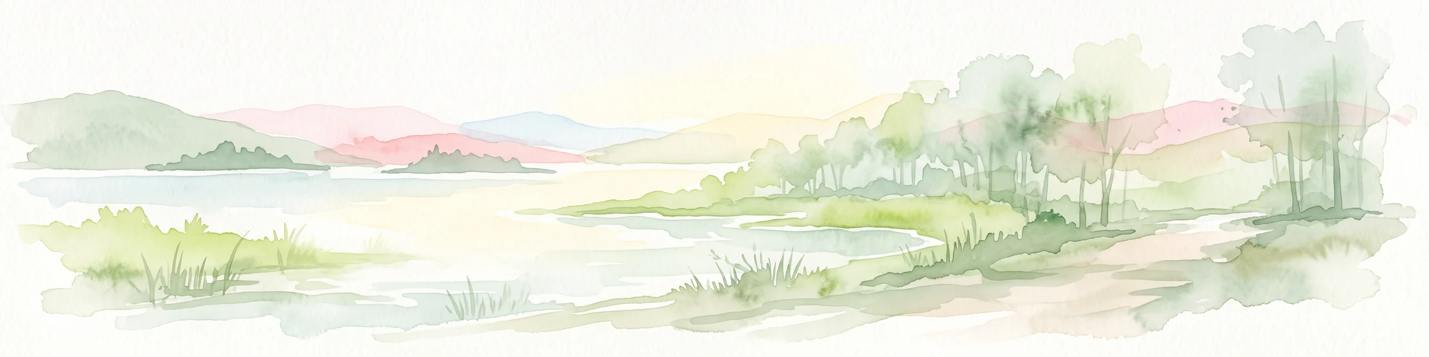
A soft watercolor painting of a wetland landscape with a gentle shoreline, grassy foreground, scattered trees, and distant hills under a pale sky.
Nature reserveRheinland-Pfalz
About 15 km away#5 closest

West

Schachenwald Nature Reserve: Geographic Overview and Protected Landscape Boundaries

Mapping the sand dunes and wetland terrain of Rheinland-Pfalz

Schachenwald functions as a vital nature reserve in the Kaiserslautern district, distinguished by its tightly knit combination of dry, sandy dune forests and damp alder swamp woodlands. The reserve highlights the complex interaction between weathered Buntsandstein ridge geology and bog-influenced lowlands, providing a clear window into the ecological diversity of the regional landscape.

Area
0.638 km²
Established
1987
IUCN
IV
Relief
Lowland
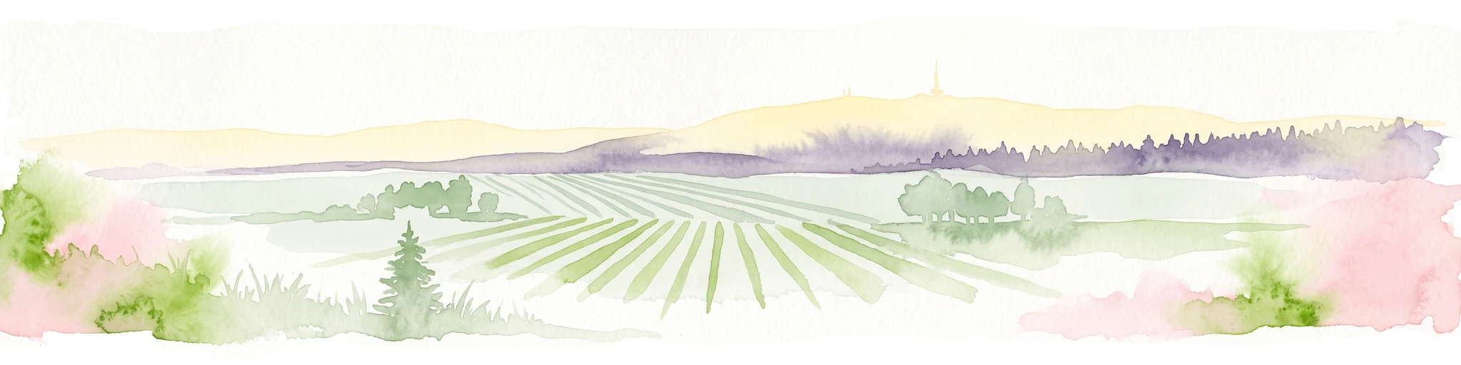
A soft watercolor painting depicting a rolling landscape with fields, a small forest edge, and a mountain peak in the background.
Protected areaRhineland-Palatinate
15 km away#6 closest

Northeast

Donnersberg Protected Area: A Geographic Atlas of the Palatinate Region's Highest Massif

Geological landscapes, Celtic heritage sites, and forested mountain terrain.

The Donnersberg massif represents a critical point of geographic and archaeological interest in Rhineland-Palatinate. This protected area encompasses a 24-square-kilometer rhyolite cryptodome featuring high-altitude plateaus, a complex network of forest ecosystems, and well-preserved remnants of ancient Celtic fortifications. Its steep slopes and diverse rock formations offer a clear look at the geological and historical layering of the German landscape.

Area
24 km²
Relief
Mountain
Climate
Temperate
Access
Easy access
A minimalist watercolor illustration featuring a green treeline, soft rolling hills, and a calm body of water in warm light tones on a white background.
Protected landscapeRhineland-Palatinate
About 17 km away#7 closest

West

Landstuhler Bruch Protected Landscape: Regional Geography and Mapped Wetland Basin

Exploring the historic moorland basin of the Westpfalz

Situated in the Westpfalz region of Rhineland-Palatinate, the Landstuhler Bruch is a gentle lowland depression marked by a complex history of drainage and conservation. This protected area offers deep insight into the regional geology, preserved wetland pockets, and hydrological networks that define the local landscape. Understanding this basin provides a window into the intersection of cultural heritage and active ecological restoration in southwestern Germany.

Area
67 km²
Established
1985
IUCN
V
Relief
Lowland
A soft, light-toned watercolor painting of a wetland landscape featuring a small stream, grassy banks, and a treeline under a pale pink sky.
Nature reserveRhineland-Palatinate
About 18 km away#8 closest

West

Scheidelberger Woog Nature Reserve: Geographic Overview of a Palatinate Wetland Landscape

Tracing the protected peat-rich moorland boundaries in Rhineland-Palatinate

Scheidelberger Woog stands as a vital nature reserve and lowland moor basin in the western Palatinate. Its mapped terrain features a fine-grained mosaic of reed beds, damp woodlands, and river-fed ponds. This geographic detail provides essential insight into the area's ongoing conservation efforts and its role within the wider moor network of the Kaiserslautern district.

Area
2.32 km²
Established
1987
Relief
Lowland
Scope
Terrestrial

Common questions about visiting, size, designation, and location context for Naturschutzgebiet Vogelwoog-Schmalzwoog

Naturschutzgebiet Vogelwoog-Schmalzwoog FAQs for park facts, access, geography, and protected area context

Find quick answers about Naturschutzgebiet Vogelwoog-Schmalzwoog, including protected-area facts, park geography, trail and visitor context, and how the park fits into its surrounding country and regional landscape.
MoriAtlas Explorer

Continue Your Protected Areas Search Across the Global Atlas

Deepen your exploration by continuing the structured search for national parks and protected areas worldwide. Utilize the comprehensive filtering capabilities to compare different conservation landscapes and refine your understanding of global park geography. Discover more about the distribution and characteristics of protected natural areas.

Global natural geography