Mori Atlas logo
Park earthquake history

A comprehensive catalogue of seismic events mapped by distance from the reserve

Historical Earthquake Records and Recorded Seismic Activity Near Vrch Hazmburk

Explore a structured collection of historical earthquake records linked by epicenter proximity to the Vrch Hazmburk nature reserve in the Ustecky Region. This catalogue provides transparent access to documented seismic events, including magnitude and depth, for those studying the regional landscape and its geomorphic context. Data is aggregated based on distance from the park boundaries to support focused analysis of local seismic history.

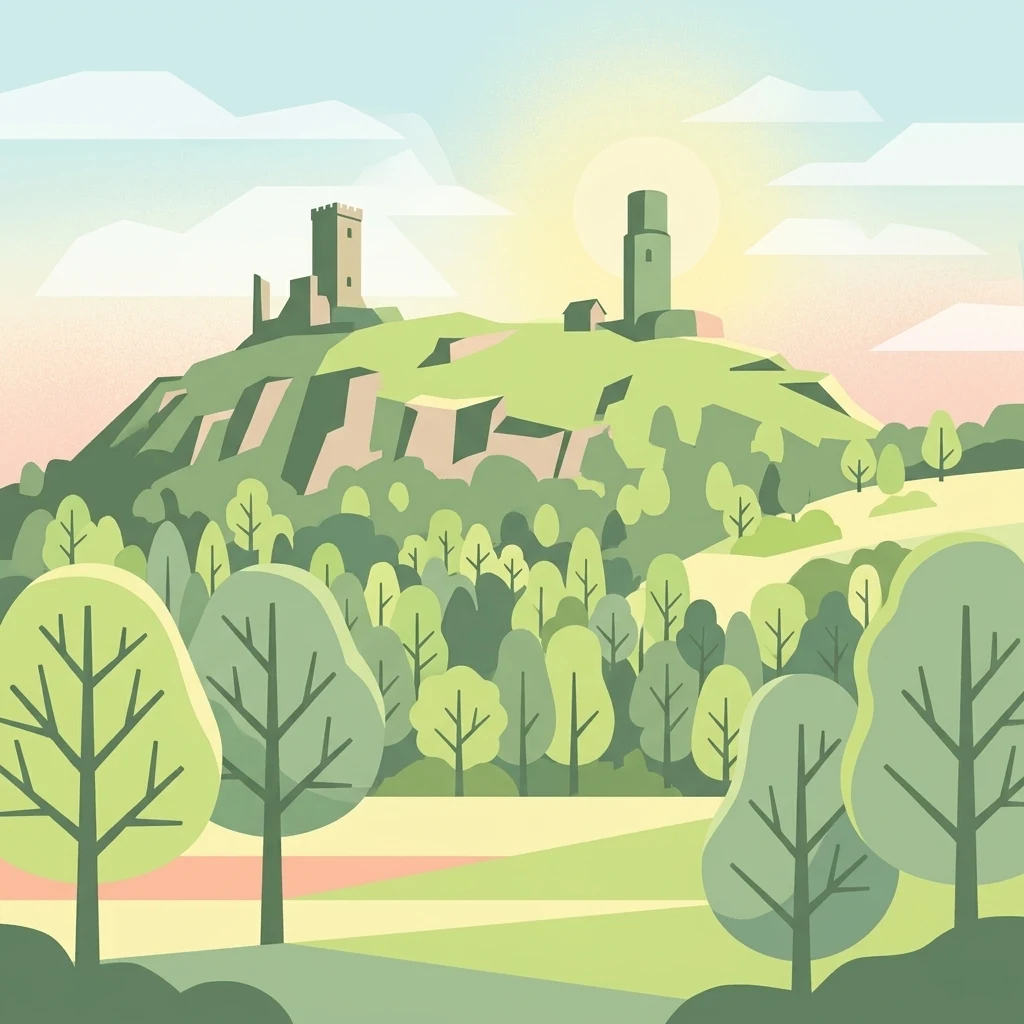
A stylized vector-style illustration of the Hazmburk Castle ruins perched on a hill, surrounded by trees and fields under a soft, sunrise-like sky.

A volcanic hill in northern Bohemia protecting rare steppe habitats and a centuries-old castle ruin.

Vrch Hazmburk

Vrch Hazmburk is a small protected natural monument in northern Bohemia, Czech Republic, just east of the village of Klapý and a few kilometers northwest of Libochovice in the Litoměřice district. The reserve covers around 60 hectares on the slopes of a prominent Neovolcanic hill, leaving out the summit crowned by the ruins of the medieval Hazmburk castle. Despite its modest size, the site stands out for its combination of exposed basalt outcrops, scree slopes, dry grassland, and old orchards, creating a mosaic of steppe and forest-steppe habitats. Because of its warm, dry microclimate and unusual geology, the hill supports a striking concentration of thermophilic plant and invertebrate species, including a Czech endemic grasshopper subspecies that is one of the main reasons the area was given legal protection. The site is also classified as a European Site of Community Importance, linking local biodiversity to the wider Natura 2000 network.

Location
Czechia
Park type
Nature reserve
Established
2011
Area
0.6 km²
Highest point
414 m
Vrch Hazmburk Nature Reserve Atlas

Compare Vrch Hazmburk records by date and distance

Explore past earthquakes in the wider Vrch Hazmburk area

Vrch Hazmburk covers 0.604 km² of Czech mountains, cliffs, partial forest, and volcanic terrain between 245 and 414 metres. Examine linked earthquakes by their source details and distance rather than assuming a volcanic cause, a boundary crossing, local damage, or current risk.

Sort by
Magnitude
Location

This page describes catalogued earthquakes associated with the park by epicentre location and distance. It does not establish causation, assess current danger, or predict future earthquakes.

No earthquake records match the current filters

Park atlas

Continue after Vrch Hazmburk earthquake records

Browse more parks and protected places beyond Vrch Hazmburk

After exploring Vrch Hazmburk’s earthquake section and northern Bohemian volcanic hill, steppe habitat, and castle ruin, browse a distinct group of protected destinations. Their appearance is not a statement of common volcanic origin, cultural heritage, reserve status, geology, seismic exposure, geographic proximity, current hazard, risk, or source coverage.
A horizontal watercolor painting depicting a soft-focus landscape with light green trees and low rolling hills under a pale, warm-toned sky.
Protected landscapeLitoměřice District
About 6.5 km away#1 closest

East

Dolní Poohří Nature Park: Protected Landscape and River Geography

A riparian corridor through the Litoměřice District

The landscape of Dolní Poohří Nature Park follows the irregular arc of the lower Ohře River across the Bohemian plain. Its narrow boundaries protect a functional floodplain ecosystem characterized by silted oxbows, gravel banks, and rare forest fragments. This atlas entry details the geographic features, protected status, and the interplay between the active river channel and the historic townscapes found along its banks.

Area
40 km²
Established
2001
Relief
Lowland
Climate
Temperate
Natural monumentÚstecký kraj
7.8 km away#2 closest

South

V hlubokém Natural Monument: Protected Calcareous Landscapes and Terrain in Ústecký kraj

A study of rare sesleria grasslands and opuka slope geography

V hlubokém serves as a significant protected site in the Czech Republic, encompassing twenty hectares of hillside defined by soft calcareous opuka rock. This natural monument is recognized for its rare sesleria grasslands and thermophilic plant assemblages that contrast with the surrounding woodland. The protected area forms a critical link in the broader geography of the Débeř valley, offering a clear example of localized botanical diversity supported by unique alkaline substrate conditions.

Area
0.202 km²
Established
1947
IUCN
III
Relief
Upland
A horizontal watercolor illustration depicting a soft, rolling landscape with green hills, a small winding stream, and meadow vegetation on a white background.
Natural monumentÚstecký kraj
10 km away#3 closest

Southeast

Na Dlouhé stráni Natural Monument: Regional Protected Area and Botanical Landscape

A conservation-focused look at the Mšenský potok valley slope

Na Dlouhé stráni is a designated natural monument in the Czech Republic, renowned for its concentration of thermophilous grassland flora. This protected area, located near Mšené-lázně, preserves a specific slope habitat that supports declining plant species. The site offers an important look at regional conservation efforts and the mapping of small-scale protected habitats within the diverse Ústecký kraj geography.

Area
0.126 km²
Established
2012
IUCN
IV
Relief
Lowland
Natural monumentLitoměřice District
10 km away#4 closest

Southeast

Vrbka Natural Monument: Exploring Protected Limestone Habitats and Bohemian Lowland Geography

A rare botanical reserve in the Litoměřice District of the Czech Republic

Vrbka Natural Monument protects a significant 15.5-hectare expanse of warm limestone slopes and dry meadows. This geographic landmark serves as an essential repository for rare orchid species and diverse insect populations, functioning as a representative habitat patch within the intensively cultivated landscapes of the surrounding region.

Area
0.155 km²
Established
2013
IUCN
IV
Relief
Upland
A soft watercolor illustration of rolling green hills with distant mountain peaks under a light sky.
Natural monumentÚstecký kraj
11 km away#5 closest

Northeast

Radobýl Natural Monument: Basalt Formations and Volcanic Geography in Ústecký kraj

A protected volcanic landmark with steppe ecosystems and ridge views.

Radobýl stands as a distinctive volcanic remnant in the Ústecký kraj, featuring profound columnar basalt jointing and frost-weathered cliffs. This protected natural monument shelters rare dry grassland habitats and rocky terrain, while offering expansive views across the Litoměřice basin and the surrounding Bohemian landscape.

Area
0.063 km²
Established
1966
IUCN
IV
Relief
Mountain
A horizontal watercolor illustration showing a soft-toned landscape with green trees in the foreground, rolling yellow-green fields in the midground, and faint mountains in the background.
Natural monumentStředočeský kraj
19 km away#6 closest

Southwest

Smradovna Natural Monument: Geography and Protected Habitats in Central Bohemia

A protected stream valley system within the Stredocesky kraj region.

Smradovna preserves a unique concentration of lowland habitats, including calcareous beech forests and rare alkaline fens. This protected natural monument, located near Bilichov, is defined by its characteristic travertine springs and continuous stream-corridor ecosystem. Gain insight into the regional geography and botanical significance of this tightly knit protected landscape through our structured mapping and data.

Area
1.556 km²
Established
2014
IUCN
IV
Relief
Upland
A horizontal watercolor painting showing rolling green hills in the distance and colorful, stylized vegetation in the foreground.
Nature reserveÚstí nad Labem Region
About 21 km away#7 closest

North

Rač Nature Reserve: Volcanic Slopes and Protected Habitats in Ústí nad Labem

Geomorphology and ecological succession in the České středohoří range

Rač Nature Reserve is a landmark for volcanic ecology, preserving a mosaic of trachyte rock formations and open grassland on the slopes of Hradiště u Habří. This protected area serves as a vital refuge for rare steppe-like flora and a high concentration of thermophilic insect species, offering a concentrated look at natural land recovery and geological history in northern Bohemia.

Area
0.154 km²
Established
1953
IUCN
IV
Relief
Mountain
Watercolor illustration of a peaceful, open landscape with gentle hills in the background and clusters of trees in the foreground.
Nature reserveStředočeský kraj
About 22 km away#8 closest

South

Na Pilavě Nature Reserve: A Detailed Botanical Atlas of the Středočeský kraj Landscape

Mapping protected orchid habitats and forest flora in the Džbán highland.

Na Pilavě is a specialized nature reserve in the Kladno District, valued for its dense concentration of rare woodland orchids and the critically endangered black false hellebore. Set within the forested slopes of the Pilavské údolí, this protected area serves as a vital refuge for thermophilic plant communities and ancient deciduous forest flora.

Area
0.031 km²
Established
1969
IUCN
IV
Relief
Upland
MoriAtlas Explorer

Explore the Mapped Geography and Protected Landscapes of Vrch Hazmburk

Investigate the unique geological features and protected habitats of Vrch Hazmburk through our MoriAtlas entry. Gain a clearer understanding of this volcanic hill, its role in local biodiversity conservation, and how its specific terrain sits within the broader geography of the Czech Republic.

Global natural geography