
Mori Atlas logo
Natural monumentVrch Káčov

A detailed geographic atlas examining volcanic rock outcrops and protected hill terrain

Vrch Káčov Natural Monument and the Volcanic Landscapes of the Central Bohemian Region

(Přírodní památka Vrch Káčov)

Vrch Káčov represents a distinct volcanic natural monument within the Central Bohemian Region, characterized by its prominent rock outcrops and rare contact-metamorphic geology. This protected area serves as a focal point for understanding the smaller-scale topographic shifts and geological history inherent to the Bohemian hill country. The mapped boundaries preserve an elevated landscape that bridges the gap between scientific geological value and the surrounding rural terrain of the Mladá Boleslav district.

volcanic geologycontact metamorphismporcelaniterock outcropnatural monumentBohemian hills
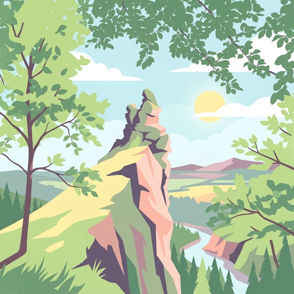
A graphic illustration showing a prominent, light-colored rocky outcrop rising above a forested landscape with a winding river and a sunlit sky.

Vrch Káčov

Natural monument

Park overview

Structured park overview, official facts, and landscape profile for Vrch Káčov

Vrch Káčov park facts, protected area profile, and essential visitor context

Review the core facts for Vrch Káčov, including designation, size, terrain, visitor scale, habitats, and operating context in one park-focused overview.

About Vrch Káčov

Vrch Káčov sits in the gently rolling Jičínská pahorkatina, a hill region north of Prague in central Bohemia. The protected area takes in the northwestern part of a modest hill of the same name, dominated by a small, exposed rock formation that rises above the surrounding farmland and woodland edge. Although the monument is tiny in area, its compact footprint concentrates a remarkable geological story in one place.

The defining feature of the site is its volcanic and metamorphic geology. The hill consists of rock that was originally formed by volcanic activity, and parts of it were later altered by contact metamorphism, producing distinctive rock types including porcelanite. These minerals and rock textures are otherwise uncommon in the region, giving the site recognized scientific value among Czech geologists and conservation authorities.

Ecologically, the rocky substrate and warm, dry microclimate create conditions that favor sun-loving plant species and a varied insect community. Botanical surveys have identified dozens of higher plant species on the hill, while zoological work has recorded beetles, butterflies, and a notable bird community, including both common songbirds and occasional breeding species that are otherwise rare in the area. The mix of exposed rock, dry grassland patches, scrubby edges, and small woodland fragments produces an unusually rich habitat mosaic for such a small territory.

Visually, Vrch Káčov offers an open, panoramic character, with views toward landmarks such as Ještěd on the horizon. The hill itself is modest in elevation but stands out because of its exposed rock outcrop and the open vegetation that surrounds it. This combination of striking geology, ecological diversity, and accessibility from nearby villages makes Vrch Káčov a compact but meaningful protected landscape in the Central Bohemian Region.

Quick facts and research context for Vrch Káčov

Vrch Káčov is a Czech natural monument (přírodní památka) located near the village of Sychrov in the Mladá Boleslav district of the Central Bohemian Region. It covers about 1.88 hectares at elevations of roughly 305 to 348 meters above sea level. The site protects a volcanic rock outcrop with contact-metamorphic rocks, including porcelanite, and was placed under protection on 15 September 1953 by the Ministry of Culture. It is one of the older formally protected natural sites in the country, with roots going back to an even earlier land allocation to the Czech Tourist Club in 1925.

Protection and recognition

Documented territory management, international recognition, and designation facts.

Vrch Káčov Protection Status and Terrestrial Conservation Scope

Terrestrial conservation frameworks define the documented protection status governing Vrch Káčov across its natural landscape. Structured designation records outline the official administrative scope and international recognition assigned to the terrain.

Protection details

Protection scope
Terrestrial
Park context

Deeper park guide and search-rich context for Vrch Káčov

Vrch Káčov history, landscape, wildlife, and travel context

Explore Vrch Káčov through its history, landscape character, ecosystems, wildlife, conservation priorities, cultural context, and seasonal travel timing in a structured park guide built for atlas discovery and search intent.

Why Vrch Káčov stands out

Vrch Káčov is best known for its geological character: a small but distinctive hill of volcanic origin featuring contact-metamorphic rocks, including the unusual porcelanite formations. The exposed rock suk at the summit of the hill serves as the visual and scientific focal point of the monument, illustrating how volcanic activity once altered the surrounding rocks into rare mineral varieties. The site is a textbook example of how a minor landscape feature can carry outsized geological significance within the Bohemian hill country.
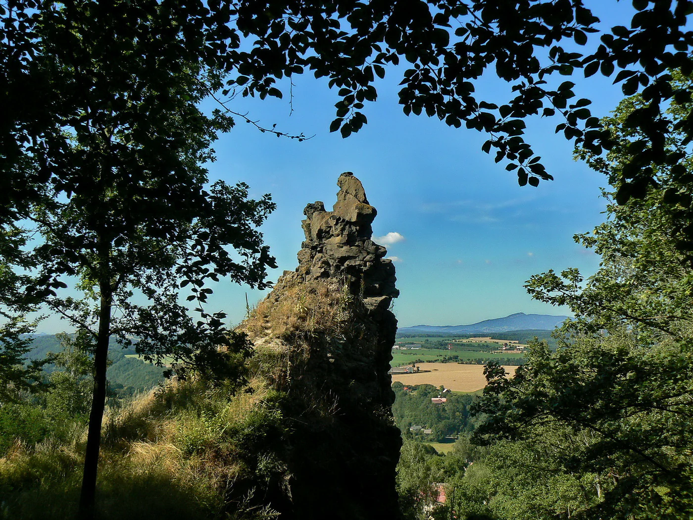
A prominent, jagged rock formation stands in the center foreground, surrounded by trees. In the background, rolling fields and a distant mountain peak are visible under a clear blue sky.
A rocky volcanic formation at Vrch Káčov, framed by foliage with a distant mountain view.

Vrch Káčov history and protected-area timeline

The history of conservation at Vrch Káčov reaches back further than the monument itself. In 1925, the State Land Office in Prague transferred the hill of Káčov into the stewardship of the local branch of the Czech Tourist Club in Mnichovo Hradiště, an unusually early example of organized care for a natural site in what is now the Czech Republic.

In 1950, a larger nature reserve called Káčov was established in the area, but this reserve deliberately excluded the very rock outcrop that would later form the heart of the current monument. Just three years later, on 15 September 1953, the smaller site covering the volcanic rocks was declared a protected natural monument by the Ministry of Culture, fixing the boundaries and protective purpose that essentially remain today.

The original 1950 reserve was abolished in 1965 despite its recognized scientific value, but the 1953 monument endured and remains the active protected designation for the hill's geological core. The juxtaposition of these early protective actions, and the fact that the hill was effectively curated for natural values already in the 1920s, gives Vrch Káčov a notable place among the older conservation sites in the country.

Vrch Káčov landscape and geographic character

Vrch Káčov occupies a modest hill in the Jičínská pahorkatina, where the terrain is shaped into gentle ridges and shallow valleys typical of central Bohemian hill country. The hill rises to around 348 meters at its highest point and drops to roughly 305 meters within the protected area, giving the monument a compact but discernible topographic identity.

The most striking landscape element is the rock suk at the northwestern part of the hill: a small, exposed mass of volcanic and contact-metamorphic rock that breaks the otherwise smooth vegetated profile of the slope. Around this rocky core, the hill transitions into dry grassland, scattered shrubs, and patches of woodland, with farmland and settlements of the nearby Sychrov village visible at its base.

Because the monument lies on an elevated, partly open slope, the site offers broad views across the surrounding lowland landscape. On clear days, prominent regional landmarks such as Ještěd can be seen on the horizon. The combination of exposed rock, open ground, and panoramic exposure gives the small hill a sense of prominence that belies its modest elevation.

Vrch Káčov ecosystems, habitats, and plant life

The ecological character of Vrch Káčov is closely tied to its geology. The exposed volcanic and metamorphic rocks create thin, well-drained soils that, together with the warm and dry local climate, support open, sun-exposed plant communities more typical of steppe-like habitats than of the surrounding Bohemian lowlands.

Botanical surveys have recorded around 60 species of higher plants on the hill, including Arenaria serpyllifolia, Artemisia campestris, and Agrimonia eupatoria, a mix that points to the dry-grassland and rocky-substrate character of the site. These warm-loving species coexist with shrubby vegetation and small woodland fringes, creating a mosaic of habitats in a very small area.

The combination of rocky outcrops, dry grassland, and woody edges produces valuable habitat for insects, which in turn supports characteristic birds of open and semi-open Bohemian countryside. Even though the protected area is small, the diversity of microhabitats found here is unusually high relative to the number of hectares protected, reinforcing the scientific interest of the site.

Vrch Káčov wildlife and species highlights

Zoological work at Vrch Káčov has documented a notable insect community for such a small area. Surveys have recorded 17 beetle species, including the threatened ground beetle Carabus ullrichi ullrichi, and 29 butterfly species. The presence of these insect groups reflects the warm, dry, flower-rich conditions maintained by the rocky and grassy parts of the hill.

Ornithological surveys in 2000 recorded 17 songbird species and 2 non-songbird species in the area. Common species observed include Buteo buteo and Dendrocopos major. The black redstart (Phoenicurus ochruros) is described as an exceptional breeder on the site, marking the hill as a localized and uncommon breeding location for this species in the region.

While no large mammals are highlighted specifically in the available records, the mosaic of dry grassland, shrubs, and small woodland patches provides suitable foraging and sheltering conditions for typical Bohemian lowland fauna. The bird and insect diversity remain the most prominent wildlife signals associated with the monument.

Vrch Káčov conservation status and protection priorities

Vrch Káčov's conservation value lies in the preservation of a geologically unusual site within a small, well-defined area. The monument focuses on protecting a rare combination of volcanic rocks and contact-metamorphic minerals, including porcelanite, that would otherwise be vulnerable to quarrying, weathering damage, or complete loss to land-use change. By securing the rocky core of the hill, the monument keeps an accessible and representative geological exposure available for future research and education.

The site is also conservation-relevant because of its biological diversity. The dry, rocky conditions sustain plant and insect communities that are atypical of the wider region, and the monument safeguards not only the rocks themselves but also the habitat mosaic that depends on them. In this sense, Vrch Káčov illustrates how geological protection can simultaneously deliver ecological benefits.

The protected area is managed by the Regional Authority of the Central Bohemian Region (Krajský úřad Středočeského kraje), and its IUCN category III designation places it among natural monuments or features of national conservation interest. The site's long history of recognition, including its earlier status as part of a nature reserve and its even earlier protection-related land allocation by the Czech Tourist Club, reinforces its standing as one of the more historically important protected natural features in the Czech Republic.

Vrch Káčov cultural meaning and human context

Vrch Káčov carries an unusual early conservation legacy that is itself a form of cultural heritage. In 1925, the hill was placed under the stewardship of the Czech Tourist Club branch in Mnichovo Hradiště, an early example of a non-governmental organization taking practical responsibility for a natural site and one of the earliest protective arrangements in what would later become the Czech Republic's modern protected-area network.

The hill also belongs to the traditional landscape of the Mladá Boleslav region, where hills like Káčov have long shaped local settlement patterns, land use, and travel routes. The nearby village of Sychrov lies directly at the foot of the hill, and the monument's history reflects how local communities and regional institutions have engaged with this small but distinctive feature of the Bohemian countryside for nearly a century.

Top sights and standout views in Vrch Káčov

Vrch Káčov's standout qualities are its volcanic geology, contact-metamorphic rocks, and the unusual presence of porcelanite within a small hill near Sychrov. The exposed rock suk makes the geology visible at the surface and gives the monument an immediately recognizable landscape feature. The site's ecological diversity, including dry-grassland plants, a varied insect fauna, and notable bird species such as the locally rare breeding black redstart, adds further distinction. Its long protection history, including the 1925 land allocation by the Czech Tourist Club, makes it a heritage site in its own right.

Best time to visit Vrch Káčov

The hill at Vrch Káčov is most rewarding to visit in late spring and summer, when the dry-grassland vegetation is in full development and the insect and butterfly communities are at their most active. Warm, sunny days bring out the rocky character of the suk and improve the chances of observing the site's characteristic flora and fauna, including flower-rich patches that support the recorded beetle and butterfly diversity.

Early morning and late afternoon tend to be the best periods for bird observation, when songbird activity is highest and there is a chance of seeing species such as Buteo buteo passing overhead or Phoenicurus ochruros near the rocks. Clear weather also offers the wider panoramic view toward landmarks such as Ještěd on the horizon, giving visitors a stronger sense of the hill's open, exposed setting. Cooler seasons remain suitable for visitors focused on the geological and landscape features, which are themselves the main reason for the monument's protection.

Monthly climate preview

Review measured monthly weather averages and annual meteorological rhythms for Vrch Káčov

Vrch Káčov Climate Normals, Long-Term Temperature and Precipitation Patterns

Long-term representative coordinate records outline the annual temperature swings and precipitation distribution across Vrch Káčov from 1991 to 2020. Examining the complete twelve-month meteorological profile reveals detailed monthly averages for planning geographical research and analysis.
Annual mean8 °C
-3 °C19 °C
Jan-3°
Feb-2°
Mar
Apr
May13°
Jun17°
Jul19°
Aug18°
Sep13°
Oct
Nov
Dec-2°
Warmest month
July

18.7 °C

Coolest month
January

-3.1 °C

Wettest month
July

2.9 mm/day

Driest month
April

1.3 mm/day

Park location guide

Geography guide, regional context, and park location map for Vrch Káčov

Vrch Káčov park geography, regions, and map view in Czechia

Understand where Vrch Káčov sits in Czechia through a broader geographic reading of the surrounding landscape, nearby location context, and its mapped position within the national park landscape.

How Vrch Káčov fits into Czechia

Czech Republic is a landlocked Central European country with a population of approximately 10.9 million people. The nation was established as an independent state on January 1, 1993, following the dissolution of Czechoslovakia. Its capital and largest city is Prague, with other major urban centers including Brno, Ostrava, Plzeň, and Liberec.

Wider geography shaping Vrch Káčov in Czechia

The Czech Republic is a landlocked country in Central Europe. It is bordered by Germany to the west, Austria to the south, Poland to the northeast, and Slovakia to the southeast. The landscape is predominantly hilly, with the territory covering 78,871 square kilometers.

Map view of Vrch Káčov

Use this park location map to pinpoint Vrch Káčov in Czechia, understand its exact geographic position, and read its mapped placement within the surrounding landscape more clearly.

Pigeon | © OpenStreetMap contributors

Location context for Vrch Káčov

Central Bohemian Region

Explore the visual character of the volcanic rock outcrop, dry grasslands, and Bohemian hill terrain.

Vrch Káčov Photos and Volcanic Landscape Scenery: Protected Area Views

Visual records capture the distinctive geological formations and exposed volcanic rock outcrops defining the protected monument. Photographic documentation reveals the underlying terrain and dry grassland habitats shaping the natural environment of the Bohemian hill country.

A prominent, jagged rock formation stands in the center foreground, surrounded by trees. In the background, rolling fields and a distant mountain peak are visible under a clear blue sky.

A steep, craggy dark volcanic rock formation rising above a forest floor with deciduous trees and leaf litter.

Park atlas

Discover related Bohemian hill country reserves and geological formations

Explore Parks Near Vrch Káčov and Surrounding Protected Landscapes

Compare Vrch Káčov with other protected natural monuments and geological reserves across the Central Bohemian hill region. Evaluating nearby terrain and volcanic formations provides a broader context for understanding local conservation landscapes.
A soft watercolor illustration depicting a riverbank with light green trees and a prominent rocky outcrop or cliff face near the water.
Natural monumentCentral Bohemian Region
About 4.5 km away#1 closest

Southwest

Skalní sruby Jizery Natural Monument: Sandstone Landforms and River Geography

Protected riparian sandstone terrain in the Central Bohemian Region

This natural monument protects a rare geological formation along the Jizera River, where lateral erosion has created an extensive sandstone rock shelter. The site showcases advanced pseudokarst weathering and supports a dense concentration of botanical and avian diversity within its two-hectare boundary in the Central Bohemian Region.

Area
0.02 km²
Established
1979
IUCN
III
Relief
Upland
Natural monumentStředočeský kraj
About 8.2 km away#2 closest

East

V Dubech Natural Monument: Protected Wetland Landscapes and Geography in Czech Republic

A compact wetland mosaic in the Středočeský kraj region

V Dubech is a protected natural monument situated at the base of the Příhrazské skály sandstone formations in the Czech Republic. This site preserves a valuable wetland mosaic, including base-rich peat meadows and alder woodlands that support rare species. The park provides an essential look at the localized, water-dominated geography within the broader context of the Bohemian Paradise protected landscape.

Area
0.047 km²
Established
1998
IUCN
III
Relief
Lowland
Natural monumentStředočeský kraj
About 10 km away#3 closest

Southwest

Valcha Natural Monument: Mapping Protected Wetland Ecosystems in Středočeský Kraj

A rare mosaic of forest ponds and mire habitats

Situated in the Středočeský kraj region, Valcha Natural Monument protects a distinctive silting pond and marshland ecosystem. This site demonstrates the ecological significance of small, hydrologically active ravine landscapes nestled within the broader Jizerská tabule plateau terrain, providing critical refuge for rare wetland species.

Area
0.024 km²
Established
2013
IUCN
III
Relief
Lowland
Natural monumentSemily District
About 10 km away#4 closest

East

Vústra Natural Monument: Mapping the Protected Wetland Landscapes of the Semily District

A concentrated botanical and geological sanctuary in the Bohemian Paradise

Vústra is a highly localized natural monument in the Semily District that preserves a vital wetland complex including a pond and calcareous fen. Surrounded by characteristic sandstone rock towers and alder-spruce forests, the site serves as a vital ecological anchor within the wider Bohemian landscape. This detail page traces the specific boundaries and topographical features that define this protected monument.

Area
0.023 km²
Established
1996
IUCN
IV
Relief
Lowland
Natural monumentCentral Bohemian Region
About 11 km away#5 closest

West

Velký Radechov Natural Monument: Geography and Protected Habitat Mapping

Neovolcanic upland terrain within the Central Bohemian Region

Explore the mapped boundaries and natural features of Velký Radechov. This protected site in the Central Bohemian Region serves as an ecological mosaic, showcasing how neovolcanic hill slopes and formerly managed habitats provide refuge for a wide range of flora and fauna in the Czech landscape.

Area
0.22 km²
Established
1999
IUCN
IV
Relief
Upland
Natural monumentKrálovéhradecký kraj
About 12 km away#6 closest

East

Meziluží Natural Monument: Mapping Protected Landscape Geography in Královéhradecký Kraj

A study of sandstone terrain and historic conservation within the Bohemian Paradise

Meziluží provides a detailed look at the geography of small-scale protected sites in the Czech Republic. By analyzing its steep sandstone slopes and traditional orchard-pasture land use, users gain a clearer understanding of the complex relationship between regional geology and botanical conservation history in the Bohemian Paradise area.

Area
0.015 km²
Established
1997
Relief
Upland
Scope
Terrestrial
Watercolor painting showing a river, grassy banks, scattered trees, and distant hills
Protected landscapeCzechia
About 14 km away#7 closest

East

Bohemian Paradise Protected Landscape: Discover Czech Republic's Sandstone Geology and Park Boundaries

Mapped sandstone formations and historic regional geography.

Delve into Bohemian Paradise, a protected landscape in the Czech Republic celebrated for its dramatic sandstone rock formations and ancient castles. This detailed entry provides context on its unique geological character, the extent of its protected boundaries, and its significant position within the regional geography. Explore the mapped terrain and understand the atlas value of this historic protected area.

Area
181.17 km²
Established
1955
IUCN
V
Relief
Upland
A watercolor painting showing a panoramic view of a wetland area with reeds in the foreground and a forested ridge in the background.
Protected landscapeMladá Boleslav District
About 18 km away#8 closest

South

Přírodní park Chlum: Exploring the Geography of a Protected Czech Woodland Ridge

Mladá Boleslav District protected landscape analysis

Examine the structural character of Přírodní park Chlum, an asymmetric horst ridge in the Czech Republic that serves as a vital ecological corridor. This protected landscape preserves rare forest communities and geological features, providing essential habitat continuity across the surrounding agricultural lowlands of the Mladá Boleslav District.

Area
13.19 km²
Established
2000
Relief
Upland
Climate
Temperate

Common questions about visiting, size, designation, and location context for Vrch Káčov

Vrch Káčov FAQs for park facts, access, geography, and protected area context

Find quick answers about Vrch Káčov, including protected-area facts, park geography, trail and visitor context, and how the park fits into its surrounding country and regional landscape.
MoriAtlas Explorer

Continue Your Protected Areas Search Across the Global Atlas

Deepen your exploration by continuing the structured search for national parks and protected areas worldwide. Utilize the comprehensive filtering capabilities to compare different conservation landscapes and refine your understanding of global park geography. Discover more about the distribution and characteristics of protected natural areas.

Global natural geography