
Mori Atlas logo
Natural monumentVústra

Mapping the convergence of calcareous fens, protected wetland biotopes, and sandstone rock formations in northern Bohemia

Vústra Natural Monument: A Detailed Geographic Atlas of Wetland Landscapes and Sandstone Terrains in the Semily District of the Czech Republic

Vústra stands as a compact yet ecologically significant natural monument within the Semily District of the Czech Republic. This protected area compresses a diverse array of wetland habitats, including a spring-fed pond and calcareous fen, into a narrow valley basin bordered by the dramatic sandstone formations of the Český ráj region. The site provides essential sanctuary for rare plant species and amphibians while showcasing the intricate interplay between damp valley-bottom ecosystems and the elevated rocky terrain above.

wetlandcalcareous fenpondamphibiansorchidssandstone landscape
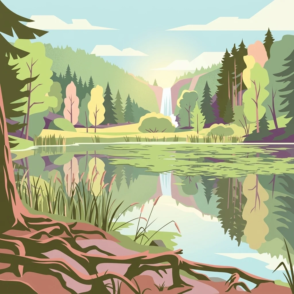
An artistic flat-style illustration showing a pond with reflective water, a waterfall in the distance, and trees including firs and deciduous trees in a valley.

Vústra

Natural monument

Park overview

Structured park overview, official facts, and landscape profile for Vústra

Vústra park facts, protected area profile, and essential visitor context

Review the core facts for Vústra, including designation, size, terrain, visitor scale, habitats, and operating context in one park-focused overview.

About Vústra

Vústra lies in a quiet section of the Bohemian sandstone landscape, on the edge of the Český ráj Protected Landscape Area. Its setting combines three distinct land elements: a small open valley bottom holding the Vústra pond and fen meadow, forested slopes dominated by spruce, and sandstone rock towers that rise above the tree line and frame the scene. Beyond the boundary of the reserve, the hill Kozlov also carries the remains of the medieval rock castle Chlum-Kozlov, adding a sense of historical depth.

Ecologically, Vústra's significance comes from its wetland habitats, which are unusual within an otherwise dry, sandstone-dominated region. The valley floor holds a slope seepage, a calcareous fen, and a still pond, producing a sequence of very different micro-environments in a tiny footprint. The reserve's purpose is to maintain this wetland biotope and the specific conditions needed by a community of specially protected plants and animals that depend on it.

The protected area is small in absolute terms, only about 2.24 to 2.26 hectares, but it is valued precisely because such intact, species-rich fens have become rare in the Czech landscape. By conserving the hydrology and vegetation of the valley, Vústra sustains both rare plants like Davall's sedge and cottongrass, and the amphibians, dragonflies, and waterbirds that rely on the pond and surrounding wet meadow.

Quick facts and research context for Vústra

Vústra is a Czech přírodní památka (natural monument) in the Liberec Region, near the villages of Olešnice and Všeň, lying on the border between the Liberec and Semily administrative districts. The reserve was declared on 1 January 1996 by the Administration of the Český ráj Protected Landscape Area and is now managed by AOPK ČR through its Liberecko regional office.

The protected area covers only about 2.24 to 2.26 hectares at an elevation of roughly 280 to 300 meters above sea level, yet it protects a disproportionately rich wetland biotope. The site consists of a small pond, a calcareous fen meadow, and a slope seepage, ringed by spruce-dominated forest, an alder grove below the dam, and sandstone rock towers that frame the valley.

Protection and recognition

Analysis of terrestrial protected area designation and recognition records

Vústra Protection Status and Documented Conservation Scope

Vústra maintains a defined terrestrial protection scope within the global conservation framework. Documented status records outline the verified management framework and administrative details for this protected natural area.

Protection details

Protection scope
Terrestrial
Park context

Deeper park guide and search-rich context for Vústra

Vústra history, landscape, wildlife, and travel context

Explore Vústra through its history, landscape character, ecosystems, wildlife, conservation priorities, cultural context, and seasonal travel timing in a structured park guide built for atlas discovery and search intent.

Why Vústra stands out

Vústra is best known as a compact wetland sanctuary within the broader Český ráj sandstone region. Its defining feature is a calcareous fen meadow paired with a small pond and seepage, surrounded by sandstone rock towers and spruce forest. The site is appreciated for its rare wetland plants such as cottongrass, marsh violet, and Davall's sedge, together with orchids like the globe flower Trollius altissimus and the marsh orchid Dactylorhiza majalis. The reserve also stands out for combining botanical richness with sightings of wetland wildlife such as grey herons, kingfishers, common toads, and several newt species, all packed into a very small area at the edge of a forested sandstone valley.
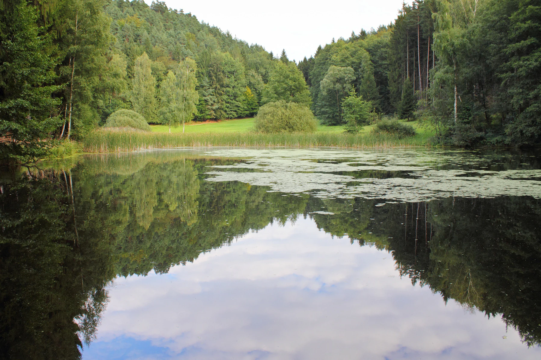
A peaceful, still pond reflecting the surrounding trees and cloudy sky, with a grassy meadow and forest in the background.
A calm pond surrounded by dense forest at the Vústra natural monument.

Vústra history and protected-area timeline

The area now known as Vústra has a long history of local habitation, visible in traditional dialect forms of its name. On older maps the locality appears as V ústře, and local residents have historically used the form Vústří, while the modern protected-area spelling uses Vústra. Local tradition links the name to the old Czech expression v ústrety, meaning opposite or facing each other, although alternative explanations connect it to the Ostrý/Ostrá hill south-west of the valley or to the abundance of sedges (ostřice).

The nature reserve itself is a product of late twentieth-century conservation policy in the Czech Republic. It was formally declared on 1 January 1996 by the Administration of the Český ráj Protected Landscape Area, responding to the high botanical and zoological value of the small wetland. Since that designation, responsibility for the site has rested with the Czech Agency for Nature Conservation and Landscape Protection (AOPK ČR), operating through its regional office for the Liberecko area.

Although the reserve is young, the cultural landscape around it is much older. The sandstone cliffs above the valley hold the ruins of Chlum-Kozlov, a medieval rock castle associated with the wider network of hilltop fortifications in the Bohemian sandstone region. Thus the modern nature monument sits within a valley that has been shaped both by human fortification and, more recently, by deliberate ecological protection.

Vústra landscape and geographic character

The valley containing Vústra is a narrow, sheltered basin set among the sandstone formations characteristic of the Český ráj region. On the valley floor, a small pond with its own earthen dam is paired with a calcareous fen meadow that develops on sloping, spring-fed ground. A surviving strip of valley-bottom alder forest (olšina) clings to the area just below the dam, contrasting with the drier slopes above.

The slopes rising around the wetland are dominated by spruce forest, giving the valley a dark, enclosed feel in many seasons. Above the tree line, the landscape opens up into the dramatic sandstone rock towers that are the geological signature of this part of Bohemia. These cliff formations define the visual character of the area and help maintain the cool, humid microclimate that supports the wetland below.

To the north, the hill called Kozlov rises above the reserve and carries the remains of the rock castle Chlum-Kozlov, linking the natural monument to a wider cultural landscape of medieval sandstone fortifications. The combination of pond, fen, alder grove, spruce forest, and sandstone cliffs gives Vústra a layered scenery in which each landscape element reinforces the next.
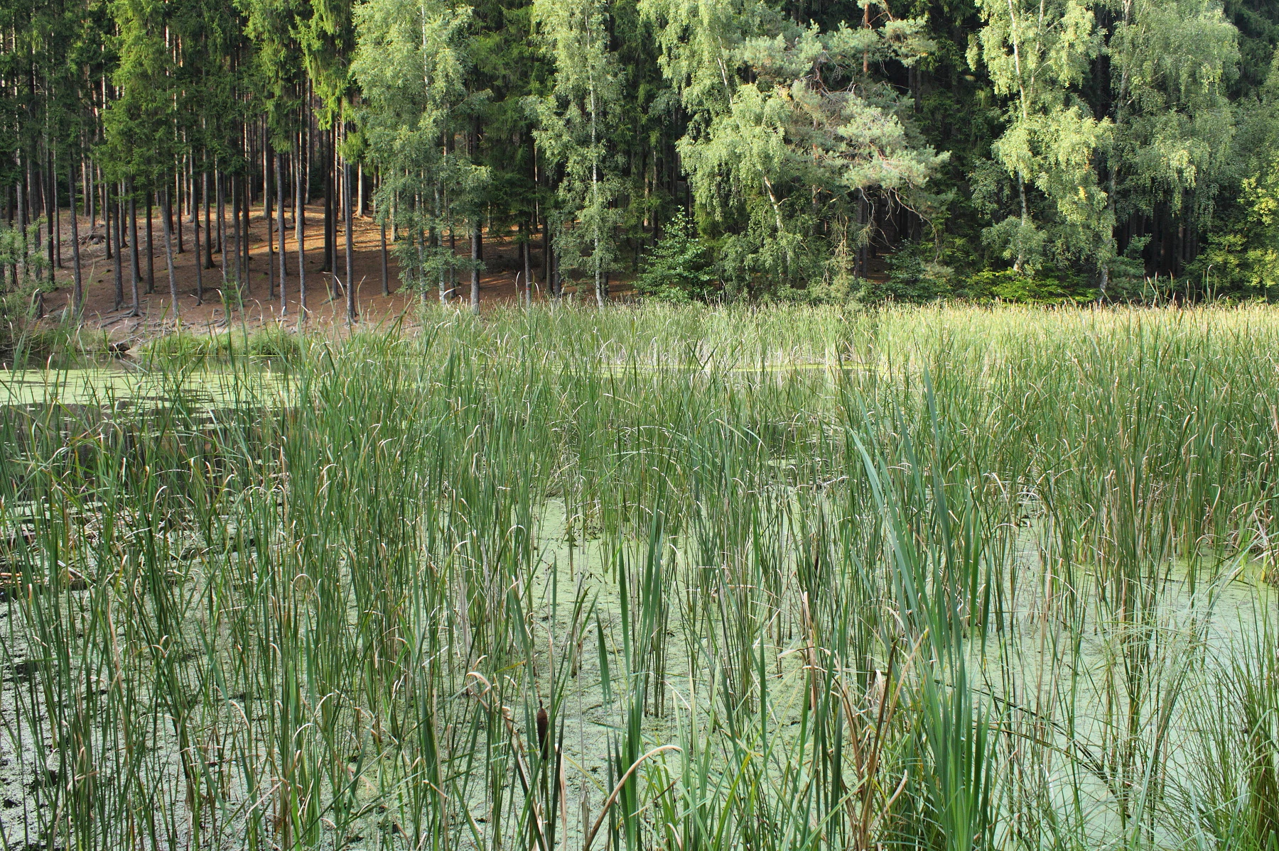
A green, pond-like wetland covered with aquatic vegetation and tall reeds, backed by a dense forest of evergreen and deciduous trees.
A view of the wetland habitat and surrounding forest at Vústra natural monument.

Vústra ecosystems, habitats, and plant life

Vústra's ecological identity is defined primarily by its wetland communities, which form a striking contrast with the drier sandstone surroundings. The pond is bordered by reedbeds that pass into open water, while the adjacent fen is maintained by regular mowing, a traditional management practice that keeps the meadow from being overgrown by shrubs and trees. Above the fen, a small slope seepage keeps soils saturated and supports plants adapted to very wet, mineral-rich conditions.

The fen hosts several rare and specially protected plant species. The Czech source highlights cottongrass (Eriophorum angustifolium), marsh violet (Viola palustris), and Davall's sedge (Carex davalliana) as characteristic of the wettest part of the habitat. A thistle-rich hay meadow extends from these core fen communities and includes the globe flower Trollius altissimus and the marsh orchid Dactylorhiza majalis, two species of particular conservation interest.

Around the wetland, the vegetation changes rapidly. The damp valley floor holds the surviving alder grove below the dam, while the slopes are cloaked in spruce forest. The transition from open water to reedbed, to fen, to hay meadow, to alder, to spruce, and finally to sandstone cliff creates a compressed sequence of habitats unusually rich for so small an area.
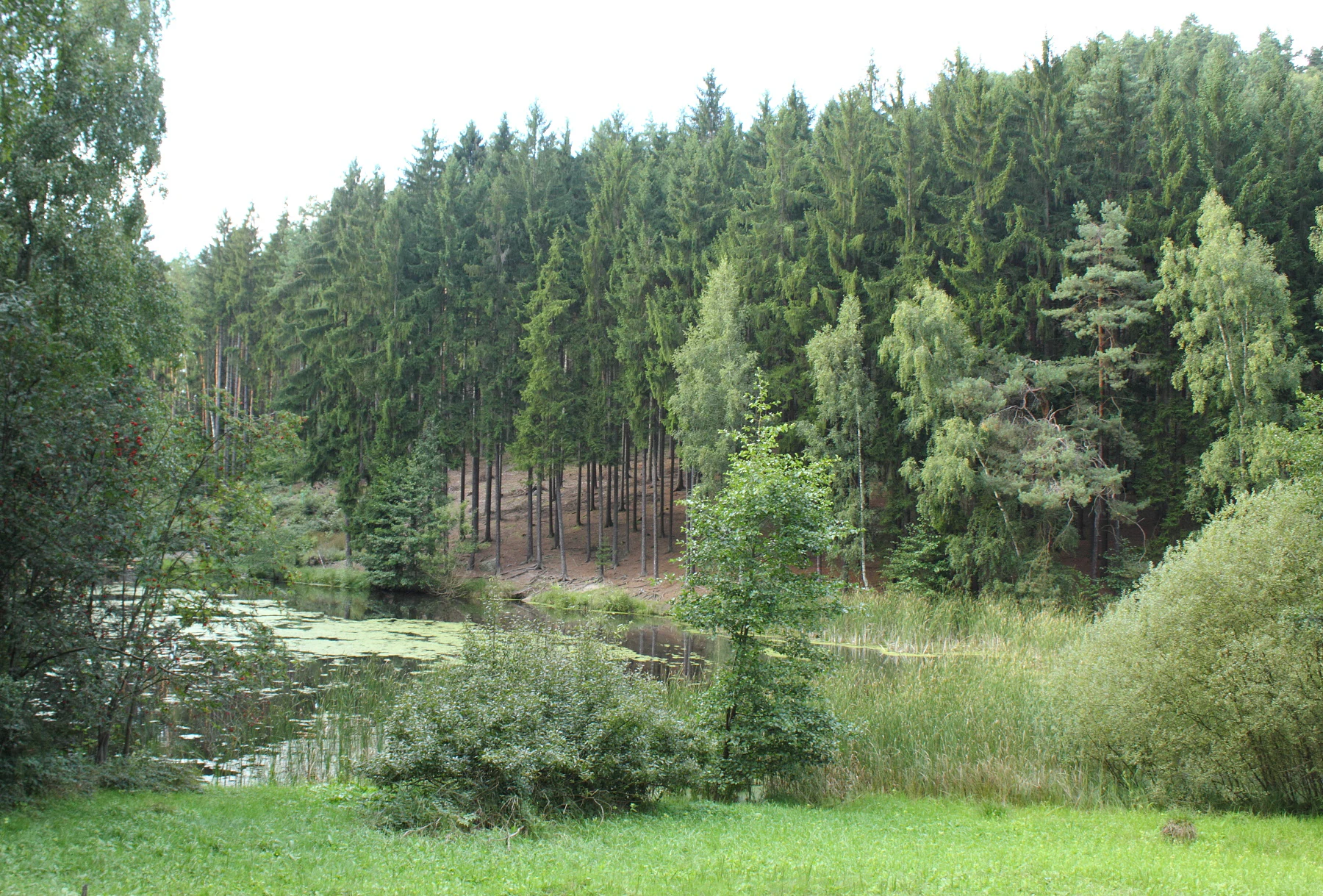
A landscape view of a small pond surrounded by a dense mixed forest and tall grasses on an overcast day in Vústra, Czech Republic.
A view of the pond and surrounding forest within the Vústra protected area.

Vústra wildlife and species highlights

The pond, reeds, and wet meadow at Vústra together host a dense community of wetland-associated animals. Over thirty vertebrate species have been recorded in the reserve. The pond itself supports fish that are managed within it, alongside populations of common toad (Bufo bufo), common frog (Rana temporaria), smooth newt (Lissotriton vulgaris), and alpine newt (Ichthyosaura alpestris), making the small waterbody an important local amphibian refuge.

The open water and reeds also attract waterbirds. Grey heron (Ardea cinerea) is regularly observed around the site, and the river kingfisher (Alcedo atthis) uses the pond and stream edges as feeding habitat. The mosaic of water, reedbed, fen, and adjacent forest allows birds, amphibians, and invertebrates to move among different microhabitats within a very short distance.

Although the reserve is too small to support the larger mammals often associated with national parks, its ecological richness lies in invertebrates, amphibians, and breeding or foraging waterbirds whose populations depend on the maintenance of this particular wetland complex.

Vústra conservation status and protection priorities

Vústra's conservation value lies in the persistence of a high-quality wetland biotope within an otherwise rocky and forested landscape where such habitats are scarce. The reserve was specifically designated to protect the wetland community and to maintain the conditions required for the survival of its specially protected plants and animals. Continuous management, especially regular mowing of the fen meadow, is essential to preventing encroachment by shrubs and trees and to sustaining the open, species-rich meadow character.

The site is officially recorded as a přírodní památka, a national category corresponding to IUCN management category IV, which recognizes it as an area managed mainly for the conservation of a particular species or habitat. Within the broader regional network, Vústra is part of the system of small protected sites administered by AOPK ČR and complements the larger Český ráj Protected Landscape Area that surrounds it.

By protecting a small but ecologically distinctive wetland, Vústra contributes to the conservation of rare sedges, orchids, and amphibians that have declined across much of Central Europe. Its preservation demonstrates the importance of safeguarding even very small, locally important natural sites alongside larger landscape-scale reserves.

Vústra cultural meaning and human context

Although Vústra is primarily a natural monument, it sits within a landscape marked by long human presence. The traditional local forms of its name, V ústře and Vústří, recorded on historical maps and still used by residents, reflect the way place names in the Bohemian countryside preserve older linguistic layers and reflect local identity.

The most visible cultural element associated with the reserve is the medieval rock castle Chlum-Kozlov, whose ruins stand on the hill Kozlov to the north of the wetland. This stronghold is part of the wider network of sandstone castles that once controlled the Český ráj region and gives the area a strong sense of historical depth, even though the castle itself lies outside the formal protected boundary of the nature monument.

The combination of a small sanctuary for rare wetland species with sandstone cliffs and a ruined fortress illustrates how nature conservation in the Czech Republic often takes place within landscapes that have been inhabited and culturally shaped for centuries.

Top sights and standout views in Vústra

Vústra compresses an unusually wide range of habitats into just over two hectares: a pond, reedbeds, calcareous fen, hay meadow, alder grove, spruce forest, and sandstone cliffs all within view of each other. The reserve is notable for rare wetland plants such as Davall's sedge, cottongrass, and the globe flower, together with breeding amphibians including alpine newts and common toads.

The site's setting at the edge of the Český ráj sandstone region, with the ruins of Chlum-Kozlov above the valley, adds cultural and scenic depth to a primarily ecological destination. For visitors interested in small, focused nature reserves rather than large national parks, Vústra offers a concentrated example of Czech wetland conservation in action.

Best time to visit Vústra

Vústra can be visited at any time of year, and the marked trail around the reserve is freely accessible. Late spring and early summer are generally the most rewarding periods, when the fen meadow is mowed on a regular cycle and the orchids and globe flowers, as well as wetland sedges, are most visible. The pond and reeds are also most active with amphibians and dragonflies during the warmer months.

In autumn, the surrounding spruce forest takes on darker tones and the sandstone towers become more visually prominent against the sky, while winter visits can offer quiet observation of waterbirds on the unfrozen sections of the pond during mild spells. Because the site is small and exposed mainly along a footpath, comfortable walking conditions are more important than any specific calendar window.

Monthly climate preview

Long-term representative averages and monthly weather patterns across Vústra

Vústra Climate Normals, Annual Temperature and Precipitation Rhythm

Recorded temperature and precipitation measurements illustrate the annual climate rhythm across sampled coordinate points in Vústra. Accessing the complete monthly profile provides detailed context on long-term thermal variations and precipitation distribution.
Annual mean8 °C
-3 °C19 °C
Jan-3°
Feb-2°
Mar
Apr
May13°
Jun17°
Jul19°
Aug18°
Sep13°
Oct
Nov
Dec-2°
Warmest month
July

18.7 °C

Coolest month
January

-3.1 °C

Wettest month
July

2.9 mm/day

Driest month
April

1.3 mm/day

Park location guide

Geography guide, regional context, and park location map for Vústra

Vústra park geography, regions, and map view in Czechia

Understand where Vústra sits in Czechia through a broader geographic reading of the surrounding landscape, nearby location context, and its mapped position within the national park landscape.

How Vústra fits into Czechia

Czech Republic is a landlocked Central European country with a population of approximately 10.9 million people. The nation was established as an independent state on January 1, 1993, following the dissolution of Czechoslovakia. Its capital and largest city is Prague, with other major urban centers including Brno, Ostrava, Plzeň, and Liberec.

Wider geography shaping Vústra in Czechia

The Czech Republic is a landlocked country in Central Europe. It is bordered by Germany to the west, Austria to the south, Poland to the northeast, and Slovakia to the southeast. The landscape is predominantly hilly, with the territory covering 78,871 square kilometers.

Map view of Vústra

Use this park location map to pinpoint Vústra in Czechia, understand its exact geographic position, and read its mapped placement within the surrounding landscape more clearly.

Pigeon | © OpenStreetMap contributors

Location context for Vústra

Semily District

Visual reference for sandstone formations, fen meadows, and habitats

Vústra Photos and Landscape Views of the Protected Wetland Sanctuary

Photographic records document the diverse habitats and dramatic sandstone scenery found within Vústra. Visual exploration reveals the unique interplay between sheltered wetland biotopes and surrounding rocky terrain.

A peaceful, still pond reflecting the surrounding trees and cloudy sky, with a grassy meadow and forest in the background.

Exposed tree roots in the foreground overlooking a pond with green algae and reeds, backed by dense forest.

A green, pond-like wetland covered with aquatic vegetation and tall reeds, backed by a dense forest of evergreen and deciduous trees.

A landscape view of a small pond surrounded by a dense mixed forest and tall grasses on an overcast day in Vústra, Czech Republic.

Park atlas

Compare regional protected landscapes and discover adjacent wetland reserves

Explore Protected Areas and Parks Near Vústra in Northern Bohemia

Browse other protected areas and reserves located near Vústra in the surrounding Bohemian sandstone landscape. Expanding the geographic view helps compare regional conservation habitats and connected natural monuments across northern Bohemia.
Natural monumentStředočeský kraj
About 4.1 km away#1 closest

Southwest

V Dubech Natural Monument: Protected Wetland Landscapes and Geography in Czech Republic

A compact wetland mosaic in the Středočeský kraj region

V Dubech is a protected natural monument situated at the base of the Příhrazské skály sandstone formations in the Czech Republic. This site preserves a valuable wetland mosaic, including base-rich peat meadows and alder woodlands that support rare species. The park provides an essential look at the localized, water-dominated geography within the broader context of the Bohemian Paradise protected landscape.

Area
0.047 km²
Established
1998
IUCN
III
Relief
Lowland
Natural monumentKrálovéhradecký kraj
About 4.8 km away#2 closest

South

Meziluží Natural Monument: Mapping Protected Landscape Geography in Královéhradecký Kraj

A study of sandstone terrain and historic conservation within the Bohemian Paradise

Meziluží provides a detailed look at the geography of small-scale protected sites in the Czech Republic. By analyzing its steep sandstone slopes and traditional orchard-pasture land use, users gain a clearer understanding of the complex relationship between regional geology and botanical conservation history in the Bohemian Paradise area.

Area
0.015 km²
Established
1997
Relief
Upland
Scope
Terrestrial
Watercolor painting showing a river, grassy banks, scattered trees, and distant hills
Protected landscapeCzechia
About 5.4 km away#3 closest

Southeast

Bohemian Paradise Protected Landscape: Discover Czech Republic's Sandstone Geology and Park Boundaries

Mapped sandstone formations and historic regional geography.

Delve into Bohemian Paradise, a protected landscape in the Czech Republic celebrated for its dramatic sandstone rock formations and ancient castles. This detailed entry provides context on its unique geological character, the extent of its protected boundaries, and its significant position within the regional geography. Explore the mapped terrain and understand the atlas value of this historic protected area.

Area
181.17 km²
Established
1955
IUCN
V
Relief
Upland
Natural monumentCentral Bohemian Region
About 10 km away#4 closest

West

Vrch Káčov Natural Monument: Mapped Geological Features in Central Bohemia

Volcanic rock formations and regional terrain context

Vrch Káčov is a designated natural monument preserving a unique volcanic hill and rock suk in the Central Bohemian Region. Its landscape is defined by contact metamorphism and porcelanite formations, offering a concentrated look at the geological evolution of the Jičínská pahorkatina hill country. The site provides a valuable reference for analyzing protected Bohemian terrain and its surrounding geographic characteristics.

Area
0.019 km²
Established
1953
IUCN
III
Relief
Upland
A watercolor illustration of rolling hills with a treeline and meadow, featuring soft green and orange tones on a white background.
Natural monumentKrálovéhradecký kraj
About 11 km away#5 closest

Southeast

Na víně Natural Monument: Protected Opoka Slopes and Botanical Geography in Královéhradecký kraj

Geographic atlas and ecological profile of a protected Czech natural monument

Na víně represents an essential, small-scale protected landscape in the Jičín District of Královéhradecký kraj. This site is defined by its characteristic calcareous opoka hill slopes and its role as a botanical refuge for rare, thermophilous species. By mapping the interaction between the underlying Cretaceous geology and the surviving dry grassland communities, this analysis highlights the importance of localized conservation within the broader Bohemian Cretaceous Basin.

Area
0.055 km²
Established
1990
IUCN
IV
Relief
Upland
A soft watercolor illustration of a rolling natural landscape with green trees, distant hills, and gentle colors on a white background.
Natural monumentLiberec Region
About 12 km away#6 closest

Northeast

Na Vápenici Natural Monument: Geological Mapping and Protected Landscape Analysis

Calcareous outcrops and rare forest microhabitats in the Liberec Region

Na Vápenici represents a focused example of geological diversity, where a distinct limestone outcrop supports unique vegetation and paleontological richness. This natural monument provides a case study for understanding how isolated calcareous substrates contribute to the broader ecological health and terrain character of the Liberec Region.

Area
0.079 km²
Established
2008
IUCN
IV
Relief
Upland
A soft watercolor illustration depicting a riverbank with light green trees and a prominent rocky outcrop or cliff face near the water.
Natural monumentCentral Bohemian Region
About 13 km away#7 closest

West

Skalní sruby Jizery Natural Monument: Sandstone Landforms and River Geography

Protected riparian sandstone terrain in the Central Bohemian Region

This natural monument protects a rare geological formation along the Jizera River, where lateral erosion has created an extensive sandstone rock shelter. The site showcases advanced pseudokarst weathering and supports a dense concentration of botanical and avian diversity within its two-hectare boundary in the Central Bohemian Region.

Area
0.02 km²
Established
1979
IUCN
III
Relief
Upland
Watercolor illustration of sandstone rock towers and coniferous trees in a landscape setting with a light color palette.
Nature reserveKrálovéhradecký kraj
About 15 km away#8 closest

Southeast

Prachovské skály Nature Reserve: Geologic Atlas of Bohemian Sandstone Formations

Mapped sandstone towers and protected forest terrain in Královéhradecký kraj

Prachovské skály consists of a concentrated sandstone massif characterized by towering pinnacles and labyrinthine gorges. This nature reserve serves as a prime example of sedimentary erosion in the Bohemian Paradise region, offering a distinct landscape profile that stands in sharp contrast to the surrounding agricultural plains of the Czech Republic.

Area
2.624 km²
Established
1928
IUCN
IV
Visitors
300K annual

Common questions about visiting, size, designation, and location context for Vústra

Vústra FAQs for park facts, access, geography, and protected area context

Find quick answers about Vústra, including protected-area facts, park geography, trail and visitor context, and how the park fits into its surrounding country and regional landscape.
MoriAtlas Explorer

Continue Your Protected Areas Search Across the Global Atlas

Deepen your exploration by continuing the structured search for national parks and protected areas worldwide. Utilize the comprehensive filtering capabilities to compare different conservation landscapes and refine your understanding of global park geography. Discover more about the distribution and characteristics of protected natural areas.

Global natural geography