
Mori Atlas logo
Nature reserveFFH-Gebiet Wälder an der Bondenau

A historic protected landscape within the Angeln peninsula glacial valley and forest mosaic

FFH-Gebiet Wälder an der Bondenau: Mapping Protected Deciduous Forests in Northern Germany

FFH-Gebiet Wälder an der Bondenau represents a vital network of protected deciduous woodlands in the northern German state of Schleswig-Holstein. Spanning fragmented forest blocks near the Angeln peninsula, this nature reserve is defined by documented beech, oak-hornbeam, and floodplain alder-ash communities rooted in the region's ancient glacial tunnel valley terrain. These protected landscapes offer a clear geographic window into the historic continuity of Northern German lowlands.

deciduous forestbeech forestoak-hornbeam forestfloodplain woodlandNatura 2000FFH-Gebiet
A flat vector illustration showing a winding dirt path and a river flowing through a green meadow, flanked by pine trees, with large reddish rock formations and a waterfall in the background.

FFH-Gebiet Wälder an der Bondenau

Nature reserve

Park overview

Structured park overview, official facts, and landscape profile for FFH-Gebiet Wälder an der Bondenau

FFH-Gebiet Wälder an der Bondenau park facts, protected area profile, and essential visitor context

Review the core facts for FFH-Gebiet Wälder an der Bondenau, including designation, size, terrain, visitor scale, habitats, and operating context in one park-focused overview.

About FFH-Gebiet Wälder an der Bondenau

FFH-Gebiet Wälder an der Bondenau (Natura 2000 site DE-1223356) is a protected forest area in the northern German state of Schleswig-Holstein, located in the Kreis Schleswig-Flensburg within the municipality of Mittelangeln. The site lies in the Angeln peninsula, a culturally and geologically distinctive region that forms part of the broader Schleswig-Holsteinisches Hügelland. Glacial processes during the last Ice Age shaped the underlying tunnel valley of Niesgrau-Frörup, in which the forests are positioned south of the small Bondenau river.

Although modest in size at about 126 hectares, the site is composed of three separate woodland areas northwest of Satrup: the western Obdrupholzkoppel (Obdrup Skovkobbel in Danish), the central Hasenholz (Hareskov) together with Jeßlundholz (Jeslundkobbel), and the eastern Kleine Holzkoppel with Norderholz and Küsterwiese. These names reflect the region's Danish and Low German heritage and signal the long continuity of forest cover in this part of Schleswig. Indeed, all three forest blocks appear on Johann Heinrich Christian du Plat's 1805 map of the Duchy of Schleswig, confirming that the woods have been recognized and used for at least two centuries.

The site's ecological significance lies in its nearly pure composition of deciduous tree species. Beech forests of the Hainsimsen and Waldmeister types dominate, with oak-hornbeam communities of the Sternmieren-Eichen-Hainbuchenwald type also present. A small but ecologically valuable priority habitat of alder, ash, and softwood floodplain woodland (Auwald) occurs in the Norderholz and Kleine Holzkoppel sections along the Bondenau. Because the area is owned and managed by the Schleswig-Holsteinische Landesforsten, conservation is integrated with active forest stewardship rather than left as untouched wilderness.

Culturally, the area contains two recorded archaeological earthwork monuments: a burial mound remnant in Norderholz with the monument number aKD-ALSH-Nr. 003 843, and a burial mound in Küsterwiese (aKD-ALSH-Nr. 003 842), as well as an additional burial mound remnant that is not formally listed. Together with the Norderholz memorial stone commemorating Kaiser Wilhelm I, these features give the forest an additional layer of historical depth. Although there are no visitor signs marking the FFH boundary and no public information leaflet has been published, the site is quietly valued as one of many small but well-monitored forest reserves in Schleswig-Holstein's Natura 2000 network.

Quick facts and research context for FFH-Gebiet Wälder an der Bondenau

FFH-Gebiet Wälder an der Bondenau is a Natura 2000 Habitats Directive site (FFH-Gebiet) of about 126 ha in Schleswig-Holstein, northern Germany. The area lies in the Angeln peninsula, within the Schleswig-Holsteinisches Hügelland, and consists of three historic forest blocks: Obdrupholzkoppel, Hasenholz with Jeßlundholz, and Kleine Holzkoppel with Norderholz and Küsterwiese. The site ranges in elevation from about 30 m to 41.8 m above sea level. Ownership and management rest with the Schleswig-Holsteinische Landesforsten (SHLF), the state forest administration, which applies special management guidelines for Natura 2000 areas. The official standard data form was issued in May 2004, and the area was confirmed by the European Union as a Site of Community Importance in November 2007 before being designated a Special Area of Conservation in January 2010.

Protection and recognition

Review documented protection metrics and official international recognition records

FFH-Gebiet Wälder an der Bondenau Protection Status and Recognition

Protected area records for FFH-Gebiet Wälder an der Bondenau compile official conservation status and administrative tracking numbers. Global database entries outline baseline recognition data without assuming management outcomes.

Protection details

WDPA ID
555517787
Park context

Deeper park guide and search-rich context for FFH-Gebiet Wälder an der Bondenau

FFH-Gebiet Wälder an der Bondenau history, landscape, wildlife, and travel context

Explore FFH-Gebiet Wälder an der Bondenau through its history, landscape character, ecosystems, wildlife, conservation priorities, cultural context, and seasonal travel timing in a structured park guide built for atlas discovery and search intent.

Why FFH-Gebiet Wälder an der Bondenau stands out

The area is best known for its ancient, well-documented deciduous forest stands of the Angeln peninsula. The protection focus lies on Hainsimsen beech forests, Waldmeister beech forests, and Sternmieren oak-hornbeam forests, supplemented by priority alluvial alder and ash floodplain woodland. The forests also carry cultural and historical value, as they are already depicted on early 19th-century maps of the Duchy of Schleswig and contain archaeological burial mound remains. Together, these qualities make the site a representative example of lowland forest conservation in northernmost Germany, embedded in the glacial tunnel valley landscape of Niesgrau-Frörup.
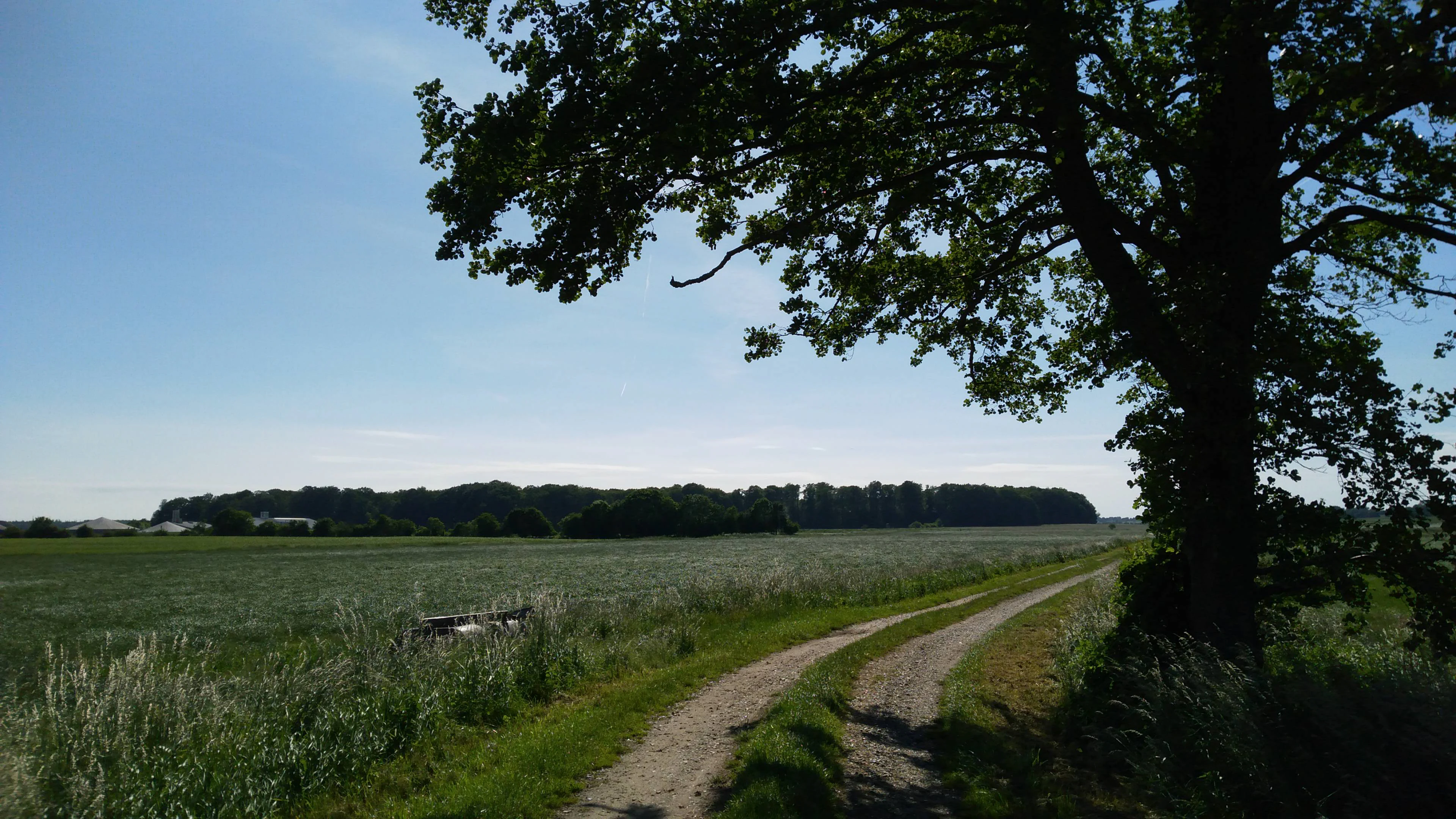
A dirt path winds through a green field with a large tree on the right and a forest line in the distance under a clear blue sky.
A dirt track curves through a grassy meadow towards a distant forest line, framed by a large tree in the foreground.

FFH-Gebiet Wälder an der Bondenau history and protected-area timeline

The history of the Wälder an der Bondenau area as a documented landscape extends back more than two centuries. The three separate woodland blocks that make up today's FFH-Gebiet already appear on Johann Heinrich Christian du Plat's 1805 cartographic work on the Duchy of Schleswig, under Danish-influenced names such as Obdrup Skovkobbel, Hareskov, and Jeslundkobbel. This early cartographic record confirms continuous forest presence and gives the area a high degree of historical continuity.

In modern administrative terms, the Natura 2000 standard data form for the site was prepared in May 2004 by the Landesamt für Landwirtschaft, Umwelt und ländliche Räume (LLUR) of Schleswig-Holstein. The area was proposed as a Site of Community Importance (GGB) to the European Union in September 2004, confirmed in that role by the EU in November 2007, and formally designated a Besonderes Erhaltungsgebiet (Special Area of Conservation) in January 2010 under German federal and state nature conservation law.

In April 2011, the Ministry for Agriculture, Environment and Rural Areas of Schleswig-Holstein published the site's management plan, setting out the framework for ongoing conservation. Between 2007 and 2012, the first follow-up mapping of biotope and habitat types was completed and became the basis for the current May 2017 standard data form. A targeted conservation measure taken by the state forest administration in July 2020 was the partial fencing of the Waldmeister beech forest section east of the forest road in Obdrupholzkoppel, using a wildlife protection fence to reduce browsing damage to young beech regeneration.

FFH-Gebiet Wälder an der Bondenau landscape and geographic character

The landscape of FFH-Gebiet Wälder an der Bondenau is shaped by the gentle topography of the Angeln peninsula, part of the broader Schleswig-Holsteinisches Hügelland. The site itself spans a narrow altitudinal range from about 30 m above sea level at the northern tip of the Obdrupholzkoppel forest to 41.8 m at the southern edge of the Küsterwiese woodland. This modest relief reflects the regional character of Angeln, classified by the Federal Agency for Nature Conservation as a landscape area of lesser overall landscape significance but still hosting ecologically valuable forest fragments.

Underlying the forests is a glacial tunnel valley, the Niesgrau-Frörup Rinne, formed during the last Ice Age. This geological feature helps explain the mosaic of soils, moisture conditions, and habitat types encountered across such a relatively small protected area. The Bondenau stream itself runs along the northern edge of the forests, shaping local hydrology and supporting the small floodplain woodland communities within the site.

The visual character of the area is that of a classic northern German lowland forest: closed deciduous canopies, internal forest roads, occasional forest ponds such as the small Waldteich at the end of a forest track in the Obdrupholzkoppel, and forest entrances marked only by the simple boundary signs of the Schleswig-Holstein state forests. Although modest in scenic drama, these forests are visually characteristic of the low, rolling countryside between the Schlei inlet and the Flensburg fjord.
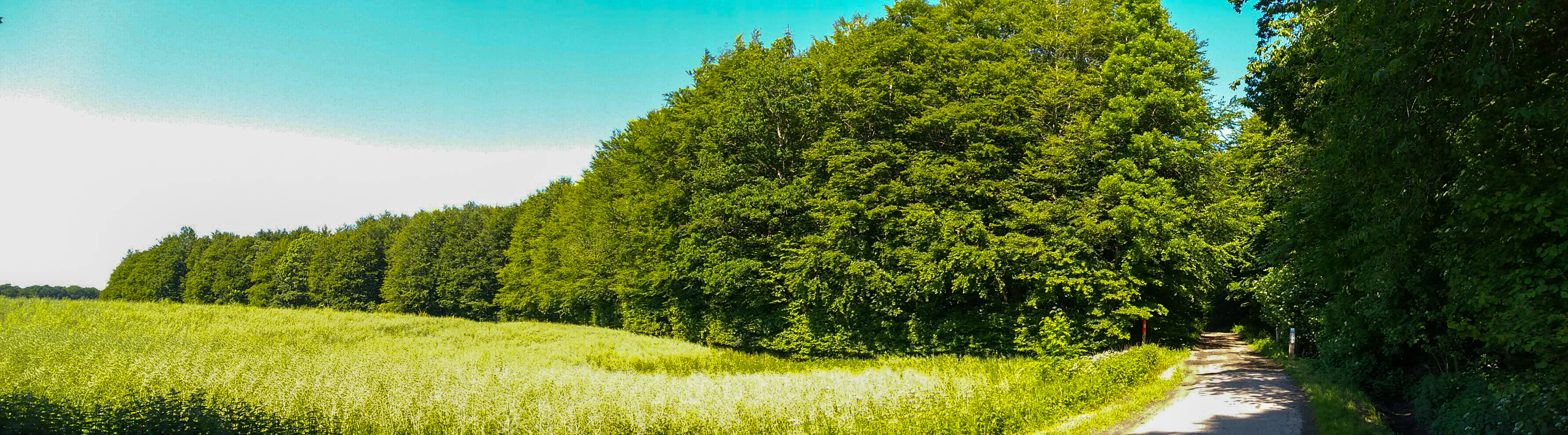
A panoramic view of a narrow path leading into a dense green deciduous forest, with a bright green field in the foreground and a blue sky with light clouds above
West entrance to the Norderholz forest area along a narrow path bordered by a green field and dense deciduous trees

FFH-Gebiet Wälder an der Bondenau ecosystems, habitats, and plant life

Ecologically, the FFH-Gebiet Wälder an der Bondenau is overwhelmingly a deciduous forest landscape, with coniferous trees playing only a minor role. Four formal habitat types are reported under the EU Habitats Directive: Hainsimsen beech forest (9110), Waldmeister beech forest (9130), Sternmieren oak-hornbeam forest (9160), and the priority habitat type of alder, ash and softwood floodplain woodland (91E0).

The beech and oak forests correspond to well-known central European lowland forest communities adapted to glacial moraine and till soils. The presence of both drier beech woodland types on the higher ground and a small, ecologically important floodplain community along the Bondenau gives the relatively compact area a meaningful ecological gradient. The small Auwald remnant, first mapped in the 2012 follow-up monitoring in the 306 and 307 compartments of the Norderholz and in the Kleine Holzkoppel, is especially significant because habitat type 91E0 is a priority type under the Habitats Directive.

Three of the four habitat types, the two beech forest types and the oak-hornbeam type, were officially declared FFH-Erhaltungsziele, or conservation targets, indicating they are considered particularly important for the site's long-term integrity. Conservation status across these habitats, as reported in the May 2017 standard data form, is largely classified as good (B), with some areas in insufficient condition (C) and a narrow strip of very good Waldmeister beech forest along the northern edge of the Obdrupholzkoppel noted in the earlier 2006 assessment.
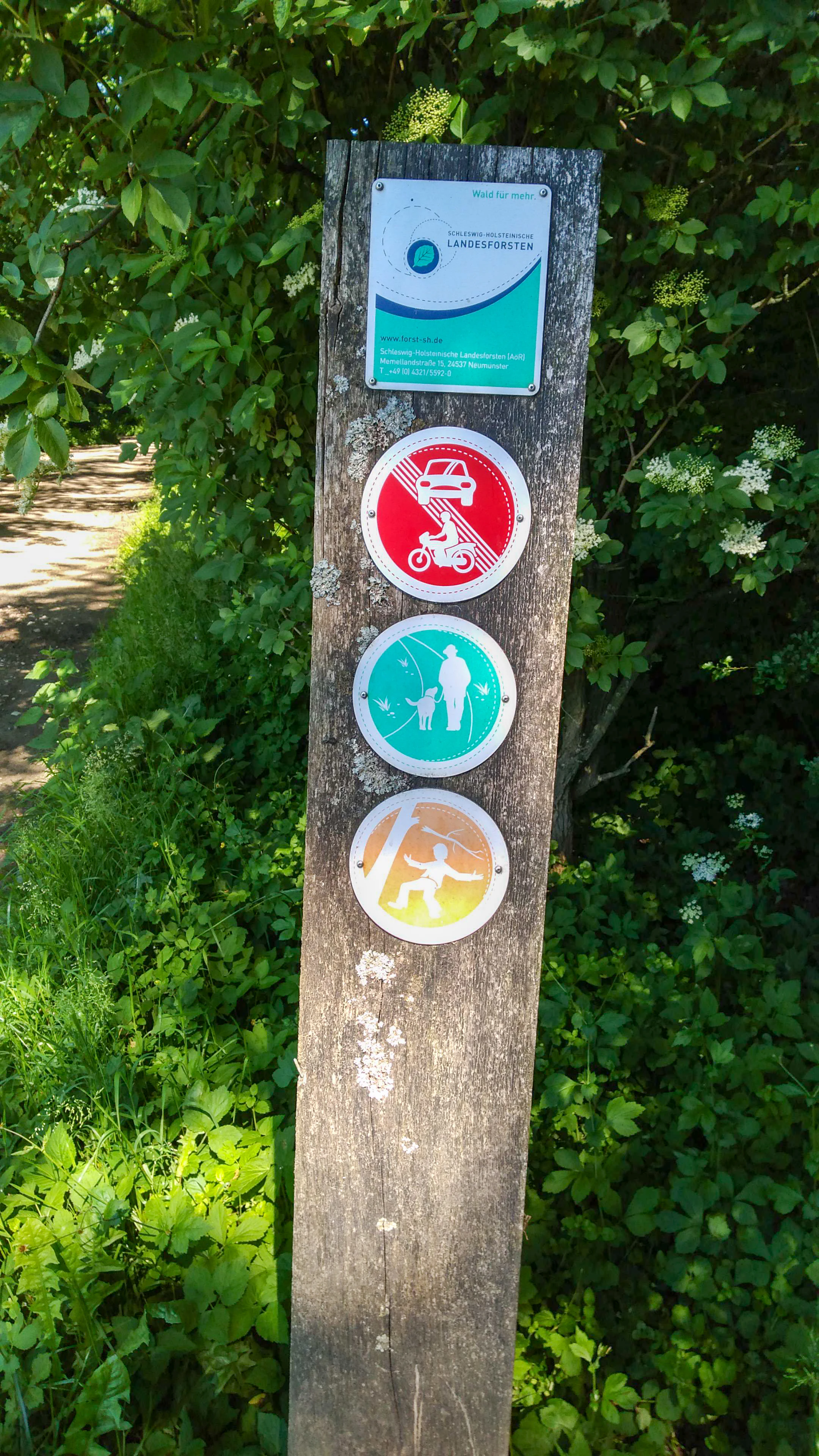
A wooden post with a rectangular sign for Schleswig-Holstein State Forests and three circular signs indicating no motor vehicles, allowed pedestrian and dog walking, and hiking.
Wooden signpost with forest usage signs at the entrance to Norderholz forest.

FFH-Gebiet Wälder an der Bondenau wildlife and species highlights

The wildlife profile of the Wälder an der Bondenau is not primarily about charismatic mammals or birds but about the broader ecological integrity of mature lowland deciduous forest. The site provides habitat continuity and structural complexity typical of old beech and oak stands, including fallen wood, shaded forest interiors, and small open water features such as the Waldteich.

Forest management concerns identified in the source material relate primarily to browsing pressure on young beech regeneration. The state forest administration has responded by erecting a wildlife protection fence in part of the Obdrupholzkoppel to reduce damage from browsing animals, an indication that ungulate management is part of the conservation strategy. The Bondenau stream corridor also offers a small but distinct alluvial habitat supporting the priority floodplain woodland community.

Because the site is small, quiet, and embedded in an agricultural and forested regional landscape, its broader ecological value rests more on habitat representation and connectivity within the Schleswig-Holstein forest network than on hosting large mammal or bird populations distinctive to the area.
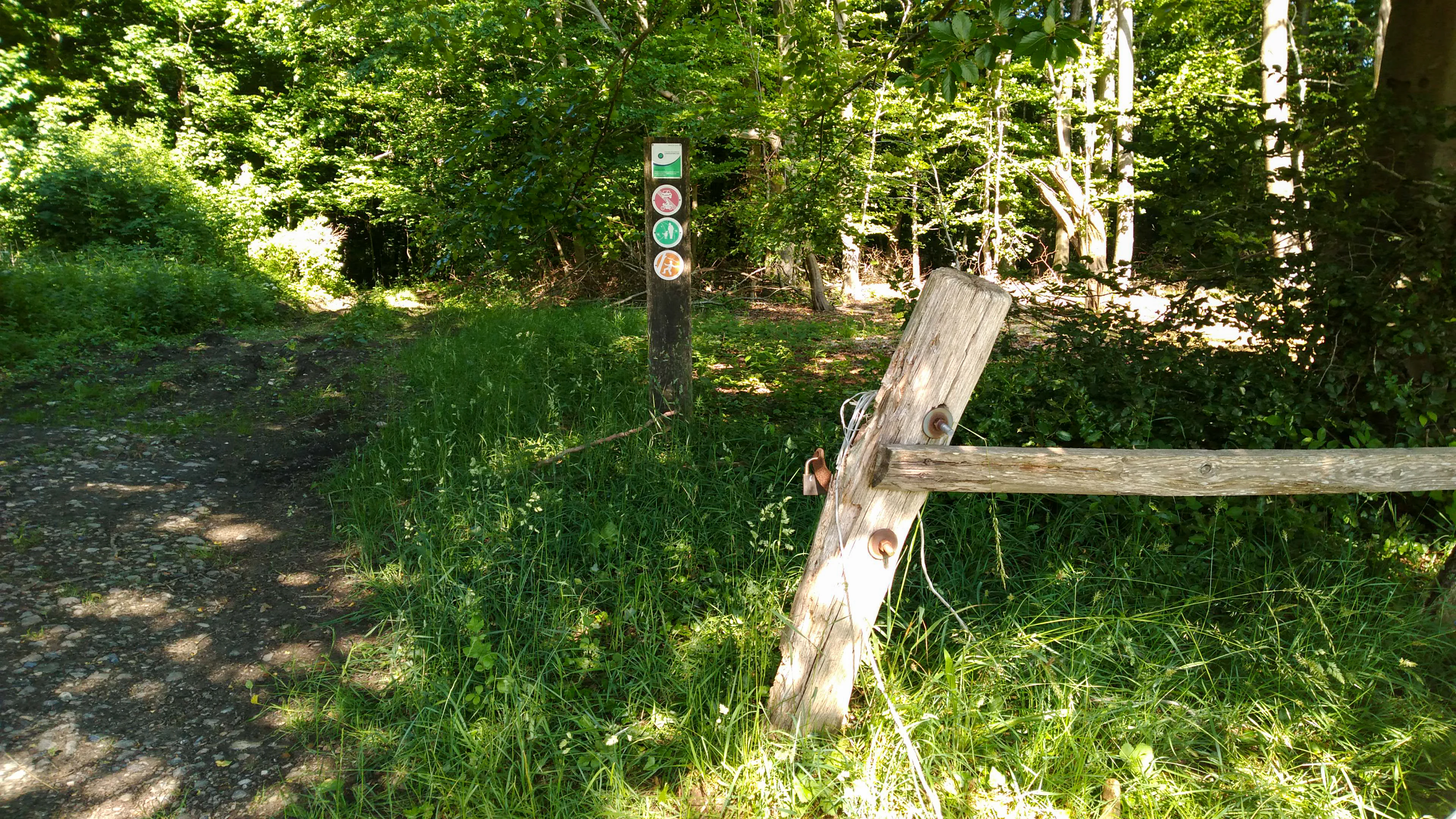
A dirt path enters a dense green forest, flanked by a wooden post with colorful circular trail markers and a rustic wooden barrier gate in the foreground.
A dirt path leading into a green forest, marked by a trail signpost and a rustic wooden barrier.

FFH-Gebiet Wälder an der Bondenau conservation status and protection priorities

The fundamental conservation purpose of the Wälder an der Bondenau is the long-term preservation of representative lowland deciduous forest habitat types in compliance with the European Union's Habitats Directive. As an FFH-Gebiet (Fauna-Flora-Habitat-Gebiet), the site sits within the EU Natura 2000 network, a coordinated system of protected areas designed to safeguard threatened habitat types and species across member states.

The official conservation targets focus on three of the woodland habitat types present: Hainsimsen beech forest, Waldmeister beech forest, and Sternmieren oak-hornbeam forest. The site also contains the priority habitat alder-ash-softwood floodplain woodland, which receives special attention under EU law. Conservation status for the three main targets is assessed as good overall, while parts of the area are in insufficient condition and a small strip of high-quality Waldmeister beech forest has been documented.

Active conservation measures include rewetting by removing drainage ditches and pipes, restoration of natural hydrology by raising groundwater levels, and the gradual replacement of conifer plantations with deciduous woodland in line with the management principles of the Schleswig-Holsteinische Landesforsten for Natura 2000 forests. Continuous monitoring through sample-based follow-up mapping and the May 2017 standard data form update ensures that conservation outcomes are tracked over successive reporting cycles.

FFH-Gebiet Wälder an der Bondenau cultural meaning and human context

The cultural setting of Wälder an der Bondenau is closely tied to the Angeln peninsula, a historically Danish-influenced region that became part of the Duchy of Schleswig and later the German state of Schleswig-Holstein. The traditional Danish and Low German place names for the woodland blocks, Obdrup Skovkobbel, Hareskov, Jeslundkobbel, and Norderholz, reflect this layered cultural history and indicate long-standing local recognition of these forest areas.

The area carries archaeological significance as well. Two registered archaeological earthwork monuments are recorded within the FFH-Gebiet: a burial mound remnant in the Norderholz, listed under monument number aKD-ALSH-Nr. 003 843, and a further burial mound (aKD-ALSH-Nr. 003 842) in the Küsterwiese. An additional burial mound remnant in the Norderholz is also documented though not formally listed. A memorial stone commemorating Kaiser Wilhelm I can be found in the Norderholz as well.

These elements combine to give the site a quiet cultural depth. Although the forests are not heavily promoted as a historical attraction and the FFH boundary is not marked with visitor information, the area's historic forest names, ancient burial mounds, and 19th-century commemorative stones illustrate the long interplay between people and woodland in this corner of northern Germany.
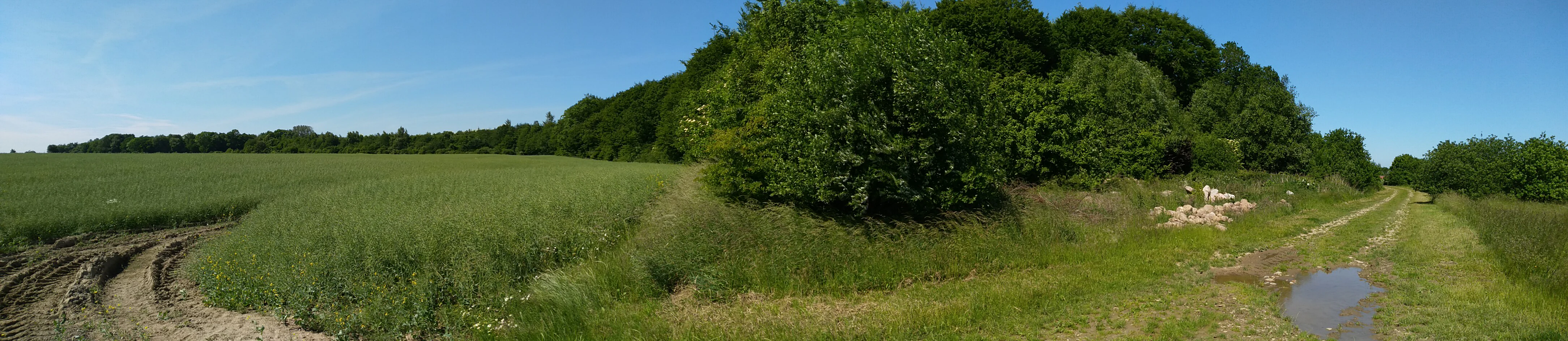
Panoramic view of a rural landscape showing a green agricultural field with tire tracks on the left, a dirt path with a small puddle on the right, and a dense line of deciduous trees forming a forest edge in the background under a clear blue sky.
Southern end of the Obdrupholzkoppel beech forest, showing the forest edge meeting open agricultural fields with dirt tracks.

Top sights and standout views in FFH-Gebiet Wälder an der Bondenau

FFH-Gebiet Wälder an der Bondenau stands out for combining historic woodland continuity, well-documented deciduous forest habitat types, and a modest but ecologically meaningful floodplain community along the Bondenau stream. Its three separate beech and oak forest blocks, already mapped in 1805, illustrate the long stability of forest cover in the Angeln peninsula.

The priority status of its alder-ash floodplain woodland under EU law, its network of small forest roads and ponds, and the presence of prehistoric burial mounds in the forest interior add further distinctiveness. The site's integration into a single state forest ownership under the Schleswig-Holsteinische Landesforsten allows coordinated conservation management, including hydrological restoration, conifer-to-deciduous conversion, and targeted wildlife protection.
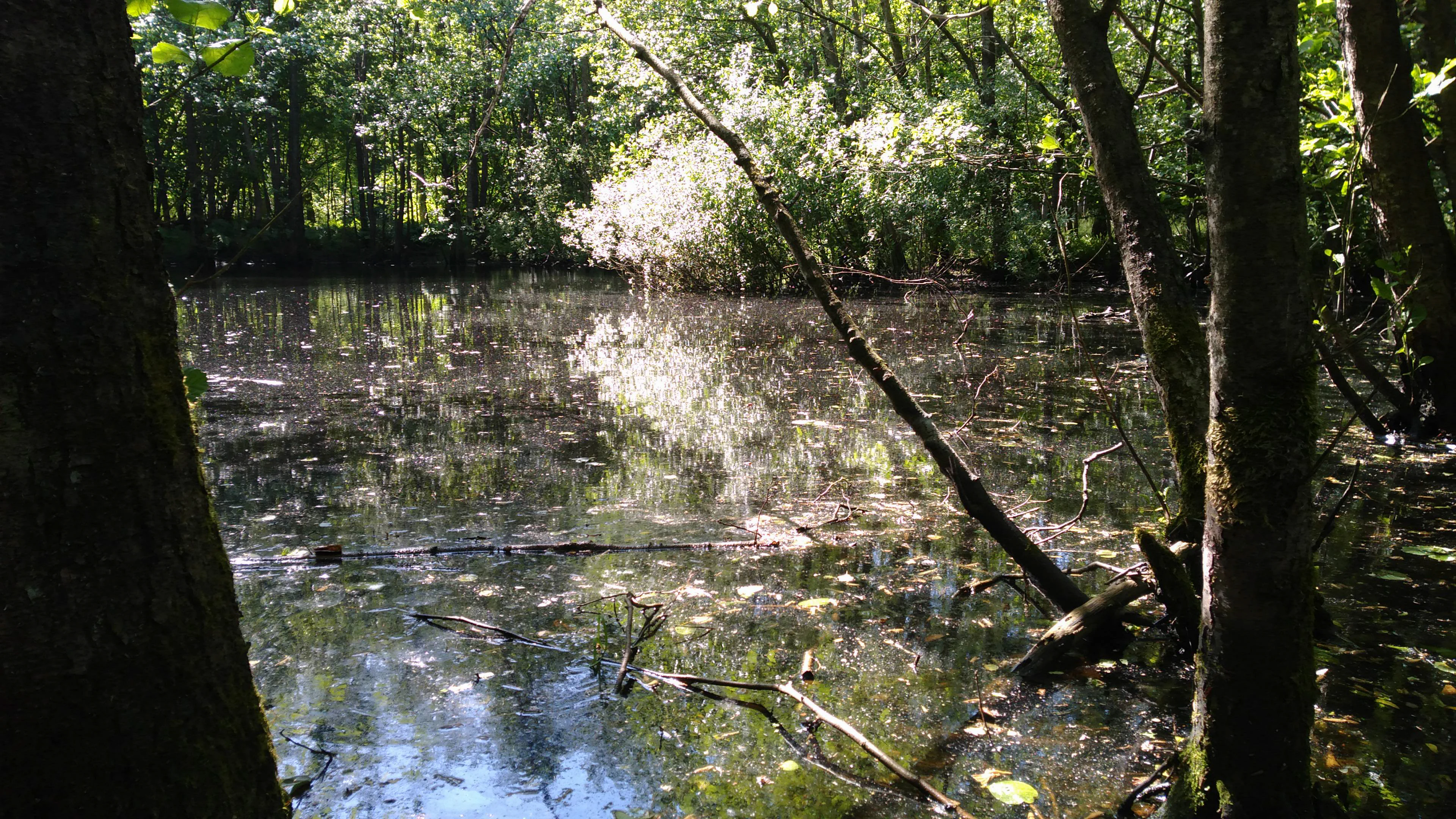
A view of a dark forest pond with floating debris, framed by tree trunks on the left and right, with sunlight illuminating the trees in the background.
A forest pond in the Obdrupholzkoppel beech forest, framed by tree trunks.

Best time to visit FFH-Gebiet Wälder an der Bondenau

Because the Wälder an der Bondenau is a lowland deciduous forest in northernmost Germany, its atmosphere shifts with the seasons in ways common to such landscapes. Late spring and early summer bring fresh green beech and oak foliage and active forest understory growth, while autumn produces the most striking visual change as the broadleaf canopy turns color and forest paths become softer under fallen leaves. Summer days are longest, offering more time to explore the separate forest blocks, though forest interiors remain cool and shaded.

In winter, the bare deciduous structure reveals the gentle relief of the Angeln peninsula, the shape of the tunnel valley, and the boundary of the small floodplain community along the Bondenau. Visitors should be aware that this is an active state forest with no formal FFH visitor signage, no published information leaflet, and only simple SHLF boundary signs at the forest entrances.

Monthly climate preview

Long-term temperature ranges and monthly precipitation averages recorded across representative park coordinates

FFH-Gebiet Wälder an der Bondenau Climate Normals and Annual Weather Patterns

Representative coordinates record measured monthly temperature fluctuations and precipitation averages spanning the year at FFH-Gebiet Wälder an der Bondenau. Examining the complete twelve-month climatology profile reveals deeper numerical context regarding historical temperature and moisture patterns across the protected landscape.
Annual mean9 °C
1 °C17 °C
Jan
Feb
Mar
Apr
May12°
Jun15°
Jul17°
Aug17°
Sep14°
Oct10°
Nov
Dec
Warmest month
August

17.4 °C

Coolest month
January

1.3 °C

Wettest month
August

2.7 mm/day

Driest month
April

1.4 mm/day

Park location guide

Geography guide, regional context, and park location map for FFH-Gebiet Wälder an der Bondenau

FFH-Gebiet Wälder an der Bondenau park geography, regions, and map view in Germany

Understand where FFH-Gebiet Wälder an der Bondenau sits in Germany through a broader geographic reading of the surrounding landscape, nearby location context, and its mapped position within the national park landscape.

How FFH-Gebiet Wälder an der Bondenau fits into Germany

Germany is a federal republic in Western and Central Europe with a population of over 83 million across sixteen constituent states. It is Europe's largest economy by nominal GDP and a major global exporter and importer. The capital is Berlin, and the country borders Denmark, Poland, Czech Republic, Austria, Switzerland, France, Luxembourg, Belgium, and the Netherlands.

Wider geography shaping FFH-Gebiet Wälder an der Bondenau in Germany

Germany is located in Western and Central Europe, spanning 357,022 km². It borders Denmark to the north, Poland and the Czech Republic to the east, Austria and Switzerland to the south, and France, Luxembourg, Belgium, and the Netherlands to the west. The country has coastlines on the Baltic Sea and North Sea to the north, with the Alps located in the southern region.

Map view of FFH-Gebiet Wälder an der Bondenau

Use this park location map to pinpoint FFH-Gebiet Wälder an der Bondenau in Germany, understand its exact geographic position, and read its mapped placement within the surrounding landscape more clearly.

Pigeon | © OpenStreetMap contributors

Location context for FFH-Gebiet Wälder an der Bondenau

Schleswig-Holstein

Visualizing ancient deciduous forest habitats, lowland terrain, and protected woodlands

FFH-Gebiet Wälder an der Bondenau Photos and Mapped Landscape Scenery

Examinations of FFH-Gebiet Wälder an der Bondenau reveal closed canopies, ancient beech stands, and glacial stream environments across the Angeln peninsula. Photographic documentation clarifies protected woodland structures, soil moisture mosaics, and regional conservation characteristics.

A dirt path winds through a green field with a large tree on the right and a forest line in the distance under a clear blue sky.

A sunny view from a dense green forest looking out over a valley with a small stream and a distant field under a blue sky.

A panoramic view of a narrow path leading into a dense green deciduous forest, with a bright green field in the foreground and a blue sky with light clouds above

A wooden post with a rectangular sign for Schleswig-Holstein State Forests and three circular signs indicating no motor vehicles, allowed pedestrian and dog walking, and hiking.

A dirt path enters a dense green forest, flanked by a wooden post with colorful circular trail markers and a rustic wooden barrier gate in the foreground.

A narrow stream flows through a green grassy meadow with a forest line in the distance under a clear blue sky.

Panoramic view of a rural landscape showing a green agricultural field with tire tracks on the left, a dirt path with a small puddle on the right, and a dense line of deciduous trees forming a forest edge in the background under a clear blue sky.

A view of a dark forest pond with floating debris, framed by tree trunks on the left and right, with sunlight illuminating the trees in the background.

Park atlas

Compare nearby regional forests and connected northern German conservation landscapes.

Explore Protected Areas and Parks Near FFH-Gebiet Wälder an der Bondenau

Browse other protected areas and lowland forests situated across the surrounding Angeln peninsula region. Compare regional park geography to understand the broader network of deciduous woodland habitats.
Nature reserveSchleswig-Holstein
About 10 km away#1 closest

West

FFH-Gebiet Wald-, Moor- und Heidelandschaft der Fröruper Berge und Umgebung Landscape Profile

Glacial moraine ridges and wetland mosaic in Schleswig-Holstein.

Analyze the protected boundaries and natural terrain of this German nature reserve. The site hosts a rare combination of beech woodland, transition mires, and sandy inland dunes that represent the complex ecological transition within the Obere Treenelandschaft region.

Area
9.4 km²
Established
2004
Relief
Upland
Climate
Temperate
Nature reserveSchleswig-Holstein
About 16 km away#2 closest

South

FFH-Gebiet Wellspanger-Loiter-Oxbek-System und angrenzende Wälder Protected Landscapes

Schleswig-Holstein nature reserve map and geography

This protected area bundles a wide range of priority habitat types, including calcareous springs, inland dunes, and old-growth beech forests. Spanning the Angeln peninsula, the site protects a hydrological backbone of stream systems and rare wet meadows that remain critical for regional biodiversity in Northern Germany.

Area
14.34 km²
Established
2004
Relief
Upland
Climate
Temperate
Wildlife reserveSchleswig-Holstein
About 21 km away#3 closest

Southeast

Vogelschutzgebiet Schlei: Protected Brackish Coastal Landscapes and Fjord Geography

Wildlife reserve mapping within the Schleswig-Holstein region

Vogelschutzgebiet Schlei acts as a critical wildlife reserve along the Baltic coastline, characterized by a 40-kilometer fjord system. The protected area encompasses varied terrain including shallow sand flats, freshwater fens, and dense beech woodlands. Analyze the geographical extent of this Natura 2000 corridor and explore how its salt marshes and reedbeds serve as central features within the Schleswig-Holstein coastal landscape.

Area
86.86 km²
Established
1997
IUCN
IV
Nature reserveBrandenburg
About 21 km away#4 closest

Southeast

Tiergarten Nature Reserve: Geography and Protected Habitat Mapping in Brandenburg, Germany

Ancient oak woodland, riparian wetlands, and historic forest trails.

Spanning 158 hectares, the Tiergarten nature reserve serves as an ecologically rich sanctuary of oak-hornbeam forests and wet meadows. This area, formerly a royal hunting ground, offers a dense mosaic of riparian zones along the Staabe river, protecting essential habitats within the broader Brandenburg landscape.

Area
1.58 km²
Established
1995
IUCN
IV
Nature reserveSchleswig-Holstein
About 25 km away#5 closest

Southwest

Wälder im Süderhackstedtfeld: Protected Nature Reserve and Geest Landscape Atlas

Examining forest habitats in northern Schleswig-Holstein

Trace the boundaries of Wälder im Süderhackstedtfeld, a notable nature reserve in Schleswig-Holstein. This site contains priority atlantic beech and oak forest types within a classic glacial ridge topography, showcasing long-term woodland continuity and structured forest restoration within a compact geographic footprint.

Area
0.76 km²
Established
2004
Relief
Upland
Climate
Temperate
Protected areaSchleswig-Holstein
About 29 km away#6 closest

Southwest

Wälder der Ostenfelder Geest: Geographic Mapping of Protected Forests in Northern Germany

A twelve-parcel woodland mosaic in the Schleswig-Holstein Geest.

Wälder der Ostenfelder Geest serves as a prime example of lowland conservation. This protected area connects diverse forest types across a glacial landscape, providing a stable habitat for beech and oak woodland communities while preserving the historic character of the Bredstedt-Husumer terrain.

Area
7.33 km²
Established
2004
Relief
Lowland
Climate
Temperate
A horizontal watercolor painting depicting a soft, rolling landscape with green trees in the foreground, a light-colored meadow or field in the midground, and distant muted hills in the background.
Protected areaSchleswig-Holstein
About 32 km away#7 closest

South

FFH-Gebiet Wälder der Hüttener Berge: Protected Area and Glacial Moraine Atlas

Ancient beech woodland mosaics in Schleswig-Holstein.

FFH-Gebiet Wälder der Hüttener Berge comprises eleven distinct state forest parcels stretching across northern Germany. This atlas entry details the site's rich habitat structure, including rare Atlantic beech forests, transition mires, and glacial soils, providing essential geographic context for this vital Natura 2000 protected territory.

Area
4.16 km²
Established
2004
Relief
Upland
Climate
Temperate
Nature reserveSchleswig-Holstein
About 35 km away#8 closest

South

FFH-Gebiet Übergangsmoor im Kropper Forst: Protected Landscape and Mire Geography

A study of transitional mire habitats in Schleswig-Holstein.

This protected area centers on a treeless mire depression embedded within the coniferous Gehege Kropp forest. Covering 18 hectares of glacial terrain, the site illustrates the delicate balance of mire hydrology and the long-term ecological impact of regional landscape management in northern Germany.

Area
0.18 km²
Established
2004
Relief
Lowland
Climate
Temperate

Common questions about visiting, size, designation, and location context for FFH-Gebiet Wälder an der Bondenau

FFH-Gebiet Wälder an der Bondenau FAQs for park facts, access, geography, and protected area context

Find quick answers about FFH-Gebiet Wälder an der Bondenau, including protected-area facts, park geography, trail and visitor context, and how the park fits into its surrounding country and regional landscape.
MoriAtlas Explorer

Continue Your Protected Areas Search Across the Global Atlas

Deepen your exploration by continuing the structured search for national parks and protected areas worldwide. Utilize the comprehensive filtering capabilities to compare different conservation landscapes and refine your understanding of global park geography. Discover more about the distribution and characteristics of protected natural areas.

Global natural geography