
Mori Atlas logo
Protected areaWälder der Ostenfelder Geest

Analyzing the forest mosaic, glacial soil patterns, and river corridor catchments across the Bredstedt-Husumer Geest.

Wälder der Ostenfelder Geest: A Comprehensive Geographic Atlas of Protected Lowland Forest Habitats

(FFH-Gebiet Wälder der Ostenfelder Geest)

Wälder der Ostenfelder Geest comprises twelve distinct forest parcels spread across the gently undulating terrain of the Bredstedt-Husumer Geest in Schleswig-Holstein. This protected area preserves a complex mosaic of ancient beech and pedunculate oak communities that have remained woodland for over a century. By examining the mapped boundaries and natural stream corridors, the geography reveals a transition from dry sandy ridges to moist alder-ash floodplain habitats.

FFH siteNatura 2000Schleswig-Holsteinlowland forestbeech forestoak forest
A flat-style vector illustration depicting a mountain valley with steep cliffs on either side, a central waterfall feeding into a winding river, and pine forests in the foreground, all rendered in a simplified, pastel-colored palette.

Wälder der Ostenfelder Geest

Protected area

Park overview

Structured park overview, official facts, and landscape profile for Wälder der Ostenfelder Geest

Wälder der Ostenfelder Geest park facts, protected area profile, and essential visitor context

Review the core facts for Wälder der Ostenfelder Geest, including designation, size, terrain, visitor scale, habitats, and operating context in one park-focused overview.

About Wälder der Ostenfelder Geest

Wälder der Ostenfelder Geest is a forested Natura 2000 area in the state of Schleswig-Holstein, set in the gently undulating terrain of the Bredstedt-Husomer Geest between the river Treene and the town of Husum. Rather than forming a single continuous block, the protected area spreads across twelve distinct woodland parcels that together give a representative picture of the forest heritage of this corner of northern Germany.

The forests of the Ostenfelder Geest have long been recognized as established woodland, with old map evidence dating back to the mid-nineteenth century. Their position on the sandy edge of the Geest, alternating with wetter brook valleys and fishpond systems, creates a recurring pattern of dry upland woods, wet alder-ash edges, and small open waters. From the conservation perspective, this is important because such habitat variety on a regional scale has become unusual in an otherwise agricultural landscape.

The habitat mosaic supports several woodland types listed under the European Habitats Directive. The Hainsimsen beech forests occur on the more acidic and nutrient-poor sites, while the Waldmeister beech forests occupy richer soils. Old oak forests dominated by pedunculate oak characterise the sandy flats, and oak-hornbeam forests appear in transitional moister positions. Smaller areas of alder-ash floodplain woodland follow the courses of small streams such as the Krummbek, Holmsbek, Falkenburg Graben, and Oldersbek.

A distinctive feature of the area is the Bremsburger Wald, which lies along the Treene floodplain and contains some of the oldest trees in the protected area. Several tracts of state-owned forest, including substantial portions of the Lehmsieker Forst and Langenhöfter Forst, have been formally declared natural forest and are no longer harvested. The protected area connects through bordering natural forest to neighboring Natura 2000 sites along the Treene, so the Wälder der Ostenfelder Geest functions less as an isolated refuge and more as a step in a wider corridor of lowland forest across Nordfriesland.

Quick facts and research context for Wälder der Ostenfelder Geest

The Wälder der Ostenfelder Geest is an FFH (Flora Fauna Habitat) site under the European Natura 2000 network, located in the Bredstedt-Husumer Geest natural region of Schleswig-Holstein. It spans twelve spatially separate forest areas across the districts of Nordfriesland and Schleswig-Flensburg, including the municipalities of Wester-Ohrstedt, Wittbek, Ostenfeld, Schwabstedt, Treia, and Oster-Ohrstedt. The total area approaches 733 hectares, with elevations ranging from about 1 meter at the Kirchenwald low point to 40 meters on the Lehmsieker Forst ridge. The protected habitats include Hainsimsen beech forests, Waldmeister beech forests, old pedunculate oak forests on sandy plains, oak-hornbeam forests, and remnants of alder-ash floodplain woodland. The great crested newt is the site's notable faunal feature. The sanctuary was proposed as a Site of Community Importance in 2004 and formally confirmed by the European Union in 2007.

Protection and recognition

Terrestrial conservation history, designation year, and Natura 2000 records

Wälder der Ostenfelder Geest Protection Status and International Recognition

Terrestrial protection status, designation history, and management scope establish the conservation framework for Wälder der Ostenfelder Geest since 2010. Official records link the protected area directly to Natura 2000 recognition sources for structured geographical analysis.

International recognition

Protection details

Protection scope
Terrestrial
Designated year
2010
Transboundary protection
No
WDPA ID
555517828
Park context

Deeper park guide and search-rich context for Wälder der Ostenfelder Geest

Wälder der Ostenfelder Geest history, landscape, wildlife, and travel context

Explore Wälder der Ostenfelder Geest through its history, landscape character, ecosystems, wildlife, conservation priorities, cultural context, and seasonal travel timing in a structured park guide built for atlas discovery and search intent.

Why Wälder der Ostenfelder Geest stands out

Wälder der Ostenfelder Geest is best known as a cluster of old beech and oak forest patches on the sandy and loamy soils of the northern Geest. The stronghold habitat is the beechwood community produced by woodruff and related species, the Waldmeister-Buchenwald, which dominates several of the larger parcels and represents the typical regional expression of broadleaf forest on glacial substrates. The site is equally valued for its old pedunculate oak forests on acidic sandy soil, a habitat type that has become rare in this intensively farmed part of Germany. Together, the mosaic of beechwood and oakwood communities, together with quiet brook corridors and small ponds, gives the protected area its character as one of the more coherent lowland forest refuges in northwestern Schleswig-Holstein.
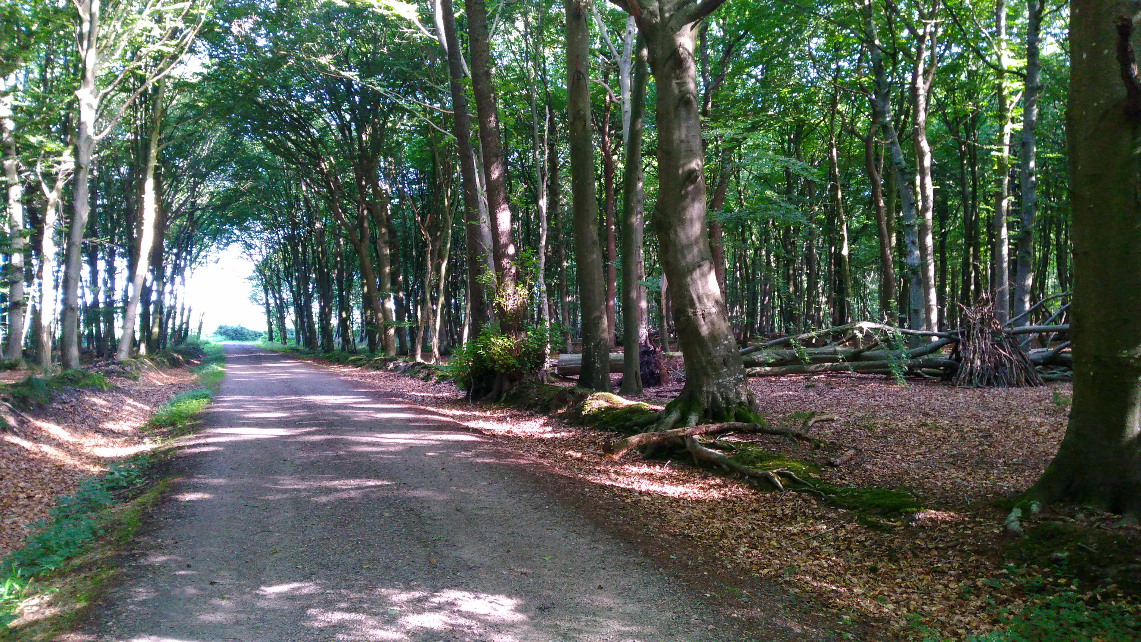
A dirt path flanked by tall, mature deciduous trees creating a shaded canopy, with forest floor covered in autumn leaves and visible roots of large tree trunks to the right.
A woodland path in the Oster-Ohrstedtholz segment of the Wälder der Ostenfelder Geest nature conservation area.

Wälder der Ostenfelder Geest history and protected-area timeline

The woodlands of the Ostenfelder Geest have been mapped as forest since at least 1858, when they were recorded on the Danish General Staff cartographic surveys. By the time of the Prussian land survey of 1879, the forest mosaic was largely in place, although smaller parcels such as the Mittelholz had already shrunk in area compared to their nineteenth-century extent.

The modern protection history began in May 2004, when the Schleswig-Holstein State Agency for Agriculture, Environment and Rural Areas produced the Natura 2000 Standard Data Form for the area. The site was proposed as a Site of Community Importance in September 2004 and confirmed at the European level in November 2007. In January 2010, it was formally designated as a Special Area of Conservation under national law, following both federal nature conservation legislation and the Schleswig-Holstein nature conservation act.

The management plan for the area was published on 26 January 2011, focusing on the portions not owned by the Schleswig-Holstein state forestry service. A separate plan for the state forest holdings followed on 8 October 2013. Since 2018, most of the area has also been embedded in the broader Ostenfeld-Schwabstedter Geest landscape protection area, reinforcing its role in regional conservation policy.

Wälder der Ostenfelder Geest landscape and geographic character

The protected area lies within the Bredstedt-Husumer Geest, a gently rolling countryside shaped by the sandy and loamy soils of the former glacial margins. Elevations are modest. The highest point, around 40 meters above sea level, lies in the Lehmsieker Forst near the village of Lehmsiek, while the lowest point, only about 1 meter above sea level, lies at the southern tip of the Kirchenwald. The forests therefore sit as low islands of woodland above nearby meadows, river floodplains, and drained marsh edge.

The terrain is broken by small streams that radiate into the wider Treene and Husumer Mühlenau catchments. The Krummbek, a tributary of the upper Treene, drains several northern parcels, while the Holmsbek, Oldersbek, and the Falkenburg Graben cut through others. These watercourses have carved shallow valleys that contrast with the higher Geest ridges on which the dry woodland types grow. The result is a gently undulating forest scene rather than dramatic topography, but with a clear distinction between dry sandy flats and moist brook corridors.

Within the area, the largest continuous forest is the Bremsburger Wald along the Treene floodplain, followed by the Oster-Ohrstedtholz and Lehmsieker Forst. Smaller parcels such as the Bagholt, Mittelholz, Westerholz, Kirchenwald, and the two Nordbrook sections appear as quieter woodland fragments with similar internal relief. The forest mosaic as a whole extends roughly 14 kilometers in its longest northeast to southwest direction.
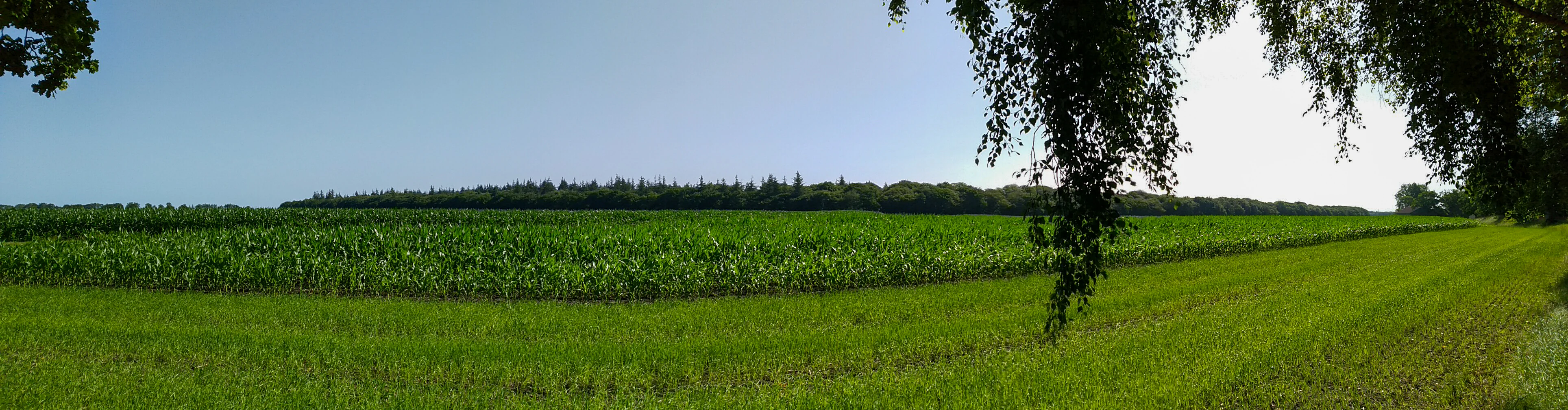
Panoramic landscape showing a field of tall green crops, likely corn, bordered by a dense line of trees in the distance, with overhanging tree branches in the foreground right.
A panoramic view of the agricultural landscape bordering the Bremsburger Wald section of the Wälder der Ostenfelder Geest protected area.

Wälder der Ostenfelder Geest ecosystems, habitats, and plant life

The ecological character of Wälder der Ostenfelder Geest is shaped by the contrast between dry sandy uplands and wetter brook-influenced lowlands. The nutrient-poor sandy sites support acid-tolerant beechwoods dominated by woodrush and the Waldmeister-type community in richer positions. On the oldest stands, particularly within the Bremsburger Wald and along the Lehmsieker ridge, the beech trees have grown beyond one hundred years, creating the kind of structurally rich old-growth conditions that are scarce in this region.

In the moister zones along streams and on the lower edges of slopes, the woodland shifts toward oak-hornbeam communities and patches of alder-ash floodplain forest, a priority habitat type under the Habitats Directive. Old pedunculate oak forests hold sway on sand flats, with the oaks acting as the main canopy layer over an acidic ground flora. Scattered throughout are small eutrophic ponds, drainage ditches, and boggy patches that add further habitat diversity.

Along the landscape scale, the area lies at the meeting point of the Geest sandy soils and the lower-lying marshes of the river Treene. This transitional geography, combined with the long continuity of woodland cover documented since the nineteenth century, gives the site an unusually high conservation value for forest habitat types in northwestern Schleswig-Holstein.
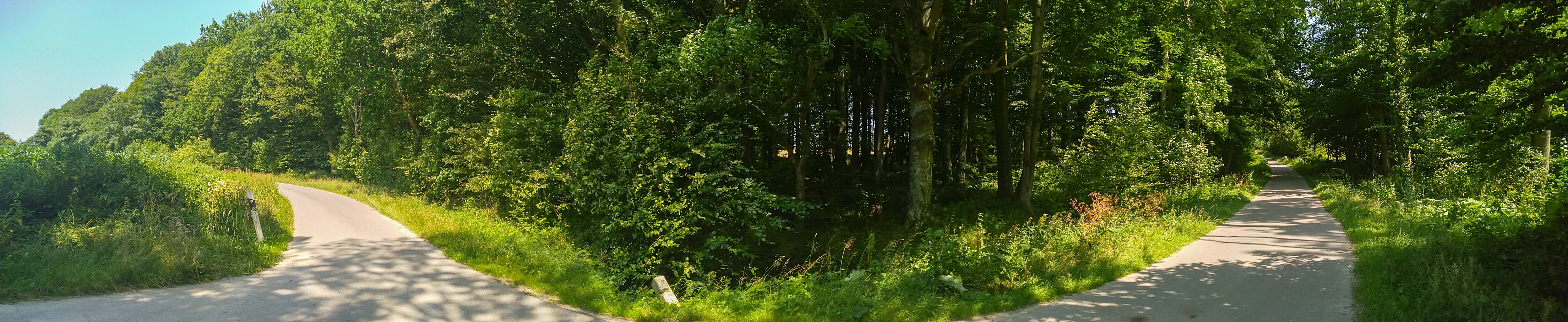
A panoramic view of a paved forest trail winding through a dense green forest, featuring trees on both sides and grassy borders.
A woodland path leading through the Bagholt section of the Wälder der Ostenfelder Geest nature reserve.

Wälder der Ostenfelder Geest wildlife and species highlights

Wildlife interest in the Wälder der Ostenfelder Geest is centered on forest-dwelling and freshwater-dependent species associated with old deciduous woodland. The site supports the great crested newt, an amphibian of European conservation concern, which depends on the small fish-free ponds and quiet brooks scattered through the forest parcels. The species is recognized as a conservation target for the protected area, reflecting the importance of the still-water habitats within the forest mosaic.

The mature beech and oak stands provide nesting opportunities for typical woodland birds, while the network of small streams and ditches offers amphibian habitat along their banks. The longer-established forest parcels, particularly the Bremsburger Wald and Langenhöfter Forst, also support the invertebrate and fungal communities associated with ancient broadleaf woodland. Although bird or mammal species are not enumerated in detail in the source material, the structural diversity of the stands creates a forest wildlife setting of regional significance.
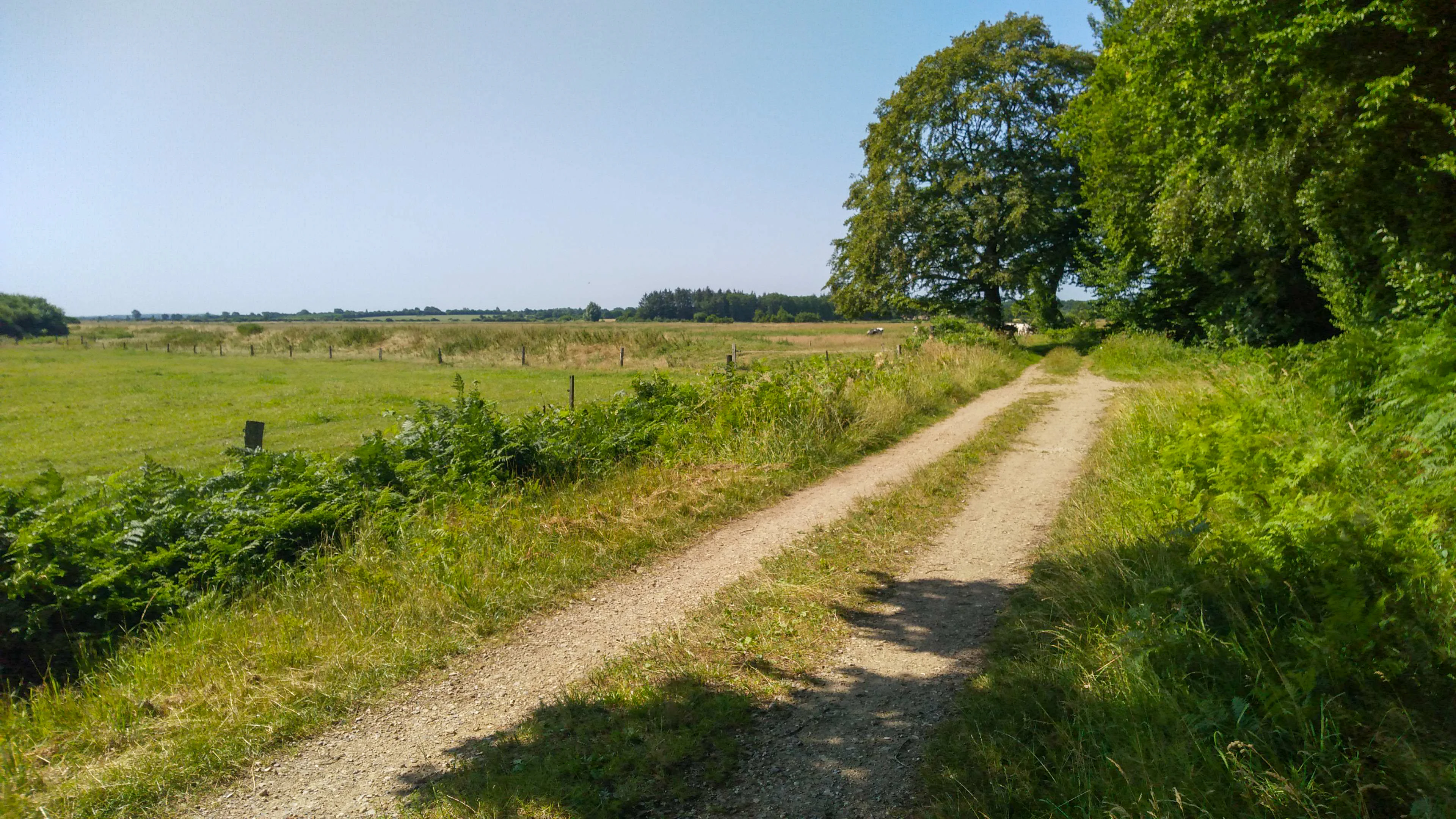
A dirt hiking path leading into the distance, with a lush green forest on the right and an open pasture with a wire fence on the left.
A dirt path running along the edge of the Bremsburger Wald forest area.

Wälder der Ostenfelder Geest conservation status and protection priorities

The Wälder der Ostenfelder Geest sits at the heart of regional conservation planning in northern Schleswig-Holstein. As an FFH site, it is part of the European Natura 2000 network, and its conservation significance lies in preserving a coherent set of lowland forest habitat types that are otherwise rare in this heavily agricultural part of Germany. The protected area safeguards several Directive-listed habitat types, and the management framework combines the Site of Community Importance status with national special area of conservation designation.

A key feature of its conservation approach is the long-term conversion of substantial portions of state-owned forest into natural forest, with all harvesting set aside. This applies to older stands in the Oster-Ohrstedtholz, Langenhöfter Forst, and Lehmsieker Forst. On the privately owned parcels, recommended measures focus on increasing deadwood, retaining near-natural forest structures, and encouraging the transition from non-native conifer stands to site-appropriate broadleaf woodland.

A second strand of conservation work targets the interface between forest and surrounding farmland. Buffer strips and stepped forest edges are being promoted along the intensive agricultural borders to reduce wind-driven nutrient input into the forest. Hydrological restoration, including small-scale impoundments in selected streams and the clearing of overgrown banks, supports both the alder-ash floodplain habitat type and amphibian breeding sites. Most of the area also carries an additional layer of protection through the 2018 Ostenfeld-Schwabstedter Geest landscape protection area.

Wälder der Ostenfelder Geest cultural meaning and human context

The forest landscape of the Ostenfelder Geest is interwoven with the rural settlement pattern of the surrounding villages such as Ostenfeld, Wester-Ohrstedt, Oster-Ohrstedt, Wittbek, Schwabstedt, and Treia. Several of the protected forest parcels carry names that reflect this older cultural landscape. Names like Bagholt, Lehmsieker Forst, Kirchenwald, and Westerholz connect the woodland to historical farms, local field names, and in the case of the Kirchenwald, the parish community of Ostenfeld, which still owns part of the forest today.

A distinctive recent cultural feature is the presence of the Ruheforst in the Kirchenwald, a forest cemetery operated by the Nordfriesisches Friedhofswerk near the K 54 road. This gives one part of the protected area a quiet memorial function alongside its ecological role. Elsewhere, an 18-hectare natural experience area in the Lehmsieker Forst is used by a forest kindergarten, anchoring the woodlands further into public environmental education. The local conservation organization Mittleres Nordfriesland and the broader Runder Tisch Naturschutz Nordfriesland grouping provide ongoing civic stewardship for the site.
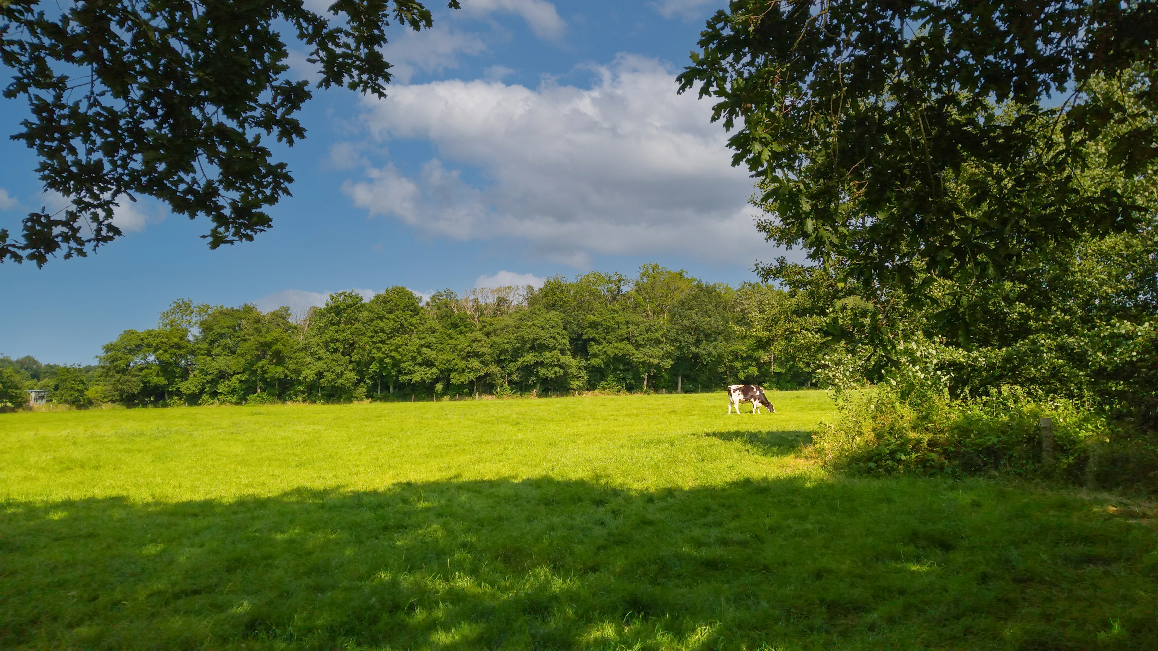
A sunny, open green meadow in the foreground with mature trees bordering a distant forest edge under a blue sky with scattered clouds.
A pastoral view of the Nordbrook area within the protected forests of the Ostenfelder Geest.

Top sights and standout views in Wälder der Ostenfelder Geest

The Wälder der Ostenfelder Geest stands out as one of the more ecologically coherent collections of lowland broadleaf forest in northwestern Schleswig-Holstein. Its twelve separate forest parcels collectively preserve a representative selection of European Habitats Directive forest types, from acidic beechwood communities through to small but valuable patches of alder-ash floodplain forest.

A particular point of distinction is the Bremsburger Wald, where ancient broadleaf stands border the meadows of the Treene floodplain. Equally notable are the long stands of pedunculate oak on sandy soil and the formal natural forest designations within the state-owned areas, which together signal a serious long-term commitment to allowing woodland processes to resume without active management.

Wide panoramic shot of a golden wheat field in the foreground, with a dense green forest line in the background under a clear blue sky.
A panoramic view of the agricultural landscape bordering the Kirchenwald and Bagholt forest areas within the Wälder der Ostenfelder Geest.

Best time to visit Wälder der Ostenfelder Geest

As a quiet mosaic of lowland forests, the Wälder der Ostenfelder Geest offers different experiences through the year. Late spring and early summer bring the most vivid ground flora in the Waldmeister beech forests and the fresh green canopy across all twelve parcels. Summer is the best season for amphibian interest around the ponds and ditches, and for exploring the more shaded brook corridors.

Autumn is rich in mushroom and deadwood interest, particularly in the older broadleaf stands and the natural forest areas in the Lehmsieker Forst and Langenhöfter Forst. Winter offers a clearer view of the gentle relief, the dry sandy trails of the upland forests, and the bark, branch, and structural character of mature beech and oak without the leaf cover. Visitors should expect typical North Sea weather year-round, and several smaller parcels are not formally open for hiking beyond their forest roads.

Monthly climate preview

Long term temperature and precipitation measurements for Wälder der Ostenfelder Geest

Wälder der Ostenfelder Geest Climate Normals and Monthly Weather Records

Wälder der Ostenfelder Geest exhibits a measured annual rhythm ranging from freezing winter minimums to warm summer maximums alongside consistent monthly precipitation. Reviewing the complete twelve month dataset provides deeper insight into the long term climate profile recorded at representative park coordinates.
Annual mean9 °C
1 °C17 °C
Jan
Feb
Mar
Apr
May12°
Jun15°
Jul17°
Aug17°
Sep14°
Oct10°
Nov
Dec
Warmest month
August

17.4 °C

Coolest month
January

1.3 °C

Wettest month
August

2.7 mm/day

Driest month
April

1.4 mm/day

Park location guide

Geography guide, regional context, and park location map for Wälder der Ostenfelder Geest

Wälder der Ostenfelder Geest park geography, regions, and map view in Germany

Understand where Wälder der Ostenfelder Geest sits in Germany through a broader geographic reading of the surrounding landscape, nearby location context, and its mapped position within the national park landscape.

How Wälder der Ostenfelder Geest fits into Germany

Germany is a federal republic in Western and Central Europe with a population of over 83 million across sixteen constituent states. It is Europe's largest economy by nominal GDP and a major global exporter and importer. The capital is Berlin, and the country borders Denmark, Poland, Czech Republic, Austria, Switzerland, France, Luxembourg, Belgium, and the Netherlands.

Wider geography shaping Wälder der Ostenfelder Geest in Germany

Germany is located in Western and Central Europe, spanning 357,022 km². It borders Denmark to the north, Poland and the Czech Republic to the east, Austria and Switzerland to the south, and France, Luxembourg, Belgium, and the Netherlands to the west. The country has coastlines on the Baltic Sea and North Sea to the north, with the Alps located in the southern region.

Map view of Wälder der Ostenfelder Geest

Use this park location map to pinpoint Wälder der Ostenfelder Geest in Germany, understand its exact geographic position, and read its mapped placement within the surrounding landscape more clearly.

Pigeon | © OpenStreetMap contributors

Location context for Wälder der Ostenfelder Geest

Schleswig-Holstein

Visual reference of ancient beechwoods, oak habitats, and glacial terrain

Wälder der Ostenfelder Geest Landscapes and Forest Scenery Photography

Photographs capture the diverse forest mosaic, rolling glacial topography, and wetland brook corridors defining Wälder der Ostenfelder Geest. Visual research helps observers understand habitat distribution and broadleaf woodland characteristics across the protected area.

A dirt path flanked by tall, mature deciduous trees creating a shaded canopy, with forest floor covered in autumn leaves and visible roots of large tree trunks to the right.

A winding asphalt road curves through a landscape featuring a dense forest edge on the left and a green agricultural field on the right under a partly cloudy sky.

Panoramic landscape showing a field of tall green crops, likely corn, bordered by a dense line of trees in the distance, with overhanging tree branches in the foreground right.

A panoramic view of a paved forest trail winding through a dense green forest, featuring trees on both sides and grassy borders.

A dirt hiking path leading into the distance, with a lush green forest on the right and an open pasture with a wire fence on the left.

A rectangular outdoor information sign mounted on a wooden frame in a forest, displaying text, maps, and photographs about the protected area.

A sunny, open green meadow in the foreground with mature trees bordering a distant forest edge under a blue sky with scattered clouds.

Wide panoramic shot of a golden wheat field in the foreground, with a dense green forest line in the background under a clear blue sky.

A panoramic view of a lush green meadow leading toward a dense line of deciduous trees under a clear blue sky, with a dirt path curving through the foreground.

A wide view of a green meadow in the foreground leading to a dense line of trees on the horizon under a clear sky.

A panoramic outdoor view showing a paved road on the left, a large green corn field in the center, and a dense line of mature forest in the background under a clear sky.

A wide view of a cornfield next to a road, with a dense forest in the background under a clear blue sky.

A wide view of a grassy meadow with a large old tree in the foreground and a dense line of trees in the background, bordered by a wire fence.

A wide panoramic shot of a rural road intersecting with an agricultural field and a dense treeline in the background under a clear sky.

A dirt track winds through a lush, green deciduous forest landscape under a clear blue sky, with prominent mature trees in the foreground.

A wide, sunny field of green crops adjacent to a grassy path and a large tree, with wind turbines visible on the horizon.

Park atlas

Compare adjacent woodland reserves and regional protected habitats across Schleswig-Holstein

Other Parks Near Wälder der Ostenfelder Geest and Connected Protected Landscapes

Browsing other parks near Wälder der Ostenfelder Geest reveals a wider network of lowland broadleaf forests and river valley reserves. Examining these adjacent protected areas provides valuable regional context for comparing northern German woodland habitats and glacial Geest geography.
Nature reserveSchleswig-Holstein
About 5.4 km away#1 closest

South

FFH-Gebiet Wälder bei Bergenhusen: Geographic Profile of Northern German Protected Woodlands

Protected forest habitat and historical geest landscapes in Schleswig-Holstein

Covering roughly 145 hectares within the Eider-Treene-Sorge lowland, this nature reserve protects a rare sequence of deciduous forest types and nutrient-rich aquatic habitats. The site is characterized by its distinct northern and southern parcels, which reveal the interplay between post-glacial geomorphology and long-standing human land use patterns preserved through centuries of forestry.

Area
1.45 km²
Established
1999
Relief
Lowland
Climate
Temperate
Nature reserveSchleswig-Holstein
6.2 km away#2 closest

North

Wälder im Süderhackstedtfeld: Protected Nature Reserve and Geest Landscape Atlas

Examining forest habitats in northern Schleswig-Holstein

Trace the boundaries of Wälder im Süderhackstedtfeld, a notable nature reserve in Schleswig-Holstein. This site contains priority atlantic beech and oak forest types within a classic glacial ridge topography, showcasing long-term woodland continuity and structured forest restoration within a compact geographic footprint.

Area
0.76 km²
Established
2004
Relief
Upland
Climate
Temperate
Watercolor illustration of a landscape with green hills, a body of water, and grassy foregrounds
National parkSchleswig-Holstein
11 km away#3 closest

West

Schleswig-Holstein Wadden Sea National Park: Germany's Largest Protected Tidal Landscape

Explore the mapped geography of this vital North Sea national park.

Schleswig-Holstein Wadden Sea National Park is a monumental protected area, recognized globally as a UNESCO World Heritage Site for its extraordinary tidal wetland ecosystem. This page offers detailed insights into its geographic scope, from the North Frisian Islands to the Elbe estuary, highlighting the dynamic interplay of mudflats, salt marshes, and coastal terrain. Discover the park's critical role as a migratory bird flyway and marine nursery, providing rich data for geographic and atlas exploration of this unique North Sea protected landscape.

Area
4,410 km²
Established
1985
IUCN
II
Visitors
1.7M annual
Nature reserveBrandenburg
13 km away#4 closest

Southeast

Tiergarten Nature Reserve: Geography and Protected Habitat Mapping in Brandenburg, Germany

Ancient oak woodland, riparian wetlands, and historic forest trails.

Spanning 158 hectares, the Tiergarten nature reserve serves as an ecologically rich sanctuary of oak-hornbeam forests and wet meadows. This area, formerly a royal hunting ground, offers a dense mosaic of riparian zones along the Staabe river, protecting essential habitats within the broader Brandenburg landscape.

Area
1.58 km²
Established
1995
IUCN
IV
Nature reserveSchleswig-Holstein
About 16 km away#5 closest

Southeast

FFH-Gebiet Übergangsmoor im Kropper Forst: Protected Landscape and Mire Geography

A study of transitional mire habitats in Schleswig-Holstein.

This protected area centers on a treeless mire depression embedded within the coniferous Gehege Kropp forest. Covering 18 hectares of glacial terrain, the site illustrates the delicate balance of mire hydrology and the long-term ecological impact of regional landscape management in northern Germany.

Area
0.18 km²
Established
2004
Relief
Lowland
Climate
Temperate
Nature reserveSchleswig-Holstein
About 17 km away#6 closest

Northeast

FFH-Gebiet Wellspanger-Loiter-Oxbek-System und angrenzende Wälder Protected Landscapes

Schleswig-Holstein nature reserve map and geography

This protected area bundles a wide range of priority habitat types, including calcareous springs, inland dunes, and old-growth beech forests. Spanning the Angeln peninsula, the site protects a hydrological backbone of stream systems and rare wet meadows that remain critical for regional biodiversity in Northern Germany.

Area
14.34 km²
Established
2004
Relief
Upland
Climate
Temperate
Nature reserveSchleswig-Holstein
About 21 km away#7 closest

Southwest

Weiße Moor Nature Reserve: Coastal Marshland Geography in Schleswig-Holstein

A rare surviving raised bog and wetland restoration site

Weiße Moor stands as a critical protected area in northern Germany, preserving the last coastal marsh raised bog in the Dithmarschen district. Its 69-hectare footprint provides a study in lowland bog restoration, showcasing a transition from a central peat dome through wet heath to scrub, all set against the backdrop of an intensively managed agricultural coastal plain.

Area
0.69 km²
Established
1979
Nature reserveSchleswig-Holstein
About 21 km away#8 closest

Northeast

FFH-Gebiet Wald-, Moor- und Heidelandschaft der Fröruper Berge und Umgebung Landscape Profile

Glacial moraine ridges and wetland mosaic in Schleswig-Holstein.

Analyze the protected boundaries and natural terrain of this German nature reserve. The site hosts a rare combination of beech woodland, transition mires, and sandy inland dunes that represent the complex ecological transition within the Obere Treenelandschaft region.

Area
9.4 km²
Established
2004
Relief
Upland
Climate
Temperate

Common questions about visiting, size, designation, and location context for Wälder der Ostenfelder Geest

Wälder der Ostenfelder Geest FAQs for park facts, access, geography, and protected area context

Find quick answers about Wälder der Ostenfelder Geest, including protected-area facts, park geography, trail and visitor context, and how the park fits into its surrounding country and regional landscape.
MoriAtlas Explorer

Continue Your Protected Areas Search Across the Global Atlas

Deepen your exploration by continuing the structured search for national parks and protected areas worldwide. Utilize the comprehensive filtering capabilities to compare different conservation landscapes and refine your understanding of global park geography. Discover more about the distribution and characteristics of protected natural areas.

Global natural geography