
Mori Atlas logo
Nature reserveWahrberg

Mapping the distinct calcareous dry grasslands and botanical mosaic within the Weser-Leine hill country

Wahrberg Nature Reserve: A Detailed Geographic Atlas of Limestone Hilltop Habitats in Lower Saxony

(Naturschutzgebiet Wahrberg)

Wahrberg stands as a compact nature reserve situated on a distinctive limestone hilltop southwest of Northeim. This protected area represents a rare ecological mosaic within the broader Leine valley, featuring calcium-rich soils and open grassland communities maintained by traditional grazing. Our atlas coverage details the terrain and botanical zones that define this essential protected landscape in southern Lower Saxony.

calcareous dry grasslandlimestone hilltopnature reserveFFH habitatLeine valleyLower Saxony
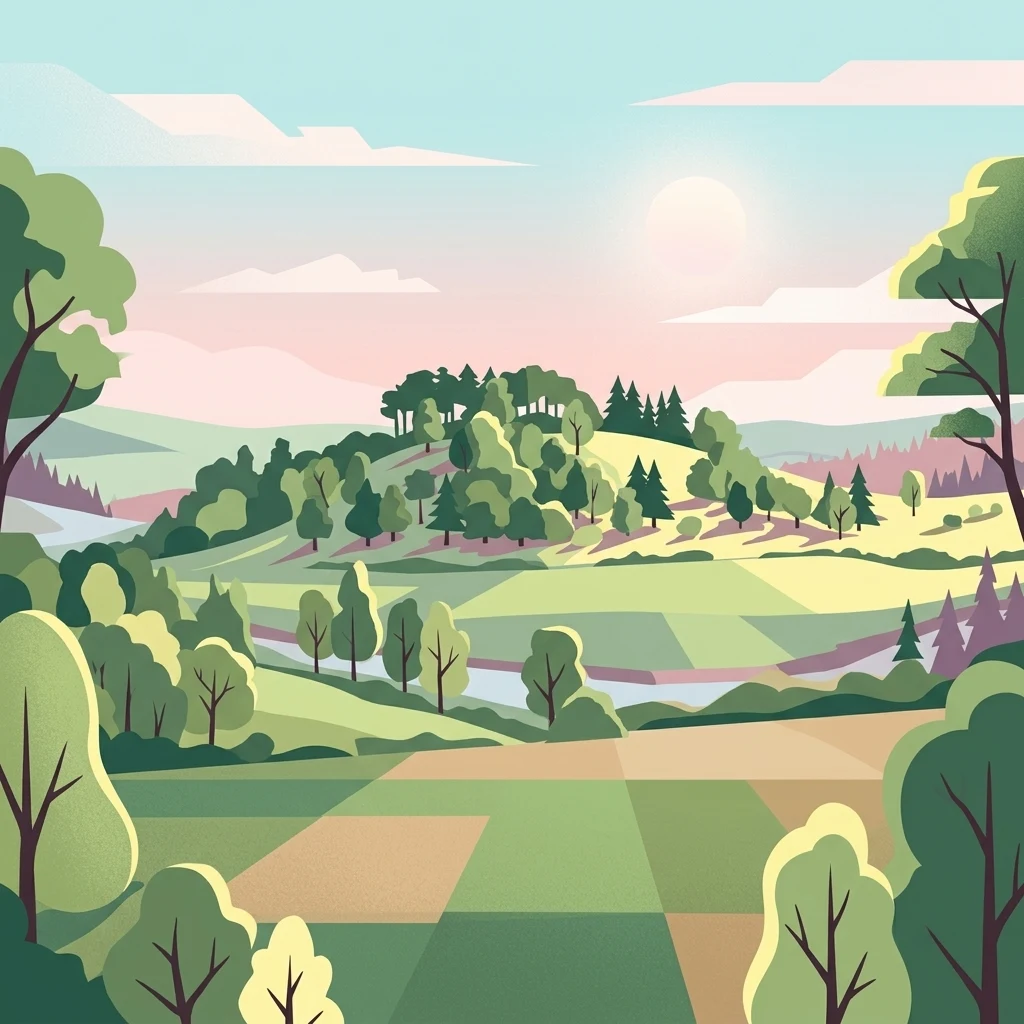
Digital illustration of a rolling rural landscape with fields, scattered trees, and a distant forested hill under a soft light.

Wahrberg

Nature reserve

Park overview

Structured park overview, official facts, and landscape profile for Wahrberg Nature Reserve

Wahrberg Nature Reserve park facts, protected area profile, and essential visitor context

Review the core facts for Wahrberg Nature Reserve, including designation, size, terrain, visitor scale, habitats, and operating context in one park-focused overview.

About Wahrberg Nature Reserve

Wahrberg Nature Reserve protects a small but ecologically rich limestone hilltop just southwest of Northeim in the district of Landkreis Northeim, southern Lower Saxony. With an area of about 25 hectares, it is one of the more botanically distinctive reserves in the surrounding Leine hill country. The protected landscape rises to roughly 251 meters above sea level and sits at the western edge of the Leine valley.

Although modest in size, Wahrberg carries considerable regional importance as a refuge for calcareous grassland habitats that have become rare across much of central Europe. The reserve lies within the natural region of the Northeim Keuper hill country, part of the broader Weser-Leine hill land (Weser- und Leinebergland), and borders directly onto the meadows of the Leine floodplain. Its limestone geology produces the thin, calcium-rich soils that underpin the site's unusual flora.

The reserve is officially designated as a Naturschutzgebiet under the identifier NSG BR 103 and is administered by the Niedersächsischer Landesbetrieb für Wasserwirtschaft, Küsten- und Naturschutz (NLWKN). The site's protection status was formalized in the early 1990s and updated through a 2010 ordinance. Wahrberg also coincides fully with the EU FFH habitat site numbered 284, reinforcing its conservation standing.

Quick facts and research context for Wahrberg Nature Reserve

Wahrberg is a nature reserve (Naturschutzgebiet) of roughly 25 hectares, established officially in the early 1990s and managed under Lower Saxony's NSG designation "NSG BR 103" by NLWKN. The site coincides entirely with the FFH habitat area 284.

Located southwest of Northeim in the district of Landkreis Northeim, the reserve sits in the Weser-Leine hill country near the Leine river floodplain. Its core environmental value lies in the calcareous dry grasslands and their associated shrub and woodland transitions.

Protection and recognition

Explore documented conservation designations and official recognition sources for Wahrberg.

Wahrberg Protection Status, Natura 2000 Recognition, and WDPA Records

Examine the verified protection status, administrative records, and official Natura 2000 designations established for Wahrberg. Review the documented conservation framework and international recognition data compiled for this protected area.
Park context

Deeper park guide and search-rich context for Wahrberg Nature Reserve

Wahrberg Nature Reserve history, landscape, wildlife, and travel context

Explore Wahrberg Nature Reserve through its history, landscape character, ecosystems, wildlife, conservation priorities, cultural context, and seasonal travel timing in a structured park guide built for atlas discovery and search intent.

Why Wahrberg Nature Reserve stands out

Wahrberg is best known for its calcareous dry grasslands on a limestone hilltop, an unusual habitat in the region that supports orchid-rich flora and a high diversity of invertebrates and reptiles. The site's combination of open dry grassland, scattered shrubs, and replanted native broadleaf woodland creates a fine-grained mosaic of warmth-loving plant communities.
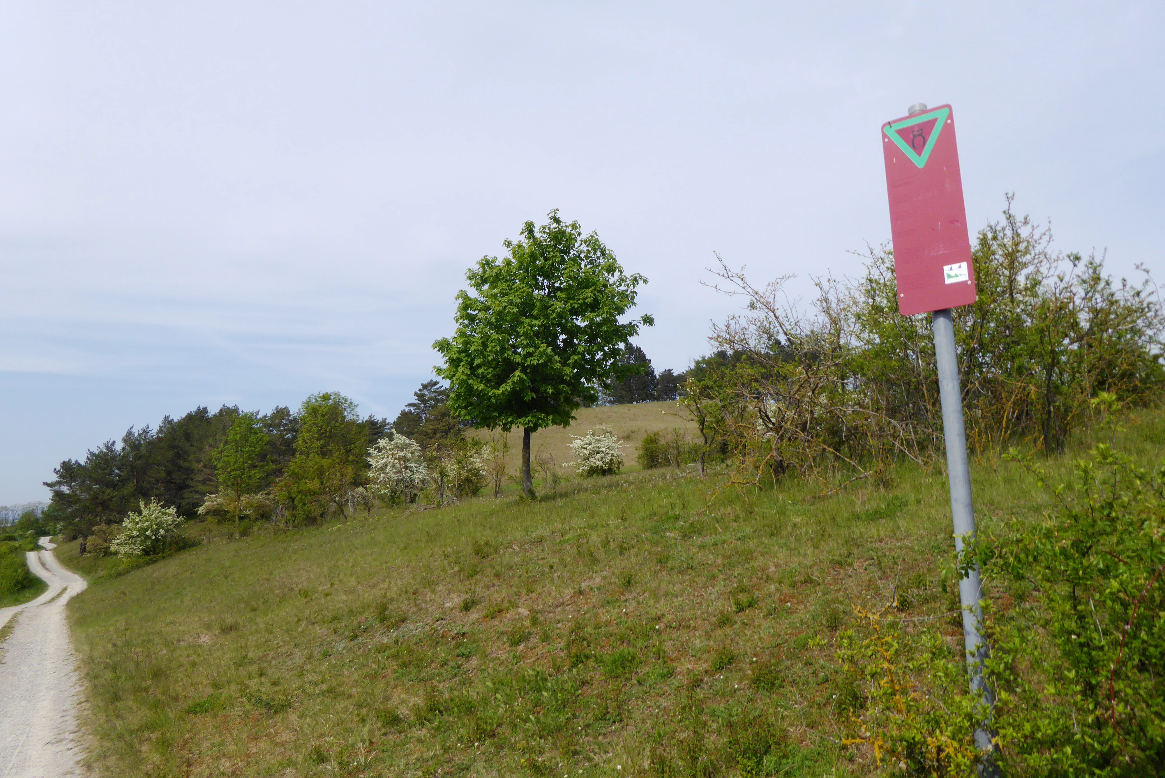
A red rectangular sign with a green inverted triangle at the top stands on a metal pole in a grassy hillside landscape next to a gravel path.
A nature reserve boundary sign along a path on the Wahrberg hillside.

Wahrberg Nature Reserve history and protected-area timeline

The Wahrberg area has a long legacy of grazing use, which once supported an active pastoral system centered on the hill. Over time, this historical land use shaped the open dry grassland communities that today form the foundation of the reserve's ecological value.

Formal nature protection began in 1990 when the Bezirksregierung Braunschweig designated the area as a Naturschutzgebiet, and it has carried the NLWKN designation "NSG BR 103" since. A current ordinance governing the reserve was issued on 26 February 2010 by NLWKN as the responsible nature conservation authority.

In addition to national protection, the site has been recognized as part of the European Union Natura 2000 network: its boundaries are fully aligned with FFH area 284. Modern management also includes the removal of non-native conifer stands planted in earlier decades, which have been progressively replaced with site-appropriate native broadleaf trees.

Wahrberg Nature Reserve landscape and geographic character

Wahrberg is a compact hill rising to about 251 meters above sea level, forming a distinctive knoll within the otherwise gently rolling terrain of the Leine hill country. Geologically, the hill is shaped by limestone bedrock, whose weathering produces the thin, calcium-rich soils that define the surface character of the reserve.

Surrounding the hilltop, the broader landscape transitions into the low-lying meadows of the Leine floodplain, and the reserve lies at the western edge of the broader Leine valley. Within the protected boundary, the terrain alternates between open grassy slopes, transition zones with encroaching shrubs, and patches of replanted broadleaf woodland, creating a patchwork of habitats across the small area.

Wahrberg Nature Reserve ecosystems, habitats, and plant life

Ecologically, Wahrberg's identity is defined by its calcareous dry grasslands, one of the more uncommon habitat types in Lower Saxony. These open, sun-exposed grasslands on thin limestone soils are interspersed with shrub-dominated transitions and small areas of native broadleaf woodland established as part of the reserve's management.

Historically, the dry grassland communities were maintained by extensive grazing. Today this role is fulfilled by sheep and goats, whose continued pasturing is essential to preventing the grasslands from being overtaken by shrubs. Reserve managers have additionally removed non-native conifer stands that had colonized parts of the hill, replacing them with site-appropriate broadleaf species to strengthen habitat quality.

Wahrberg Nature Reserve wildlife and species highlights

The warm, dry, calcium-rich conditions of the Wahrberg grasslands support a notably rich community of invertebrates and reptiles that are specially adapted to such extreme habitats. The site is recognized for its high diversity of insect groups, which benefit from the abundance of wildflowers and the open, sun-exposed terrain.

Typical reptiles associated with similar warm dry grassland complexes in the region find suitable basking and shelter conditions across the hillside. The mosaic of open grassland and shrubby margin also creates valuable edge habitat for a range of small animals tied to these transitional zones.

Wahrberg Nature Reserve conservation status and protection priorities

Wahrberg's conservation significance lies primarily in the regional rarity of its calcareous dry grassland habitat and the unusually rich flora and fauna it supports. The protection order specifically emphasizes preserving the Wahrberg's landscape-defining character as habitat for plant and animal communities tied to calcium-rich substrates.

The reserve's status as both a Naturschutzgebiet and a fully overlapping FFH area reflects its role in the broader European conservation framework. Active management, including grazing by sheep and goats and the replacement of conifer plantations with native broadleaf trees, is central to maintaining the conservation value of the site.

Top sights and standout views in Wahrberg Nature Reserve

Wahrberg stands out as one of the few protected calcareous dry grassland sites in southern Lower Saxony, with its full alignment between national nature reserve and EU FFH habitat designation reinforcing its conservation stature.

The reserve's small but high-quality mosaic of open dry grassland, shrub transitions, and broadleaf woodland, together with active grazing-based management, makes it a notable example of how modest sites can deliver disproportionate botanical and ecological value.

Monthly climate preview

Long-term monthly temperature averages and precipitation patterns for Wahrberg

Wahrberg Climate Normals, Annual Temperature and Precipitation Rhythm

Historical coordinate measurements reveal long-term average temperature and precipitation rhythms across the representative terrain of Wahrberg. Examining the full twelve-month climate profile provides detailed insight into monthly thermal ranges and precipitation distribution.
Annual mean8 °C
-1 °C18 °C
Jan-1°
Feb
Mar
Apr
May12°
Jun16°
Jul18°
Aug18°
Sep14°
Oct
Nov
Dec
Warmest month
July

18.2 °C

Coolest month
January

-0.9 °C

Wettest month
July

2.6 mm/day

Driest month
April

1.5 mm/day

Park location guide

Geography guide, regional context, and park location map for Wahrberg Nature Reserve

Wahrberg Nature Reserve park geography, regions, and map view in Germany

Understand where Wahrberg Nature Reserve sits in Germany through a broader geographic reading of the surrounding landscape, nearby location context, and its mapped position within the national park landscape.

How Wahrberg Nature Reserve fits into Germany

Germany is a federal republic in Western and Central Europe with a population of over 83 million across sixteen constituent states. It is Europe's largest economy by nominal GDP and a major global exporter and importer. The capital is Berlin, and the country borders Denmark, Poland, Czech Republic, Austria, Switzerland, France, Luxembourg, Belgium, and the Netherlands.

Wider geography shaping Wahrberg Nature Reserve in Germany

Germany is located in Western and Central Europe, spanning 357,022 km². It borders Denmark to the north, Poland and the Czech Republic to the east, Austria and Switzerland to the south, and France, Luxembourg, Belgium, and the Netherlands to the west. The country has coastlines on the Baltic Sea and North Sea to the north, with the Alps located in the southern region.

Map view of Wahrberg Nature Reserve

Use this park location map to pinpoint Wahrberg Nature Reserve in Germany, understand its exact geographic position, and read its mapped placement within the surrounding landscape more clearly.

Pigeon | © OpenStreetMap contributors

Location context for Wahrberg Nature Reserve

Lower Saxony
Recorded earthquake history

Explore the Documented Earthquake History and Seismic Catalogue for Wahrberg

Review a detailed catalogue of historical seismic events recorded near Wahrberg. MoriAtlas provides a structured view of local earthquake data including event magnitudes and epicentre distances to assist in the geographic observation of seismic activity across the Lower Saxony hill country.

Wahrberg Earthquake History Data

Catalogued events

2 events

Strongest magnitude

Magnitude 3.1

Most recent event

Mar 30, 1995

This history includes earthquakes recorded inside the park or within 50 km of its borders

Explore photographic records of calcareous dry grassland habitats and protected terrain features

Wahrberg Photos and Landscape Imagery: Visualizing the Limestone Hill and Dry Grasslands

Visual documentation of Wahrberg reveals the limestone hilltop terrain, open grassy slopes, and protected mosaic habitats across the nature reserve. Examining these landscape photographs helps researchers understand the geological character and botanical diversity of the region.

A red rectangular sign with a green inverted triangle at the top stands on a metal pole in a grassy hillside landscape next to a gravel path.

A gentle green hill covered with trees sits in the middle ground, surrounded by rolling agricultural fields and meadows under an overcast sky.

Park atlas

Compare regional limestone terrain and surrounding protected landscapes

Explore Other Protected Areas and Nearby Parks Around Wahrberg

Browse other protected areas and regional reserves connected to the broader Weser-Leine hill country. Comparing adjacent conservation landscapes reveals shared botanical traits and regional geological patterns.
Nature reserveLower Saxony
About 6.6 km away#1 closest

North

Wasservogelreservat Northeimer Seenplatte Protected Nature Reserve and Wetland Mapping

A floodplain lake mosaic within the Lower Saxony river valley landscape

Wasservogelreservat Northeimer Seenplatte encompasses roughly 80 hectares of protected wetland in Lower Saxony. This nature reserve features a distinct series of gravel-pit lakes framed by agricultural grasslands, serving as a vital sanctuary for migratory and breeding waterbirds. The terrain represents a focused ecological complex positioned within the Leine floodplain, defined by its historical industrial origins and current conservation status.

Area
0.8 km²
Established
1984
IUCN
IV
Relief
Lowland
Nature reserveLower Saxony
About 9.4 km away#2 closest

West

Weper, Gladeberg und Aschenburg Protected Nature Reserve and Hilltop Mosaic

Calcareous grassland and forest network in Lower Saxony

Explore the geographic composition of the Weper, Gladeberg und Aschenburg nature reserve in Lower Saxony. This protected area encompasses a series of hill fragments and slopes characterized by sun-exposed calcareous grasslands and dense deciduous forest stands, providing essential habitat connectivity in the regional uplands.

Area
2.67 km²
Established
2020
Relief
Upland
Scope
Terrestrial
Nature reserveLower Saxony
10 km away#3 closest

West

Wald am Großen Streitrodt bei Delliehausen: Protected Beech Forests of Lower Saxony

Geographic overview of the eastern Solling upland nature reserve

The Wald am Großen Streitrodt bei Delliehausen nature reserve protects a rich, near-natural beech woodland matrix in the eastern Solling. Spanning gentle ridges and slopes, the area features significant deadwood habitats and a distinct southeastern meadow mosaic carved by the Kobbeke headwaters. This record details the park landscape and ecological boundaries within the broader forested context of southern Lower Saxony.

Area
228 km²
Established
2020
Nature reserveLower Saxony
13 km away#4 closest

Northwest

Wälder im Solling bei Lauenberg Nature Reserve: Geographic and Landscape Analysis

Protected oak pasture remnants in the Lower Saxony Solling

Analyze the mapped parcels of Wälder im Solling bei Lauenberg. This protected site integrates old growth oak forest with open meadows and brook corridors, showcasing the unique cultural and ecological legacy of the Solling region in southern Lower Saxony.

Area
3.22 km²
Established
2020
Nature reserveLower Saxony
14 km away#5 closest

West

Wälder im östlichen Solling Nature Reserve: Regional Geography and Forest Landscape

Protected beech woodland in the Lower Saxony eastern Solling range

Wälder im östlichen Solling is a specialized nature reserve in the German state of Lower Saxony, covering a vast landscape of broadleaf high forest and historical wood-pasture. This atlas entry focuses on its mapped terrain, featuring mature beech stands, alder-ash spring forests, and intact stream ecosystems along the Riepenbach and Wolfsbach, providing a clear view of its ecological boundaries.

Area
14.79 km²
Established
2020
Nature reserveLower Saxony
About 18 km away#6 closest

Southwest

Wälder am Schäferstein und am Hohen Rott bei Verliehausen: Protected Nature Reserve Landscape

Ancient woodland geography in the Southern Solling uplands

A significant nature reserve in Lower Saxony, these forest tracts at Schäferstein and Hohen Rott protect near-natural beech and oak stands. The site is characterized by an exceptional density of deadwood and historical relict oak pastures, serving as a vital sanctuary for specialized saproxylic beetles and cavity-nesting birds within the broader Solling ridge system.

Area
1.02 km²
Established
2020
Relief
Mountain
Climate
Temperate
A soft watercolor painting depicting a gentle, winding river flowing through a forested landscape with rolling hills in the background.
Protected landscapeLower Saxony
About 23 km away#7 closest

West

Naturpark Solling-Vogler Protected Landscape: Regional Geography and Mapped Terrain

Extensive forested low-mountain region in Lower Saxony

Naturpark Solling-Vogler acts as a core protected region within the Weserbergland of Lower Saxony. This atlas entry details its dual landscape identity, bridging the wide upland Solling plateau with the sharp, narrow Vogler ridge. Explore the mapped river valleys and woodland habitats that define this important German nature park.

Relief
Mountain
Climate
Temperate
Scope
Terrestrial
Water
Major water bodies
Watercolor illustration of a mountainous landscape with forests and a winding path
National parkLower Saxony
26 km away#8 closest

East

Harz National Park: A Mapped Protected Landscape in Lower Saxony's Mountains

Explore geographic boundaries and regional terrain.

Harz National Park is a protected area defined by its unique mountain landscape and extensive forests in Lower Saxony, Germany. This MoriAtlas entry details its geographic scope, allowing for exploration of its mapped boundaries and its place within the regional geography. Understand the terrain, from its highest peaks to its alpine bogs, offering a structured view of this significant protected landscape for atlas-based discovery.

Area
247 km²
Established
2006
IUCN
II
Visitors
4M annual

Common questions about visiting, size, designation, and location context for Wahrberg Nature Reserve

Wahrberg Nature Reserve FAQs for park facts, access, geography, and protected area context

Find quick answers about Wahrberg Nature Reserve, including protected-area facts, park geography, trail and visitor context, and how the park fits into its surrounding country and regional landscape.
MoriAtlas Explorer

Continue Your Protected Areas Search Across the Global Atlas

Deepen your exploration by continuing the structured search for national parks and protected areas worldwide. Utilize the comprehensive filtering capabilities to compare different conservation landscapes and refine your understanding of global park geography. Discover more about the distribution and characteristics of protected natural areas.

Global natural geography