
Why Waller Flachteiche stands out
The reserve is especially known for its shallow standing-water bodies in a former sand quarry, where periodically drying pools support strandling and dwarf rush communities, along with rare aquatic plants such as slender stonewort, shining glossy stonewort, opposite-flowered water milfoil, water pennywort, floodwater celery, six-stamened waterwort, and small white water lily. The mosaic of pioneer swards, wet heath, and encroaching moor birch scrub around the ponds, combined with small patches of mixed deciduous woodland to the south, gives the area its distinctive ecological character. Waller Flachteiche is also recognized for its amphibian fauna, including northern crested newt, smooth newt, garlic toad, natterjack toad, common toad, moor frog, and common frog, many of which rely on the temporary pools for breeding.
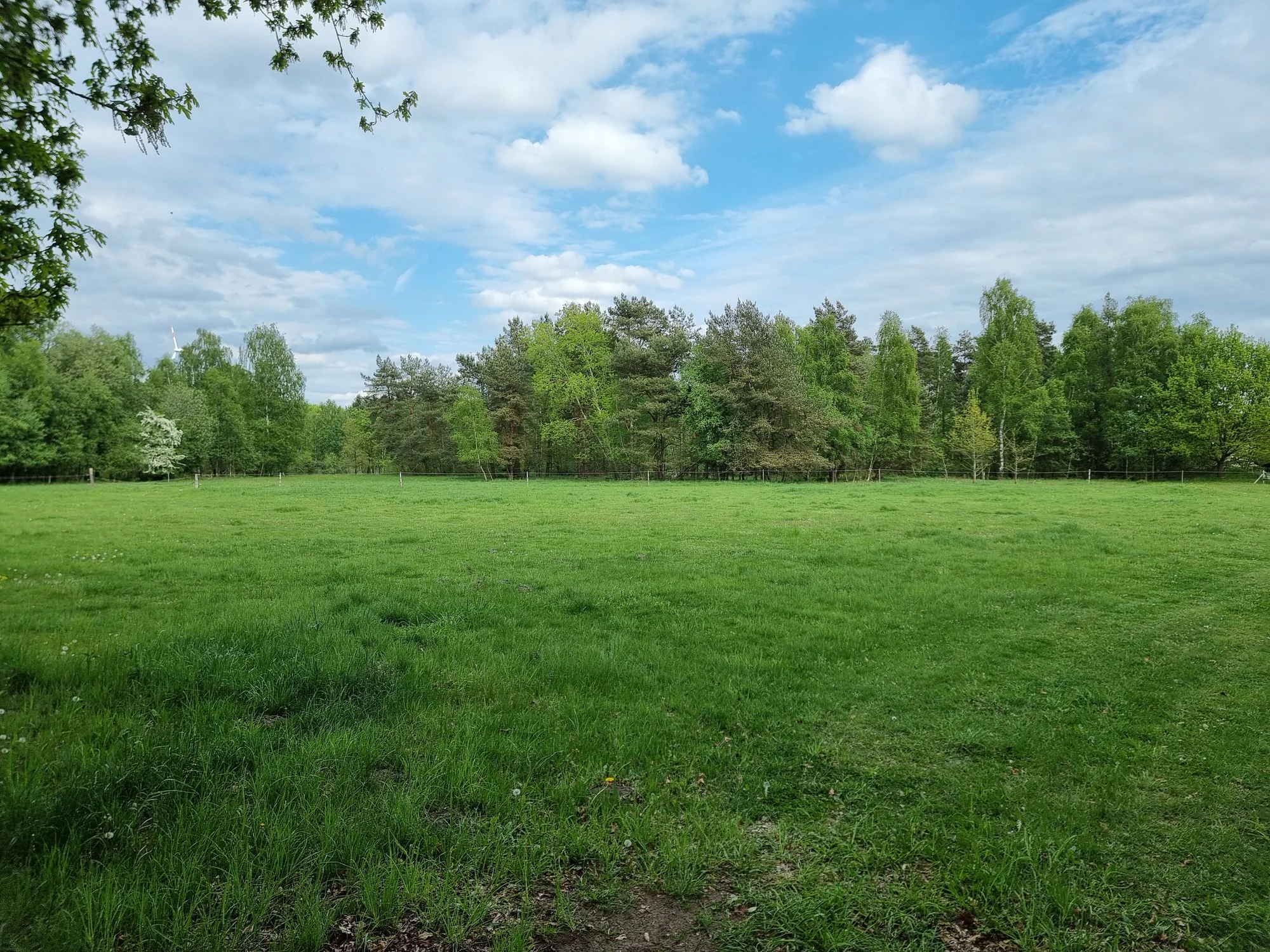
Waller Flachteiche history and protected-area timeline
The history of Waller Flachteiche as a protected site began in the early twenty-first century, but the landscape it now protects has a longer industrial and ecological past. The shallow ponds at the heart of the reserve originated as a sand quarry, an excavation site that over time filled with rainwater and developed into a network of small standing-water bodies. As extraction ceased, nature began to reclaim the disturbed ground, and the quarry pit turned into a refuge for pioneer wetland vegetation, rare aquatic plants, and amphibians adapted to temporary waters.
Recognition of the site's conservation importance grew during the decades following the end of sand extraction. A portion of the quarry area was designated as the Sandgrube bei Walle Habitats Directive (FFH) site, formally incorporating it into the European Natura 2000 network and confirming its value for protected habitats and species. Building on this designation and on surveys of its flora and fauna, the surrounding area was legally protected as the nature reserve Waller Flachteiche under the code NSG LÜ 338 on 1 December 2018. The Landkreis Verden became the responsible lower nature protection authority, while the Lower Saxon State Agency for Water Management, Coastal Protection and Nature Conservation (NLWKN) provides state-level oversight.
Since designation, the reserve has been actively supported by the Naturschutzbund Deutschland, reflecting the cooperative model of conservation management common in Lower Saxony. The protection status aims to preserve the mosaic of temporary ponds, pioneer communities, wet heath, and mixed woodland that has developed on the former quarry site, while also addressing pressures such as scrub encroachment by moor birch and the spread of non-native species such as needle spike-rush.
Waller Flachteiche landscape and geographic character
Waller Flachteiche sits in the gently undulating sandy terrain of the northern German lowlands, just northeast of Verden (Aller) in the Landkreis Verden region of Lower Saxony. The reserve's elevations are modest, ranging roughly between 43 and 50 metres above sea level, and the surrounding land is shaped by glacial and post-glacial sandy deposits typical of the Geest landscape north of the Aller river.
The defining physical feature of the area is the cluster of very shallow standing water bodies that fill the hollows of a former sand quarry. Some of these ponds dry out partially or completely during dry periods, exposing damp, sandy shorelines. Around the water bodies the ground rises gently into drier sandy slopes and low ridges, where open vegetation, scrub, and small patches of woodland alternate. To the southeast of the reserve runs a country lane or farm track, while in the northwest the district road between Walle and Holtum (Geest) forms a clear boundary, framing the protected area within a network of agricultural and forest land.
Waller Flachteiche ecosystems, habitats, and plant life
The ecological character of Waller Flachteiche is shaped by the unusual combination of former industrial disturbance and natural hydrological dynamics. The reserve's shallow quarry ponds and their exposed banks create conditions for strandling and dwarf rush communities, specialized vegetation that thrives on the short-lived transition between aquatic and terrestrial habitats. These pioneer swards are embedded in a broader mosaic of periodically wet, moist, and dry microhabitats, which together support an unusually high diversity of plant species for such a small area.
Pockets of Schnabelried vegetation with round-leaved sundew, marsh clubmoss, and Sphagnum-rich rush swards add a more acidic, boggy character, while nearby dry sandy stands support heath communities dominated by common heather and grey and eared willow scrub. Small areas of species-rich extensively managed grassland contribute further diversity, along with grazed and ungrazed sections where open conditions have been maintained. In the southern part of the reserve, mixed deciduous woodland with oak, birch, and other broadleaf species provides shade, leaf litter, and structural complexity, contrasting sharply with the open pioneer habitats around the ponds.
The presence of neophytes, especially needle spike-rush, points to ongoing ecological change as new species arrive and may gradually alter the composition of plant communities. Combined with the increasing spread of moor birch into formerly open areas, this means the ecological balance of Waller Flachteiche is in a state of active transition, requiring continued management to preserve the rare pioneer and aquatic habitats that gave the reserve its protected status.
Waller Flachteiche wildlife and species highlights
Although Waller Flachteiche is primarily valued for its habitat mosaic, its wildlife profile is distinctive, especially for amphibians. The shallow, sometimes temporary ponds of the former sand quarry provide breeding habitat for a notable assemblage of species, including the northern crested newt, smooth newt, garlic toad, natterjack toad, common toad, moor frog, and common frog. The presence of moor frog alongside rarer species such as the garlic toad and natterjack toad is particularly significant, as these amphibians typically depend on open, sandy landscapes with shallow, sun-exposed water bodies that are largely free of predatory fish.
The mix of open water, wet shorelines, dry heath, scrub, and small woodland patches also supports a wide range of invertebrates, which in turn sustain insectivorous birds and other small fauna typical of the Lower Saxon Geest. The 5.31-hectare Sandgrube bei Walle Habitats Directive site within the reserve further underscores the area's role in conserving habitat types and species of European conservation interest, particularly those linked to dynamic, sandy, and wet pioneer environments.
Waller Flachteiche conservation status and protection priorities
Conservation interest in Waller Flachteiche is closely linked to its status as a former sand quarry that has developed into a high-value secondary habitat. The reserve was formally designated as a Naturschutzgebiet under the code NSG LÜ 338 on 1 December 2018, with the Landkreis Verden acting as the responsible lower nature protection authority and the NLWKN providing oversight at state level. The protection order recognizes the area for its shallow ponds, pioneer plant communities, amphibian populations, and small patches of mixed deciduous woodland.
Within the reserve, a 5.31-hectare area is protected as the Sandgrube bei Walle Habitats Directive (FFH) site, integrating Waller Flachteiche into the European Natura 2000 network and giving it relevance beyond regional nature conservation. The reserve also borders the Poggenmoor landscape protection area to the south, extending the effective conservation landscape in this part of Landkreis Verden. The Naturschutzbund Deutschland supports practical management on the ground, helping to monitor habitats and address pressures such as scrub encroachment by moor birch and the spread of non-native species like needle spike-rush.
At a broader level, the reserve contributes to the conservation of open, sandy, and wet habitats in the Lower Saxon lowlands that have become increasingly rare under modern agricultural and forestry practices. By protecting a site that combines temporary standing water, pioneer communities, wet heath, and species-rich grassland, Waller Flachteiche helps safeguard both regional biodiversity and habitat types recognized at the European level.
Top sights and standout views in Waller Flachteiche
Waller Flachteiche's standout qualities include its origin as a former sand quarry that has been reclaimed by nature, the bright mosaic of shallow ponds and exposed sandy shorelines that surround them, and the rare combination of pioneer aquatic vegetation, wet heath, species-rich grassland, and small mixed woodland within a compact area. The reserve formally entered the Natura 2000 network through its 5.31-hectare Sandgrube bei Walle Habitats Directive site, and its 2018 designation as a Lower Saxon nature reserve reflects recognition of both its botanical and amphibian value. A rich suite of uncommon aquatic plants and breeding amphibians, set in a quiet rural district near Verden, makes this small reserve an unusually rich example of post-industrial habitat recovery in northern Germany.
Best time to visit Waller Flachteiche
Waller Flachteiche is best appreciated in late spring and summer, when the shallow quarry ponds are full, the pioneer swards and wet heath communities are in active growth, and amphibians are most easily observed around the water bodies. Visits in the warmer months also make it easier to see the contrast between the open, sandy pioneer habitats around the ponds and the shady mixed woodland in the southern part of the reserve. Because some pools periodically dry out, late summer may reveal exposed shorelines with strandling and dwarf rush communities. The reserve is a working conservation area rather than a developed visitor destination, so visits are best planned with awareness of the surrounding rural roads and limited on-site facilities.