
Streams
Park geography
Mapped terrain, protected boundary coverage, and regional landscape classification
Structured Geographic Profile of Wallowa-Whitman National Forest in Oregon and Idaho
Examine the detailed geographic configuration of Wallowa-Whitman National Forest, spanning regions across Oregon and Idaho. This profile maps the 9,682 square kilometer boundary, identifying mountain relief, temperate coniferous forests, and internal natural features such as Ruby Peak and Joseph Creek.
A vast Oregon national forest of alpine wilderness, deep river gorges, and ancient old-growth habitat.
Wallowa-Whitman National Forest
The Wallowa-Whitman National Forest is a large United States National Forest spanning the northeastern corner of Oregon and extending into small portions of Idaho. It was formed in 1954 when the Wallowa and Whitman national forests were administratively merged, and today it covers well over two million acres of mountainous terrain, river canyons, and forested ridges. Its landscape is defined by two major mountain systems: the Wallowa Mountains in the east, where the glacial Eagle Cap Wilderness sits at the alpine heart of the range, and the Elkhorn Mountains, a sub-range of the broader Blue Mountains, in the western portion of the forest. Together, these areas encompass deep river valleys, high country, and the dramatic Snake River corridor of Hells Canyon, the deepest gorge in North America. The forest is notable for its ecological diversity, from low-elevation grasslands and ponderosa pine stands to subalpine fir and whitebark pine at higher elevations. It supports a wide range of large mammals, including Shiras moose and Rocky Mountain elk, and is managed cooperatively with the Nez Perce Tribe and the Confederated Tribes of the Umatilla Indian Reservation, the descendants of the people whose homeland this region has been for centuries.
- Location
- United States of America
- Park type
- Protected landscape
- Established
- 1905
- Area
- 9,682 km²
Location overview
National park administration across Oregon and Idaho within the United States
Wallowa-Whitman National Forest Geographic Setting and Regional Scope
Wallowa-Whitman National Forest spans recorded territory across the United States within the states of Oregon and Idaho. Regional memberships and administrative boundaries establish the primary geographic footprint for this protected area.
- Countries
- United States of America
- Regions
- Idaho, Oregon
- Primary location
- Oregon
- Geographic setting
- Inland
Boundary and coordinates
Interactive boundary geometry and derived spatial measurements
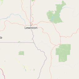
Wallowa-Whitman National Forest Boundary Map and Extent Metrics
Mapped geographic outlines provide clear spatial context for analyzing territorial limits across the protected landscape. Accompanying facts detail total area coverage, coordinate spans, and central reference points without implying legal survey precision.
- Boundary area
- 9,735 km²
- Boundary perimeter
- 3,454.1 km
- Northernmost point
- 45.9967° N
- Southernmost point
- 44.2633° N
- Easternmost point
- 116.3785° W
- Westernmost point
- 118.7373° W
- Geographic centre
- 45.2277° N, 117.4757° W
- North–south span
- 192.6 km
- East–west span
- 185.6 km
Terrain and natural features
Catalog of stored mountain landforms, ridges, peaks, and interior streams
Wallowa-Whitman National Forest Terrain and Named Natural Features
Mountain park classifications define the regional terrain profile alongside recorded peaks, ridges, and interior streams. Linked feature cards supply official names, types, and spatial relationships across the protected area.
Selected named natural features
Streams
Parker Creek
Mountain saddles
Wonker Pass
2,580 m
Ridges
Long Ridge
Peaks
Fairview Point
1,664 m
Peaks
Hazel Mountain
2,544 m
Environmental setting
Temperate mountain relief, forest cover, and aquatic systems
Wallowa-Whitman National Forest Environmental Classifications
Recorded landscape features, habitat types, and climatic zones frame the physical setting of Wallowa-Whitman National Forest. Stored classifications connect specific terrain properties to matching geographical destinations across the atlas.
- Relief
- Mountain
- Climate
- Temperate
- Water
- Major water bodies
- Forest cover
- Mostly forested
- Seasonality
- Seasonal
Landscape features
Mountains · Valleys · Cliffs · Canyon · Forest · Grassland · Wetland · Lakes · Rivers · Coast
Habitat types
Temperate coniferous forest · Montane forest · Alpine meadow · Grassland
Park atlas
Compare regional mountain ranges, river canyons, and connected wilderness landscapes.
Other Parks Near Wallowa-Whitman National Forest and Surrounding Protected Areas
Browse nearby national forests and protected landscapes sharing the rugged mountain terrain of the Pacific Northwest. Comparing adjacent conservation areas reveals the broader regional spread of alpine wilderness and river gorges.
Wildlife reserveOregon
Park boundaries overlap#1 closest
West

Eagle Cap Wilderness: Map and Protected Area Overview in Northeastern Oregon
High elevation terrain, glacial valleys, and mountain ecosystems
Spanning over 350,000 acres, Eagle Cap Wilderness defines the high-altitude geography of the Wallowa Mountains. This protected area is characterized by sharp granite ridges, more than 60 named alpine lakes, and deeply carved U shaped glacial valleys. It acts as a primary water source for the region, hosting the headwaters of several major rivers while supporting diverse wildlife populations in a preserved backcountry environment.
- Area
- 1,462.72 km²
- Established
- 1940
- IUCN
- Ib
- Relief
- Mountain
Protected landscapeUnited States of America
Park boundaries overlap#2 closest
Northeast
Hells Canyon National Recreation Area: Geologic Boundaries and Snake River Corridor Atlas
Deep canyon terrain and archaeological heritage in the American Northwest
This protected landscape encompasses the profound depth of the Snake River gorge, featuring rugged basalt cliffs and diverse forested uplands. The area serves as a significant intersection of natural history and ancient cultural presence, providing a detailed look at the topographic complexity defining the Oregon and Idaho boundary region.
- Area
- 2,641 km²
- Established
- 1975
- Relief
- Mountain
- Climate
- Temperate
Protected landscapeOregon
Park boundaries overlap#3 closest
Southwest
Malheur National Forest: Exploring Oregon's Vast Protected Mountain and Desert Landscape
A geographic study of the Blue Mountains and high desert terrain
Spanning over 1.4 million acres, Malheur National Forest represents a complex protected landscape in eastern Oregon. Its geography is defined by a central spine of the Strawberry Mountains, creating a transition zone between arid high desert ecosystems and dense coniferous forests. Known for large wilderness areas and extensive old growth stands, this forest serves as a vital point for understanding the interplay between topographic elevation and regional climate in the Pacific Northwest.
- Area
- 5,929.81 km²
- Established
- 1908
- Visitors
- 242K annual
- Relief
- Mountain
Protected landscapeIdaho
Park boundaries overlap#4 closest
Southeast
Payette National Forest: Geographic Overview of Idaho's Rugged Mountain Wilderness
Protected granite landscapes and glacial basin geography
Encompassing a vast portion of central Idaho, Payette National Forest represents a significant protected wilderness corridor. The forest geography transitions from granite-based alpine peaks and deep river gorges to dense coniferous slopes, providing essential habitat and extensive trail connectivity throughout the Northern Rockies.
- Area
- 9,419.55 km²
- Established
- 1944
- Relief
- Mountain
- Access
- Access unknown
Protected landscapeOregon
About 16 km away#5 closest
West
Umatilla National Forest: A Comprehensive Atlas of Blue Mountains Protected Landscapes
Explore mountain terrain, wilderness areas, and river-carved geography
Spanning over one million acres, Umatilla National Forest encompasses a complex array of river-cut canyons, high-country ridges, and substantial old-growth woodlands. This protected landscape offers a deep look into the ecological and physical character of the Blue Mountains, from the remote reaches of the Wenaha-Tucannon Wilderness to the headwaters of the Umatilla River.
- Area
- 5,694 km²
- Established
- 1908
- Visitors
- 703K annual
- Relief
- Mountain
Wildlife reserveIdaho
37 km away#6 closest
East
Frank Church, River of No Return Wilderness: Idaho Protected Mountain and River Landscapes
Discover massive roadless geography and river-carved mountain terrain.
Spanning over 2.3 million acres in central Idaho, the Frank Church, River of No Return Wilderness represents one of the most significant intact roadless landscapes in the lower 48 states. This protected area features a complex mosaic of coniferous forests, high-altitude alpine ridges, and the steep, jagged canyons of the Salmon River, creating a unique geographic profile for regional exploration.
- Area
- 9,578.21 km²
- Established
- 1980
- IUCN
- Ib
- Relief
- Mountain
Protected areaOregon
90 km away#7 closest
West
Ochoco National Forest: Mapping the Rugged Canyons and High Desert of Central Oregon
A vast protected area defined by rimrock plateaus and pine-forest watersheds.
Located in the heart of the Ochoco Mountains, this protected landscape offers a study in ecological contrast. From its dense ponderosa pine groves to the exposed volcanic ridges of the high desert, the forest acts as a critical habitat corridor for mule deer and elk, while protecting the headwaters of the North Fork Crooked River within a diverse, multi-terrain framework.
- Area
- 3,444.01 km²
- Established
- 1911
- Visitors
- 575K annual
- Relief
- Mountain

Protected landscapeIdaho
98 km away#8 closest
East
Salmon, Challis National Forest: Geography and Protected Land Map in Central Idaho
Extensive alpine ridges and wild river corridors
Spanning over 4.2 million acres, Salmon, Challis National Forest is a foundational protected landscape in Idaho. This area includes the highest peaks in the state, such as Borah Peak, and holds the majority of the Frank Church, River of No Return Wilderness. Utilize this atlas resource to examine the intricate mountain topography, expansive river systems, and the contiguous wild corridors that define this significant portion of the northern Rockies.
- Area
- 17,142.2 km²
- Established
- 1908
- Relief
- Mountain
- Climate
- Temperate
MoriAtlas Explorer
Explore the Geographic Boundaries of Wallowa-Whitman National Forest
Navigate the complex terrain and protected watersheds of Wallowa-Whitman National Forest through detailed map-based discovery. Use the MoriAtlas database to examine how these mountain ranges and river canyons define the regional character of northeastern Oregon.
Browse next
Global natural geography
Explore related park routes
Explore MoriAtlas Global ParksBrowse All MoriAtlas ParksGlobal Park Map DiscoveryMoriAtlas: Browse All CountriesBrowse All MoriAtlas ContinentsNational Park Environment AtlasGrand Canyon National Park AtlasYellowstone National Park AtlasYosemite National Park Atlas and GeographySerengeti National Park AtlasGalápagos National Park Protected LandscapeBanff National Park Geography and AtlasKruger National Park Atlas EntryUluṟu-Kata Tjuṯa National Park AtlasExplore Uluru-Kata Tjuta National Park GeographyPlitvice Lakes National Park AtlasFiordland National Park Protected LandscapeGreat Smoky Mountains National Park AtlasAfghanistan National Parks and Protected AreasAlbania National Parks and Protected AreasAlgeria National Parks and Protected AreasAmerican Samoa National Parks and Protected AreasAndorra National Parks and Protected AreasAngola National Parks and Protected AreasAntarctica National Parks and Protected AreasAntigua and Barbuda Park List