
Mori Atlas logo
Protected landscapeWester Ross National Scenic Area

Mapping the rugged terrain, Torridonian mountain massifs, and coastal corridors of this iconic Scottish region.

Wester Ross National Scenic Area: A Detailed Geographic Overview of Highland Protected Landscapes

Wester Ross National Scenic Area represents a massive 1,635 square kilometer expanse of protected countryside and seascape within the Northwest Highlands of Scotland. This domain encompasses some of the most dramatic mountain peaks in the British Isles, including the Torridon Hills, alongside deep sea lochs, ancient Caledonian pinewoods, and remote blanket moorlands. As a critical conservation landscape, it showcases an erosive legacy of glacial activity and ancient geological formations that define the unique terrain of the Highland region.

highland scenerymountain landscapecoastal scenerysea lochsCaledonian pinewoodblanket bog
A flat-design illustration showing towering, jagged mountain peaks in the background with a river winding through a valley and surrounding coniferous forests.

Wester Ross National Scenic Area

Protected landscape

Park overview

Structured park overview, official facts, and landscape profile for Wester Ross National Scenic Area

Wester Ross National Scenic Area park facts, protected area profile, and essential visitor context

Review the core facts for Wester Ross National Scenic Area, including designation, size, terrain, visitor scale, habitats, and operating context in one park-focused overview.

About Wester Ross National Scenic Area

Wester Ross National Scenic Area covers a vast swathe of the Northwest Highlands, stretching from Loch Kishorn in the south to Little Loch Broom in the north. It encompasses some of the most celebrated mountain and coastal scenery in Scotland, anchored by the Torridon Hills and a series of deep sea lochs that cut deeply into the landscape. The area is sparsely populated, with small crofting townships scattered along the coastline, and remains one of the least densely inhabited regions in Europe.

The National Scenic Area designation sits within a broader set of conservation recognitions. Wester Ross was designated a UNESCO Biosphere Reserve in April 2016, linking the scenic protection with neighbouring Lochalsh in a transition zone that includes inhabited communities. Approximately one-fifth of the land area is legally protected as Sites of Special Scientific Interest, and over 59,000 hectares of coastal waters between Rubha Rèidh and Coigach form a Nature Conservation Marine Protected Area.

Geologically, Wester Ross rests on some of the oldest and most varied rocks in Europe. Lewisian gneiss, dating back around 2.5 billion years, is overlain by Torridonian sandstone formed around 750 million years ago, and the Moine Thrust Belt runs northeast across the area from near the Kyle of Lochalsh. Pleistocene glaciation carved the dramatic glens, fjards, and sea lochs that give the region its present character. Habitats span coastal cliffs and sandy dunes, sheltered sea lochs with maerl beds, rivers supporting Atlantic salmon and freshwater pearl mussels, Caledonian pinewoods, expansive blanket bogs, and alpine heaths above 1,000 metres.

Culturally, Wester Ross retains a strong Gaelic heritage, with around one in ten residents reporting Gaelic language ability, well above the Scottish average. Traditional crofting, fishing, and a growing tourism economy shape modern life, while National Trust for Scotland properties such as Inverewe Garden, Balmacara, Torridon, and Corrieshalloch Gorge add layers of cultural and natural significance. Together, these elements make Wester Ross one of the defining protected landscapes of Highland Scotland.

Quick facts and research context for Wester Ross National Scenic Area

Wester Ross National Scenic Area lies in the Highland council area of Scotland, covering roughly 1,635 square kilometres of mountainous terrain, coastline, and sea lochs between Loch Kishorn and Little Loch Broom. It is the largest of Scotland's National Scenic Areas in terms of land area and is managed under the scenic-area framework administered by NatureScot.

The region overlays one of the most ancient geological foundations in Europe, with Precambrian Lewisian gneiss near Gruinard Bay dating back around 2.5 billion years. The landscape was shaped by heavy glaciation, producing the steep glens, deep sea lochs, and isolated sandstone peaks that define the area. Around 20% of Wester Ross is protected as Sites of Special Scientific Interest, and the northern coastal waters form a Nature Conservation Marine Protected Area.

Protection and recognition

Documented conservation scope, designation year, and recognized protection frameworks

Wester Ross National Scenic Area Protection Status and Official Designation History

Wester Ross National Scenic Area maintains a documented mixed protection status established in 2016. Review the recorded designation timeline and administrative history governing this protected landscape.

Protection details

Protection scope
Mixed
Designated year
2016
Transboundary protection
No
Park context

Deeper park guide and search-rich context for Wester Ross National Scenic Area

Wester Ross National Scenic Area history, landscape, wildlife, and travel context

Explore Wester Ross National Scenic Area through its history, landscape character, ecosystems, wildlife, conservation priorities, cultural context, and seasonal travel timing in a structured park guide built for atlas discovery and search intent.

Why Wester Ross National Scenic Area stands out

Wester Ross is best known for the Torridonian sandstone mountains that rise abruptly from sea lochs and glens, often compared to isolated castles with terraced sides and broken summit ridges. Peaks such as Liathach, Beinn Eighe, Slioch, and An Teallach are regarded among the most dramatic in the British Isles, rivaled in grandeur only by the Cuillin of Skye. Beyond the mountains, the area is celebrated for its ancient Caledonian pinewoods around Shieldaig, Coulin, Torridon, Beinn Eighe, and the Loch Maree Islands. These genetically distinct Scots pine forests host rare mosses, lichens, Scottish wood ants, red squirrels, and black grouse, contributing to Wester Ross's reputation as a globally important natural area.
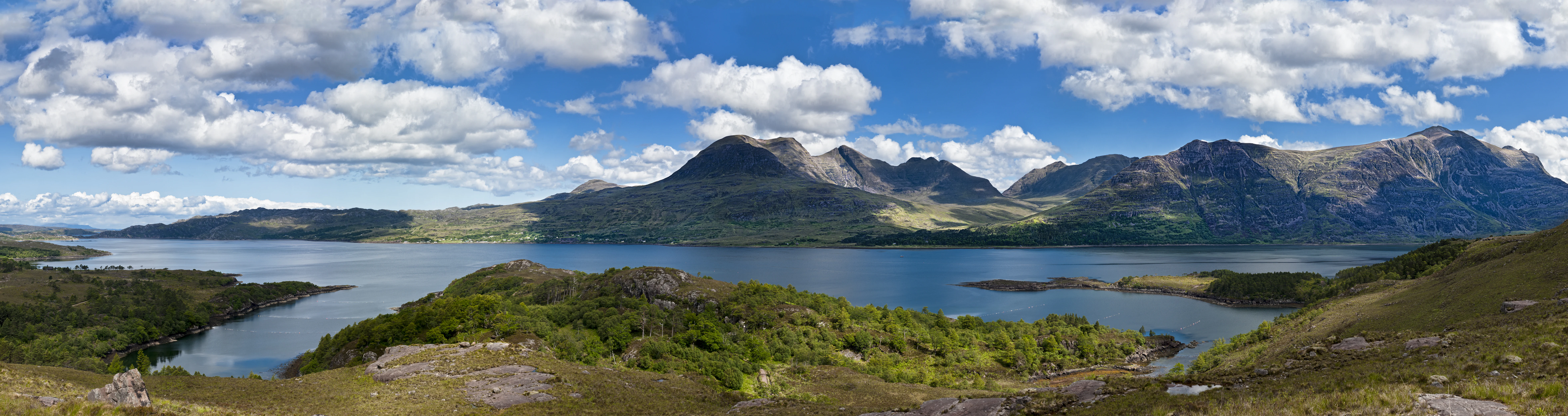
Panoramic view of a calm, large sea loch surrounded by rolling green hills, dense forested slopes, and prominent craggy mountain peaks under a bright blue sky with scattered white clouds.
A sweeping panoramic view of Upper Loch Torridon, showcasing the rugged mountain peaks and reflective waters characteristic of the Wester Ross National Scenic Area.

Wester Ross National Scenic Area history and protected-area timeline

Wester Ross has been inhabited since the Mesolithic period, with traces of early occupation found at sites including Redpoint, Shieldaig, and the rock shelter at Sand on the Applecross peninsula, where bone, stone, and antler tools were recovered alongside food-processing waste. Permanent settlement expanded during the Neolithic era as forests were cleared for farming.

The area came under Pictish influence in late antiquity and was largely Christianised by the seventh century. From the eighth century, Norse settlers established dominance along the western seaboard, and the legacy of this Norse contact lives on in many coastal place names. After the decline of Norse power following the Battle of Largs, the semi-independent Lords of the Isles held sway over the western coast until the fifteenth century, when the Scottish Crown reasserted control.

The sixteenth century marked the height of the Highland clan system, and Wester Ross was contested between the Mackenzies and the Macdonalds. Land was farmed under the communal run-rig system, with cattle-rearing, droving, and the cultivation of oats, bere, and later potatoes forming the economic backbone. From the late eighteenth century, the Highland Clearances reshaped the region, displacing small tenants to make way for larger sheep farms, deer forests, and industrial ventures such as kelping. The planned fishing village of Ullapool was founded by the British Fishing Society in the 1780s as part of these changes.

The Crofters' Holdings Act of 1886 brought the era of clearances to a close by granting security of tenure to crofters, although large single-owner estates still dominate the landscape. The National Scenic Area designation followed in 1981, recognising the area's exceptional scenery and providing a framework to safeguard it from inappropriate development. The region was further recognised when UNESCO designated the Wester Ross Biosphere Reserve in April 2016.

Wester Ross National Scenic Area landscape and geographic character

The landscape of Wester Ross is shaped by some of the oldest rocks in Europe and by the erosive legacy of the ice age. Lewisian gneiss, more than 2.5 billion years old in places such as gruinard Bay, forms the foundation of the area, overlain by Torridonian sandstone deposited around 750 million years ago. The Moine Thrust Belt, a major linear geological feature, runs northeast across the area from near the Kyle of Lochalsh, while widespread glaciation carved the steep-sided glens, deep sea lochs, and isolated peaks that define the region today.

The mountains are the dominant scenic feature. The Torridon Hills include the Munros of Liathach, Beinn Eighe, and Beinn Alligin, together with the Corbetts of Beinn Dearg, Baosbheinn, and Beinn an Eoin. Other notable ranges include An Teallach and Slioch in the Dundonnell and Fisherfield Forest, and the hills of the Coulin Forest between Glen Torridon and Strathcarron. These Torridonian peaks rise as isolated massifs with steep terraced flanks and broken summit crests, often described as castle-like. Further south, the mountains of Kintail take the form of peaks linked by ridges that climb sharply from narrow glens and the sea.

The coastline is equally striking, with cliffs, rocky shores, skerries, sheltered sea lochs, and occasional sandy beaches and dune systems. Sea lochs such as Loch Carron and Loch Maree penetrate far inland, while the Bealach na Bà pass rises dramatically above the Applecross peninsula. Inland, the terrain includes broad glens like Glen Torridon and Glen Docherty, river systems with freshwater pearl mussel populations, blanket mires, and remote tracts of moorland and pinewood.
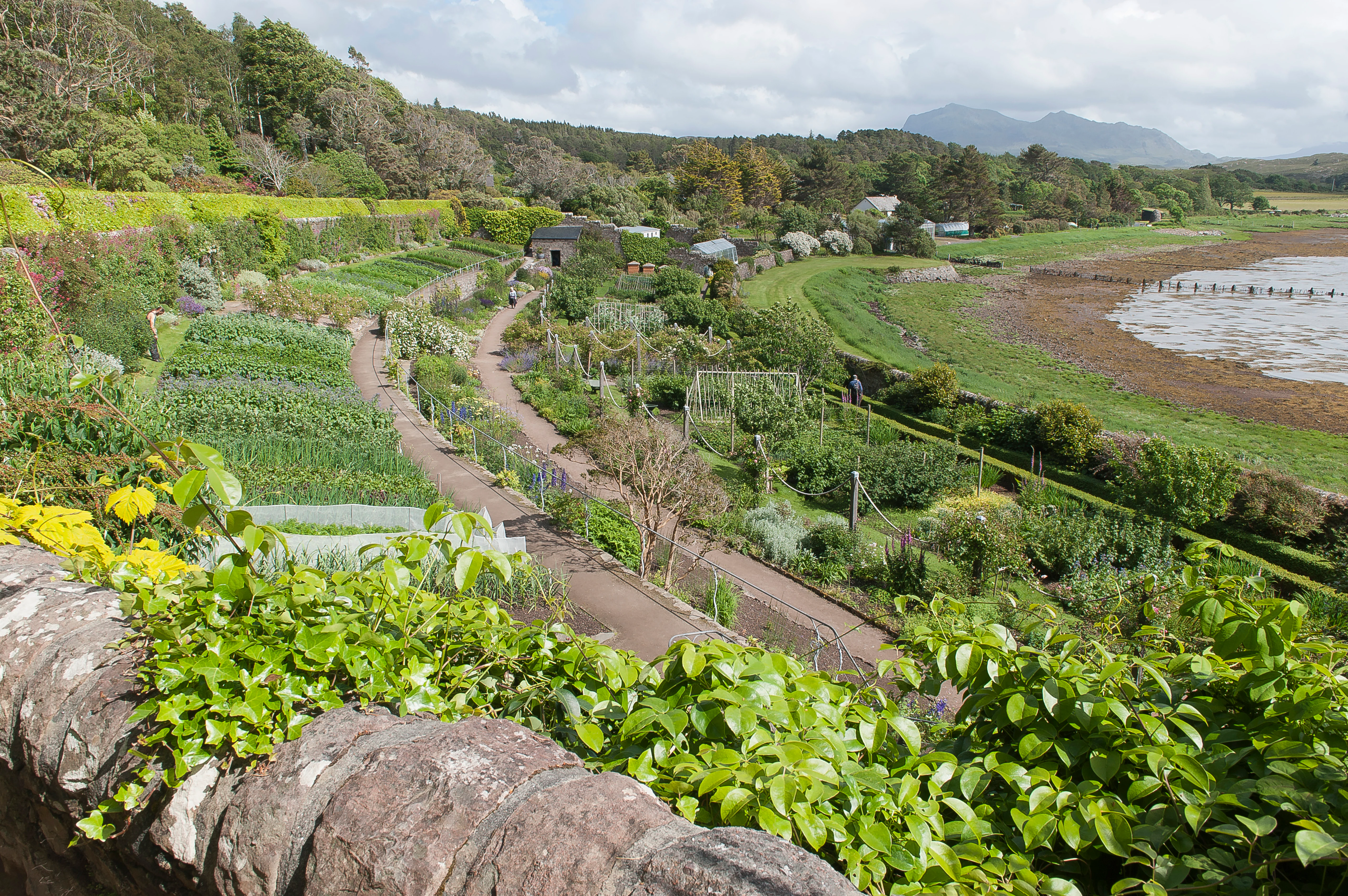
A high-angle view of a garden with various planted beds and pathways sloping toward a coastal shoreline with mudflats, framed by a stone wall covered in greenery in the foreground.
A view overlooking the cultivated paths and plant beds at Inverewe Gardens, situated along the shoreline.

Wester Ross National Scenic Area ecosystems, habitats, and plant life

Wester Ross supports one of the richest concentrations of distinct habitats in Scotland, ranging from sheltered sea lochs and coastal cliffs to high alpine heaths above 1,000 metres. The area forms part of one of the traditional Watsonian vice-counties used for biological recording, reflecting its ecological significance.

Coastal and marine habitats include rocky cliffs colonised by barnacles and seaweed, rocky islets used by harbour seals, sandy beaches and dune systems, sheltered sea lochs with maerl beds and deep mud banks, and the world's largest known flame shell beds in Loch Carron. Rivers and lochs support Atlantic salmon, sea trout, Arctic charr, freshwater pearl mussels, otters, and water voles, while freshwater lochs hold internationally important breeding concentrations of black-throated divers.

Inland, fragmented Caledonian pinewoods survive at Shieldaig, Coulin, Torridon, Beinn Eighe, Rhidorroch, Achnashellach, and on the Loch Maree Islands. These pinewoods, dominated by Scots pine with birch and rowan, are genetically distinct from pinewoods elsewhere in Scotland and support rare mosses, lichens, Scottish wood ants, red squirrels, and black grouse. Expansive blanket bogs dominated by sphagnum mosses host breeding golden plover, greenshank, dunlin, and red grouse, while montane heaths of mosses, liverworts, lichens, dwarf shrubs such as alpine bearberry, juniper, crowberry, and cowberry shelter arctic-alpine specialists such as ptarmigan, dotterel, and snow bunting, along with raptors including golden eagle and merlin.
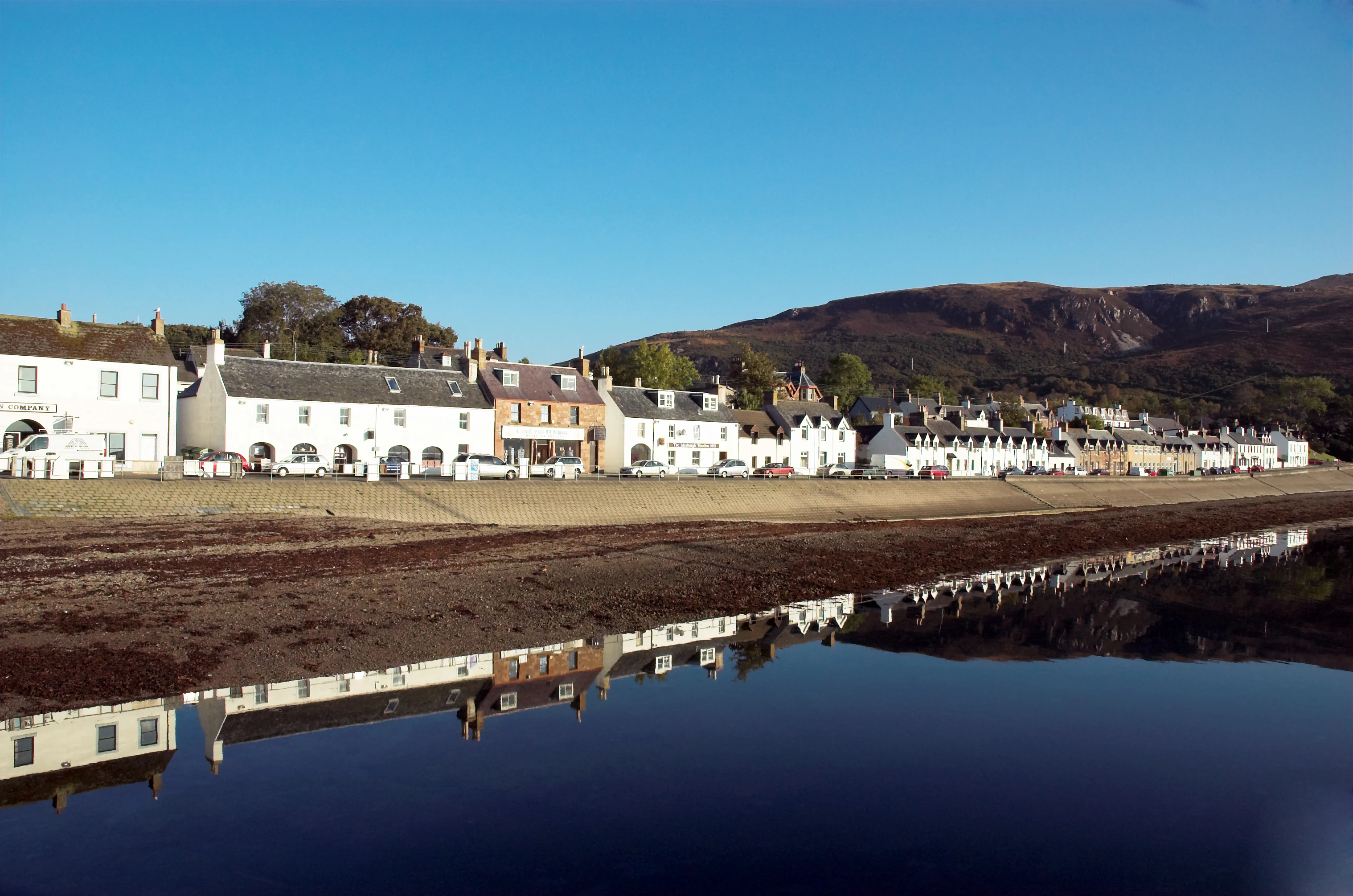
A wide view of a row of white and stone buildings along a shoreline, with their reflections visible in calm water and hills in the background under a clear sky.
The coastal village of Ullapool set against hills in the Wester Ross National Scenic Area.

Wester Ross National Scenic Area wildlife and species highlights

Wester Ross supports a remarkable breadth of wildlife, reflecting the variety of habitats from sea level to high summits. The cliffs and rocky islets of the coastline host large colonies of seabirds including puffins, fulmars, kittiwakes, razorbills, guillemots, black guillemots, cormorants, and shags. Whales, dolphins, porpoises, and seals are frequently seen in the outer lochs and open waters, while the sheltered sea lochs support distinct marine communities including maerl beds and flame shell reefs.

Inland, the rivers and lochs are internationally important for Atlantic salmon, sea trout, Arctic charr, and freshwater pearl mussels. Otters and water voles remain relatively numerous, although water voles elsewhere in Britain have been heavily impacted by American mink, which have only recently reached Wester Ross. The freshwater lochs are also a stronghold for breeding black-throated divers, near the southern edge of the species' range.

The Caledonian pinewoods and pine-oak mixtures provide habitat for red squirrels, black grouse, and rare invertebrates such as the Scottish wood ant, while the moorlands support breeding golden plover, greenshank, dunlin, and a resident population of red grouse. The alpine zone is home to ptarmigan, dotterel, snow bunting, and raptors such as golden eagle and merlin. White-tailed eagles were reintroduced to Wester Ross during the 1990s, building on the earlier reintroduction on Rùm, and this has been an important step in the species' recovery along Scotland's west coast.
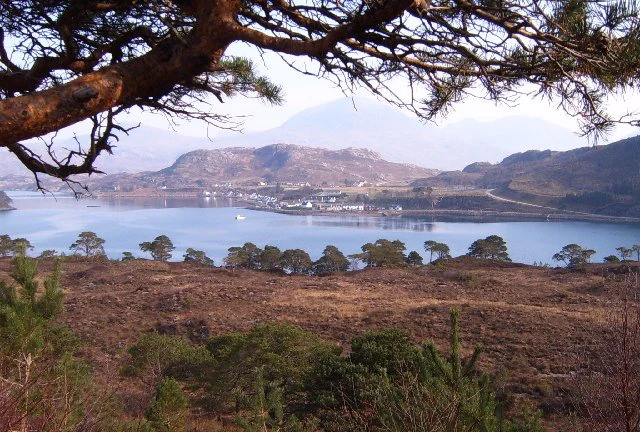
A wide, eye-level view of a village nestled along the shore of a calm sea loch, surrounded by rolling hills and mountains under a clear sky, with pine branches visible in the upper foreground.
A scenic view of the village of Shieldaig situated along the coast, framed by foreground trees.

Wester Ross National Scenic Area conservation status and protection priorities

Wester Ross holds an unusually rich stack of conservation designations. The National Scenic Area designation, one of forty across Scotland and established in 1981, provides protection against inappropriate development across 1,635 square kilometres of countryside and seascape. Around 20% of the area is further protected as Sites of Special Scientific Interest, recognising its botanical, geological, and ecological importance.

In April 2016, Wester Ross became a UNESCO Biosphere Reserve under the Man and the Biosphere Programme. The biosphere is structured into a Core Zone centred on the Beinn Eighe and Loch Maree Islands National Nature Reserve and Coille Mhór Special Area of Conservation, surrounded by a Buffer Zone that includes the National Trust for Scotland's Balmacara estate, and an extensive Transition Zone that covers inhabited crofting communities. The marine environment is also protected: in 2014 almost 60,000 hectares of coastal waters from Rubha Rèidh to Coigach were declared a Nature Conservation Marine Protected Area, safeguarding habitats such as maerl beds and the flame shell reefs of Loch Carron.

The conservation story is also one of active species recovery. The reintroduction of white-tailed eagles to Wester Ross in the 1990s contributed to a population that, by 2014, included 98 breeding pairs along Scotland's west coast. Conservation efforts elsewhere in Scotland have genetic relevance here as well: the Caledonian pinewoods of Wester Ross are genetically distinct from the pinewoods of central and eastern Scotland, making their protection internationally significant.

Wester Ross National Scenic Area cultural meaning and human context

Wester Ross retains a distinctive Gaelic cultural identity within the broader Highland region. Historically a Gaelic-speaking area, the language declined through persecution and the spread of compulsory English-language schooling in the late nineteenth century, but it remains comparatively strong here: according to the 2011 census, around 10.6% of residents reported Gaelic language ability, compared with just 1.1% across Scotland as a whole. Gaelic culture continues to shape local life through traditional music, ceilidhs, and place names of Gaelic and Norse origin.

The area's crofting townships preserve a long-standing pattern of small-scale, mixed land use along the coast, echoing the run-rig farming traditions that stretch back centuries. Modern Wester Ross combines traditional crofting, commercial fishing, fish farming, agriculture, and renewable energy, with tourism now accounting for a substantial share of employment. Cultural and historical layers are maintained by National Trust for Scotland properties such as the ruins of Strome Castle, the crofting estate at Balmacara, and Inverewe Garden, the latter founded by Osgood Mackenzie and renowned for its collection of exotic plants. The region's scenery has also reached wider audiences through films including Stardust and The Wicker Man, and through writers who have drawn on Wester Ross for both fiction and place-name inspiration.
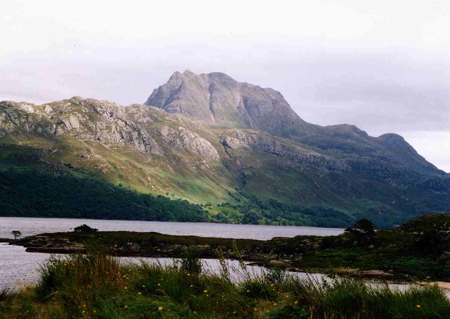
A wide landscape view of a large, rugged mountain peak, Slioch, looming over the calm, dark surface of Loch Maree, with green slopes and a rocky, vegetated foreground.
The peak of Slioch rising above the waters of Loch Maree.

Top sights and standout views in Wester Ross National Scenic Area

Wester Ross National Scenic Area encompasses some of the most iconic Highland scenery in Scotland, anchored by the Torridon Hills massif and a coastline of deep sea lochs, cliffs, and scattered settlements. Liathach, Beinn Eighe, Slioch, and An Teallach form the mountainous backbone of the area, while Loch Maree, Corrieshalloch Gorge, Glen Docherty, and the Bealach na Bà are among its most celebrated scenic landmarks.

Equally significant are the ecological highlights: surviving fragments of Caledonian pinewood, internationally important populations of freshwater pearl mussels and breeding black-throated divers, the world's largest flame shell beds in Loch Carron, and the dune systems at Achnahaird that host plant species found nowhere else in Scotland. Layered with the cultural heritage of crofting, Gaelic language, and National Trust for Scotland properties, these features combine to make Wester Ross a landscape of national and international conservation importance.
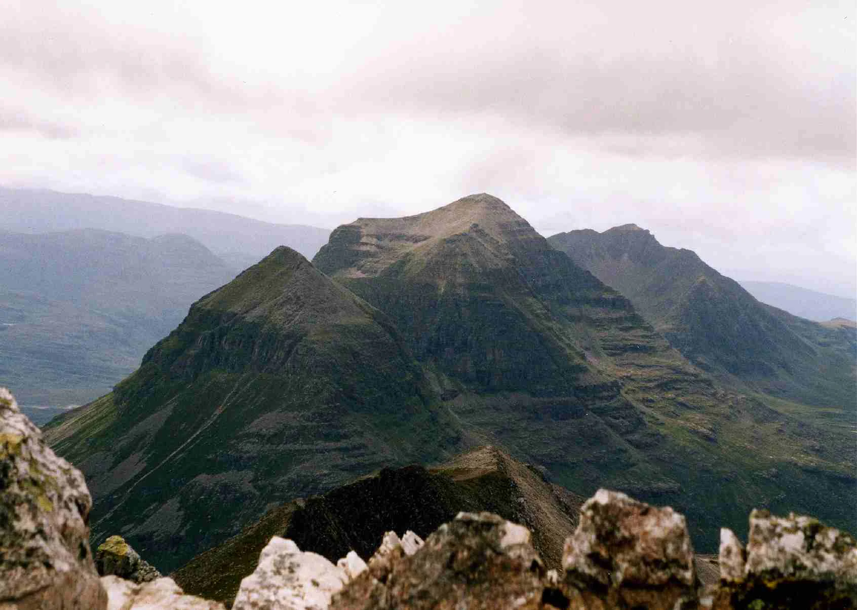
A wide shot of a jagged mountain massif with steep, terraced slopes under a cloudy sky, seen from a rocky high-altitude vantage point.
The rugged Liathach massif as seen from the slopes of Beinn Eighe in Wester Ross.

Best time to visit Wester Ross National Scenic Area

Wester Ross has a maritime climate moderated by the Gulf Stream, making it relatively mild for its latitude, though conditions vary sharply between coastal and upland areas. Late spring and summer bring longer days, warmer temperatures, and the best conditions for hill walking on the Torridonian ridges, with more stable weather for scrambling and mountaineering. Wildlife watching is rewarding across the warmer months: sea lochs host breeding seabirds, calving and feeding cetaceans, and seals, while inland lochs and pinewoods offer sightings of breeding divers, golden eagles, and pinewood specialists.

Autumn brings vivid colour to the birch, rowan, and Scots pine stands and can be quieter for visitors, though days shorten quickly. Winter conditions turn many hill routes into serious expeditions, with snow and ice on the high summits, while coastal areas remain comparatively mild, offering atmospheric scenery, dramatic skies, and winter birdlife. The shoulder seasons often balance accessibility, scenery, and visitor numbers, supporting a range of coastal, woodland, and hill experiences across the year.

Monthly climate preview

Long-term representative monthly temperature and precipitation data patterns

Wester Ross National Scenic Area Climate Normals and Temperature Rhythms

Representative coordinate measurements reveal the annual temperature progression and monthly precipitation averages recorded across Wester Ross National Scenic Area from 1991 to 2020. Reviewing the complete twelve-month climatology profile provides deeper analytical context for long-term regional weather variations.
Annual mean6 °C
1 °C12 °C
Jan
Feb
Mar
Apr
May
Jun10°
Jul12°
Aug12°
Sep10°
Oct
Nov
Dec
Warmest month
July

12.3 °C

Coolest month
January

1.4 °C

Wettest month
January

5.1 mm/day

Driest month
April

3.3 mm/day

Park location guide

Geography guide, regional context, and park location map for Wester Ross National Scenic Area

Wester Ross National Scenic Area park geography, regions, and map view in United Kingdom

Understand where Wester Ross National Scenic Area sits in United Kingdom through a broader geographic reading of the surrounding landscape, nearby location context, and its mapped position within the national park landscape.

How Wester Ross National Scenic Area fits into United Kingdom

The United Kingdom is a parliamentary constitutional monarchy located in northwestern Europe, consisting of four constituent countries: England, Scotland, Wales, and Northern Ireland. As a major global power with over 69 million residents, it maintains significant international influence in politics, economics, and culture.

Wider geography shaping Wester Ross National Scenic Area in United Kingdom

The United Kingdom is an island nation located in northwestern Europe, surrounded by the Atlantic Ocean, North Sea, English Channel, Celtic Sea, and Irish Sea. It shares a land border with the Republic of Ireland to the west. The territory includes the island of Great Britain, the northeastern portion of Ireland, and most of the smaller British Isles islands.

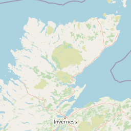
Map view of Wester Ross National Scenic Area

Use this park location map to pinpoint Wester Ross National Scenic Area in United Kingdom, understand its exact geographic position, and read its mapped placement within the surrounding landscape more clearly.

Pigeon | © OpenStreetMap contributors

Location context for Wester Ross National Scenic Area

HighlandScotland

Visual reference guide to the terrain, mountain massifs, and protected habitats

Wester Ross National Scenic Area Photos and Landscape Scenery

High-resolution photography captures the dramatic topography and coastal sea lochs defining Wester Ross National Scenic Area. Visual analysis of the rugged terrain reveals ancient geological formations, steep glens, and rare Caledonian pinewood remnants.

Panoramic view of a calm, large sea loch surrounded by rolling green hills, dense forested slopes, and prominent craggy mountain peaks under a bright blue sky with scattered white clouds.

A wide view of jagged mountain peaks under a cloudy sky in the Scottish Highlands, with a lone hiker in the bottom left foreground.

A high-angle view of a garden with various planted beds and pathways sloping toward a coastal shoreline with mudflats, framed by a stone wall covered in greenery in the foreground.

A wide view of a row of white and stone buildings along a shoreline, with their reflections visible in calm water and hills in the background under a clear sky.

A wide, eye-level view of a village nestled along the shore of a calm sea loch, surrounded by rolling hills and mountains under a clear sky, with pine branches visible in the upper foreground.

A narrow, deep gorge with a waterfall cascading down the center, surrounded by lush green forest and rocky cliffs.

A wide landscape view of a large, rugged mountain peak, Slioch, looming over the calm, dark surface of Loch Maree, with green slopes and a rocky, vegetated foreground.

A wide shot of a jagged mountain massif with steep, terraced slopes under a cloudy sky, seen from a rocky high-altitude vantage point.

Two hikers walking along a rocky, steep mountain ridge with a towering, sharp-peaked mountain massif in the background under an overcast sky.

A sloped hillside covered in sparse, native Scots pine trees above a wire fence, set against a clear blue sky.

A high-angle view looking over a rocky, desolate mountain summit toward a deep valley with a dark lake and layered mountain ridges under a blue sky with wispy clouds.

Park atlas

Compare adjacent highland terrain, sea lochs, and regional protected areas in Northwest Scotland

Exploring Parks Near Wester Ross National Scenic Area and Surrounding Protected Landscapes

Continue browsing nearby protected areas and mountain reserves situated across the surrounding Northwest Highlands region. Comparing adjacent terrain helps contextualize the unique sandstone massifs and coastal sea lochs found within Wester Ross National Scenic Area.
A soft, impressionistic watercolor painting of a Scottish loch surrounded by rolling green hills and distant mountain silhouettes.
Marine protected areaRoss and Cromarty
About 38 km away#1 closest

Southwest

Loch Carron Marine Protected Area: Coastal Geography and Protected Seabed Landscape Atlas

Exploring the tidal basins and underwater terrain of Ross and Cromarty.

Loch Carron stands as a landmark marine protected area defined by its dramatic underwater depth changes and robust tidal currents. This protected sea loch features the world's largest flame shell colony nestled beneath the cliffs at Strome Castle. The surrounding Highland geography of Ross and Cromarty creates a compressed, mountain-framed landscape that influences the rich ecological character of this essential coastal habitat.

Area
23 km²
Established
2019
Relief
Lowland
Climate
Temperate
Marine protected areaHighland
About 51 km away#2 closest

Southwest

Loch Alsh Nature Conservation Marine Protected Area: Geography and Protected Boundaries

A vital Highland marine landscape featuring rare underwater flame shell colonies.

Loch Alsh sits as a distinct marine boundary in the Northwest Highlands of Scotland. This protected area safeguards a vast seafloor ecosystem, most notably a massive flame shell colony that has transformed local understanding of marine biodiversity in the region. The loch landscape blends ancient metamorphic geology with the fjord-like waters separating Skye from the mainland, offering a unique perspective on protected coastal terrains.

Area
0.75 km²
Established
2014
Relief
Mountain
Climate
Temperate
Protected landscapeHighland
About 63 km away#3 closest

West

Trotternish National Scenic Area: A Geographic Atlas of the Isle of Skye Protected Landscape

Basalt escarpments and geologic landmarks in the Scottish Highlands

Trotternish National Scenic Area features a long, continuous basalt escarpment that defines the spine of northern Skye. This protected landscape contains complex ridge formations, dramatic coastal cliffs, and a rich record of Jurassic geology. Learn about the physical geography, mapped extent, and natural terrain that make this region a key protected area within the Highland geography of Scotland.

Established
1981
Relief
Upland
Climate
Temperate
Access
Moderate access
Watercolor painting of soft rolling dunes, green hills, and light clouds.
Protected areaSutherland
About 78 km away#4 closest

East

Coul Links Protected Area: Coastal Dune and Heathland Geography in Sutherland, Scotland

A study of coastal dune succession and wetland terrain

Coul Links serves as a quintessential example of a Scottish coastal links landscape, tracing a continuous path from active beach fronts through to stable, juniper-rich heathland. Situated in Sutherland, the site offers a window into the formation of dune slacks, seasonal freshwater lochans, and the ecological dynamics of a complex, interwoven coastal system.

Relief
Lowland
Climate
Temperate
Access
Easy access
Scope
Terrestrial
A wide watercolor illustration showing a mountain range in the distance, a valley, and green forests on either side, with soft pastel colors.
Protected landscapeHighland
About 81 km away#5 closest

North

North West Sutherland National Scenic Area: Mapping the Peaks and Coasts of Highland Scotland

Protected quartzite mountain landscapes and Atlantic coastal geography

This detailed overview of the North West Sutherland National Scenic Area maps the dramatic interplay between the white quartzite mountains of Foinaven and Arkle and the darker Lewisian gneiss that forms the underlying Highland landscape. The analysis provides deep insights into the region's knock and lochan topography, sea lochs, and the protected coastal habitats of Handa Island, anchoring the area within its broader Scottish geological context.

Area
266 km²
Established
1981
Relief
Mountain
Climate
Temperate
Watercolor painting depicting mountains, forested hills, and a river in a scenic landscape
National parkScotland
About 83 km away#6 closest

Southeast

Cairngorms National Park: Explore Scotland's Largest Protected Mountain Landscape

Mapped boundaries and arctic-alpine geography.

As the United Kingdom's largest national park, Cairngorms National Park in Scotland presents a vast expanse of distinctive arctic-alpine terrain and ancient Caledonian forests. This protected landscape offers a unique opportunity to explore mapped geographic features, from its extensive mountain plateaus to its vital river systems. Discover the contours and context of this significant natural area within the broader atlas of Scotland's protected lands.

Area
4,528 km²
Established
2003
IUCN
V
Visitors
1.9M annual
Watercolor painting of a coastal landscape with distant mountains, a rocky shoreline, and light foreground vegetation on a white background.
Protected landscapeHighland
About 100 km away#7 closest

Southwest

Small Isles Protected Landscape: Atlas of the Highland Inner Hebrides Archipelago

Mapped terrain, volcanic geology, and coastal protected areas.

Delve into the geography of the Small Isles, a protected landscape encompassing Rùm, Eigg, Canna, and Muck. This atlas entry provides a structured look at the volcanic peaks, maritime skerries, and diverse land-stewardship boundaries that define this remote Scottish archipelago.

Area
472.35 km²
Established
1981
Relief
Mountain
Climate
Temperate
A pale, minimalist watercolor painting showing gentle hills, a curved shoreline, and sparse grass against a white background.
Protected areaNa h-Eileanan Siar
About 101 km away#8 closest

Northwest

Isle of Lewis Protected Area: Geography, Coastal Landscapes, and Highland Terrain

Mapped regional geography of the Outer Hebrides

The Isle of Lewis represents a significant protected landscape defined by its ancient geological roots and diverse coastal ecosystems. From the lime-rich machair grasslands of the west to the deeply indented sea lochs of the east, this area offers a unique perspective on the physical geography and inland peatland networks of the North Atlantic.

Area
1,770 km²
Visitors
219K annual
Relief
Mixed relief
Climate
Temperate

Common questions about visiting, size, designation, and location context for Wester Ross National Scenic Area

Wester Ross National Scenic Area FAQs for park facts, access, geography, and protected area context

Find quick answers about Wester Ross National Scenic Area, including protected-area facts, park geography, trail and visitor context, and how the park fits into its surrounding country and regional landscape.
MoriAtlas Explorer

Continue Your Protected Areas Search Across the Global Atlas

Deepen your exploration by continuing the structured search for national parks and protected areas worldwide. Utilize the comprehensive filtering capabilities to compare different conservation landscapes and refine your understanding of global park geography. Discover more about the distribution and characteristics of protected natural areas.

Global natural geography