Mori Atlas logo
National parkWhite Sands National Park

Trace the protected boundaries and unique dune landscape of White Sands National Park.

White Sands National Park: A National Park Mapped and Explored in New Mexico

White Sands National Park represents a distinct protected area within the geography of New Mexico, offering a unique mapped landscape for focused exploration. This national park serves as a key entity for understanding regional protected lands and their geographic context, providing a specific lens through which to discover the natural terrain and mapped boundaries characteristic of this iconic desert environment.

gypsum dunesdesert landscapeunique geologyendemic speciesNew Mexico national parksPleistocene fossils

White Sands National Park

National park

Park overview

Structured park overview, official facts, and landscape profile for White Sands National Park

White Sands National Park park facts, protected area profile, and essential visitor context
Review the core facts for White Sands National Park, including designation, size, terrain, visitor scale, habitats, and operating context in one park-focused overview.

About White Sands National Park

White Sands National Park occupies a unique position in the American protected areas landscape, preserving not only a geological wonder but also a living laboratory of adaptation and survival. The Tularosa Basin, where the park is situated, has a rich geological history dating back to the Permian Period when shallow seas left behind gypsum deposits that would eventually form the dramatic white dunes. The current dunefield began forming approximately 7,000 to 10,000 years ago as ancient Lake Otero dried, leaving behind selenite crystals that wind and water broke down into the fine white sand that defines the landscape today. Unlike desert dunes found elsewhere in the world, which are typically composed of silica-based quartz, the gypsum dunes of White Sands represent a rare geological phenomenon. The sand remains cool to the touch even on hot days because gypsum has a low thermal conductivity, and the dunes constantly shift and reform under the prevailing southwestern winds, creating an ever-changing landscape. The park is completely encircled by military installations, creating a unique juxtaposition of natural preservation and national defense that has shaped its management and visitor experience since the establishment of White Sands Missile Range in 1941.

Quick facts and research context for White Sands National Park

White Sands National Park is located in Otero and Doña Ana counties in southern New Mexico, with the nearest city being Alamogordo approximately 15 miles northeast. The park was established as a national monument on January 18, 1933, by President Herbert Hoover and redesignated as a national park on December 20, 2019, making it one of the newest national parks in the United States. The park receives approximately 600,000 to 700,000 visitors annually, making it the most visited National Park Service site in New Mexico. The gypsum dunefield contains about 4.5 billion short tons of sand and reaches depths of about 30 feet below the interdunal surface.

Park context

Deeper park guide and search-rich context for White Sands National Park

White Sands National Park history, landscape, wildlife, and travel context
Explore White Sands National Park through its history, landscape character, ecosystems, wildlife, conservation priorities, cultural context, and seasonal travel timing in a structured park guide built for atlas discovery and search intent.

Why White Sands National Park stands out

White Sands is best known for its extraordinary gypsum dunefield, the largest of its kind on Earth. The bright white dunes, composed of calcium sulfate crystals rather than typical silica-based sand, create a surreal landscape that shifts and moves with the wind. The park is also famous for its paleontological significance, housing some of the oldest known human footprints in North America, dating back 21,000 to 23,000 years, alongside fossil tracks of Ice Age megafauna including mammoths, ground sloths, and saber-toothed cats. The unique white coloration of many endemic species, from reptiles to moths, has evolved to blend with the bleached landscape.

White Sands National Park history and protected-area timeline

The human history of White Sands National Park spans tens of thousands of years, beginning with Paleo-Indians who inhabited the shores of Lake Otero around 12,000 years ago. These early inhabitants left behind not only stone tools and projectile points but also the oldest known human footprints in North America, discovered preserved in the gypsum soil of the basin. The Archaic people arrived approximately 4,000 years ago, followed by the Jornada Mogollon who established permanent settlements around 200 CE. Apache peoples arrived over 700 years ago, establishing territorial claims that they defended fiercely against colonial encroachment. The Battle of Hembrillo Basin in 1880 represents the closest archaeological evidence of the Apache Wars within the region. The area remained largely avoided by Spanish colonists due to limited water sources and Apache presence, though salt-gathering expeditions traveled to the salinas north of Alkali Flat beginning in 1647. Hispanic farming communities emerged at Tularosa in 1861 and La Luz in 1863, where residents used gypsum sand mixed with water to create plaster for their adobe homes. The concept of protecting the white sands dates to 1898, though the national monument was only established on January 18, 1933, by President Herbert Hoover. Tom Charles became the first custodian, and the WPA-built visitor center and support buildings constructed between 1936 and 1938 were added to the National Register of Historic Places in 1988. The redesignation to national park occurred on December 20, 2019, when President Donald Trump signed legislation that also added approximately 2,029 acres to the park.

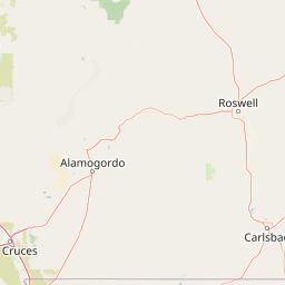
White Sands National Park landscape and geographic character

The physical landscape of White Sands National Park is defined by its extraordinary gypsum dunefield, which stretches across the Tularosa Basin in a sea of white that contrasts dramatically with the surrounding desert. The dunes vary significantly across the park, with the tallest exceeding 50 feet along the western margins and progressively decreasing in height toward the eastern boundary where they come to an abrupt stop. Several distinct dune types are present: dome dunes along the southwest margins, transverse and barchan dunes in the central field, and parabolic dunes along the northern, southern, and northeastern margins. The underlying geology includes the Alkali Flat, a large flat area of selenite crystals remaining from the evaporated Lake Otero, and Lake Lucero, an ephemeral lake in the southwest corner that periodically fills with gypsum-laden water. The San Andres Mountains rise beyond the park's western boundary, while the Twin Buttes rock formation lies to the south on Bureau of Land Management territory. Groundwater lies only a few feet below the surface throughout most of the dunefield, and the dunes themselves create a cooler, wetter microclimate than the surrounding desert soils.

White Sands National Park ecosystems, habitats, and plant life

The ecological character of White Sands National Park is defined by a harsh yet remarkably biodiverse desert environment where specialized species have evolved to thrive in conditions that would be inhospitable to most life. The park supports over 800 animal species and more than 300 plant species, with a particular concentration of endemic organisms that exist nowhere else on Earth. At least 45 species are endemic to the park, including 40 moth species, the Apache pocket mouse, the White Sands woodrat, and the bleached earless lizard. The gypsum-rich alkaline soils present challenges for plant life, yet drought-tolerant species including cacti, desert succulents, and specialized grasses have adapted to survive in temperatures ranging from sub-freezing to over 100 degrees Fahrenheit. Many plants are gypsophiles, thriving specifically in the gypsum-rich soils. The dunefield creates distinct habitat zones, with the more vegetated eastern dunes supporting different species assemblages than the sparsely vegetated western margins where dunes move most rapidly. The park's ecological significance extends to its function as a biological island within the larger desert ecosystem, with species adapting unique camouflage strategies to match the white landscape.

White Sands National Park wildlife and species highlights

White Sands National Park hosts an remarkable diversity of wildlife, with more than 800 animal species inhabiting the dunefield and surrounding desert environments. Several species have evolved distinctive white or off-white coloration as camouflage against the gypsum sand, including the Apache pocket mouse, bleached earless lizard, sand-treader camel cricket, sand wolf spider, and numerous moth species. Invertebrates form the largest group with over 600 species, including spiders, wasps, beetles, and the notably toxic Maricopa harvester ant, whose venom is among the most toxic in the insect world. Bird species number over 246, with common visitors including mourning doves, turkey vultures, red-tailed hawks, and Chihuahuan ravens, though most bird activity occurs in vegetated areas away from the heart of the dunefield. Mammals include coyotes, bobcats, badgers, kit foxes, desert cottontails, black-tailed jackrabbits capable of speeds up to 40 miles per hour, and Merriam's kangaroo rats that can jump up to 10 feet when frightened. Reptiles include the bleached earless lizard, little white whiptail, several snake species including the venomous rattlesnake and massasauga, and the desert box turtle. The White Sands pupfish represents the only fish species endemic to the Tularosa Basin.

White Sands National Park conservation status and protection priorities

White Sands National Park holds significant conservation value as the protector of the world's largest gypsum dunefield and the unique species that have evolved within this specialized environment. The park's designation as an IUCN Category V protected landscape recognizes its cultural and ecological significance, while the presence of 45 endemic species underscores its irreplaceable biodiversity value. The National Park Service has implemented specific conservation measures, including the construction of a 67-mile boundary fence in 1996 to prevent invasive oryx from the adjacent missile range from competing with native species for forage. The park's paleontological resources, including the oldest known human footprints in North America and extensive Ice Age megafauna tracks, represent irreplaceable scientific and cultural heritage requiring careful preservation. The redesignation to national park status in 2019 added approximately 2,029 acres of land and provided enhanced protection mechanisms, while also requiring careful coordination with the surrounding military installations to balance public access with defense-related operations.

White Sands National Park cultural meaning and human context

The cultural landscape of White Sands National Park encompasses thousands of years of human habitation, from Paleo-Indian hunter-gatherers to contemporary communities. The Tularosa Basin was home to the Jornada Mogollon people who established permanent agricultural settlements around 200 CE, leaving behind adobe structures and pottery that remain visible in the archaeological record. Apache peoples, particularly the Mescalero Apache, maintain an active cultural affinity to the landscape of their ancestors and supported the park's redesignation as a national park. Hispanic communities that settled in Tularosa and La Luz during the 1860s developed distinctive building practices using gypsum sand to create white plaster for adobe homes, a tradition that gave the landscape its characteristic architectural identity. The park's visitor center and support buildings, constructed in the Pueblo Revival style by the Works Progress Administration between 1936 and 1938, represent significant historical architecture and were added to the National Register of Historic Places as the White Sands National Monument Historic District.

Top sights and standout views in White Sands National Park

White Sands National Park offers visitors a distinctive combination of geological wonder, paleontological significance, and recreational opportunities centered around its extraordinary gypsum dunefield. The eight-mile Dunes Drive provides vehicle access into the heart of the white sand landscape, while five marked trails totaling nine miles allow exploration on foot through varying dune formations. The park's unique recreation options include sledding on the dunes, a practice that has occurred for generations and remains popular despite the park's closure of alcohol possession from February through May. Ranger-guided programs include sunset strolls year-round, monthly Lake Lucero hikes from November through April, and full moon guided hikes from April through October. The backcountry campground offers overnight stays within the dunefield itself, providing an immersive experience of the ever-shifting landscape. Paleontological resources include the White Sands fossil footprints, representing potentially the oldest known human footprints in North America, alongside extensive Ice Age megafauna trackways.

Best time to visit White Sands National Park

White Sands National Park can be visited year-round, though the experience varies considerably by season. The busiest periods occur during March and July, each receiving more than 60,000 visitors, while November through February see the fewest visitors with less than 30,000 monthly. Summer months from June through August bring afternoon temperatures averaging around 97 degrees Fahrenheit, though the gypsum sand remains surprisingly cool to the touch due to its low thermal conductivity. Winter months from November through March feature cooler temperatures with average highs in the 50s and 60s Fahrenheit, though nighttime temperatures can drop below freezing. The park is completely surrounded by White Sands Missile Range, and periodic missile tests may require temporary closures of Dunes Drive and all visitor activities, sometimes with as little as 24 hours notice. Photography is popular throughout the year, with the white dunes providing striking contrast against blue skies and colorful sunsets. Visitors seeking fewer crowds should consider visiting during the cooler months from November through February.

Park location guide

Geography guide, regional context, and park location map for White Sands National Park

White Sands National Park park geography, regions, and map view in United States of America
Understand where White Sands National Park sits in United States of America through a broader geographic reading of the surrounding landscape, nearby location context, and its mapped position within the national park landscape.

How White Sands National Park fits into United States of America

The United States of America is a federal presidential republic and one of the world's largest countries by area and population. It consists of 50 states across a vast territory spanning multiple time zones, with its capital in Washington, D.C. and largest city in New York City. The nation has a diverse economy, influential political system, and significant cultural and military presence globally.

Wider geography shaping White Sands National Park in United States of America

The United States occupies a vast territory in North America, bordered by Canada to the north and Mexico to the south. The 48 contiguous states stretch from the Atlantic to the Pacific Ocean, while Alaska occupies the northwestern region and Hawaii is an archipelago in the Pacific. The country encompasses diverse terrain including the Rocky Mountains, Appalachian Mountains, Great Plains, and extensive river systems.

Map view of White Sands National Park

Use this park location map to pinpoint White Sands National Park in United States of America, understand its exact geographic position, and read its mapped placement within the surrounding landscape more clearly.

Pigeon | © OpenStreetMap contributors

Location context for White Sands National Park

Doña Ana CountyNew MexicoOtero County
Park atlas

Map related protected areas, diverse desert landscapes, and regional parks near White Sands National Park.

Explore Parks Near White Sands National Park: Related Protected Areas
Discover other national parks and protected areas located near White Sands National Park, encompassing varied desert landscapes and regional mountain ranges. Compare different conservation landscapes and diverse park geographies, extending your exploration from the iconic gypsum dunes into the broader American Southwest.
National parkCulberson County

Guadalupe Mountains National Park: Mapped Boundaries and Protected Landscape Identity

Explore the geography and terrain of this Texas national park.

Guadalupe Mountains National Park is a key protected area within Culberson County, West Texas. This national park offers a distinct geographic focus, allowing for detailed exploration of its mapped boundaries and the unique natural landscapes that define its protected status. Understanding its place within the Trans-Pecos region provides valuable context for regional geography and atlas-based discovery of conservation lands in Texas.

Area
349.51 km²
Established
1972
IUCN
II
Visitors
206.4K annual
National parkEddy County

Carlsbad Caverns National Park: Detailed Protected Area and Landscape Exploration

View mapped terrain and geographic context for this Eddy County national park.

Gain a deep understanding of Carlsbad Caverns National Park through its specific geographic features and protected landscape identity. This entry provides foundational atlas-level information on the park's mapped boundaries and its role as a designated national park within the broader regional geography of Eddy County. It is designed to offer precise context for users focused on understanding the specific natural terrain and conservation geography of this important protected area, facilitating structured discovery.

Area
189.26 km²
Established
1930
IUCN
II
Visitors
410.8K annual
National parkNavajo County

Petrified Forest National Park: National Park Protected Landscape and Geographic Atlas

Explore its mapped terrain and regional park context.

Petrified Forest National Park represents a significant protected landscape within Navajo County, Arizona, offering focused insights into its unique terrain and geographic distribution. As a national park, it provides valuable data for understanding mapped park boundaries, regional landscape context, and its role within the broader atlas of protected areas. Discover the specific geographic features and natural identity that define this unique natural reserve.

Area
895.94 km²
Established
1962
IUCN
II
Visitors
644.9K annual
National parkPima County

Saguaro National Park: Discover Its Protected Landscape Geography and Mapped Boundaries

Explore the natural terrain and regional context of this national park.

Saguaro National Park offers a focused exploration of a specific protected landscape, highlighting its unique geographic features and mapped boundaries within Pima County. This detail page provides an atlas perspective, allowing for a deep dive into the park's natural terrain and its regional significance. Understand the protected area's identity and its place within the wider geographical context.

Area
371.16 km²
Established
1994
IUCN
II
Visitors
946.4K annual
National parkChihuahua

Cumbres de Majalca National Park: National Park Discovery and Geographic Context in Chihuahua

Mapped protected landscape exploration in Chihuahua.

Delve into the protected landscape of Cumbres de Majalca National Park, a national park situated in the Chihuahua region of Mexico. This entry provides essential geographic context and details on its mapped boundaries, serving as a key point for atlas-based exploration of Mexico's protected areas. Understand its specific contribution to the regional geography and conservation landscape.

Area
47.72 km²
Established
1939
IUCN
II
Relief
Mountain
National parkBrewster County

Big Bend National Park: National Park, Mapped Protected Landscape, and Regional Geography

Explore Brewster County's protected natural terrain.

Big Bend National Park is a prominent national park defined by its protected landscape and geographic features within Brewster County. This destination provides users with detailed atlas-style information, focusing on the park's mapped boundaries and its contribution to the understanding of regional natural geography. Delve into the specific context of this protected area to enhance your geographic discovery.

Area
3,242.19 km²
Established
1944
IUCN
II
Visitors
568.1K annual
National parkMontezuma County

Mesa Verde National Park: Protected Landscape Atlas and Geographic Identity

Discover the mapped terrain and regional context of this national park.

Mesa Verde National Park serves as a critical protected landscape within Montezuma County, offering distinct insights into regional geography and mapped terrain. This entry details the park's identity as a National Park, emphasizing its geographic setting and providing a foundation for atlas-driven exploration. Understand the park's place within the broader landscape context and its significance as a mapped protected area, ideal for focused geographic study.

Area
212.4 km²
Established
1906
IUCN
II
Visitors
463.1K annual
National parkOcampo Municipality

Basaseachic Falls National Park: National Park Geography and Mapped Boundaries

Explore protected lands within Ocampo Municipality.

Basaseachic Falls National Park serves as a key protected area within Ocampo Municipality, Mexico. This page provides detailed geographic information and mapped boundaries, essential for understanding its landscape context and its significance as a national park. Dive into the atlas-style data to appreciate the park's protected terrain and its contribution to the regional geography, offering a factual discovery experience.

Area
58.03 km²
Established
1981
IUCN
II
Relief
Mountain

Common questions about visiting, size, designation, and location context for White Sands National Park

White Sands National Park FAQs for park facts, access, geography, and protected area context
Find quick answers about White Sands National Park, including protected-area facts, park geography, trail and visitor context, and how the park fits into its surrounding country and regional landscape.
MoriAtlas Explorer

Continue Your Protected Areas Search Across the Global Atlas

Deepen your exploration by continuing the structured search for national parks and protected areas worldwide. Utilize the comprehensive filtering capabilities to compare different conservation landscapes and refine your understanding of global park geography. Discover more about the distribution and characteristics of protected natural areas.

Global natural geography