
Mori Atlas logo
Protected areaWildebach

Mapping the natural creek corridors and damp meadow landscapes of this protected district

Wildebach Protected Area and Stream Valley Geography in the Siegerland of Nordrhein-Westfalen

(Naturschutzgebiet Wildenbachtal)

The Wildebach protected area preserves an ecologically intact stream valley within the rolling low-mountain terrain of Nordrhein-Westfalen, Germany. This site features a natural watercourse winding between forested ridges and damp, traditional meadows, serving as a critical habitat counterbalance to the surrounding conifer and farmland regions of the Rothaargebirge foothills. Explore the specific valley topography and watershed features that define this representative section of the Siegerland landscape.

stream valleynature reservewet meadowlow mountain landscapeRothaargebirge foothillsprotected landscape
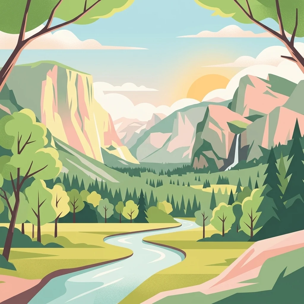
A flat vector illustration of a valley between tall mountains with a winding river flowing through the center. Pine trees and deciduous trees line the banks of the river under a soft sunrise sky.

Wildebach

Protected area

Park overview

Structured park overview, official facts, and landscape profile for Wildenbachtal Nature Reserve

Wildenbachtal Nature Reserve park facts, protected area profile, and essential visitor context

Review the core facts for Wildenbachtal Nature Reserve, including designation, size, terrain, visitor scale, habitats, and operating context in one park-focused overview.

About Wildenbachtal Nature Reserve

The Wildenbachtal Nature Reserve occupies a narrow section of the Wildebach valley in the southern Siegerland, a low-mountain region on the northern edge of the Rothaargebirge. The reserve follows the lower course of the Wildebach between the villages of Wilden and Salchendorf, capturing a stretch of valley where the stream still runs within its natural bed.

The Wildebach itself is a modest stream that rises near Wilnsdorf at an elevation of roughly 515 meters above sea level. From its source, it flows around the Wildenberg hill, passes through the Landeskroner Weiher reservoir, and continues northwestward past the Landeskrone industrial area into the villages of Mittelwilden, Oberwilden, and Unterwilden. After emerging from the smaller settlements and tracing the Bautenberg hill, the stream enters Salchendorf, briefly runs beneath the SSI Schäfer company site in a culvert, and finally reaches the town of Neunkirchen, where it empties into the Heller river from the right bank at an elevation of about 257 meters.

The protected area established in 1990 preserves the lower reaches of this course, focusing on a roughly 1.8 kilometer stretch where the valley retains a semi-natural character. The valley floor consists of damp, species-rich meadows that historically were not heavily fertilized, allowing native wet-grassland vegetation to persist. The flanking slopes and valley sides are largely wooded, although much of the surrounding forest consists of economically planted spruce rather than natural mixed woodland.

Although small in absolute terms, the Wildenbachtal reserves an unusually coherent example of a Rothaargebirge stream valley landscape. The reserve's roughly 20 hectares, of which about 15 lie within Neunkirchen municipality, document a valley profile ranging from about 25 meters wide at its narrowest constrictions to about 350 meters at its widest openings. This combination of natural stream morphology, undisturbed wet meadows, and relatively intact valley geometry gives the reserve its ecological and cultural value within the district's broader network of protected sites.

Quick facts and research context for Wildenbachtal Nature Reserve

The Wildenbachtal Nature Reserve lies within the Kreis Siegen-Wittgenstein district in the southern Siegerland, in the German state of North Rhine-Westphalia. Designated a protected nature area (Naturschutzgebiet) in 1990, it encompasses roughly 20 hectares of valley habitat along the Wildebach, of which approximately 15 hectares belong to the municipality of Neunkirchen.

The protected zone stretches about 1.8 kilometers between the settlements of Wilden and Salchendorf, ranging in width from roughly 25 meters at its narrowest point to about 350 meters at its broadest. It sits between elevations of approximately 300 and 330 meters above sea level, and is bordered on both sides by the forest edge.

Protection and recognition

Explore the recorded management scope and established conservation timeline for Wildebach.

Wildebach Protection Status and Terrestrial Designation History

Wildebach maintains a documented terrestrial protection status established in 1990 without external transboundary affiliations or imported international recognition sources. Structured administrative records outline the formal designation history and baseline management framework governing the natural area.

Protection details

Protection scope
Terrestrial
Designated year
1990
Transboundary protection
No
Park context

Deeper park guide and search-rich context for Wildenbachtal Nature Reserve

Wildenbachtal Nature Reserve history, landscape, wildlife, and travel context

Explore Wildenbachtal Nature Reserve through its history, landscape character, ecosystems, wildlife, conservation priorities, cultural context, and seasonal travel timing in a structured park guide built for atlas discovery and search intent.

Why Wildenbachtal Nature Reserve stands out

The Wildenbachtal is known for its preserved natural stream course and its damp, traditionally unfertilized meadows. Together, these features create a small but ecologically coherent valley habitat that contrasts with the surrounding conifer plantations and agricultural land use typical of the Rothaargebirge foothills.
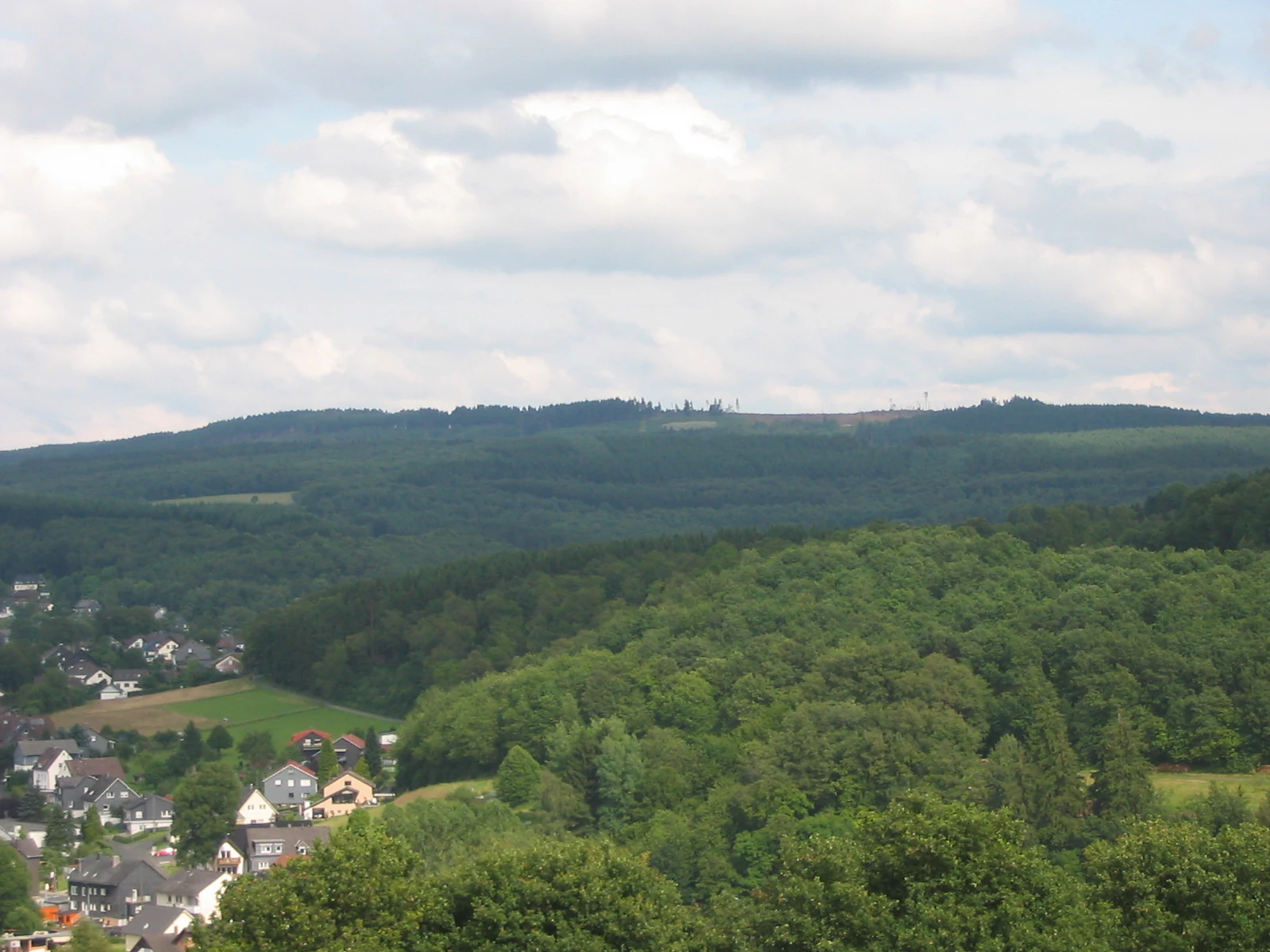
A wide view of a forested hill ridge under a cloudy sky, with a small village nestled in the valley in the foreground.
The Kalteiche hill seen from the village of Wilden, part of the Wildebach region.

Wildenbachtal Nature Reserve history and protected-area timeline

The valley has a long history of human use tied to agriculture and water management. The villages of Wilden, Oberwilden, Mittelwilden, and Unterwilden grew up along the stream, and the Landeskroner Weiher was created upstream by a dam to regulate water in the watershed. Historical floods shaped the relationship between the local population and the creek; the most severe documented event occurred in November 1890, when sustained rainfall combined with the failure of the Landeskroner Weiher dam to inundate fields, meadows, farmhouses, sheds, and stables along the Wildebach, destroying much of the winter harvest in the Wilden area.

Following subsequent decades of flood experience, the local built environment was gradually elevated through earthworks, so that houses and roads now sit above the level of the stream. The Wildenbachtal itself was formally designated as a nature reserve (Naturschutzgebiet) in 1990, formalizing the protection of about 20 hectares of valley habitat between Wilden and Salchendorf and establishing it as one of the recognized protected sites within the Kreis Siegen-Wittgenstein district.

Wildenbachtal Nature Reserve landscape and geographic character

The Wildenbachtal occupies part of a rolling low-mountain landscape on the northern slopes of the Rothaargebirge, where the watershed drains northward toward the Heller, the Sieg, and ultimately the Rhine. The valley falls within a broader upland region characterized by forested ridges, small stream-cut valleys, and scattered agricultural clearings.

The course of the Wildebach drops roughly 258 meters over its 11.7 kilometer length, producing an average bed gradient of about 22 per mille. The stream rises between the Kalteiche, the dominant summit at 579.3 meters, and the Wildenberg, which reaches 468.7 meters. Other notable hills around the watershed include the Löhrsberg (561.6 m), the Walkersdorfer Berg (526 m), the Bautenberg (512.9 m), the Stollenberg (467.2 m), and the Elkersberg (443.2 m), together with a series of smaller elevations such as the Kleine Rausche, Große Rausche, Spitzenberg, Stahlseifer Kopf, Leyenkopf, Rassberg, and Reifenberg.

The reserve itself occupies the flatter valley floor between about 300 and 330 meters above sea level. Its width varies considerably, from narrow constrictions roughly 25 meters across to broader openings up to about 350 meters wide. Forest stands reach down to the valley edge on both sides, and the creek continues to follow its original channel, broken in places only by the engineered dam at Landeskroner Weiher and by a short culvert section beneath the SSI Schäfer industrial site in Salchendorf.
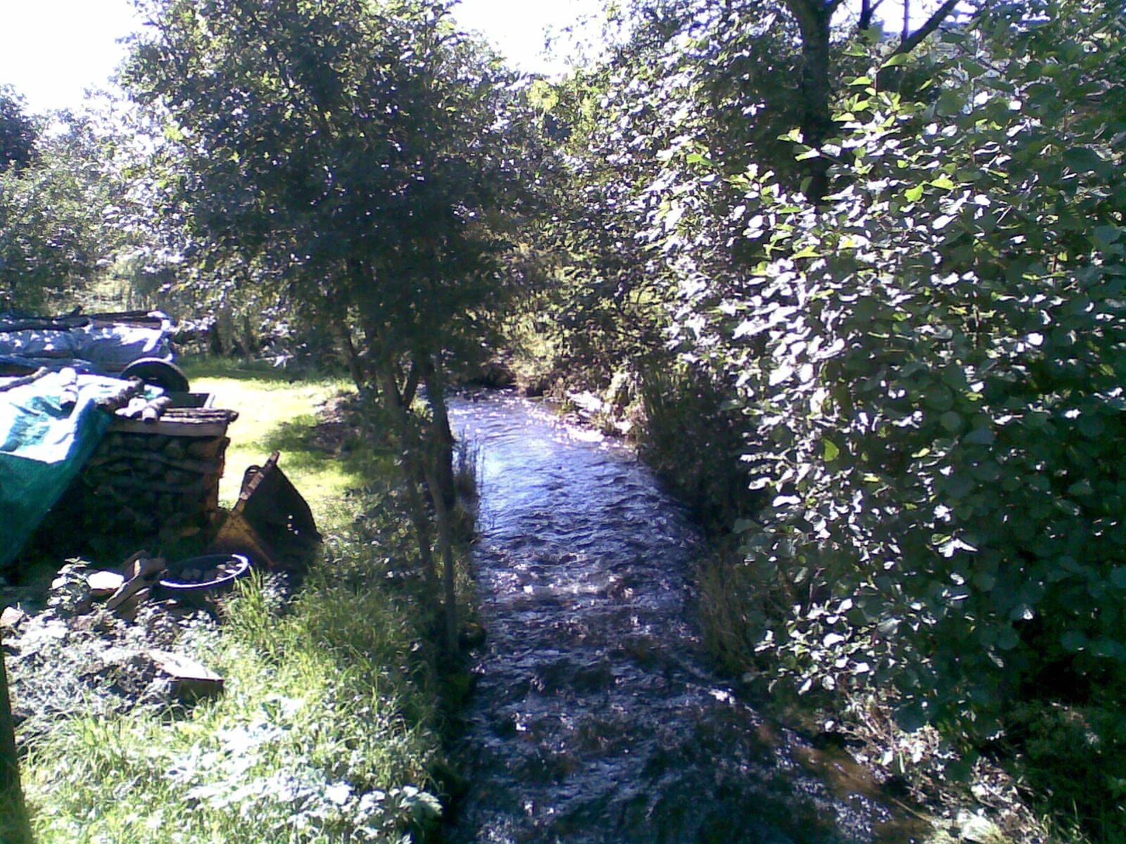
A small, narrow stream flowing through a tree-lined channel with a grassy bank and some storage materials on the left side.
The Wildebach stream flowing through Unterwilden.

Wildenbachtal Nature Reserve ecosystems, habitats, and plant life

The dominant habitat within the reserve consists of damp, traditionally unmanaged meadows, which retain a wet-grassland character due to the high groundwater levels along the valley floor and the long history of low-intensity use. These conditions support the kind of species composition typical of natural valley grassland: moisture-loving grasses, sedges, and herbaceous plants tolerant of seasonal flooding.

The flanking valley sides are wooded, although most of the surrounding woodland is composed of commercially planted spruce rather than natural mixed forest. The combination of wet meadow, natural stream channel, and adjacent forest edge produces a relatively narrow but ecologically diverse habitat mosaic within the reserve. Its valley geometry, with broad open sections where the meander belt fans out and narrow constrictions cut between the hillsides, also creates distinct microhabitats for insects, amphibians, and small aquatic life associated with slow-moving lowland stretches of the stream.

Wildenbachtal Nature Reserve wildlife and species highlights

Although the article does not enumerate specific species, the structural habitat of the reserve suggests a community typical of wet valley landscapes in the Rothaargebirge foothills. The unaltered stream bed and slow-moving reaches along the valley floor provide habitat for amphibians, aquatic invertebrates, and fish species adapted to small low-mountain waterways. The damp meadows support insect populations that in turn sustain small mammals and a variety of birds typical of low-intensity grassland habitats.

The surrounding spruce plantations limit the diversity of the woodland bird community compared to natural mixed forest, but the contrast between open meadow and forest edge nonetheless provides hunting and nesting habitat for common valley and forest-edge species. Historical accounts of severe floods indicate that the stream has historically been powerful enough to reshape valley meadows, a dynamic that continues to influence habitat turnover within the protected site.

Wildenbachtal Nature Reserve conservation status and protection priorities

The Wildenbachtal was formally protected as a Naturschutzgebiet in 1990, giving it legal status within the district-level network of nature reserves in Kreis Siegen-Wittgenstein. The designation covers about 20 hectares of valley habitat, of which approximately 15 hectares fall within the municipality of Neunkirchen, and extends roughly 1.8 kilometers along the valley floor between Wilden and Salchendorf.

The reserve's conservation value lies in the preservation of a near-natural stream course and the maintenance of traditional, unfertilized wet meadows. These features contrast with the surrounding land use, which includes spruce plantations and agricultural fields. By protecting the natural hydrology, the wet meadow vegetation, and the valley profile, the reserve maintains a small but ecologically representative example of the Rothaargebirge foothill valley landscape and contributes to habitat continuity along the broader Heller watershed.

Wildenbachtal Nature Reserve cultural meaning and human context

The Wildebach valley is closely tied to the rural settlement history of the southern Siegerland. The place names Oberwilden, Mittelwilden, and Unterwilden reflect a layered historical pattern of forest clearance and agricultural colonization along the stream, while the closely linked settlement of Neunkirchen represents the valley's traditional market and administrative center. Water management infrastructure such as the Landeskroner Weiher dam illustrates the long-standing importance of the stream for local water regulation and industry, including the modern SSI Schäfer company site through which the creek now briefly passes in a culvert.

Flood events, particularly the catastrophic November 1890 inundation caused by the failure of the Landeskroner Weiher dam, are part of the local collective memory of the valley. Recovery from that event shaped the elevated position of houses and roads relative to the present-day streambed. The 1990 designation of the Wildenbachtal as a nature reserve formalized a new stage in this relationship, positioning the valley both as cultural landscape and as a protected natural area within the district.

Top sights and standout views in Wildenbachtal Nature Reserve

The Wildenbachtal protects the longest and most ecologically intact stretch of valley along the Wildebach between Wilden and Salchendorf, combining a natural stream course with traditional damp meadows within a clearly bounded protected zone.

Its combination of narrow valley constrictions, broader meadow openings, and forested edges gives the reserve a varied microtopography in a compact area, and its location within the larger Heller watershed ties it to a wider network of valley habitats in the Kreis Siegen-Wittgenstein district.

Best time to visit Wildenbachtal Nature Reserve

Late spring into early summer is typically the most rewarding period to experience the Wildenbachtal, when low-intensity wet meadows produce their richest display of herbaceous vegetation and the stream flow is usually moderate. Late summer and early autumn can also offer pleasant walking conditions and active insect life in the meadows.

Heavy rain events and snow melt can cause the Wildebach to spill over its banks and flood the valley meadows. Visitors interested in the broader valley landscape will find the most stable ground and clearest meadow views outside the wettest parts of the year, while those drawn to wetland character may find milder wet conditions more characteristic of the valley's natural state.

Monthly climate preview

Long-term representative records tracking monthly averages and weather patterns

Wildebach Climate Normals: Annual Temperature and Precipitation Rhythm

Wildebach records sustained shifts in average temperature and precipitation across its representative coordinate point from 1991 to 2020. Examining the complete twelve-month climatology profile reveals deeper variations in historical weather patterns.
Annual mean8 °C
-1 °C17 °C
Jan-1°
Feb
Mar
Apr
May12°
Jun15°
Jul17°
Aug17°
Sep13°
Oct
Nov
Dec
Warmest month
July

17.4 °C

Coolest month
January

-0.7 °C

Wettest month
December

3 mm/day

Driest month
April

1.8 mm/day

Park location guide

Geography guide, regional context, and park location map for Wildenbachtal Nature Reserve

Wildenbachtal Nature Reserve park geography, regions, and map view in Germany

Understand where Wildenbachtal Nature Reserve sits in Germany through a broader geographic reading of the surrounding landscape, nearby location context, and its mapped position within the national park landscape.

How Wildenbachtal Nature Reserve fits into Germany

Germany is a federal republic in Western and Central Europe with a population of over 83 million across sixteen constituent states. It is Europe's largest economy by nominal GDP and a major global exporter and importer. The capital is Berlin, and the country borders Denmark, Poland, Czech Republic, Austria, Switzerland, France, Luxembourg, Belgium, and the Netherlands.

Wider geography shaping Wildenbachtal Nature Reserve in Germany

Germany is located in Western and Central Europe, spanning 357,022 km². It borders Denmark to the north, Poland and the Czech Republic to the east, Austria and Switzerland to the south, and France, Luxembourg, Belgium, and the Netherlands to the west. The country has coastlines on the Baltic Sea and North Sea to the north, with the Alps located in the southern region.

Map view of Wildenbachtal Nature Reserve

Use this park location map to pinpoint Wildenbachtal Nature Reserve in Germany, understand its exact geographic position, and read its mapped placement within the surrounding landscape more clearly.

Pigeon | © OpenStreetMap contributors

Location context for Wildenbachtal Nature Reserve

Nordrhein-Westfalen

Explore detailed imagery of the stream course, damp meadows, and low mountain terrain

Wildebach Photos and Landscape Scenery: Visualizing the Protected Valley Habitat

Visual documentation of Wildebach reveals the protected valley landscape, natural stream habitats, and surrounding upland terrain. Examining these protected area photographs provides clear insight into the topography and ecological character of the nature reserve.

A wide view of a forested hill ridge under a cloudy sky, with a small village nestled in the valley in the foreground.

A wide valley floor covered in meadow grass surrounded by dense coniferous and deciduous forests under a blue sky with scattered clouds.

A small, narrow stream flowing through a tree-lined channel with a grassy bank and some storage materials on the left side.

Park atlas

Compare nearby low mountain reserves and connected regional stream habitats

Explore Other Parks Near Wildebach and Surrounding Protected Valleys

Browsing other protected areas near Wildebach reveals broader ecological patterns across the low mountain foothills. Comparing adjacent valley reserves provides essential regional context for understanding local stream habitats and upland watersheds.
Protected areaNordrhein-Westfalen
About 8 km away#1 closest

Southwest

Wälder und Wiesen bei Burbach und Neunkirchen: Protected Area and Regional Geography

High Westerwald upland forests and mountain meadow mosaic

Situated across the tri-border area of North Rhine-Westphalia, this protected zone sustains a rare habitat combination of beech-dominated slopes and extensive montane grasslands. The basalt-influenced terrain supports specialized bird breeding populations, making the area a distinctive feature within the broader context of the central German uplands.

Area
46.546 km²
Established
2001
Relief
Upland
Climate
Temperate
A soft, painterly watercolor illustration of a rolling green landscape with a gentle stream or wetland area in the foreground and rounded hills in the background.
Nature reserveHessen
About 12 km away#2 closest

South

Aubachtal bei Rabenscheid Nature Reserve: Mapped Geography and Protected Area Data

A primary stream-valley habitat within the Hessen region

Aubachtal bei Rabenscheid offers a detailed look at a high-quality nature reserve in the Lahn-Dill-Kreis area of Hessen. The landscape is defined by the narrow valley of the Aubach, which supports a complex mosaic of wet meadows, alder swamp woodlands, and sedge mires. This site functions as a significant ecological refuge, contributing to the broader European network of protected areas through its distinct biodiversity and clean-water stream ecosystems.

Area
0.63 km²
Established
1984
IUCN
IV
Relief
Upland
A watercolor illustration of a forest edge with trees, mossy rocks, and ferns, featuring a soft, bright, and airy color palette.
Nature reserveHessen
About 12 km away#3 closest

South

Rabenscheider Holz Nature Reserve: Protected Landscapes and Stream Valleys in Hessen

Westerwald upland terrain and diverse woodland habitats

Rabenscheider Holz preserves a vital cross-section of Westerwald habitats, integrating mature broadleaf forests and traditionally managed grasslands. This nature reserve serves as an ecological anchor within the Ketzerbach stream valley, maintaining important woodland and meadow biodiversity in the state of Hessen.

Area
0.573 km²
Established
1994
IUCN
IV
A horizontal watercolor painting depicting a soft, impressionistic landscape with rolling hills in the background and a line of green trees and meadow in the foreground.
Nature reserveHessen
About 15 km away#4 closest

South

Feuerheck bei Waldaubach Nature Reserve: Upland Forest and Habitat Geography in Hessen

Protected broadleaf woodland landscapes and high-elevation habitat patterns.

Located in the German central highlands of Hessen, Feuerheck bei Waldaubach stands as a meticulously protected 24-hectare nature reserve. The site features a sophisticated interplay of deciduous woodland and moist meadow clearings, driven by high annual rainfall and varied soil conditions. This atlas entry provides essential data on the reserve's topography, forest management status, and its role as a key habitat for specialized invertebrates and woodland birds.

Area
0.244 km²
Established
1984
IUCN
IV
A soft watercolor painting showing green rolling hills in the foreground and faded purple and yellow mountain silhouettes against a white background.
Nature reserveRhineland-Palatinate
About 15 km away#5 closest

South

Fuchskaute Nature Reserve: Topographic Atlas and Protected Landscape Overview

Highland basalt summit of the Westerwald range in Rhineland-Palatinate

Fuchskaute represents a primary geographic landmark and nature reserve in the Hoher Westerwald. The site features an ancient, erosion-resistant basalt cap that supports rare upland heaths and species-rich meadows, distinct from the surrounding Devonian sediments. Our atlas data tracks its complex overlapping conservation status and provides a clear view of its summit plateau and surrounding hydrographic networks.

Area
0.402 km²
Established
1984
Relief
Mountain
Climate
Temperate
Watercolor painting of a soft, hazy landscape featuring gentle green hills, clusters of trees, and open fields against a white background.
Nature reserveHessen
About 16 km away#6 closest

South

Bermershube bei Heisterberg Protected Area: Geography and Landscape Atlas

Nature reserve in the Hoher Westerwald region of Hessen

Located in the Lahn-Dill district, Bermershube bei Heisterberg represents a concentrated mosaic of upland natural features. The protected landscape combines deciduous slope forests with spring-fed wetlands and meadows, creating an essential ecological corridor within the Hoher Westerwald plateau. Detailed geographic insights reveal the interplay between the Amdorf brook drainage and the surrounding undisturbed forest ecosystems.

Area
0.449 km²
Established
1984
IUCN
IV
Relief
Upland
A horizontal watercolor painting depicting a soft, green landscape with a winding stream through a flowery meadow and forested hills in the background.
Nature reserveHessen
About 18 km away#7 closest

South

Die Heck bei Hohenroth Nature Reserve: Hessen Protected Forest and Geography

High-elevation woodland habitats in the Hoher Westerwald

Located in the Lahn-Dill district, Die Heck bei Hohenroth provides a specialized look at Mittelgebirge ecology. The reserve functions as a node within European conservation networks, protecting a mosaic of wet and dry forest patches that support rare lichens, fungi, and native bird populations across its rolling upland terrain.

Area
0.204 km²
Established
1998
IUCN
IV
Watercolor painting of a soft, hazy landscape featuring rolling green hills, distant mountains, and water in the foreground.
Nature reserveWesterwaldkreis
About 18 km away#8 closest

South

Breitenbachtalsperre Nature Reserve: Geography and Protected Habitat Mapping in Westerwaldkreis

Managed wetland and reservoir landscape in western Germany

Breitenbachtalsperre protects an important reservoir ecosystem, including shallow margins and wet meadows near Waigandshain. This nature reserve provides a focused look at habitat management in the Westerwald, where stream-fed waters sustain diverse plant societies and wildlife in a compact, protected basin.

Area
0.47 km²
Established
1988
IUCN
IV

Common questions about visiting, size, designation, and location context for Wildenbachtal Nature Reserve

Wildenbachtal Nature Reserve FAQs for park facts, access, geography, and protected area context

Find quick answers about Wildenbachtal Nature Reserve, including protected-area facts, park geography, trail and visitor context, and how the park fits into its surrounding country and regional landscape.
MoriAtlas Explorer

Continue Your Protected Areas Search Across the Global Atlas

Deepen your exploration by continuing the structured search for national parks and protected areas worldwide. Utilize the comprehensive filtering capabilities to compare different conservation landscapes and refine your understanding of global park geography. Discover more about the distribution and characteristics of protected natural areas.

Global natural geography