
Mori Atlas logo
Nature reserveWillinger Berg

Analyzing the double summit silhouette, karst terrain, and protected forest boundaries of this regional landmark.

Willinger Berg Nature Reserve: A Detailed Geographic Study of this Thuringian Limestone Outlier

Willinger Berg rises as a distinct muschelkalk outlier within the Ilm-Saale-Platte region of Thuringia, Germany. This nature reserve protects a significant expanse of beech forest across its characteristic double summit and limestone slopes. The mountain serves as a pivotal point between the Ilm and Unstrut river systems, offering a clear geological contrast where Triassic limestone transitions into the Buntsandstein lowlands.

muschelkalk mountainzeugenbergbeech forestkarst landscapenature reservethuringia
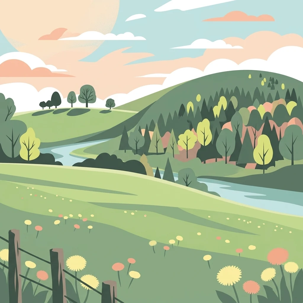
A stylized flat illustration of a mountainous landscape with a river winding through green fields, meadows with flowers, and a forest on a hill under a sunset sky.

Willinger Berg

Nature reserve

Park overview

Structured park overview, official facts, and landscape profile for Willinger Berg

Willinger Berg park facts, protected area profile, and essential visitor context

Review the core facts for Willinger Berg, including designation, size, terrain, visitor scale, habitats, and operating context in one park-focused overview.

About Willinger Berg

Willinger Berg stands as one of the more prominent outliers of the Ilm-Saale-Platte, the broad upland surface that characterizes much of central Thuringia. Reaching an elevation of 502.1 meters above sea level, the mountain rises about 100 meters above the surrounding lowlands, giving it a commanding presence despite its modest absolute height. Its muschelkalk base marks it as a Zeugenberg, a residual outlier left behind as the surrounding softer rocks eroded away, and its slopes are partly ringed by the redder Buntsandstein deposits of the Paulinzellaer Vorland.

What sets Willinger Berg apart visually is its distinctive double-peaked form, which makes it a recognizable feature of the local skyline and a frequent subject for views from nearby roads, including the A 71 motorway that passes immediately west of the mountain. The hill's geological character as a limestone mass within a wider sandstone landscape gives it karst features and a particular soil profile, which in turn supports habitat types different from those of the surrounding terrain.

The mountain is deeply embedded in the local geography and rural identity of the region. It is named after the village of Willingen at its foot, and it sits among a constellation of small villages including Oberwillingen, Niederwillingen, and Behringen to the north, Traßdorf to the south, Griesheim to the east, and Neuroda to the west. Hydrologically, the mountain serves as part of the watershed between the Ilm and Unstrut river systems, giving it broader significance within the Thuringian drainage network.

Quick facts and research context for Willinger Berg

Willinger Berg is a 502.1 meter summit in the Ilm-Kreis district of Thuringia, forming a southwestern outlier of the Ilm-Saale-Platte. It is composed of muschelkalk limestone, partly surrounded by Buntsandstein of the Paulinzellaer Vorland, and rises roughly 100 meters above its surroundings. The mountain carries a double-peaked profile that makes it a recognizable landmark visible from the nearby A 71 motorway. A nature reserve of 83.8 hectares protects its mainly beech-covered slopes, with a portion managed as a total reserve.

Protection and recognition

Terrestrial conservation management scope and official recognition details

Willinger Berg Protection Status and Official Designation Records

Willinger Berg maintains a documented terrestrial protection scope and structured conservation framework. Official records compile management parameters and designated area status without external recognition sources.

Protection details

Protection scope
Terrestrial
Transboundary protection
No
Park context

Deeper park guide and search-rich context for Willinger Berg

Willinger Berg history, landscape, wildlife, and travel context

Explore Willinger Berg through its history, landscape character, ecosystems, wildlife, conservation priorities, cultural context, and seasonal travel timing in a structured park guide built for atlas discovery and search intent.

Why Willinger Berg stands out

Willinger Berg is best known for its distinctive double summit, which gives the mountain a characteristic silhouette against the surrounding Thuringian landscape. It is also recognized for its muschelkalk geology and karst features, as well as for the extensive beech forest that blankets its flanks. The nature reserve status, including a total reserve designation, highlights its ecological importance within the Ilm-Kreis region.
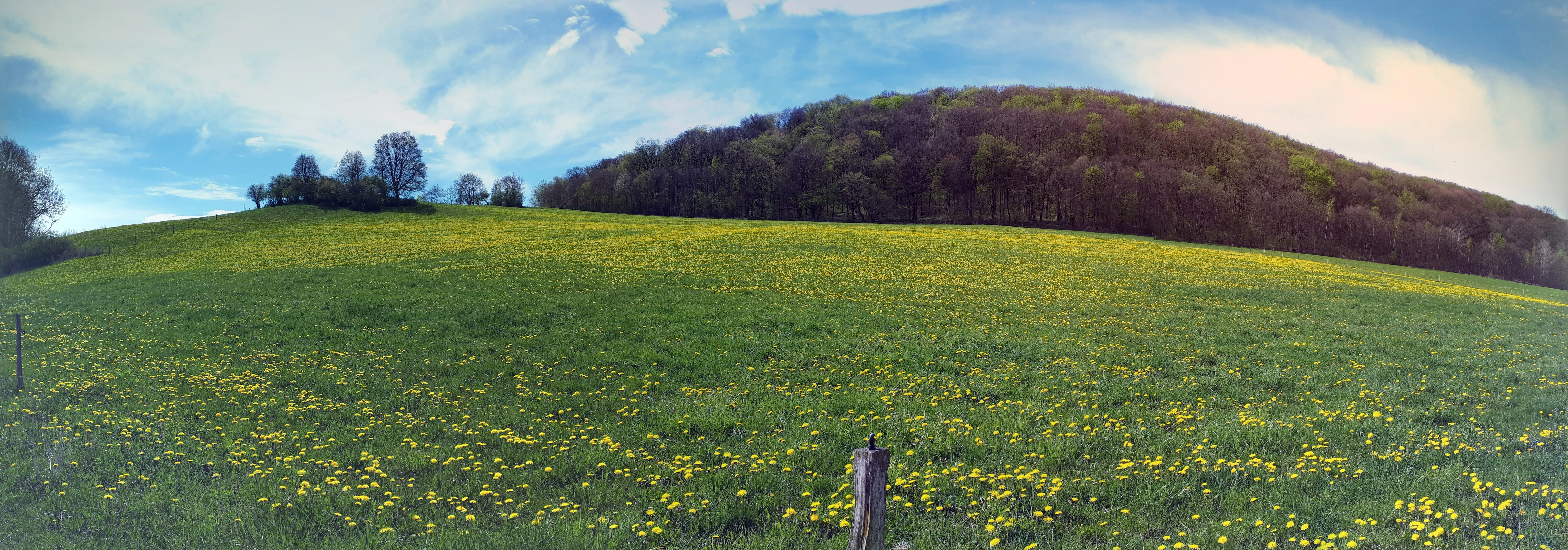
Panoramic landscape view of a green meadow filled with yellow dandelions, leading up to a wooded hill under a blue, cloudy sky.
Panoramic view of Willinger Berg featuring a meadow with blooming dandelions and a forested hill.

Willinger Berg landscape and geographic character

The mountain's defining landscape feature is its double summit, which creates a silhouette distinct from neighboring hills on the Ilm-Saale-Platte. Geologically, it is a muschelkalk Zeugenberg, an outlier composed of Triassic limestone that has resisted erosion while the surrounding terrain wore down. The flanks transition into the Buntsandstein lowlands of the Paulinzellaer Vorland to the southwest, producing a clear geological contrast within a compact area.

Karst processes have shaped parts of the limestone slopes, and the mountain sits at the meeting point between two drainage basins, the Ilm to one side and the Unstrut to the other. The hill rises about 100 meters above its base, making it a visible landmark from the adjacent A 71 motorway and from the surrounding villages.

Willinger Berg ecosystems, habitats, and plant life

Willinger Berg is primarily covered by beech forest, which dominates both slopes and contributes significantly to the ecological character of the mountain. The combination of muschelkalk soils, karst terrain, and the protected forest cover creates habitat conditions that differ from those of the surrounding sandstone lowlands. The nature reserve designation reflects the value of these forest and karst ecosystems within the regional landscape.

The mountain represents an important patch of semi-natural woodland in a region that has otherwise been shaped by agriculture and settlement. The presence of a total reserve, where natural forest dynamics are allowed to proceed without management, adds further ecological significance by setting aside forest areas for undisturbed development.

Willinger Berg conservation status and protection priorities

An 83.8 hectare nature reserve, designated as Willinger Berg, protects the mountain's forest and karst habitats. Within this reserve, a portion of the area is set aside as a total reserve, meaning it is left to natural processes without active forestry or other intervention. The conservation designation recognizes the value of the mountain's beech forest, its muschelkalk geology, and its karst ecosystems within the Ilm-Kreis and the broader Thuringian landscape.

The reserve is part of a network of protected areas in the district, alongside sites such as Gottesholz, Jonastal, and Veronikaberg, contributing to regional habitat connectivity and biodiversity protection.

Top sights and standout views in Willinger Berg

A double-peaked muschelkalk summit on the Ilm-Saale-Platte, rising clearly above the surrounding countryside. Karst features on limestone slopes bordered by Buntsandstein lowlands. Extensive beech forest protected as an 83.8 hectare nature reserve, with part managed as a total reserve. A landmark visible from the A 71 motorway and from nearby villages including Willingen, Behringen, and Oberwillingen.

Monthly climate preview

Long-term representative averages tracking monthly temperature and precipitation rhythm

Willinger Berg Climate Normals and Measured Annual Temperature Patterns

Representative coordinate records show measured multiyear temperature and precipitation distributions across the protected landscape. Examining the complete twelve-month climatology profile reveals deeper numerical variations in monthly averages.
Annual mean9 °C
-1 °C19 °C
Jan-1°
Feb
Mar
Apr
May13°
Jun17°
Jul19°
Aug19°
Sep14°
Oct
Nov
Dec
Warmest month
July

18.9 °C

Coolest month
January

-1 °C

Wettest month
July

2.5 mm/day

Driest month
April

1.3 mm/day

Park location guide

Geography guide, regional context, and park location map for Willinger Berg

Willinger Berg park geography, regions, and map view in Germany

Understand where Willinger Berg sits in Germany through a broader geographic reading of the surrounding landscape, nearby location context, and its mapped position within the national park landscape.

How Willinger Berg fits into Germany

Germany is a federal republic in Western and Central Europe with a population of over 83 million across sixteen constituent states. It is Europe's largest economy by nominal GDP and a major global exporter and importer. The capital is Berlin, and the country borders Denmark, Poland, Czech Republic, Austria, Switzerland, France, Luxembourg, Belgium, and the Netherlands.

Wider geography shaping Willinger Berg in Germany

Germany is located in Western and Central Europe, spanning 357,022 km². It borders Denmark to the north, Poland and the Czech Republic to the east, Austria and Switzerland to the south, and France, Luxembourg, Belgium, and the Netherlands to the west. The country has coastlines on the Baltic Sea and North Sea to the north, with the Alps located in the southern region.

Map view of Willinger Berg

Use this park location map to pinpoint Willinger Berg in Germany, understand its exact geographic position, and read its mapped placement within the surrounding landscape more clearly.

Pigeon | © OpenStreetMap contributors

Location context for Willinger Berg

Thuringia

Explore detailed photography of the double summit, karst terrain, and protected reserve character.

Willinger Berg Photos and Landscapes: Visualizing the Limestone Outlier and Protected Beech Forest

Visual records capture the distinctive double-peaked silhouette and limestone geology that set Willinger Berg apart from the surrounding Thuringian lowlands. Examining these protected-area habitats and forested slopes provides a clearer understanding of the mountain's unique outlier geography.

Panoramic landscape view of a green meadow filled with yellow dandelions, leading up to a wooded hill under a blue, cloudy sky.

Park atlas

Discover related regional landscapes and neighboring limestone terrain

Explore Protected Areas and Parks Near Willinger Berg in Thuringia

Browse protected areas and natural reserves located near Willinger Berg to examine regional limestone geology and surrounding forest ecosystems. Extending geographic comparisons across nearby terrain reveals broader ecological patterns throughout the local district.
Nature reserveThuringia
About 5.5 km away#1 closest

Northeast

Hohes Kreuz Nature Reserve: Mapping Forest Conservation in the Ilm District of Thuringia

A preserved oak-hornbeam landscape within the central German agricultural mosaic.

Hohes Kreuz is a protected nature reserve in Thuringia, Germany, renowned for preserving a residual oak-hornbeam forest on a Muschelkalk plateau. The site functions as an ecological refuge, supporting a wide variety of bird species and broadleaf vegetation while providing a striking contrast to the surrounding farmland of the Ilm district.

Area
0.105 km²
Established
1961
IUCN
IV
Relief
Upland
Nature reserveThuringia
About 8 km away#2 closest

Southwest

Veronikaberg Nature Reserve: Protected Muschelkalk Ridge and Forest Landscapes in Thuringia

Geographic overview of the southern Reinsberge range.

Veronikaberg functions as a critical nature reserve at the southeastern edge of the Ohrdrufer Platte. The landscape is defined by its Muschelkalk geology, which supports a unique microclimate for beech and yew forests. This record details the park boundaries and the terrain transitions that characterize this significant conservation site in central Germany.

Area
1.161 km²
Established
1961
Relief
Mountain
Water
No major water
Nature reserveIlm-Kreis
About 9.2 km away#3 closest

Northwest

Gottesholz Nature Reserve: Mapping the Protected Landscapes of Ilm-Kreis, Thuringia

A study of shell-limestone woodland geography

Gottesholz serves as an essential nature reserve in Ilm-Kreis, defined by its porous shell-limestone bedrock and rich, diverse vegetation. This detailed view covers the physical landscape, the strict forest reserve status, and the ecological markers that define this distinctive central German site.

Area
0.593 km²
Established
1961
IUCN
IV
A soft watercolor illustration of a pond landscape with green reeds in the foreground, calm water in the midground, and distant rolling hills in the background.
Nature reserveIlm-Kreis
About 9.4 km away#4 closest

Southwest

Ilmenauer Teichgebiet: Wetland Landscape and Protected Nature Reserve Atlas

Mapped pond system and geographic terrain in Ilm-Kreis

The Ilmenauer Teichgebiet nature reserve is defined by its six interconnected ponds, which create a significant wetland complex on the eastern edge of Ilmenau. Anchored by the Grosser Teich and supported by a gypsum basin, this area preserves both the history of medieval fish farming and critical habitats for waterbirds and amphibians, offering a unique look at the regional geography of central Thuringia.

Area
0.58 km²
Established
2002
IUCN
IV
Relief
Lowland
A horizontal watercolor painting depicting a landscape with soft, rolling hills in the background, a band of mixed forest with hints of autumn foliage in the midground, and a winding stream flowing through wetland grasses in the foreground.
Nature reserveThuringia
About 10 km away#5 closest

South

Pennewitzer Teiche und Unteres Wohlrosetal Nature Reserve: Thuringian Wetland Geography

A dense mosaic of historic ponds, moor woodlands, and framing stream valleys.

Located in Thuringia, this nature reserve is defined by an extraordinary density of aquatic habitats. The terrain features historic pond groups and flooded forest pits linked by brook valleys. This protected area serves as an essential example of the interplay between cultural pond construction and natural wetland ecosystems in central Germany.

Area
4.246 km²
Established
2004
IUCN
IV
A soft watercolor illustration showing gentle, rolling green hills and a small patch of wildflowers in the foreground on a white background.
Protected areaThuringia
About 12 km away#6 closest

East

Großer Kalmberg Protected Area: Geography and Landscape of the Ilm-Saale-Platte

Examining the asymmetric summit and calcareous habitats in central Thuringia.

Großer Kalmberg rises as a focal point of the Ilm-Saale-Platte, offering a clear view into the geological history of the region. This summit integrates pine-forested slopes with protected dry grasslands and rocky outcrops, creating a complex mosaic of terrain that characterizes this part of Thuringia.

Area
2.64 km²
Established
1999
Relief
Mountain
Climate
Temperate
Nature reserveThuringia
About 20 km away#7 closest

Northwest

Werra bis Treffurt mit Zuflüssen: Protected River and Floodplain Network in Thuringia

Mapping an extensive 191 kilometer Natura 2000 river corridor.

The Werra bis Treffurt mit Zuflüssen protected area serves as a vital ecological corridor in Thuringia. This site encompasses a complex mosaic of fast-flowing highland brooks, expansive floodplain meadows, inland salt sites, and rare dissolution lakes. Its geography bridges high-altitude source regions with lower river valleys, creating a distinctive landscape transect that supports essential freshwater habitats and rare aquatic species across the state.

Area
22.6 km²
Established
2008
IUCN
IV
Relief
Mixed relief
Protected landscapeThuringia
About 21 km away#8 closest

Northeast

Landschaftsschutzgebiet Mittleres Ilmtal: Protected Landscape Geography and Map Discovery

Thuringia regional atlas and protected area profile

Gain insight into the diverse topography of Landschaftsschutzgebiet Mittleres Ilmtal, which spans roughly 150 square kilometers. This protected landscape is characterized by its dramatic shifts from Buntsandstein forests in the Tannrodaer Sattel to the elevated Muschelkalk escarpments, offering a detailed case study in German mid mountain geography.

Area
150 km²
Relief
Upland
Climate
Temperate
Access
Access unknown

Common questions about visiting, size, designation, and location context for Willinger Berg

Willinger Berg FAQs for park facts, access, geography, and protected area context

Find quick answers about Willinger Berg, including protected-area facts, park geography, trail and visitor context, and how the park fits into its surrounding country and regional landscape.
MoriAtlas Explorer

Continue Your Protected Areas Search Across the Global Atlas

Deepen your exploration by continuing the structured search for national parks and protected areas worldwide. Utilize the comprehensive filtering capabilities to compare different conservation landscapes and refine your understanding of global park geography. Discover more about the distribution and characteristics of protected natural areas.

Global natural geography