
Mori Atlas logo
Nature reserveWupperaue bei Gogarten

A vital riparian habitat and protected floodplain mosaic within the Oberbergischer Kreis region

Wupperaue bei Gogarten Nature Reserve and the Wipper River Valley Protected Landscape

(Naturschutzgebiet Wupperaue bei Gogarten)

Wupperaue bei Gogarten preserves a near-natural corridor along the Wipper river, showcasing a rich mosaic of alder gallery forests, gravel bars, and wet meadow ecosystems. As a critical stepping stone habitat within the larger Natura 2000 network, this protected area sustains diverse riverine species and maintains essential floodplain connectivity across the Bergisches Land terrain. The site offers an intimate look at the geomorphology of upland stream corridors.

floodplainriparian forestalder gallery forestwet meadowriverine habitatkingfisher habitat
A flat-style digital illustration of a waterfall cascading into a winding river through a pine-forested valley, set against a backdrop of mountain peaks under a soft sky.

Wupperaue bei Gogarten

Nature reserve

Park overview

Structured park overview, official facts, and landscape profile for Wupperaue bei Gogarten

Wupperaue bei Gogarten park facts, protected area profile, and essential visitor context

Review the core facts for Wupperaue bei Gogarten, including designation, size, terrain, visitor scale, habitats, and operating context in one park-focused overview.

About Wupperaue bei Gogarten

Wupperaue bei Gogarten lies in the gently rolling landscape of the Oberbergische Land, in the upper reaches of the Wupper river system. The protected area follows the Wipper, a narrow, mostly straight stretch of river between four and five meters wide, where the channel runs along the right side of the valley. Despite its largely straight course, the river here is strikingly close to nature, with exposed steep banks, gravel and shingle bars, accumulations of dead wood, and an almost unbroken band of alder-dominated riparian forest.

The valley floor is ecologically diverse. In the upper part of the reserve, an extensively managed wet meadow dominates, while downstream the floodplain opens into moist and wet grassland fallows, often forming a mosaic with willow shrubs and developing gallery woodland along the brook. Dry, species-rich lean meadows and bellflower-rich grasslands on the slopes add further botanical value. Small stands of spruce are present, but management aims include their removal in order to strengthen the truly floodplain-typical vegetation.

Designated in 2005 and managed under the landscape plan of the Oberbergischer Kreis by the Untere Landschaftsbehörde, the reserve plays an important role within the broader Natura 2000 network. It is a partial area of the FFH site Wupper östlich Wuppertal, and its protection targets the conservation of typical floodplain structures and vegetation, a near-natural flooding regime, and the maintenance of complex small-scale river habitats. Walking routes such as the Bergische Panoramasteig and regional trails marked with a rhombus or half mill-wheel symbol pass along the right bank between Schmitzwipper and Gogarten, offering low-impact access to the area.

Quick facts and research context for Wupperaue bei Gogarten

Wupperaue bei Gogarten is a nature reserve (Naturschutzgebiet) in Marienheide, Oberbergischer Kreis, North Rhine-Westphalia, Germany. It covers around 7 hectares, sits at elevations between about 310 and 320 meters, and was designated in 2005 under the local landscape plan. The reserve is a constituent part of the cross-border FFH (Flora-Fauna-Habitat) site DE-4810-301 Wupper und Wipper bei Wipperfürth, which itself spans roughly 147 hectares and is managed as a habitat and species management area under IUCN category IV.

Protection and recognition

Documented management scope and official protected area records for Wupperaue bei Gogarten

Wupperaue bei Gogarten Protection Status and Terrestrial Conservation Data

Terrestrial conservation records detail the established protection status and administrative framework governing Wupperaue bei Gogarten. Systematic environmental tracking provides verified reference metrics regarding regional protected area management and recognition history.

Protection details

Protection scope
Terrestrial
Transboundary protection
No
WDPA ID
344826
Park context

Deeper park guide and search-rich context for Wupperaue bei Gogarten

Wupperaue bei Gogarten history, landscape, wildlife, and travel context

Explore Wupperaue bei Gogarten through its history, landscape character, ecosystems, wildlife, conservation priorities, cultural context, and seasonal travel timing in a structured park guide built for atlas discovery and search intent.

Why Wupperaue bei Gogarten stands out

The reserve is best known for protecting a near-natural stretch of the Wipper river with alder gallery forest, steep banks, gravel bars, and a rich community of aquatic and riparian species. It stands out as a vital stepping-stone habitat for species such as the kingfisher, bullhead, brook lamprey, and water crowfoot, linking larger river and floodplain systems across the Oberbergische region.
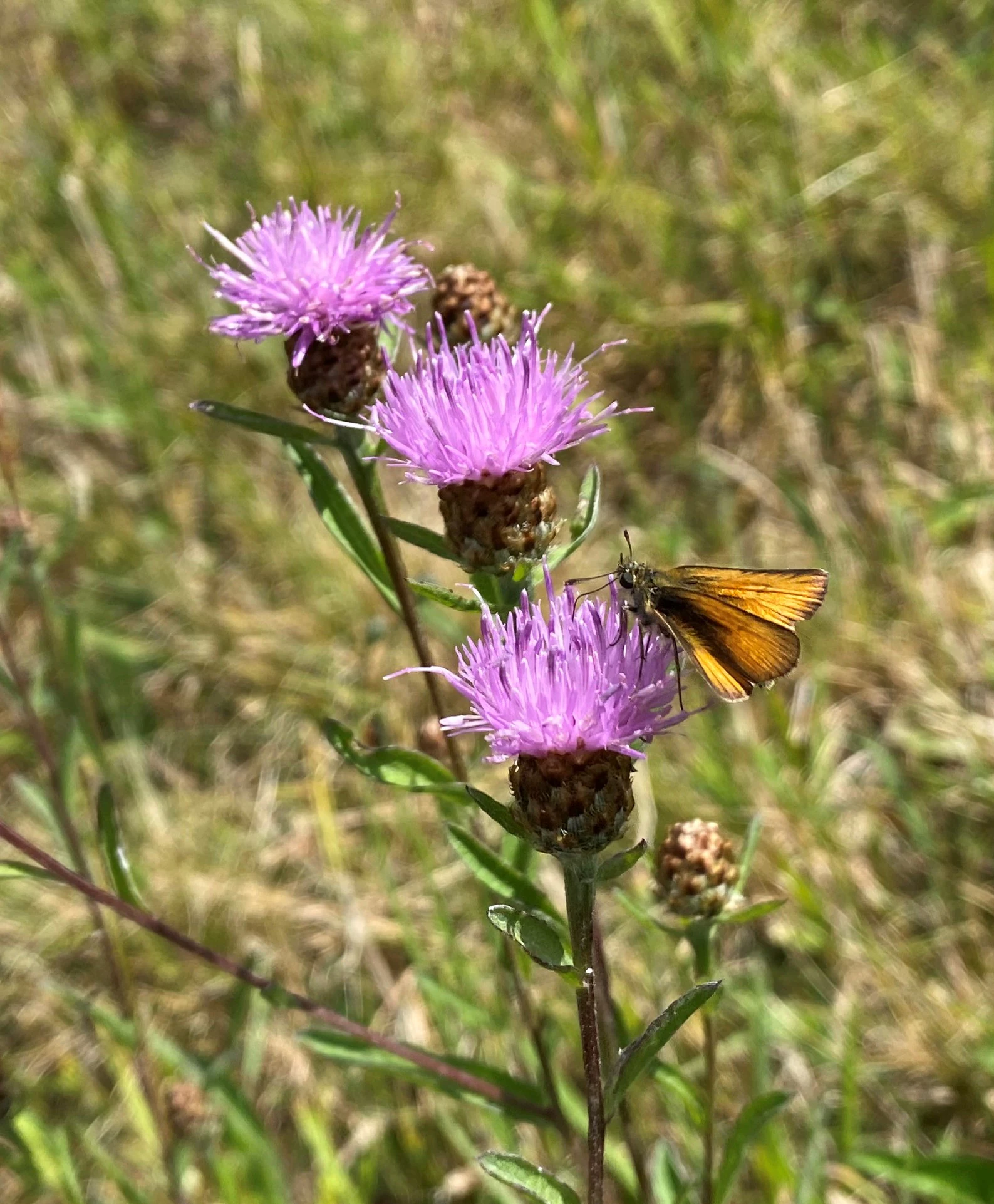
A close-up view of a small orange-brown skipper butterfly perched on a cluster of bright purple knapweed flowers, with a blurred green meadow background.
A skipper butterfly rests on a vibrant purple knapweed flower in the Wupperaue bei Gogarten nature reserve.

Wupperaue bei Gogarten history and protected-area timeline

The Wupperaue bei Gogarten was placed under formal nature protection in 2005, based on the landscape plan of the Oberbergischer Kreis. Its designation was driven by the recognition of the Wipper floodplain near Marienheide and Gogarten as a particularly valuable riverine habitat within the upper Wupper catchment, including its role as a stepping-stone within the regional biotope network. The reserve was also incorporated as a constituent area of the larger FFH (Habitats Directive) site Wupper und Wipper bei Wipperfürth, designated under the Natura 2000 framework. While the river corridor itself has long been part of the regional cultural and hydrological landscape, formal habitat protection in this specific stretch is a comparatively recent development.

Wupperaue bei Gogarten landscape and geographic character

The reserve occupies a narrow, north-south oriented section of the Wipper river valley, with the valley floor and its slopes forming the protected mosaic. The river itself is small, typically only four to five meters wide, but visually striking thanks to its largely undeveloped banks, occasional steep eroded bluffs, and exposures of gravel and shingle that create shifting patterns along the channel.

Surrounding the watercourse, the valley forms a sequence of gently sloping wet meadows, moister grassland fallows, and developing riparian woodland dominated by alder. The slopes rising from the floodplain carry lean, flower-rich meadows and, in some places, small conifer stands. Overall the landscape is defined less by dramatic relief than by the intricate texture of a small lowland river corridor: riparian trees, dead wood accumulations, and flood-meadow edges create a structured but subtle scenery typical of the upland Bergisches Land.
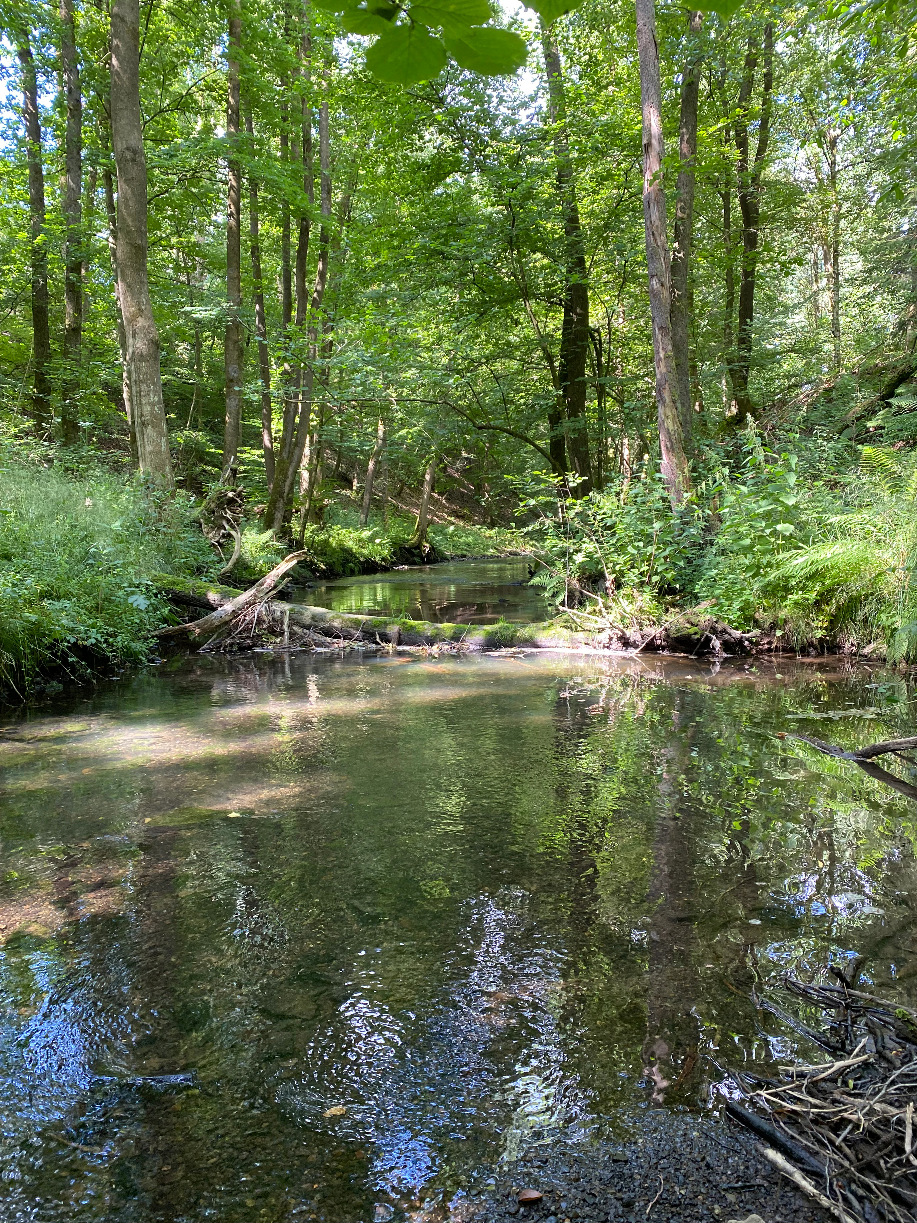
A small, calm river flows through a dense, lush green forest with trees reflected in the clear water and a fallen log crossing the stream.
The Wipper river flowing through the riparian forest within the Wupperaue bei Gogarten nature reserve.

Wupperaue bei Gogarten ecosystems, habitats, and plant life

Ecologically, Wupperaue bei Gogarten is a floodplain and riverine habitat complex of the type once widespread but now rare across much of central Europe. The Wipper remains a near-natural lowland stream within the reserve, supporting an active flow regime, exposed gravel banks, and undercut banks with associated microhabitats for invertebrates and fish.

Vegetation in the reserve reflects the transition from floodplain meadow to wet woodland. Extensive wet meadows dominate the upper valley, while the lower valley features wet and moist grassland fallows interspersed with willow shrubs and gallery forest dominated by alder. The aquatic and bank flora includes species such as the pencil-leaved water crowfoot (Ranunculus penicillatus), which grows directly in the flowing water.

The reserve also contains drier elements, with species-rich lean meadows on the slopes supporting plants such as the round-leaved bellflower and a diversity of meadow flowers that in turn support a rich insect community, including butterflies like the skipper (Dickkopffalter) and dragonflies such as the beautiful demoiselle (Calopteryx virgo). Unlike many protected areas, its biodiversity value lies less in rare single species than in the interaction between flowing water, dead wood, gallery forest, and floodplain meadows as an intact ecological system.
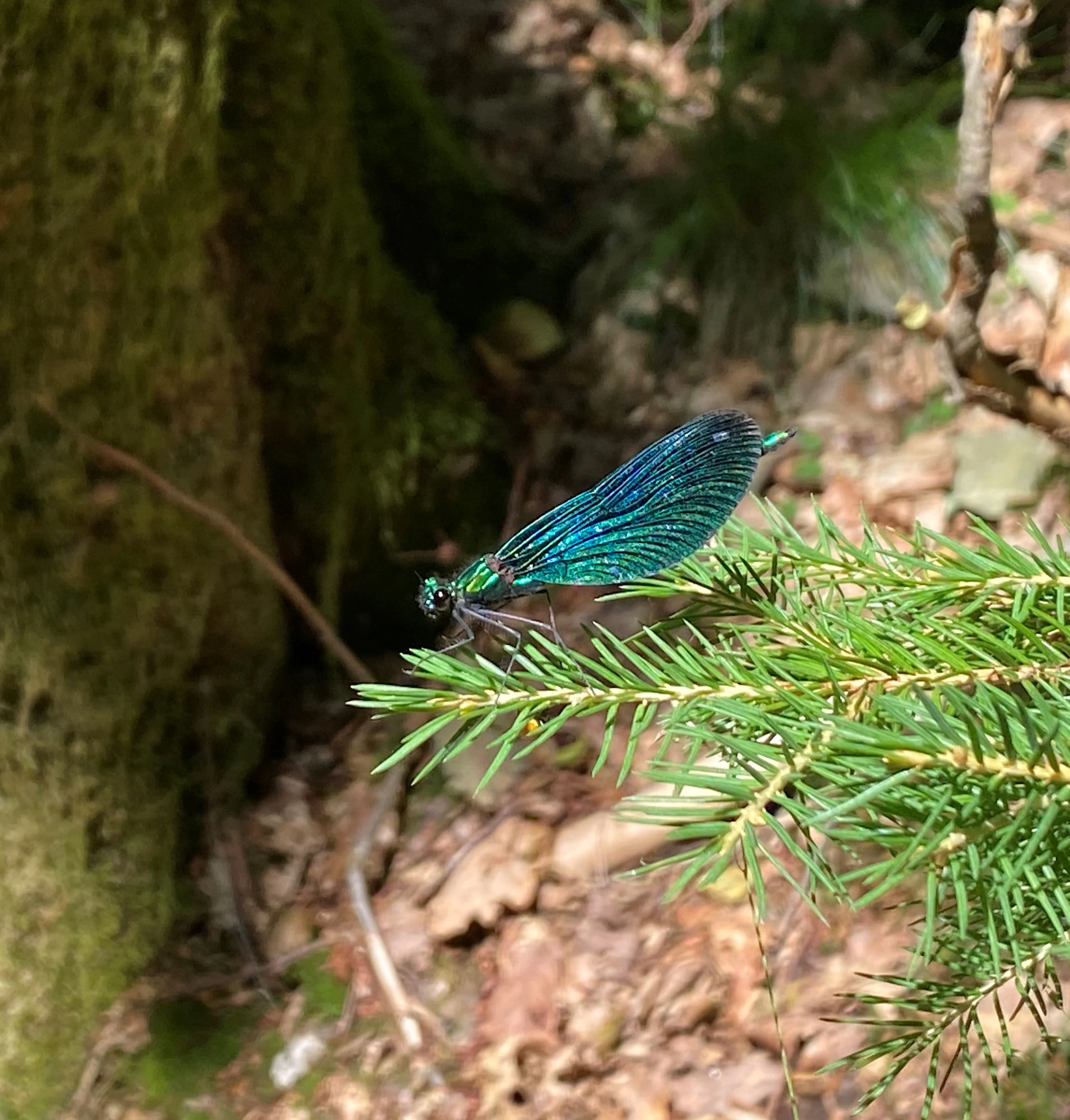
A metallic blue-winged damselfly resting on the green needles of a coniferous branch in a forest setting.
A Beautiful Demoiselle damselfly resting on a coniferous branch in the Wupperaue bei Gogarten nature reserve.

Wupperaue bei Gogarten wildlife and species highlights

The Wipper section at the heart of Wupperaue bei Gogarten is recognized as a habitat of outstanding and even international importance for several sensitive riverine species. The reserve supports healthy populations of the bullhead (Cottus gobio) and the brook lamprey (Lampetra planeri), both of which depend on clean gravel beds and unaltered flow dynamics. Aquatic vegetation, particularly stands of water crowfoot, provides spawning and refuge habitat for these species.

Along the banks, the riparian woodland, dead wood, and exposed vertical banks offer ideal conditions for the common kingfisher (Alcedo atthis), which is resident in the area and uses the steep earth faces for nesting. Dead wood in the river also supports an unusually rich invertebrate community, including dragonflies such as the beautiful demoiselle and a wide range of aquatic insect larvae that underpin the food web for fish and birds.

The mosaic of wet meadows, grassland fallows, and flowery lean meadows on the slopes supports a diverse insect fauna, including various butterflies and meadow pollinators, which in turn sustain insectivorous birds and small mammals typical of the Bergisches Land. Overall, the wildlife significance of the reserve is closely tied to the integrity of the small-scale river and floodplain system rather than to any single charismatic species.
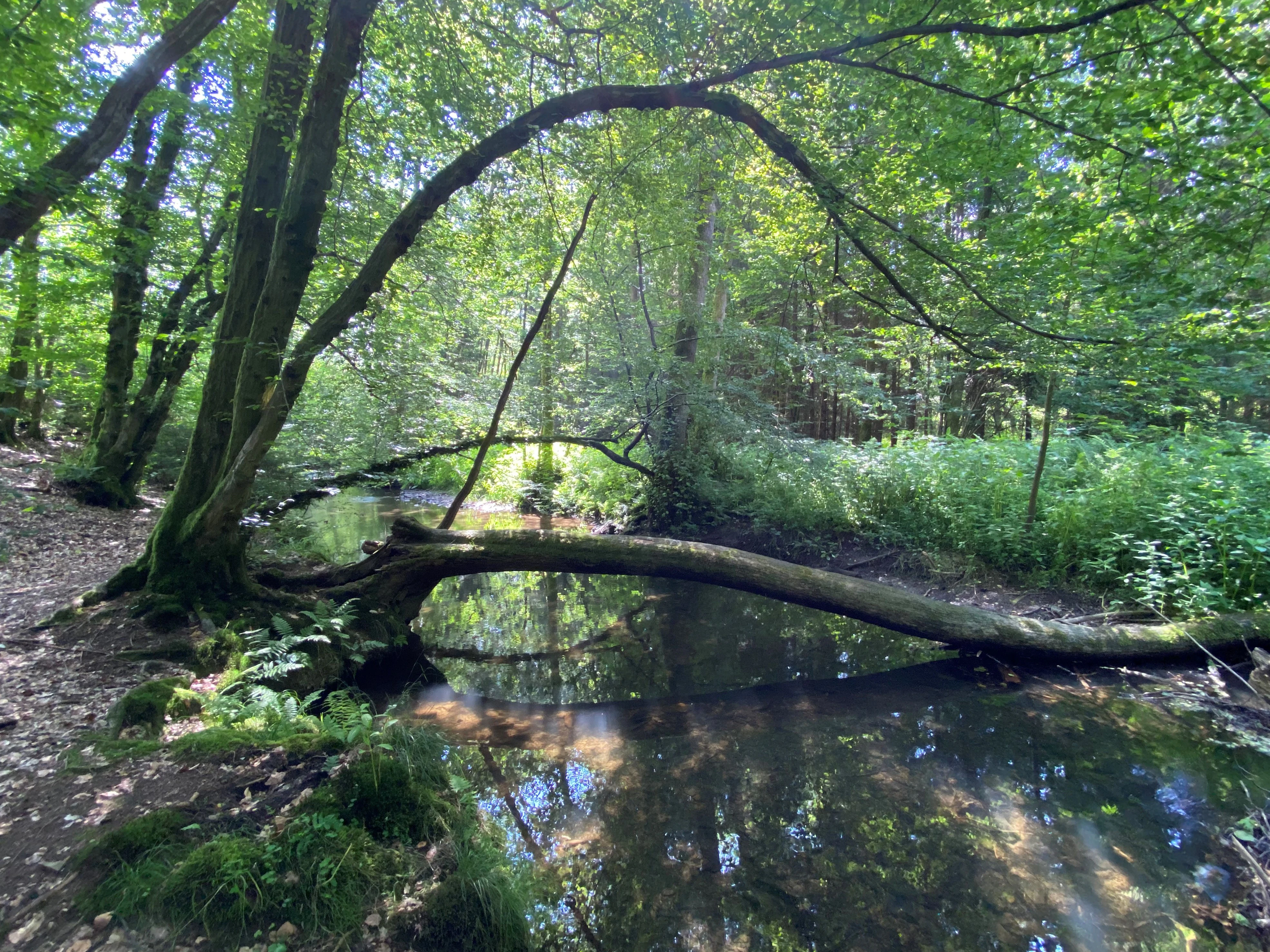
A calm, narrow river flowing through a dense forest, with a large, moss-covered log lying across the water, and lush green trees and foliage on the riverbanks.
A tranquil river section in the Wupperaue bei Gogarten nature reserve, characterized by lush riparian vegetation and fallen deadwood.

Wupperaue bei Gogarten conservation status and protection priorities

Wupperaue bei Gogarten is classified as a Habitat/Species Management Area under IUCN management category IV, placing it among protected areas where active management is used to maintain specific habitat conditions. Its protection objectives focus on preserving and developing the characteristic structures and vegetation of the floodplain and watercourse, as well as safeguarding a near-natural flooding and flow dynamic that supports the aquatic and riparian communities.

A central conservation aim is ongoing removal of small spruce stands, which are considered ecologically out of place in a floodplain context. By contrast, the reserve seeks to promote and develop the gallery woodland, wet meadows, and the diverse small structures inside and along the stream, including gravel bars, dead wood, and unhardened banks.

On a wider scale, the reserve is recognized as a stepping stone of outstanding and international significance for the regional biotope network (Biotopverbund), linking fragments of near-natural river habitat across the Wipper and Wupper catchments. Its integration into the Natura 2000 site DE-4810-301 (Wupper und Wipper bei Wipperfürth) gives it additional importance within the EU-wide network of protected riverine habitats.

Wupperaue bei Gogarten cultural meaning and human context

The Wipper river valley around Marienheide and Gogarten has long been part of the working cultural landscape of the Bergisches Land, with extensive traditional use of valley meadows for hay production and grazing. The presence of an old ford (Furt) at Gogarten, mentioned in the reserve's description, indicates historic local reliance on the river as a crossing point, integrating the stream into everyday rural life.

Modern management has retained elements of this traditional land use. Some of the wet meadows in the upper section are still managed extensively, a practice that supports both the cultural character of the valley and the conservation of meadow flora and fauna. Regional walking routes, including the Bergische Panoramasteig and local trails marked with a rhombus or half mill-wheel symbol, follow the right bank through the reserve, linking it into the broader network of long-distance paths across the Oberbergischer Kreis.
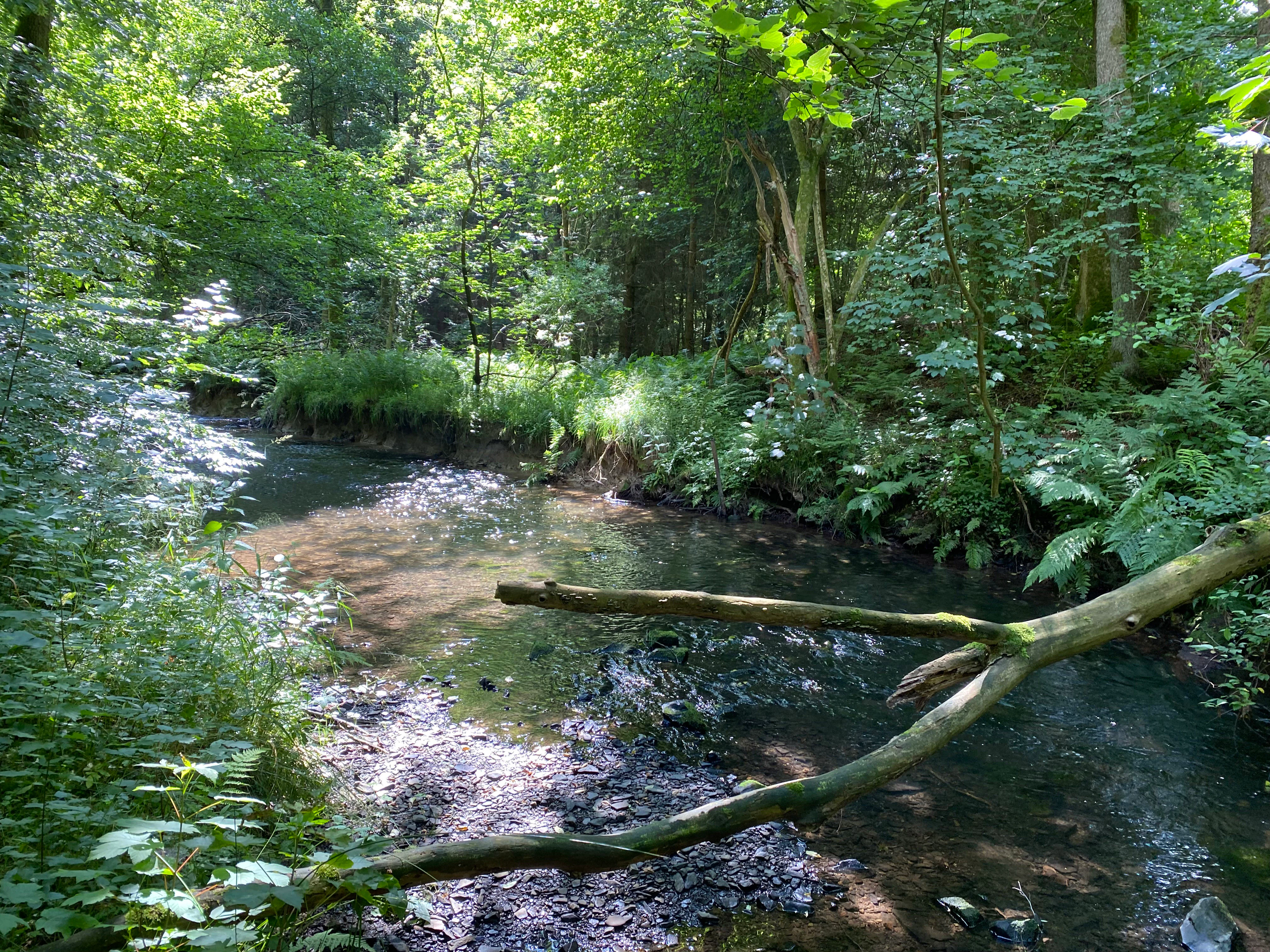
A small, clear river flows through a dense forest with a large fallen branch extending over the water.
The Wipper river flowing through the lush vegetation of the Wupperaue bei Gogarten nature reserve.

Top sights and standout views in Wupperaue bei Gogarten

Near-natural Wipper stretch with steep banks, gravel bars, and extensive alder gallery forest; small but ecologically rich mosaic of floodplain meadows, wet grassland fallows, and developing riparian woodland; internationally important stepping-stone habitat for riverine species including bullhead, brook lamprey, and kingfisher; part of the larger Natura 2000 FFH site Wupper und Wipper bei Wipperfürth; trail access via the Bergische Panoramasteig and regional routes along the right bank between Schmitzwipper and Gogarten.
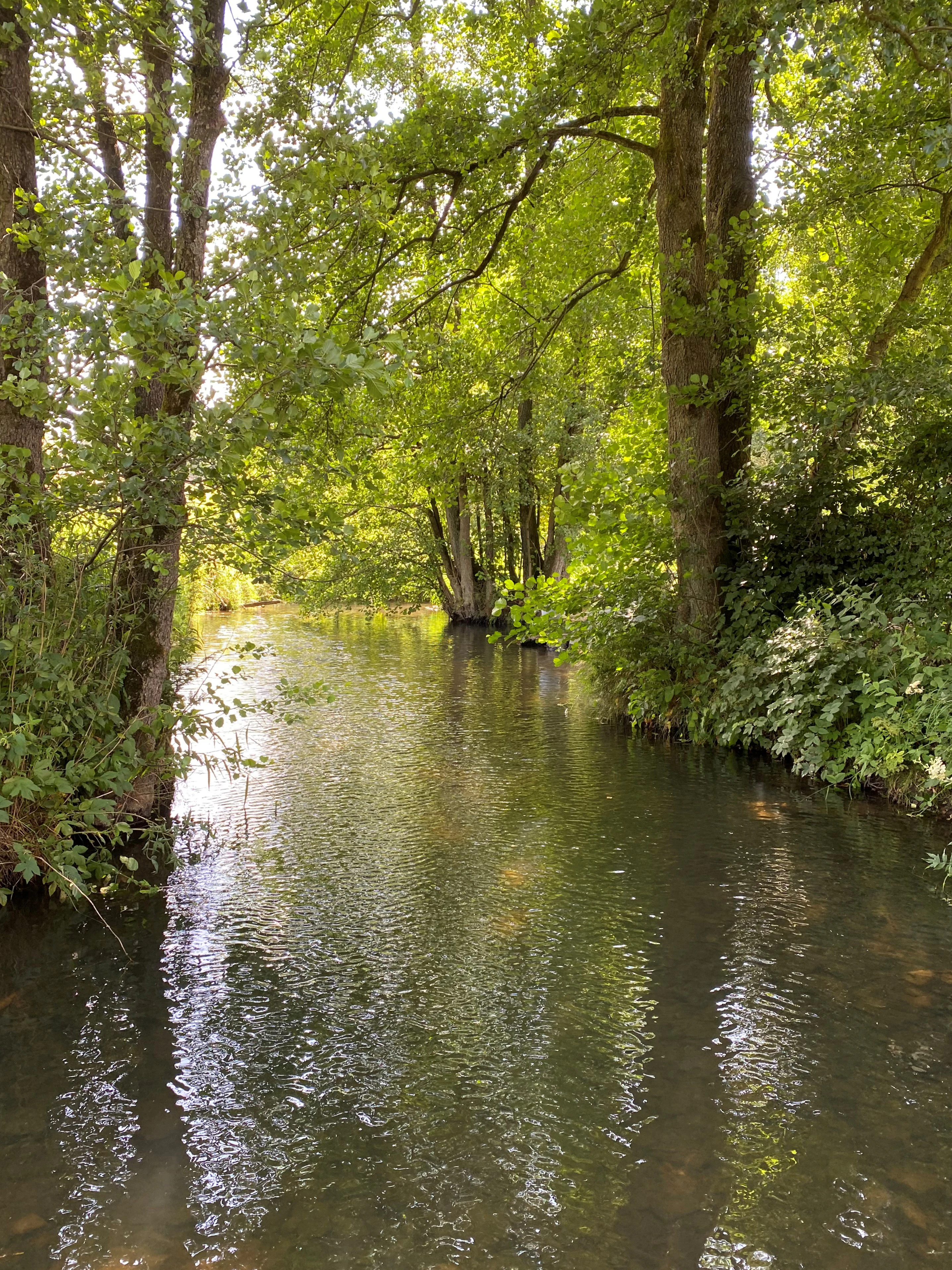
A peaceful stream flows through a dense, leafy deciduous forest with trees lining both banks and casting dappled shadows on the water surface.
The Wipper river flowing through the lush vegetation of the Wupperaue bei Gogarten nature reserve.

Best time to visit Wupperaue bei Gogarten

Late spring and early summer are particularly rewarding, when the wet and lean meadows along the Wipper reach their richest flowering period and insect activity along the river and its banks is at its peak. In late summer and early autumn, lower water levels expose more of the gravel bars and banks, making it easier to observe the river's small-scale structure and associated birdlife such as kingfishers. Winter visits can be quieter and offer clearer views through the alder gallery forest, although meadow flora is not in season. The area is gentle in gradient and best suited to low-impact walks along the right-bank trail.

Monthly climate preview

Long-term representative point measurements for monthly temperature and precipitation patterns

Wupperaue bei Gogarten Climate Normals and Annual Temperature Rhythm

Historical data records a measured annual temperature range from sub-zero winter minimums to warm summer maximums alongside consistent daily precipitation averages at the representative coordinate. Examining the complete twelve-month climatology profile reveals detailed fluctuations across all recorded meteorological periods.
Annual mean9 °C
0 °C18 °C
Jan
Feb
Mar
Apr
May13°
Jun16°
Jul18°
Aug18°
Sep14°
Oct
Nov
Dec
Warmest month
July

18.3 °C

Coolest month
January

0.3 °C

Wettest month
December

3 mm/day

Driest month
April

1.8 mm/day

Park location guide

Geography guide, regional context, and park location map for Wupperaue bei Gogarten

Wupperaue bei Gogarten park geography, regions, and map view in Germany

Understand where Wupperaue bei Gogarten sits in Germany through a broader geographic reading of the surrounding landscape, nearby location context, and its mapped position within the national park landscape.

How Wupperaue bei Gogarten fits into Germany

Germany is a federal republic in Western and Central Europe with a population of over 83 million across sixteen constituent states. It is Europe's largest economy by nominal GDP and a major global exporter and importer. The capital is Berlin, and the country borders Denmark, Poland, Czech Republic, Austria, Switzerland, France, Luxembourg, Belgium, and the Netherlands.

Wider geography shaping Wupperaue bei Gogarten in Germany

Germany is located in Western and Central Europe, spanning 357,022 km². It borders Denmark to the north, Poland and the Czech Republic to the east, Austria and Switzerland to the south, and France, Luxembourg, Belgium, and the Netherlands to the west. The country has coastlines on the Baltic Sea and North Sea to the north, with the Alps located in the southern region.

Map view of Wupperaue bei Gogarten

Use this park location map to pinpoint Wupperaue bei Gogarten in Germany, understand its exact geographic position, and read its mapped placement within the surrounding landscape more clearly.

Pigeon | © OpenStreetMap contributors

Location context for Wupperaue bei Gogarten

Nordrhein-WestfalenOberbergischer Kreis

Visual reference of river habitats, alder gallery forests, and floodplain terrain

Wupperaue bei Gogarten Photos and Landscape Scenery

Visual documentation captures the near-natural stream channel, steep banks, and gravel bars defining the protected Wipper river valley. Detailed imagery reveals the intricate structure of surrounding wet meadows, alder woodlands, and aquatic habitats across the reserve.

A close-up view of a small orange-brown skipper butterfly perched on a cluster of bright purple knapweed flowers, with a blurred green meadow background.

A small, calm river flows through a dense, green forest with dappled sunlight reflecting on the water surface and mossy tree trunks along the banks.

A small, calm river flows through a dense, lush green forest with trees reflected in the clear water and a fallen log crossing the stream.

A metallic blue-winged damselfly resting on the green needles of a coniferous branch in a forest setting.

A calm, narrow river flowing through a dense forest, with a large, moss-covered log lying across the water, and lush green trees and foliage on the riverbanks.

A cluster of bell-shaped, violet-blue harebell flowers with slender green stems and unopened buds growing against a background of soil and greenery.

A small, clear river flows through a dense forest with a large fallen branch extending over the water.

A peaceful stream flows through a dense, leafy deciduous forest with trees lining both banks and casting dappled shadows on the water surface.

A view of the small, flowing Wupper river framed by dense green trees and foliage in a nature reserve.

A shallow river ford with flat stone stepping stones crossing the water, bordered by dense green trees and a wooden rail fence.

A weathered wooden elevated hunting stand stands at the edge of a lush green floodplain meadow under a blue sky with scattered clouds.

A calm, shallow section of the Wupper River surrounded by dense green forest foliage, with several large mossy logs lying across the water.

A dirt hiking trail leads away from the viewer through a grassy meadow bordered by trees under a blue sky with scattered clouds, with a person walking in the distance.

Park atlas

Discover adjacent river corridors, valley reserves, and regional habitats across the surrounding landscape.

Explore Protected Areas and Parks Near Wupperaue bei Gogarten

Browse other protected areas and nature reserves located close to Wupperaue bei Gogarten in the Oberbergischer Kreis. Comparing adjacent river valleys and floodplain habitats provides valuable geographic context for regional conservation networks.
Nature reserveOberbergischer Kreis
About 3.6 km away#1 closest

East

Wipperaue Eulenbecke: A Detailed Map of Protected Riparian Landscapes and Habitats

Ecological geography within the Oberbergischer Kreis region

Wipperaue Eulenbecke protects a structured headwater stream and associated floodplain fragments along the upper Wupper river. Through its network of wet meadows, alluvial woodland, and tributary valleys, the reserve demonstrates the importance of small-scale aquatic conservation in a forested, mid-elevation landscape. Access detailed geographic data on its terrain, stream morphology, and connectivity within the wider regional conservation network.

Area
0.219 km²
Established
2005
IUCN
IV
Relief
Upland
A flat, vector-style illustration of a valley with a winding path in the foreground, coniferous trees, a waterfall, and rocky cliffs under a light sky.
Nature reserveOberbergischer Kreis
About 4.3 km away#2 closest

Northwest

Ibachtal und Nebenbäche Nature Reserve: Geographic Overview and Protected Stream Landscape

Stream valley connectivity in the Oberbergischer Kreis

Trace the landscape of the Ibachtal und Nebenbäche nature reserve through its distinct stream valleys, alder gallery forests, and botanically diverse wet meadows. This area serves as a primary example of stream-based ecological protection in the Bergisches Land, characterized by narrow ravine-like tributaries and expansive floodplain grassland.

Area
0.268 km²
Established
2013
IUCN
IV
A soft watercolor illustration showing a misty, open wetland landscape with grassy foreground, a line of trees in the middle distance, and gentle hills in the background.
Nature reserveNordrhein-Westfalen
About 5.3 km away#3 closest

East

Nass- und Feuchtgrünlandkomplex östlich Holzwipper Protected Wet Grassland Nature Reserve

Examining riparian valley geography in the Oberbergischer Kreis.

The Nass- und Feuchtgrünlandkomplex östlich Holzwipper protects a rare, small-scale mosaic of wet meadow, sedge communities, and river-fringe vegetation. This nature reserve serves as an essential ecological anchor for damp valley systems in the Nordrhein-Westfalen region, offering a clear view of specialized botanical landscapes and stream-side terrain.

Area
0.023 km²
Established
1998
IUCN
IV
Nature reserveNorth Rhine-Westphalia
About 12 km away#4 closest

West

Wupperaue bei Westenbrücke Nature Reserve Landscape and Geographic Mapping

Protected riparian floodplain in the Oberbergischer Kreis

This nature reserve protects a vital 2.3 kilometer segment of the Wupper river valley. Its landscape is characterized by a mosaic of wet meadows, alder and willow stands, and riparian corridors, providing a crucial stepping-stone habitat within the Hückeswagen area of North Rhine-Westphalia.

Area
0.318 km²
Established
2013
IUCN
IV
Watercolor painting of a rolling landscape with soft green hills, forest patches, and a winding stream.
Nature reserveGermany
About 13 km away#5 closest

West

Schwarzenbachtal Nature Reserve: Regional Protected Landscape and Stream Valley Atlas

A mapped overview of protected habitats in North Rhine-Westphalia

Schwarzenbachtal serves as a vital protected area in Germany, defined by its elongated brook valley and intricate transitions between wet meadows and dry grassland mosaics. As part of the Bergisches Land stream network, this nature reserve illustrates the ecological significance of small-scale valley landscapes and their role in regional conservation geography.

Area
0.082 km²
Established
2013
Relief
Upland
Climate
Temperate
A soft watercolor illustration of a green valley with a central stream or river winding through meadows towards distant hills.
Nature reserveOberbergischer Kreis
About 14 km away#6 closest

Northwest

Leiverbachtal und Talhänge: Protected Stream Valley and Forest Habitat in Oberbergischer Kreis

Examining the geography of a Bergisches Land nature reserve

Leiverbachtal und Talhänge stands as a significant nature reserve within the Oberbergischer Kreis, defined by its near-natural meandering stream and diverse riparian ecosystem. The site offers a detailed look at floodplain meadows, slope forest transitions, and the ongoing shift toward broadleaf woodland within the German Mittelgebirg landscape.

Area
0.92 km²
Established
2006
IUCN
IV
Relief
Upland
A horizontal watercolor illustration depicting rolling hills, forest patches, and a soft, hazy valley against a white background.
Nature reserveNorth Rhine-Westphalia
About 16 km away#7 closest

West

Mausbachtal Nature Reserve in North Rhine-Westphalia: Protected Stream Valley and Forest Landscapes

Regional stream valley network and deciduous forest landscape

This protected area in the Oberbergischer Kreis offers a window into the Bergische Hochflächen topography. The reserve highlights a mosaic of near-natural beech forest, wet meadows, and floodplain woodland, forming an integral link in the regional stream network connected to the Große Dhünn.

Area
0.237 km²
Established
2013
IUCN
IV
Nature reserveRheinisch-Bergischer Kreis
About 18 km away#8 closest

Southwest

Naturschutzgebiet Olpebachtal: Nature Reserve and Protected Stream Valley Geography

A protected landscape mosaic in Rheinisch-Bergischer Kreis

Naturschutzgebiet Olpebachtal protects a unique, near-natural section of the Olpebach stream valley. Characterized by wide floodplains, wet meadows, and narrow tributary ravines, the reserve functions as a critical habitat linkage within the rolling terrain of the Bergische Hochflächen. Its geography provides a clear window into the stream-floodplain systems that define the natural character of the broader region.

Area
0.251 km²
Established
1990
IUCN
IV

Common questions about visiting, size, designation, and location context for Wupperaue bei Gogarten

Wupperaue bei Gogarten FAQs for park facts, access, geography, and protected area context

Find quick answers about Wupperaue bei Gogarten, including protected-area facts, park geography, trail and visitor context, and how the park fits into its surrounding country and regional landscape.
MoriAtlas Explorer

Continue Your Protected Areas Search Across the Global Atlas

Deepen your exploration by continuing the structured search for national parks and protected areas worldwide. Utilize the comprehensive filtering capabilities to compare different conservation landscapes and refine your understanding of global park geography. Discover more about the distribution and characteristics of protected natural areas.

Global natural geography