
Mori Atlas logo
Nature reserveWurmberg

Examining the high-altitude terrain, granite cliff features, and forest restoration zones of the upper Harz.

Wurmberg Nature Reserve: A Detailed Geographic Atlas of Protected Harz Mountain Landscapes

Wurmberg Nature Reserve spans 183 hectares across the western and southwestern flanks of the Wurmberg mountain in Lower Saxony, Germany. This protected area safeguards a complex upper-Harz environment characterized by exposed granite cliffs, abandoned quarry land, and high-altitude bogs. The site serves as a vital transition zone, adjoining the Harz National Park while actively managing the restoration of natural mixed deciduous woodland in place of legacy spruce stands.

mountain reservespruce forestbroadleaf forest restorationhighland bogsgranite cliffsabandoned quarry
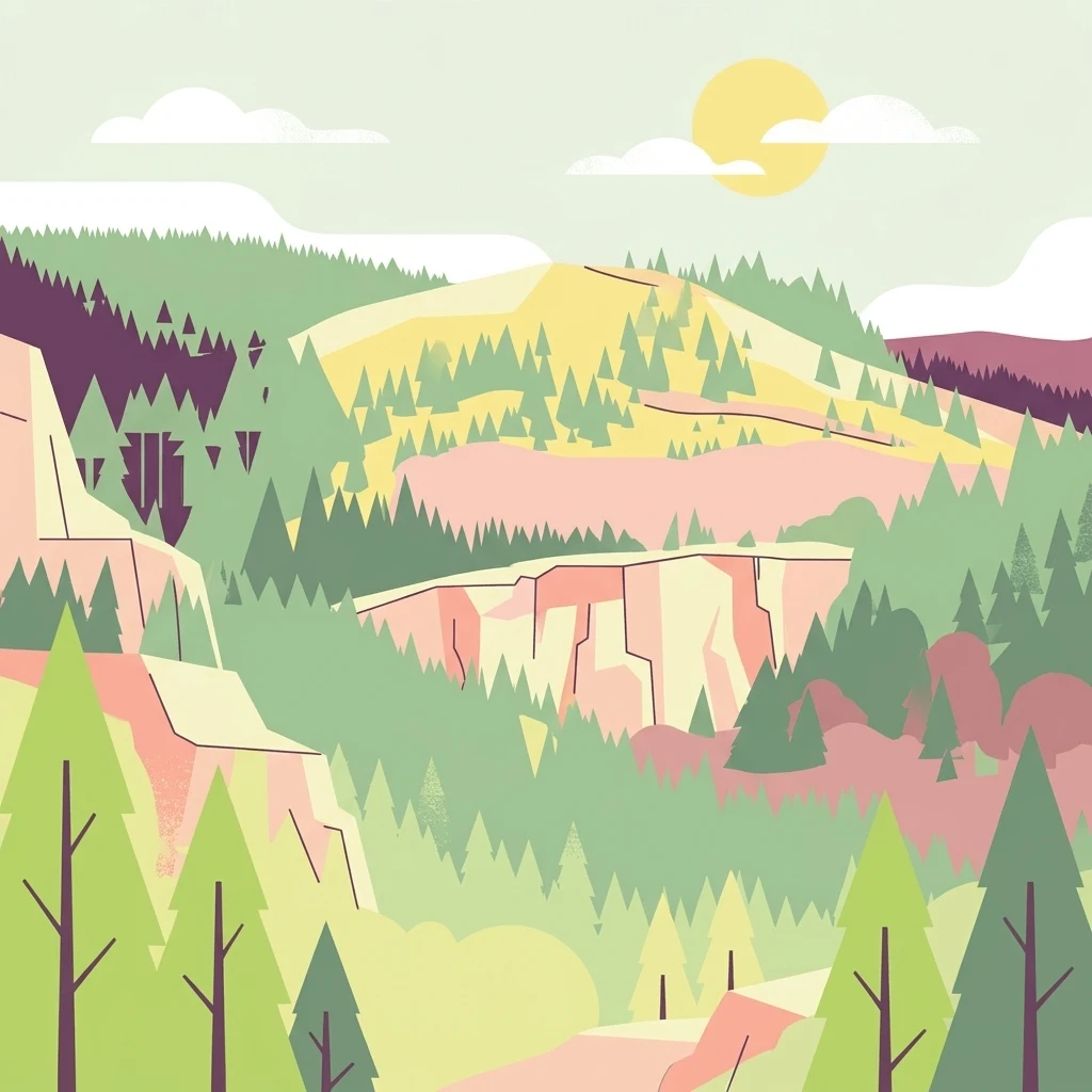
A flat-style digital illustration showing a mountainous forest landscape with rocky slopes, conifer trees, and a pale sun in the sky.

Wurmberg

Nature reserve

Park overview

Structured park overview, official facts, and landscape profile for Wurmberg Nature Reserve

Wurmberg Nature Reserve park facts, protected area profile, and essential visitor context

Review the core facts for Wurmberg Nature Reserve, including designation, size, terrain, visitor scale, habitats, and operating context in one park-focused overview.

About Wurmberg Nature Reserve

Wurmberg Nature Reserve sits on one of the most recognizable mountains in northern Germany's Harz range. The Wurmberg rises to about 971 meters and is the second-highest summit in the Harz after the Brocken. The reserve does not cover the bare summit but instead follows the western and southwestern flanks of the mountain, where the terrain falls through a steep mix of cliff faces, boulder fields, old quarry workings, boggy plateaus, and forested slopes.

The reserve is divided into two separate sections. The northern section is the larger of the two and lies close to the boundary with Harz National Park, with the upper course of the Große Bode stream running along much of that border. The southern section is smaller and adjoins the national park only on its western edge, while the Warme Bode and its Bode waterfall features run past its southwestern flank. Together the two sections enclose a continuous belt of upper-Harz habitats that link directly into the larger national park network to the north and west.

Protected since 26 October 2006 and currently managed as a Habitat/Species Management Area under the IUCN system, the Wurmberg reserve represents a focused effort to conserve and restore the natural character of the upper Harz that was historically altered by large-scale spruce planting and peatland drainage. Its location right beside the country's most heavily used mountain leisure area, with cable cars, ski jumps, toboggan runs, and dense hiking traffic crossing nearby, also makes it a notable example of how strict protection and active tourism can sit side by side in a small geographic space.

Quick facts and research context for Wurmberg Nature Reserve

Wurmberg Nature Reserve covers 183 hectares across the western and southwestern slopes of the Wurmberg in Braunlage, Lower Saxony. It lies within the Harz Nature Park and directly borders Harz National Park on its western and northern edges, sharing its southern boundary with managed land that includes the Wurmberg cable car route.

The reserve was established on 26 October 2006 and is administered by the Lower Saxon Agency for Water Management, Coastal Protection, and Nature Conservation (NLWKN), with the district of Goslar acting as the responsible local nature conservation authority.

Protection and recognition

Analysis of terrestrial conservation scope and official database identifiers

Wurmberg Protection Status and Documented Terrestrial Area Records

Wurmberg maintains recorded terrestrial protection status within official international databases without supplementary international recognition sources. Structured administrative records compile management scope and geographic identifiers for conservation tracking.

Protection details

Protection scope
Terrestrial
Transboundary protection
No
WDPA ID
378384
Park context

Deeper park guide and search-rich context for Wurmberg Nature Reserve

Wurmberg Nature Reserve history, landscape, wildlife, and travel context

Explore Wurmberg Nature Reserve through its history, landscape character, ecosystems, wildlife, conservation priorities, cultural context, and seasonal travel timing in a structured park guide built for atlas discovery and search intent.

Why Wurmberg Nature Reserve stands out

Wurmberg Nature Reserve is best known for protecting the high-altitude forest and rock habitats of the Wurmberg in the Upper Harz, including the prominent Große Klippe granite cliff complex and the onetime Wurmberg quarry, both of which lie inside the protected zone. It is equally important for its small high-moor and transitional bog remnants on the mountain's slopes, where rewetting measures have been introduced to reverse long-term drainage. The reserve also stands out as a working example of forest conversion in the Harz. The existing spruce stands, which were historically planted in place of the area's natural broadleaf and mixed forests, are being deliberately restructured into more natural deciduous and mixed woodland, while brook-side alder and ash galleries are being allowed to expand.
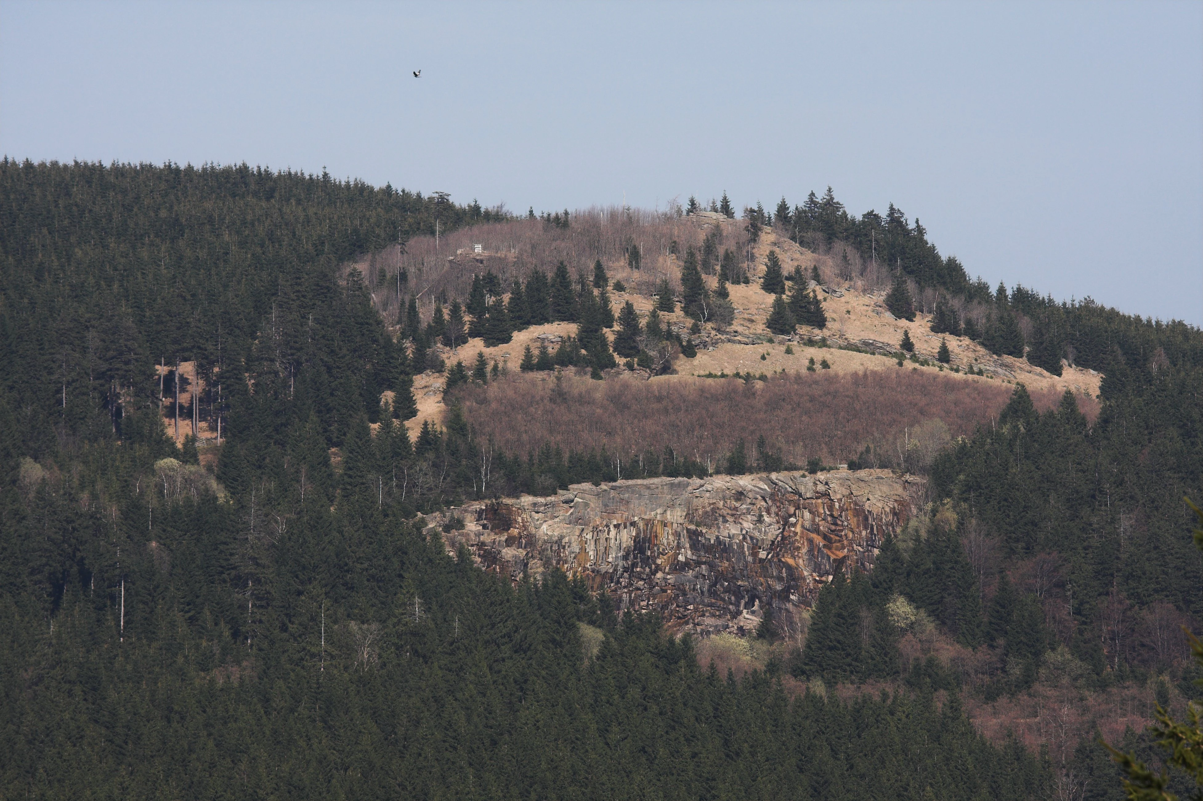
A mountain slope covered in dense coniferous forest with a visible exposed rock face and quarry area in the midground.
A view of the former granite quarry and surrounding forested slopes of the Wurmberg.

Wurmberg Nature Reserve history and protected-area timeline

The current Wurmberg Nature Reserve has its administrative roots in the much older Oberharz Nature Reserve, which was first designated on 10 April 1954 and which once covered significant parts of the Wurmberg along with other Harz landscapes such as the Ecker dam and Kellwasser areas near Torfhaus. When the modern Wurmberg reserve was established in 2006, sections of that earlier Oberharz designation on the Wurmberg were absorbed into the new protected area, while the Ecker dam and Kellwasser components were instead released from strict protection and folded into the broader Harz (Goslar district) landscape protection area that surrounds the national park.

Since its designation, a clear management direction has emerged. The spruce-dominated forest, which replaced the original broadleaf and mixed woodland over decades of forestry practice, is being deliberately restructured into more natural forest types. In 2020, drainage ditches in parts of the high-altitude bogs were closed off to hold water back and re-establish the wet conditions that the original peatlands need, marking a turning point in active conservation on the mountain.

Wurmberg Nature Reserve landscape and geographic character

The landscape of the Wurmberg reserve is shaped by the geology of the upper Harz. Granite is the defining rock here, and the mountain's steep western and southwestern faces have produced prominent cliff features and boulder fields. The Große Wurmbergklippe, often simply called the Große Klippe, is a large granite cliff complex that rises out of the forested slope and is one of the most visible landmarks within the protected area. Just below it sits the abandoned Wurmberg quarry, where Wurmberg granite was once extracted and where the cut rock face, spoil heaps, and disturbed ground now form a distinctive, partly artificial landscape inside the reserve.

The terrain rises from about 600 meters at the lower edge of the reserve to roughly 850 meters on the upper slopes, well below the exposed summit of the Wurmberg itself but high enough to support upper-montane habitats. Natural block and talus slopes flank parts of the rock faces, while the gentler sections of the mountain hold pockets of high bog and transitional mire that have survived centuries of forestry pressure. Streams such as the Große Bode and the Warme Bode define the boundary on the west and southwest, and the Bode waterfalls, including the Untere Bodefall and Obere Bodefall, frame the landscape around the southern section.

Wurmberg Nature Reserve ecosystems, habitats, and plant life

Ecologically, the Wurmberg reserve is a forest-dominated upper-Harz landscape in transition. Most of the protected area is currently covered by spruce forest that, in management terms, is considered biologically impoverished compared with the natural forest types the mountain could support. The management goal is therefore to shift large parts of these stands back toward broadleaf and mixed forest composed of beech, birch, rowan, and other native species typical of the Harz.

Along the smaller streams and at their springs, the reserve contains small but ecologically important patches of alder-ash woodland and willow swamp scrub, vegetation types that depend on year-round moisture and that contrast strongly with the surrounding spruce stands. The high-altitude peatlands, although small in extent, bring a separate ecological dimension to the site. By 2020, drainage ditches in parts of these mires had already been blocked, re-flooding formerly drained ground and allowing bog vegetation to recover.

Wurmberg Nature Reserve wildlife and species highlights

The reserve's wildlife profile is shaped less by a list of headline species and more by the habitat mosaic of rock, bog, regenerating forest, and stream corridor. The cliff faces and boulder fields, including the Große Klippe and the rock walls of the old Wurmberg quarry, support lichen communities, hair grass, and low-growing dwarf shrubs such as bilberry and heather, which in turn provide shelter for rock-dwelling and edge-loving invertebrates.

The wetter parts of the reserve, including the alder-lined brook corridors and the rewetted peatland sections, attract moisture-dependent fauna typical of the upper Harz, including typical Harz bog and stream species. The recovering deciduous and mixed forest now being actively encouraged will, over time, shift the bird and mammal community away from species associated with dense conifer plantations toward those typical of more natural Harz forest.

Wurmberg Nature Reserve conservation status and protection priorities

From a conservation standpoint, the Wurmberg reserve is significant as a place where the long-term ecological trajectory of the upper Harz is being deliberately redirected. The spruce plantations covering most of the area do not represent the original forest cover, and the current management strategy explicitly aims to convert these stands into more natural broadleaf and mixed forest that better fits the local soils and climate.

The peatland component gives the reserve a second, distinct conservation value. By closing drainage ditches in selected mire areas in 2020, the site entered active bog restoration, a relatively rare intervention in the central German uplands. Together with its direct border with Harz National Park to the north, the reserve also functions as a connecting element in the wider Harz protected-area network, increasing the effective size of the contiguous habitat available to forest, bog, and cliff species.

Wurmberg Nature Reserve cultural meaning and human context

The Wurmberg and the surrounding upper Harz carry a long tradition of granite quarrying, of which the old Wurmberg quarry inside the reserve is a visible reminder. The granite worked there was distinctive enough to be known to geologists as Wurmberg granite. The mountain also carries a more recent cultural layer of mountaintop leisure use, exemplified by the Wurmberg cable car, the historic Rodelhaus with its toboggan run, and the Brockenweg ski jumping hills that stand just outside the protected area. Plans to extend tourist use around the Wurmberg have periodically been in tension with the conservation ambitions of the reserve, and the 2006 designation reflects a formal response to that pressure.

Top sights and standout views in Wurmberg Nature Reserve

The two most visually striking features inside the reserve are the Große Wurmbergklippe granite cliff and the abandoned Wurmberg granite quarry that lies directly beneath it; together they form the geological heart of the protected area. Equally important, but less visible, are the rewetted high-altitude peatlands on the western slope and the pockets of alder-ash woodland along the headwaters of the Bode streams, which together carry much of the reserve's conservation weight. The reserve's direct border with Harz National Park turns these small sites into a meaningful extension of the larger Harz protected-area system rather than an isolated patch.

Best time to visit Wurmberg Nature Reserve

Late spring and early summer tend to bring out the contrast between the dark spruce stands, the paler deciduous regrowth in the valley bottoms, and the bright bilberry and heather slopes around the cliffs, while high summer shows the moors at their wettest after snowmelt and spring rains. Autumn produces strong color contrasts between the bogs, the heath, and the rocky cliffs; winter gives the cliffs and boulder fields their most dramatic appearance under snow but also coincides with the most active ski and cable car use around the mountain.


Monthly climate preview

Long-term temperature and precipitation trends across twelve recorded intervals

Wurmberg Climate Normals and Measured Monthly Weather Patterns

Wurmberg exhibits measured annual temperature variations and steady precipitation rates across recorded monthly observation periods. Reviewing the complete twelve-month climate profile provides detailed insight into long-term meteorological normals at the representative elevation.
Annual mean8 °C
-1 °C18 °C
Jan-1°
Feb-1°
Mar
Apr
May12°
Jun15°
Jul18°
Aug18°
Sep13°
Oct
Nov
Dec
Warmest month
July

17.7 °C

Coolest month
January

-1.4 °C

Wettest month
July

2.8 mm/day

Driest month
April

1.5 mm/day

Park location guide

Geography guide, regional context, and park location map for Wurmberg Nature Reserve

Wurmberg Nature Reserve park geography, regions, and map view in Germany

Understand where Wurmberg Nature Reserve sits in Germany through a broader geographic reading of the surrounding landscape, nearby location context, and its mapped position within the national park landscape.

How Wurmberg Nature Reserve fits into Germany

Germany is a federal republic in Western and Central Europe with a population of over 83 million across sixteen constituent states. It is Europe's largest economy by nominal GDP and a major global exporter and importer. The capital is Berlin, and the country borders Denmark, Poland, Czech Republic, Austria, Switzerland, France, Luxembourg, Belgium, and the Netherlands.

Wider geography shaping Wurmberg Nature Reserve in Germany

Germany is located in Western and Central Europe, spanning 357,022 km². It borders Denmark to the north, Poland and the Czech Republic to the east, Austria and Switzerland to the south, and France, Luxembourg, Belgium, and the Netherlands to the west. The country has coastlines on the Baltic Sea and North Sea to the north, with the Alps located in the southern region.

Map view of Wurmberg Nature Reserve

Use this park location map to pinpoint Wurmberg Nature Reserve in Germany, understand its exact geographic position, and read its mapped placement within the surrounding landscape more clearly.

Pigeon | © OpenStreetMap contributors

Location context for Wurmberg Nature Reserve

Lower Saxony
Natural feature types

Investigate Natural Features and Landmarks of the Wurmberg Nature Reserve

Explore the structured dataset of geological and natural formations associated with the Wurmberg Nature Reserve. This MoriAtlas collection connects users with the physical landscape, from granite cliffs to restored highland bogs, defining the topography of this protected German mountain zone.
Recorded earthquake history

Examine the Historical Catalogue of Recorded Seismic Activity Around Wurmberg

Review documented earthquakes and seismic data associated with the Wurmberg landscape through this structured historical collection. MoriAtlas provides these records to support objective geographic study of the Harz mountain environment and surrounding seismic history.

Wurmberg Earthquake History

Catalogued events

4 events

Strongest magnitude

Magnitude 3.6

Most recent event

Oct 25, 2006

This history includes earthquakes recorded inside the park or within 50 km of its borders

Explore visual records of granite cliffs, highland bogs, and recovering upper-montane forest zones.

Wurmberg Photos and Landscape Scenery: Visualizing the Protected Harz Mountain Environment

Examine detailed Wurmberg photos to understand the rugged terrain, exposed granite formations, and diverse protected-area habitats of the Harz uplands. Visual documentation of the landscape reveals active forest conversion projects, restored peatlands, and dramatic mountain scenery.

A mountain slope covered in dense coniferous forest with a visible exposed rock face and quarry area in the midground.

Park atlas

Compare surrounding mountain terrain and regional conservation areas

Explore Other Parks Near Wurmberg and Connected Protected Landscapes

Browse nearby national parks and protected areas sharing the highland geography and forest character of Wurmberg. Expanding the comparison across the surrounding mountain region reveals broader ecological patterns and connected conservation landscapes.
Watercolor illustration of a mountainous landscape with forests and a winding path
National parkLower Saxony
Park boundaries overlap#1 closest

Northwest

Harz National Park: A Mapped Protected Landscape in Lower Saxony's Mountains

Explore geographic boundaries and regional terrain.

Harz National Park is a protected area defined by its unique mountain landscape and extensive forests in Lower Saxony, Germany. This MoriAtlas entry details its geographic scope, allowing for exploration of its mapped boundaries and its place within the regional geography. Understand the terrain, from its highest peaks to its alpine bogs, offering a structured view of this significant protected landscape for atlas-based discovery.

Area
247 km²
Established
2006
IUCN
II
Visitors
4M annual
Nature reserveThuringia
About 14 km away#2 closest

Southeast

Vogelherd Nature Reserve: Montane Beech Forest Landscape in Thuringia, Germany

Protected forest geography in the northern Harz mountains.

Vogelherd is a significant nature reserve located in the Harz mountains of Thuringia. It serves as a vital reference area for upper montane forest ecology, showcasing how acidic bedrock and high elevation shape the transition between beech and spruce woodland populations.

Area
0.151 km²
Established
1961
IUCN
IV
Protected landscapeLower Saxony
About 18 km away#3 closest

Northwest

Naturpark Harz (Niedersachsen): Mapped Protected Landscapes and Regional Terrain

Regional geography and protected area boundaries in Lower Saxony

Spanning roughly 790 square kilometers, Naturpark Harz (Niedersachsen) serves as a vital protected area along the western Harz mountains. The park landscape showcases a transition from high-elevation summits like the Wurmberg down to lowland foothills, integrated with a historic system of reservoirs and river valleys that define the regional geography.

Area
790 km²
Established
1960
Water
Major water bodies
Nature reserveLower Saxony
19 km away#4 closest

Southwest

Steinberg bei Scharzfeld Nature Reserve: Dolomite Geology and Harz Foothill Geography

A detailed protected-area profile of the dolomite ridge in Lower Saxony.

Steinberg bei Scharzfeld is a protected nature reserve in the southern Harz region, defined by its rare dolomite geology and rugged cliff habitats. This site features exposed rock outcrops, drought-prone calcareous grasslands, and the natural Steinkirche cave monument. It serves as a vital anchor for understanding the ecological diversity of the local karst landscape and its distinct geological character compared to the surrounding mountain environments.

Area
0.14 km²
Established
1988
Relief
Upland
Climate
Temperate
Nature reserveThuringia
About 21 km away#5 closest

South

Sülzensee, Mackenröder Wald: A Detailed Look at Thuringia's Protected Nature Reserve

Exploring the beech forest landscapes and stream-carved terrain of northern Thuringia.

Sülzensee, Mackenröder Wald is a protected nature reserve in northern Thuringia known for its expansive beech forests and diverse geological foundation. Spanning over 280 hectares, the area features undulating ridges, deep-cut stream valleys, and a unique position atop the Elbe-Weser watershed. This geography-focused overview details the reserve's status as a corridor for wildlife and its significant role in regional habitat conservation.

Area
2.802 km²
Established
2000
IUCN
IV
A soft watercolor illustration showing a panoramic view of rolling green hills, trees, and soft-toned landscape features on a plain white background.
Nature reserveThuringia
About 26 km away#6 closest

Southeast

Rüdigsdorfer Schweiz: Protected Gypsum Karst Nature Reserve in Thuringia, Germany

A rare mapped landscape of karst sinkholes and dry valleys.

Rüdigsdorfer Schweiz stands as a critical protected area in Thuringia, known for its intact gypsum karst terrain. This landscape of gentle hills, earth collapses, and soluble rock formations serves as a vital ecological anchor in the Harz foothills. Explore the geography of this nature reserve to understand its layered protection and the distinctive geological history carved into its irregular surface.

Area
3.006 km²
Established
1997
IUCN
IV
A horizontal watercolor painting depicting rolling green hills and a dense forest canopy against a soft, light background.
Nature reserveThuringia
About 31 km away#7 closest

Southeast

Alter Stolberg Nature Reserve: Mapping the Karst Landscapes of the South Harz

A study of Zechstein geology and forested ridge geography in Thuringia

The Alter Stolberg serves as a primary example of karst topography within the South Harz Zechstein Belt, offering a compact and heavily wooded plateau landscape. This protected area includes distinct geological features like the Heimkehle gypsum cave and historical medieval ruins, illustrating the integration of natural processes and cultural history in central Germany. Explore the geographic boundaries and terrain characteristics that define this essential protected area.

Area
6.233 km²
Established
1961
IUCN
IV
Relief
Upland
A soft watercolor illustration depicting layered green and pale pink rolling hills under a light sky.
Protected areaThuringia
32 km away#8 closest

South

Bleicheröder Berge: Geographic Profile and Protected Landscape Context in Thuringia

Mapping the forested ridges and Muschelkalk geology of the Thuringian region.

Investigate the Bleicheröder Berge as a vital protected area in Thuringia. This resource outlines the range's formation as a series of isolated hill remnants, its fossil-bearing limestone cliffs, and the botanical diversity characterizing its beech forests and rare orchid populations.

Area
16 km²
Relief
Mountain
Climate
Temperate
Access
Easy access

Common questions about visiting, size, designation, and location context for Wurmberg Nature Reserve

Wurmberg Nature Reserve FAQs for park facts, access, geography, and protected area context

Find quick answers about Wurmberg Nature Reserve, including protected-area facts, park geography, trail and visitor context, and how the park fits into its surrounding country and regional landscape.
MoriAtlas Explorer

Continue Your Protected Areas Search Across the Global Atlas

Deepen your exploration by continuing the structured search for national parks and protected areas worldwide. Utilize the comprehensive filtering capabilities to compare different conservation landscapes and refine your understanding of global park geography. Discover more about the distribution and characteristics of protected natural areas.

Global natural geography