
Mori Atlas logo
Nature reserveWüstebachtal

A vital Eifel habitat featuring complex brook corridors, marshy floodplains, and mountain meadow flora.

Wüstebachtal Nature Reserve and Protected Stream Valley Landscapes in Nordrhein-Westfalen

(Naturschutzgebiet Wüstebachtal)

Wüstebachtal serves as a significant nature reserve located within the Eifel mountain region of Nordrhein-Westfalen, Germany. This protected area centers on the upper valley of the Wüstebach stream, encompassing a diverse mosaic of near-natural brook corridors, wet Bärwurz meadows, and remnant alder swamps. Integrated into the broader Eifel National Park and Natura 2000 network, the reserve safeguards rare plant and animal communities within a V-shaped valley setting that defines the regional hydrology of the Rur river system.

nature reservestream valleyBärwurz meadowswet meadowsbrookEifel
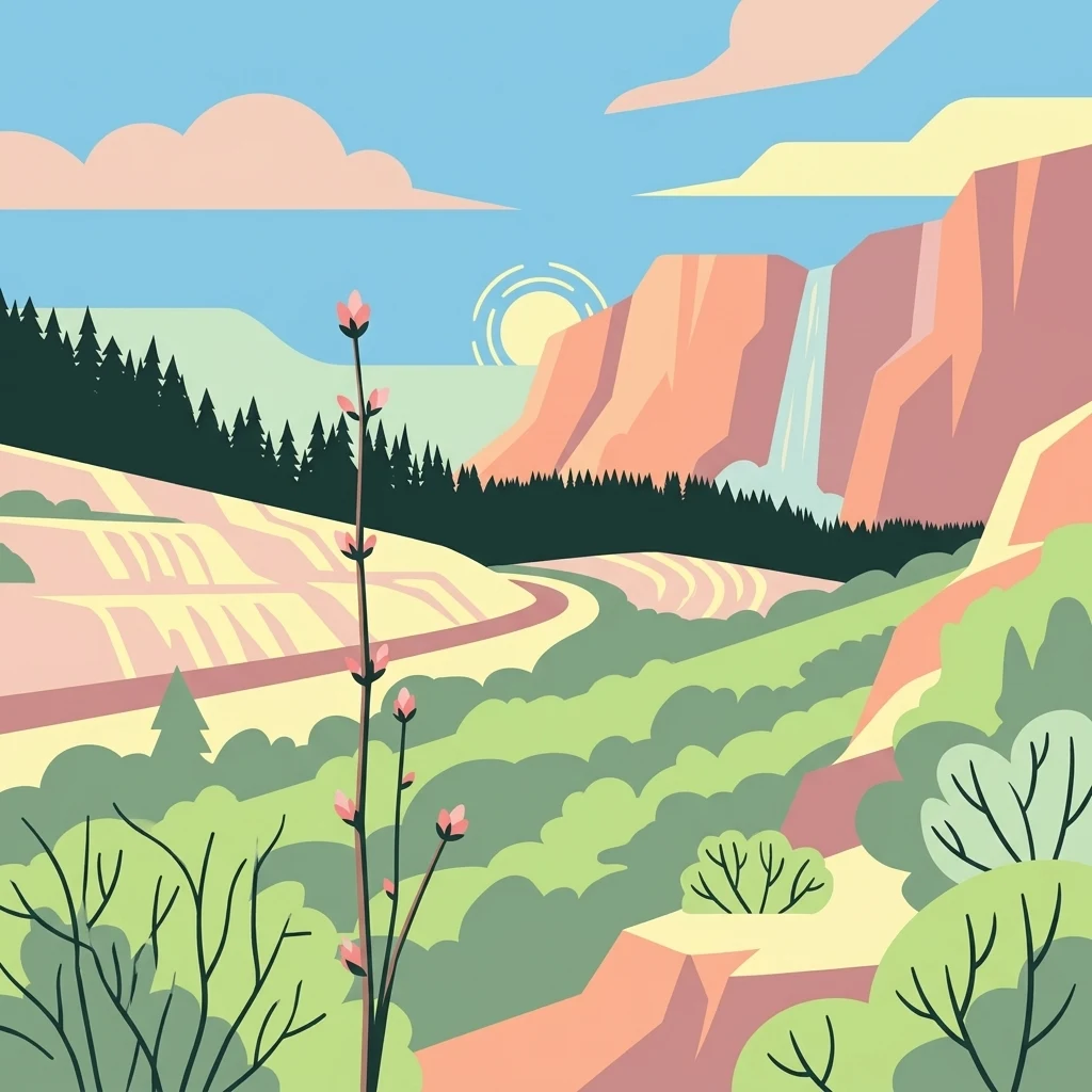
A graphic illustration showing a sunlit landscape with a tall wildflower in the foreground, a dense evergreen forest in the middle ground, and rocky cliffs with a waterfall in the background.

Wüstebachtal

Nature reserve

Park overview

Structured park overview, official facts, and landscape profile for Wüstebachtal

Wüstebachtal park facts, protected area profile, and essential visitor context

Review the core facts for Wüstebachtal, including designation, size, terrain, visitor scale, habitats, and operating context in one park-focused overview.

About Wüstebachtal

Wüstebachtal is one of many small nature reserves tucked into the valleys surrounding Monschau in the western Eifel, but it stands out for the layered ecological richness compressed into a single drainage system. The reserve was established in 1997 to protect the upper floodplain of the Wüstebach and its tributaries, and it operates under the broader umbrella of the Eifel National Park and the Hohes Venn-Eifel Nature Park.

The valley itself is a modest, up to 60-metre-wide corridor of wet and dry habitats flanked by old spruce forest. Along the upper stream, a small peat moss (Torfmoos) area, a remnant alder swamp (Erlensumpf), and a narrow strip of former grassland give way to a roughly 400-metre-long complex of wet and nutrient-poor meadow fallows (Nass- und Magerweidenbrachen). In the wider section at the mouth of a left tributary, the floodplain can reach up to 100 metres across and hosts particularly species-rich Bärwurz meadows with conspicuous yellow narcissus populations.

Downstream, the valley tightens into a slightly more incised Kerbtal (a V-shaped gorge-like valley) as far as the confluence with the Schwarzbach. Here the slopes are lined by old spruce plantations, while the brook itself retains strips of alder, ash (Esche), sycamore maple (Bergahorn), and shrub willows. Scattered fire-water ponds with reeds and pondweed stands, and a former fish pond further down, add small lentic habitats to the otherwise lotic system. The overall ecological value of Wüstebachtal stems from this mosaic of near-natural streams, swamp forest remnants, wet and dry meadows, and reed beds, which together support a high density of regionally threatened species.

Quick facts and research context for Wüstebachtal

Wüstebachtal is a designated Naturschutzgebiet (nature reserve) located near Monschau in the Städteregion Aachen, North Rhine-Westphalia, Germany. The reserve covers roughly 83 hectares within the Eifel National Park and the Hohes Venn-Eifel Nature Park. It was formally established in 1997 under the designation ACK-058 and is administered under the Monschau landscape plan by the lower landscape authority of the Städteregion Aachen.

The protected area is part of the larger Natura 2000 site DE-5404-303, covering the floodplains of the Püngel, Wüstebach and upper Erkensruhr. It is bordered by the landscape protection area Monschau-Hellenthaler Waldhochfläche. Its IUCN category is IV, identifying it as a Habitat/Species Management Area focused on conserving species-rich meadows, near-natural brook sections, swamp forest remnants, and rare plants such as Trichomanes speciosum and the yellow narcissus.

Protection and recognition

Examine documented conservation data and official registry entries for Wüstebachtal

Wüstebachtal Protection Status and Official Protected Area Designation Records

Wüstebachtal conservation records compile verified protection metrics alongside official database identifiers for research and mapping. Structured registry details outline the documented administrative framework governing this protected natural landscape.

Protection details

WDPA ID
319356
Park context

Deeper park guide and search-rich context for Wüstebachtal

Wüstebachtal history, landscape, wildlife, and travel context

Explore Wüstebachtal through its history, landscape character, ecosystems, wildlife, conservation priorities, cultural context, and seasonal travel timing in a structured park guide built for atlas discovery and search intent.

Why Wüstebachtal stands out

Wüstebachtal is best known for its narrow, ecologically rich stream valley in the Eifel, where species-rich Bärwurz meadows with large populations of the yellow narcissus (Narcissus pseudonarcissus) blend with near-natural brook corridors, alder swamps, marshy remnants, and old spruce stands. The reserve is recognised as a refugium for threatened plants and bats in North Rhine-Westphalia, and as an integral component of the larger Eifel National Park's Natura 2000 network. Its distanct identity also lies in being a textbook example of a small, valley-focused Habitat/Species Management Area: tightly shaped around hydrology, meadow succession, and the conservation of Annex I habitats such as flowing waters with submerged vegetation and mountain hay meadows, rather than around dramatic scenery or large charismatic mammals.
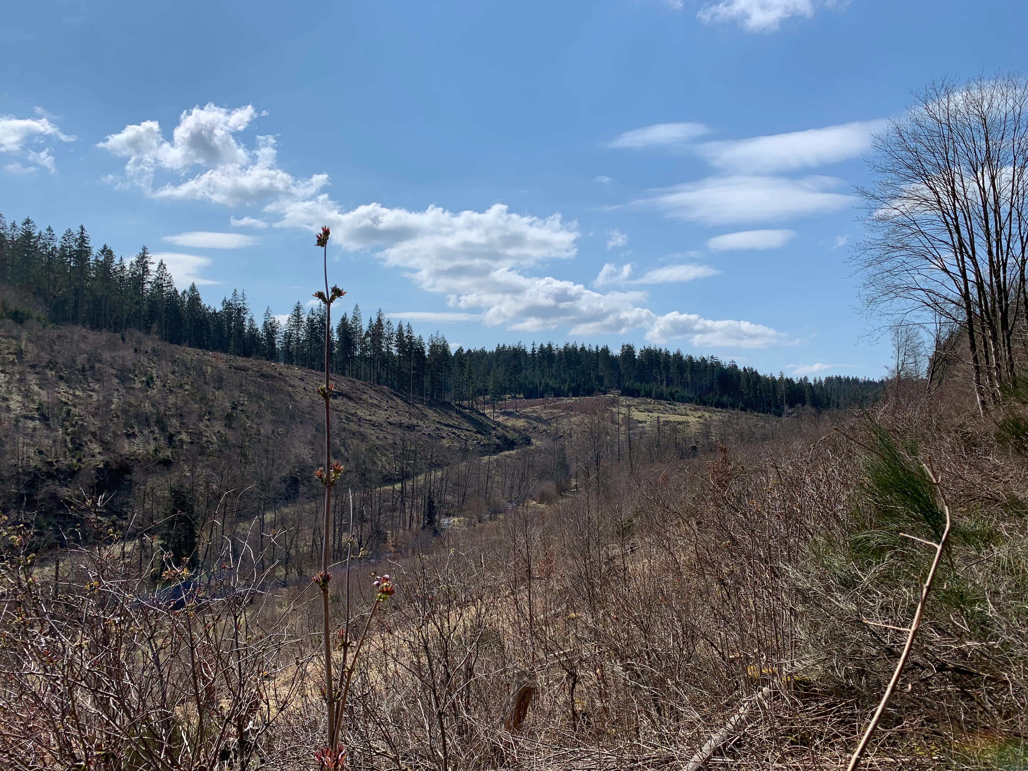
A wide, outdoor shot of the Wüstebachtal valley, showing rolling hills, brown brush, and sparse young trees under a blue sky with light clouds.
A view of the Wüstebachtal nature reserve, featuring characteristic valley landscape with sparse vegetation.

Wüstebachtal history and protected-area timeline

The Wüstebachtal was formally designated as a Naturschutzgebiet (nature reserve) in 1997 under the designation ACK-058, and is administered under the Monschau landscape plan by the Untere Landschaftsbehörde (lower landscape authority) of the Städteregion Aachen.

Its designation was driven by the recognition that the small stream valley, despite its limited area, harboured a remarkable concentration of habitats and red-listed species. Since its establishment, the reserve has also been integrated into the EU Natura 2000 network as a component of the larger FFH site "Dedenborn, Talaue des Püngel-, Wüstebaches und Erkensruhroberlauf" (DE-5404-303), placing its conservation within a region-wide strategy for protecting the floodplain ecosystems of the upper Rur catchment.

Wüstebachtal landscape and geographic character

Wüstebachtal occupies a narrow, dissected section of the Eifel landscape near Monschau, on the western edge of the Eifel uplands. Its defining feature is the upper valley of the Wüstebach and the short tributaries Schwarzbach and Viehbach, all part of the Rur river system draining towards the north.

Geomorphologically, the valley changes character from west to east. The upper reach lies in a comparatively open, gently sloping floodplain up to 60 metres across, occasionally widening to about 100 metres where a left-hand tributary joins. Downstream, the valley narrows and steepens into a Kerbtal, a tight, V-shaped incision in which the brook runs between older spruce stands on the upper margins and a string of small wetlands along the banks. The surrounding plateau is covered by the wider forest landscape of the Monschau-Hellenthaler Waldhochfläche, which shields the reserve as a landscape protection area.

Wüstebachtal ecosystems, habitats, and plant life

Ecologically, Wüstebachtal is best understood as a small but highly compressed mosaic of stream, mire, meadow, and forest habitats typical of the higher Eifel.

The aquatic and semi-aquatic zones include near-natural, unmodified stretches of the Wüstebach with submerged vegetation, small fire-water ponds ringed by reeds (Röhricht) and pondweed (Laichkraut) stands, and a former fish pond further down. Along the valley margins, a peat-moss area, a remnant alder swamp, and narrow strips of alder swamp forest (Sumpfwald) and floodplain forest (Auenwald) preserve relict wetland communities that have largely disappeared from the wider agricultural plateau.

Above the brook, the valley carries two contrasting meadow types: nutrient-poor, dry meadow fallows (Magerwiesenbrachen) and wet meadow fallows (Nasswiesenbrachen), interspersed with species-rich Bärwurz meadows. These open habitats harbour characteristic plants of the region, including large populations of the yellow narcissus. The slopes are clothed in old spruce forest, with pockets of ash, sycamore maple, and shrub willows along the lower valley edges, producing a transitional zone between cultivated grassland and coniferous plantation.

Wüstebachtal wildlife and species highlights

Because of its compact structure and varied habitats, Wüstebachtal supports a notable concentration of regionally threatened species for its size. The reserve has particular significance for several bat species, including the greater mouse-eared bat (Großes Mausohr), the Daubenton's bat (Wasserfledermaus), the whiskered bat (Kleine Bartfledermaus), and the brown long-eared bat (Braunes Langohr), which use the wooded valley sections and old forest stands as foraging and roosting habitat.

Among plants, the most conspicuous faunal elements relate less to charismatic mammals and more to the invertebrate and bryophyte communities of the wet meadows, the rare Killarney fern (Prächtiger Dünnfarn, Trichomanes speciosum), and the extensive populations of the yellow narcissus that shape the valley's spring appearance. Brook fauna typical of near-natural upland streams, supported by submerged vegetation and structurally intact banks, also contribute to the reserve's ecological profile.

Wüstebachtal conservation status and protection priorities

The conservation value of Wüstebachtal rests on its role as a refugium for habitats and species that have become scarce in the surrounding intensively used Eifel landscape. Classified at the European level as IUCN Category IV (Habitat/Species Management Area) and integrated into the EU Natura 2000 network through the FFH site DE-5404-303, the reserve is explicitly designed to maintain and develop Annex I habitats, including flowing waters with submerged vegetation and mountain hay meadows (Berg-Mähwiesen).

The reserve's biotope types also include wet and moist grassland (Nass- und Feuchtgrünland), near-natural unmodified brook sections, nutrient-poor meadows (Magerwiesen), swamps (Sümpfe), alder swamp and floodplain forest fragments, and reed beds (Röhrichte). These habitats support numerous species listed on North Rhine-Westphalia's Red List of endangered plants, fungi, and animals. Notable conservation targets include the rare fern Trichomanes speciosum and the yellow narcissus, which depend on the continued survival of the traditional meadow management and hydrological regime. By embedding the valley within the Eifel National Park and the wider Püngel-Wüstebach-Erkensruhr floodplain complex, the reserve also functions as a stepping stone in a larger corridor of protected stream valleys in the Städteregion Aachen.

Top sights and standout views in Wüstebachtal

Wüstebachtal's principal highlight is the convergence of a near-natural upland brook, species-rich Bärwurz meadows, and old spruce forest within a single narrow Eifel valley. The large springtime stands of the yellow narcissus (Narcissus pseudonarcissus) give the reserve a distinctive seasonal character and are among the most visible ecological features in the surrounding Monschau landscape.

Other defining highlights include the mosaic of wet and dry meadow fallows, the relict peat-moss and alder swamp communities, the V-shaped Kerbtal section, the scattered fire-water ponds with reed and pondweed stands, and the reserve's role within the larger Natura 2000 floodplain system of the upper Rur catchment. Together, these elements make Wüstebachtal a compact but information-dense example of valley-focused habitat conservation in the western Eifel.

Best time to visit Wüstebachtal

Wüstebachtal is best appreciated in late spring, when the Bärwurz meadows across the upper floodplain come into bloom and the large populations of the yellow narcissus create the valley's most distinctive colour signal against the dark spruce forest. Early summer further allows the full species richness of the wet and dry meadow fallows to be observed, while the still intact brook reaches are most visually accessible during dry spells when water levels are low and the submerged vegetation is visible.

Late autumn and winter shift the emphasis from flowering meadow communities to the structural features of the valley itself: the incised Kerbtal, the alder and ash strips along the brook, the reed-ringed fire-water ponds, and the surrounding spruce stands. Mushrooms, bryophytes, and the bat fauna are also more notable elements of the reserve during these colder months. Because the site is a protected nature reserve, visitors should expect restricted access and to limit their impact on meadows and brook-side vegetation.


Monthly climate preview

Long-term temperature ranges and monthly precipitation patterns sampled at representative coordinate elevation

Wüstebachtal Climate Normals and Measured Annual Weather by Month

Representative coordinates record measured monthly averages spanning sub-zero winter minimums to warm summer maximums alongside consistent daily precipitation. Exploring the complete twelve-month climate profile reveals detailed temperature variation and long-term precipitation rhythms across the protected area.
Annual mean8 °C
0 °C17 °C
Jan
Feb
Mar
Apr
May11°
Jun15°
Jul17°
Aug17°
Sep13°
Oct
Nov
Dec
Warmest month
July

17 °C

Coolest month
January

-0 °C

Wettest month
December

3.1 mm/day

Driest month
April

1.9 mm/day

Park location guide

Geography guide, regional context, and park location map for Wüstebachtal

Wüstebachtal park geography, regions, and map view in Germany

Understand where Wüstebachtal sits in Germany through a broader geographic reading of the surrounding landscape, nearby location context, and its mapped position within the national park landscape.

How Wüstebachtal fits into Germany

Germany is a federal republic in Western and Central Europe with a population of over 83 million across sixteen constituent states. It is Europe's largest economy by nominal GDP and a major global exporter and importer. The capital is Berlin, and the country borders Denmark, Poland, Czech Republic, Austria, Switzerland, France, Luxembourg, Belgium, and the Netherlands.

Wider geography shaping Wüstebachtal in Germany

Germany is located in Western and Central Europe, spanning 357,022 km². It borders Denmark to the north, Poland and the Czech Republic to the east, Austria and Switzerland to the south, and France, Luxembourg, Belgium, and the Netherlands to the west. The country has coastlines on the Baltic Sea and North Sea to the north, with the Alps located in the southern region.

Map view of Wüstebachtal

Use this park location map to pinpoint Wüstebachtal in Germany, understand its exact geographic position, and read its mapped placement within the surrounding landscape more clearly.

Pigeon | © OpenStreetMap contributors

Location context for Wüstebachtal

Nordrhein-Westfalen

Visual reference for stream valleys, wet meadows, and forest habitats

Wüstebachtal Photos and Landscape Scenery in the Eifel Protected Area

Visual documentation of Wüstebachtal reveals the distinctive terrain of the Eifel uplands, featuring narrow brook corridors and marshy floodplains. Examining these protected area images provides a clearer understanding of local habitat structures and regional valley morphology.

A wide, outdoor shot of the Wüstebachtal valley, showing rolling hills, brown brush, and sparse young trees under a blue sky with light clouds.

Park atlas

Compare adjacent valley reserves and connected upland landscapes in western Germany

Parks Near Wüstebachtal and Surrounding Eifel Protected Areas

Browsing parks near Wüstebachtal reveals neighboring valley reserves and upland habitats across the western Eifel region. Continuing the comparison connects individual stream corridors to broader protected landscapes within North Rhine Westphalia.
Watercolor illustration of rolling green hills and meadows with patches of pink and yellow flowers
National parkNorth Rhine-Westphalia
Mapped location lies within the park boundary#1 closest

Northeast

Eifel National Park: North Rhine-Westphalia Protected Area Atlas

Explore mapped boundaries and regional geography.

Gain a structured understanding of Eifel National Park, a key protected area within Germany's North Rhine-Westphalia region. This page focuses on its geographic identity, detailing mapped boundaries and offering context within the state's broader natural landscapes. MoriAtlas enhances your exploration by presenting Eifel National Park as a distinct entity within a larger geographic framework, ideal for atlas-based research and understanding protected land distribution.

Area
107 km²
Established
2004
IUCN
II
Relief
Upland
Watercolor illustration showing a soft-focus landscape with rolling green hills, a winding stream, and hints of red floral color against a light background.
Nature reserveNordrhein-Westfalen
About 2.9 km away#2 closest

West

Naturschutzgebiet Perlenbach-Fuhrtsbachtal: Geographic Atlas and Protected Area Context

Mapped brook valleys and rare Eifel wetland habitats

The Naturschutzgebiet Perlenbach-Fuhrtsbachtal protects a distinctive valley system near the Eifel plateau. This area is recognized for its cold, humid microclimate and diverse habitats, ranging from spring-fed fens to ancient meadow systems. Beyond its rare floral displays, the reserve serves as a critical refuge for freshwater pearl mussels and ice-age butterfly relict species, illustrating the intersection of regional geography and conservation.

Area
3.4 km²
Established
1976
IUCN
IV
Relief
Upland
Protected landscapeBelgium
About 3 km away#3 closest

Southwest

Hohes Venn, Eifel Nature Park: A Protected Landscape in Belgium for Geographic Atlas Exploration

Explore mapped natural terrain and protected area details.

The Hohes Venn, Eifel Nature Park in Belgium represents a key protected landscape for atlas and geographic discovery. This entry focuses on the park's specific identity, its geographic setting within Belgium, and the value it holds for users interested in mapped terrain and protected area exploration. Understand the landscape context and the detailed geographic information available for this significant natural area, supporting structured learning about Belgium's conservation efforts.

IUCN
V
A pale, minimalist watercolor painting showing a soft-focus landscape with green trees in the foreground, rolling hills in the background, and hints of pink in the foreground foliage.
Protected areaGermany
About 4.4 km away#4 closest

Northwest

Holderbachtal, Dürholderbachtal: Protected Area Geography and Landscape Mapping in Germany

Integrated stream valley and wetland habitat analysis

Holderbachtal, Dürholderbachtal covers 187 hectares of diverse terrain in Germany, blending alder swamp forests with species-rich grasslands. This protected area offers deep insight into the valley-bound ecology and hydrological characteristics that define the Eifel region. Explore the connection between the primary stream systems, spring mires, and the surrounding woodland mosaic in this structured geographic overview.

A soft watercolor illustration of a rolling green landscape with flowering trees and distant forested hills, isolated on a white background.
Nature reserveNordrhein-Westfalen
About 6.3 km away#5 closest

Northwest

Kluckbachtal Nature Reserve: Geographic Atlas and Protected Stream Valley Overview

Mapped riparian forest and orchard meadow habitats in Nordrhein-Westfalen

Kluckbachtal protects a distinctive valley segment between Rohren and Höfen, featuring a complex of stream beds, wet grasslands, and old oak and alder woodland. This nature reserve is recognized for its significant role in preserving Red List species and traditional cultural landscapes, offering a detailed look at the ecology of the northern Eifel region through its varied habitats.

Area
1.13 km²
Established
1997
IUCN
IV
Relief
Upland
A horizontal watercolor painting showing a soft, stylized landscape with rolling green hills, distant purplish ridges, and grassy foreground elements on a white background.
Nature reserveNordrhein-Westfalen
About 6.3 km away#6 closest

Northwest

Mittleres Rurtal mit den Felsbildungen der Perdsley und Wiselsley Protected Nature Reserve Map

Exploring the Rur valley river dynamics and cliff geology

Investigate the topographical features of the Mittleres Rurtal mit den Felsbildungen der Perdsley und Wiselsley, a critical nature reserve characterized by free flowing river segments and steep ravine forests. This overview outlines the ecological distribution of rock formations and riparian habitats across the Monschau region landscape.

Area
1.33 km²
Established
2003
IUCN
IV
A watercolor painting depicting a soft, panoramic landscape of a meandering stream valley with rolling hills, meadows, and scattered patches of trees.
Nature reserveNordrhein-Westfalen
About 9.8 km away#7 closest

Northwest

Kleines Laufenbachtal Nature Reserve: Geographic Atlas of an Eifel Stream Valley

Protected brook habitats and natural rock landscapes in North Rhine-Westphalia

Investigate the topographical features and habitat diversity of Kleines Laufenbachtal, an established nature reserve in the Eifel. This protected area showcases a dense assembly of wet grasslands, reed banks, and rocky slopes that anchor local ecological corridors within the Monschau landscape.

Area
0.13 km²
Established
1997
IUCN
IV
A soft watercolor illustration showing a hazy, green landscape with a winding stream, distant hills, and low-lying vegetation on a white background.
Nature reserveNordrhein-Westfalen
About 9.8 km away#8 closest

Northwest

Kranzbach und Kranzbruchvenn: Protected Nature Reserve and Bog Landscape in Nordrhein-Westfalen

Wetland stream valleys and historic military relic landscapes

Investigate the specialized wetland ecosystems of Kranzbach und Kranzbruchvenn, a nature reserve in Nordrhein-Westfalen known for its bog and fen habitats. The site offers a detailed case study of small-stream hydrology and the transformation of former Westwall dragon teeth structures into unique marsh environments.

Area
0.328 km²
Established
2002
IUCN
IV

Common questions about visiting, size, designation, and location context for Wüstebachtal

Wüstebachtal FAQs for park facts, access, geography, and protected area context

Find quick answers about Wüstebachtal, including protected-area facts, park geography, trail and visitor context, and how the park fits into its surrounding country and regional landscape.
MoriAtlas Explorer

Continue Your Protected Areas Search Across the Global Atlas

Deepen your exploration by continuing the structured search for national parks and protected areas worldwide. Utilize the comprehensive filtering capabilities to compare different conservation landscapes and refine your understanding of global park geography. Discover more about the distribution and characteristics of protected natural areas.

Global natural geography