
Mori Atlas logo
Protected landscapeZuckerberg-Muckensturm

Tracing the geological character and mapped vineyard boundaries within the Neckar river valley

Zuckerberg-Muckensturm Protected Landscape: Analyzing Regional Geography and Vineyard Terraces

(Landschaftsschutzgebiet Zuckerberg-Muckensturm)

Zuckerberg-Muckensturm is a defined protected landscape in the northeastern sector of Stuttgart, Baden-Württemberg. This area features a distinctive combination of steep, dry-stone-walled vineyard terraces and exposed Muschelkalk limestone geological formations. The terrain spans from the Neckar river valley slopes up to an elevated plateau of small-scale agricultural parcels and allotment gardens, creating a complex mosaic of cultural viticulture history and layered natural earth heritage.

landscape protection areaNeckar valleyterraced vineyardsMuschelkalk slopescultural landscapeperi-urban conservation
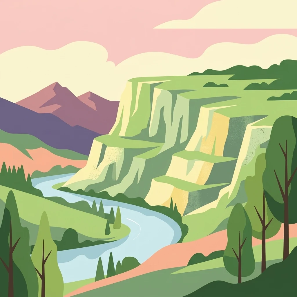
A flat-style vector illustration showing a river winding through a valley with steep, terraced cliffs and green trees under a soft, pastel-colored sky.

Zuckerberg-Muckensturm

Protected landscape

Park overview

Structured park overview, official facts, and landscape profile for Zuckerberg-Muckensturm

Zuckerberg-Muckensturm park facts, protected area profile, and essential visitor context

Review the core facts for Zuckerberg-Muckensturm, including designation, size, terrain, visitor scale, habitats, and operating context in one park-focused overview.

About Zuckerberg-Muckensturm

Zuckerberg-Muckensturm is a German landscape protection area, or Landschaftsschutzgebiet, situated in the northeastern portion of Stuttgart, the state capital of Baden-Württemberg. Although Stuttgart is a sizable urban center, the municipality contains a network of protected landscape areas that preserve fragments of its surrounding rural, agricultural, and seminatural environments. Zuckerberg-Muckensturm is one of these protected areas and represents a compact but characteristic slice of the Neckar valley's traditional wine-growing landscape.

The protected area covers approximately 50.5 hectares on the right-hand slope of the Neckar river valley. It lies between the Steinhaldenfeld and Sommerrain neighborhoods and stretches across parts of the city's Hofen and Cannstatt districts. From a natural geography perspective, the area belongs to the Neckar basin (Neckarbecken), a region defined by deeply incised river valleys and layered sedimentary geology. The dominant rocks in the area are Muschelkalk limestones, a Triassic-age geological formation that shapes the steep slopes and produces the characteristic cliff faces and quarry exposures visible throughout the protected area.

The most visually defining feature of Zuckerberg-Muckensturm is the dense network of terraced vineyards climbing the steep valley slopes. These terraces, retained by dry stone walls, reflect a centuries-old tradition of wine cultivation along the Neckar and demonstrate how human land use has shaped the modern landscape. Above the vineyard belts, the protected area also includes the Vordere Wohlfahrt and Hintere Wohlfahrt parcels, used for mixed small-scale agriculture, and the Kreistel area, which is mostly given over to allotment gardens. Together, these zones illustrate the patchwork of small-scale rural land use that has historically coexisted with the city's expansion.

In the southern part of the protected area, a small patch of woodland grows on a disused quarry bench above the Sicherheitshafen harbor area. Further north, the abandoned Stephan quarry is recognized as a natural monument for its geological and ecological value, and at the southern edge near Steinhalden, an exposed contact zone between Muschelkalk limestone and Lettenkeuper sedimentary layers has similarly been protected as a natural monument for its earth-historical significance. These features give Zuckerberg-Muckensturm a layered identity: a working cultural landscape on one hand, and a showcase for local geological and ecological heritage on the other.

Quick facts and research context for Zuckerberg-Muckensturm

Zuckerberg-Muckensturm is a landscape protection area (Landschaftsschutzgebiet) located within the city limits of Stuttgart in Baden-Württemberg, in southwestern Germany. It was formally designated on 12 October 1987 by the city of Stuttgart and replaces an older landscape protection designation that had covered parts of the same area since 1961.

The protected area covers about 50.5 hectares along the right bank of the Neckar river, between the Steinhaldenfeld and Sommerrain neighborhoods. It is managed by the Stuttgart city administration and is part of the broader Neckar river basin natural region. The area is dominated by terraced Muschelkalk vineyard slopes, small agricultural plots, allotment gardens, and abandoned limestone quarries with exposed geological features.

Protection and recognition

Examine the documented conservation framework and official designation history.

Zuckerberg-Muckensturm Protection Status and International Recognition

Zuckerberg-Muckensturm protection status details compile available international registry data and designation records. Visitors can review documented management scope and official administrative parameters for this protected area.

Protection details

WDPA ID
326000
Park context

Deeper park guide and search-rich context for Zuckerberg-Muckensturm

Zuckerberg-Muckensturm history, landscape, wildlife, and travel context

Explore Zuckerberg-Muckensturm through its history, landscape character, ecosystems, wildlife, conservation priorities, cultural context, and seasonal travel timing in a structured park guide built for atlas discovery and search intent.

Why Zuckerberg-Muckensturm stands out

Zuckerberg-Muckensturm is best known for its steep, terraced vineyard landscape on the right bank of the Neckar, where dry-stone-walled Muschelkalk slopes form a classic example of an urban-adjacent wine-growing cultural landscape. The combination of working vineyards, natural limestone rock outcrops, and abandoned quarries gives the protected area a distinctive geological and cultural identity. It is also notable among Stuttgart's landscape protection areas for its exposed Muschelkalk and Lettenkeuper boundary, which has been designated as a natural monument for its value in illustrating regional earth history.
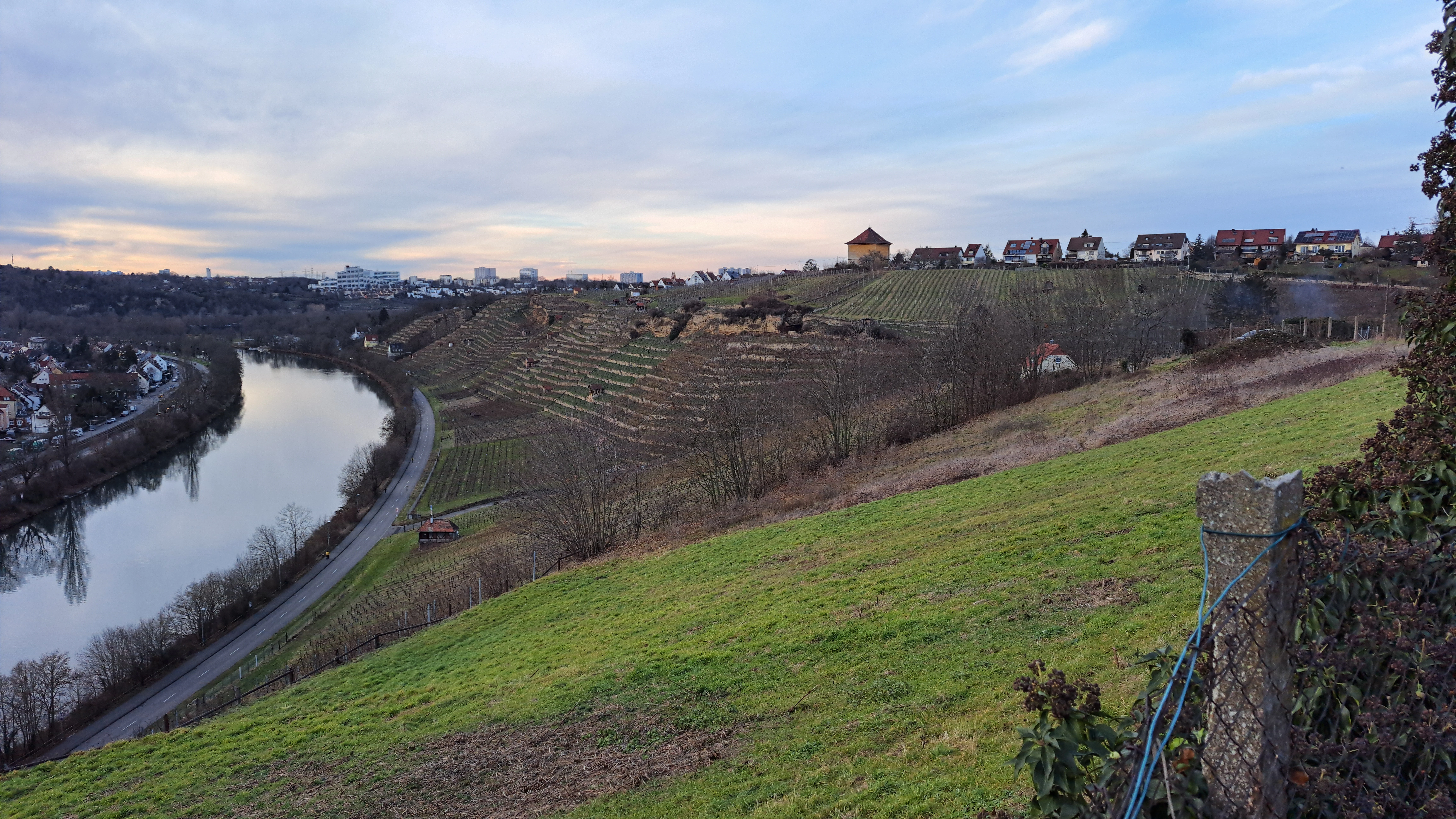
A wide landscape view of the Zuckerberg-Muckensturm area featuring terraced vineyard slopes descending toward the Neckar River with a town skyline in the background.
A view overlooking the terraced vineyards and the Neckar River within the Zuckerberg-Muckensturm protected area.

Zuckerberg-Muckensturm history and protected-area timeline

Parts of what is now Zuckerberg-Muckensturm were already protected as a landscape conservation area beginning in 1961. The current protected area was formally designated through a city ordinance issued on 12 October 1987 by the Landeshauptstadt Stuttgart, the state capital of Stuttgart. When the new designation was established, the older 1961 ordinance was repealed within the overlapping territory.

In 2005, the protected area was reduced by approximately three hectares in the Mittlere Wohlfahrt section, reflecting a boundary adjustment. Beyond these administrative milestones, the area represents a continuation of much older land-use traditions tied to viticulture and small-scale agriculture along the Neckar valley slopes.

Zuckerberg-Muckensturm landscape and geographic character

The landscape of Zuckerberg-Muckensturm is dominated by the steep, sun-exposed right-bank slopes of the Neckar valley, which descend sharply from the elevated plateau above down to the river. These slopes have been extensively modified for viticulture, with vineyards organized into terraces supported by dry stone walls that step down the hillside in tight succession. The terraces and retaining walls are among the most visually distinctive elements of the area and reflect generations of careful land shaping.

Natural Muschelkalk limestone rock outcrops interrupt the vineyard terraces in several places, producing small cliffs and rocky ledges that contrast with the cultivated land. Abandoned quarry faces are scattered across the slopes; among these, the Stephan quarry in the north of the protected area is large enough to have been designated as a separate natural monument for its geological exposures. At the southern end of the area near Steinhalden, another exposure marks the geological contact between Muschelkalk and underlying Lettenkeuper layers, illustrating the stratigraphy of the region.

Above the vineyard zone, the land levels out onto a plateau that has been shaped by small-scale agricultural parcels and allotment gardens, creating a softer, more cultivated character compared with the dramatic slopes below. In the south, a small woodland stand occupies an old quarry bench above the Sicherheitshafen, adding a wooded dimension to an otherwise vineyard-and-garden landscape.

Zuckerberg-Muckensturm ecosystems, habitats, and plant life

Ecologically, Zuckerberg-Muckensturm sits at the interface between a working cultural landscape and patches of more natural rocky habitat. The dry, sun-exposed Muschelkalk slopes host xerothermic (warm- and drought-adapted) plant communities typical of the Neckar valley, while the abandoned quarries and rock faces provide refuge for species that thrive on bare stone, crevice habitats, and thin mineral soils.

The mixed land-use mosaic of vineyards, small agricultural plots, allotment gardens, and a small woodland patch creates a heterogeneous habitat pattern characteristic of traditional European rural landscapes. This mosaic supports a variety of edge habitats, hedgerows, stone wall microhabitats, and fallow ground, all of which contribute to local biodiversity within an otherwise heavily urbanized setting.

Zuckerberg-Muckensturm wildlife and species highlights

Wildlife in Zuckerberg-Muckensturm is shaped by the mixture of vineyard terraces, rocky Muschelkalk exposures, allotment garden zones, plateau fields, and the small woodland above the old quarry. The warm, dry slopes with their loose stone walls and rocky outcrops provide habitat typical of inner-city and peri-urban Neckar valley environments, supporting reptiles and invertebrates adapted to exposed rock and thin soils.

The garden allotments and small agricultural parcels add softer habitat elements such as hedgerows, fruit trees, and flowering garden plants, which in turn attract pollinating insects and common urban birdlife. The woodland fragment in the southern quarry adds further habitat complexity, offering cover and nesting opportunities for typical small woodland bird species. The overall mosaic supports a community typical of Stuttgart's protected peri-urban landscapes rather than species associated with large wilderness areas.

Zuckerberg-Muckensturm conservation status and protection priorities

Zuckerberg-Muckensturm was designated specifically to protect the traditional vineyard and small-scale agricultural landscape on the Neckar valley slopes from further urban encroachment and to preserve its characteristic cultural and geological features. The 1987 designation consolidated earlier, smaller-scale protections into a single coherent landscape protection area, reflecting an effort to maintain a recognizable piece of the city's regional wine-growing heritage.

From a conservation perspective, the area's significance lies less in large wilderness habitat than in preserving the integrity of a working cultural landscape alongside embedded geological features. The two designated natural monuments within the protected area, the Stephan quarry and the Muschelkalk/Lettenkeuper contact outcrop near Steinhalden, give the area added scientific and educational value and ensure that significant fossil-bearing and stratigraphically informative exposures remain undamaged.

Zuckerberg-Muckensturm cultural meaning and human context

The vineyards of Zuckerberg-Muckensturm are part of the broader Württemberg wine-growing tradition that has shaped the Neckar valley for centuries. Stuttgart is one of the few large German cities with a substantial working vineyard area within its municipal boundaries, and Zuckerberg-Muckensturm preserves a representative example of this heritage. The maintenance of dry-stone-walled terraces reflects traditional craftsmanship and land stewardship that remains part of the identity of the Hofen and Cannstatt districts.

The mix of vineyard slopes, allotment gardens, and small agricultural fields also reflects the historical pattern of smallholder land use at the urban-rural fringe, where city residents have long maintained compact garden plots and small farms alongside larger vineyard operations.

Top sights and standout views in Zuckerberg-Muckensturm

The defining highlights of Zuckerberg-Muckensturm are its steep, dry-stone-walled vineyard terraces on the right bank of the Neckar and its exposed Muschelkalk limestone geology, including two designated natural monuments of geological interest. The working wine-growing landscape at the edge of Stuttgart gives the protected area a strong cultural identity, while its abandoned quarries and earth-history outcrops add geological and educational significance.

Best time to visit Zuckerberg-Muckensturm

Late spring through early autumn is the most engaging period to experience the Zuckerberg-Muckensturm landscape, when the vineyard terraces are actively worked and the slopes are most visually expressive. The warmer months also highlight the contrast between cultivated land and exposed Muschelkalk rock faces, and during harvest time in early autumn the cultural landscape dimension of the area is at its most visible. In winter, the bare vines and visible stone walls emphasize the dormant structure of the terraced slopes.

Monthly climate preview

Long-term monthly temperature and precipitation rhythm across representative coordinates

Zuckerberg-Muckensturm Climate Normals and Measured Annual Temperature Patterns

Zuckerberg-Muckensturm records long-term monthly temperature and precipitation averages derived from historical coordinate sampling between 1991 and 2020. Reviewing the complete twelve-month profile provides detailed meteorological context for regional analysis across the protected landscape.
Annual mean9 °C
0 °C20 °C
Jan
Feb
Mar
Apr
May13°
Jun17°
Jul20°
Aug20°
Sep15°
Oct10°
Nov
Dec
Warmest month
July

19.6 °C

Coolest month
January

-0.2 °C

Wettest month
July

2.7 mm/day

Driest month
April

1.6 mm/day

Park location guide

Geography guide, regional context, and park location map for Zuckerberg-Muckensturm

Zuckerberg-Muckensturm park geography, regions, and map view in Germany

Understand where Zuckerberg-Muckensturm sits in Germany through a broader geographic reading of the surrounding landscape, nearby location context, and its mapped position within the national park landscape.

How Zuckerberg-Muckensturm fits into Germany

Germany is a federal republic in Western and Central Europe with a population of over 83 million across sixteen constituent states. It is Europe's largest economy by nominal GDP and a major global exporter and importer. The capital is Berlin, and the country borders Denmark, Poland, Czech Republic, Austria, Switzerland, France, Luxembourg, Belgium, and the Netherlands.

Wider geography shaping Zuckerberg-Muckensturm in Germany

Germany is located in Western and Central Europe, spanning 357,022 km². It borders Denmark to the north, Poland and the Czech Republic to the east, Austria and Switzerland to the south, and France, Luxembourg, Belgium, and the Netherlands to the west. The country has coastlines on the Baltic Sea and North Sea to the north, with the Alps located in the southern region.

Map view of Zuckerberg-Muckensturm

Use this park location map to pinpoint Zuckerberg-Muckensturm in Germany, understand its exact geographic position, and read its mapped placement within the surrounding landscape more clearly.

Pigeon | © OpenStreetMap contributors

Location context for Zuckerberg-Muckensturm

Baden-Württemberg

Visualizing terraced vineyards, limestone geology, and protected valley habitats

Zuckerberg-Muckensturm Photos and Landscape Scenery

Visual documentation captures the steep terraced vineyards and exposed Muschelkalk limestone outcrops defining the protected landscape. Photographic records reveal the regional terrain and traditional land-shaping character across the Neckar river valley slopes.

A wide landscape view of the Zuckerberg-Muckensturm area featuring terraced vineyard slopes descending toward the Neckar River with a town skyline in the background.

A geological outcrop featuring layers of rock along a hillside, adjacent to a road with a stone retaining wall and a small information sign.

Park atlas

Compare regional valley terrain and adjacent conservation areas

Explore Parks Near Zuckerberg-Muckensturm and Surrounding Protected Landscapes

Browse other protected areas and nearby national parks that share similar regional geography and valley terrain. Comparing these locations helps place Zuckerberg-Muckensturm within a broader network of protected landscapes.
A watercolor painting of a gentle, rolling landscape with soft green hills, forests, and a light-filled sky.
Protected landscapeBaden-Württemberg
About 5.1 km away#1 closest

Northeast

Hartwald mit Umgebung Protected Landscape and Regional Geographic Map Context

Forested hill topography and traditional orchard landscapes in Baden-Württemberg.

The Hartwald mit Umgebung protected area provides a focal point for understanding regional geography in the Neckar basin. Defined by a forested summit rising above loess plains, the protected landscape preserves valuable stream corridors and ancient burial mounds. This site serves as a vital case study in geological relief inversion and the preservation of culturally shaped natural terrain near the Rems and Neckar river confluence.

Area
2.025 km²
Established
1968
IUCN
V
Protected landscapeBaden-Württemberg
About 7.5 km away#2 closest

Northeast

Unteres Remstal mit Randgebieten Protected Landscape and Regional Geographic Map

Mapping the cultural landscapes of Baden-Württemberg

Unteres Remstal mit Randgebieten represents a key protected landscape in Baden-Württemberg, encompassing the lower Rems river valley. This area preserves a rich mosaic of traditional orchard meadows, scrubby wastelands, and transitional slope reliefs that connect the valley floor to the rising Gäu plateau, forming a vital buffer for regional habitat connectivity.

Area
2.5 km²
Established
1987
IUCN
V
Relief
Lowland
A soft watercolor painting showing a pale river curving through green hills and vegetation.
Protected landscapeBaden-Württemberg
About 8.8 km away#3 closest

North

Neckartal zwischen den Neckarbrücken von Hochberg und Neckarweihingen Protected Landscape Overview

A detailed geographic look at the Neckar river valley and its surrounding terrain.

Analyze the protected landscape boundaries of the Neckar valley between Hochberg and Neckarweihingen. This area features a complex mosaic of renaturalized river floodplains, traditional terraced vineyards with stone walls, and wooded edge habitats in the Ludwigsburg district of Baden-Württemberg.

Area
3.803 km²
Established
1988
IUCN
V
Relief
Lowland
Protected areaBaden-Württemberg
About 9.7 km away#4 closest

West

Penal Substitution: Protected Area Mapping and Regional Geography in Baden-Württemberg

Cultural landscape and habitat mosaic overview

Penal Substitution represents a preserved cultural landscape in the German state of Baden-Württemberg, featuring a structured mix of orchard meadows, farmland, and riparian habitats. This area serves as a critical regional green link, where mapped boundaries reveal a complex interplay of agricultural history and active environmental conservation just outside the urban core.

Area
2.586 km²
Established
2004
Relief
Upland
Climate
Temperate
A horizontal watercolor painting of layered, soft green and yellow hills, stylized and minimalist.
Protected landscapeBaden-Wuerttemberg
About 14 km away#5 closest

North

Neckartal zwischen Benningen und Großingersheim mit angrenzenden Gebieten Geography and Maps

A preserved Swabian river valley and vineyard landscape

This protected landscape in Baden-Wuerttemberg encompasses the scenic Neckar river bend. The area combines traditional vineyard terraces, riparian corridors, and gentle valley topography to maintain a functional cultural landscape within the Ludwigsburg district.

Area
4.1 km²
Established
1985
IUCN
V
Relief
Lowland
Protected landscapeBaden-Württemberg
About 15 km away#6 closest

Northwest

Wartbiegel - Katharinenlinde und Umgebung: Mapped Protected Landscape and Regional Geography

Traditional orchard mosaic in the Neckar basin, Germany

Discover the geographic structure of Wartbiegel - Katharinenlinde und Umgebung. This protected landscape preserves a unique relief of slopes and agricultural patterns in Baden-Württemberg. The area functions as a vital example of traditional land-use conservation, combining local ecological value with a textured rural landscape near Schwieberdingen.

Area
0.421 km²
Established
1987
IUCN
V
Relief
Upland
Protected landscapeBaden-Württemberg
About 16 km away#7 closest

East

Zipfelbachtal, Korber Kopf, Buocher Höhe, Remstalhänge, Ramsbachtal und Grafenberg Protected Landscape Map

Mapping the Keuper cultural landscape of Baden-Württemberg

Study the intricate topography and land use patterns of this expansive protected area in the Rems-Murr-Kreis. The region preserves a variety of habitats, including vineyard slopes, traditional Streuobst orchards, and forested ravines, providing a clear window into the natural and agricultural heritage of the eastern Stuttgart region.

Area
20.856 km²
Established
1968
IUCN
V
Relief
Upland
Protected landscapeBaden-Württemberg
About 16 km away#8 closest

Southeast

Unteres Körschtal Protected Landscape: Geography and Mapped Boundaries in Baden-Württemberg

An ecological green corridor within the Swabian Keuper-Lias landscape

Unteres Körschtal protects the natural valley floor and adjacent slopes of the lower Körsch river. This landscape conservation area provides essential habitat and recreational space between the Filder plateau and the Neckar valley, standing as a primary example of regional geography in Germany.

Area
4.729 km²
Established
1978
IUCN
V

Common questions about visiting, size, designation, and location context for Zuckerberg-Muckensturm

Zuckerberg-Muckensturm FAQs for park facts, access, geography, and protected area context

Find quick answers about Zuckerberg-Muckensturm, including protected-area facts, park geography, trail and visitor context, and how the park fits into its surrounding country and regional landscape.
MoriAtlas Explorer

Continue Your Protected Areas Search Across the Global Atlas

Deepen your exploration by continuing the structured search for national parks and protected areas worldwide. Utilize the comprehensive filtering capabilities to compare different conservation landscapes and refine your understanding of global park geography. Discover more about the distribution and characteristics of protected natural areas.

Global natural geography