

Mori Atlas logo
Wildlife reserveZugvogelschutzgebiet Port Hebert

Examining the dynamic tidal flats and migratory waterfowl habitats of the Atlantic coastline

Zugvogelschutzgebiet Port Hebert: A Coastal Wildlife Reserve in Nova Scotia, Canada

(Port Hebert Migratory Bird Sanctuary)

Zugvogelschutzgebiet Port Hebert represents a significant protected wildlife reserve situated along the southwestern shores of the Nova Scotia peninsula. This sanctuary serves as a vital intertidal environment within the Atlantic Canada region, defined by expansive mudflats and shallow waters that support thousands of migratory waterfowl. Through detailed geographic analysis, the site reveals a complex system of channels and sandbars shaped by regional tidal dynamics and consistent coastal conservation efforts.

migratory bird sanctuarywaterfowl habitattidal flatscoastal wetlandsAtlantic coastNova Scotia

Zugvogelschutzgebiet Port Hebert

Wildlife reserve

Park overview

Structured park overview, official facts, and landscape profile for Port Hebert Migratory Bird Sanctuary

Port Hebert Migratory Bird Sanctuary park facts, protected area profile, and essential visitor context

Review the core facts for Port Hebert Migratory Bird Sanctuary, including designation, size, terrain, visitor scale, habitats, and operating context in one park-focused overview.

About Port Hebert Migratory Bird Sanctuary

The Port Hebert Migratory Bird Sanctuary is a federally protected wetland area on Canada's Atlantic coast, situated in the province of Nova Scotia. It lies roughly 30 kilometers southwest of the town of Liverpool and stretches along the inner portion of the Port L'Hebert inlet, a deeply indented bay on the south shore of the Nova Scotia peninsula. The site occupies about 3.5 square kilometers of coastal water, tidal flats, and shallow channels.

The sanctuary's character is shaped by its geography. The waters of the inner Port L'Hebert bay are exceptionally shallow, and the tides in this part of the Atlantic coast produce significant daily fluctuations in water level. As the tide recedes, broad mudflats and sandbanks are exposed across most of the protected area, offering rich foraging conditions for waterfowl. The majority of the protected surface consists of these shallow tidal waters and exposed flats, while the remainder takes the form of channels and slightly deeper water.

Although the area is small in absolute size, it plays an important role in the broader migratory bird conservation system of eastern North America. The sanctuary sits within the Important Bird Area known as South Shore (Port Joli sector), and it is closely linked ecologically with two adjacent federal bird sanctuaries at Port Joli and Sable River. Together, these sites form a connected chain of protected coastal wetlands that support tens of thousands of waterfowl each year.

The sanctuary is managed by the Canadian Wildlife Service, the federal agency responsible for migratory bird protection in Canada. It is classified internationally as a strict nature reserve, reflecting the primarily conservation-oriented purpose of the site. While not designed as a recreational destination, the sanctuary is recognized for its ecological contributions, particularly as winter habitat for geese and a range of sea ducks and dabbling ducks that depend on Nova Scotia's tidal coastline.

Quick facts and research context for Port Hebert Migratory Bird Sanctuary

Port Hebert Migratory Bird Sanctuary is located in Nova Scotia, Canada, along the Atlantic coast of the southwestern Nova Scotia peninsula. It is classified as a strict nature reserve under international protected-area standards. The sanctuary was established in 1941 and is administered by the Canadian Wildlife Service.

The site occupies a small area along the inner reaches of Port L'Hebert, where shallow waters and tidal flats dominate the landscape. It is part of the Important Bird Area known as the South Shore (Port Joli sector) and supports thousands of migratory waterfowl each year, including large flocks of Canada geese and several duck species.

Protection and recognition

Review documented conservation management scope and international recognition records

Zugvogelschutzgebiet Port Hebert Protection Status and Protected Area Designation

Zugvogelschutzgebiet Port Hebert maintains structured records detailing official protected area designation metrics and baseline conservation status. Consolidated international registry data supplies transparent context regarding recognized environmental boundaries and administrative tracking frameworks.

Protection details

WDPA ID
39501
Park context

Deeper park guide and search-rich context for Port Hebert Migratory Bird Sanctuary

Port Hebert Migratory Bird Sanctuary history, landscape, wildlife, and travel context

Explore Port Hebert Migratory Bird Sanctuary through its history, landscape character, ecosystems, wildlife, conservation priorities, cultural context, and seasonal travel timing in a structured park guide built for atlas discovery and search intent.

Why Port Hebert Migratory Bird Sanctuary stands out

The sanctuary is best known for its role as a wintering and staging habitat for migratory waterfowl along Nova Scotia's South Shore. Its exceptionally shallow waters and broad tidal flats make it a natural feeding and resting ground for Canada geese, diving ducks, and dabbling ducks during the colder months. The site's tidal dynamics are central to its ecological value. With tidal ranges of roughly 1.2 to 2.4 meters, the sanctuary regularly exposes large sand and mudflats where waterfowl can forage at low tide. This combination of shallow coastal habitat and dependable food resources defines the sanctuary's ecological identity and distinguishes it as a key component of the regional bird protection system in Atlantic Canada.

Port Hebert Migratory Bird Sanctuary history and protected-area timeline

The Port Hebert Migratory Bird Sanctuary was established in 1941 as a federal protected area under the oversight of the Canadian Wildlife Service. Its creation reflects the early-to-mid twentieth century approach of identifying and protecting key coastal sites across Canada to safeguard migratory bird populations, particularly waterfowl that travel along the Atlantic flyway.

The sanctuary was set apart at a time when Canada was formalizing its network of migratory bird sanctuaries, many of which were designated in coastal bays, estuaries, and freshwater wetlands identified as important for breeding, staging, or wintering birds. By the mid-twentieth century, these sanctuaries formed the backbone of Canada's waterfowl conservation system.

In more recent decades, the sanctuary has continued to be recognized for its ecological significance beyond its original administrative purpose. Its inclusion in the Important Bird Area program, under the designation South Shore (Port Joli sector), reflects ongoing efforts by bird conservation organizations to highlight the regional importance of Nova Scotia's tidal coastline for migratory species. The sanctuary's long-standing protection status has helped preserve its tidal flats and shallow waters as functional habitat even as the surrounding coastline has seen other land uses change.

Port Hebert Migratory Bird Sanctuary landscape and geographic character

The landscape of the Port Hebert Migratory Bird Sanctuary is defined overwhelmingly by water and tidal exposure rather than dry land. The protected area occupies the inner reaches of Port L'Hebert, a broad inlet that penetrates several kilometers into the southwestern coast of the Nova Scotia peninsula. The bay is unusually shallow, and during low tide, expansive sand and mudflats are exposed across most of the sanctuary's surface.

Tidal action is the most important physical force shaping the sanctuary. The tidal range along this part of Nova Scotia is roughly 1.2 to 2.4 meters, so the surface visible at low tide is dramatically reduced at high tide. The result is a dynamic landscape of channels, sandbars, and shallow pools that reorganize with each tidal cycle.

On the margins of the sanctuary, the surrounding coastline takes the form of low, wooded shorelines typical of Nova Scotia's Atlantic coast. The Port L'Hebert Provincial Park lies adjacent to the protected area, and Nova Scotia Highway 103 passes nearby, connecting the region to the broader South Shore transportation network. Despite this proximity to infrastructure, the sanctuary itself remains a tranquil intertidal environment dominated by water, sediment, and sky.

Port Hebert Migratory Bird Sanctuary ecosystems, habitats, and plant life

The natural environment of the Port Hebert sanctuary is essentially an intertidal and shallow marine ecosystem shaped by the daily rhythm of the tides. Because so much of the protected area is exposed at low tide, the habitat is best described as a tidal mud and sandflat ecosystem interspersed with shallow channels and slightly deeper pools.

This type of habitat is highly productive biologically. The exposed sediments support invertebrates that form the base of the food web for waterfowl and shorebirds, while the surrounding shallow waters provide refuge and feeding areas for ducks when the tide rises. The transition between wet and dry conditions across the tidal cycle creates a complex mosaic of habitats used by birds at different times of day and in different seasons.

Beyond the immediate sanctuary, the broader South Shore region of Nova Scotia is characterized by mixed coastal forests, rocky shorelines, and a chain of sheltered bays. Within the sanctuary itself, however, the natural character is overwhelmingly wetland and marine, with little dry terrestrial habitat inside the protected boundary. The intertidal nature of the site defines both its ecological richness and its vulnerability to coastal change.

Port Hebert Migratory Bird Sanctuary wildlife and species highlights

The wildlife of the Port Hebert Migratory Bird Sanctuary is dominated by migratory waterfowl, for which the site was specifically protected. The sanctuary together with the neighboring bird sanctuaries at Port Joli and Sable River supports an estimated 4,000 to 5,000 Canada geese each year. These geese typically begin arriving in late September and remain in the area through mid-March, using the tidal flats and surrounding wetlands as wintering habitat along Nova Scotia's South Shore.

Ducks are the second major group of birds associated with the sanctuary. During autumn and winter, more than a thousand blue-winged teal are regularly recorded on the site, and similar numbers of green-winged teal make stopovers during the fall migration. Other waterfowl documented at the sanctuary include northern pintails, common goldeneyes, buffleheads, and greater scaup, along with various scoters of the genus Melanitta and mergansers.

The combination of dabbling ducks, diving ducks, and large numbers of geese reflects a rich mosaic of habitat types within the sanctuary. Shallow tidal flats support surface-feeding ducks, deeper channels accommodate diving species, and the broader coastal landscape provides safe roosting and loafing areas for geese. This mix of bird groups is a defining characteristic of the sanctuary and a major reason for its protected status.

Port Hebert Migratory Bird Sanctuary conservation status and protection priorities

The Port Hebert sanctuary has been protected as a federal migratory bird sanctuary since 1941, giving it more than eight decades of continuous legal protection. Its designation as a strict nature reserve under international protected-area categories reflects its conservation rather than recreational purpose. The site's long history of protection has helped preserve the natural tidal processes that are central to its ecological value.

The sanctuary's most important conservation role is as wintering and staging habitat for migratory waterfowl along the Atlantic coast. By providing predictable access to shallow feeding grounds and sheltered waters, the sanctuary helps support populations of Canada geese and multiple duck species that depend on coastal Nova Scotia during the colder months. Its contribution becomes even more significant when considered alongside the adjacent Port Joli and Sable River sanctuaries, which together form a network of protected coastal wetlands for migratory birds.

The sanctuary's inclusion in the Important Bird Area known as South Shore (Port Joli sector) further underscores its conservation significance. Important Bird Areas are identified using standardized criteria relating to the presence of threatened species, large concentrations of birds, or restricted habitat types. Inclusion in this network signals that the sanctuary meets internationally recognized thresholds for bird conservation importance.

Looking forward, the sanctuary's intertidal character means its long-term conservation value is tied closely to the health of Nova Scotia's coastal waters. Maintaining water quality, undisturbed tidal flows, and minimal human disturbance within the protected boundary will continue to be central to preserving the site as functional waterfowl habitat.

Port Hebert Migratory Bird Sanctuary cultural meaning and human context

The Port Hebert area reflects the longstanding cultural relationship between Nova Scotia's coastal communities and the sea. The shoreline of the South Shore has long supported small fishing communities, and the sheltered bay of Port L'Hebert carries a place name of Acadian heritage, reflecting the broader historical settlement patterns of the region.

While the sanctuary itself is primarily an ecological reserve rather than a cultural landscape, the presence of the adjacent Port L'Hebert Provincial Park and the proximity of Highway 103 indicate that the surrounding area is integrated into the recreational life of Nova Scotia residents. Local communities have historically used the coast for fishing, boating, and shoreline livelihood, and the region's tidal flats have long been recognized informally as important bird habitat even before formal protection.

Top sights and standout views in Port Hebert Migratory Bird Sanctuary

The sanctuary's signature feature is its broad tidal flat system, which is regularly exposed and flooded by tides ranging roughly 1.2 to 2.4 meters. This dynamic creates exceptional feeding conditions for waterfowl and is the central reason the site was protected in 1941.

Its role as winter habitat for thousands of Canada geese, together with its importance for blue-winged teal, green-winged teal, and a range of diving ducks and scoters, gives the sanctuary strong ecological significance. Its integration into a regional network of bird sanctuaries and Important Bird Areas along Nova Scotia's South Shore adds further weight to its conservation profile.

Best time to visit Port Hebert Migratory Bird Sanctuary

The sanctuary's value is strongest in the colder half of the year, when migratory waterfowl arrive in large numbers. Canada geese typically begin appearing in late September and remain until mid-March, while dabbling ducks such as blue-winged teal and green-winged teal are particularly prominent during the autumn migration.

Late autumn and winter are therefore the most ecologically active seasons at the site, when the tidal flats are most heavily used by waterfowl. For observers interested in seasonal bird presence, these periods reflect the sanctuary's defining ecological character, although access to the protected area itself is limited and governed by its conservation mandate.

Monthly climate preview

Long-term temperature ranges and precipitation averages across twelve recorded intervals

Zugvogelschutzgebiet Port Hebert Climate Normals and Monthly Weather Patterns

Representative coordinates record measured monthly temperature swings from negative lows to warm summer maximums alongside steady precipitation rates throughout the year. Reviewing the complete twelve-month climate profile provides deep analytical insight into regional meteorological baselines for Zugvogelschutzgebiet Port Hebert.
Annual mean8 °C
-3 °C18 °C
Jan-3°
Feb-3°
Mar
Apr
May10°
Jun14°
Jul18°
Aug18°
Sep15°
Oct10°
Nov
Dec
Warmest month
August

18.3 °C

Coolest month
January

-3 °C

Wettest month
December

4.2 mm/day

Driest month
July

2.6 mm/day

Park location guide

Geography guide, regional context, and park location map for Port Hebert Migratory Bird Sanctuary

Port Hebert Migratory Bird Sanctuary park geography, regions, and map view in Canada

Understand where Port Hebert Migratory Bird Sanctuary sits in Canada through a broader geographic reading of the surrounding landscape, nearby location context, and its mapped position within the national park landscape.

How Port Hebert Migratory Bird Sanctuary fits into Canada

Canada is a federal parliamentary constitutional monarchy spanning North America from the Atlantic to the Pacific and Arctic Oceans. With a population of over 41 million, it is officially bilingual in English and French at the federal level. The country gained independence from the United Kingdom through a gradual process culminating in 1982.

Wider geography shaping Port Hebert Migratory Bird Sanctuary in Canada

Canada occupies the northern portion of North America, sharing its longest international border with the United States. The country extends from the Atlantic Ocean to the Pacific Ocean and northward into the Arctic Ocean, giving it the longest coastline of any nation.

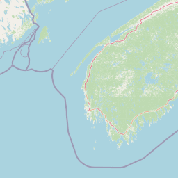
Map view of Port Hebert Migratory Bird Sanctuary

Use this park location map to pinpoint Port Hebert Migratory Bird Sanctuary in Canada, understand its exact geographic position, and read its mapped placement within the surrounding landscape more clearly.

Pigeon | © OpenStreetMap contributors

Location context for Port Hebert Migratory Bird Sanctuary

Nova Scotia
Park atlas

Compare adjacent coastal wetlands and regional wildlife reserves across the South Shore

Parks Near Zugvogelschutzgebiet Port Hebert and Surrounding Protected Landscapes

Browsing other protected areas near Zugvogelschutzgebiet Port Hebert reveals a connected network of tidal sanctuaries and coastal wetlands along the Atlantic shoreline. Expanding the geographic comparison highlights similar intertidal habitats and regional conservation zones across the peninsula.
Wildlife reserveNova Scotia
2.5 km away#1 closest

Southwest

Haley Lake Migratory Bird Sanctuary: Protected Wildlife Reserve in Nova Scotia

Freshwater avian sanctuary and coastal nesting habitat

Haley Lake Migratory Bird Sanctuary provides a crucial freshwater refuge on the southwestern coast of Nova Scotia. This wildlife reserve features a unique lakeside environment that supports large gatherings of migratory waterfowl and a historic great blue heron breeding colony, situated between the brackish tidal flats of the surrounding estuarine landscape.

Area
0.95 km²
Established
1980
IUCN
Ia
Relief
Lowland
Wildlife reserveNova Scotia
5.7 km away#2 closest

Southwest

Zugvogelschutzgebiet Sable River Wildlife Reserve and Nova Scotia Coastal Geography

Protected estuarine sanctuary and waterfowl habitat

Spanning the sheltered waters of a river estuary, Zugvogelschutzgebiet Sable River acts as a essential component of the coastal conservation landscape in Nova Scotia. This protected wildlife reserve remains a vital staging area for migratory species, defined by its tidal salt marshes and open aquatic terrain which function in coordination with neighboring Atlantic sanctuary sites.

Area
3.13 km²
Established
1941
IUCN
Ia
Watercolor painting showing a river landscape with green trees, rolling hills, and mountains in the background
National parkNova Scotia
48 km away#3 closest

North

Kejimkujik National Park: Detailed Protected Landscape and Regional Geography

Explore mapped boundaries and geographic context in Nova Scotia.

Kejimkujik National Park offers a dedicated entry for understanding protected natural areas. As a national park in Nova Scotia, its geographic features and protected boundaries are detailed here to support atlas-based exploration. Discover the park's unique landscape context and its positioning within regional geography, providing a factual basis for comprehending its role as a conservation area.

Area
404 km²
Established
1967
IUCN
II
Visitors
75.3K annual
Wildlife reserveNova Scotia
137 km away#4 closest

North

Kentville Migratory Bird Sanctuary: A Protected Wetland Reserve in the Cornwallis River Valley

Mapped riparian ecosystems and migratory bird habitats in Nova Scotia.

Discover the unique geography of the Kentville Migratory Bird Sanctuary, a compact wildlife reserve in Nova Scotia. This protected area features a blend of river channels, open fields, and forest mosaic that serves as a seasonal sanctuary for waterfowl. Learn about the riparian terrain that defines this critical node in the broader Atlantic flyway network.

Area
5.06 km²
Established
1939
Relief
Lowland
Scope
Terrestrial
Wildlife reserveNova Scotia
About 152 km away#5 closest

North

Boot Island National Wildlife Area: Mapping Coastal Conservation in Nova Scotia

Protecting intertidal mudflats and migratory bird habitats

Located in the Southern Bight of the Minas Basin, Boot Island National Wildlife Area serves as a key protected refuge within the Bay of Fundy. This reserve safeguards essential coastal and marshland habitats that support migratory bird populations, offering a focused look at how specific island geography functions within a larger, dynamic estuarine wetland system.

Area
1.07 km²
Established
1979
IUCN
Ia
Relief
Lowland
Wildlife reserveNova Scotia
About 153 km away#6 closest

North

Île Haute Wildlife Reserve: Mapped Volcanic Geography and Coastal Protected Terrain

Bay of Fundy protected area, Nova Scotia

Rising abruptly from the Bay of Fundy, Île Haute features a steep, isolated plateau encircled by 100-meter basalt cliffs. This wildlife reserve showcases Jurassic volcanic geology and provides essential habitat for migratory seabirds and marine mammals. Gain insights into the island's unique coastal geography and its role as a protected natural sanctuary in Atlantic Canada.

Area
0.8 km²
Established
2025
Relief
Upland
Scope
Mixed
National parkNew Brunswick
184 km away#7 closest

North

Fundy National Park: New Brunswick National Park Atlas and Geographic Exploration

Mapped protected landscape and regional park context.

Fundy National Park represents a vital protected area, offering rich geographic discovery within New Brunswick, Canada. This national park detail provides context for its mapped boundaries and landscape, supporting atlas-based exploration of its regional significance. Understand Fundy National Park's protected status and its contribution to the mapped natural terrain of eastern Canada.

Area
207 km²
Established
1948
IUCN
II
Visitors
303.6K annual
Wildlife reserveNew Brunswick
About 205 km away#8 closest

North

Réserve nationale de faune de Shepody: Geographic Overview of a New Brunswick Wildlife Reserve

Coastal wetlands and protected intertidal geography

Located along the Bay of Fundy, Réserve nationale de faune de Shepody represents an essential network of salt marshes and freshwater habitats. This mapping analysis traces the intersection of tidal dynamics, riverine estuaries, and ancient sandstone formations that define this critical protected area in New Brunswick.

Area
10.69 km²
Established
1980
IUCN
IV
Relief
Lowland

Common questions about visiting, size, designation, and location context for Port Hebert Migratory Bird Sanctuary

Port Hebert Migratory Bird Sanctuary FAQs for park facts, access, geography, and protected area context

Find quick answers about Port Hebert Migratory Bird Sanctuary, including protected-area facts, park geography, trail and visitor context, and how the park fits into its surrounding country and regional landscape.
MoriAtlas Explorer

Continue Your Protected Areas Search Across the Global Atlas

Deepen your exploration by continuing the structured search for national parks and protected areas worldwide. Utilize the comprehensive filtering capabilities to compare different conservation landscapes and refine your understanding of global park geography. Discover more about the distribution and characteristics of protected natural areas.

Global natural geography